
Scan the QR code and open PeakVisor on your phone
The Deep Creek Range include 24 named peaks. The highest is Ibapah Peak at 3,678 m. Other notable peaks include Haystack Peak, Red Mountain and Rocky Peak.
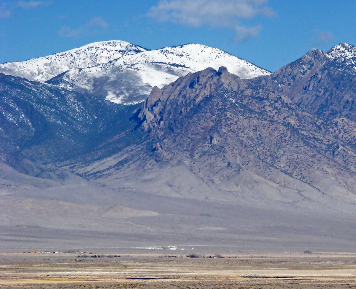
An isolated mountain range rising up dramatically from the Great Basin below, the Deep Creek Range is a collection of very prominent peaks located along the border of the US states of Utah and Nevada. The range contains 22 named mountains, the highest and most prominent of which is Ibapah Peak (12,018ft/3,663m).
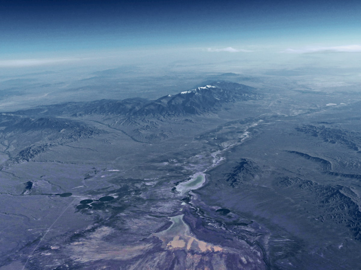
The Deep Creek Range (Goshute: Pi'a-roi-ya-bi) is a north to south trending collection of peaks that lies mostly within the state of Utah but extends slightly into Nevada. It is about 32 miles (51.5 km) long and is located in Utah’s Tooele and Juab counties with a small section in White Pine County in Nevada.
Located in a very remote part of western Utah, the Deep Creek Range is surrounded by basins, ranges, and desert. To the north of the Deep Creek Range lies the Great Salt Lake Desert, which separates the range from other mountainous areas, like the Silver Island Mountains, the Hill Air Force Range, the Hogup Mountains, and the Cedar Mountains.
Moreover, the range is bordered to the east by the Snake Valley, which separates it from the Fish Springs Range and, by association, the Thomas Range, the Dugway Range, the Simpson Mountains, and the Sheeprock Mountains.
Meanwhile, the Deep Creek Valley lies to the west of the range and separates it from the Antelope Range, the Snake Range, the Schell Creek Range, and the Cherry Creek Range. Finally, the Deep Creek Range is situated to the north of a number of smaller mountain ranges, such as the Confusion Range and the House Range.
Despite being surrounded by mountain ranges, however, the Deep Creek Range is one of the most prominent features in the landscape for miles. Indeed, the range’s highpoint, Ibapah Peak, has a prominence of 5,207ft (1,587m), and many other peaks in the range have prominences over 328ft (100m).
However, unlike many of the other surrounding mountain ranges, the Deep Creek Range is not part of a national forest, such as the Humboldt National Forest and Uinta-Wasatch-Cache National Forest, which are located to the west and east, respectively. Instead, the Deep Creek Range is mostly on land managed by the Bureau of Land Management (BLM) and part of the range is included within the Deep Creek Mountains Wilderness Study Area.
The Deep Creek Range is part of the Great Basin Ranges, which is a massive collection of peaks that covers much of Nevada, eastern California, western Utah, and southern Idaho and Oregon.
Within the Great Basin Ranges, the landscape is characterized by a series of alternating valleys and ridges, like what we see with the Deep Creek Range and its neighboring Fish Spring Range and Antelope Range.
Like much of the rest of the Great Basin Ranges, the Deep Creek Range is underlain by sizable layers of sedimentary rock, including quartzites, dolomites, and limestones, some of which date back to the Lower Cambrian. However, the Deep Creek Range also has some sizable outcrops of granite, which isn’t overwhelmingly common within the region.
That being said, the Deep Creek range is known for being relatively rich in mineral resources. The range has a long history of mining activity, and some of the many resources extracted from the region or prospected for over the years include gold, silver, tungsten, mercury, zinc, copper, tin, beryllium, and molybdenum. Nevertheless, the concentration of some of these minerals and metals in the rock of the Deep Creek Range is often too low to make it particularly profitable.
Geological surveys also suggest that the range has yet-untapped areas of coal, gas, thorium, oil, uranium, and even the potential for geothermal energy. The range also has potential resources to support quartzite, dolomite, and limestone extraction for industrial uses.
Major peaks in the range include Ibapah Peak, Haystack Peak, Red Mountain, Rocky Peak, Dutch Mountain, Ochre Mountain, and Montezuma Peak.
For the most part, the Deep Creek Range has an ecology similar to that of the rest of the Great Basin Ranges. This means that it boasts sprawling grasslands and sagebrush at lower elevations, as well as juniper and pinyon pine at the mid-elevations.
However, the sheer prominence of the Deep Creek Range has turned it into a sort of island range and an oasis for flora and fauna. Due to the immense relief of the range over the basins below, it manages to capture the little moisture in the air masses that pass over it. As a result, it is home to a staggering array of plant and animal life, particularly when compared to the surrounding area.
For example, the Deep Creek Range is home to some particularly prolific alpine meadows, aspen forests, and stands of conifers. It’s even home to the beautiful and ancient bristlecone pine, which can grow to be thousands of years old.
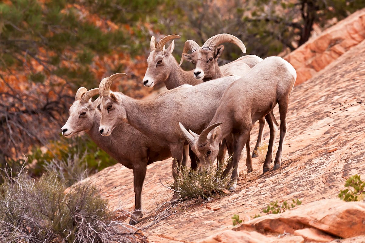
Wildlife in the range is abundant as well, with species such as bighorn sheep, pronghorns, elk, and mountain lions calling the area home.
In the Deep Creek Range, there are also a number of perennial streams, some of which are home to the Bonneville cutthroat trout (Oncorhynchus clarkii utah). The Bonneville cutthroat trout is native to the Great Salt Lake region and it was once thought to be extinct as a result of overfishing, though it is now considered to be a sensitive species.
Human inhabitation of the Deep Creek Range dates back thousands of years. The ancestors of the Skull Valley Band of Goshute Indians and the Confederated Tribes of the Goshute Reservation lived in the region for thousands of years before the arrival of European-American settlers.
Indeed, the region is the ancestral homelands of the Goshute people and many of the members of the Confederated Tribes of the Goshute Reservation live on a reservation on the western side of the Deep Creek Range.
Perhaps the first person of European Descent to travel near the Deep Creek Range was Jedediah Smith who traversed the Great Basin in the 1820s.
By the late 1850s, a small mail station was established in Pleasant Valley, just to the south of the Deep Creek Range. This mail station would later become particularly important after a group of Mormon missionaries established a mission at Ibapah as the mail station served as a post for the Pony Express.
The influx of missionaries and settlers of European descent in the Deep Creek Range region led to fairly frequent outbreaks of violence between the settlers and the Goshute people who were being forcibly pushed off their homelands.
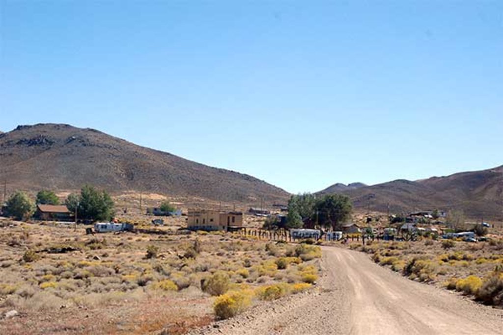
During the 1870s and 1880s, a number of small towns, homesteads, and settlements sprung up in the area around the Deep Creek Range. The turn of the century brought a renewed interest in mining and a number of mining districts were established in the area.
Some of the largest mining operations in the region extracted many thousands of tungsten, silver, lead, gold, and even arsenic, though many of the towns that were established during this time have long since been abandoned.
Interestingly, the region around the Deep Creek Range was one of the last places in the continental United States to get electricity, paved highways, and private telephone lines. Many of these utilities arrived in the 1970s, including the paved highway that connects the city of Ely, Nevada to the town of Ibapah.
To this day, the distance between the Deep Creek Range and the region's major cities means that it seems relatively few visitors, particularly when compared to the Wasatch Range and the mountains near Salt Lake City.
Nevertheless, the Deep Creek Range is a great place to visit if you’re looking to travel through a beautiful and remote part of the state of Utah.
As you might imagine with a range as remote as the Deep Creek Range, maintained hiking trails are hard to come by. Indeed, much of the region’s trails are unmarked and poorly maintained, so a solid knowledge of backcountry navigation skills is essential.
Moreover, temperatures can get hot in the region and streams can run dry, so visitors should come prepared with everything they need to thrive in this challenging environment. With that in mind, here are some of the best hiking areas in the Deep Creek Range:
The tallest mountain in the Deep Creek Range, Ibapah Peak is a must-visit if you’re keen to take in some excellent views. Getting to the mountain is a bit of a trek and you’ll have to follow a dirt road called Granite Creek Road for quite some time in order to get to the trailhead.
Hiking to the summit of Ibapah Peak is about 18 miles (29km) round trip, though the trail only leads about halfway up the peak. Once you get into the alpine, the unmaintained trail disappears for a large section until it reappears right below the summit, so off-trail navigation abilities are a must.
Once you’re at the top of Ibapah Peak, however, the views make the long hike well worth the effort.
Technically speaking, the path to Tom’s Canyon is an ATV/Jeep trail, though the sheer beauty of the terrain make it a nice place to visit even if you plan to do your adventuring on foot. The trail is about 20 miles (32.2km) long and can be accessed from the east of the Deep Creek Range from near the town of Wendover.
This trail doesn’t really have a ‘destination,’ per se, but it winds its way through the eastern part of the range, offering excellent views of some of the most prominent mountains, including Ibapah Peak and Haystack Peak. There are also some historic cabins along the route, which make for scenic places to stop and enjoy a break during your hike.
The Deep Creek Range is remote, so there aren’t many sprawling metropolises in this area. However, there are quite a few sizable towns and cities within a day’s drive of the range that are certainly worth checking out. Here are some of the best places to stay near the Deep Creek Range:
Located just to the southwest of the Deep Creek Range, the city of Ely, Nevada is the major population center of White Pine County. The city has about 4,200 residents and it was originally founded as a stop along the Pony Express.

These days, Ely is a center for tourism in the region, thanks to its proximity to Great Basin National Park. Although the city no longer has commercial air service, it is located along US 50, which crosses Nevada from Lake Tahoe in California to the Utah border and is often called the “Loneliest Road in America.”
The city of Elko is located a decent distance to the northwest of the Deep Creek Range, but it is one of the largest cities in the region, so it’s a good place to stay if you’re also interested in visiting the Ruby Mountains.
Elko is home to about 20,000 people and it is a popular destination in northern Nevada for outdoor recreation. It is located along I-80, so it’s easy to get to by road from Salt Lake City and Reno. There is also regular bus and train service to the city.

The third largest city in the state of Utah, Provo is about a 4 hour drive from the Deep Creek Mountains. About 115,000 people live in Provo, which is also the location of the main campus of Brigham Young University. Provo is home to the second busiest airport in the state and it has bus, train, and road connections to the rest of the Rocky Mountain region.
Located about a 3.5 hour drive to the northeast of the Deep Creek Mountains, Salt Lake City is an excellent starting point for any adventures in Utah. Salt Lake City is the capital and largest city in the state with some 200,000 residents and it is situated within driving distance of some of the state’s most popular mountain destinations in the Wasatch Range.
The city is home to the largest airport in Utah and it is located at the intersection of I-15 and I-80, which makes it an easy place to get to by road.


ultra
western-state-climbers
western-state-climbers-star
great-basin
great-basin-star
utah-ultras
ultra
western-state-climbers
western-state-climbers-star
great-basin
great-basin-star
utah-ultras
The highest peak in the Deep Creek Range is Ibapah Peak, at 3,678 m.
The Deep Creek Range have 24 named peaks.


