
Scan the QR code and open PeakVisor on your phone
Deep Creek Mountains Wilderness Study Area has 11 named peaks. The highest is Ibapah Peak at 3,678 m. Other notable peaks include Haystack Peak, Red Mountain and Rocky Peak.
The Deep Creek Mountains Wilderness Study Area (WSA) is a north to south running mountain range situated in the western region of the US state of Utah. The range marks the highest in the western portion of the state. The tallest and most prominent peak in the WSA is Ibapah Peak at 12,067 feet (3,678 m) tall with 5,256 feet (1,602 m) of prominence.
The Deep Creek Mountains Wilderness Study Area is located in the heart of the Deep Creek Mountains of western Utah. Situated near the state’s border with Nevada, these peaks mark the tallest range in all of western Utah.
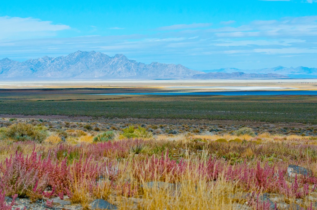
Similar to many of the surrounding ranges in the Great Basin Ranges, the Deep Creek Mountains runs in a north to south direction. The Great Salt Lake Desert extends to the east while the Deep Creek Valley lies just west of the range and WSA.
The protected WSA spans roughly 70,000 acres (28,328 ha) within the range, covering land in both Juab and Toole counties. Elevations within the Deep Creek Mountains range from 4,200 feet (1,280 m) along the valley floor, up to over 12,000 feet (3,658 m).
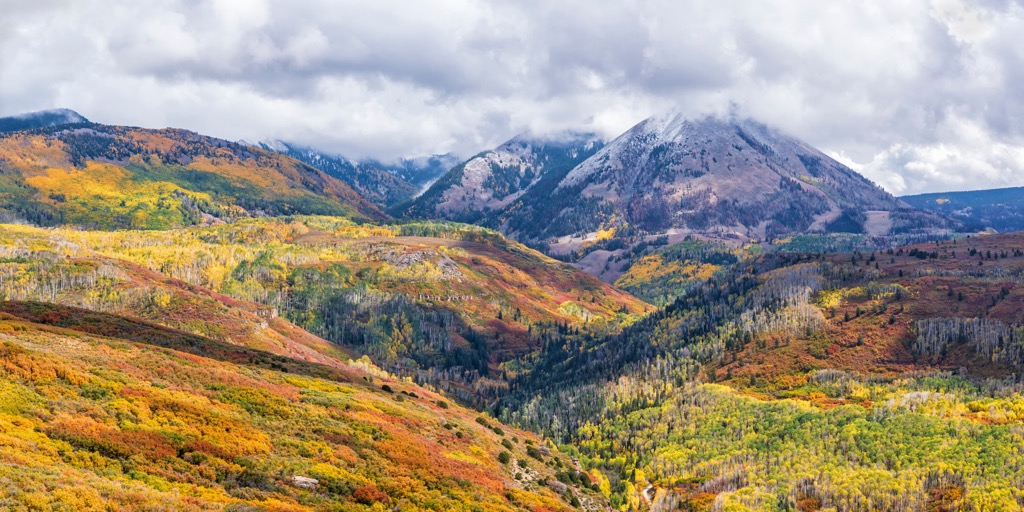
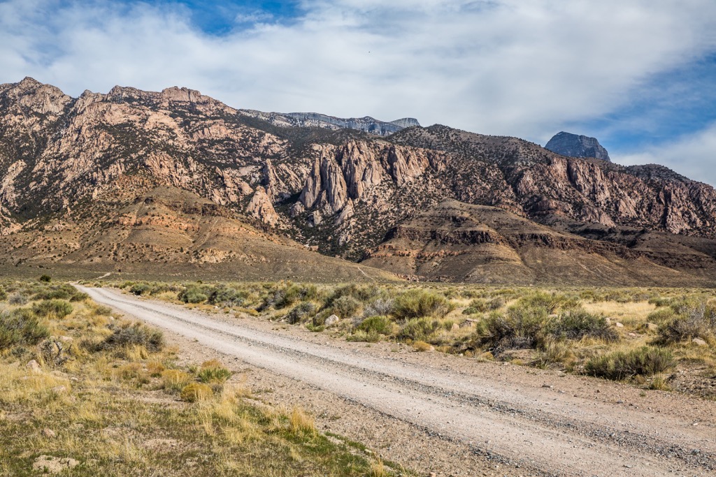
There are nine perennial streams throughout the range though there are no major rivers in the region. Terrain is similar to that found throughout western Utah and western Nevada. The forested foothills of the range rise steeply, quickly giving way to rugged and rocky ridgelines.
Lower elevations are marked by sagebrush-grasslands which transition into the densely forested sections of the WSA. The highest elevations in the region are marked by rocky peaks, ridgelines, and alpine meadows.
Deep canyons cut across the landscape in an east to west direction while the main ridgeline runs in a north to south direction. The remote range is classified as an “island landscape” due to its isolated nature and surrounding desert terrain.
The Deep Creek Mountains WSA is situated near numerous other areas for outdoor recreation. The Deep Creek Wilderness lies in the southern stretches of the Deep Creek Mountains. Sections of the Humboldt - Toiyabe National Forest extend to the west while Howell Peak, Swasey Mountain, and Notch Peak Wilderness Study Area are located to the southeast. Cedar Mountain Wilderness and Uinta-Wasatch-Cache National are situated to the northeast.
The peaks within the Deep Creek Mountains WSA are part of the Deep Creek Mountains. These peaks mark a subrange of the larger Great Basin Ranges, which as a whole extend throughout much of Nevada, Utah, Idaho, Oregon, and California.
This mountainous region began forming roughly 40 million years ago. Around 100 million years ago, the Farallon oceanic plate was subducted beneath North America. This continued subduction led to the formation of these peaks during the Early Miocene.
As the Earth’s crust was stretched and folded, numerous fault lines were left in the region. Continual extension of the crust slowly formed the series of alternating peaks and valleys which give the region its name. The vast majority of ranges in the region trend in a north to south direction.
Tectonic extension still plays a role in the Deep Creek Mountains and the other surrounding ranges. As the valleys continue to slowly drop in elevation, the peaks are being thrust upwards even further.
During the Pleistocene, glaciers formed throughout the region. Glacial retreating, coupled with millions of years of erosion, further carved out the landscape, leaving behind the steep valleys and canyons visible today.
Ranges in the region feature a metamorphic core complex along with igneous rock. The outer layers of the range are often composed of sedimentary rocks. Both granite and quartzite are common throughout the WSA.
Major peaks within the Deep Creek Mountains WSA are Ibapah Peak, Rocky Peak, Red Mountain, and Haystack Peak.
The varying landscapes and dramatic changes in elevation throughout the WSA, help support a variety of both flora and fauna.
Lower elevations in the WSA and surrounding range are marked by sagebrush-grasslands which feature various low growing grasses and shrubs. As elevations increase, the landscape gives way to pinyon-juniper forests.
The highest peaks in the WSA are populated by sections of evergreen and aspen forest, alpine meadows, steep ridgelines and rocky cliffs, which are often free of flora. The remote range helps support numerous plants and animal species not found in any nearby ranges.
Common animals include mule deer, elk, bighorn sheep, coyote, and bobcat. Various birds of prey inhabit the region. Some of the most common birds are golden eagles, turkey vultures, prairie falcons, great-horned owls, and long-eared owls.
Present-day Utah has been inhabited by humans for thousands of years, long before the arrival of European colonizers. The land within and surrounding the Deep Creek Mountains WSA, marks part of the ancestral homelands of the Goshute. Today, descendants of the Goshute are represented by the Confederated Tribes of the Goshute Reservation.
The Goshute Reservation, home to the Confederated Tribes of the Goshute Reservation, lies in the southern stretches of range, extending into portions of both Utah and Nevada. The Goshute refer to themselves as Newe (nɨwɨ) or Newenee (nɨwɨnɨɨ) and are a Western Shoshone people.
Traditionally the Goshute covered vast sections of land across the Basin and Range Province. They traditionally lived nomadically, migrating with the changing seasons of the region. The Deep Creek Mountains are located in the western stretches of the traditional Goshute territory.
The first recorded contact between the Goshute and people of European descent was during the mid-1800s. Shortly after fur trappers arrived in the region, Brigham Young sent Mormon missionaries to present-day Utah during the 1840s. The missionaries were sent in order to establish communities in Salt Lake Valley. The arrival of the Mormon people led to increased population in the region and resulted in the exploitation of Indigenous peoples and their native lands.
The end of the 1840s marked the California Gold Rush, leading to more people traveling through present-day Utah en route to California. Tribes across Utah and Nevada were repeatedly attacked, harassed, killed, and displaced by the settlers of the region who were often backed by the US military.
Some of the most prominent battles between these two groups include the Goshute War, Pyramid Lake War, Owens Valley Indian War, Snake War, and the Bannock War. These battles, along with the arrival of infectious diseases, such as smallpox and measles, drastically reduced the number of Indigenous peoples.
Those who were able to survive were eventually forced onto reservations. Today, the two primary Goshute Tribes are the Confederated Tribes of the Goshute Reservation and the Skull Valley Band of Goshute Indians of Utah.
The Confederated Tribes are headquartered on the Goshute Reservation, located in the southern stretches of the Deep Creek Mountains. The Skull Valley Band of Goshute Indians of Utah are headquartered on the Skull Valley Reservation, which lies west of the Cedar Mountains, south of Great Salt Lake.
Despite the stunning beauty of the region, there are minimal amounts of designated hiking trails in the Deep Creek Mountains WSA. Below are a few hikes in the surrounding region to check out on your next visit:
Looking for a place to stay near the Deep Creek Mountains WSA? Here are some of the best cities and villages to check out in the region.
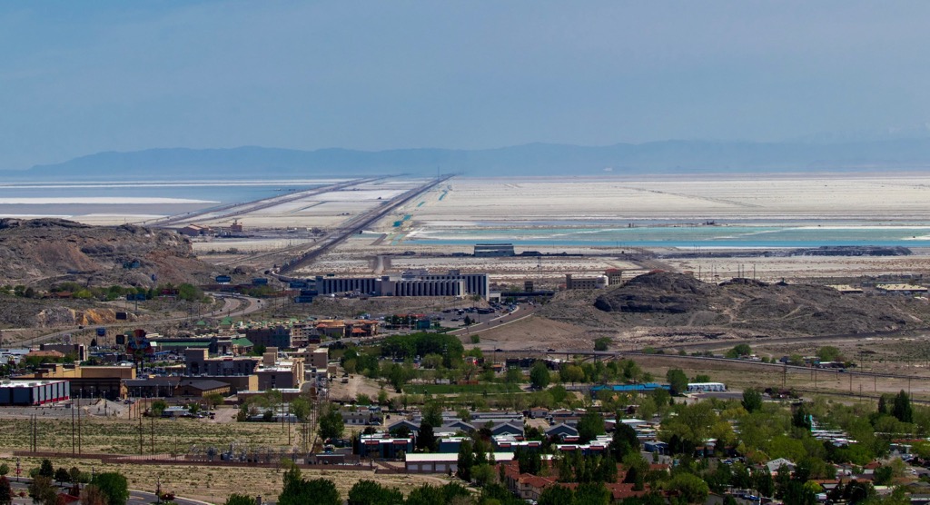
The city of West Wendover lies north of the WSA, along the state’s border with Utah. Situated along Interstate 80, the city is part of a joint community with Wendover, Utah. West Wendover marks the easternmost stop along the Cowboy Corridor road trip route.
Surrounded by the Basin and Range province, the city also lies in close proximity to Bonneville Salt Flats. The small downtown is full of a plethora of casinos and local restaurants, while the iconic neon cowboy marks the city’s official landmark.
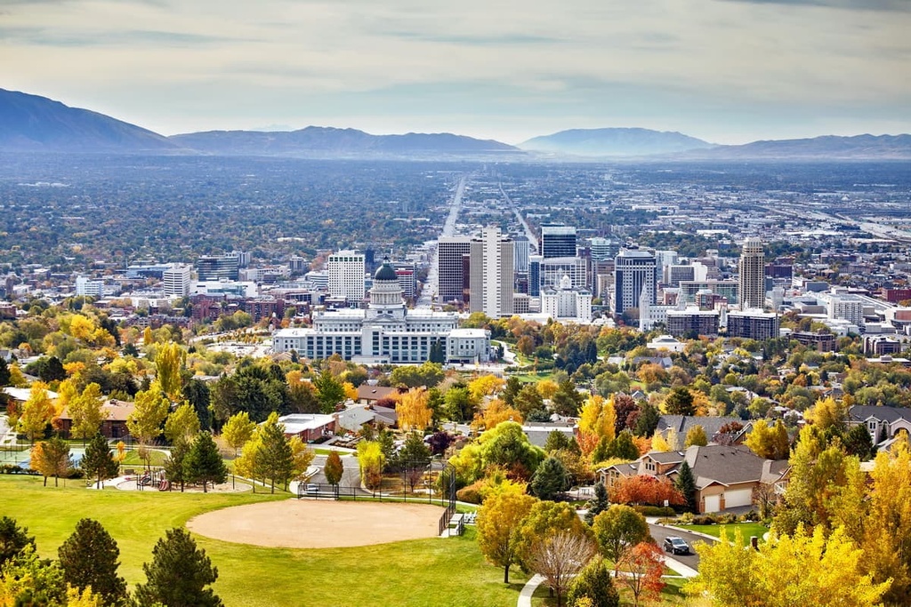
Salt Lake City lies northeast of the WSA, marking the closest major city to the protected region. While the city itself is home to 200,000 residents, Salt Lake City boasts a metropolitan population of over 1,2 million, making it the most populous region in the state.
Surrounded by mountain ranges and situated on the edge of Great Salt Lake, the city is known for being a hub for outdoor recreation. Nearby national parks and national forests offer an escape from the sprawling populated region.
Locals and visitors alike get to explore the nine ski resorts located within an hour’s drive of the city. Opportunities for hiking, mountain biking, and trail running are all within close proximity while the downtown feature numerous museums including the Natural History Museum of Utah and Utah Museum of Fine Arts.


ultra
western-state-climbers
western-state-climbers-star
great-basin
great-basin-star
utah-ultras
ultra
western-state-climbers
western-state-climbers-star
great-basin
great-basin-star
utah-ultras
The highest peak in Deep Creek Mountains Wilderness Study Area is Ibapah Peak, at 3,678 m.
Notable peaks in Deep Creek Mountains Wilderness Study Area include Ibapah Peak, Haystack Peak, Red Mountain, Rocky Peak and Bald Mountain.


