
Scan the QR code and open PeakVisor on your phone
Cedar Mountain Wilderness Area has 14 named peaks. The highest is Cedar Benchmark at 2,351 m. Other notable peaks include Peak 7700, Peak 7180 and Peak 6960.
The Cedar Mountain Wilderness is located in the state of Utah in the United States, southwest of Salt Lake City. The wilderness covers 99,429 acres and lies just south of Great Salt Lake. Cedar Mountain Wilderness comprises over half of the Cedar Mountain Herd Management Area. The region was established back in 2006 and is often accessible year-round.
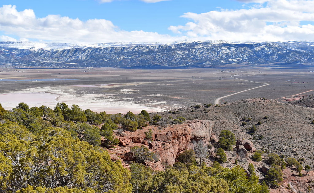
There are 13 named mountains in Cedar Mountain Wilderness. The highest and the most prominent mountain is Cedar Benchmark, at 7,697 feet. Elevations in the wilderness range from 4,200 feet up to the summit of Cedar Benchmark. Cedar Mountain is similar to other mountains within the Great Basin, trending north-south. The lowlands of the wilderness are characterized by rolling hills with sagebrush and juniper along with outcrops of limestone throughout. On the east side of the wilderness, the rolling hills are replaced with mountain peaks dropping down to sheer cliffs.
The environment of the wilderness is high desert, with an average of just 15 inches of precipitation. This high desert environment allows the animals such as mule deer, antelope, raptors, snakes, lizards, and mountain lions to flourish. While these animals inhabit the region throughout the year, bighorn sheep simply use the land as a passage from one nearby range to another. During the summer months, temperatures often reach 100 degrees Fahrenheit and down to freezing during the winter. Feral horses roam the land and can often be seen throughout the wilderness.
There are no designated trails or trailheads throughout the Cedar Mountain Wilderness. However, that doesn’t mean that you can’t explore. Signage directs visitors to boundary roads and hiking is allowed throughout the open terrain. This allows hikers to search amongst the terrain for scenic viewpoints and wildlife. Explore the rolling hills and be on the lookout for the 250 wild horses that roam the area. Higher elevations offer panoramic views of the surrounding region of the Great Basin with Great Salt Lake and the Bonneville Salt Flats in the near distance.
Salt Lake City is the most populous city in the state of Utah and it lies just over 45 minutes to the west of the Cedar Mountain Wilderness. The city’s population is 200,000 while the metropolitan area is estimated to be about 1.2 million. The city is known for being an outdoor adventure paradise. Surrounding the city are seemingly endless places to go hiking, biking, running, and skiing. The city was home to the 2002 Winter Olympics and is closely located to numerous ski resorts. There are 5 national parks near the city, allowing for countless opportunities for hiking. Popular restaurants include Red Iguana, White Horse, The Copper Onion, and Nomad Eatery.


The highest peak in Cedar Mountain Wilderness Area is Cedar Benchmark, at 2,351 m.
Notable peaks in Cedar Mountain Wilderness Area include Cedar Benchmark, Peak 7700, Peak 7180, Peak 6960 and Peak 6942.


