
Scan the QR code and open PeakVisor on your phone
Basin and Range National Monument has 8 named peaks. The highest is Worthington Peak at 2,732 m. Other notable peaks include Meeker Peak, Mount Irish and Sanderson Mountain.
Located in the southeastern region of the US state of Nevada, the Basin and Range National Monument protects 704,000 acres (284,899 ha) of unique rock formations and rugged Basin and Range topography. The monument includes 8 named mountains, the highest and most prominent of which is Worthington Peak (8,963 ft/2,732 m).
The Basin and Range National Monument lies in the Basin and Range Province, a vast physiographic region that extends from eastern California to central Utah and from southern Idaho to the state of Sonora in Mexico.
More specifically, the monument is in what is known as the Great Basin, a part of the Basin and Range province that contains roughly 200,000 square miles (517,998 sq km) of land throughout Nevada, eastern California, southeastern Oregon, southern Idaho, western Utah, and the northwestern corner of Arizona.
It’s worth noting that how the Great Basin is defined depends on whether one is talking about geologic, ecologic, hydrographic, topographic, enthogranic, or geographic area. Though each of these will give you a different geographic boundary of the Great Basin, the hydrographic definition is most widely used.
The Basin and Range National Monument protects two noncontiguous units: the Basin Unit and Shooting Gallery Unit.
The Basin Unit encompasses about 704,000 acres (284,899 ha) of land and stretches for 53 miles (85 km) from north-south and 40 miles (64 km) from east-west. This part of the monument contains several prominent features, including two basins that connect eight mountain ranges, three of which are entirely contained within the monument.
The Mount Irish Range lies along the southern boundary of the Basin Unit and is topped by 8,743-foot (2,665 m) Mount Irish. To the north of the Mount Irish Range, the Golden Gate Range runs from north to south through the center of the park, separating Garden Valley to the west from Coal Valley to the east.
Along the western boundary of the monument, the Worthington Mountains reach 8,963 feet (2,732 m) at the summit of Worthington Peak, the highest peak in the monument. The only designated wilderness within the park’s boundaries, the Worthington Mountains Wilderness, lies in the Worthington Mountains. Finally, the Seaman Range, anchored by Timber Mountain, stretches for roughly 30 miles (48 km) along the eastern boundary of the monument.
Meanwhile, some 15 miles (24 km) to the south of the Basin Unit, the Shooting Gallery Unit protects about 5,100 acres (2,064 ha) along the eastern flank of Badger Mountain and is separated from the Basin Unit by the Pahranagat Range.
Though the Worthington Mountains Wilderness is the only designated wilderness area within the Basin and Range National Monument, there are several designated wilderness areas nearby.
Just to the south of Mount Irish, over 28,000 acres (11,331 ha) of the rugged Mount Irish Range are designated as the Mount Irish Wilderness. To the east of Mount Irish, a series of ponds and lakes skirt the Desert National Wildlife Refuge.
The park’s western boundary is shared with two wilderness areas administered by the Humboldt-Toiyabe National Forest: the Quinn Canyon Wilderness and Grant Range Wilderness. The Seaman Range is home to the Weepah Spring Wilderness.
Three additional wilderness areas are located east of the monument. This includes the Big Rocks Wilderness in the North Pahroc Range, the South Pahroc Wilderness in the South Pahroc Range, and the Delamar Mountains Wilderness in the Delamar Mountains.
However, the Basin and Range National Monument should not be confused with Great Basin National Park, which is along the Nevada-Utah border.
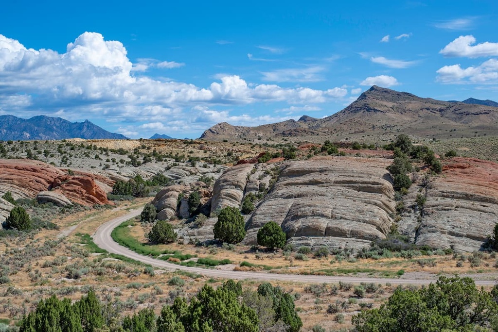
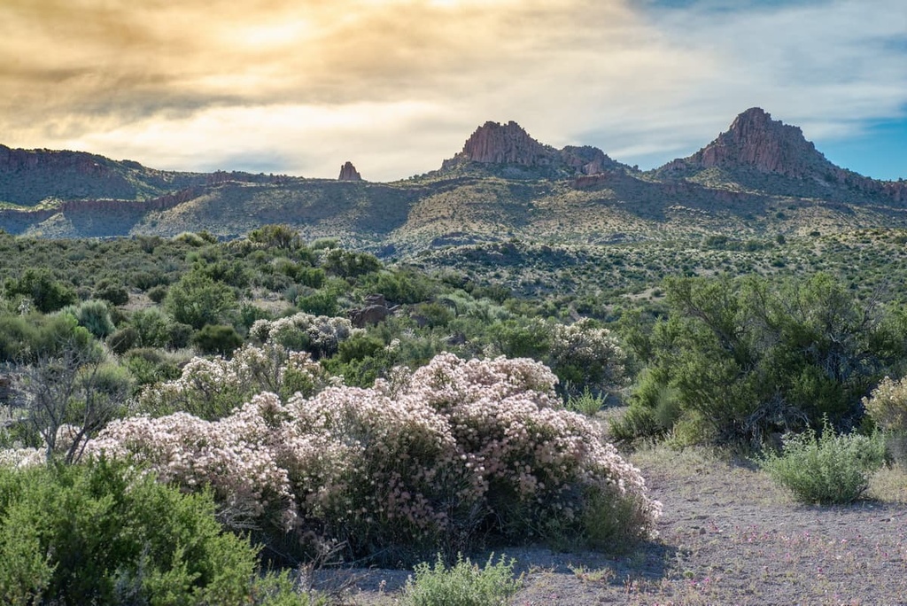
The Basin and Range National Monument is an excellent representation of what is considered characteristic Basin and Range topography. Such topography features narrow, alternating, north-south trending mountain ranges and intervening basin valleys.
Despite the region’s complex geologic past, it is generally accepted that the topography in the basin and range region is largely attributed to widespread tectonic expansion that took place during the Miocene. Millions of years ago, the Earth’s crust and upper mantle stretched dramatically in this area. As the crust progressively thinned, faults formed.
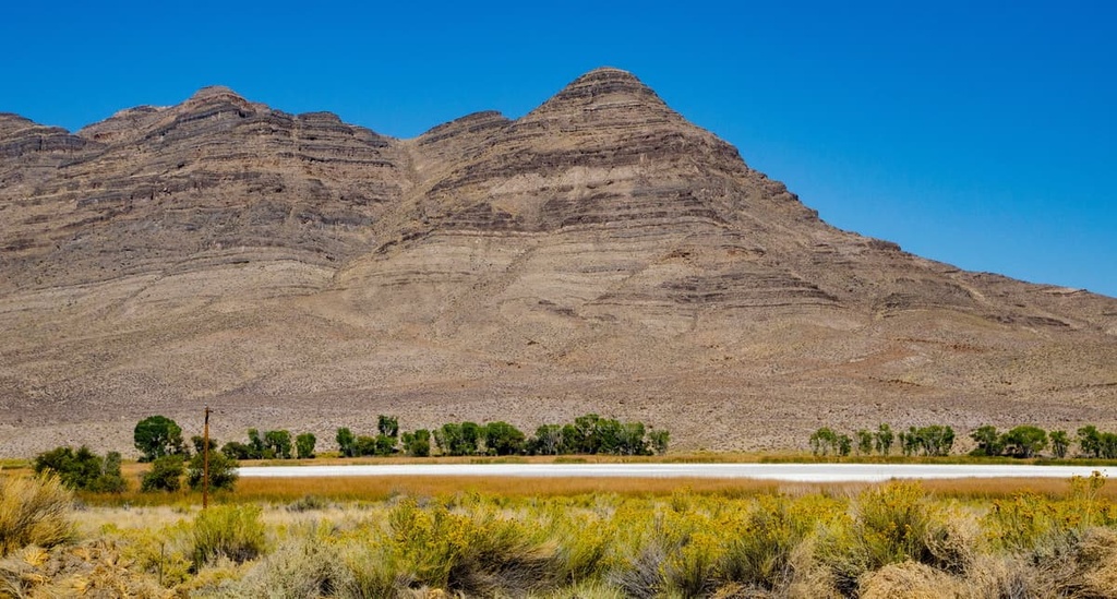
During the wet Pleistocene climatic period, pluvial lakes formed in many of the region’s valleys. When conditions became hotter and drier, during the Holocene, most of these pluvial lakes dried up.
The region’s geologic history, however, has been further complicated by an enormous asteroid impact that occurred 367 million years ago during the Devonian period. Evidence of this impact, which is known as the Alamo bolide impact, can be found in the Worthington Mountains within the Basin and Range National Monument.
The Basin and Range region is rich in minerals, including gold, silver, lead, zinc, copper, and tungsten deposits. Silver was mined on the eastern flank of Mount Irish, along Silver Canyon, in the 1860s and 1870s. The Freiberg district, located on the northeast end of the Worthington Mountains, was also the site of several mining operations throughout the twentieth century.
Located in the rain shadow of the Sierra Nevada and Cascade Mountains, the Basin and Range region is a temperate desert characterized by hot, dry summers and cold, snowy winters.
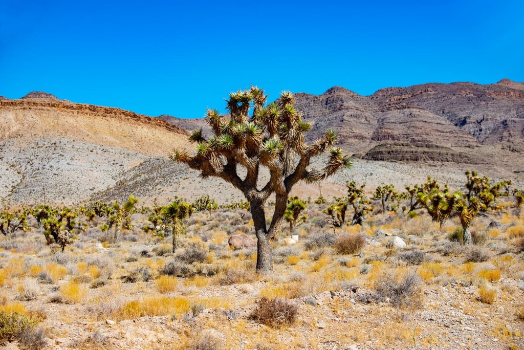
The Basin and Range National Monument is one of the largest, ecologically intact, undeveloped landscapes in the Great Basin region. The monument serves as a transition zone between the Mojave Desert and sagebrush steppe ecosystems.
Sagebrush communities and mixed desert scrublands dominate lower elevations. Meanwhile, pockets of native grasslands thrive in Coal Valley. At mid-elevations, sagebrush gives way to singleleaf pinyon, Utah juniper, mountain mahogany, quaking aspen, and other conifers. Additionally, at higher elevations, ponderosa and limber pines become more common.
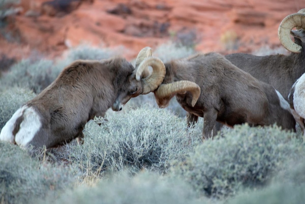
Large mammals known to frequent the area include desert bighorn sheep, mule deer, Rocky Mountain elk, pronghorn, and mountain lion. Jackrabbits, coyotes, kit fox, black-tailed jackrabbits, and several species of mouse are also known inhabitants of the monument.
Several bird species also travel throughout the monument, including sage thrashers, Brewer’s sparrow, western burrowing owl, and several dove and pigeon species. Numerous hawk species, including golden eagles, Cooper’s hawks, and ferruginous hawks have also been spotted in the Worthington Mountains.
Archeological evidence located in Coal Valley suggests people of the Paleo-Indian culture were the first human inhabitants of the present-day Basin and Range National Monument. These nomadic people thrived on food sources along the shores of now-dry lakes, including prehistoric Coal Valley Lake.
As the climate began to warm, the region’s many tribal nations in the region were forced to move between ecosystems to access natural resources. Many tribes traveled through this part of the Basin and Range region, but it is specifically considered to be the ancestral homelands of the Southern Paiute and Western Shoshone.
Today, only two percent of the Basin and Range National Monument area has been studied for archeological resources.
Still, it contains many incredible archeological sites, including the Mount Irish Archeological District, on the eastern flank of the Mount Irish Range, the White River Narrows Historic District, in the Weepah Spring Wilderness, and the Shooting Gallery rock art site. Each of these sites provides a glimpse into the cultural lives of the region’s earliest inhabitants
European-American fur traders, emigrants, and colonizers reached the Basin and Range region in the 1820s, followed by Mormon settlers in the mid-nineteenth century. Because the region was so arid and remote, it was not immediately attractive for Euro-American settlement.
Increased settlement in the Basin and Range National Monument region is largely attributed to the establishment of mining operations in the area. In the 1860s, prospectors traveled to the north end of the Worthington Mountains to establish the Worthington Mining District. Other miners established the Pahranagat Mining district, 30 miles (48 km) to the south of the monument.
Early settlers not only excavated precious ore in the mountains, but they also used nearby valleys for livestock grazing, herding and farming, further displacing Indigenous peoples from their ancestral lands.
The Basin and Range National Monument was created under the Antiquities Act in 2015. It was the second of three national monuments created in Nevada between 2014 and 2016 alongside Tule Springs Fossil Beds and Gold Butte national monuments.
There are very few developed recreational opportunities in the Basin and Range National Monument. However, the area is regularly visited by campers, hikers looking to explore petroglyph sites, and off-road enthusiasts. Here are some of the more popular places to check out if you’re looking to visit the Basin and Range National Monument:
Located on the eastern flank of the Mount Irish Range, the Mount Irish Archaeological District covers 640 acres (259 ha) and boasts a variety of prehistoric rock art and habitation sites. Interpretive trails lead to three of the largest rock art sites in the district.
Two main rock art styles are present in the Mount Irish district, the Pahranagat Style and a style often associated with Basin and Range tradition. The Mount Irish district is also home to one of the largest concentrations of bighorn sheep images in eastern Nevada.
White River Narrows is an archeological district that contains the largest concentrations of rock art in eastern Nevada. The district covers about 4,000 acres (1,619 ha) and contains rock art styles associated with Basin and Range tradition and Fremont groups. The White Rivers Narrows was placed on the National Register of Historic Places in 1976.
Located on the east flank of Badger Mountain, roughly 8 miles (13 km) from Alamo, the Shooting Gallery is an archeological district rich in prehistoric rock art, hunting sites, and campsites.
Though there is no formal trail system established in this area, visitors are welcome to explore a variety of rock art left by Indigenous peoples over the course of millennia. Two styles of rock art can be found at Shooting Gallery—Basin and Range tradition and Pahranagat Anthropomorphic Style.
If you’re looking for a place to stay near the Basin and Range National Monument, here are a few good options:
Located at the heart of Pahranagat Valley, Alamo is a quiet, unincorporated community that was the home to rustlers and horse thieves in the early 1900s.
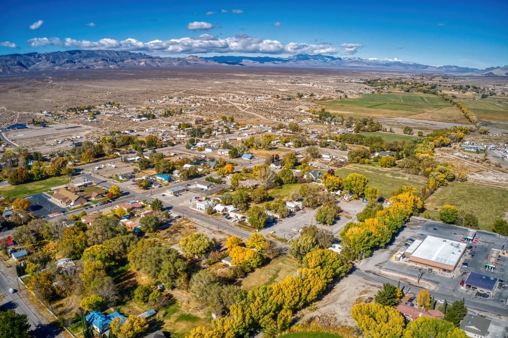
Today, Alamo is the perfect destination for outdoor enthusiasts looking to explore the Pahranagat National Wildlife Refuge or learn more about Nevada’s fascinating mining history. Alamo also lies just 8 miles (13 km) from the Shooting Gallery in the Basin and Range National Monument.
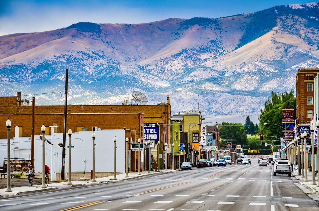
Located at the edge of the “Nevada’s Loneliest Highway,” Ely is a remote mountain town packed with history, art, and outdoor adventure. Ely was first established in the 1870s as a stagecoach stop and trading post along the Pony Express and Central Overland Route.
Today, it’s modest downtown attractions highlight the town’s fascinating history and cultural diversity. Ely is central to several parks and natural attractions, including the Basin and Range National Monument, Great Basin National Park, Cave Lake State Park, Ward Charcoal Ovens State Park, and the Ward Mountain Recreation Area.
Originally founded in 1901, the city of Caliente is a small, quaint community that once hosted the Union Pacific Railroad. Today, the Union Pacific Train Depot is the crown jewel of Caliente’s main street and allows visitors to learn about the town’s fascinating history. Despite its modest size, Caliente is home to many lodging and restaurant options. There are several parks and attractions nearby, including Beaver Dam, Cathedral Gorge, Spring Valley, Echo Canyon, and Kershaw-Ryan.
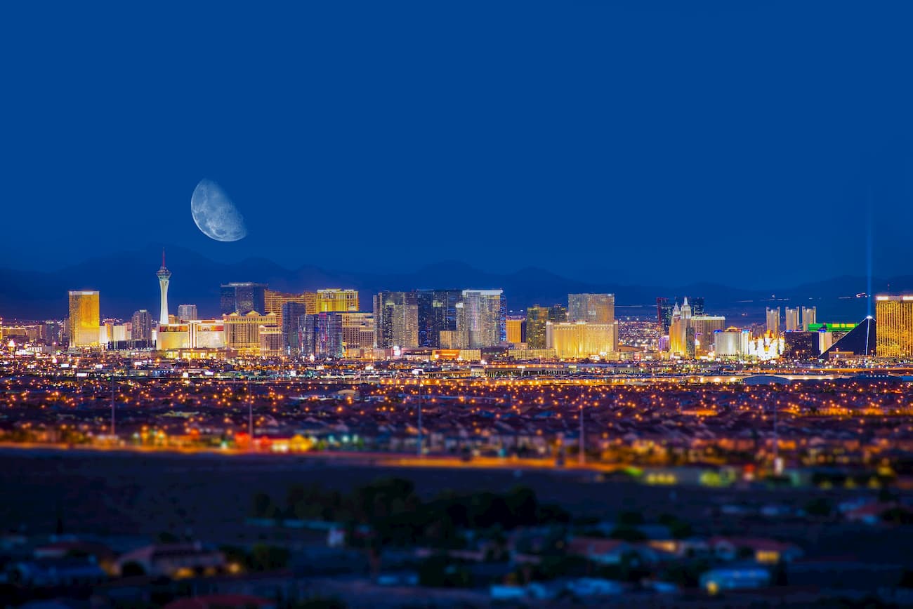
Las Vegas isn’t the closest community to the Basin and Range National Monument, but it’s home to the state’s largest international airport and hosts a huge variety of dining and lodging options. Before venturing off the beaten path, visitors can spend some time in Nevada’s most extravagant city, experiencing its world-renowned entertainment and lively nightlife.
Las Vegas is also centrally located to several other recreation options, including the Desert National Wildlife Refuge, Red Rock Canyon National Conservation Area, Lake Mead National Recreation Area, Valley of Fire State Park, and Spring Mountains National Recreation Area.


The highest peak in Basin and Range National Monument is Worthington Peak, at 2,732 m.
Notable peaks in Basin and Range National Monument include Worthington Peak, Meeker Peak, Mount Irish, Sanderson Mountain and Badger Mountain.


