Scan the QR code and open PeakVisor on your phone
The Black Rock Range is a small mountain range located in the northwestern region of Nevada in the United States. The range covers a region spanning 185,520 acres across both public and private land. The name Black Rock comes from the iconic Black Rock Point located in the southern region of the range. Black Rock Range divides the Black Rock Desert into eastern and western sections. Most of the range lies within the Black Rock Desert-High Rock Canyon Emigrant Trails National Conservation Area. Other parts of the range lie within the Pahute Peak Wilderness and the North Black Rock Range Wilderness.
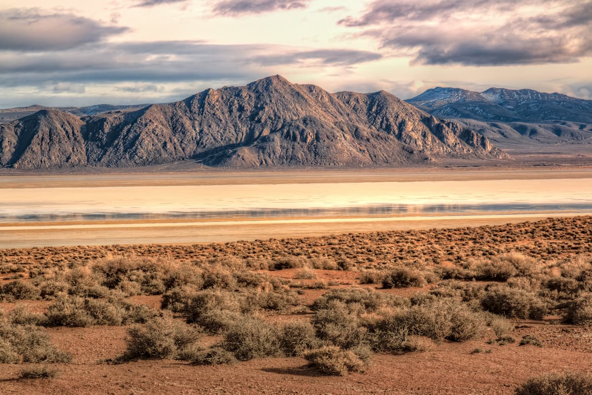
There are 9 named mountains in Black Rock Range. The highest and the most prominent mountain is Big Mountain, also known as Pahute Peak, standing at 8,579 feet. Elevations in the region range from 4,400 feet up to the summit of Big Mountain. Other well-known features within the range include the Black Rock Desert, Bartlett Peak, along with the Coleman and Slumgullion Creeks among others.
Due to the desert location of the range, much of the vegetation at lower elevation is characterized by salt desert shrubs while sagebrush and grass can be found at higher elevations. Domestic livestock inhabits the land during parts of the year living amongst the native wildlife. Common species include mule deer, pronghorn antelope, California bighorn sheep, and rodents. Other animals include trout, quail, and partridge.
The Black Rock Range is also known for its large population of wild horses. The horses are thought to be descendants of ranch horses that either escaped or were set free. Because of this, many of the horses in the region look rather domesticated compared to wild horses. While horses roam throughout the region, there is also a group of Baskir Curly horses that frequent the land around Pinto Mountain within the range.
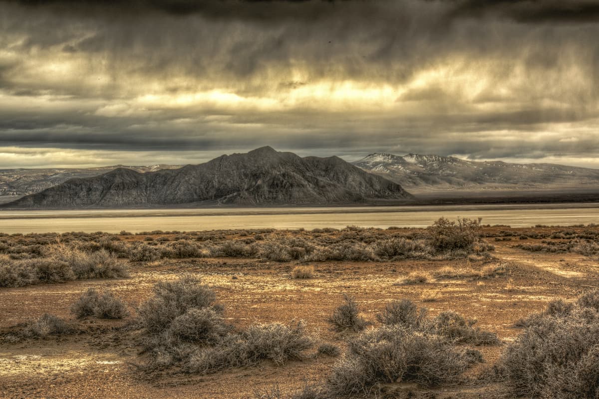
Black Rock Desert-High Rock Canyon Emigrant Trails National Conservation Area: This protected region encompasses a majority of the black Rock Range. The region spans 1,245 square miles and was established back in 2000. Within the Conservation Area are 120 miles of emigrant trails through the Black Rock Desert and the High Rock Canyon. The most popular destinations within this protected area are Black Rock Desert playa, narrow gorge of the High Rock Canyon, and Trego Hot Springs. The trail to Trego Hot Springs totals just 0.8 miles out and back with 190 feet of elevation gain. Historic wagon trails also lie throughout the region.
Pahute Peak Wilderness: The Pahute Peak Wilderness covers nearly 57,000 acres in Black Rock Range, Nevada the Black Rock Range and the surrounding land. Pahute Peak, also known as Big Mountain, is the highest peak in the range and lies within this wilderness. Hike to the summit of this iconic peak for panoramic views of the wilderness and the mountain range. To the south of the peak lies colorful badland rock formations. Part of the point to point Desert Trail crosses through the wilderness, though the trail is not maintained.
North Black Rock Range Wilderness: The North Black Rock Range Wilderness covers 30,647 acres of land. This section of land is known for its colorful cliffs that look out over Summit Lake. The steep banks of the land lead hikers down to Coleman, Soldier, and Battle Creeks that run through the region. During winter months, this region remains popular for snowshoeing and cross-country skiing. North of the North Black Rock Range Wilderness lies the Summit Lake Indian Reservation.
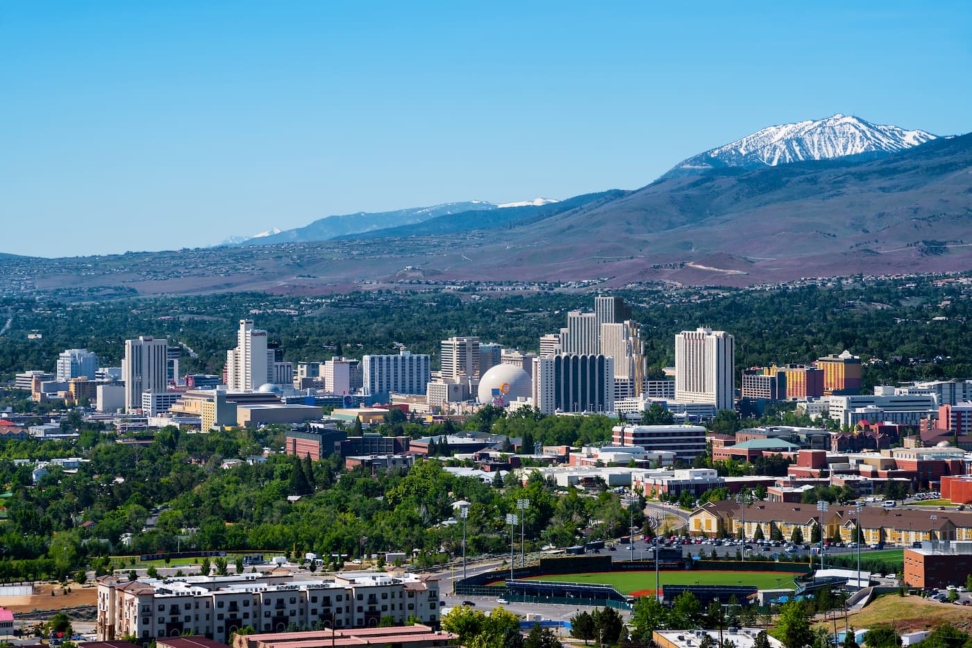
Three hours south of the Black Rock Range lies the city of Reno, Nevada. Reno is known for its casino and tourism industry. The city sits two and a half hours from the South Warner Wilderness. The city sits in the high desert river valley at the foot of the Sierra Nevada. The city is known as “The Biggest Little City in the World” and it sits 22 miles from the gorgeous Lake Tahoe. With a population of 255,000, the city is by far the largest in the area. Outdoor activities are abundant year-round with the city’s close proximity to Lake Tahoe, Truckee River, Pyramid Lake and 18 nearby ski resorts.
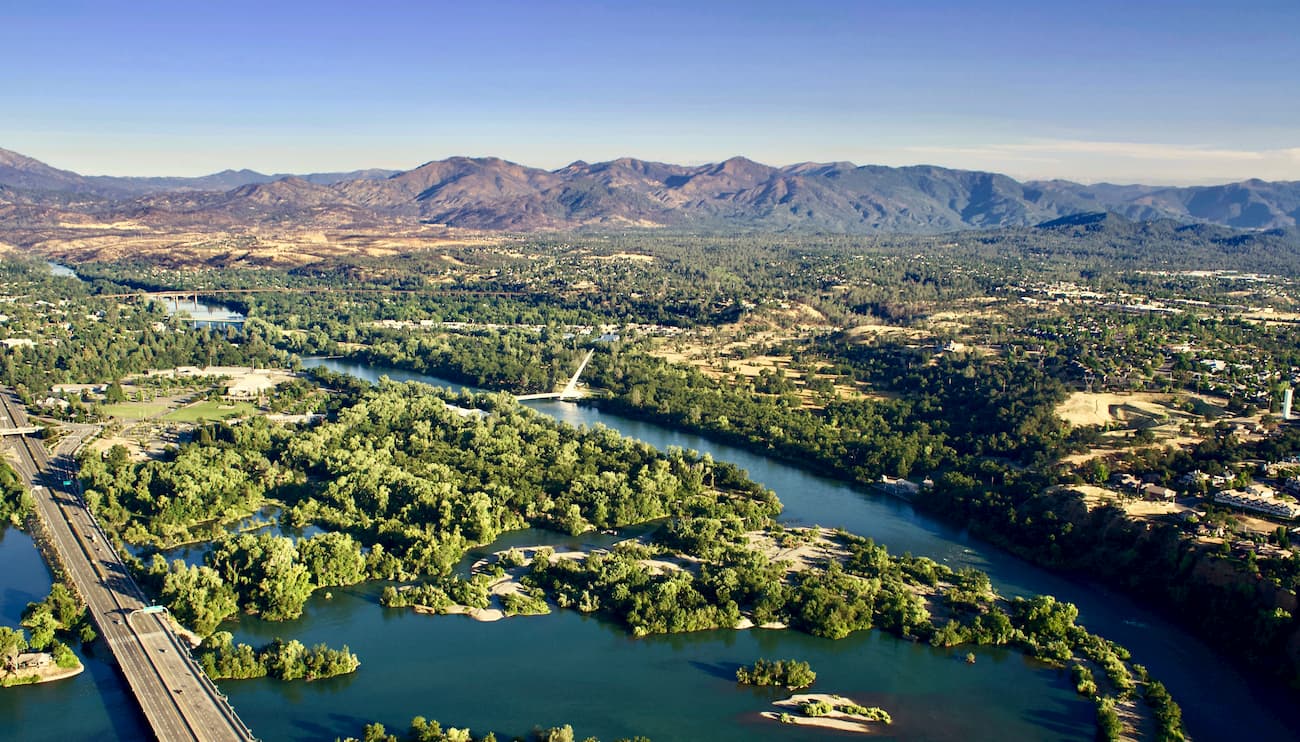
Located four and a half hours west of the Black Rock Range lies the city of Redding, CA. The city sits along the Sacramento River and is just 15 miles south of Shasta Lake. The city’s population is just over 90,000 and is at the very northwestern end of the Central Valley. Redding is surrounded by mountains to the north, east and west. The Market Center located downtown is the perfect place to explore the city and grab a bite to eat after a long day of hiking.
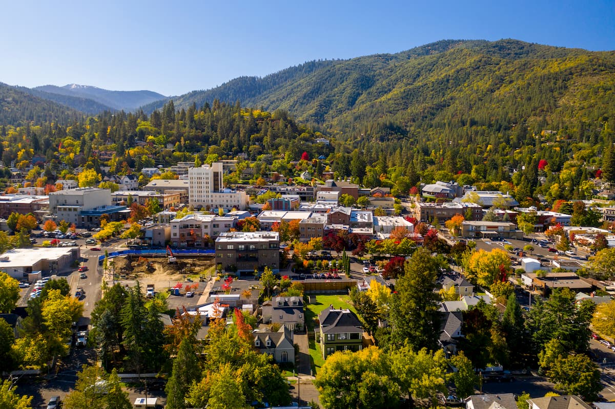
The city of Ashland, Oregon lies just under five hours to the northwest. Located in south central Oregon, Ashland has a population of around 21,000. The small city is known for being home to the Oregon Shakespeare Festival. The town is known for being very liberal, a sharp contrast to much of southern Oregon. Many of the city’s historical buildings have been preserved which give the downtown a quaint setting. Ashland is the perfect place to stay after a long hike in the mountains and is ideal for grabbing a bite to eat or check out a local gallery. The nearby city of Medford also has ample housing with close proximity to the surrounding mountain trails.