
Scan the QR code and open PeakVisor on your phone
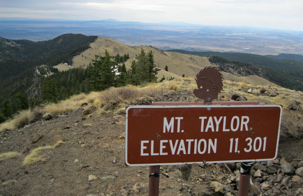
The North San Mateo Mountains are located west of Albuquerque, New Mexico in the southwestern United States. Occupying part of the Colorado Plateau, the range contains 198 mountains. Mount Taylor is the highest at 11,316 ft (3,449 m) and the most prominent (4,091 ft/1,247 m). The range is part of the Mount Taylor Ranger District of Cibola National Forest.
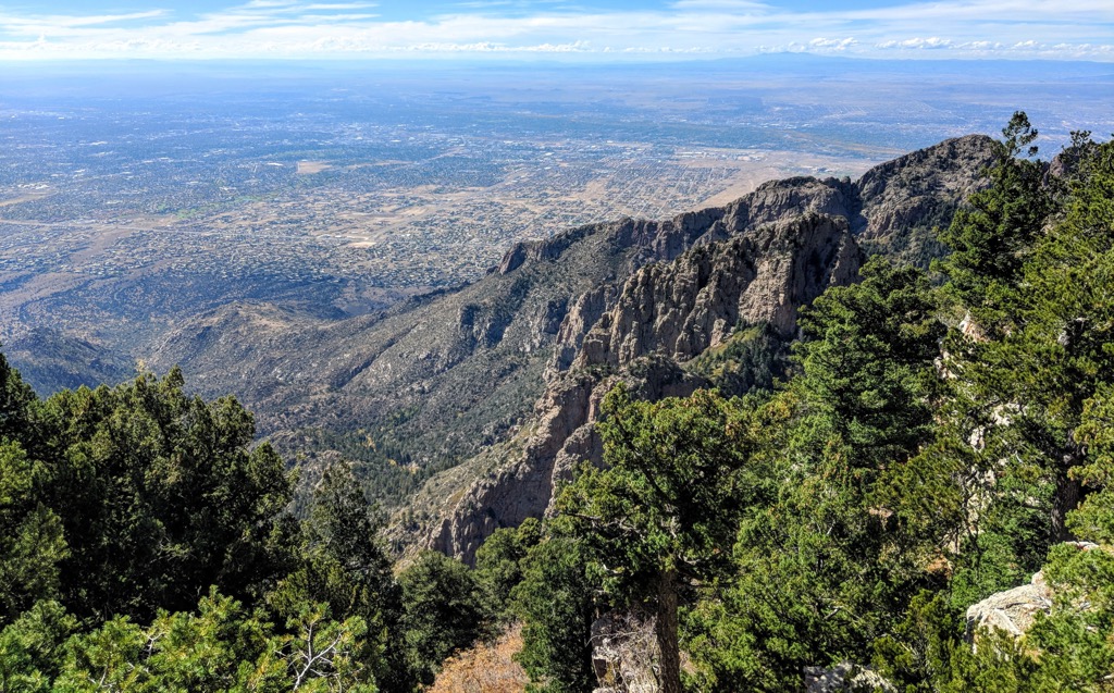
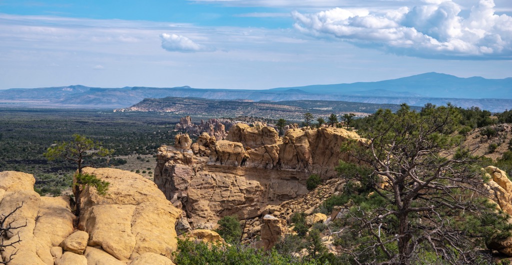
Located in Cibola County in New Mexico, the North San Mateo Mountains are part of the Mount Taylor Ranger District of Cibola National Forest. This northwestern portion of the state occupies the Colorado Plateau, a landscape marked by mesas, canyons, and highlands.
The mountains contain the watersheds of the East Rio San Jose, the Arroyo Chico, and the Rio Puerco. Some water flows on the surface but most percolates back to the water table. Streams feed into tributaries which in turn flow to the Rio San Jose and Rio Puerco.
Mount Taylor is the tallest peak in the range at 11,316 ft (3,449 m). The range is located nearby and to the west of the Zuni Mountains and just north of El Malpais National Monument.
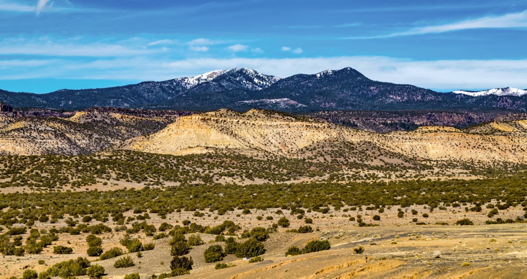
Mount Taylor, the tallest peak in the range, is a stratovolcano that was active between 3.3 and 2.5 million years ago. It is part of a larger volcanic field that was shaped by a series of volcanic events rather than a single explosion.
For example, Grants Ridge, a landform near Mount Taylor, formed prior to the volcano as rhyolite magma flowed through cracks in the earth’s crust. Pumice formed and perlite has been mined from it since the mid-1900s.
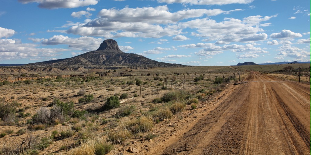
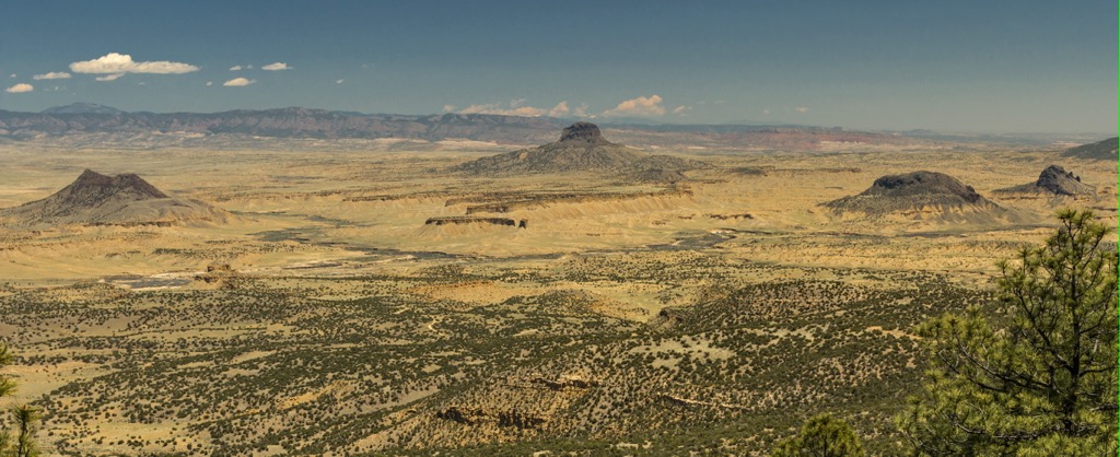
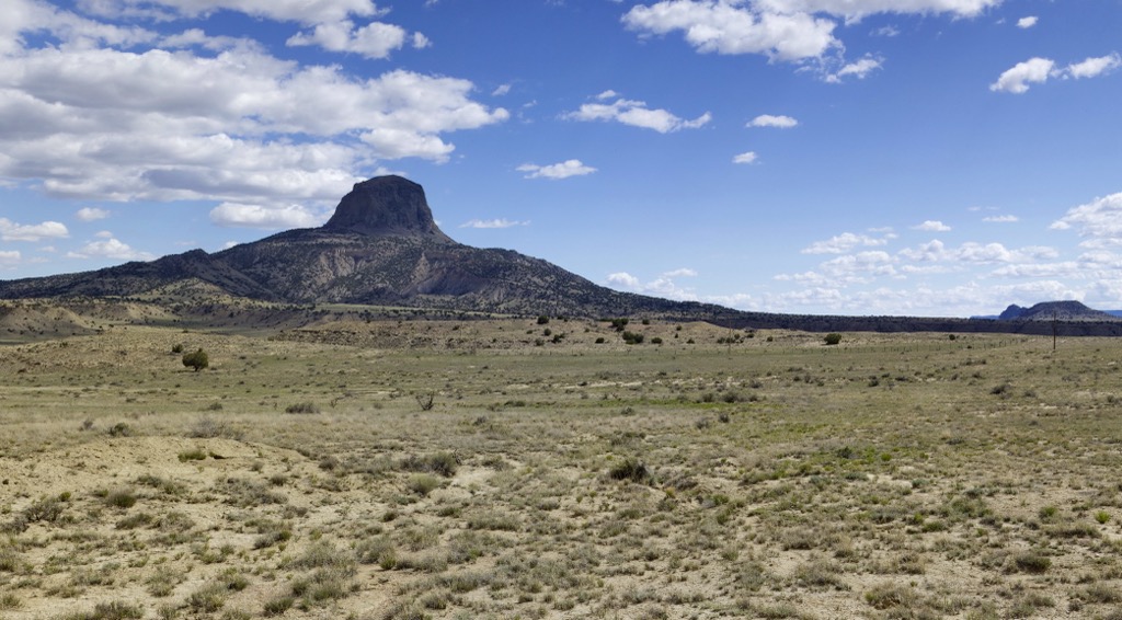
The volcanic field is composed mainly of basalt. The mount range is on the Colorado Plateau, near the transition zone between the plateau and the Rio Grande Rift. Cabezon Peak is the largest volcanic plug in the area. To the south, El Malpais National Monument contains impressive lava fields.
In the 1950s there was mining on Mount Taylor. Some coal was extracted from Rinconada Canyon but the main focus was uranium. 13 million tons of it were mined between 1946 and 1968 from Grants Mineral Belt. Uranium mining continued into the 1980s.
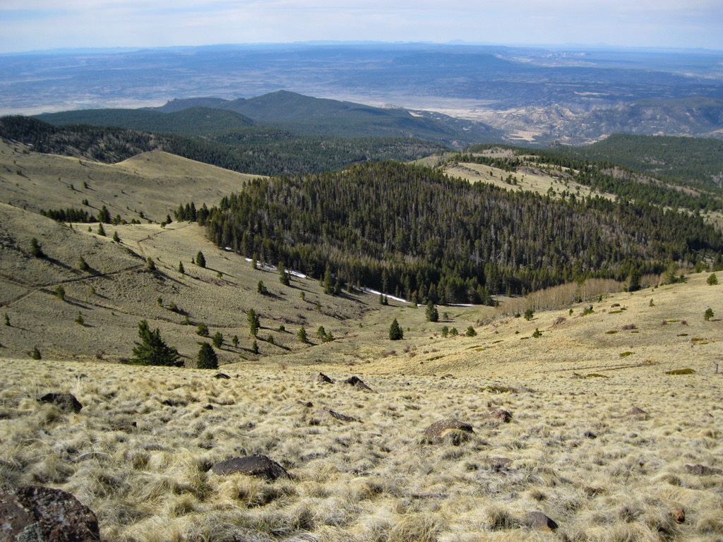
A variety of vegetation types exist across the mountains’ varying elevations. Engelman spruce, douglas fir, and aspen grow at the highest elevations. As elevation decreases, ponderosa pine becomes more prominent, followed by piñon pine and juniper. Oak grows in some areas and grasses and shrubs grow near the mountain bases and on top of mesas. The plants in the area are well adapted to the region’s semi-arid conditions.
A number of birds make their homes in the forests and canyons such as hawks, owls, falcons, and eagles. Some of the most common mammals in the area include elk, deer, rabbits, coyotes, bobcats, mountain lions, foxes, and black bears.
Prehistoric human activity in the area dates back more than 5,000 years and mainly took place in the lowlands. Obsidian artifacts and a hunting ambush site are evidence of early human life in the region.
The population density increased around 950 A.D and great houses like El Rito Outlier were constructed around 1000 AD. There have been numerous Ancestral Puebloan habitations found in the San Mateo Valley. Higher elevations were likely used for hunting and gathering resources. Wood from Ancestral Puebloan great houses in Chaco Canyon can be traced to the North San Mateo Mountains.
Ancestral Puebloan use of the area was focused on hunting, gathering (particularly piñon), obsidian, firewood, and perhaps occasional farming.
The Navajo moved into the region by the late 1500s and began arriving near Mount Taylor in the 1600s. The region saw many Navajo raids from the mid-1600s to early 1700s on Acoma and Zuni pueblos.
By the 1800s, the Navajo shifted their focus from farming to livestock, particularly sheep. In 1863, many Navajo were forcibly removed by the US Army to the Bosque Redondo reservation at Ft. Sumner. Over time, some made their way back from the reservation and picked up life again along the mountains. A number of sites date from this time – hogans, corrals, and piñon nut gathering camps.
Spanish contact in the region dates back to 1540 when the Francisco Vasquez de Coronado expedition passed through. Four decades later, the Antonio de Espejo expedition arrived in the area. A decade later, in the 1890s, Juan de Oñate spent time around the mountains in efforts to colonize locals.
Tensions between the Spanish and Navajo were exacerbated by land grants given to Hispanic settlers. Seboyeta and San Mateo are two of the area’s earliest Spanish settlements. Sheep farming was a big part of life for Spanish settlers.
The transcontinental railroad was constructed south of Mount Taylor in 1880. The town of Grants had a station and grew into a prominent community. Logging, then carrot farming and mining led to booms in the town’s population and economy.
After the construction of the Atlantic and Pacific Railroad, the railroad was given all odd number sections on either side of the right-of-way to finance the project. In 1906, even number sections became part of Forest Reserves. In 1943, this alternating land use pattern was eliminated via a land exchange with the New Mexico Timber Company.
Over the last 100 years, the area has been primarily used for livestock grazing, logging, and mining and today Cibola National Forest offers a number of recreation opportunities.
There are a couple popular hikes in the North San Mateo Mountains and Coal Mine Campground is located near Mount Taylor.
The Gooseberry Trail is 6.2 mi (10 km) out and back with just over 2,000 ft (610 m) elevation gain to summit Mount Taylor. The trail is rated as hard with some steady and steep climbing sections. However, the trail is well marked and there are great views from the top.
The road to the trailhead is gravel but well maintained. Parts of the trail do not have tree cover so come prepared from sun exposure. Livestock grazing is allowed so there may be cattle near or along the trail.
The trail to the volcanic plug Cabezon Peak is 1.9 mi (3 km) out and back with about 1,300 ft (395 m) elevation gain. It is a challenging hike and it is recommended to wear a hard hat in case of falling rocks. The route is steep and it is important to keep an eye on cairns to stay on track. Despite the work it takes for this trail, the views and fascinating geology make it worth the effort.
The North San Mateo Mountains are located only a few hours or less from several main cities in New Mexico and Arizona.
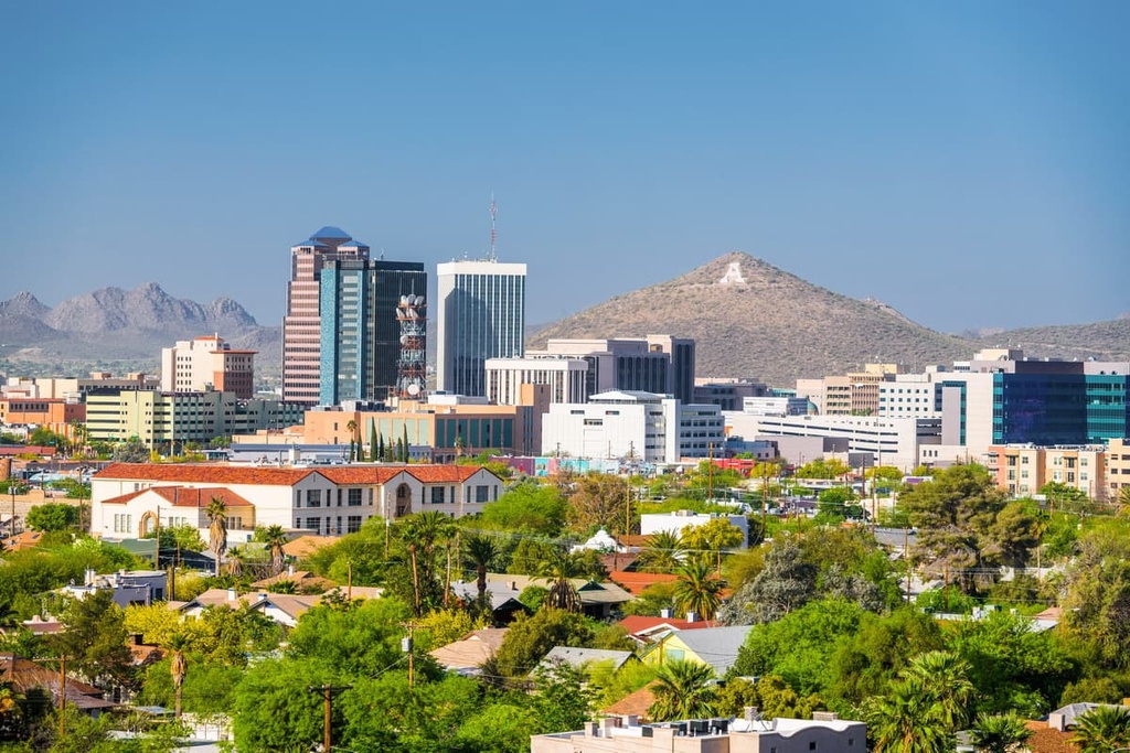
Albuquerque, New Mexico is located east of the mountains and has a population of 560,000 people. Visit the historic Old Town around the city’s central plaza with its cobblestone streets, galleries, shops, and restaurants. Top attractions include the Indian Pueblo Cultural Center with its rich exhibits of Native American arts and culture, Petroglyph National Monument, and the Sandia Peak Tramway.
The city has a rich dining scene, in particular boasting excellent restaurants offering some of the best New Mexican cuisine. There are also a range of other cuisines available, and cafes, breweries, and delis. Staying over in the city is easy with options including boutique hotels, B&Bs, resorts, rental properties, and campgrounds and RV parks.
A bit further northeast from Albuquerque, Santa Fe, New Mexico has a population of 85,000 people. Many visitors like to stop by Canyon Road, the heart of the city’s art scene. The Santa Fe Plaza, a historic central plaza, houses the Cathedral Basilica of St. Francis of Assisi and the Palace of the Governors. Other cultural activities around the city include visiting the Georgia O’Keeffe Museum, the Museum of Indian Arts and Culture, or the Santa Fe Farmers Market.
The Sangre de Cristo Mountains lie only a few miles from town. The mountains offer many great hiking and biking trails. Another outdoor option is to explore the Sandia Mountains, located between Santa Fe and Albuquerque.
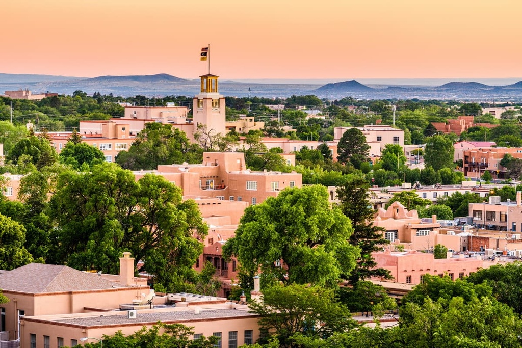
The city has many accommodation options, including standard hotels and motels, historic hotels such as La Fonda on the Plaza, B&Bs, resorts and spas, and campgrounds and RV parks. Santa Fe is a great spot to sample top notch New Mexican cuisine, excellent Mexican food, and a wide variety of cuisines including Spanish, Swahili, and Indian. There are also classic American restaurants such as burger joints, cafes, and delis.
Lying west of the mountains and in Arizona, Flagstaff has a population of 73,000 people. The city gets an average of 108 in (274 cm) of snow per year, making it truly an all-season city. It is surrounded by the world’s largest contiguous ponderosa pine forest.
Popular spots to visit from the city include Walnut Canyon National Monument with its Sinagua cliff dwellings, Sunset Crater Volcano National Monument with hiking trails across and around the volcano, and Wupatki National Monument displaying sites of Ancestral Puebloans from over 1,000 years ago.
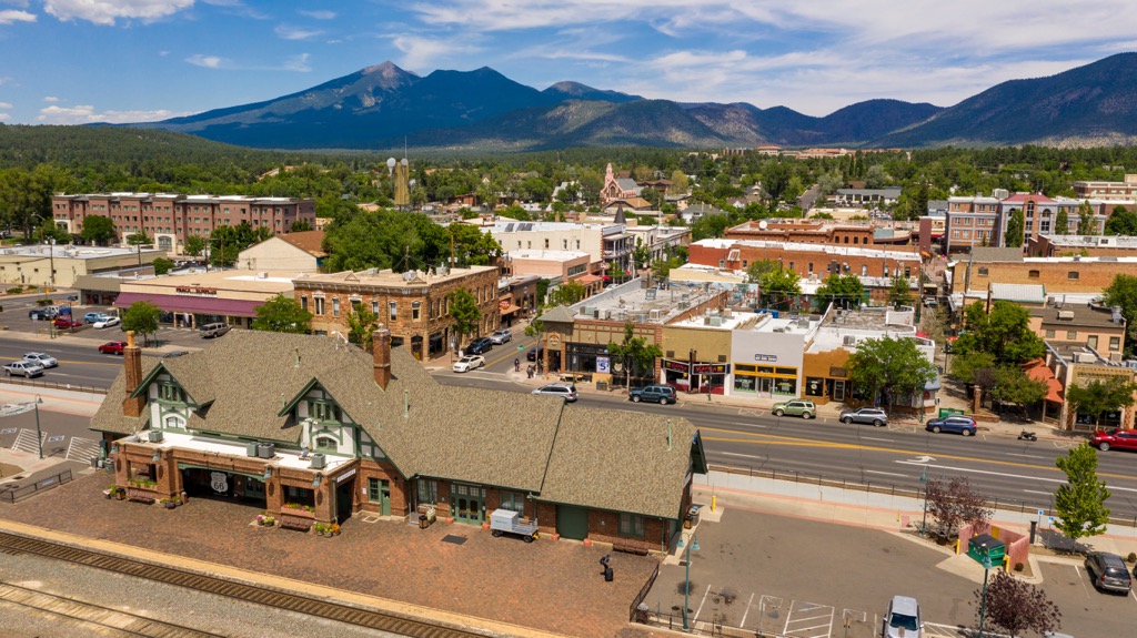
The Museum of Northern Arizona exhibits Native American art and culture, as well as other art and objects related to the natural science of the region. Grand Canyon National Park is only 80 mi (130 km) away, making it an easy day trip.
The city offers a range of restaurants including pizzerias, breweries, wine bars, delis, cafes, Indian, vegan, and farm-to-table options. It has an equally wide offering of lodging – hotels, B&Bs, rental cabins, campsites, and RV parks.


