Scan the QR code and open PeakVisor on your phone
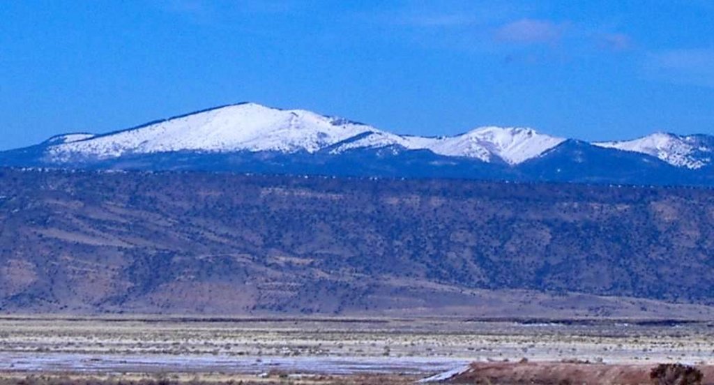
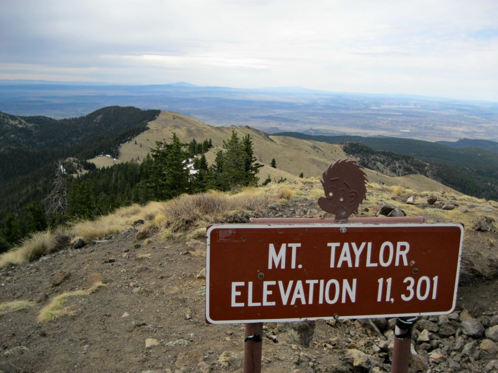
The Mt. Taylor Ranger District of the Cibola National Forest lies in the west-central region of the US state of New Mexico. The desert and forest landscape within the ranger district includes 21 named mountains. The highest and most prominent peak in the ranger district is Mount Taylor at 11,316 feet (3,449 m) tall with 4,091 feet (1,247 m) of prominence.
The Mt. Taylor Ranger District is part of the larger Cibola National Forest. The entire forest spans 1.6 million acres (647,497 ha) of terrain across the state of New Mexico. There are four major ranger districts: Mt. Taylor, Sandia, Mountainair, and Magdalena.
The Mt. Taylor Ranger District encompasses over 520,000 acres (210,437 ha) of terrain and is further divided into east and west sections. This mountainous region encompasses two mountain ranges, Mt. Taylor and the Zuni Mountains.
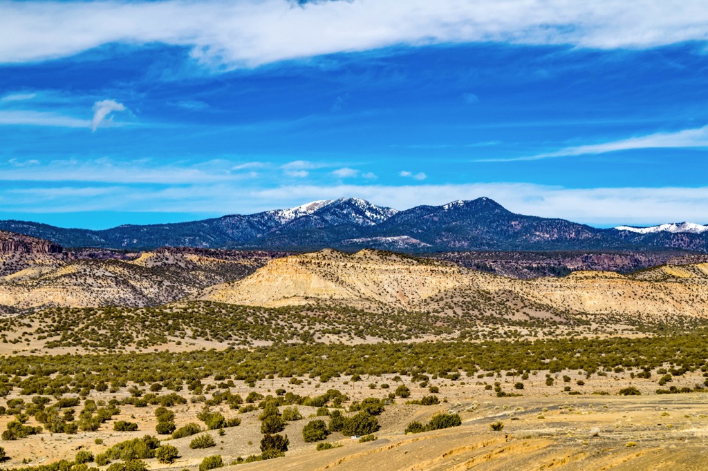
Land directly north and east of the ranger district features relatively flat terrain, while the ranges rise steeply from the desert floor. The ranger district spans across portions of both Cibola and McKinley counties.
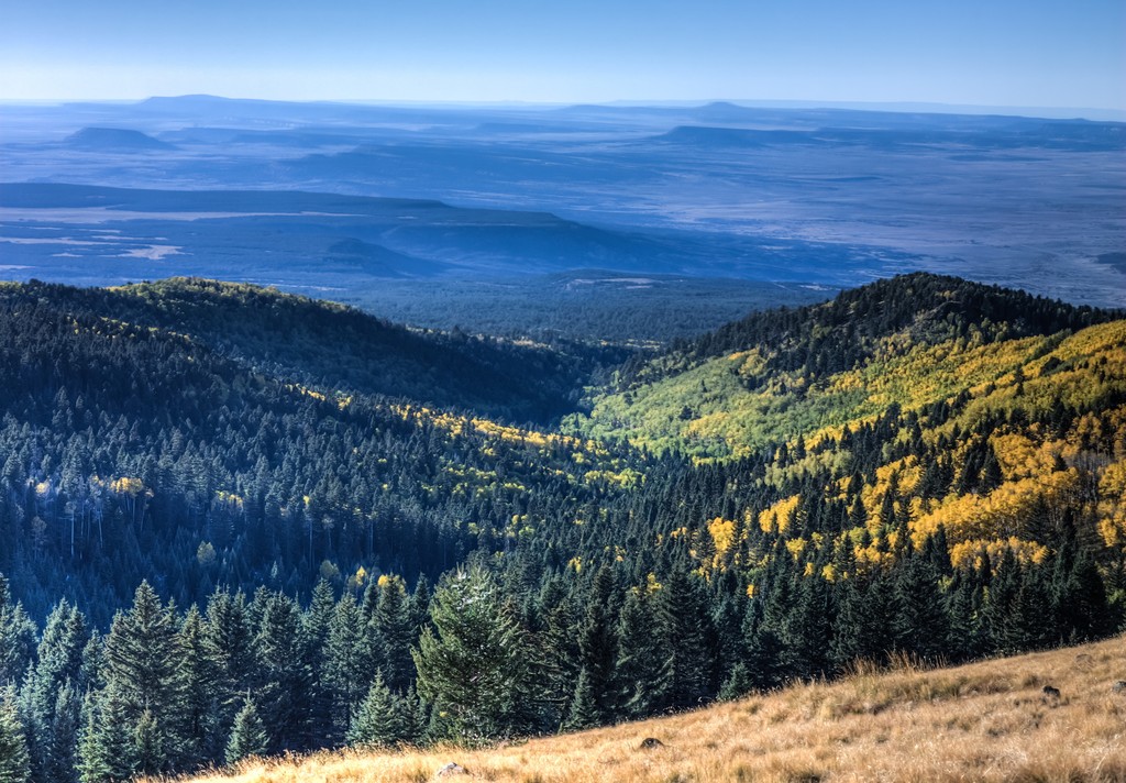
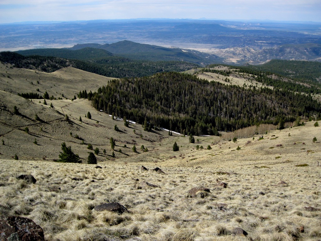
Elevations in the region range from 6,500 feet (1,981 m) up to 11,316 feet (3,449 m) at the summit of Mount Taylor. Steep slopes and high mesas mark this protected region, with a majority of the ranger district being densely forested.
Numerous creeks and streams cut across the Zuni Mountains with some of the most prominent being Cebolla Creek and Bluewater Creeks. Most of these streams feed into small ponds and lakes located in the foothills of the range and ranger district.
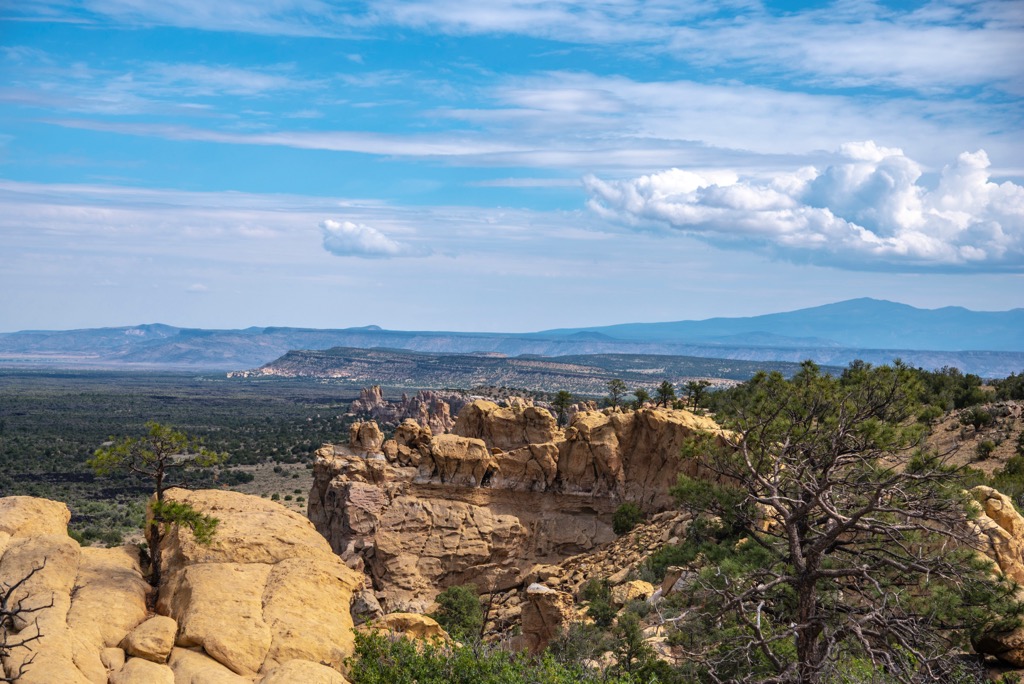
Additionally, the Mt. Taylor Ranger District is situated near various other areas for outdoor recreation. Directly north of the district lies Ignacio Chavez Wilderness Study Area and La Leña Wilderness Study Area. Southwest of the district lies the El Malpais Wilderness Study Area, El Malpais National Monument, Canyons Wilderness Study Area, and the El Malpais National Conservation Area.
The Mt. Taylor Ranger District helps protect both the Mt. Taylor Mountains and the Zuni Mountains. These peaks mark subranges of the North San Mateo Mountains, situated along the southwestern edge of the Colorado Plateau.
Known for being geologically stable, the Colorado Plateau has experienced minimal amounts of folding and thrusting over the past 600 million years. Layers of rock were well-preserved as the plateau was slowly thrust upwards.
Over the course of millions of years, erosion washed away the softer rocks and left behind the mesas visible throughout the region and the ranger district. Mount Taylor marks the tallest peak in the ranger district and the surrounding North San Mateo Mountains.
This peak, and the surrounding range, is estimated to be between 3.3 and 2.5 million years old. Mount Taylor is part of a widespread volcanic field. Rather than having been formed by one volcanic eruption, Mount Taylor took shape through a series of repeated volcanic activity.
Basalt is common throughout the surrounding volcanic field while the Rio Grande Rift lies just south of the range. These lava fields help showcase the extensive geological history of the region.
Major peaks that are located within the ranger district include Mount Taylor, San Mateo Mesa, Mesa de Ortega, Cerro Chavez, and Jesus Mesa.
The forested and desert sections of the range district help support a variety of both flora and fauna. Some larger mammals that are commonly found in the region include mule deer, elk, bobcats, mountain lions, black bears, coyotes, and foxes.
Various species of birds inhabit the region including birds of prey such as vultures, golden eagles, bald eagles, red-tailed hawks, northern goshawks, peregrine falcons, and Mexican spotted owls.
The lowest elevations in the district feature low growing grasses and shrubs. A majority of the protected region is densely forested with pinyon-juniper dominating the landscape up to around 8,000 feet (2,440 m). Higher elevations are populated by stands of spruce, ponderosa pine, and aspen.
Humans have inhabited this region for over 10,000 years, long before the arrival of European colonizers. This region has historically been inhabited by the Puebloan peoples of the Laguna, Zuni, Acoma, and Navajo. This area in particular marks part of the ancestral homelands of the Laguna Pueblo, located directly southeast of the ranger district.
This land once marked the boundary between the Ancestral Pueblo people, who lived to the north, and the Mogollon cultures, who traditionally lived to the south.
During the late 1500’s, the Navajo people began inhabiting the region, often raiding the Acoma and Zuni Pueblos. The groups of Ancestral Puebloans that inhabited the region practiced a culture centered around hunting, gathering, and some farming.
The first recorded contact between these Indigenous peoples and Europeans occurred in 1540 when a Spanish expedition led by Francisco Vasquez de Coronado passed through the region. Spaniards revisited the region in 1599 which ultimately led to the Acoma Massacre where roughly 500 people of the Acoma Pueblo were killed.
Spanish civil offices were constructed in the Pueblos in 1620 following a royal decree. Their presence led to heightened tension with the surrounding Pueblos joining forces in 1680 to form the Pueblo Revolt. The Laguna Pueblo was formed by Indigenous people who left during this time.
The Pueblo Revolt lasted from 1680 to 1696, and in 1699 the Spanish constructed the Mission San José de la Laguna on the land of the old Pueblo, now known as Old Laguna. Europeans also brought over infectious diseases that drastically affected the Pueblos as the Indigenous peoples had no natural immunity to the illnesses.
Construction of railroads during the nineteenth century led to a rapid increase of population for the surrounding region. Despite their continual efforts to protect their land, Indigenous peoples of the region were continually harassed, attacked, displaced, and killed by the US government, ultimately being forced onto reservations.
The Cibola National Forest began as a forest reserve in 1906. The land that is now part of Mt. Taylor Ranger District was heavily logged before it was eventually added to the national forest.
The Mt. Taylor District of the Cibola National Forest is home to numerous hiking trails. Here are some of the best trails to check out during your next trip to the region.
This out and back path leads to the summit of Mount Taylor, which marks the tallest peak in the surrounding mountain range and ranger district. While there are numerous routes to reach the summit, this out and back path is the most direct.
The trail climbs steadily throughout, winding through the forested hillsides before reaching the summit. Near the top of Mount Taylor, the forested landscape begins to thin, giving way to panoramic views. The route is 6.2 miles (10 km) and features 2,017 feet (615 m) of elevation gain.
This loop trail begins the same as Mount Taylor via Gooseberry Trail. After climbing through the forest and reaching the summit of Mount Taylor, the trail then descends along trail 2419 back toward the trailhead.
While the loop adds a bit more distance to the route, hikers are more likely to experience solitude as the main route is more heavily trafficked. This loop is 7.8 miles (12.6 km) long and features 2,112 feet (644 m) of total elevation gain.
This short section of the Continental Divide trail offers sweeping views of the landscape, located just off of NM 547. After passing through the shrubs, grasses, and trees in the southern foothills of the ranger district, the route opens up to a sweeping mesa.
Hikers are rewarded with views of the desert terrain, forested hillsides, and surrounding mesas. This out and back route is 3.7 miles (6 km) and features 954 feet (291 m) of elevation gain.
Looking for a place to stay near Mt. Taylor Ranger District? Here are some of the best cities and villages to check out in the region.
The city of Grants lies along the southern edge of the ranger district. Situated along the historic Route 66, the Main Street of Grants is home to a plethora of local shops and restaurants that showcase some of the history of the region.
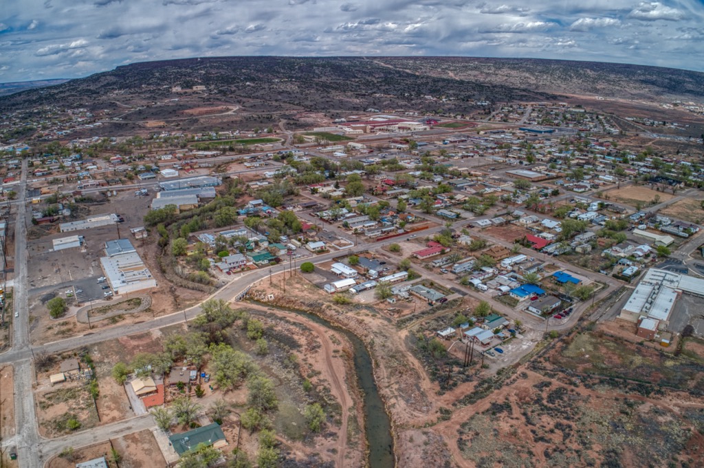
Nicknamed the “Uranium Capital of the World”, Grants has a long history of mining and was used for mining uranium until the 1980s. Surrounded by national forests and national monuments, visitors can explore numerous hiking and mountain biking trails near the city. Within Grants also lies the Grants Mining Museum and the Western New Mexico Aviation Heritage Museum.
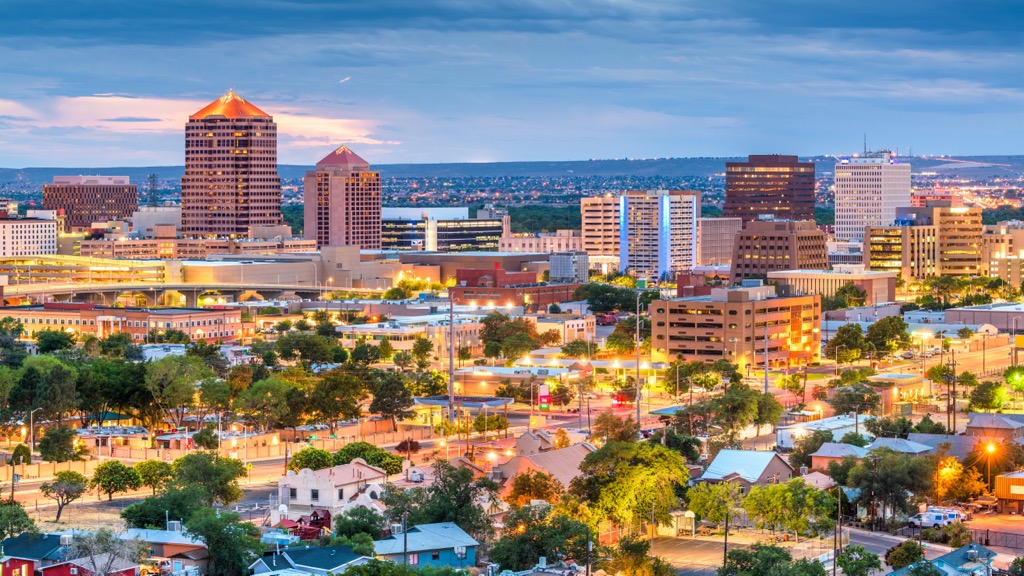
Albuquerque lies east of the ranger district, marking the closest major city. Home to 560,000 residents, Albuquerque marks the most populated city in the state of New Mexico.
The city acts as an economic and cultural hub for the region, home to numerous events and festivals each year. Every October Albuquerque hosts the annual International Balloon Fiesta, which marks the world’s largest gathering of hot air balloons. Those visiting can explore the New Mexico Museum of Natural History to learn more about the history of the region.
The nearby Sandia Peak Ski Area offers opportunities for outdoor recreation during the winter months. The ski area is also home to the Sandia Peak Tramway, which marks one of the longest tramways in the world and leads to the summit of Sandia Peak.