
Scan the QR code and open PeakVisor on your phone
The Blackrkidge Wilderness Area is a protected region situated in the southwestern corner of Utah in the US. The tallest and most prominent peak in the wilderness area is Black Ridge at 6,565 ft (2,001 m) in elevation and with 489 ft (149 m) of prominence.
The Blackridge Wilderness Area is located in southwestern Utah, near the state’s border with Nevada and Arizona. The wilderness encompasses 13,108 acres (5,305 ha) of land and is part of the greater Zion Wilderness system.
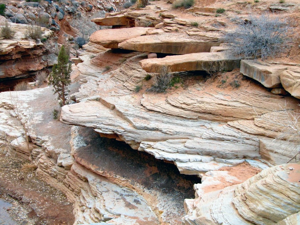
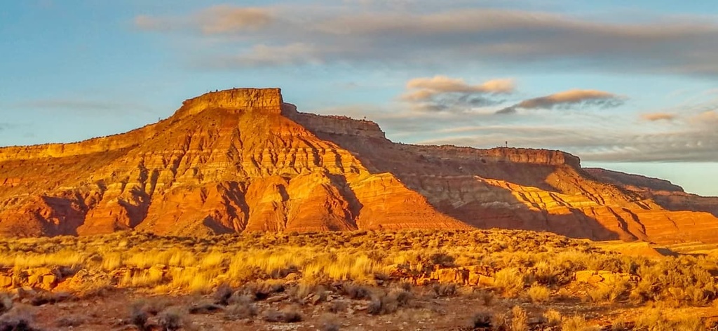
Managed by the Bureau of Land Management, the Blackridge Wilderness is marked by rugged rocky outcrops as well as deep canyons and valleys. The cliffs within the wilderness are part of the Grand Staircase plateaus.
Sheer cliffs stand over 1,000 feet (305 m) tall along the sides of the main canyon in the Blackridge Wilderness. Dramatic changes in elevation in the wilderness have also led to the formation of a multitude of ecosystems, allowing for a variety of flora and fauna to thrive within the region’s desert environment.
Red rocky outcrops mark the highest elevations in the wilderness. The rest of the canyon is marked by distinct shelves of rock that are often covered in trees and low growing shrubs. Scenic viewpoints can be found throughout the region, too, offering unobstructed views of the surrounding landscape.
The Blackridge Wilderness is located near numerous national forests, parks and wilderness areas. The Dixie National Forest lies to the west and north of the wilderness while Zion National Park is situated directly to the east. To the southeast of the wilderness are the Canaan Mountain Wilderness and Parunuweap Canyon Wilderness Study Area.
The peaks within the Blackridge Wilderness Area are part of the larger Great Basin Ranges, which extend throughout much of Utah, Nevada, Idaho, Oregon, and California.
The topography of the Great Basin Ranges is unique compared to the other ranges found in eastern Utah. The ranges are named after the series alternating ranges and basins that can be found within the Blackridge Wilderness and the overall Great Basin region.
The geological features of the Blackridge Wilderness are deeply intertwined with those of the adjacent Zion National Park. The exposed outcrops within the wilderness are part of the larger Grand Staircase.
Sections of the Grand Staircase date back 150 million years and consist of Mesozoic-aged sedimentary rock. The wilderness is also part of the larger Colorado Plateau, which has been uplifted thousands of feet over the course of millions of years.
The dramatic changes in elevation in the regions as a result of the uplift of the Colorado Plateau led to the steepening of the rivers and streams on the plateau. This allowed the rivers to carve out the deep canyons of the region.
The wilderness is situated along the Hurricane Fault, which separates the Great Basin Ranges and Colorado Plateau. Continual shifting along the fault has added to the dramatic landscape seen within the wilderness today.
The two major peaks within the Blackridge Wilderness are Black Ridge and Pace Knoll.
The ecology of the Blackridge Wilderness is diverse, and the wilderness is currently home to a multitude of ecoregions. Elevations in the wilderness range from a low of around 3,650 feet (1,112 m) up to the summit of Black Ridge.
The highest elevations in the wilderness are home to groups of white fir, Douglas fir, ponderosa pine, Rocky Mountain juniper, and Douglas fir. As elevations decrease, the landscape gives way to oak, shrubs, yucca, pinyon-juniper, and littleleaf mountain mahogany.
At elevations lower than 4,500 feet (1,372 m), the landscape is classified as desert. Here, visitors will find large expanses of land that are dominated by creosote bush, saltbush, and blackbrush. These types of flora are able to withstand the drought conditions present at the bottom of the canyons.
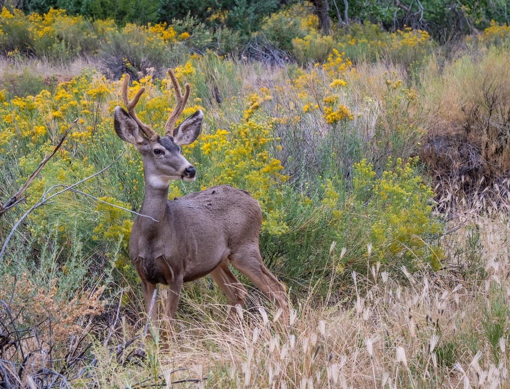
Large populations of mule deer inhabit much of the wilderness. The mule deer’s primary predator is the mountain lion, which often hunts alone and stays hidden from humans.
Various raptors live within the wilderness’ canyon landscape, perching above the canyon in search of small rodents. These species include the peregrine falcon, bald eagle, prairie falcon, American kestrel, golden easy, Cooper’s hawk, and red-tailed hawk.
The peregrine falcon is one of the more prominent species in the region. Meanwhile, bald eagles often only visit the region during the winter months.
Humans have inhabited the region surrounding the Blackridge Wilderness Area for over nearly 8,000 years.
Over the millennia the Great Basin region has been inhabited by numerous Indigenous groups and Tribes. Many tribal nations, including the Ute Indian Tribe, Eastern Shoshone Tribe, Confederated Goshute Tribes of the Goshute Reservation, Skull Valley Band of Goshute, and Shoshone-Bannock Tribes consider the region to be part of their ancestral homelands.
The Ute Indian Tribe has historically been the most prominent in the region, traveling throughout canyon country with the changing of the seasons. Other bands of Ute were traditionally less nomadic and more agricultural, planting corn, squash, and other crops.
The Ute people had contact with Spanish conquistadors as early as the sixteenth century. By the eighteenth century, people of European descent had begun exploring the region and making contact with the indigenous groups.
Jedediah Smith began traveling in the region around 1825 as part of the American Fur Company. His travels in the area paved the way for numerous fur trapper settlements in what is now southern Utah. Around the same time, Brigham Young sent a group of Mormons to northern Utah in order to claim what they believe to be their promised land.
By 1847, Mormons had begun settling in the Virgin River region, despite resistance from local Tribal Nations. Numerous wars broke out while the Ute people fought to preserve and protect their native lands.
Settlers of European descent were often supported by US troops in their efforts to displace Tribal Nations. Many of these wars resulted in the forced removal of Indigenous peoples to reservations.
While nearby Zion National Park was established in 1919, the Blackridge Wilderness wasn’t created until 2009.
The Blackridge Wilderness is home to a number of hiking routes. Here are some of the most popular hiking trails in the wilderness:
Just to the west of the wilderness lies Interstate 15. Scenic viewpoints along the highway offer some of the best views of the wilderness area.
From the road, visitors can gaze down the deep canyons and see the distinct layers of rock that have made the Blackridge Wilderness the special place that it is today. On a clear day, visitors can also spot the outcrops of the Kolob Canyons, which lie within Zion National Park just to the east of the wilderness.
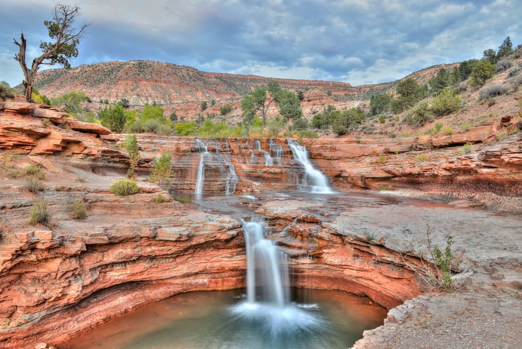
Situated near the southern edge of the wilderness lies Toquerville Falls. The trail to the falls is 11.7 miles (19 km) long with 1,984 ft (605 m) of elevation gain. The out and back trail can be hiked or accessed with a high clearance four wheel drive vehicle.
The trail winds through shrublands with canyon walls towering above. Distinct layers of rocks can be seen in the rocks formation along the trail and trees dot the highest elevations along the path. Eventually, the trail arrives at Toquerville Falls, which cascades down about 20 feet (6 m) in a stair-like formation.
Looking for a place to stay near the Blackridge Wilderness? Here are some of the best cities and villages to check out in the region:
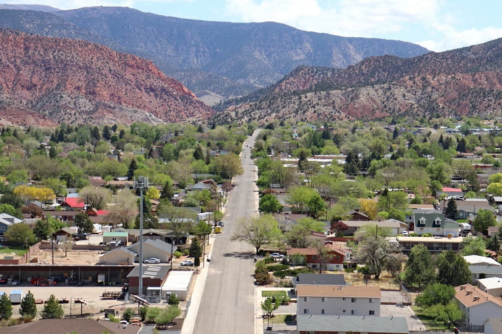
Directly south of the wilderness lies the town of Hurricane, which has a population of around 17,000 people. The city was established in 1896 in the Hurricane Valley. Popular places to check out in the region include Sand Hollow State Park, Quail Creek State Park, and the Virgin River.
Hurricane provides easy access to Blackridge Wilderness, Pine Valley Mountain Wilderness, and Zion National Park. Though small in size, the city acts as a perfect gateway to much of southern Utah’s beauty.
Cedar City is located just to the north of the Blackridge Wilderness. Home to Southern Utah University, the city has a population of around 35,000 people, making it the most populous city in southwestern Utah. Each year, Cedar City hosts numerous festivals and events that are well worth checking out.
Annual festivals in Cedar City include the Utah Shakespeare Festival and Utah Summer Games. Brian Head Ski Resort is also located just outside of the city along with various national parks, forests, and wilderness areas.
Las Vegas is situated a two hour drive to the southwest of the Blackridge Wilderness. Vegas has a metro population of around 2.2 million people and it is the closest major city to the wilderness area. The city is also famous for its entertainment industry.
Massive casinos and resorts are found throughout the city, attracting visitors from around the world. Yet the busy city is also surrounded by amazing destinations for hiking, mountain biking, and rock climbing. Las Vegas is also located in close proximity to various national forests, wilderness areas, and national parks.


