
Scan the QR code and open PeakVisor on your phone
The Desolation Canyon Wilderness is a federally protected area located in the eastern part of Utah that happens to be one of the most remote places in the contiguous US. There are 15 named mountains in the wilderness area. The highest point in the wilderness is Flat Top (8,684 ft/2,647 m) while the most prominent mountain is Mount Elliott with 2,303 ft (702 m) of prominence.
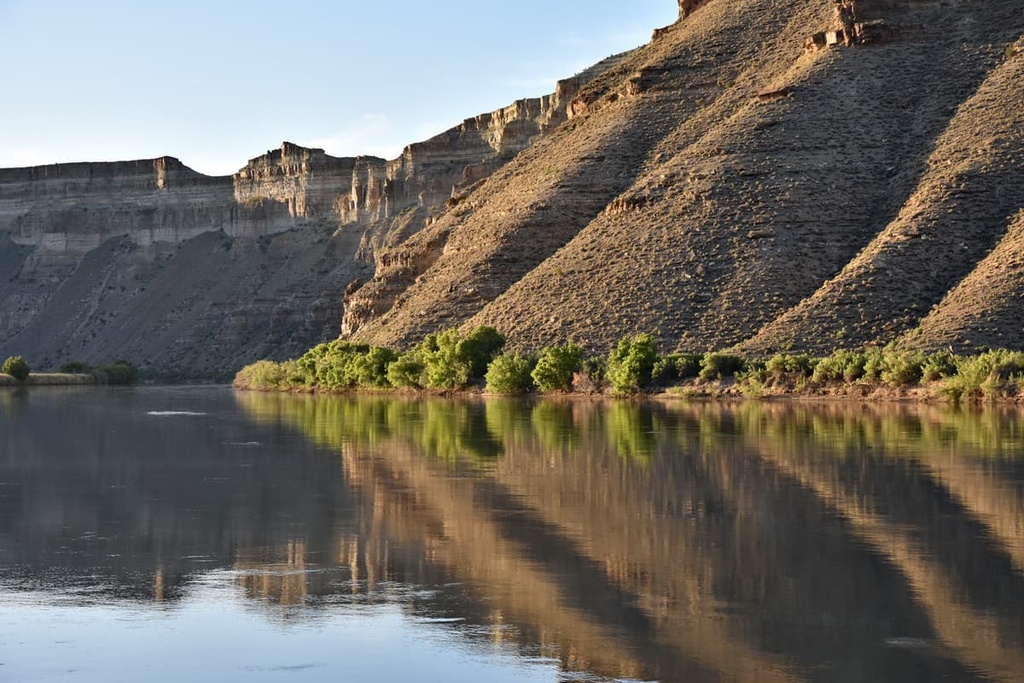
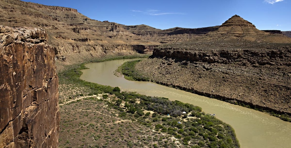
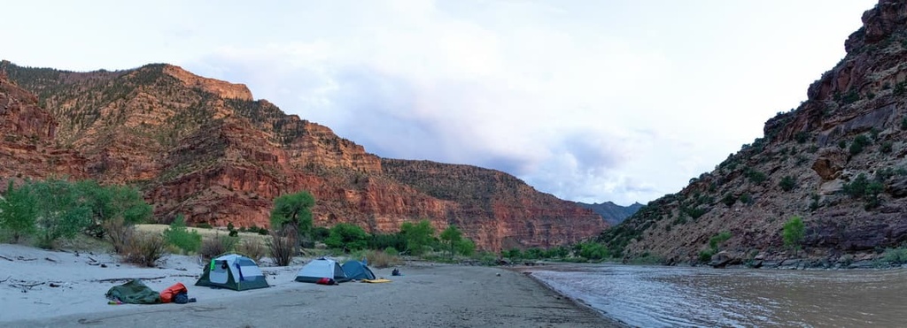
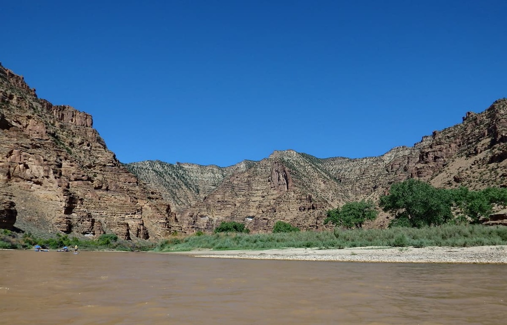
The Desolation Canyon Wilderness lies in the eastern part of the US state of Utah and covers 142,996 acres (57,868 ha) of terrain. The wilderness encompasses an 84-mile (135 km) segment of the Green River, which drains into the Colorado River.
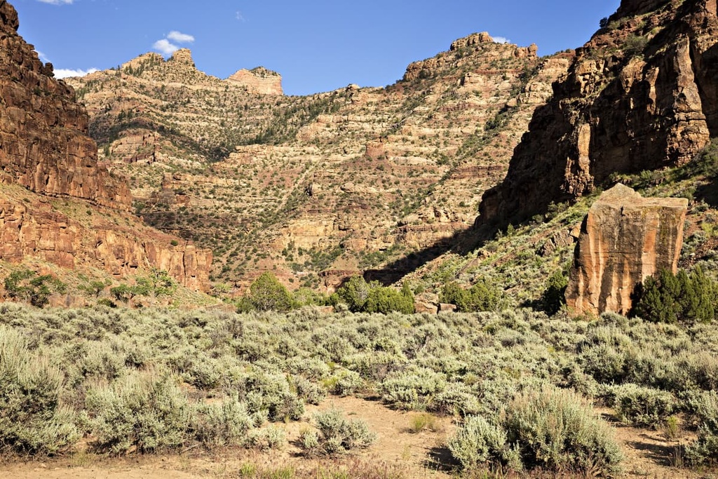
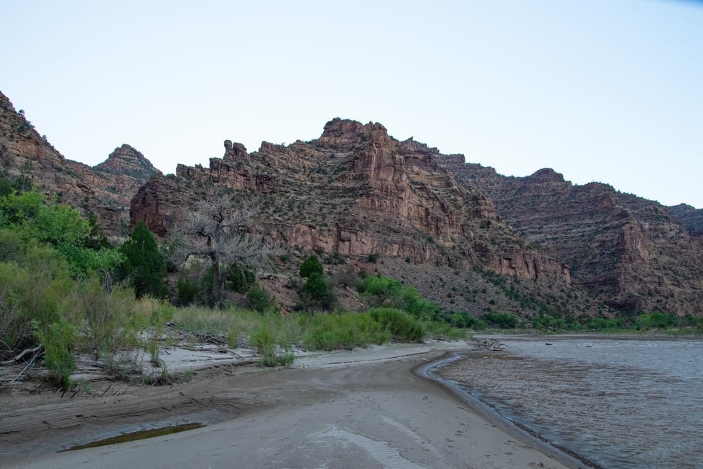
Additionally, the Desolation Canyon Wilderness covers land in both Desolation and Gray canyons. These steep canyons are the main geographic feature of the region and the wilderness as a whole. Deep canyons wind their way throughout the wilderness and many of them boast creeks that drain into the Green River.
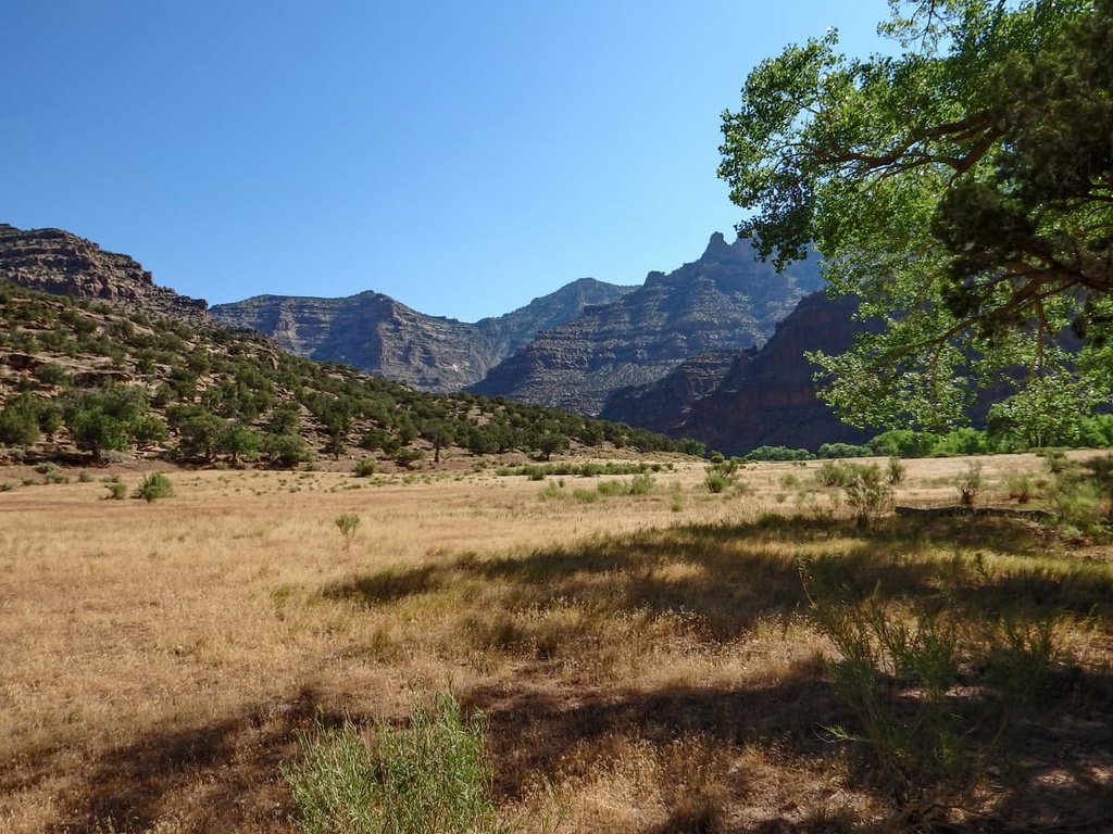
Elevations vary throughout the wilderness from lows of around 3,000 ft (914 m) up to the summit of Flat Top at 8,684 ft (2,647 m). In some sections of the wilderness area, the canyon is over 1 mile (1.6 km) deep. Alongside its stunning canyons, the wilderness also features pinnacles, arches, and various other rock formations.
The Desolation Canyon Wilderness is part of a larger network of protected areas that encompasses much of eastern Utah. For example, the Spruce Canyon Wilderness Study Area and Coal Canyon Wilderness Study Area are situated to the east of the Desolation Canyon Wilderness, while the Turtle Canyon Wilderness Area is located to the northwest. Additionally, the Mexican Mountain Wilderness lies to the southwest of Desolation Canyon while Arches National Park is nestled to the southeast.
The Desolation Canyon Wilderness has a rich geological history as it is part of the Wasatch Formation. The Wasatch Formation is a geologic formation that’s known for its extensive collection of fossils. It is found in parts of Idaho, Montana, Wyoming, Utah, and Colorado, and it is believed to have formed between about 57 and 46 million years ago.
Although the Wasatch Formation is found across a huge area, it consists almost exclusively of sedimentary rocks. The main rocks found in this formation are mudstones, sandstones, shales, and siltstones.
The Wasatch Formation is of particular importance to paleontologists because thousands of fossils have been found in the formation to date. This includes the fossilized remains of everything from mammals and birds to reptiles, fish, amphibians, and invertebrates.
Due to the fact that the Wasatch Formation has such a high concentration of fossils, it comes as relatively little surprise that the formation also boasts a sizable deposit of fossil fuels. In particular, the Wasatch Formation has a large reservoir of natural gas and some large coal bed deposits. There are thousands of natural gas wells in the region that are still in operation to this day.
That said, the current topography of the Desolation Canyon Wilderness is as much a result of its rock strata as it is a result of millions of years of erosion. In particular, over the course of millions of years, the various rivers and creeks in the region slowly carved out the landscape, leaving behind the steep canyons that are visible today.
Major high points within the Desolation Canyon Wilderness include Flat Top, Mount Elliott, Little Elliot Mesa, Gunnison Butte, and Blue Castle Butte.
The Desolation Canyon Wilderness is centered on the canyons that surround the Green River. However, the drastic changes in elevation between the tops and bottoms of the region’s canyons allow for a diverse array of vegetation and flora to thrive in the wilderness area
The forests that exist along the canyon edges in the wilderness area feature stands of Douglas fir and pinyon-juniper woodlands. Along the edge of the wilderness area’s rivers, you’ll primarily find riparian landscapes that feature saltbrush, blackbrush, and sagebrush. Mountain mahogany is also common in various portions of the wilderness area.
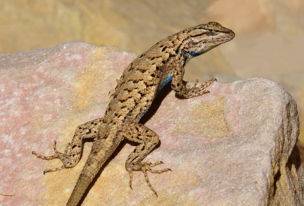
Populations of Rocky Mountain bighorn sheep are common throughout the wilderness area. Other mammals found in the region include mountain lions, mule deer, and black bears. Various species of eagles, snakes, and lizards all thrive in the wilderness area, too.
The land located within and surrounding the Desolation Canyon Wilderness has been inhabited by humans for thousands of years. Artifacts from human settlements that have been found in the surrounding region are thought to date back nearly 10,000 years.
Some of the earliest inhabitants of this region include the people of the Fremont culture. Many modern Indigenous people with ancestral ties to the area that is now the Desolation Canyon Wilderness are descendants of the people of the Fremont culture. In particular, the land within the wilderness is part of the ancestral homelands of the Ute Indian Tribe (Núuchi-u).
Additionally, the northern stretches of the wilderness extend into the Uintah and Ouray Reservation, which is located to the north and the east of Desolation Canyon. The reservation covers 6,825 square miles (17,677 sq. km) of terrain across the northeastern part of the state of Utah.
The first Europeans to travel through the region are thought to have been Spanish priests and missionaries on the Domínguez-Escalante expedition. During the late eighteenth century, this expedition traveled throughout what is now the southwestern United States in search of a route connecting Santa Fe, New Mexico, and Monterey, California.
In the following decades, more Europeans began arriving throughout the region as the local fur trade started to thrive. During the 1820s, the Uinta Mountains, which lie to the north of the wilderness, were favorite destinations of fur traders such as William Henry Ashley, a politician, prospector, slave owner, and entrepreneur.
Brigham Young sent a group of Mormons (members of the Church of Jesus Christ of Latter-day Saints) to the region in the late 1820s in order to establish communities and lay claim to the region that they believed to be their promised land. These early Mormon missionaries laid the framework for the expansion of Mormonism and colonization throughout the region.
A gold rush also brought a large influx of settlers into Utah around this same time. However, the increasingly large number of settlers in the area led to conflict between the settlers and the Indigenous people who had been living in the region for countless generations.
Throughout the 1800s, settlers in the region, often backed by the US government, repeatedly attacked, displaced, and killed the Indigenous peoples who lived on the land. In the 1880s, the US government even forced the Ute to take up agriculture in the region despite the lack of water and irrigation systems in eastern Utah.
During this period, the US government also forced Indigenous children to attend residential schools, many of which were fully or partially run by Christian organizations. The aim of these schools was to eradicate the Indigenous practices and assimilate these children into the traditions of their colonizers.
The Ute bands who managed to remain in the area were eventually forced onto the Uintah and Ouray Indian Reservation. The reservation was founded in 1861 and currently includes land in eastern Utah. It is currently the second-largest reservation in the US after the Navajo Nation (Naabeehó Bináhásdzo).
For many years, the Desolation Canyon Wilderness was actually a wilderness study area—not a fully designated wilderness. The canyon was first added to the National Register of Historic Places in 1968. It was then designated as a wilderness study area by the Bureau of Land Management in 1982 under Section 603 of the Federal Land Policy.
Although much of the study area was recommended for full wilderness status in the latter part of the twentieth century, it wasn’t formally designated as such until 2019. In 2019, Congress passed the John D. Dingell, Jr. Conservation, Management, and Recreation Act, which, among other things, established the Desolation Canyon Wilderness as part of the National Wilderness Preservation System.
Due to the remote nature of Desolation Canyon, there are relatively few hiking trails in the wilderness area. Instead of hiking, the canyon is primarily used for rafting trips. With that in mind, here’s a look at a few of the trails that you can enjoy in the wilderness and the surrounding region.
The Nephratiti Trail follows the eastern bank of the Green River in Gray Canyon. This route begins at the end of a service road that features views of petroglyphs. The trail then follows the banks of the river while the limestone canyon walls tower above on either side.
This hiking route is also used for cattle grazing and some of the vegetation can be slightly overgrown, so take care as you walk. In total, this out-and-back trail is 3.8 miles (6.1 km) long and it has 104 feet (32 m) of elevation gain.
Daddy Canyon lies just to the northwest of the wilderness within Nine Mile Canyon. The relatively short Daddy Canyon Trail features stunning views and is well worth the effort as hikers on this route can see numerous petroglyphs along with unique rock formations.
Despite the fact that the Daddy Canyon Trail takes you to a remote area, the trailhead itself is well visited, so it’s a great place to start your adventures in the region. At the trailhead, you can find a bathroom, shade shelter, and even a picnic area. This loop trail is 1 mile (1.6 km) long and it has 108 feet (33 m) of elevation gain.

The Woodside Lower Price River Road hiking route lies along the western edge of the wilderness and follows the banks of the Price River. Throughout this out-and-back route, the trail features numerous climbs and descents while the narrow and steep canyon towers overhead.
This out-and-back trail is 15.4 miles (25 km) in length and it has 1,154 feet (352 m) of elevation gain. However, hikers should note that this trail is also regularly used for off-road vehicles, so always pay attention to your surroundings as you walk.
Looking for a place to stay near the Desolation Canyon Wilderness? Here are some of the best cities and villages to check out in the region.
Moab is a mid-sized community that lies less than an hour’s drive to the southeast of the Desolation Canyon Wilderness. The city of Moab is situated along the Colorado River, and it is home to around 5,400 residents. Moab is primarily known for its plethora of outdoor activities and its close proximity to both Arches National Park and Canyonlands National Park.
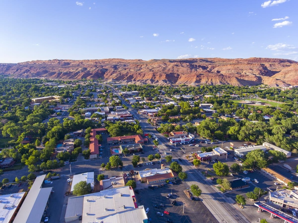
Hundreds of miles of trails surround the city while stunning red rock landscapes expand outward in every direction. The trails in this region are used for hiking, trail running, and mountain biking. Other common activities in the area around Moab include rafting, highlining, and rock climbing.
When it comes to more extreme sports, Moab is a hub for BASE jumping. Moab is also home to companies that offer tandem BASE jumping experiences for beginners.
If BASE jumping isn’t quite your thing, you can also check out the Moab Museum, which features artifacts and artwork that showcase the history of the region. Moab’s library and coffee shops are also great places to hang out when you’re not adventuring in the nearby canyons.
Located just to the east of the wilderness is the city of Grand Junction, Colorado. As it is home to around 65,000 residents, Grand Junction is the closest large city to the wilderness area. Grand Junction is the most populous city in western Colorado, and it is situated at the confluence of the Colorado and Gunnison Rivers.
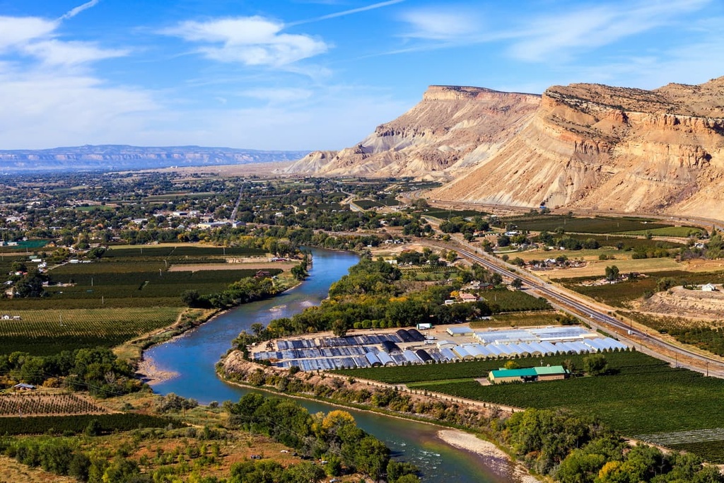
Like Moab, Grand Junction is known for its plethora of outdoor activities. Visitors to the region can also explore the nearby Colorado National Monument and the Grand Mesa National Forest.
As it is the main city in the region, Grand Junction is a hub for cultural attractions and cuisine. In fact, the local breweries and restaurants in Grand Junction provide a relaxing end to a day spent exploring the forests, canyons, and mountains that surround the city.


