Scan the QR code and open PeakVisor on your phone
The Colorado River Valley Field Office is an administrative office of the Bureau of Land Management (BLM) that’s located in the western part of the US state of Colorado. The field office manages a portion of land near the Colorado River with 53 named mountains. The tallest and most prominent peak in the field office is Castle Peak at 11,283 ft (3,439 m) in elevation and with 3,035 ft (925 m) of prominence.
The Colorado River Valley Field Office is one of 17 Bureau of Land Management (BLM) field offices in the state of Colorado. It is located in the heart of the White River National Forest, and it straddles the Colorado River.
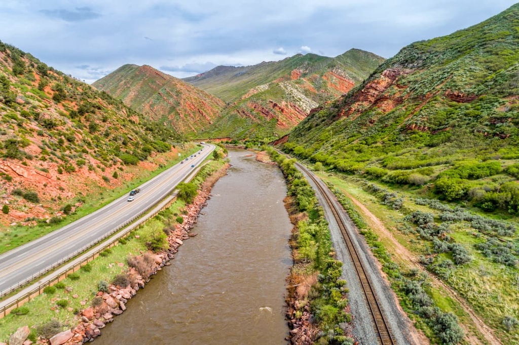
True to its name, the field office encompasses land on either side of the Colorado River Valley, roughly between the towns of Parachute to the west and Vail to the east. The field office encompasses 567,000 acres (229,450 ha) of land within Eagle, Pitkin, Routt, Garfield, Mesa, and Rio Blanco counties.
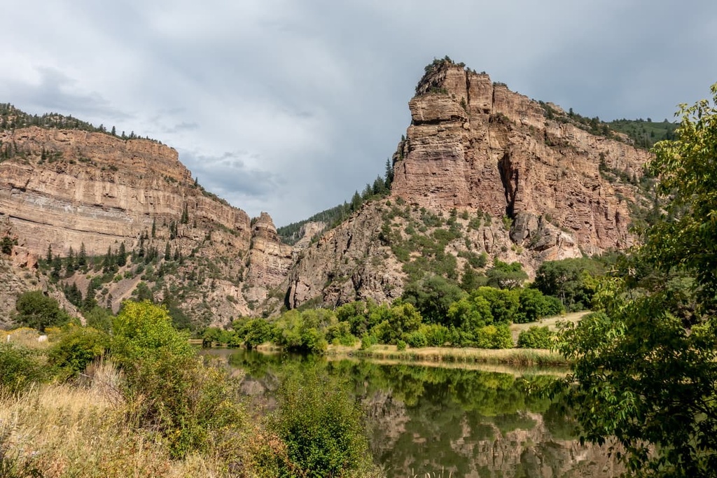
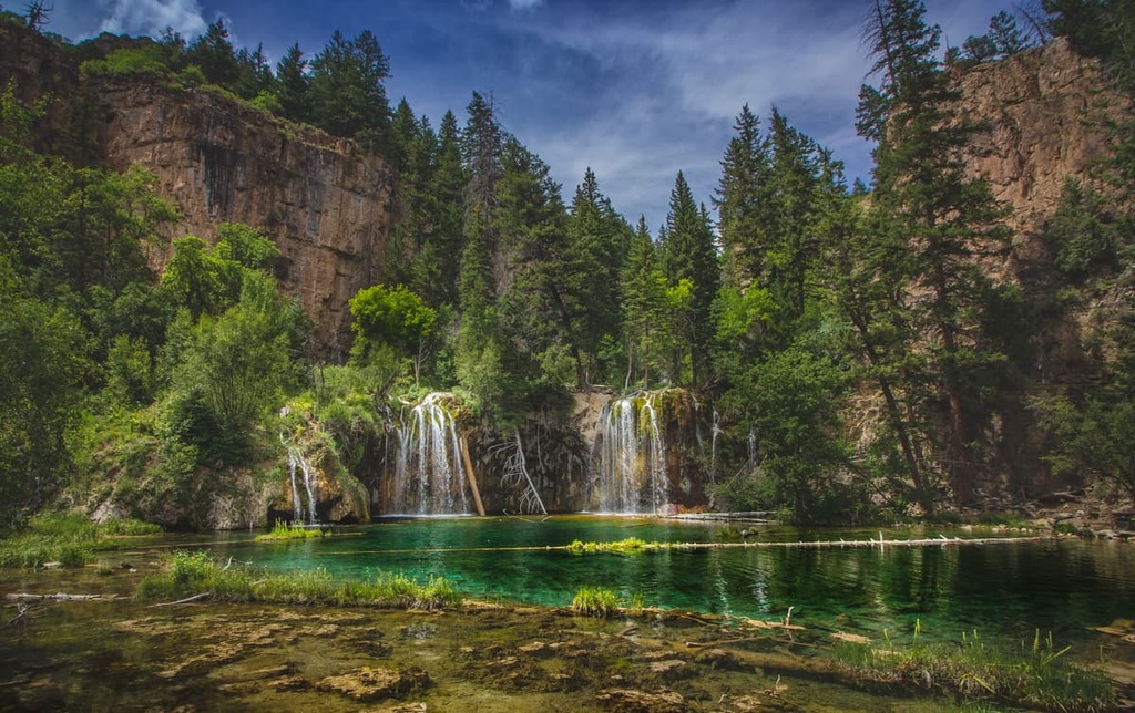
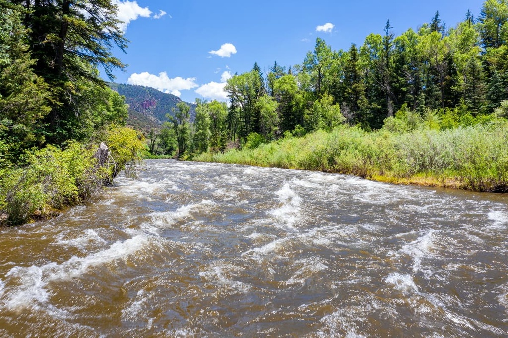
The major water features within the field office are the Colorado River and its tributaries. Forested hillsides within the field office rise steeply from the banks of the river. The highest elevations areas in the field office are often free of trees, so they showcase craggy peaks and sweeping ridgelines.
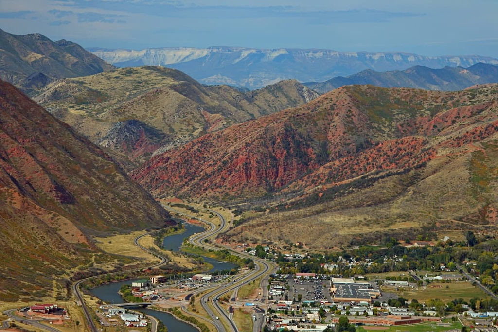
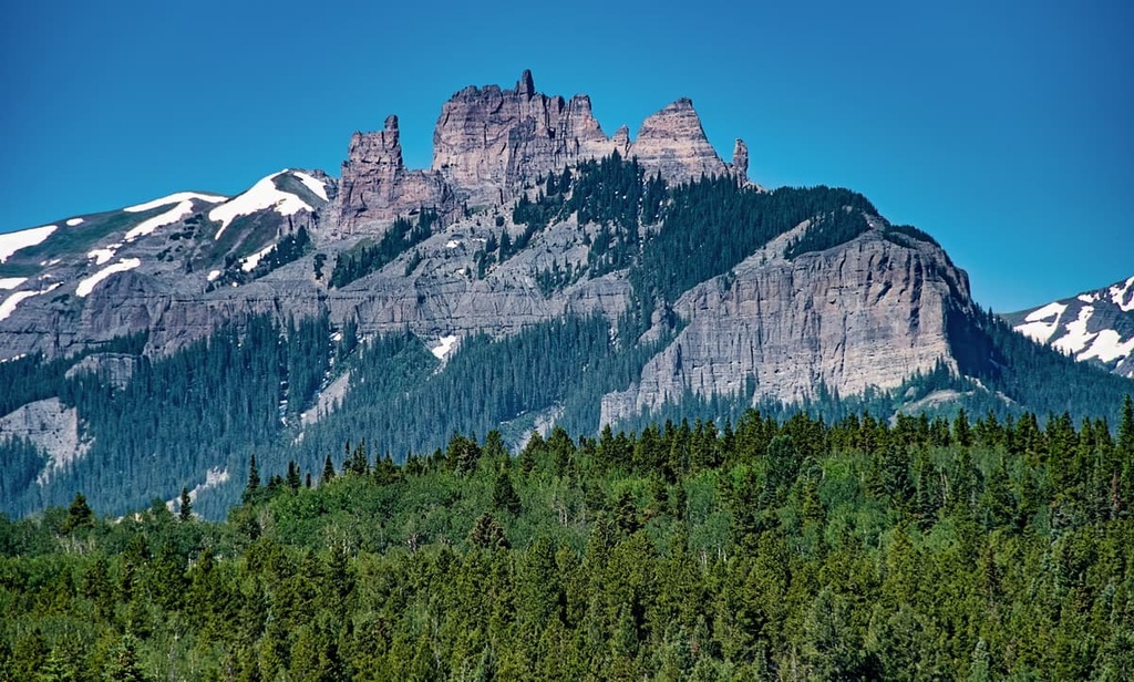
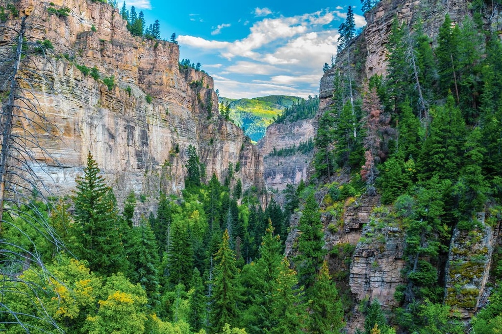
The mountains within the Colorado River Valley Field Office feature both densely forested areas and barren hillsides. Deep, rugged, and rocky canyons are found throughout the field office. Many of these canyons have been carved out by seasonal creeks and streams. The highest elevations in the region are home to alpine terrain featuring meadows, fields, and small lakes.
The Colorado River Valley Field Office is surrounded by various other national forests and parks. White River National Forest surrounds the field office on nearly all sides while Grand Mesa National Forest is located to the southwest. Gunnison National Forest is also situated to the south of the field office while the Flat Tops Wilderness Area is located to the north.
The peaks within the Colorado River Valley Field Office are part of the Flat Tops and the Sawatch Range, both of which are subranges of the Southern Rocky Mountains. The greater Southern Rocky Mountains extend from southern Wyoming to central New Mexico.
The Flat Tops also lie within both the White River and Routt national forests along the northern edge of the field office. This range marks the northeastern boundary of the White River Uplift. These peaks began forming during the Eocene epoch. During the Laramide orogeny, approximately 70 million to 35 million years ago, these peaks were uplifted to around their present heights.
The Sawatch Range is located in the southeastern region of the field office. These peaks in the Sawatch Range are generally more rugged than those in the Flat Tops. The range was thrust upward by the Sawatch Uplift, which took place around 70 million to 65 million years ago.
The peaks throughout the field office were once much flatter than they are today. Over the course of millions of years, the mountains were slowly eroded away by the elements.
During the last glacial maximum, a majority of the Southern Rocky Mountains were covered in glaciers. Glacial retreat further carved out the range, leaving behind deep valleys and glacial cirques.
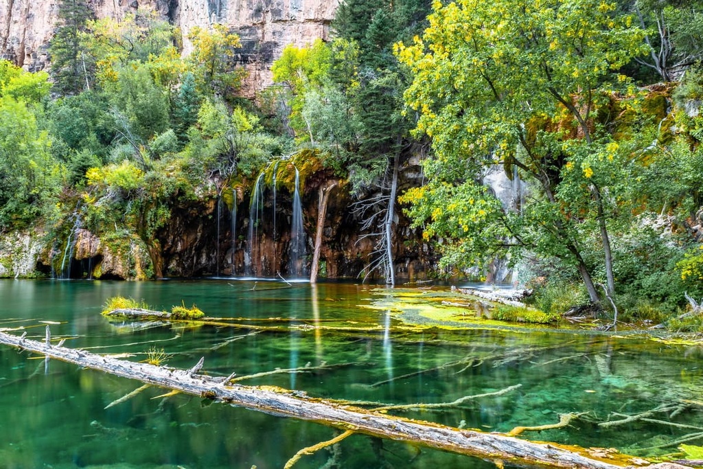
To this day, the Colorado River continues to shape the landscape of the region. Remnants of the region’s geological history can still be seen through the plethora of natural hot springs found throughout the river valley.
Major peaks located within the Colorado River Valley Field Office include Castle Peak, Monument Peak, Gardner, Blowout Hill, and Black Mountain.
Though the field office only encompasses a small portion of the Colorado River, the surrounding network of national forests allows for a variety of both flora and fauna to thrive in the region.
Animals found in the field office are similar to those found in the nearby national forests. Populations of Rocky Mountain elk, bighorn sheep, mule deer, mountain lions, and black bears are all common. The rocky terrain of the field office provides the ideal habitat for marmots while the forest itself is full of ground squirrels.
The Colorado River is home to populations of Mackinaw trout, cutthroat trout, rainbow trout, and brood fish. The plethora of fish and smaller animals found in the river provide food for birds of prey such as bald eagles, golden eagles, hawks, and falcons. Other bird species that live in the field office include chickadees, great horned owls, western screech owls, red-winged blackbirds, mallards, and gray jays, among various others.
The forested hillsides of the field office feature a variety of tree species such as lodgepole pine, Douglas fir, aspen, ponderosa pine, subalpine fir, and Engelman spruce.
Sagebrush can be found throughout the field office, particularly at lower elevations, along with other low-growing shrubs and grasses. During the summer months, the hillsides and ridgelines of the field office also feature numerous species of wildflowers.
The land in and surrounding the Colorado River Valley Field Office has a long and rich human history that dates back thousands of years. A vast portion of present-day western Colorado and eastern Utah is part of the ancestral homelands of the Ute (Núu-agha-tʉvʉ-pʉ̱).
The many Ute tribes were traditionally hunters and gatherers who would establish settlements in the lowlands and travel into the alpine terrain for hunting purposes. The natural hot springs situated along the Colorado River were used by many tribal nations prior to the arrival of European colonists and settlers.
The first recorded contact between the Ute people and Americans of European descent was in the 1820s. Many of the early non-Indigenous settlers of the region were fur trappers. The Charles Baker Expedition during the 1860s discovered gold in western Colorado, leading to a massive influx of miners and settlers.
Railroad construction throughout Colorado also contributed to a rise in the settler population, which ultimately served to further displace the Ute and other Indigenous peoples. Diseases such as smallpox decimated the Ute, and those who survived were forced to fight for their ancestral lands.
In an effort to protect and preserve their land, the Tabeguache Ute Chief Ouray signed a treaty in 1868 with the US government. The treaty was supposed to ensure that the Ute could use the land around present-day Glenwood Springs as hunting grounds in perpetuity.
Despite the signing of the treaty, settlers backed by the US government continued to attack, murder, and displace the Ute people. The Ute who remained in the region were eventually forced onto reservations, often far away from their ancestral lands.
Today, the Ute tribes have three reservations: the Southern Ute Reservation and Ute Mountain Reservation in southwestern Colorado, and the Uintah and Ouray Reservation in northeast Utah.
The city of Glenwood Springs was established in the early 1880s as railroad construction expanded throughout Colorado. In 1897, the city became one of the first communities in the nation to have electric lights. The White River National Forest, which surrounds the field office, was established in 1902.
The Colorado River Valley Field Office is home to numerous hiking trails. Here are some of the most popular hiking areas in the field office to check out during your next visit to the region.
The Glenwood Springs Boy Scout Trail is the most popular hiking route in the field office. The route can be completed as an out and back trail or a loop.
Situated just outside downtown Glenwood Springs, the trail climbs steadily through the densely forested hillside before the terrain opens up and provides sweeping views of the Colorado River, Roaring Fork River, and the various valleys below. This trail is 6.2 (10 km) miles in length and has 1,597 feet (487 m) of elevation gain.
Located just north of the town of New Castle, the Colorow Trail West and East Loop are accessible to both hikers and mountain bikers.
From the trailhead, this trail immediately starts to climb steeply above the treeline where it offers stunning views of the Colorado River and New Castle. This route is 3.1 miles (5 km) in length and has 820 feet (250 m) of elevation gain.
The Bone Yard and Red Neck Ridge Loop trail is located along the eastern edge of the field office near the town of Eagle. This loop route is 6.1 miles (9.8 km) long and has 1,043 feet (318 m) of elevation gain.
Beginning near the Eagle Bluffs, the trail climbs along a fire road before reaching a single-track route shared by hikers, runners, and mountain bikers. Along the route, hikers can enjoy views of the surrounding red rock mesas and forested hillsides.
Looking for a place to stay near the Colorado River Valley Field Office? Here are some of the best cities and villages to check out in the region:
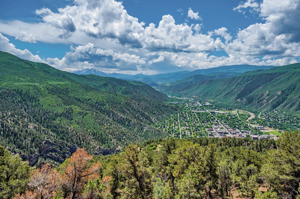
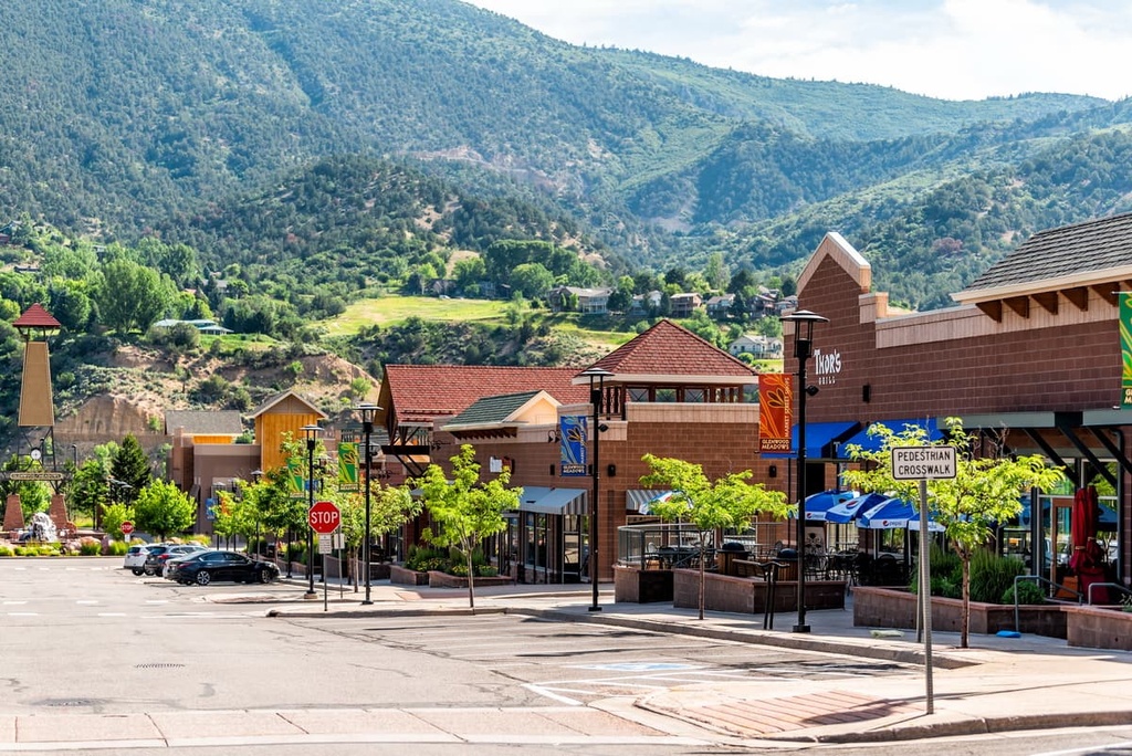
Glenwood Springs is a city situated in the heart of the Colorado River Valley Field Office and the White River National Forest. The small city is home to around 10,000 residents, and it is known for its plethora of outdoor activities. Hundreds of miles of trails surround the city, making it a popular tourist destination throughout the year.
During the summer months, visitors can enjoy hiking, trail running, and mountain biking in Glenwood Springs. The winter months provide the ideal setting for skiing, snowboarding, snowshoeing, Nordic skiing, and snowmobiling in the region. The region’s world-famous hot springs, which the city is named after, are accessible throughout the year, too.
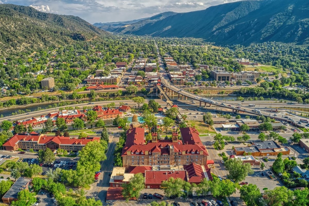
Besides the hot springs and plethora of trails, Glenwood is also home to the Glenwood Canyon Adventure Park, a unique amusement park that can only be reached by cable car. The quaint downtown area of Glenwood Springs is even lined with local breweries, restaurants, and art galleries.
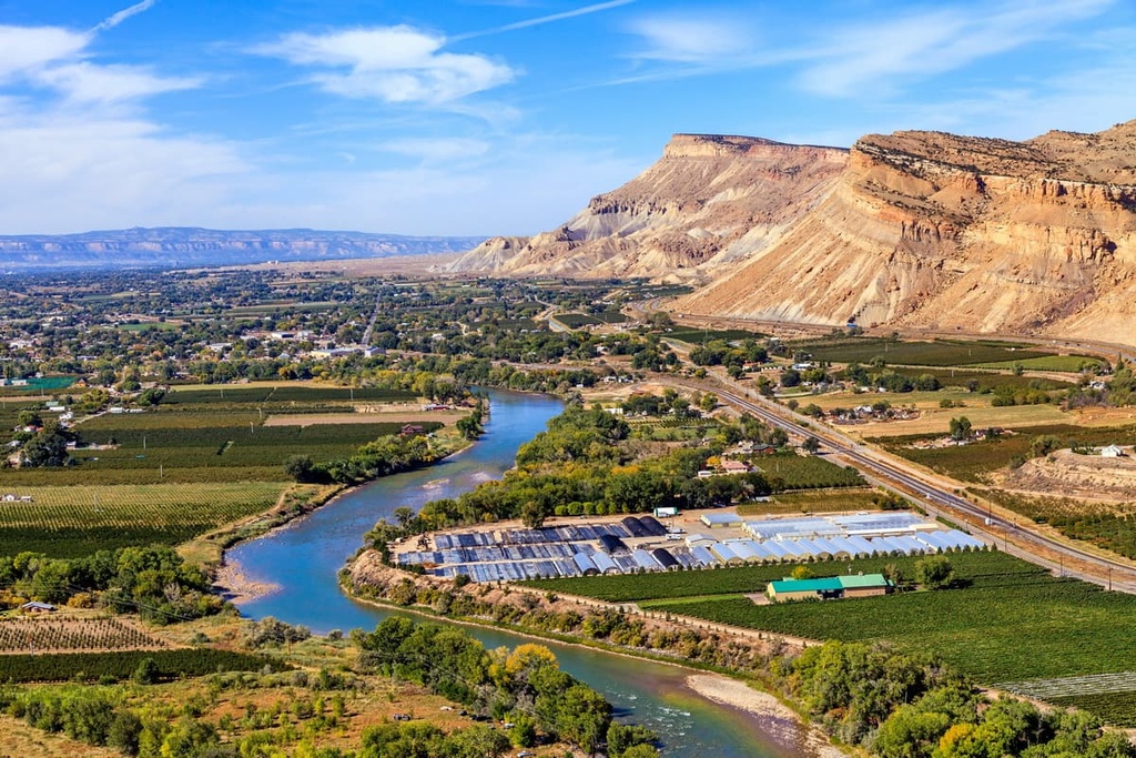
Grand Junction lies just to the west of the field office and is the biggest city in the region. As it is home to around 65,000 residents, the city is the most populous in western Colorado.
Aptly named, Grand Junction lies at the confluence of the Colorado and Gunnison rivers. The city’s location provides easy access to outdoor recreation destinations in both western Colorado and eastern Utah. Nearby attractions include the Grand Mesa National Forest and the Colorado National Monument.
The city’s population has allowed Grand Junction to become the cultural and economic hub of the region. Locals and visitors alike can relax in Grand Junction after a long day of adventuring by visiting one of the numerous local breweries, restaurants, cafes, or art galleries that line the city’s streets.