Scan the QR code and open PeakVisor on your phone
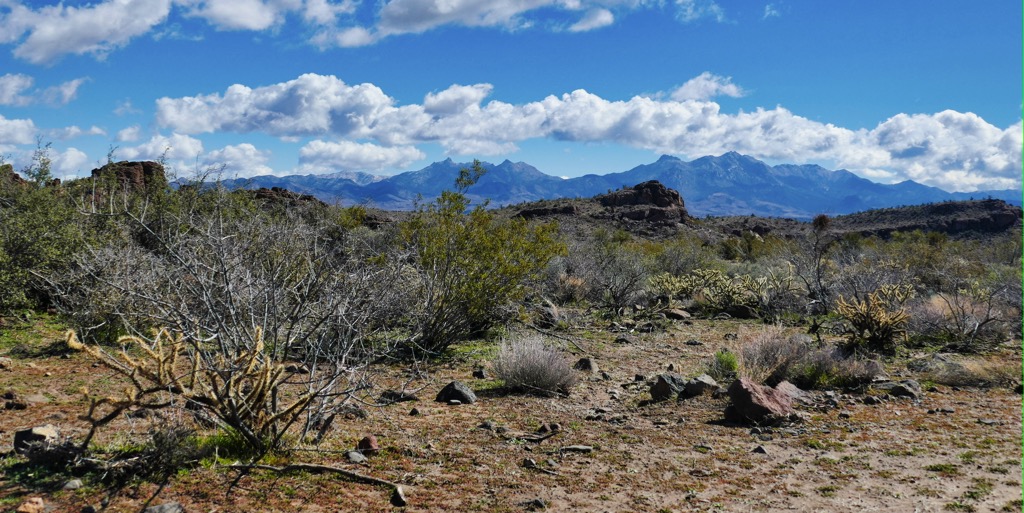
The Aquarius Mountains are a range in the west-central region of the US state of Arizona. They lie within the Arizona transition zone and contain 87 named peaks; the tallest and most prominent is Mohon Peak, at 7,493 feet (2,284 m) with 2,054 feet (626 m) of prominence.
The Aquarius Mountains lie in Western Arizona within the southeastern section of Mohave County. These peaks form the perimeter of the Arizona transition zone and are part of the Coconino Plateau, a subsection of the Colorado Plateau. The transition zone refers to the portion of the state between the Colorado Plateau highlands and southern Arizona's lower valleys.
The range travels predominantly north-to-south with a slight curve to the south-southeast. The Aquarius Mountains span 45 miles (72 km) in length and 15 miles (24 km) in width.
The Big Sandy River and the Big Sandy River Valley lie just west of the range, while the Hualapai Mountains are situated even further west. The surrounding landscape marks the southeastward extension of the Mojave Desert.
Prominent waterways include Trout Creek and Knight Creek, which flow westwards towards the Big Sandy River. The rugged and relatively remote peaks lie adjacent to the Mohon Mountains.
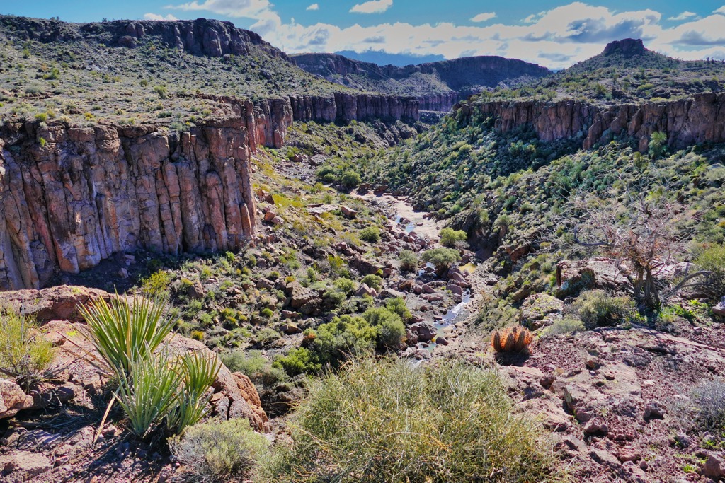
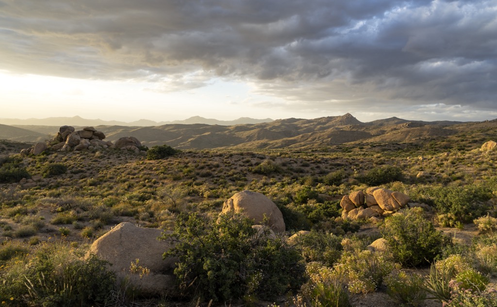
The valleys surrounding the range rise gradually, giving way to rolling hills, rocky buttes, and barren peaks. This region also marks the northwest border of Arizona’s Sonoran Desert.
The Aquarius Mountains are near numerous other regions for outdoor recreation. A portion of the range covers land in the Upper Burro Creek Wilderness. Prescott National Forest and Kaibab National Forest lie to the east. The Arrastra Mountain Wilderness is to the south, while Grand Canyon National Park is to the north.
The Aquarius Mountains lie within the Arizona transition zone, between the Colorado Plateau to the north and the Basin and Range region to the south.
The geological history of the Colorado Plateau dates back millions of years. During the Laramide orogeny, the region was slowly uplifted, with most of the lift taking place roughly 20 million years ago. The Colorado River drains most of the Plateau, with the creeks in the Aquarius Mountains flowing into the Big Sandy River.
The nearby Basin and Range region spans Nevada, Utah, Idaho, Oregon, and California. Tectonic extension during the Early Miocene stretched and deformed the landscape, creating a distinct pattern of basins and mountain ranges.
Since the Aquarius Mountains lie in the transition zone, they share geological features with the Colorado Plateau and the Basin and Range provinces. Common rocks include Precambrian schist, gneiss, and granite.
Major peaks within the range include Mohon Peak, Mount Hope, Snow Mountain, Indian Head, and Mohon Peak.
The flora and fauna are similar to much of the surrounding transition zone. At the lowest elevations, the terrain is populated by interior chaparral and various other shrubs and cacti, marking the northernmost stretches of the Sonoran Desert.
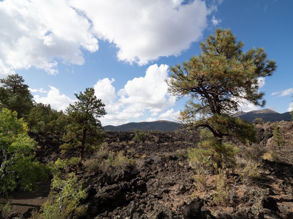
The range features ponderosa pine at slightly higher elevations, interspersed with blue spruce, white fir, quaking aspen, and Douglas fir. Many of the range's ridgelines and peaks feature minimal vegetation, although no terrain is high enough to be genuinely alpine.
The Aquarius Mountains are home to over 150 avian species. Various species of raptors and other birds of prey are ubiquitous. Mammals include desert cottontails, ring-tailed cats, bobcats, mountain lions, beavers, mule deer, javelinas, and pronghorn antelope.
Human history in the surrounding region likely dates back 12,000 years or more. This region marks part of the territory of the Patayan culture (Hakataya culture) and the Hohokam culture.
Additionally, this land is part of the ancestral homelands of the Yavapai Apache Nation and the Yavapai Prescott Indian Tribe. Many of the enrolled members of these nations live on one of the nearby reservations: the Yavapai-Prescott Reservation and the Yavapai-Apache Nation Reservation.
Settlers of European descent may have traveled through the region as early as the sixteenth century. Spanish conquistadors and missionaries may have ventured into the area, followed by French fur trappers in the following decades.
Later expeditions led by Spanish conquistadors primarily explored present-day New Mexico and California, though they also ventured through Arizona. Spain ceded this territory to Mexico following the Mexican War of Independence.
After the Mexican-American War, the US annexed the region, including New Mexico, Arizona, and parts of California. By the mid-1800s, miners and settlers began to flock to the greater Phoenix area. Prospectors struck Gold in Lynx Creek, leading to the region's gold rush in the late 1800s.
President William McKinley designated the land east of the range as the Prescott Forest Reserve in 1898. This reserve centered around protecting the region's watershed after extensive logging and mining.
Prescott Forest Reserve became Prescott National Forest in 1908. The Upper Burro Creek Wilderness was later established in 1990 and spans 27,440 acres (111 sq km).
There are no designated hiking trails in the Aquarius Mountains. Here are a few hiking routes situated near the range and the nearby town of Kingman:
The Monolith Garden Trail lies within the Cerbat Foothills Recreation Area. This route winds through the Mojave Desert, featuring a desert landscape and unique rock formations. Hikers should note there is no water on this path and minimal shade. The trail is 8.5 miles (13.7 km) long.
The White Cliffs Wagon Trail follows an old wagon route dating back to the 1800s. Hikers can walk along the wagon tracks cut deep into the stone. This route showcases the natural beauty of the desert region and provides a look into its history. Round trip, this route is 3.5 miles (5.6 km) in length.
The Hualapai Peak trail lies within the Hualapai Mountain Park. The route takes hikers through various habitat zones, transitioning from pine and oak forest to mixed conifer and finally to fir and aspen trees. From the summit, hikers are rewarded with views of the Aquarius Mountains to the southeast. This trail is around 5 miles (8 km) in length.
Looking for a place to stay near the Aquarius Mountains? Here are some of the best cities and villages to check out in the region:
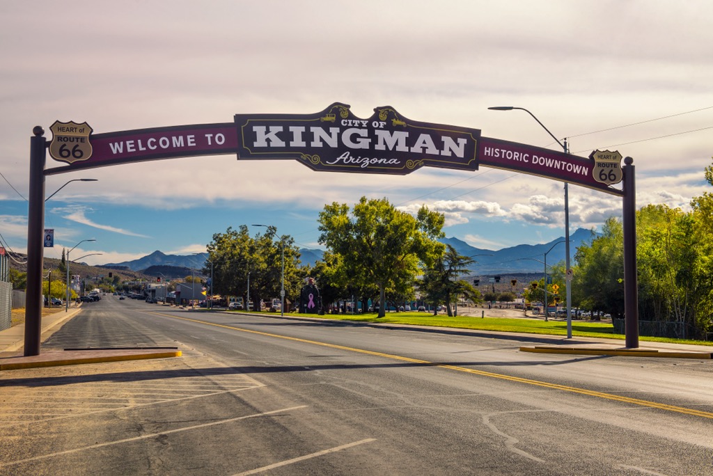
Kingman is just northwest and is the closest city to the Aquarius Mountains. Home to around 34,000 residents, Kingmann lies along the historic Route 66 in northwestern Arizona. Dubbed “The Heart of Historic Route 66”, the downtown district was constructed in the Mission Revival style.
Within the Powerhouse Visitors Center lies the Route 66 Museum, showcasing more of the city's history and the iconic route. Kingman is also home to the Mohave Museum of History and Arts. Locally owned restaurants and cafes line the downtown streets with Route 66-themed eateries.
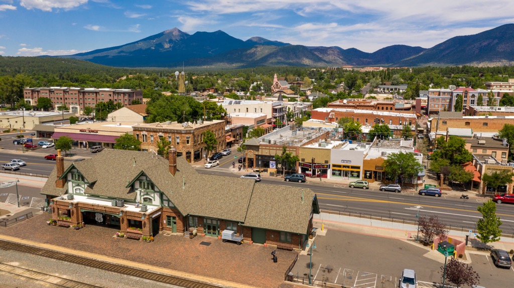
Flagstaff lies northeast of the Aquarius Mountains, in the heart of the Coconino National Forest. Flagstaff is home to around 75,000 residents and has a reputation as a paradise for outdoor recreation. The city lies at an elevation of 7,000 feet (2,130 m) and is surrounded by one of North America's largest contiguous ponderosa pine forests.
Just a short drive north of the city lies Grand Canyon National Park, making the city a popular spot for those visiting the region. The quaint downtown is full of local restaurants, bars, breweries, and art galleries, showcasing the mountain community of the city. The city is close to massive parcels of protected land and is a hub for hiking, mountain biking, and trail running.