Scan the QR code and open PeakVisor on your phone
The Natanes Mountains are a northwest trending range located in the northern portion of the San Carlos Reservation in central Arizona, USA. They are part of the Arizona Central Highlands, an ecotone transitioning from the Colorado Plateau to the Sonoran Desert in the south. There are 31 mountains in the range. Elevator Mountain is the tallest at 7,096 ft (2,163 m) and Turtle Mountain (7,001 ft/2,134 m) has the greatest prominence of 2,005 ft (611 m).
The Natanes Mountains stretch northwest-southeast in Graham and Gila countries in central Arizona. They are located in the northern portion of the San Carlos Reservation and south of the Fort Apache Reservation. The reservation is bordered by Tonto National Forest and Salt River Canyon Wilderness to the west, Sitgreaves National Forest to the north, and Apache National Forest to the east.
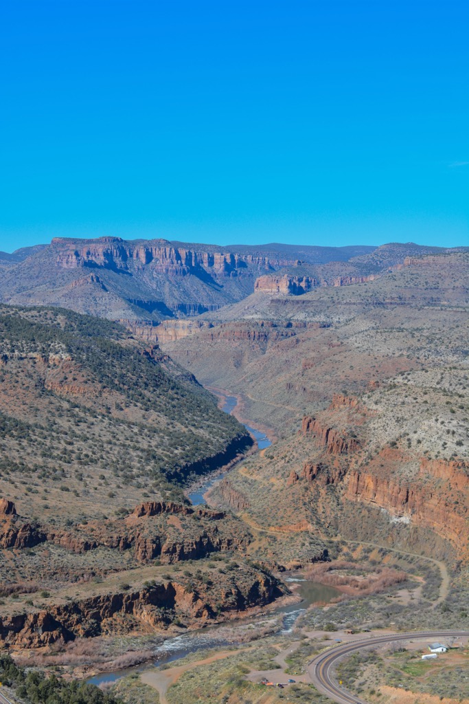
The mountains occupy approximately 1,517 square miles (3,930 sq km) and drain into the Tonto basin.
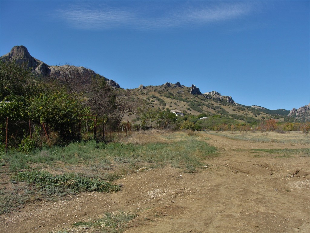
The Sevemile Mountains of Gila County are also part of the range. The southern end of these mountains lie within the San Carlos Reservation. The northern end, including the high point, is outside the reservation. While there are no trails leading to the summit, the mountain is open to free range hikers wanting to forge their own path to the top.
The Natanes Mountains are on the Natanes Plateau which is part of the Colorado Plateau. The topography of the region was shaped by block faulting. Situated south of the Mogollon Rim, the range is part of the Central Arizona Highlands. The highlands are an ecotone that transitions between the Colorado Plateau and the Sonoran Desert.
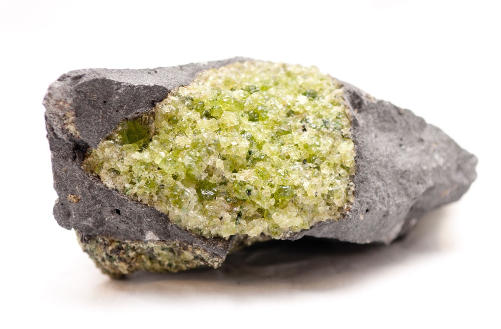
The Natanes Plateau contains various rock layers. During the Miocene, basalt, trachybasalt, and basaltic trachyandesite flows spread across the Natanes Plateau and surrounding mountains. In particular the region has olivine basalt and peridot, a rare mineral found in only several places around the world. Consolidated gravel covers the Proterozoic and Paleozoic rocks beneath the Natanes Plateau basalt and limestone is present in the western and southern portions of the plateau.
Rugged and arid, the Natanes Mountains support a range of vegetation types. The highest elevations support ponderosa pine forest with some Gambel oak interspersed. Mid-elevations host pinyon-juniper woodlands with Arizona white oak.
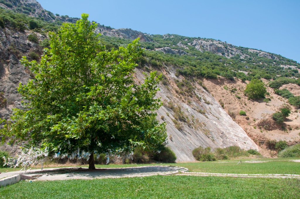
The foothills and valleys support grasslands, commonly supporting grama varieties including black, blue, sideoats, and slender grama. Lower elevations also support chaparral shrublands, typically found growing on rock types of fractured and weathered granite, schists, diabase, and sandstone.
The range is home to wildlife including elk, mule deer, turkeys, black bear, mountain lions, bighorn sheep, javelinas, and pronghorns. Although there are restrictions within the reservation, the area provides good hunting in season. There are also a number of birds that migrate through the mountains.

The San Carlos Apaches are made up of several groups including the Aravaipa, Chiricahua, Coyotero, Mimbreño, Mogollon, Pinaleno, and Tonto Apaches. The Apaches are an Athabascan people who migrated southwest from the north Pacific between the 13th and 16th centuries.
The traditional territory of the Apache spanned from central Arizona to central Texas, and from northern New Mexico to southeastern Colorado. In 1848, the US government took over Apache lands in the southwest. Several decades of conflict followed as the Apaches fiercely resisted. The San Carlos Reservation was established in 1871 as an attempt to control Apaches from raiding settlers in the region and the last of the Apache were ultimately forced to surrender by the 1890s.
Adjusting to reservation life was challenging. The Apache were pushed to agriculture although it was neither their traditional lifestyle nor were the conditions of the landscape suited for it. Moreover, the reservation was increasingly shrunk as settlers came in and claimed mining and land rights on the reservation.
The local economy improved in the 1930s with the introduction of cattle. Since then, cattle operations, timber, and some mining have been significant income generators for the reservation. Peridot, a rare mineral found only in several places around the world, is present in the reservation.
The vast majority of the Natanes Mountains fall in the San Carlos Apache Reservation. Not all areas are open to the public and those that are may require permits. The best protocol is to contact the reservation directly for the most up-to-date information.
A few points of the range, such as the northern portion of the Sevenmile Mountains, lie outside reservation boundaries. Although without official trails, the northern portion and highpoint of the Sevenmile Mountains can be explored freely.
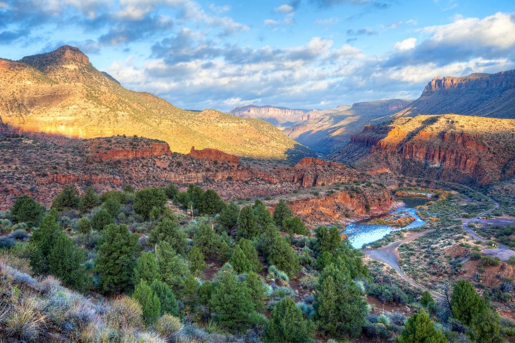
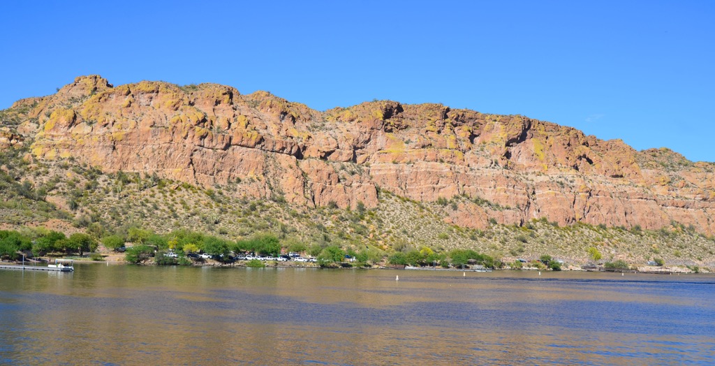
The Natanes Mountains are located near other popular and scenic outdoor spots including the Salt River Canyon Wilderness Area to the west and the Mogollon Rim Trail to the north. There are also numerous hiking opportunities in the surrounding Apache, Tonto, and Sitgreaves National Forests.
Smaller towns such as Globe lie near the mountains and there are casinos within the San Carlos Reservation. Arizona’s state capital, Phoenix, is a four hour drive to the east and Tucson is four and a half hours southwest.
With a population of 1.625 million people, Phoenix is a big city with both culture and easy access to the outdoors. Learn about the region’s indigenous heritage at the Heard Museum, or visit the Musical Instrument Museum, the Phoenix Art Museum, and the Arizona Science Center. Stretch your legs with a hike up Camelback Mountain or on the trails through the red rocks of Papago Park.
There are varied dining options throughout the city from some of the country’s best Southwestern and Mexican restaurants to steakhouses to international cuisines ranging from Middle Eastern to Asian to Latin American. Hotels are abundant through the heart of the city, and resorts, RV parks, and campgrounds offer more secluded options on the city’s outskirts.

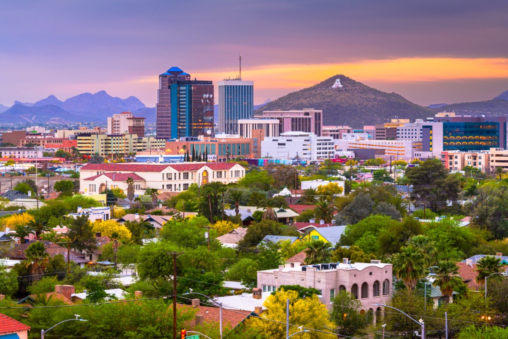
Tucson is home to 543,000 people and surrounded by the beauty of the Sonoran Desert. From Tucson, plan a trip to Saguaro National Park, Sabino Canyon Recreation Area, or Catalina State Park. Take in the city’s history by visiting the San Xavier del Bac Mission, St. Augustine Cathedral, and Presidio San Agustín del Tucson Museum. Spend a day inside at the Arizona-Sonora Desert Museum and Pima Air and Space Museum.
Tucson is the first UNESCO City of Gastronomy. Enjoy the local flavors of smoked mesquite, prickly pear, chiles, and native seeds and grains on menus shaped by Mexican, indigenous, and Spanish influence. The city has a range of accommodation options from budget campgrounds, RV parks, and motels to historical hotels, guest ranches, and resorts and spas.