Scan the QR code and open PeakVisor on your phone
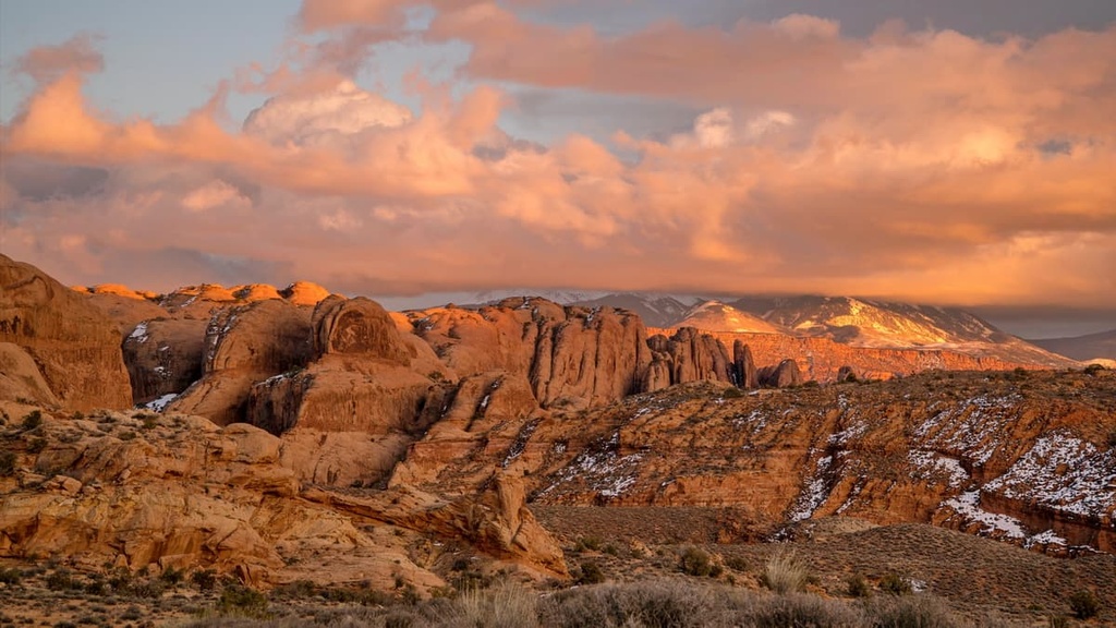
Fiddler Butte Wilderness Study Area is a federally managed outdoor recreation area located in the southwestern portion of the US state of Utah. The wilderness study area is known for its stunning red rock canyons, buttes, and rich human history. The tallest and most prominent point in the region is North Block at 7,053 ft (2,150 m) in elevation and with 1,135 ft (346 m) of prominence.
Fiddler Butte Wilderness Study Area spans 12 miles (19.3 km) from east to west and 11 miles (17.7 km) north to south. It is located in the southwestern part of the US state of Utah just to the southwest of the city of Moab.
Elevations in the wilderness study area range from 5,600 ft (1,707 m) up the summit of North Block at 7,035 ft (2,150 m). The landscape in the study area is often divided into two distinct regions, an eastern portion and a western portion.
The eastern portion is marked by a prominent mesa that’s generally referred to as The Block. This high mesa is home to the highest point in the wilderness study area. The western portion of the wilderness study area is characterized by narrow ridges and canyons.
There are eight canyons found in the region, all of which run parallel to one another and span about 5 to 8 miles (8-13 km) in length. The canyons in the wilderness study area slope into North Wash, which runs into the Colorado River.
A small section of the Dirty Devil River lies in the western portion of the wilderness. The Colorado River lies to the south, flowing from the northeast to the southwest. None of the landscape is forested, but is rather marked by rolling hills, dramatic buttes, and deep river canyons.
The wilderness is surrounded by numerous other wildernesses, parks, and monuments. In the surrounding area lie Canyonlands National Park, Little Rockies Wilderness Study Area, Glen Canyon National Recreation Area, Dark Canyon Wilderness Area, and the Dirty Devil Wilderness Study Area.
Geologically, the land within the Fiddler Butte Wilderness Study Area is part of the Colorado Plateau. The plateau is a physiographic province that covers much of Arizona, New Mexico, Colorado, and Utah.
The plateau is drained by the Colorado River, which runs through Glen Canyon National Recreation Area just to the south of the wilderness.
A majority of the plateau consists of sedimentary rock. Distinct rock layers found in the region include Navajo sandstone and Wingate sandstone, as well as the Moenave Formation and the Kayenta Formation.
The Colorado Plateau is known for being a relatively stable geological feature that’s experienced minimal folding over the last few millions of years. Instead of drastic geographical changes due to thrusting and folding, the region has gradually risen throughout its formation.
As the plateau rose, elevations increased, steepening the grade of the waterways and creating more force that would later form the landscape.
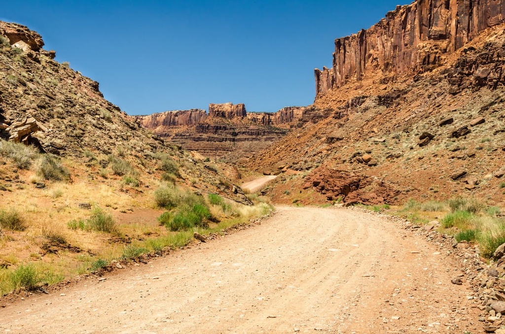
The canyons in Fiddler Butte Wilderness Study Area were formed by millions of years of erosion, similar to what is seen in Glen Canyon just to the south of the wilderness study area. The Colorado River and its tributaries have slowly carved out the dramatic rock formations and canyons of the region.
Some of the major peaks within Fiddler Butte Wilderness Study Area include North Block, Fiddler Butte, Cedar Point, Fiddler Point, and the Sewing Machine.
Despite the region’s rather barren appearance, Fiddler Butte Wilderness Study Area is home to a variety of resilient ecosystems.
The wilderness study area is part of the ecoregion referred to as the Colorado Plateau Shrublands. This ecoregion is home to multiple other subregions that are found at varying elevations.
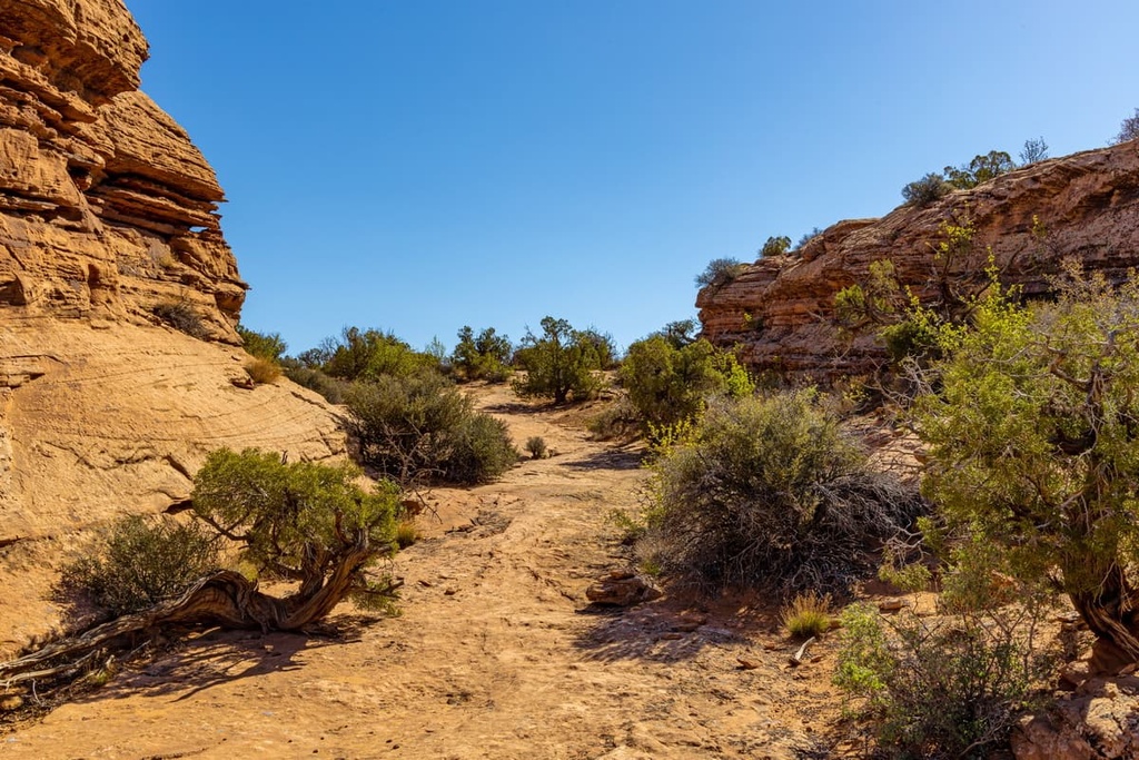
The lowest elevations in the wilderness study area are home to blackbrushes, shrubs, grasses, and sagebrushes. At slightly higher elevations live populations of pinyon-juniper woodlands.
Nearly a fifth of the wilderness study area is void of plant life, containing only rocks and sand. However, the rivers of the region allow for a variety of animals to thrive.
Common animals in the region include mule deer, bobcats, mountain lions, elk, and pronghorns. While these animals may enter the wilderness study area, they are more common in the smaller forested areas that surround the region. However, note that venomous snakes can also be found within the area.
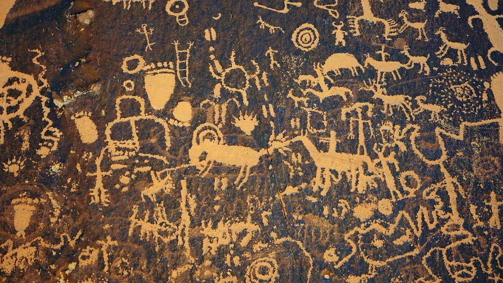
The land within the wilderness study area has a rich history that dates back thousands over years. The nearby Elk Ridge region alone is home to over 100,000 archeological sites.
The land around the wilderness study area marks the ancestral homelands of various Indigenous peoples. These tribes include the Hopi Tribe, Southern Paiute, Navajo Nation, Ute Mountain Ute Tribe, Ute Indian Tribe of the Uintah and Ouray Reservation, and the Pueblo of Zuni. Each of these tribes holds ancestral ties to the region surrounding the wilderness.
The first people of European descent to arrive in the region came during the sixteenth century. These Spaniards would go on to claim the Four Corners region as New Spain.
The Domínguez-Escalante Spanish expedition traveled throughout the southwestern United States in 1776, and they most likely traveled on or near the wilderness. This expedition actually set out to find an overland route between Santa Fe in what is now New Mexico and Monterrey in what is now California, but it spent a significant amount of time on the Colorado Plateau.
In the following decades, fur trappers began settling in the region. During the beginning of the nineteenth century, Brigham Young sent a group of Mormon missionaries to settle in present day northern Utah.
Local Tribal Nations fought to protect their homelands despite the influx of settlers to the region. Yet despite their resistance, Mormon settlers soon began establishing towns in southwestern Utah near the wilderness. By 1887, the nearby town of Monticello was established.
During the 1890s, settlers flocked to the area in hopes of finding gold throughout Glen Canyon. Indigenous peoples were harassed, removed, and killed throughout the region, as settlers began establishing more cities, and claiming the land.
The Glen Canyon National Recreation Area, which lies just south of the wilderness and spans along the Colorado River, was established in 1972.
Fiddler Butte Wilderness Study Area is home to a handful of hiking trails, though not all of them are well maintained. Here are some of the most popular hiking destinations in the area:
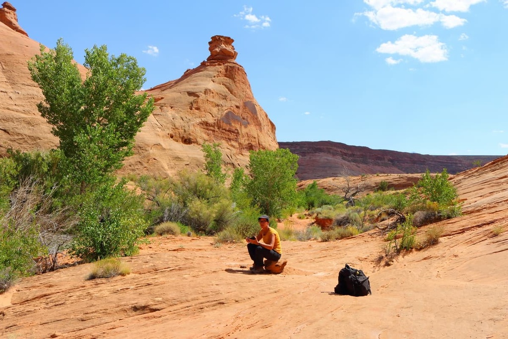
The hike to Leprechaun Canyon is a loop trail that’s approximately 2 miles (3.2 km) long with 141 ft (43 m) of elevation gain. The route combines three technical slot canyons that require both skills and the right gear to descend. However, the lower portion of the canyon can be hiked by foot until the route begins to narrow.
Dramatic and steep red rock canyon walls tower above on either side of this route. Hikers will be able to see the distinct layers of rock amidst the canyon walls. That said, visitors should avoid touching or marking the petroglyphs found in the area.
The Happy Canyon Trail is 8.1 miles (13 km) long with 1,250 ft (381 m) of elevation gain. The route lies at the northern edge of the wilderness, partially within Glen Canyon National Recreation Area. The canyon features unique and dramatic red rock canyon walls. The route begins along the rim of the canyon before the trail descends towards the river below.
Butler Canyon Trail is a 7 mile (11 km) long trail with 500 ft (152 m) of elevation gain. Situated between Hite and Hanksville, the route follows along the red rock canyon. The trail is quite primitive and hikers should be equipped to navigate through the landscape.
Once in the canyon, the trail ascends up a rocky slope to the canyon rim. After reaching the canyon rim, hikers can enjoy views of the nearby Henry Mountains.
Looking for a place to stay near the Fiddler Butte Wilderness Study Area? Here are some of the best cities and villages to check out in the region:
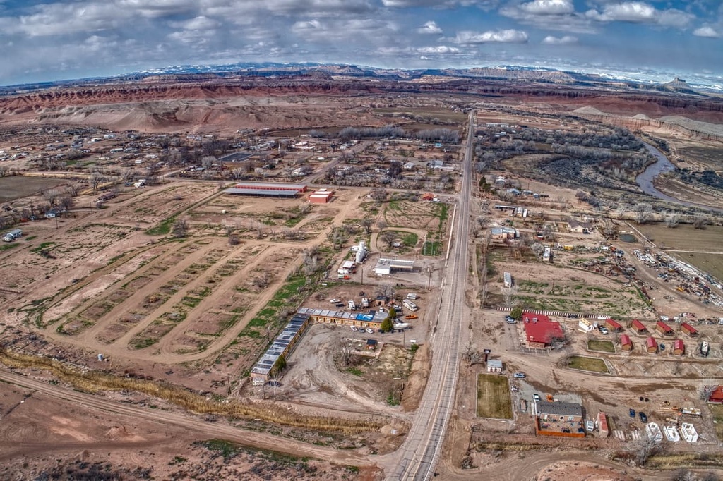
Hanksville is a small town located just a 30 minute drive north of the wilderness study area. With a population of just 220 people, Hanksville is a tiny community that lies along the Dirty Devil River as it flows south into the Colorado River.
Though small in size, the town acts as a gateway to the multitude of outdoor recreation destinations in the region. Besides its close proximity to the wilderness study area, Hanskville also lies near Capitol Reef National Park, Lake Powell, Goblin Valley State Park, and Horseshoe Canyon.
Besides a few small shops, Hanksville is also home to the Mars Desert Research Station. This station is both the largest and longest running Mars surface simulation facility in the world. The facility is run by the Mars Society, a non-profit organization focused on the human exploration of Mars.
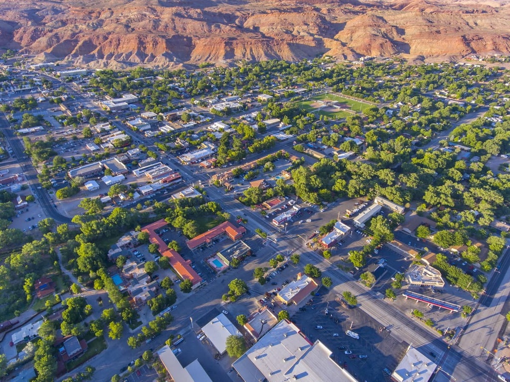
The city of Moab lies just to the northeast of the Fiddler Butte Wilderness Study Area, near the Colorado River. Moab is home to 5,400 residents, and it is known for its plethora of opportunities for outdoor recreation. Thanks to its location just outside of both Arches National Park and Canyonlands National Park, Moab is surrounded by hundreds of miles of trails.
Stunning red rock landscapes can be found throughout the city. Besides hiking, Moab is home to numerous trails for mountain biking and trail running. Rafting, rock climbing, and highlining are also common activities in the region.
Moab is also known for its base jumping opportunities. While base jumpers may travel to the city to experience its stunning beauty, the city has companies who offer tandem base jumping for beginners. The Moab Museum also offers a look into the cultural history of the region.