
Scan the QR code and open PeakVisor on your phone
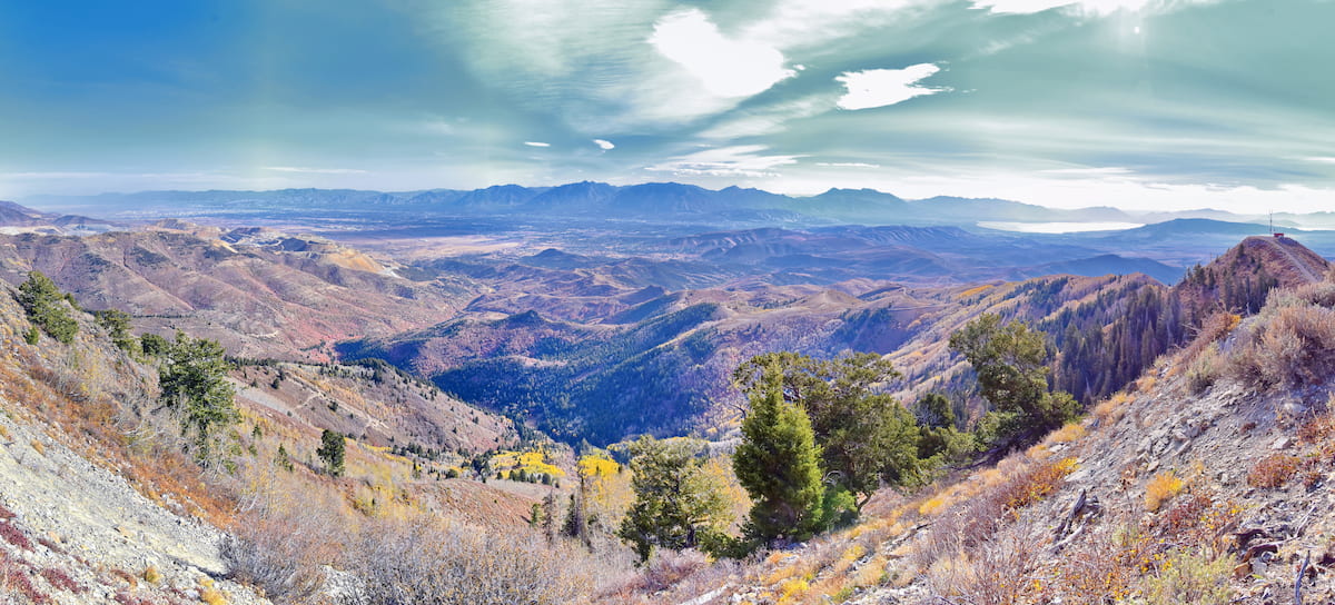
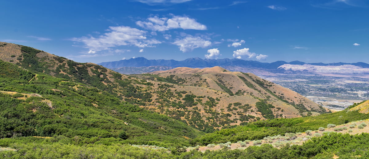
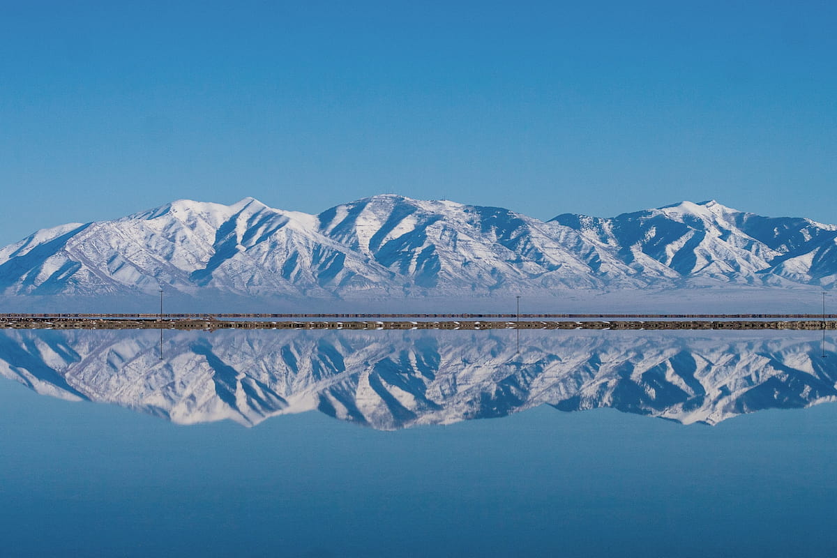
Boasting stunning views of the Great Salt Lake and the Wasatch Front, the Oquirrh Mountains are a mountain range in the northern part of the US state of Utah. The range contains 64 named peaks, the highest and most prominent of which is Flat Top Mountain (10,614ft/3,235m).
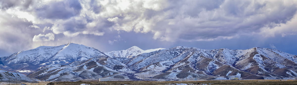
The Oquirrh Mountains (pronounced /ˈoʊkər/ or ‘o-ker’) is a small mountain range situated to the west of Salt Lake City in the northern part of Utah. Contained within both Tooele County and Utah County, the Oquirrh Mountains extend for about 30 miles (50km) from the southern shores of the Great Salt Lake to the north all the way to Route 73, which separates them from the East Tintic Mountains to the south.
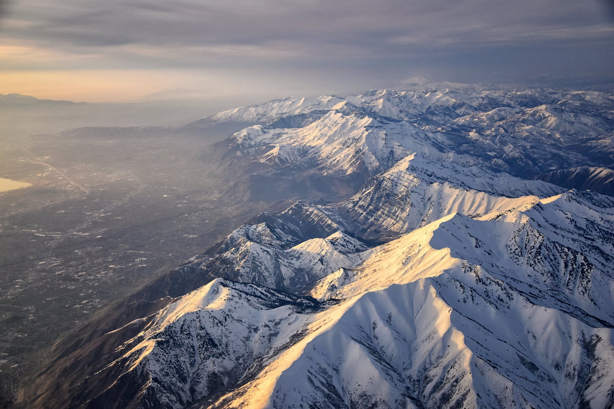
Due to their location in the mountainous northern part of Utah, the Oquirrh Mountains are surrounded by other ranges. In fact, the Oquirrh Mountains form an interesting transition point between the Wasatch Range and the Uinta Mountains of the Western Rocky Mountains to the east and the many Great Basin Ranges (including the Stansbury Mountains and the Cedar Mountains) to the west.
The Oquirrh Mountains are also surrounded by mountain ranges to the north and the south. Although the range terminates right at the southern shore of the Great Salt Lake, the peaks of the Great Salt Lake Islands, the Promotory Mountains, and the Hogup Mountains are all located to the north. Meanwhile, the East Tintic Mountains, the West Tintic Mountains, the Sheeprock Mountains, the Onaqui Mountains, and the Lake Mountains are all situated to the south.
However, it’s important to point out that, unlike the major ranges to the east and west, the Oquirrh Mountains are not part of the Uinta-Wasatch-Cache National Forest and much of the land in the range is privately owned.

This fact poses many problems for hikers, climbers, and skiers in the area as all visitors need to be sure that they’re not trespassing on private land. Since land rights and access change frequently in the region, anyone looking to hike or climb in the Oquirrh Mountains should check current trail access conditions before heading to the range and all hikers should respect any no trespassing signs that they encounter on their adventures.
While the region in and around Salt Lake City is known for being home to the Wasatch Range and the Uinta Mountains of the Western Rocky Mountains, the Oquirrh Mountains are actually geologically distinct from their eastern neighbors.
Indeed, the Oquirrh Mountains are actually part of the Great Basin Ranges and its associated province. The Great Basin Ranges cover most of Nevada, western Utah, eastern California, and the southern parts of Idaho and Oregon. They are characterized by a distinct series of alternating basins and ranges (hence the name), which can be seen in the alternating ridges formed by the Oquirrh Mountains and the Stansbury and Cedar Mountains to the west.
The Oquirrh Mountains, in particular, are underlain by a Precambrian craton which is covered by a series of accreted terranes of varying ages. Much of the exposed surface rock in the region is sedimentary in origin, though there are also some isolated metamorphic and igneous regions.
Like the rest of the Great Basin Ranges, the Oquirrh Mountains formed during a period of tectonic extension, faulting, folding, and uplift.
However, one of the most interesting parts of the Oquirrh Mountains from a geological perspective is the range’s extensive mineral deposits. The Oquirrh Mountains are actually home to one of the largest open pit mines in the world, the Bingham Canyon Mine on the eastern side of the range.
In the Oquirrh Mountains, there is a long history of mining which dates back well over a century. Over the years, miners and prospectors have extracted many millions of tons of copper, gold, molybdenum, silver, lead, zinc, tungsten, bismuth, cadmium, and limestone from the range.
Some sources even state that the Oquirrh Mountains have been so valuable that its net worth has far exceeded all of the minerals extracted during the California and Klondike (Yukon, Canada) gold rushes, as well as from the Comstock Lode in Nevada’s Virginia Range, combined.
As a result, mining activity is particularly important to the region’s economy, though it has caused some interesting issues for the range.
One of the biggest impacts of the mining activity, beyond the large land area of the mines themselves is that they have produced a substantial amount of displaced soil, rock, and other non-valuable ‘waste’ which needs to be removed to recover valuable ore. This waste, which is called overburden, then gets moved and piled up elsewhere, which can affect the hydrology of the region and the stability of the landscape.
Major peaks in the region include Flat Top Mountain, Lowe Peak, Bald Mountain, Kelsey Peak, West Mountain, Rocky Peak, Butterfield Peaks, Lewiston Peak, Nelson Peak, and Porphyry Hill.
The ecology of the Oquirrh Mountains is similar to that of the Stansbury and Cedar Mountains to the west, as well as that of the rest of the Great Basin. However, the Oquirrh Mountain’s proximity to the Wasatch Range means that it also retains some of the Western Rocky Mountains plant communities.
Like much of the rest of the region, the lowest elevation parts of the Oquirrh Mountains are home to sagebrush and grasslands. Meanwhile, at mid-elevations in the range, visitors can find juniper, pines, and aspens.
The Oquirrh Mountains are particularly well-known for their wildlife spotting opportunities. Major wildlife species in the range include mule deer, elk, black bears, and mountain lions. Moreover, the range is an especially popular spot for birders, who can see dozens of different species, including bald eagles, flying in the region.
The Oquirrh Mountains, like the rest of what is now Utah, have been home to humans for thousands of years. In particular, the region is the traditional territory and ancestral homelands of a number of Indigenous groups, including the Goshute.
These days, the Skull Valley Band of Goshute have a small reservation just to the west of the Stansbury Mountains, while many members of the Confederated Tribes of the Goshute live on a reservation that straddles the Utah/Nevada border.
Some of the first people of European descent to attempt to set up permanent settlements near the Oquirrh Mountains were Thomas and Sanford Bingham, brothers that had been sent to establish themselves in the region by Brigham Young in 1848. The Bingham brothers then spent a few years herding cattle in what is now called Bingham Canyon before being sent on a settlement mission to what is now Weber County.
A little over a decade later in the 1860s, Bingham Canyon became the site of a fairly large logging operation at the hands of George B. Ogilvie and his fellow loggers. While working in the area, Ogilvie found a piece of ore, which turned out to contain both gold and silver. This led to the start of mining in the Oquirrh Mountains and the formation of the Jordan Silver Mining Company.
Over the next few years, Bingham Canyon became the site of many quickly established mines as well as a fairly sizable prospecting rush. This rush helped establish the town of Stockton and, by 1873 the Utah Central Railroad made its way to the region.

During the 1880s, the range became known for its many quicksilver mines. As the gold veins in the region started to dry up, local miners began to shift their focus toward silver and lead.
The big advancement in Oquirrh mining, however, came in 1896 when Samuel Newhouse established his first copper mine in the range. Eventually, as the silver stocks in the range also started to dwindle, copper mining became the major industry in the region and the Oquirrh Range became synonymous with the metal.
Due to the range’s immense mining value, however, much of the region is privately owned land, which puts it in direct contrast to the Stansbury Mountains and the Cedar Mountains to the east, which are part of the Uinta-Wasatch-Cache National Forest, as well as the Cedar Mountain Wilderness and the Deseret Peak Wilderness.
These days, the Oquirrh Mountains are a patchwork of public and private land, so visitors must take personal responsibility to ensure that they are not trespassing on private property when visiting the range.
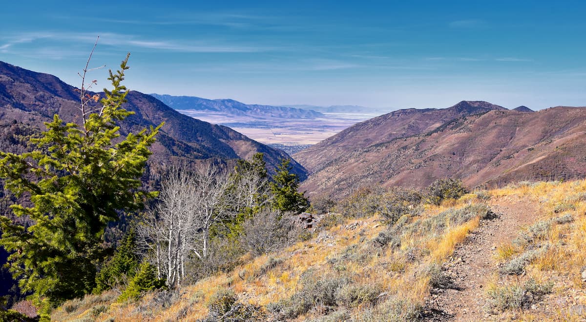
Despite their proximity to Salt Lake City and the rest of the Wasatch Front, the Oquirrh Mountains see relatively little human traffic, at least when compared to other popular trails to the east.
Part of the difficulty of visiting the Oquirrh Mountains lies in ensuring that one doesn’t trespass on private land, so hikers must check in on current land ownership issues to ensure that they stay on public BLM land at all times.
The following popular hiking trails and destinations were accessible by the general public at the time of writing, though their access status can change at any point. As a result, visitors are solely responsible for ensuring that they do not trespass in the Oquirrh Range as crossing private property, even briefly, can have serious legal consequences if you get caught.
With that in mind, here are some of the most popular places to hike in the Oquirrh Mountains:
The tallest peak in the Oquirrh Mountains, Flat Top Mountain is a popular hike for anyone that loves a scenic vista. Most hikers summit the peak by starting at the Ophir Canyon Trailhead, which leads up to a ridge, which you can follow most of the way to the summit of Flat Top Mountain.
Lowe Peak is the second highest point in the Oquirrh Mountains, though it is rife with access issues. The eastern slopes of the peak are on private property, so it’s generally best to approach from Ophir Canyon and Picnic Canyon in the west, which are on BLM land. Once you reach the summit, Lowe Peak provides excellent views of the surrounding region.
Kelsey Peak is situated near the heart of the Oquirrh Mountains and it is known for its impressive snowfall totals. During the summer and fall, the peak can be summited from Ophir Canyon or Picnic Canyon. Hikers also have an excellent chance to see a major elk herd when hiking Kelsey Peak, which can make for a particularly exciting day in the mountains.
Although mines aren’t generally very high on a list of must-see places in a mountain range, the overlook above the Bingham Canyon Copper Pit is particularly impressive and is worth checking out. Technically speaking, the overlook is accessible via a road from Butterfield Canyon, though the road is usually closed from June 1st to November 1st, which makes it open only to foot traffic.
From the top of the 5.1 mile (8.2km) hike, visitors can get great views of one of the world’s largest open pit mines, as well as excellent vistas of the Great Salt Lake and the Wasatch Range.
Here are some of the best places to stay when visiting the Oquirrh Mountains.
The small town of Ophir is located in the southern part of the Oquirrh Mountains. It is home to just about 20-40 people, so it’s not exactly a major city, but its proximity to some of the best trailheads in the range certainly warrants a mention.
Ophir also has an excellent historical district, where you can learn more about the town’s mining history and check out some restored historic buildings.
Located to the west of the Oquirrh Mountains, Tooele is home to about 30,000 residents, which makes it the largest city in Tooele County. Tooele is just a 40 minute drive from Salt Lake City, so it’s a great starting point for your adventures in the Oquirrh Mountains. The city is also known for its annual summer arts festival, which is well worth a visit.
The capital and largest city in the state of Utah, Salt Lake City is home to about 200,000 residents. Salt Lake City is located to the east of the Oquirrh Mountains and is just a short drive away. It has a major international airport and it is a commercial and cultural hub for the region, so it’s the perfect place to stay if you’re interested in visiting northern Utah.


