
Scan the QR code and open PeakVisor on your phone
Just an hour and a half’s drive from the Wasatch Front, the Deseret Peak Wilderness Area is a stunning outdoor recreation destination located in the northwestern part of the US state of Utah. The wilderness contains 16 named mountains, the highest and most prominent of which is Deseret Peak (5,807ft/3,362m).
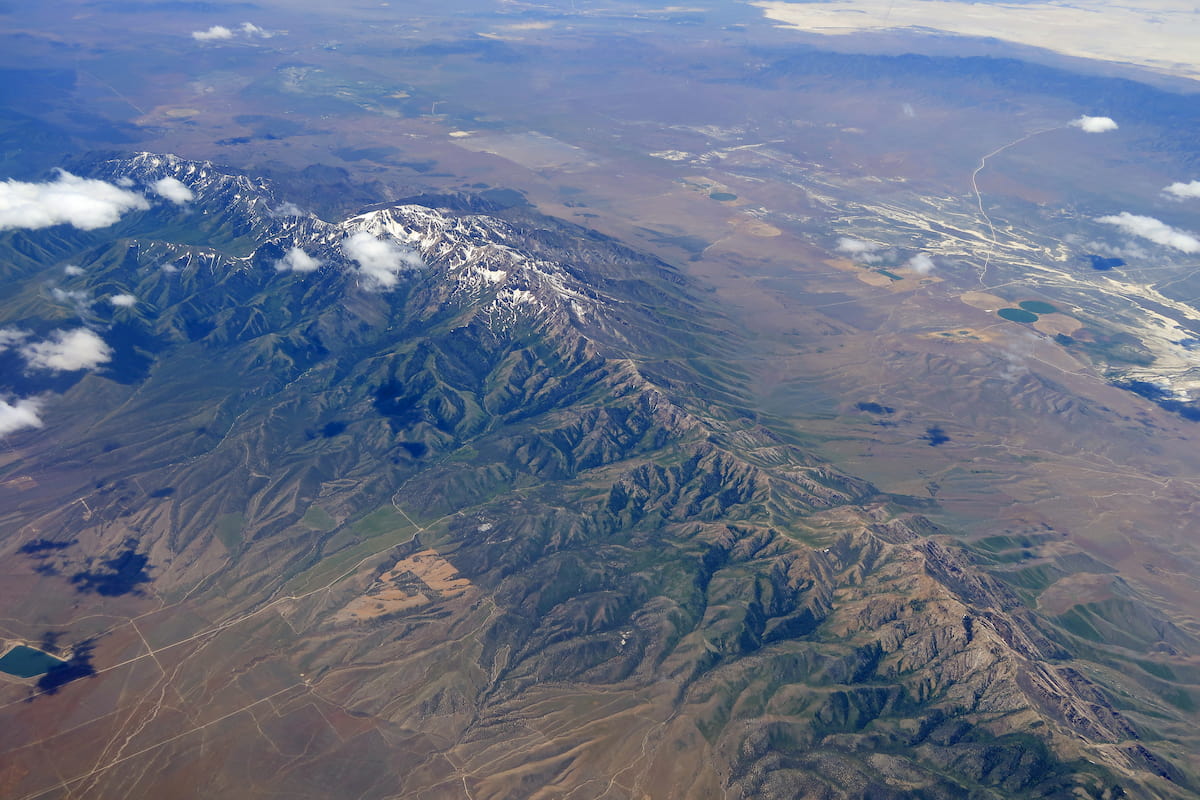
The Deseret Peak Wilderness is a federally-protected region located in northwestern Utah. It encompasses 25,212 acres (10,202 ha) of land and is wholly contained within Tooele County, just to the west of Salt Lake City.
Aptly named, the Deseret Peak Wilderness is situated around Deseret Peak, which is the high point of the Stansbury Mountains. Moreover, the wilderness is part of the Uinta-Wasatch-Cache National Forest, which covers much of northern Utah’s most mountainous regions.
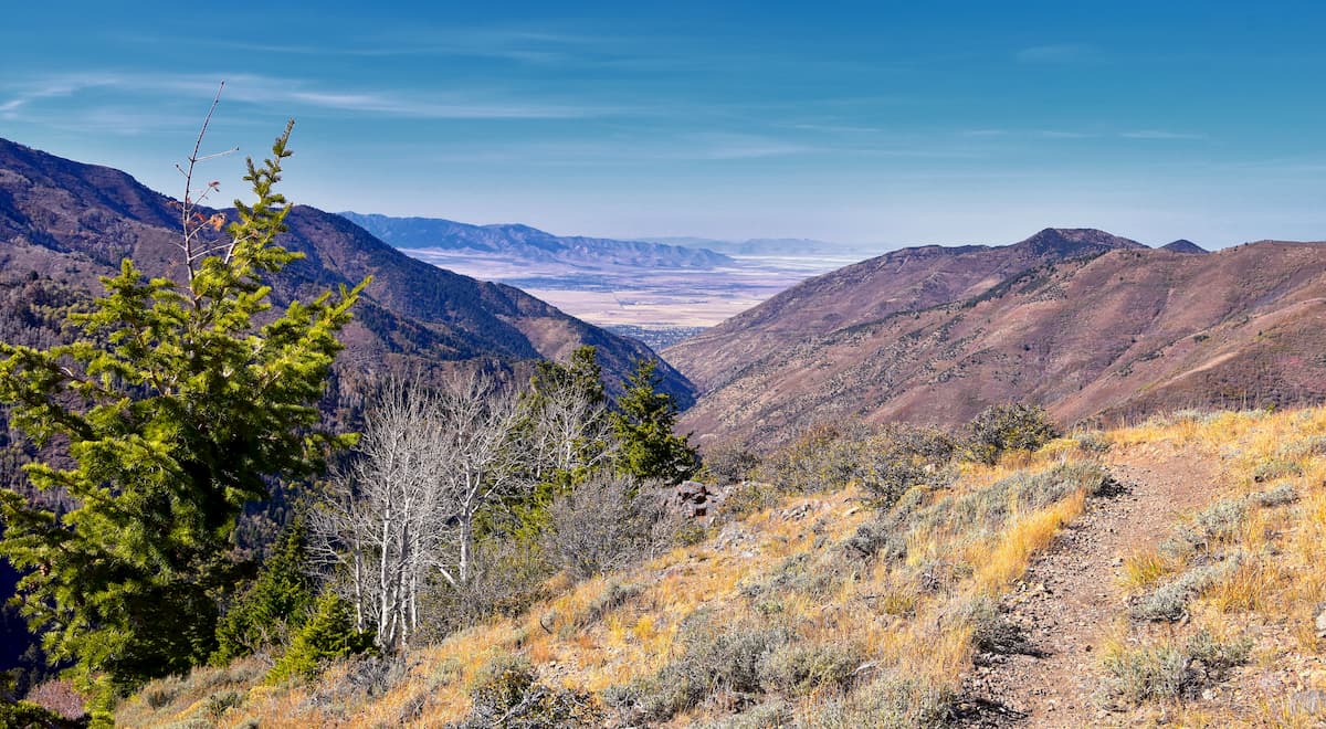
The land contained within the Deseret Peak Wilderness occupies a very interesting transitionary zone between the Great Basin Ranges to the west and the Western Rocky Mountains to the east. Indeed, while the wilderness is closer to the ranges of the Western Rocky Mountains, such as the Wasatch Range and the Uinta Mountains, in terms of distance, it is geologically and ecologically more similar to its fellow Great Basin Ranges.
That being said, the Deseret Peak Wilderness is situated in a rugged part of Utah and it is located within driving distance of a number of other mountain ranges and major areas of public land. It is also located just to the east of the Skull Valley Reservation of the Skull Valley Band of Goshute.
In particular, the Deseret Peak Wilderness and its associated Stansbury Mountains are located to the east of the Cedar Mountains of the Cedar Mountain Wilderness Area and to the west of the Oquirrh Mountains, as well as the rest of the Uinta-Wasatch-Cache National Forest.
Moreover, the Deseret Peak Wilderness is situated to the north of the Onaqui Mountains, and the Sheeprock Mountains, which are also partially included within the Uinta-Wasatch-Cache National Forest.
Finally, the Deseret Peak Wilderness is located to the south of the Great Salt Lake. Within the Great Salt Lake and around its borders, there are actually quite a few nearby mountain ranges, including the Great Salt Lake Islands of Antelope Island State Park, the Lakeside Mountains, the Hogup Mountains, the Promotory Mountains, and the Hill Air Force Range.
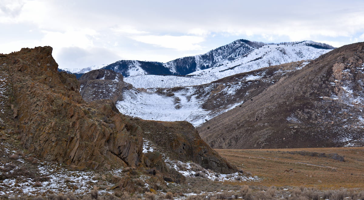
The mountains within the Deseret Peak Wilderness are a part of the Stansbury Mountains, a subrange of the Great Basin Ranges, which covers much of Nevada, Utah, Idaho, Oregon, and California.
Unlike many of the other ranges in northern Utah, such as the Wasatch Range and the Uinta Mountains, the Great Basin Ranges have a very distinct geomorphology that’s characterized by alternating ranges and basins. Indeed, this topography is evident in the Deseret Peak Wilderness’ Stansbury Mountains, which are separated from the neighboring Cedar Mountains and Oquirrh Mountains by large basins.
From a geological perspective, the region that is now the Deseret Peak Wilderness started to form during the Early Miocene. During this time, widespread tectonic extension caused warping and deformation of the landscape, which formed the basin and range topography that’s now characteristic of the region.
The mountains within the Deseret Peak Wilderness are mostly comprised of sedimentary rock, though there are some metamorphic rocks, such as shales and quartzites, found throughout the range.
Similar to other parts of the Great Basin Region, the Stansbury Mountains do contain fairly large deposits of mineral resources. However, due to the region’s wilderness designation, mining is not allowed in the area. This places the Deseret Peak Wilderness in stark contrast with the nearby Oquirrh Mountains, which are heavily mined, particularly in the eastern part of the range.
Major high points within the Deseret Peak Wilderness include Deseret Peak, South Medina, Vickory Mountain, Hickman Peak, Pockets Peak, and Stansbury-Box Elder Peak.
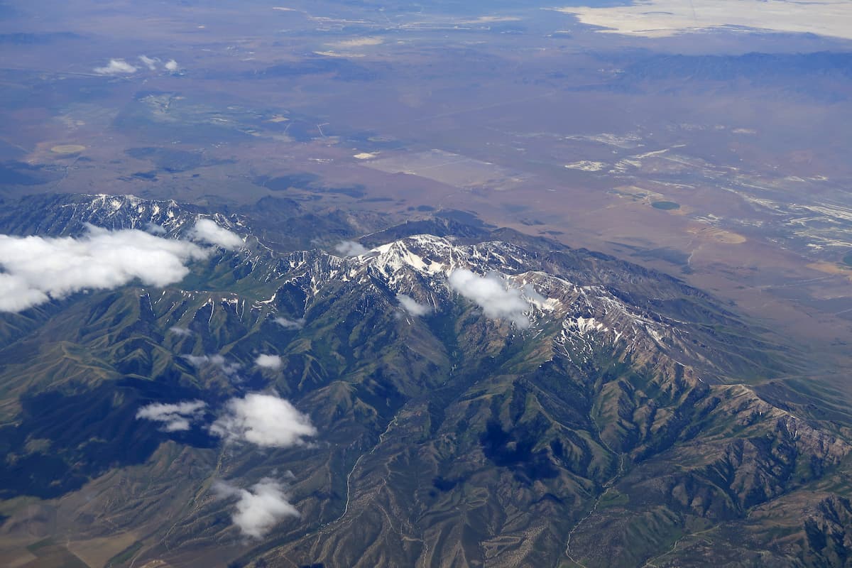
The Deseret Peak Wilderness, like the rest of the Stansbury Mountains, is within the Great Basin ecoregion. This ecoregion is known for being hot and dry, though it’s worth mentioning that Deseret Peak actually tends to get quite a bit of moisture, at least when compared to the surrounding region.
In fact, the sheer prominence of the peak (5,807ft/1,770m) means that it often ‘captures’ the limited moisture in air masses as they pass over the Stansbury Mountains during their eastward transit. As a result, Deseret Peak often gets quite a bit of snow in the winter months, so it’s a fairly popular place to backcountry ski.
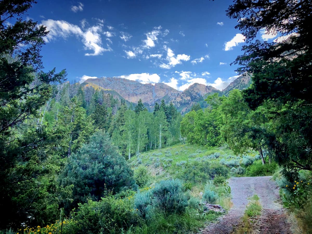
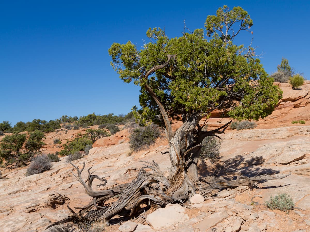
That being said, the majority of the Deseret Peak Wilderness is fairly dry. Due to its location in a transition zone between the Western Rocky Mountains and the Great Basin, the Deseret Peak Wilderness gets varying forest types, including some juniper, sagebrush, Douglas fir, and even aspen.
At lower elevations, however, the range is dominated by sagebrush and grasslands, which are typical of the Great Basin. In contrast, the highest vegetated regions in the area are mostly alpine meadow, with plenty of wildflowers, which make for excellent scenery in the summer months.
Wildlife is also particularly abundant in the Deseret Peak Wilderness. Species, such as mule deer, pronghorn, jackrabbits, coyotes, bobcats, and mountain lions can be found in the region. Moreover, there is a sizable herd of wild horses that live in the wilderness’ Big Creek Canyon, so it’s possible that you’ll encounter the herd during your travels.
Although it’s now thought of as a wild area devoid of permanent human settlement, the land that is now called the Deseret Peak Wilderness has long been home to humans. Many peoples have lived in and around the Stansbury Mountains for millenia, including the Goshute people.
Indeed, the land that is now the Deseret Peak Wilderness is located on the ancestral homelands of the Goshute. In fact, the wilderness shares a border with the Skull Valley Reservation of the Skull Valley Band of Goshute.
Some of the first people of European descent to travel through the region to the south of the Great Salt Lake include Etienne Provost and Jim Bridger. Provost and Bridger, who were from Canada and the United States, respectively, are believed to be among the earliest people of European descent to have seen the Great Salt Lake when they visited the area independently of each other in the 1820s.
Not long after Bridger and Provost’s expeditions, Peter Skene Ogden of the Hudson’s Bay Company also traveled extensively around the Great Salt Lake. About 2 decades later, John C. Fremont’s expedition also traveled near the region. Meanwhile, Howard Stansbury (the namesake of the Stansbury Mountains) of the US Army Corps of Topographical Engineers surveyed the area in the mid-19th century.
Around the same time, Brigham Young had led a group of Mormon settlers to the region around the Great Salt Lake. Their arrival and subsequent disputes over land, led to a number of violent conflicts with the many tribes and nations who had lived in the region since time immemorial.
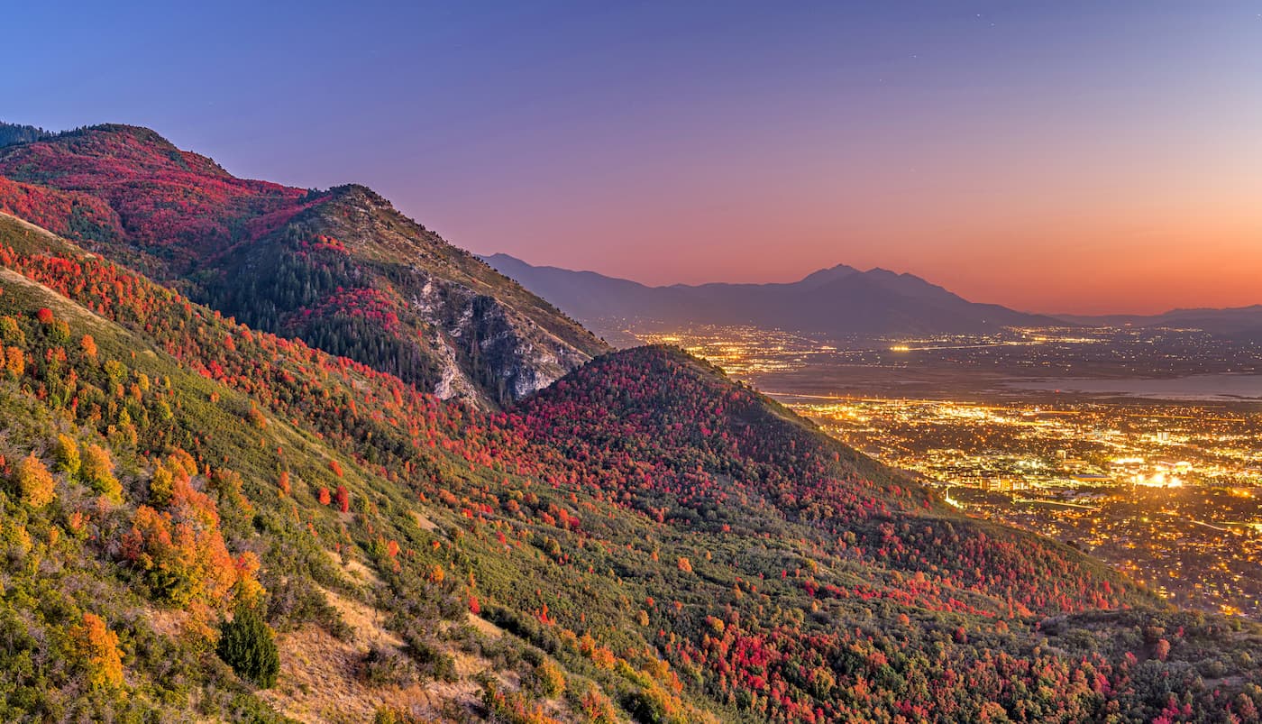
In subsequent years, however, immigration to the Wasatch Front region to the east of the Deseret Peak Wilderness increased substantially and it is now the most densely populated part of Utah. Meanwhile, the region around the Deseret Peak Wilderness is fairly sparsely populated, though there are a few sizable towns and cities in the area.
In 1906, the region was put under the control of federal land managers with the establishment of the Wasatch-Cache National Forest. More recently, these forests were combined with the Uinta National Forest to create the jointly administered Uinta-Wasatch-Cache National Forest.
About 8 decades later, the Deseret Peak Wilderness was officially established through the 1984 Utah Wilderness Act. This act set aside the entire region as a federally-protected wilderness where mining, road construction, logging, and other such human activities are prohibited.
The wilderness itself is fairly small and there are relatively few established trails in the region. However, there is plenty of adventure to be had for hikers, climbers, and skiers who have a sense of adventure.
Within the Deseret Peak Wilderness, there are only a handful of marked trails. Here are some of the best places to check out if you’re visiting the wilderness:
The out-and-back Willow Lake Trail is a 6.8 mi (10.9km) long hiking adventure in the Deseret Peak Wilderness. It starts near the town of Grantsville and it is a sure bet if you’re looking to get away from the crowds.
For the first part of the trail, you’ll hike through dense forest before poking out into the alpine. The trail continues onward, providing you with views of the Great Salt Lake and the surrounding canyons along the way. Eventually, it terminates at South Willow Lake on the eastern flank of South Medina, which is a great place to kick back and relax as you enjoy the view in the mountains.
If you’re looking to see quite a bit of the Deseret Peak Wilderness, the Stansbury Traverse might be the trail for you. This 10.2 mile (16.4km) strenuous hike starts at the Loop Campground and immediately starts to climb up to the summit of Deseret Peak.
After summiting the highest peak in the range, the trail continues down the main ridgeline of the Stansbury Mountains, giving you excellent opportunities to take in the view. At the end of the ridge, you can descend back down to the valley below via Pockets fork, which eventually loops back around to the Loop Campground Trailhead where you started.
While the Deseret Peak Wilderness is known for its remoteness, the region is fairly close to a number of major cities. Here are some of the best places to check out if you need a place to stay during your trip:
Salt Lake City is the capital and largest city in the state of Utah without about 200,000 residents. It is located just over an hour’s drive from the Deseret Peak Wilderness, making it an excellent starting point for your adventures. Salt Lake City is also home to the largest airport in the state, so it’s easy to access from locations that are a bit further afield.

Located to the south of Salt Lake City along the Wasatch Front, the city of Provo is home to about 116,000 people, which makes it the third largest city in the state. Provo is home to the main campus of Brigham Young University and its location along I-15 makes it an easy destination to get to from Salt Lake City.
The city of Tooele is situated to the east of the Deseret Peak Wilderness, just off of I-80. It is home to more than 30,000 residents, which makes it the largest city in Tooele County. From the city, visitors can enjoy great views of both the Oquirrh Mountains and the Great Salt Lake. Moreover, the city hosts an annual arts festival, which is a major gathering of local artists and craftspeople each summer.
The second largest city in Tooele County, Grantsville is a bustling city located just northeast of the Deseret Peak Wilderness Area. It is home to about 12,000 residents and its proximity to the Stansbury Mountains makes it a perfect basecamp for adventures in the region. Grantsville is also the home of the Utah Motorsports Campus, which hosts major motorsports races, such as the NASCAR K&N Pro Series.


