
Scan the QR code and open PeakVisor on your phone
Weber County is home to 37 named mountains. The highest is Ben Lomond at 2,960 m.
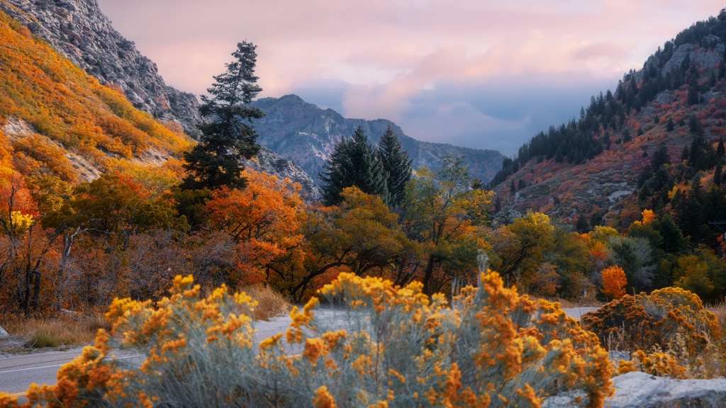
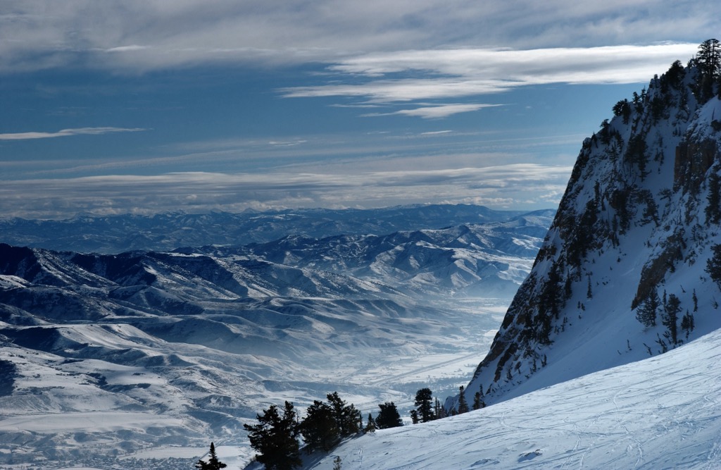
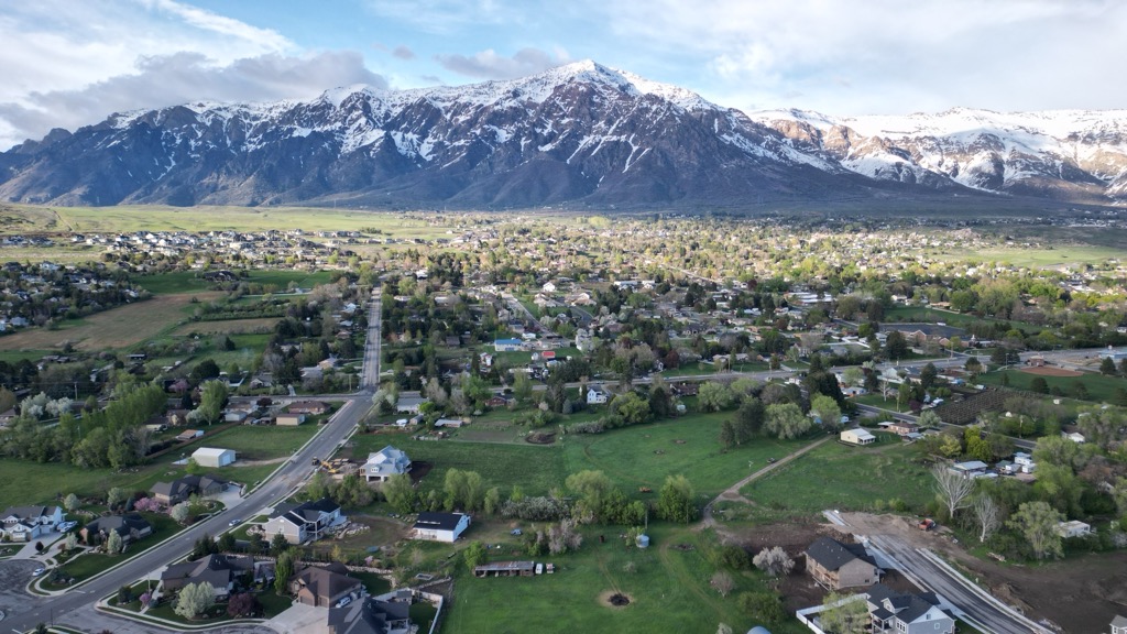
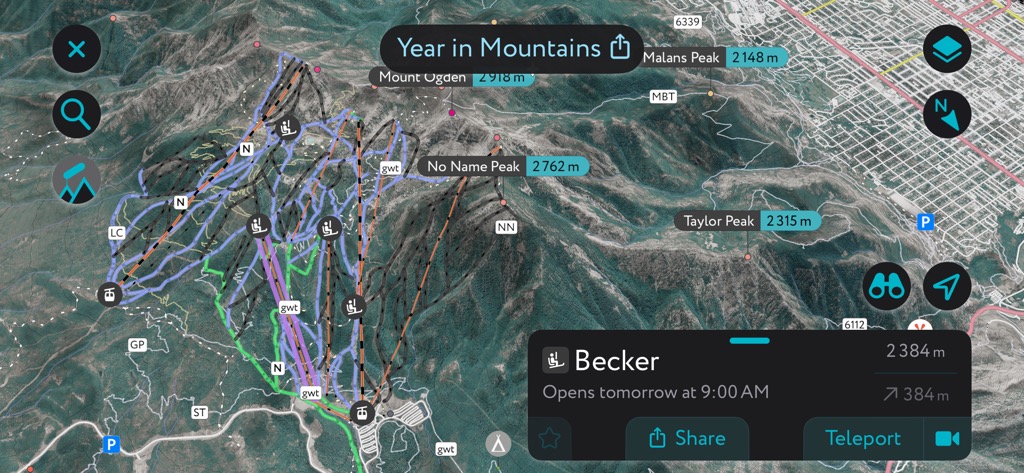
Weber County sits on the northern arm of the Wasatch Mountains, east of the Great Salt Lake and north of Salt Lake City, Utah. The county seat, Ogden, is a hub of local culture that’s considerably less busy than SLC. The area is also defined by large expanses of public land featuring excellent access to free campgrounds, lakes, and trails. There are three ski resorts in Weber County, two of which are on par with those around SLC. The mountains themselves are a bit lower than the Central Wasatch, but still get great snow and won’t drive you crazy sitting in traffic just to get to the resort. The highest mountain in Weber County is Willard Peak (9,764 ft / 2,967 m), a hair higher than the most prominent, Mount Ogden (9,573 ft / 2,918 m).
Weber County is one of five counties that make up the Wasatch Front, which includes most of Utah’s population. The cities of Salt Lake City, Provo, Orem, Layton, and Ogden all sit along the west slope of the Wasatch, within about 100 miles (160 km) of each other. Driving along I-15, you can cross the front in two hours.
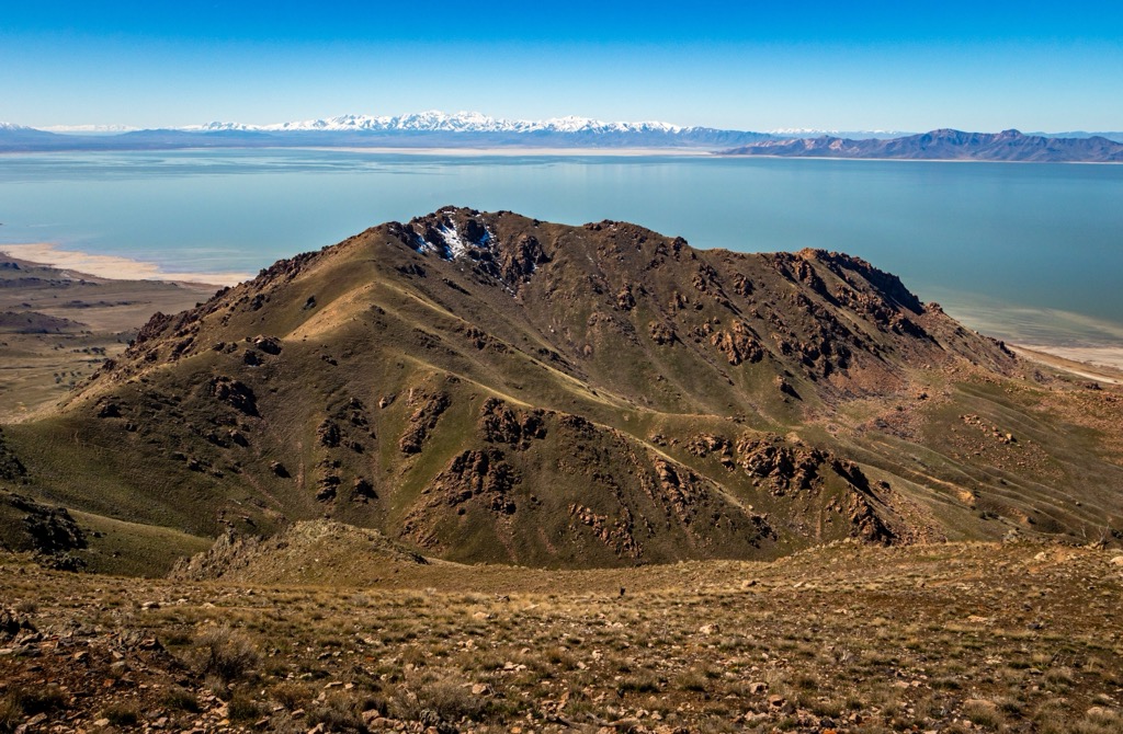
Weber County is on the northern edge of the front. It includes a good slice of the Great Salt Lake with a wide area along the shore (including the city of Ogden), as well as a collection of 37 named peaks. Weber County is slightly more hilly than the Central Wasatch around Salt Lake, which features more prominent mountains and deeper canyons. That sounds like a bad thing, but it isn’t. One side effect of how steep the Central Wasatch are is that all the traffic is directed to a few concentrated spots. By comparison, the Northern Wasatch are much more spread out. There are more roads, campgrounds, lakes, and trailheads, with fewer crowds fighting over them.

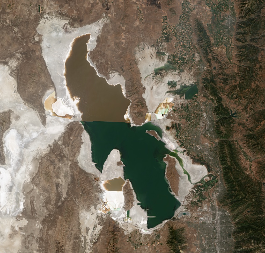
Aside from the Wasatch Mountains, which are pretty hard to ignore, the main feature of Northern Utah is the Great Salt Lake. The lake, which seems like a big deal from the plane, is actually more like a big, shallow puddle. It’s not great for swimming – not only is it too shallow, it smells horrible. These days, it mostly serves as a reminder of the effects of urban growth.
Recreation-wise, the area caters a little more to fishing (Pineview Reservoir is a hotspot in the winter), mountain biking, and motorsports than the Central Wasatch. But there are still some great ski resorts around. Snowbasin is technically the closest resort to Salt Lake International Airport, and Powder Mountain boasts a huge in-bounds backcountry area. Nordic Valley is tiny by comparison but has a fun “small-town family resort” vibe.
People usually consider Weber County and its neighbors, Morgan and Davis, one area. The county line between Morgan and Davis split part of the Northern Wasatch, including the area around Thurston Peak (9,705 ft / 2,958 m). There are some beautiful lakes and oddities like Devil’s Slide in Morgan County. Meanwhile, the main feature in Davis County is Antelope Island, some of the most rugged country in Northern Utah.
Chances are, if you know one thing about Utah, it’s that the state is full of weird rock formations. The most fascinating geology is in the southern desert, where you can find sandstone arches and hoodoos. But the Wasatch Mountains are also have an interesting geological history.
The Wasatch is a young range in geological terms, dating back about 20 million years. Back then, the Great Salt Lake covered half the state, and the mountains were full of massive glaciers. Over time, a changing climate reduced Lake Bonneville to a measly puddle and the glaciers to nothing.
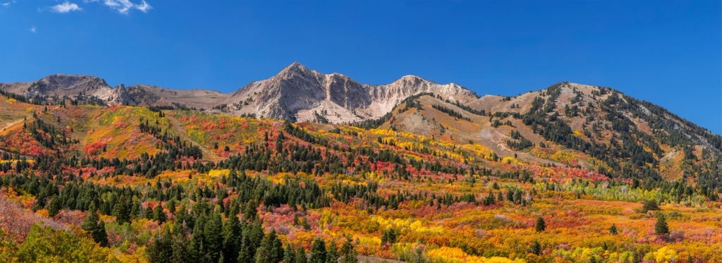
Nevertheless, these glaciers did some impressive work on the Wasatch before they receded. Ben Lomond (9,711 ft / 2,960 m) is a great example. Its southeast face is a craggy wall of quartzite and granite that runs in tiger-striped striations. It’s what climbers call “kitty litter,” not exactly good climbing. But in the rock layers, you can see millions of years of Earth’s history. Ben Lomond was also famously the inspiration for the Paramount logo.
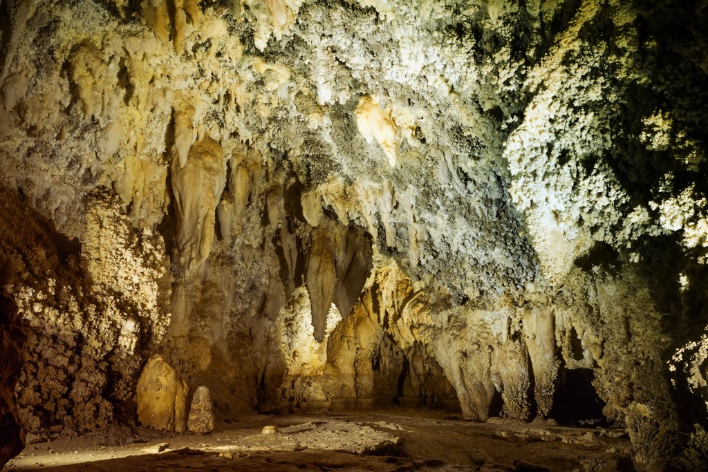
Other parts of the Wasatch area are full of limestone, which creates some interesting karst formations. Timpanogos Cave, about an hour south, is one of the most spectacular caverns in the US.
Utah’s ecology is a case of “desert meets mountains.” The Great Basin, the largest desert in the US, abruptly ends at the Wasatch Mountains. From there, the mountains rise into a cold alpine climate.
In some places, there isn’t a division between the desert and mountain ecosystems; they are stacked on top of each other. It’s not uncommon to see cacti and sagebrush in the mountains or fir trees in the high deserts around Utah.
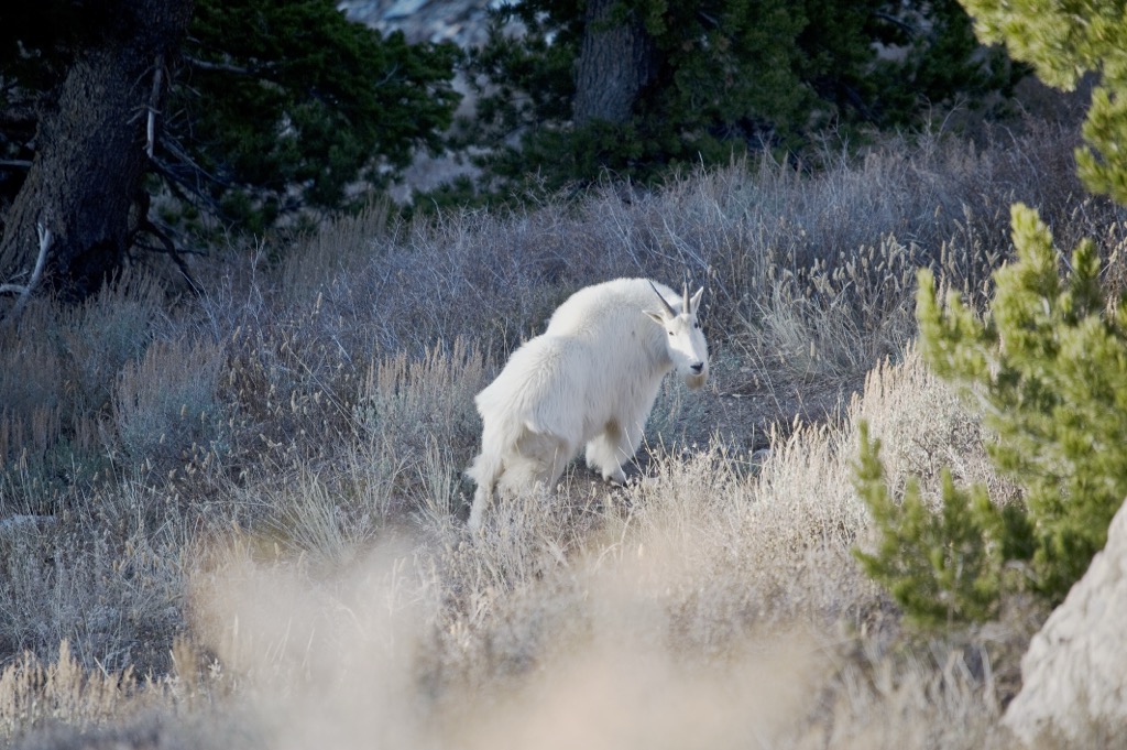
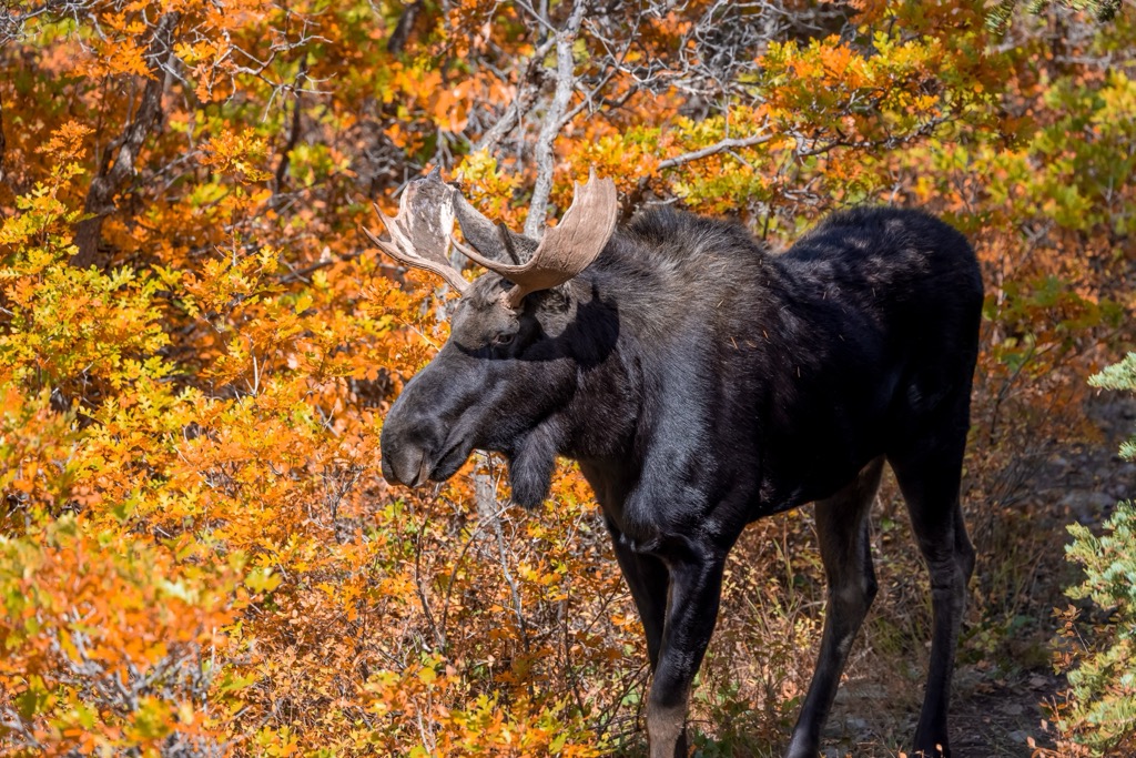
Naturally, the Wasatch is full of extraordinary wildlife. You can easily spot elk and moose in the mountains around Weber County. There’s also a small but notable herd of mountain goats around Willard Peak. But if you want to see a real spectacle, drive to Antelope Island. The island is a refuge for bison, bighorn sheep, pronghorn antelope, bobcats, and shorebirds by the millions.
Historically, the islands of the Great Salt Lake provided a safe place for shorebirds to nest. For example, about 10% of the world’s white pelicans nest around the Great Salt Lake each year. Another example is the California gull, which supposedly saved the Mormon pioneers from a plague of locusts.
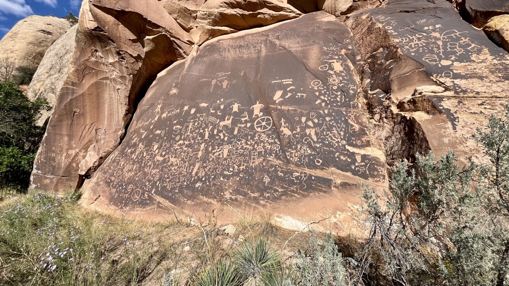
The Weber area has evidence of human occupation dating back 12,000 years. Caves around the Great Salt Lake are full of archaeological sites, including one of the world’s oldest known gambling dens. The Ute, Paiute, and Shoshone People and their ancestors thrived here for thousands of years.
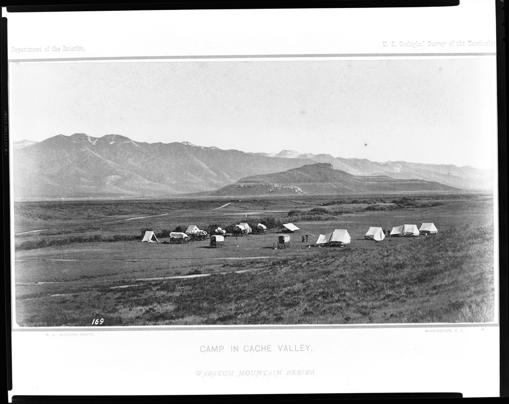
The Wasatch Mountains were once part of Mexico. After the Mexican-American War, Utah became a US territory. Fabled mountain men like Jim Bridger and Kit Carson were some of the first white explorers in the area. Fur trappers followed them, founding the city of Ogden. Eventually, Mormon Pioneers arrived and built Salt Lake City (along with hundreds of other cities in the West).
The Mormon church quickly become the de facto government in Utah, which had been mostly uninhabited until then. The church created a new alphabet, minted its own currency, and considered forming a theocratic city-state. However, it wisely opted to file for statehood instead.
In the late 1800s, the transcontinental railroad finished construction at Golden Spike National Monument, west of Ogden, Utah. The West, which had already been growing, was overtaken by an economic boom. Mining camps popped up throughout the hills of the Wasatch, leaving ghost towns behind when they collapsed. Wild West legends like Butch Cassidy and the Sundance Kid came and went.
In the 1900s, the Wasatch Front evolved from a frontier to a metropolis. Utah went from “gunfights in saloons” to “lift-serviced powder skiing” in a few decades. The 2002 Winter Olympics solidified the Wasatch as a world-class ski destination, and nothing has been the same since. Today, the Wasatch Front is one of the fastest-growing economies in the US, with more and more people heading west in search of adventure.
There are a ton of great trails within walking distance of downtown Ogden, and they’re all considerably less crowded than the Salt Lake area. If you want to head into the hills and find a slice of rugged mountain country for yourself, here’s where to go.
At PeakVisor, we love information. That’s why we write articles like this one.
Check out the PeakVisor app for even more information on thousands of additional hikes, ski tours, and ski resorts across the U.S. In fact, we’ve compiled information on all publicly maintained walking tracks worldwide, formatted onto our 3D maps.
PeakVisor started as a peak identification tool—you’ll have noticed the photos throughout this article—but we’ve evolved into purveyors of the finest 3D maps available. We continue to expand our offerings. You can track your hikes directly on the app, upload pictures for other users, and keep a diary of all your outdoor adventures.
Most recently, the PeakVisor App has included up-to-date weather reports, including snow depths, at any destination. We've also been hard at work adding the details of hundreds of mountain huts, including information on overnight accommodation, dining options, and opening hours. You can also use our Hiking Map on your desktop to create .GPX files for routes to follow later on the app.

It’s pretty hard to look at Ben Lomond (9,711 ft / 2,960 m) without thinking, “I need to get to the top of that thing.” Although it’s a charismatic summit, Willard Peak (9,764 ft / 2,967 m) to the north is actually the county’s highest. Either way, the summits are connected by a perfect little ridge, so you may as well bag both and call it a day.
There are a couple of approaches to the upper ridge and no wrong answers. The first two start from North Fork Park on the northwest side of the peaks. The Ben Lomond Trail is a little longer, totaling 14 miles (23 km) and change.
Or you can head up Cutler Creek and cut a solid five miles (8km) off the approach to Ben Lomond. From there, head north along the ridge to Willard Peak and return along the same route.
If you want to skip the tough stuff and get right to the fun part, there is a 4x4 trail to Inspiration Point, north of Willard Peak. The road is a 14-mile (23 km) out-and-back with some exposure along the way. It’s a healthy half-day, depending on your driving ability and road conditions. Some years, it’s a high-clearance road. Others, heavy snow can wash it out and add some technical obstacles.
From Inspiration Point, hike south along the ridge over Willard Peak to Ben Lomond and back. This way cuts off about 60% of the vertical gain on foot. The route is about 6 miles (10 km) of pure, unadulterated magic ridge over the city of Ogden and the Great Salt Lake.
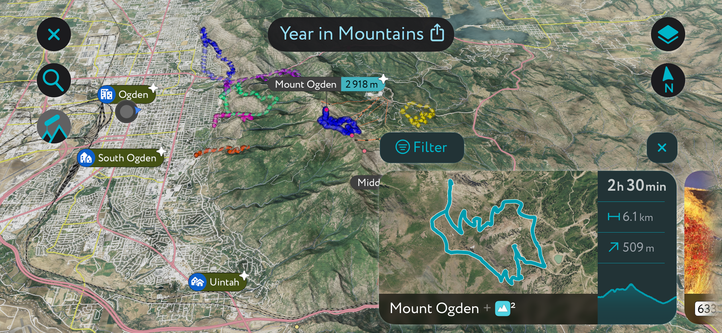
Mt. Ogden (9,573 ft / 2,918 m) is the other most obvious peak from town. It’s the highest point of Snowbasin Ski Resort, sticking up above a handful of other rocky peaks along a high ridge. This is also a great peak to ski come winter, but I’ll get to that in a minute.
There are also a couple of different approaches here. One option is to hike from town along the Malans Peak Trail. After summiting Malans Peak (7,047 ft / 2,148 m), head east to the summit's obvious drainage.
The whole enchilada is about 10 miles (16 km) of trail and just over 5,000 feet (1,500 m) of vertical. Not only is it a heavy slog, but there is a lot of scree hiking involved, which can be sketchy on the descent. Bring a sturdy pair of ankle boots and plenty of water, and watch for rattlesnakes.
The other method is to drive to Snowbasin, park in the main lot, and take the trail straight up the hill from the Needles Gondola. There can be some route-finding involved here as the trail isn’t very well marked. It winds up through some of the groomed runs into the Mt. Ogden Bowl, onto the high ridge, and north to the summit.
It’s also possible to take the gondola to Needles Lodge and scramble the Needles Cirque from there. The whole ridge is accessible from the Needles (9,259 ft / 2,822 m) but includes some spicy scrambling and exposure.
The Great Salt Lake isn’t what you would call a “swimming hole.” It smells terrible and is rarely even deep enough to swim in. But the lake has spectacle. The lake and the salt flats beyond are one of the largest expanses of nothingness in North America, a sweeping horizon covered in only saltwater and salt. On a clear day, you can see from Ogden to faraway mountain ranges in Nevada. And if the water is still enough, the lake lies perfectly flat, like a gigantic mirror.
One of the best spots to enjoy the view is from the highest point on Antelope Island: Frary Peak (6,594 ft / 2,010 m). I don’t recommend this one in the summer when the temperatures are scorching, and the sand flies are brutal. But it’s a fun jaunt in the early spring or late fall when everything else is covered in snow.
First, drive to the island and follow the road around the east side to the trailhead. The route gains about 2,300 ft in 3.5 miles or so. About halfway through, it transitions from sidehilling to a steady cruise up an exposed ridgeline to the summit. As I mentioned, there is a ton of wildlife on the island, and it’s common to see bison, bighorn sheep, pronghorn, coyotes, and badgers on the rocky slopes.
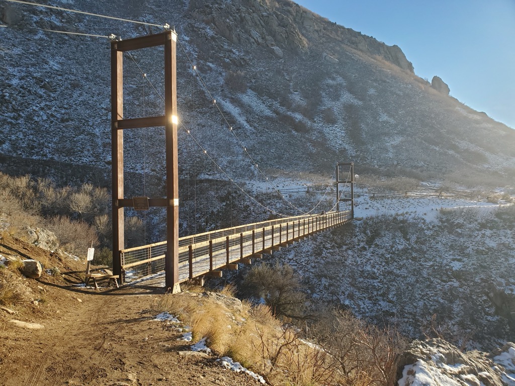
The Bonneville Shoreline trail totals over 150 miles (250 km) along the apron of the Wasatch. The whole thing is open to both hiking and biking (watch for signage), and it includes some fun intermediate singletrack for mountain bikers. The section around Ogden is arguably one of the best, and it’s easily accessible from town.
The main trailhead is at the mouth of Ogden Canyon. From there, the trail forks into a network of trails around the base of Mt. Ogden. This is an awesome place to spend an afternoon on a mountain bike, with lots of branching paths to choose from.
If you’re hiking, you can head uphill a couple different ways. Hidden Valley Trail, Indian Trail, and Malans Peak Trail all branch off from here. Each is a nice short-but-steep ascent to a pristine viewpoint.
Waterfall Canyon branches off a little further south and is one of the local favorites. It’s an easy jaunt (1,100 ft over 2.4 mi) to a photogenic waterfall that makes for a solid half day.
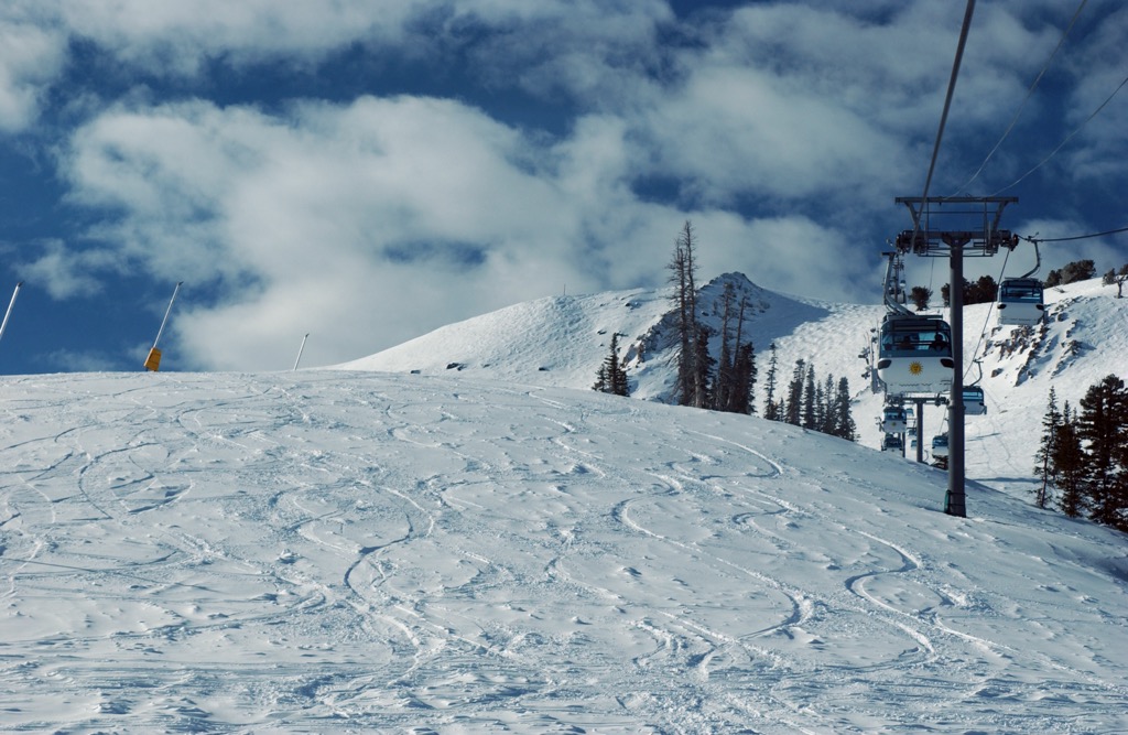
Sneakily, Weber County has two of the best resorts in Utah. And with 90% of the traffic going to the resorts around Salt Lake and Park City, you’ll have much more room to yourself—no fighting over parking or fresh turns.
Snowbasin includes about 3,000 acres (three times the size of Brighton) of terrain with mix of groomers, steep open faces, and great trees. The most serious terrain sits at the top of the Allen Peak Tram, with a few steeps and cliffs that rival those at Alta or Snowbird. The terrain parks are big and varied, with a good mix of small and large features.
The main downside of the Basin is its weather. Compared to the Central Wasatch resorts, it’s considerably more cloudy but at the same time gets less snow. This probably has something to do with its proximity to the Great Salt Lake and its lower base elevation. Overall, it’s a pretty small price to pay.
Powder Mountain, or PowMow, is much more of a “locals” resort than Snowbasin. For the last few years, Snowbasin’s marketing has been heavily focused on how close the mountain is to the airport in an attempt to draw more tourists.
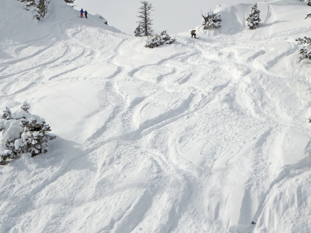
The resort surrounds a few sweeping bowls full of perfectly spaced trees and open faces for powder farming. The lift-serviced area covers about 2,800 acres, a little smaller than Basin. But the interesting draw of PowMow is how much in-bounds side-country terrain there is.
In addition to the lift-accessible area, another 5,000 acres of terrain is only accessible by shuttle, snowcat, or guided touring. Part of it is avalanche patrolled; part isn’t. But it's a fantastic way to get into the backcountry, especially for someone who doesn’t know the area.
Know before you go. Here’s the local avalanche forecast for the Ogden area.
In addition to the side-country area outside Powder Mountain, there are also some interesting lift-accessible lines on the backside of Snowbasin. One is the Banana Chute, a prominent, north-facing couloir that runs straight into town from the summit of Mt. Ogden. It’s a famously fun way to get home from the mountain and is much quicker than driving.
Beyond the resort side-country, check out the Ben Lomond area. North Fork Park is a good jumping-off area for touring on the northwest slope. There’s a lot of good tree skiing in the lower slopes and some open faces near the summit.
In general, there isn’t as much beta available for the Northern Wasatch as for the Salt Lake area. The hills east of Pineview Reservoir can make for good (if mellow) powder laps during the right conditions, but this area usually caters more to snowmobiling than skiing.
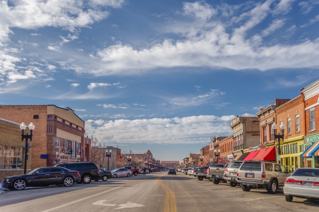
Ogden, Utah is the seat of Weber County. With an urban area of around 600,000 people, it’s about two-thirds the size of Salt Lake City. The nearest airport to Ogden is Salt Lake International. From there, you can drive or take the local FrontRunner train, which stops in downtown Ogden.
While not as big or bustling as Salt Lake, Ogden still has a lot of Western flavor and plenty to do. The historic 25th Street area is an excellent walking district with local food, coffee, and beer. The Ogden Amphitheater hosts some huge concerts during the summer and a Christmas village in the winter. During the season, you can also catch a local baseball game at Lindquist Field.


Yes. Weber County has 37 named mountains. The highest is Ben Lomond at 2,960 m.
The highest mountain in Weber County is Ben Lomond, at 2,960 m.
Weber County has 37 named mountains.


