
Scan the QR code and open PeakVisor on your phone
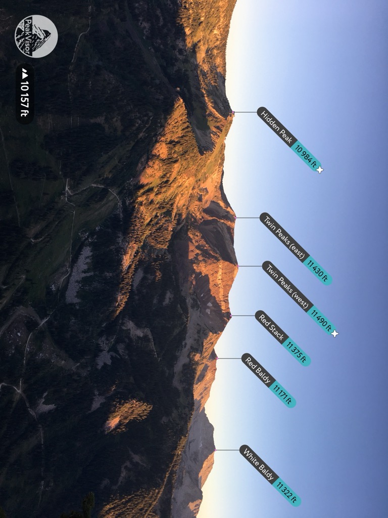
Salt Lake County is the most densely populated county in Utah, a state known far and wide for its incredible mountains and deserts. The Salt Lake Valley, with a population of over one million, provides quick access to the surrounding 120 named peaks. The most prominent of these, the Wasatch Mountains, are full of steep canyons, narrow chutes, and dramatic cliffs. The highest peak in the county, Twin Peaks (west) (11,490 ft / 3,502 m), looms over Snowbird Ski Resort. The county includes four ski resorts, all famous for their terrain and exceptional snow quality. Salt Lake County is the ultimate playground for deep powder skiers, rock climbers, mountain bikers, hikers, and nature lovers.
Salt Lake County is fairly small but packed with mountains. Its boundaries encompass the Salt Lake Valley, the Oquirrh Mountains to the west, and the Wasatch's west slope to the east. The county also includes the southeast shore of the Great Salt Lake, one of the largest salt lakes on Earth.
The Oquirrh Mountains often go unnoticed next to the skyline of the Wasatch, which is both higher and more interesting. By comparison, the Oquirrhs look more like Nevada's rolling “basin and range” landscape. They’re mostly treeless and get significantly less snow than the Wasatch.
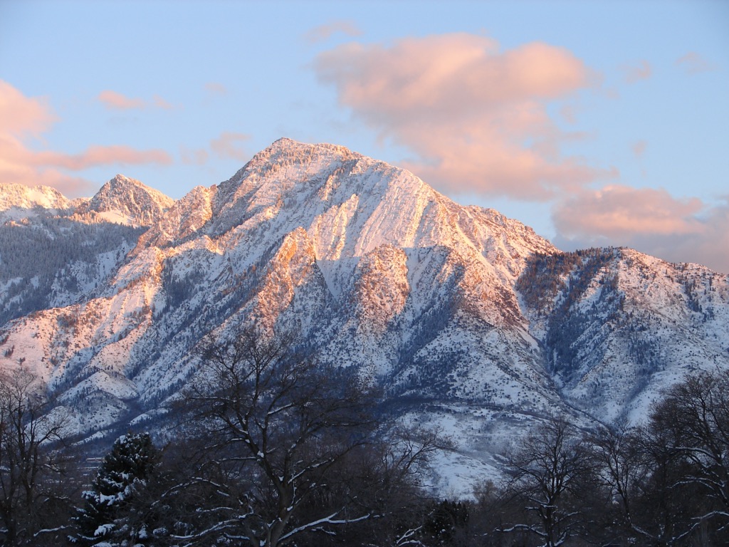
The Wasatch Front is undoubtedly Salt Lake County's most eye-catching feature. The peaks, just outside downtown Salt Lake City, tower 7,000 feet (2,133 m) above the valley floor.
And these aren’t the highest mountains in Utah, either. The Uinta Range to the east is significantly higher (topping out above 13,500’ at the summit of Kings Peak). But the mountains just outside Salt Lake are unbeatable for skiing.
The main area for “steep and deep” resort skiing is the back end of two major canyons, Big and Little Cottonwood, which sit side by side. These canyons are full of incredible ski lines, hiking trails, and climbing routes. The tallest peaks in Salt Lake County all sit on the ridges of Big and Little Cottonwood Canyons.
Further north, Millcreek Canyon sees far fewer visitors but boasts extensive backcountry skiing. Beyond that are Parley’s Canyon and Emigration Canyon, where the Mormon pioneers famously finished their trek to Utah. The area around Emigration and Parley’s caters more to mountain biking and water sports.
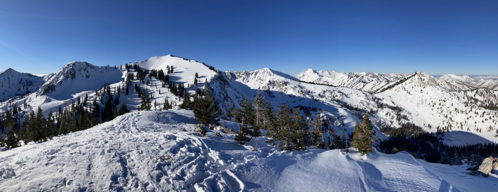
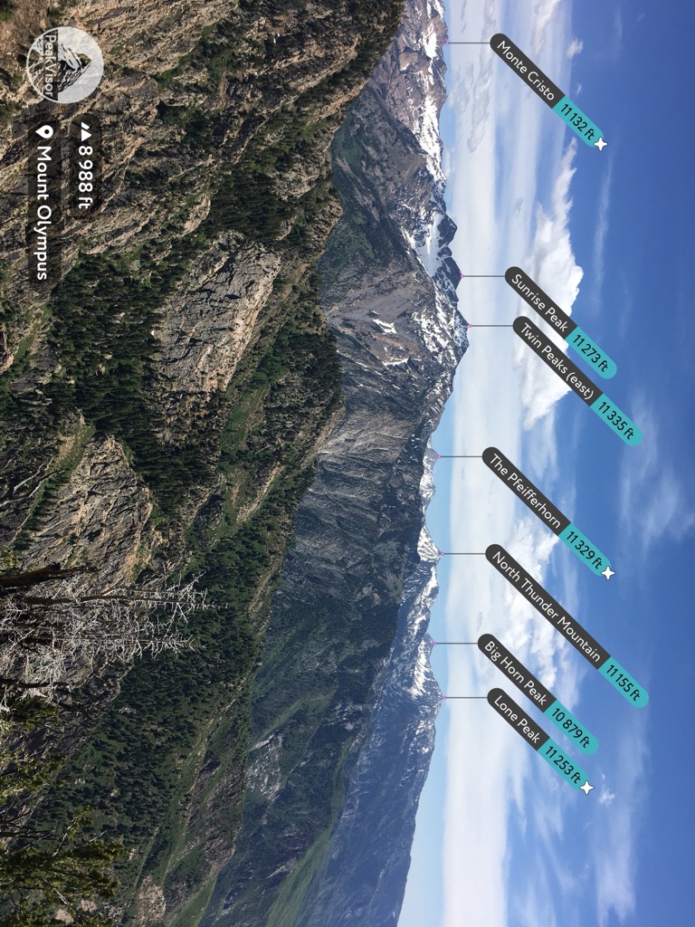
From Salt Lake, the Wasatch is hard to ignore. Some of the most scenic features in the range sit right along the west slope above the valley. The West Slabs of Mount Olympus, Broads Fork Twin Peaks (11,335 ft / 3,455 m), and Lone Peak (11,220 ft / 3,420 m) cast an imposing silhouette. From the right viewpoint, you can see the whole spread of the Wasatch from Mount Nebo (11,932 ft / 3,637 m) to Ben Lomond (9,711 ft / 2,960 m), over 100 miles (160 km) as the crow flies.
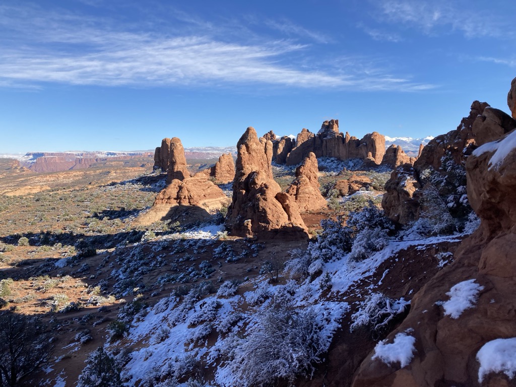
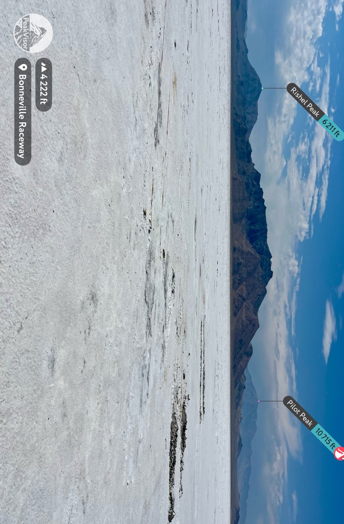
You can’t have a proper discussion about mountains without considering geology. Utah has some of the strangest geological formations in North America, from the alien landscapes around the Colorado River to the Bonneville Salt Flats.
The Salt Lake Valley used to be the eastern shore of Lake Bonneville, a vast salty lake left over when a great inland sea retreated hundreds of millions of years ago. Today, all that’s left is the Great Salt Lake. Despite its sprawling footprint, the lake is shallow, maxing out around 30 feet (9 meters) deep. Lake Bonneville also left behind the second-largest salt flat on Earth.
The Wasatch Mountains are a fairly young range in geological time, forming around 20 million years ago. By comparison, the Uinta Mountains formed around 70 million years ago and are much more eroded as a result.
While Lake Bonneville was slowly evaporating, the Wasatch was being uplifted and shaped by glaciers. The last one to recede was Timpanogos Glacier, which is functionally gone today. You can see evidence of glaciation in Little Cottonwood Canyon, which has a distinctive U shape from the slow movement of ice.
Between Little and Big Cottonwood Canyons, you can see (and climb) a lot of different rock. Big Cottonwood Canyon and features like the slabs on Mt. Olympus feature various kinds of quartzite. Little Cottonwood, by contrast, is made up of smooth granite faces. Further south, Mt. Timpanogos (11,749 ft / 3,581 m) exhibits cave-forming limestone.
The Wasatch Mountains sit on the edge of a cold mountainous region and a hot desert region. In ecology, this is called an ecotone. Ecotones usually have high biodiversity, with plants and animals from both ecosystems.
The ecosystem you see mostly depends on how high you are. For example, the Salt Lake Valley is a classic high desert full of sagebrush, coyotes, and jackrabbits. Rattlesnakes are not uncommon here, either.
As you climb the slopes, the scenery morphs into dry deciduous forest. Deer and mountain lions are resident on the hot lower hillsides.
Higher up, the valleys take on a much more alpine feel with aspen and fir trees. The forested canyons of the Wasatch are full of moose, elk, porcupines, and occasionally black bears. Near the peaks, trees give way to grassy meadows full of wildflowers, and you can spot marmots and pikas living in boulder fields.
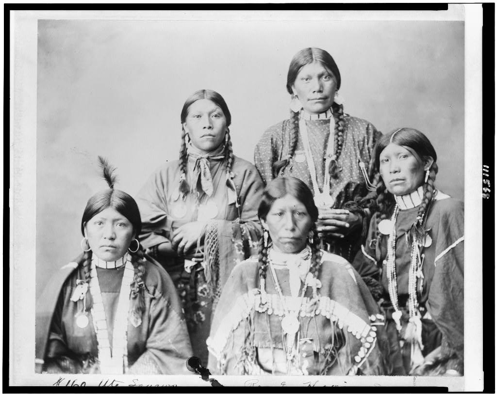
Before the Mormon pioneers set their sights west, Utah’s original residents were eight tribes of native people. The name “Utah” comes from the Ute Tribe, who lived in and around the Wasatch when settlers first arrived in the 1800s.
Before that, Spanish missionaries visited the area in the late 1700s, trying to find a way through the mountains to California. Trappers and mountain men like Jim Bridger began to show up in the early 1800s, setting up trading posts around the Great Salt Lake.
The Mormon pioneers arrived in the Salt Lake Valley in 1847 after being chased out of Illinois. They called the valley a promised land and started building Salt Lake City. In the following decades, Salt Lake would become a major hub.
The Mormons spread out from Salt Lake and built new settlements across the Wild West. They settled the cities of Las Vegas and Carson City, Nevada, Mesa, Arizona, and San Bernardino, California. Mormon settlements reached across the entire Great Basin, as far south as Mexico and well into Canada.
At first, settlers and natives coexisted in Utah. But tensions grew and eventually sparked the Black Hawk War, after which the Ute people were forced onto a reservation.
From this point forward, Salt Lake City exploded. The Mormons, known for their industry, grew the valley into one of the largest cities in the West. Less than a century later, the sport of downhill skiing started to take off in America. Brighton Ski Resort opened in 1936, the same year Sun Valley introduced the world’s first chairlift.
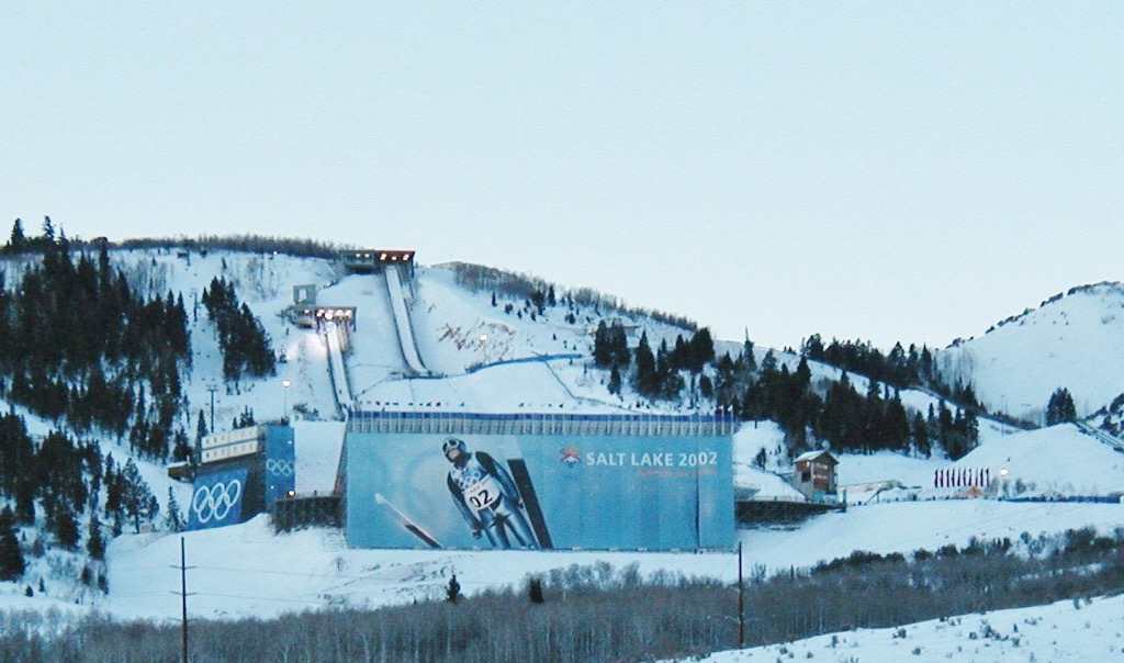
Alpine sports continued to grow in the Wasatch, with more resorts providing more access to downhill skiing. The 2002 Winter Olympics came to Salt Lake, solidifying the Wasatch as a world-class destination. Today, outdoor recreation is one of Utah’s largest industries.
It’s hard to rate all the hiking around Salt Lake City. The popular (read: busy) trails are usually popular for a reason. But tons of undiscovered retreats are still left around the Wasatch Mountains, where you can find peace and tranquility.
So why not a mix? These are some of the best hikes and scrambles in the Salt Lake area.
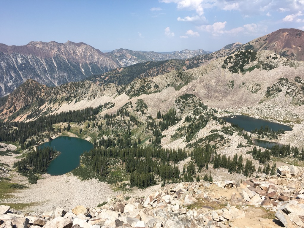
Let’s start with a happy little mountain lake. Lake Blanche is rumored to be the most photographed lake in Utah, even more so than the Great Salt Lake or Bear Lake.
Indeed, Lake Blanche is the ideal mountain lake, perched under Sundial Peak (10,305 ft / 3141 m) and surrounded by subalpine firs. Despite all the foot traffic, it’s not uncommon to see moose here. And the scree fields around the peaks are full of pikas.
The trail itself is a moderate 3.5-mile climb of about 2,900 vertical feet (900 m). The trail ascends under a rocky ridge. The exposed hillsides are good spots to see sego lilies, Utah’s state flower. The best season is probably summer (July, August), but you can also go in the fall or spring to avoid the crowds.
Mount Olympus (9,012 ft / 2747 m) is as much a part of the Salt Lake City skyline as the Mormon temple. You can spot the slabs under its north peak from just about anywhere in the valley. There are two ways to get to the top: a hiking trail, which can be pretty grueling in the summer months, and a 1,500-foot scramble up the West Slabs.
If you’re not a confident climber, stick with the trail. But be prepared. The hike ascends over 4,000 (1,250 m) feet in just under 3.5 miles and has almost no tree cover. It’s a slog, but the views from the top are well worth it.
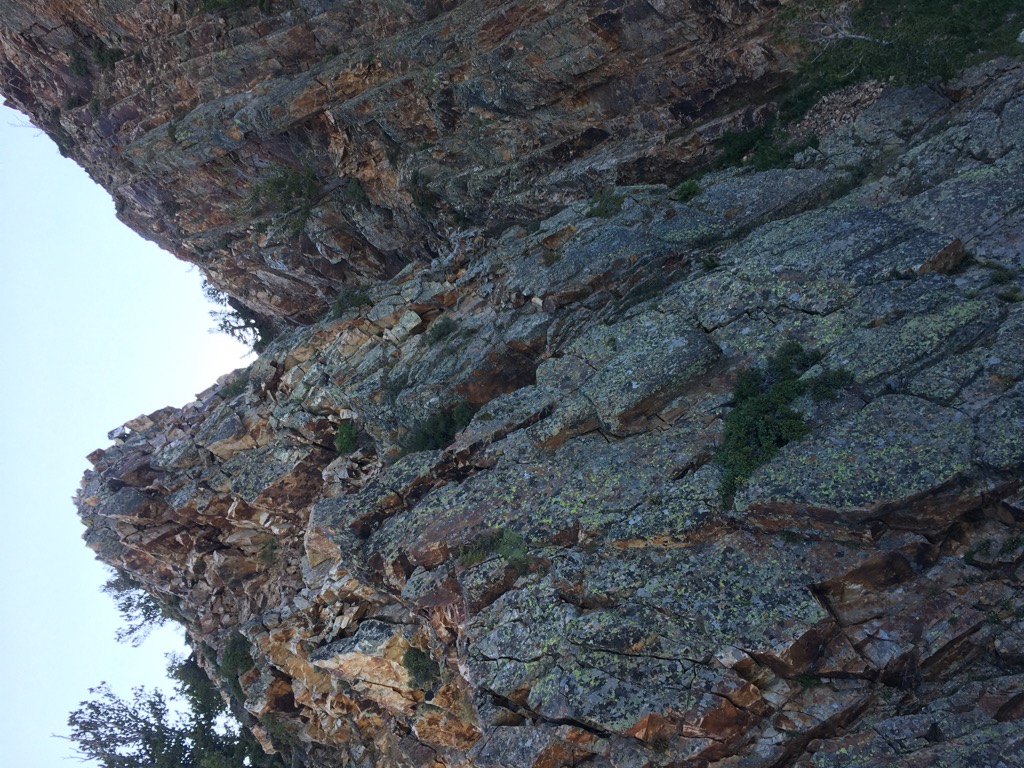
But if you want to spice things up, The West Slabs is one of the best scrambles in Utah. The slab is a shallow ocean of rock, stretching over 1,000 feet wide and pitched at a steady 45 degrees. The climbing maxes out around YDS 5.5 near the bottom and gets easier as you go.
The exposure is exhilarating, a perfect medium of “spicy but not puckery.” The most popular route, which climbs up from an obvious chute, is bolted, but most people scramble without gear.
There is a little route finding from the north peak to the true summit, but after that, you can just hike back down the foot trail.
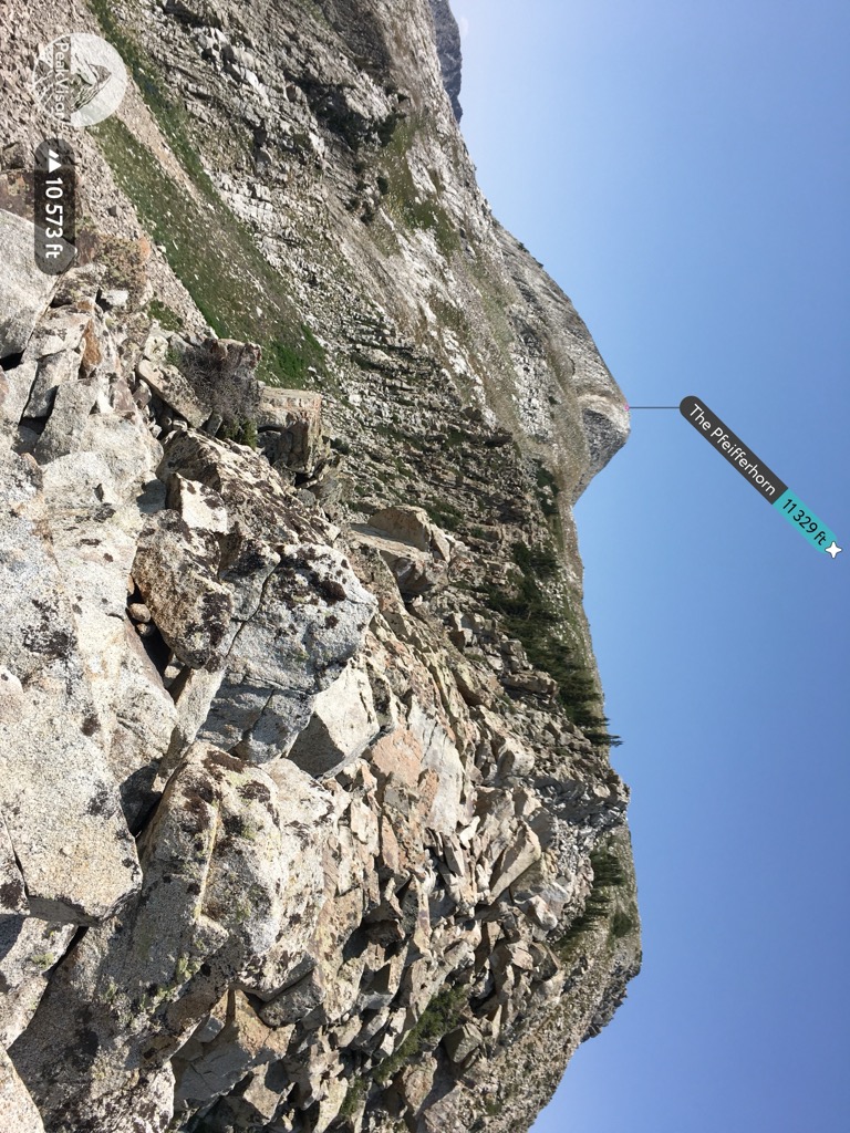
A friend once called The Pfeiff’ “the best hike in Utah.” That’s a big claim, especially with others like Angel’s Landing and Delicate Arch in the running. But it is an adventurous and very scenic (if long) day out.
The trail totals just under 10 miles and almost 4,000 feet (1,250 m) of gain. It’s also considerably less popular than some of the “Instagram” spots around Salt Lake.
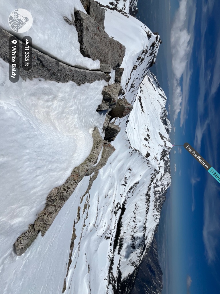
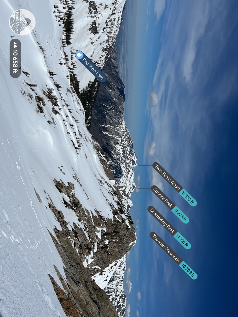
The Pfeifferhorn (11,329 ft / 3453 m) is the eighth-highest peak in the Wasatch, hiding along the south ridge of Little Cottonwood Canyon behind Lone Peak. But after spending a day looking at it, you’ll always be able to pick it out from a distance.
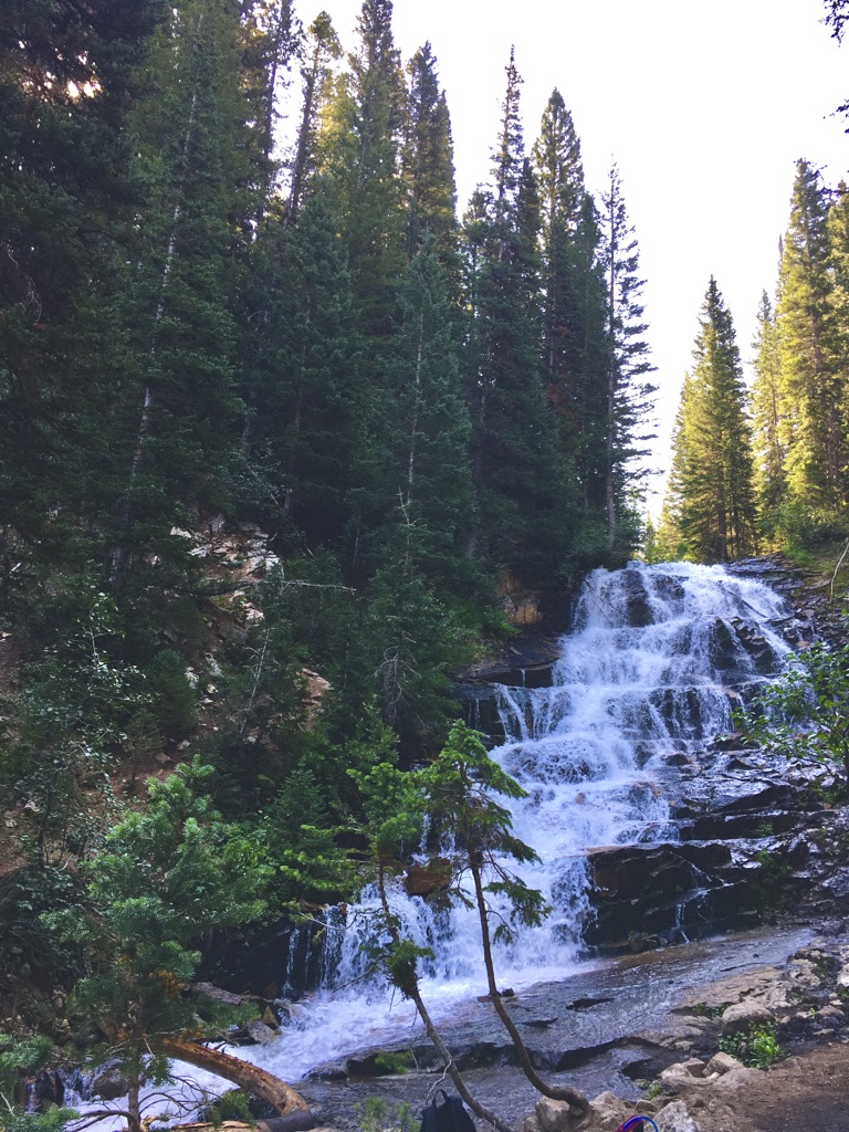
The trail starts at White Pine Lake Trailhead in Little Cottonwood Canyon and continues up to Red Pine Lake (9,600 ft / 2926 m). There is an easy detour to Gloria Falls along the way.
From Red Pine Lake, continue up through the talus to the ridge. From here out, the views are unbeatable. The trail scrambles up the east shoulder of the Pfeifferhorn to the summit, then all the way back down.
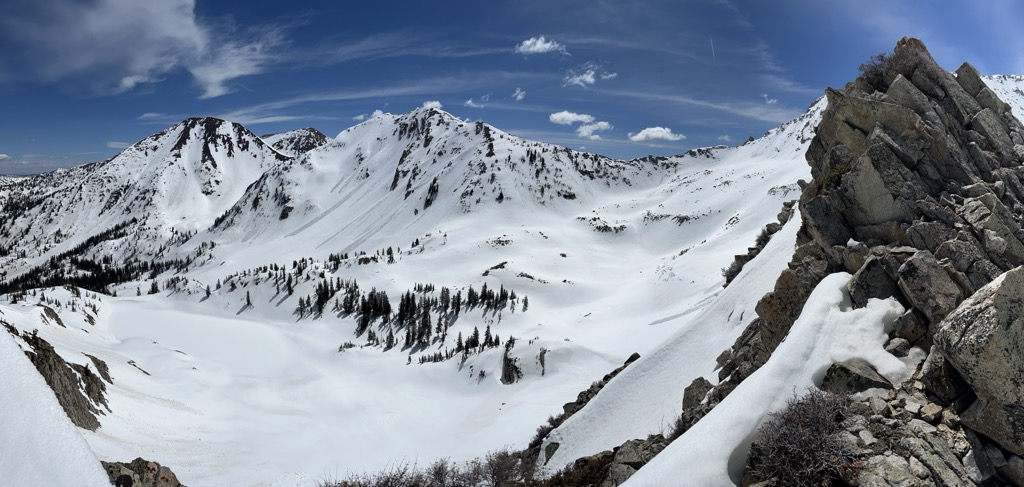
The Pfeifferhorn is also a classic Wasatch ski mountaineering route. You can approach the peak from the east, north, or west, and there are great lines to be had all over the Red Pine Lakes Basin. The next peak to the east, White Baldy (11,322 ft / 3,451 m), is also a worthy objective but sees much less traffic.
If you’ve ever skied Alta or Snowbird, you’ve probably spent some time gawking at Mount Superior (11,032 ft / 3,363 m). It isn’t the biggest peak, but it is one of the most jaw-dropping faces in the Wasatch Mountains. This peak should probably be on both the “best hikes” and “best skiing” lists, but for brevity’s sake, I’ll cover it all here.
First, there is a hiking trail to the summit of Superior. Over a few miles, it gains about 1,500 feet from the trailhead at the Hellgate Cliffs and includes some fun ridge hiking from the east.
But the real way to do Superior is via the dramatic South Ridge.
This is the obvious knife ridge that runs straight off the summit to just above the highway. It’s another example of a heart-pounding but fairly easy scramble with a huge payoff. The route maxes out at low 5th-class ample handholds, though there’s tons of exposure.
Along the South Ridge, you’ll pass over one of Utah's most classic ski lines: Suicide Chute. But don’t be fooled by the name; Suicide is a perfect couloir with a very straightforward (though avalanche-prone) approach, skinning and then booting straight from the road.
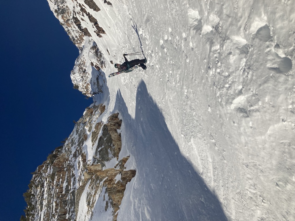
The run itself is about 800 feet of perfectly pitched chute skiing to the apron of Superior, which is fantastic. You can also climb the South Ridge to Suicide, although the added complexity of a winter ascent makes the climb much more technical.
Skiing from the summit is also very popular among Little Cottonwood locals. The summit approach typically follows the hiking trail along the east ridge. Superior’s South Face is great, but not the only option. You can also head northeast into Cardiff Fork, or follow Cardiac Ridge north to Mineral Fork.
Since the 2002 Winter Olympics, the Wasatch Mountains have become one of the most highly-regarded ski destinations in the US. Without getting too deep into technical factors affecting snowfall (see orographic lift and lake effect), the Wasatch Front has an ideal microclimate for perfect powder snow.
Any Utahn will proudly tell you our unofficial slogan: “The greatest snow on Earth.” And realistically, it’s not an exaggeration. Much of the Wasatch receives upwards of 500” (12.5 meters) of snowfall per winter, with storms—and deep powder skiing—possible from October to May. On average, southwest Colorado receives slightly drier snow but only about half as much as the Wasatch. Even Japan can’t compare, as their season is condensed into just a few weeks in January and February.
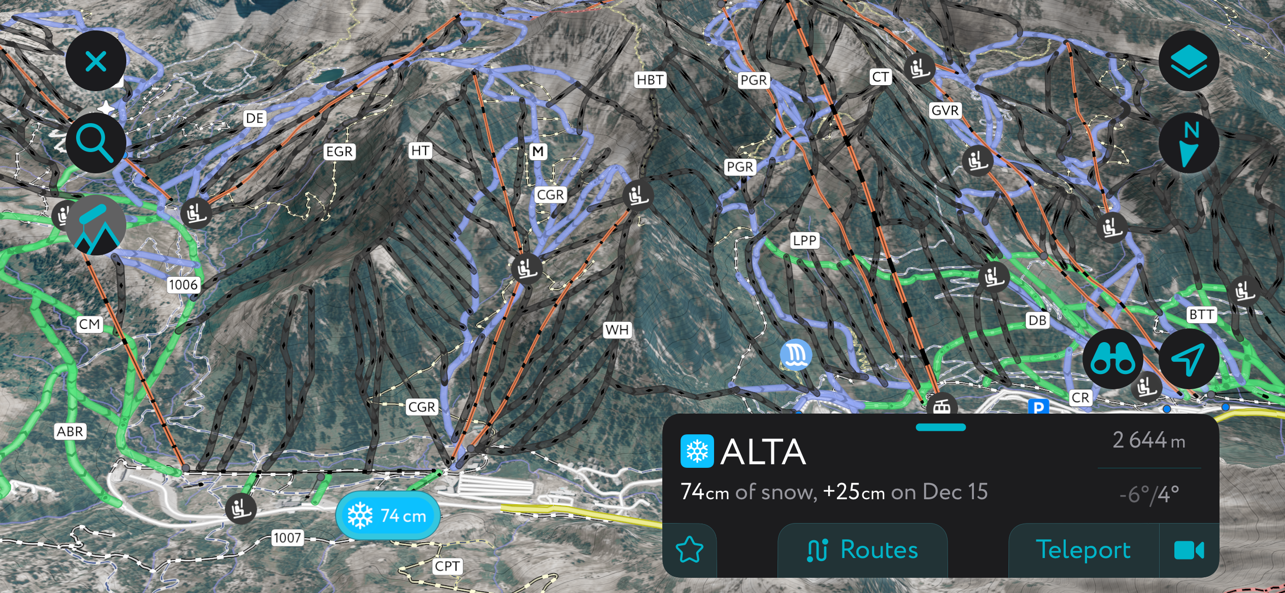
That explains why seven ski resorts would set up shop within a few dozen miles of the Central Wasatch Mountains. Four of these (arguably the best) sit in Salt Lake County: Brighton, Solitude, Alta, and Snowbird. Together, they see millions of riders per year.
Most skiers and snowboarders stick to the resorts around Salt Lake. There are two main areas for resort skiing out of Salt Lake: Big Cottonwood Canyon (Brighton and Solitude) and Little Cottonwood Canyon (Alta and Snowbird).
The Little Cottonwood Canyon resorts are both larger and tend to be steeper, catering more to freeskiers and powderhounds who like riding the fall line on big, open faces. It’s also noteworthy that Alta is one of the few remaining resorts that doesn’t allow snowboarders.
The Big Cottonwood resorts are smaller but have fantastic tree lines. Their terrain is defined more by ravines, bouldery cliffs, and short “mini golf” pitches of steep terrain. Brighton is also a hub for freestyle riders, with a few good terrain parks.
Traffic has become notoriously bad around Salt Lake in the last few years due to the influx of new skiers and boarders. The drive to the resorts, which used to take a half-hour at most, can now take multiple hours. Worse yet, the drive home is dubbed the “red snake” because of the endless brake lights stretching down the canyon.
The best strategy for getting to the resort quickly (and without being buried in an avalanche) is to get up early and take the ski bus. Resorts in the Cottonwood Canyons typically give pass holders free access to public transit.
As always, backcountry skiing is no joke, and the Wasatch is prone to major avalanches. Check conditions with the local avalanche center, stay educated, and be equipped.
The Wasatch is a never-ending treasure trove of ski spots. It would be impossible to list every great place in a concise list. The few I mention here are some of the obvious, easily accessible highlights.
Anyone interested in digging into the Wasatch backcountry should check out the official guidebook, The Chuting Gallery, by Andrew McLean. The Wasatch Backcountry Skiing guide is also a great (free!) resource for finding routes.
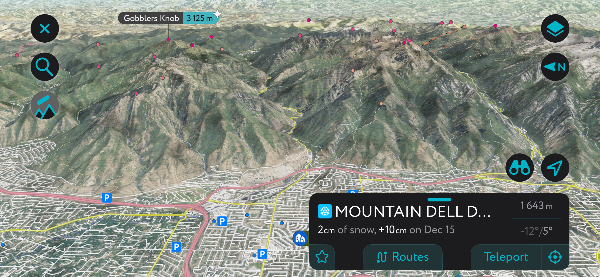
Mill D is an excellent introduction to the Wasatch's offerings. The North Fork includes some easy terrain that is much less avalanche-prone and safer when the forecast is yellow. Powder Park 1-3 are all easy-to-get-into, straightforward lines.
By contrast, the South Fork of Mill D, also called Cardiff Fork, is a buffet line of epic skiing. The upper bowl holds some of the best lines in the Wasatch. As I mentioned, you can approach this canyon from the summit of Mt. Superior. But you can also park in Big Cottonwood and skin up the valley.
Grizzly Gulch is a short, steep canyon full of moderate slopes and tons of powder. If you’re looking for the biggest payoff for the smallest investment of blood, sweat, and tears, this is it. The approach is almost non-existent because it sits right next to the Alta Ski Area. The entire canyon is lined with superb lines.
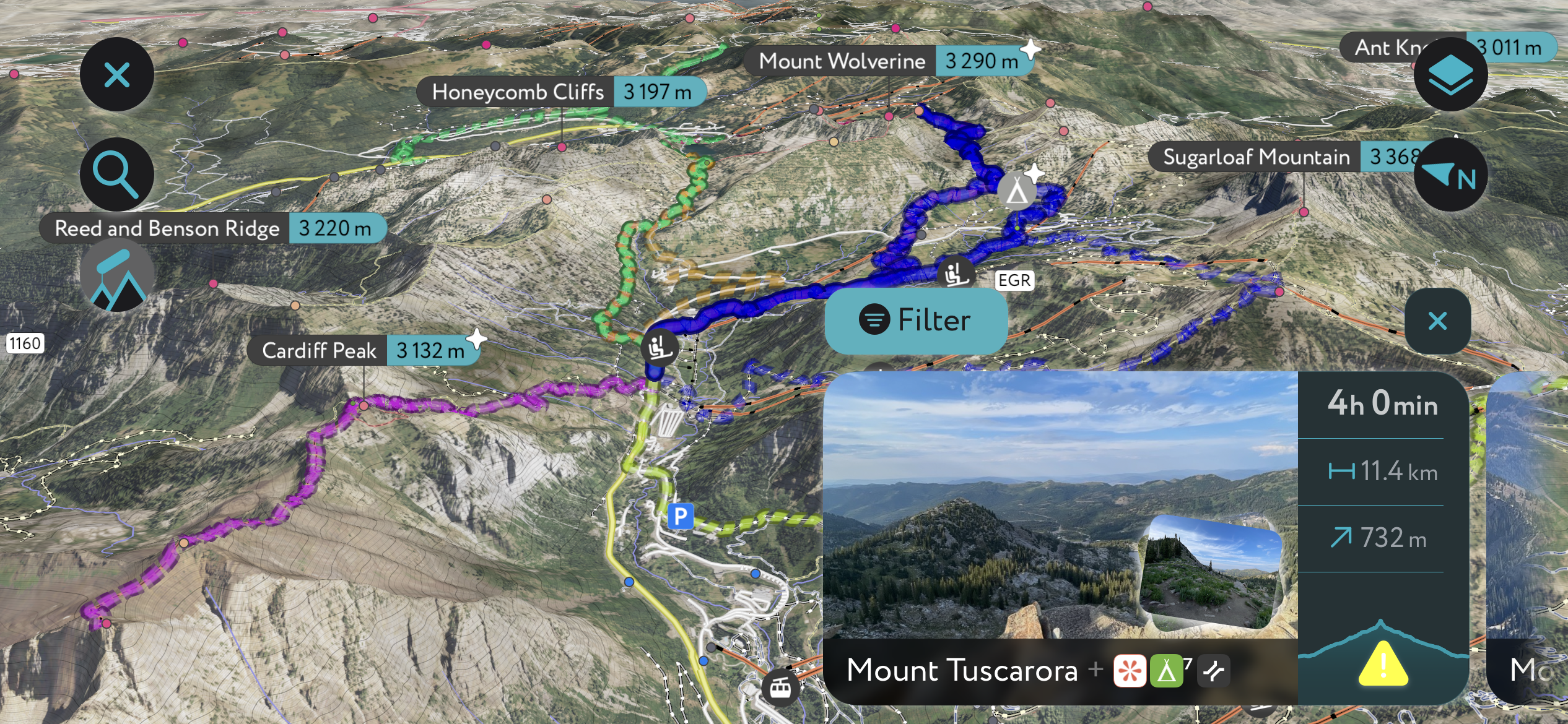
You can also climb to the top of Mt. Wolverine (10,794 ft / 3,290 m) from here and drop into the Wolverine Cirque. This is one of the most extreme areas in the Wasatch, a narrow gallery of steep, narrow chutes and massive cliffs.
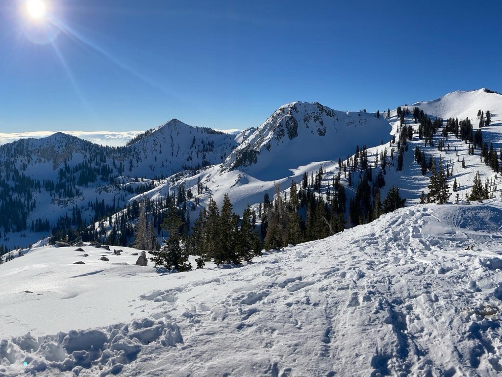
Brighton Resort sits on the edge of a vast playground. From the backcountry gates in the resort, you can quickly approach Mt. Millicent (10,453 ft / 3,186 m), Mt. Tuscarora (10,646 ft / 3,245 m), Mt. Wolverine, and the Dog Lake area. The entire bowl above the resort is full of short but fun lines. And with almost no approach, you could easily spend all day snorkeling through chest-deep powder.
At PeakVisor, we love information. That’s why we write articles like this one.
Check out the PeakVisor app for even more information on thousands of additional hikes, ski tours, and ski resorts across the U.S. In fact, we’ve compiled information on all publicly maintained walking tracks worldwide, formatted onto our 3D maps.
PeakVisor started as a peak identification tool—you’ll have noticed the photos throughout this article—but we’ve evolved into purveyors of the finest 3D maps available. We continue to expand our offerings. You can track your hikes directly on the app, upload pictures for other users, and keep a diary of all your outdoor adventures.
Most recently, the PeakVisor App has included up-to-date weather reports, including snow depths, at any destination. We've also been hard at work adding the details of hundreds of mountain huts, including information on overnight accommodation, dining options, and opening hours. You can also use our Hiking Map on your desktop to create .GPX files for routes to follow later on the app.
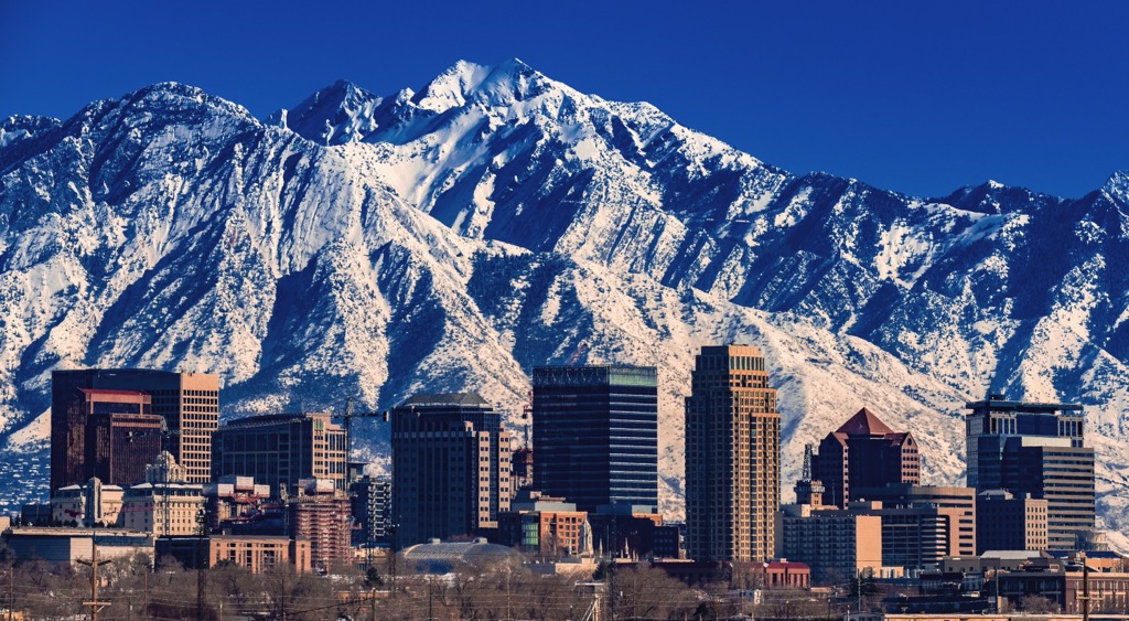
Salt Lake City is the capital of Utah and one of the largest cities in the Intermountain West. The greater metropolitan area along the Wasatch, which includes Provo, Salt Lake, and Ogden, has a population of over three million. Salt Lake International Airport services all major hubs in the United States and sits about an hour from the ski resorts.
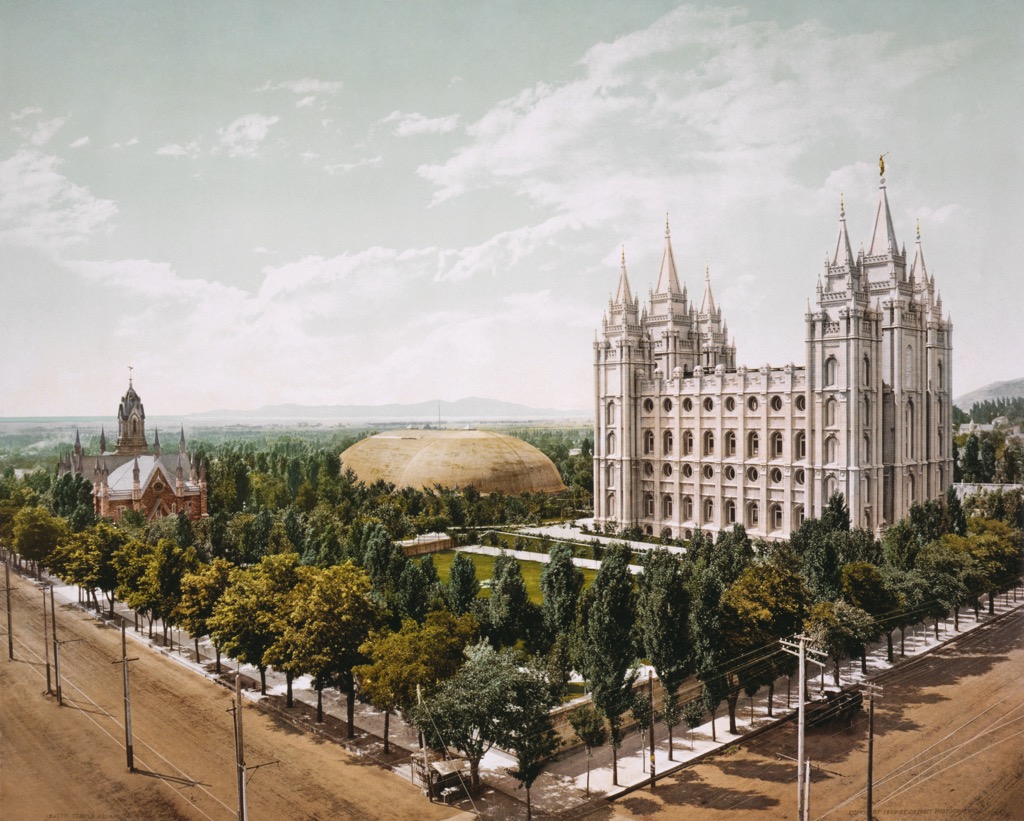
If you have downtime, the downtown area is lively and full of sightseeing. In a short walk, you could visit the Mormon temple and catch a Utah Jazz or Utah Hockey Club game at the Delta Center. Then, grab a beer at one of the dozens of local breweries. I’m a big fan of Kiitos, Wasatch, and Squatters Brewing. Within a short drive, you could also visit the Living Planet Aquarium or Hogle Zoo, as well as the Natural History Museum at the University of Utah.


