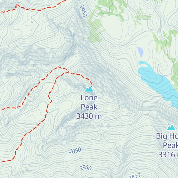
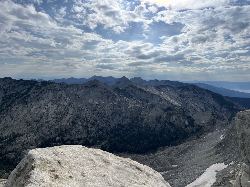
Lone Peak is a mountain summit in the Wasatch Range southeast of Salt Lake City, Utah, United States, and the center of the Lone Peak Wilderness, established in 1978. With an elevation of 11,260 feet (3,430 m), it is one of the highest peaks in the range and among the most prominent of the Wasatch Front, towering over the Salt Lake City suburb of Draper and easily visible from most of the valley, which makes it a popular destination for hiking and rock climbing.
The first person in recorded history to successfully reach the summit of Lone Peak was Richard Bell, Sr. of Riverton, Utah. Bell also led the first recorded climb of the Lone Peak Cirque. He went on to lead several expeditions and taught many alpine guides. Bells Canyon is named for him and is still a common route to the summit.
Lone Peak consists almost entirely of quartz monzonite (a granitoid or granite-like rock) of the 30.5 million-year-old Little Cottonwood Stock. Quartzite and limestone are also found in distal locations on the mountain. The high mountain ridge stretching from Little Cottonwood Canyon on the northern end to Corner Canyon on the southern end is sometimes called "Mount Jordan", the highest peak of which is Lone Peak. Nearby peaks include Ennis Peak and Big Horn Peak. Lone Peak ranks 98th by elevation on the list of Utah peaks with at least 500 feet (150 m) of topographic prominence.
There's an alpine trail (T4) called Jacob's Ladder Trail leading to the summit.
By elevation Lone Peak is
# 56 out of 1339 in the Western Rocky Mountains # 12 out of 614 in the Wasatch Range # 6 out of 111 in Salt Lake County # 9 out of 205 in Utah County # 40 out of 419 in Uinta-Wasatch-Cache National Forest # 3 out of 12 in Lone Peak Wilderness Area
By prominence Lone Peak is
# 68 out of 614 in the Wasatch Range # 9 out of 111 in Salt Lake County # 32 out of 205 in Utah County # 64 out of 419 in Uinta-Wasatch-Cache National Forest # 2 out of 12 in Lone Peak Wilderness Area
We use GPS information embedded into the photo when it is available.
3D mountains overlay
Adjust mountain panorama to perfectly match your photos because recorded by camera photo position might be imprecise.
Move tool
Rotate tool
Zoom
More customization
Choose which peak labels should make into the final photo and what photo title should be.
Next
Photo Location
Satellitte
Flat map
Relief map
Latitude
Longitude
Altitude
OR
Latitude
°'''
Longitude
°'''
Apply
Register Peak
Peak Name
Latitude
Longitude
Altitude
Register
Teleport
PeakVisor
This 3D model of Sagarmatha National Park in Nepal was made using the PeakVisor app topographic data. The mobile app features higher precision models worldwide, more topographic details, and works offline. Download PeakVisor maps today.
Download OBJ model
PeakVisor
The download should start shortly. If you find it useful please consider supporting the PeakVisor app.
PeakVisor for iOS and Android
Be a superhero of outdoor navigation with state-of-the-art 3D maps and mountain identification in the palm of your hand!


.jpg)