
Scan the QR code and open PeakVisor on your phone
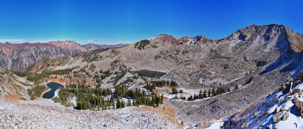
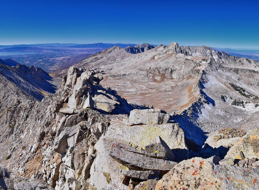
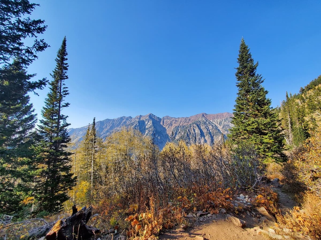
The Lone Peak Wilderness is a protected area that encompasses roughly 40,088 acres (102,183 ha) of terrain within the Uinta-Wasatch-Cache National Forest in the US state of Utah. There are 14 named mountains in the Lone Peak Wilderness, the highest of which is Pfeifferhorn (11,329 ft/3,453 m) and the most prominent of which is Box Elder Peak (11,109 ft/3,386 m).
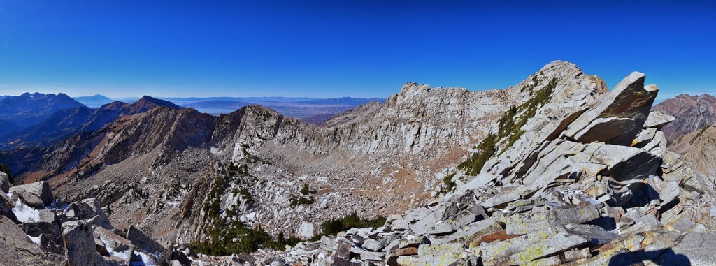
The Lone Peak Wilderness lies in the central Wasatch Range, which stretches for about 160 miles (257 km) from the central part of Utah northward to the state’s border with Idaho. It’s located along the western boundary of the Uinta-Wasatch-Cache National Forest, just an hour to the southeast of Salt Lake City.
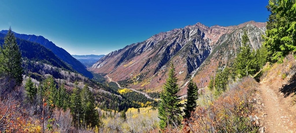
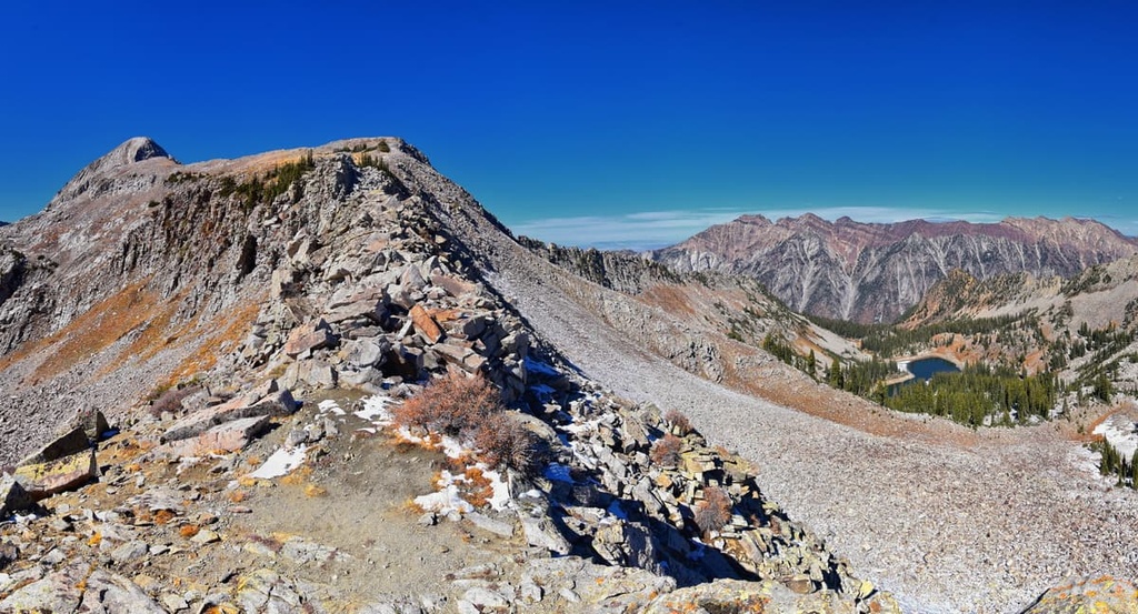
The wilderness is bordered by Little Cottonwood Canyon to the north and the American Fork Canyon to the south. Meanwhile, the southern region of the wilderness is dominated by Box Elder Peak, whose southern ridges descend abruptly into American Fork Canyon.
Pfeifferhorn, another prominent peak in the Lone Peak Wilderness, reaches over 11,300 feet (3,444 m) in elevation, and it dominates the skyline of the southern end of Little Cottonwood Canyon. The peak is also locally known as “Little Matterhorn” due to its triangular shape and impressive amount of prominence.
The Salt Lake Valley and Utah Valley lie just to the west of the Lone Peak Wilderness. Meanwhile, the American Fork Twin Peaks, which are situated on the Alpine ridge of the Wasatch Range, are located east of the wilderness. The ridge between Lone Peak and Twin Peaks is also deeply scoured by north-trending glacially carved hanging valleys, steep-walled basins, and cirques.
The Lone Peak Wilderness is surrounded by many other wilderness areas, including the Twin Peaks Wilderness and Mount Olympus Wilderness to the north and the Mount Timpanogos Wilderness to the south. Other nearby protected areas include Wasatch Mountain State Park, Jordanelle State Park, and Timpanogos Cave National Monument.
The Lone Peak Wilderness is a geologically complex area that consists of a mixture of sedimentary, metamorphic, and igneous rock formations. The most prominent feature of the Lone Peak Wilderness, the Wasatch Range, is the product of millions of years of geological faulting, volcanic activity, erosion, and glaciation.
Between 30 and 40 million years ago, a series of east-west trending volcanoes towered over the central Wasatch Range. Today, evidence of these ancient volcanoes has been preserved in the form of the granitic rocks that exist in Little Cottonwood Canyon, which is located directly to the north of the Lone Peak Wilderness.
Since the mid-Tertiary, the Wasatch Range has been uplifted several thousand feet and tilted to the east by movement along the Wasatch Fault Zone. Erosion has shaped many of the prominent peaks in the region, revealing a complex structure of folds and faults.
Historically, silver, lead, and zinc have been mined in the Lone Peak Wilderness area. Two principal mining districts in the central Wasatch Range, the Park City and Cottonwood-American Forks districts, historically produced ore that was subsequently sent to nearby Salt Lake City.
The Lone Peak Wilderness provides critical habitat for a variety of flora and fauna. Within the wilderness area, much of the terrain is classified as alpine and is characterized by large cirque basins and exposed rocky ridges.
Isolated stands of Douglas fir, subalpine fir, and aspen are common on north-facing slopes within the wilderness area, too. Meanwhile, dense mountain brush mixed with sagebrush and grass dominates the lower elevations of the region.
As far as wildlife goes, deer, elk, black bears, bobcats, cougars, grouse, and golden eagles are known inhabitants of the Lone Peak Wilderness.
The area surrounding the Lone Peak Wilderness has been inhabited by humans for more than 10,000 years.
Long before the arrival of Europeans, the Salt Lake Valley was inhabited by the ancestors of many contemporary Indigenous peoples, including the Shoshone, Paiute, Goshute, and Ute. A network of trails that traverses the region’s canyons and peaks serves as evidence of the nomadic lifestyle of these early residents, who regularly hunted, gathered, and fished in the area.
Trappers and settlers of European descent started traveling through the Salt Lake Valley as early as 1824, but few permanently settled in the area. Permanent settlement of the Salt Lake Valley began in the mid-1800s, when, at the direction of Brigham Young, a large contingent of Mormon immigrants seeking isolation and economic growth established homesteads along the Wasatch Front.
Tribal Nations and early colonizers fought regularly over the right to live on this land. After many armed conflicts, the Ute, Shoshone, Paiute, and Goshute were forced from their native homelands and onto reservations.
Over the next several decades, thousands of Mormon immigrants and California-bound prospectors funneled into Salt Lake City and nearby settlements. Many of these early communities would grow to become the largest cities in northern Utah. Today, Salt Lake City remains the economic hub and most populated area in the state of Utah.
The Lone Peak Wilderness was established in 1978 as part of the Endangered American Wilderness Act. At the time, it was the only designated wilderness area in Utah, though it has since been joined by many other areas of protected land.
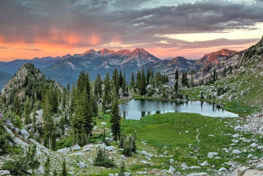
The Lone Peak Wilderness is home to many scenic hiking trails. Here’s a look at some of the most popular hiking trails in the region.
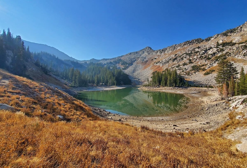
Red Pine Fork, a creek on the south side of Little Cottonwood Canyon, drains two beautiful high-mountain lakes: Upper Red Pine Lake and Lower Red Pine Lake.
The trail to Lower Red Pine Lake begins at the White Pine Trailhead and climbs roughly 1,940 feet (591 m) over the course of 6.8 miles (10.9 km). From there, hikers can continue to the upper lake or hike an additional 1.5 miles (2.4 km) to the summit of Pfeifferhorn, one of the area’s most imposing peaks.
Silver Lake is a stunning alpine lake tucked in American Fork Canyon that features incredible views of rugged White Baldy. At the start of the trail, hikers can appreciate views of Mount Timpanogos across the Silver Lake Flat Reservoir.
For most of the trail, hikers will follow Spring Creek and traverse through groves of aspen trees. Toward the last half mile of the trail, hikers will need to climb roughly 700 feet (213 m) via a series of switchbacks to reach the banks of Silver Lake.
Silver Glance Lake is a stunning alpine lake tucked in a tiny basin in American Fork Canyon. The trek to Silver Glance Lake begins on the trail used to reach the far more popular Silver Lake.
However, from Silver Lake, hikers will ascend another 940 feet (287 m) via an unmaintained route to reach Silver Glance Lake. The path is steep and rugged, but the expansive views of surrounding peaks and lakes that it offers make the hike well worth the effort.
The Rocky Mouth Falls Trail is a scenic, family-friendly hike to a stunning 70-foot (21 m) waterfall. Rocky Mouth Falls is a natural oasis tucked within a residential neighborhood in the city of Sandy, so it is easily accessible and, subsequently, very popular among local residents.
Though this 0.6-mile (1 km) trail isn’t particularly strenuous, it is steep and may get icy in the winter. For that reason, the city of Sandy closes the gate for this trail during the winter months.
The Lone Peak Wilderness lies just outside one of the fastest-growing urban areas in the Intermountain West. If you’re looking for a place to stay in the area, here are some of the best places to check out in the region.
The capital and most populous city in the state of Utah, Salt Lake City, is the center of the Salt Lake City metropolitan area, which is home to roughly 1.2 million people. The city’s location on the Wasatch Front makes it an excellent destination for outdoor recreation.
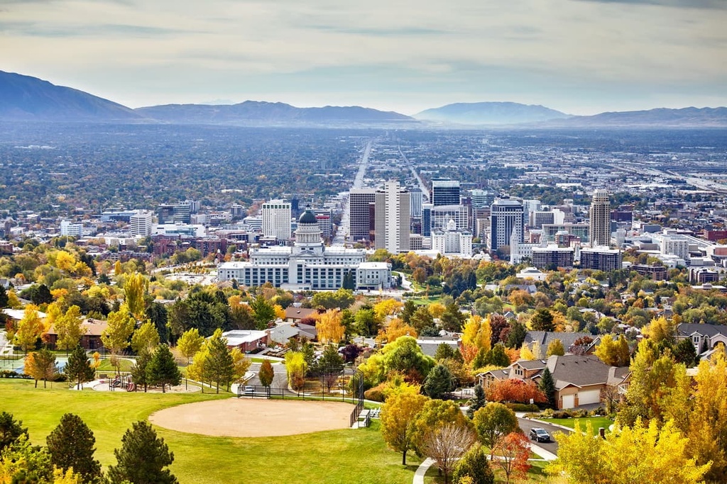
As it is located just to the east of Salt Lake City, the Wasatch Range is a popular destination for winter recreation. Eight ski resorts and several world-renowned mountain communities also lie within 50 miles (80 km) of the city.
Summer adventure opportunities in the Salt Lake City area include hiking, camping, rock climbing, mountain biking, fishing, boating, and other water-related activities. Some of the many nearby parks and protected areas that you can find in the region include Big Cottonwood Canyon, Great Salt Lake State Park, Little Cottonwood Canyon, Lone Peak Wilderness, and Twin Peaks Wilderness.
Alpine, a suburb of Salt Lake City, started out as a small farming community nestled at the base of the Wasatch Range. Since the 1850s, the city has grown to boast a population of over 10,000 people.
Alpine’s proximity to the Wasatch Range makes it an excellent basecamp for exploring the region's many parks and protected areas, including Timpanogos Cave National Monument, American Fork Canyon, Wasatch Mountain State Park, and the Lone Peak Wilderness.
Alta is a small community nestled in Little Cottonwood Canyon to the east of Salt Lake City. Despite its modest population of fewer than 400 residents, Alta sees roughly 500,000 visitors each year.
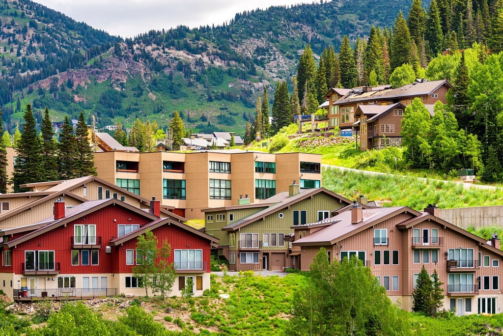
The city is centered around the Alta Ski Resort, one of the oldest ski resorts in the country. The Alta Ski Resort is a “skier’s mountain” that offers over 116 runs, 2,614 skiable acres (1,058 m), and a great mix of runs for skiers of all skill levels.


