Scan the QR code and open PeakVisor on your phone
The East Tintic Mountains are a chain of peaks situated to the southwest of Utah Lake in the north-central part of the US state of Utah. The tallest and most prominent peak in the range is Boulter Peak at 8,307 ft (2,532 m) in elevation and with 2,224 ft (678 m) of prominence.
The East Tintic Mountains are a collection of peaks that extend along the southwestern shores of the Utah Lake in north-central Utah.
The range marks the eastern edge of the Great Basin Ranges, and it is situated to the west of the Wasatch Front. Similar to many of the other ranges in the region, the East Tintic Mountains feature dramatic changes in elevation from low-lying valley bottoms below to towering peaks overhead.
The northeastern edge of the range is situated along the southern shores of Utah Lake while the rest of the range extends southward. Despite the high elevations found throughout the mountains, two major highways cut across the range.
The Tintic Mining District lies near the central part of the range along Interstate 6. Elevations to the north of the interstate highway tend to be higher than those to the south of the interstate.
The northern region of the range splits out into two distinct subranges. One of these subranges extends to the north while the other spans out to the northeast.
Throughout the East Tintic Mountains, there are rotating groups of ranges and valleys. This unique repetition is what gives the Great Basin Ranges their name. As a whole, the range has minimal vegetation, allowing the rugged and steep hillsides to be easily visible to those passing through the region.
The East Tintic Mountains are located near numerous national forests and wilderness areas. A small section of the Uinta-Wasatch-Cache National Forest lies directly to the west of the range while the Rockwell Outstand Natural Area is situated to the southwest. To the east of the range lies the Mount Nebo Wilderness Area and the majority of the Uinta National Forest.
The peaks within the East Tintic Mountains are part of the larger Great Basin Ranges, which extend throughout much of Utah, Nevada, Idaho, Oregon, and California.
The topography of the Great Basin Ranges is unique compared to the Rocky Mountains that can be found throughout eastern Utah. The alternating basins and ranges in the region is what gives the Great Basin Ranges their name.
This geological formation is clearly seen within the East Tintic Mountains. Indeed, the range is almost entirely surrounded by vast desert basins, with the exception of the peaks in the Uinta-Wasatch-Cache National Forest to the east.
The landscape of the East Tintic Mountains began taking shape during the Early Miocene. Continual movement of the tectonic plates in the region led to immense pressure of the Earth’s crust.
This pushing and pulling motion gave rise to the mountains and accompanying basins that define the Great Basin Ranges. Continual erosion over the course of millions of years further carved out the landscape, leaving behind the dramatic changes in elevation that are apparent today.
The East Tintic Mountains are composed primarily of sedimentary rock with small sections of metamorphic rock found throughout. Shale is one of the most common rocks in the area and it can usually be found at higher elevations within the range.
The Tintic Mining District in the central region of the range was once an important supplier of gold, silver, and base metals during both the nineteenth and twentieth centuries.
Major peaks within the East Tintic Mountains include Boulter Peak, Tintic Mountain, Mammoth Peak, Pinyon Peak, and Topliff Hill.
Though the East Tintic Mountains are located near the Rocky Mountains, their ecology is part of the Great Basin ecoregion. The region is known for being quite dry, though it receives a majority of its precipitation via snowfall each winter.
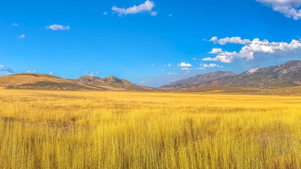
A high desert landscape can be seen throughout the East Tintic Mountains and surrounding ranges. Despite the general lack of rainfall in the region, the tallest peaks within the range receive some rain during the fall, before temperatures drop below freezing. The highest amounts of rain and snowfall in the range can be found along the northern ridgeline.
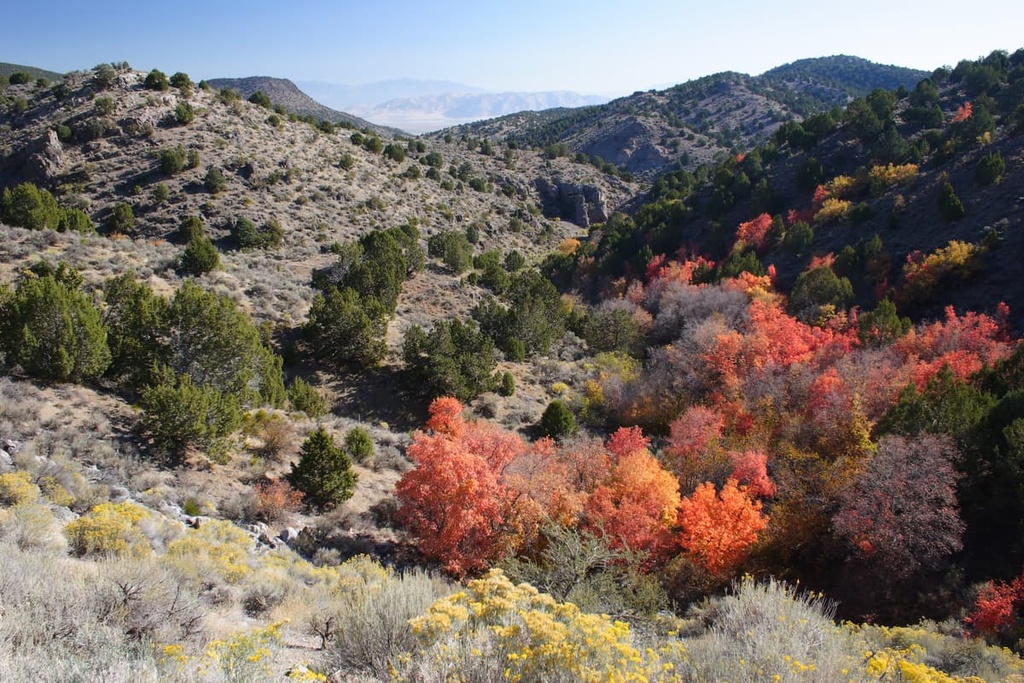
Much of the landscape in the range is dominated by sagebrush and grasslands. The higher elevations within the East Tintic Mountains have a wider variety of flora, featuring low growing shrubs and wildflowers. Flora at these higher elevations is often a mixture of common plants found in the Great Basin and the Western Rocky Mountains.
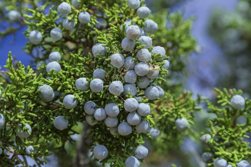
The hillsides of the East Tintic Mountains are covered in patches of juniper, Douglas fir, and aspen trees. Forested patches begin to thin as elevations increase, giving way to more low growing shrubs and wildflowers.
Wildlife in the range is similar to that of much of the Great Salt Lake region. Within the East Tintic Mountains, there are populations of cougars, mule deer, coyotes, bobcats, and pronghorn. Jackrabbits can also be spotted throughout much of the landscape.
Just to the west of the East Tintic Range, in the Sheeprock Mountains, lie a group of desert bighorn sheep. These sheep often venture into the East Tintic range. Cougars, bobcats, and desert bighorn sheep are quite elusive, though hikers can sometimes spot them while in the range.
Human history surrounding the East Tintic Mountains dates back thousands of years, long before the arrival of Europeans. It is estimated that human settlements in the area date back over 10,000 years.
The Great Basin is part of the traditional territory of many Indigenous peoples. Many tribal nations, including the Eastern Shoshone Tribe, Confederated Goshute Tribes of the Goshute Reservation, Skull Valley Band of Goshute, Ute Indian Tribe, and Shoshone-Bannock Tribes consider the region to be part of their ancestral homelands.
It wasn’t until the early 1800s that the first settlers of European descent arrived in the region. Many of the early settlers of European descent in the region were fur trappers. During the 1820s, settlers, such as William Henry Ashley, began venturing into the region’s mountain ranges, such as the Uinta Mountains, which are located to the northeast of the East Tintic Mountains.
During the late 1820s, Brigham Young sent a group of the Mormons to the region to establish communities and claim what they believe to be their promised land. Many of these early Mormon settlements laid the groundwork for more Mormons to settle throughout the region.
Settler communities began to grow within the East Tintic Mountains with the discovery of gold, silver, and base metals. In 1870, the small mining town of Eureka was established within the heart of the range.
The rapid growth of settlers in the Salt Lake region led to further exploitation of the Indigenous groups that have called the area home since time immemorial. Despite their efforts, many of the Indigenous peoples who lived in the region prior to European colonization were either killed or forcibly removed to reservations.
Following the Bear River Massacre, the Shoshone Tribe joined forces with the Bannock Tribe in another effort to reclaim their ancestral homelands. The battles that subsequently broke out would later be known as the Snake War. The Shoshone people were forcibly moved to reservations located in Idaho and Wyoming toward the end of the nineteenth century.
The Uinta National Forest was established in 1897 and was later combined in 2007 with the Wasatch-Cache National Forest to form the Uinta-Wasatch-Cache National Forest.
Today, the Uinta-Wasatch-Cache National Forest is located on either side of the East Tintic Mountains. The region surrounding Salt Lake City is now the most populous metropolitan region in the entire state.
The East Tintic Mountains are not as accessible for hiking as many of the surrounding ranges. However, here are some of the most popular hiking trails in the range:
Boulter Peak is the tallest and most prominent peak within the East Tintic Mountains. Off roading vehicles and ATVs can allow for easier access to the summit though it is possible to hike from the base of the peak.
Roundtrip the route to the summit is 9 miles (14.5 km) with 2,600 ft (792 m) of elevation gain. From the flats in Mill Canyon, the best approach is following along the dirt road. At the end of the road, you can see Boulter Peak in the distance and hikers can travel along the hillside in whatever route they choose.
Anyone visiting the region should note that there are many cougars in the area.
Tintic Mountain is the second most prominent mountain in the range. Its summit is a wide ridgeline and it is the tallest peak in the southern region of the range.
The route to Tintic Mountain begins along a 4WD road that narrows to more of an ATV trail. It then climbs gradually while traversing near the north ridge. After passing two false summits, the trail reaches the top of the mountain, offering hikers panoramic views of the range.
Looking for a place to stay near the East Tintic Mountains? Here are some of the best cities and villages to check out in the region:
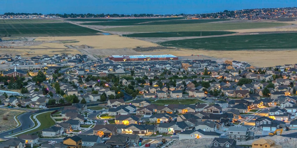
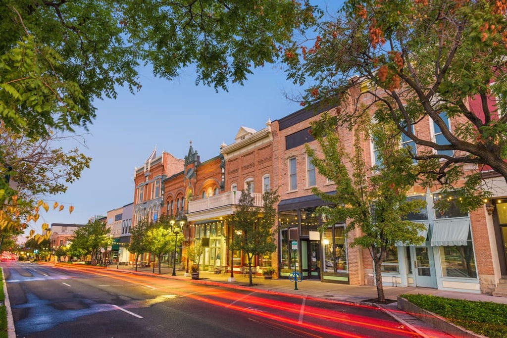
Located to the northeast of the East Tintic Mountains along the eastern shore of Utah Lake lies the city of Provo. Home to Brigham Young University, the city is also known for being home to numerous museums. As one of the largest cities in the greater Salt Lake City region, Provo has a population of around 115,000 people.
Since it is situated in a valley, Provo is surrounded by mountain ranges that provide ample opportunities for outdoor recreation. Trails for hiking, running, mountain biking, and off roading are all located just outside the city limits. Located near the city are also numerous national parks, forests, wilderness areas, and ski resorts.
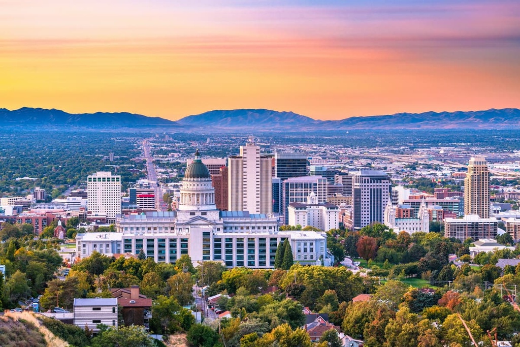
Salt Lake City lies to the northeast of the East Tintic Mountains. The city has a population of around 200,000 people with a metro population of over 1.2 million residents, making it the most populous region in the state of Utah.
Salt Lake City is an ideal location for year-round outdoor recreation. The city provides easy access to many of the state’s national parks and national forests. During the winter months, locals and visitors alike can explore the nine ski resorts that are all within an hour’s drive of the city.