Mount Nebo is the southernmost and highest mountain in the Wasatch Range of Utah, in the United States, and the centerpiece of the Mount Nebo Wilderness, inside the Uinta National Forest. It is named after the biblical Mount Nebo, overlooking Israel from the east of the Jordan River, which is said to be the place of Moses' death.
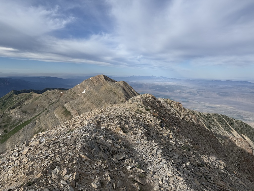
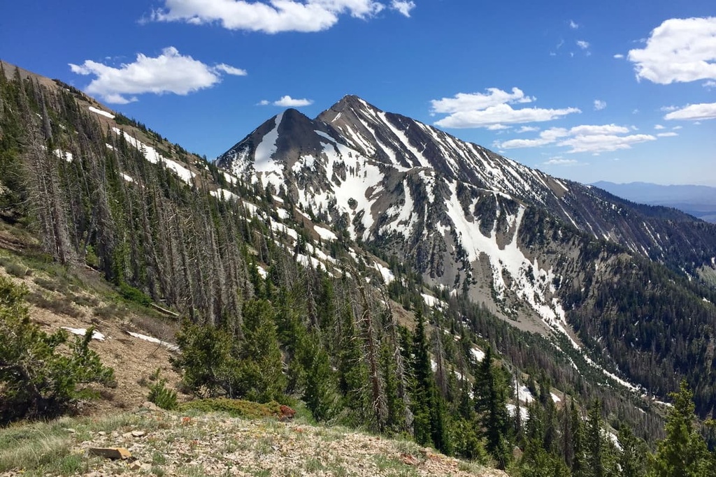
Mount Nebo has two summits: the northern summit reaches 11,933 feet (3,637 m), and the southern summit reaches 11,882 feet (3,622 m). Early surveys placed the southern peak as the highest, but the mountain was resurveyed in the 1970s and the northern peak was found to be higher. It is the high point of Utah County.
Mount Nebo is an "ultra", one of 128 ultra-prominent peaks in the United States having more than 1,500 metres (4,900 ft) of topographic prominence. The mountain is typically partially or completely covered in snow from mid-October until July. Nearby towns include Mona (closest), Payson, Nephi, and Provo.
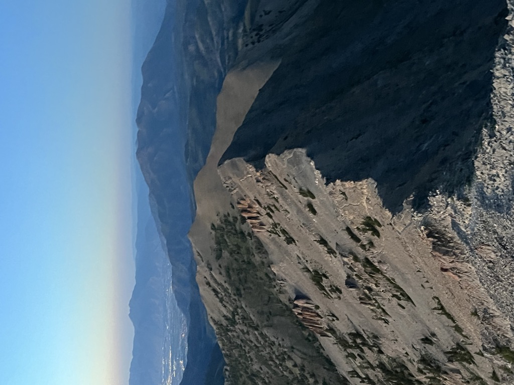
A substantial trail leads to the south summit, accessible from starting points on the east or west of the mountain. Another trail accesses the north summit, starting northeast of the mountain. A "bench trail" runs along the mountain's east side from north to south at roughly 9,000 feet elevation. Although strenuous, all of these trails are popular with hikers; many are dangerous places for horseback riders. One old-time local rider warns: "There's dead horses in every canyon on that mountain!"
The Mount Nebo Scenic Byway is a federally designated National Scenic Byway which departs I-15 at Payson and travels south through the Mount Nebo Wilderness, climbing to over 9,000 feet before rejoining the interstate at Nephi. The route features panoramic views of Mount Nebo, the Utah Valley, and Utah Lake far below. There are numerous trailheads along the route for the hiking enthusiast, including a short walk to the "Devil's Kitchen", an area that has been described as a "mini Bryce Canyon".
There's a trail called Nebo Peak Trail leading to the summit.
By elevation Mount Nebo is
# 33 out of 1339 in the Western Rocky Mountains # 1 out of 614 in the Wasatch Range # 52 out of 3409 in Utah # 3 out of 92 in Juab County # 1 out of 205 in Utah County # 24 out of 419 in Uinta-Wasatch-Cache National Forest # 1 out of 7 in Mount Nebo Wilderness Area
By prominence Mount Nebo is
# 2 out of 1339 in the Western Rocky Mountains # 1 out of 614 in the Wasatch Range # 94 out of 91437 in USA # 5 out of 3409 in Utah # 1 out of 92 in Juab County # 1 out of 205 in Utah County # 2 out of 419 in Uinta-Wasatch-Cache National Forest # 1 out of 7 in Mount Nebo Wilderness Area
We use GPS information embedded into the photo when it is available.
3D mountains overlay
Adjust mountain panorama to perfectly match your photos because recorded by camera photo position might be imprecise.
Move tool
Rotate tool
Zoom
More customization
Choose which peak labels should make into the final photo and what photo title should be.
Next
Photo Location
Satellitte
Flat map
Relief map
Latitude
Longitude
Altitude
OR
Latitude
°'''
Longitude
°'''
Apply
Register Peak
Peak Name
Latitude
Longitude
Altitude
Register
Teleport
PeakVisor
This 3D model of Sagarmatha National Park in Nepal was made using the PeakVisor app topographic data. The mobile app features higher precision models worldwide, more topographic details, and works offline. Download PeakVisor maps today.
Download OBJ model
PeakVisor
The download should start shortly. If you find it useful please consider supporting the PeakVisor app.
PeakVisor for iOS and Android
Be a superhero of outdoor navigation with state-of-the-art 3D maps and mountain identification in the palm of your hand!