Scan the QR code and open PeakVisor on your phone
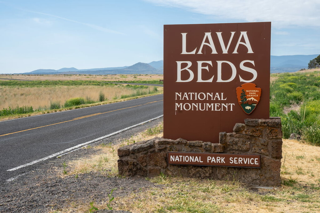
Established in 1925, Lava Beds National Monument is a protected area located in the northeastern part of the US state of California that contains more than 46,000 acres (18,600 ha) of incredible volcanic formations and features including fumaroles, cinder cones, spatter cones, pit craters, hornitos, maars, lava flows, volcanic fields, and almost 700 lava tubes.
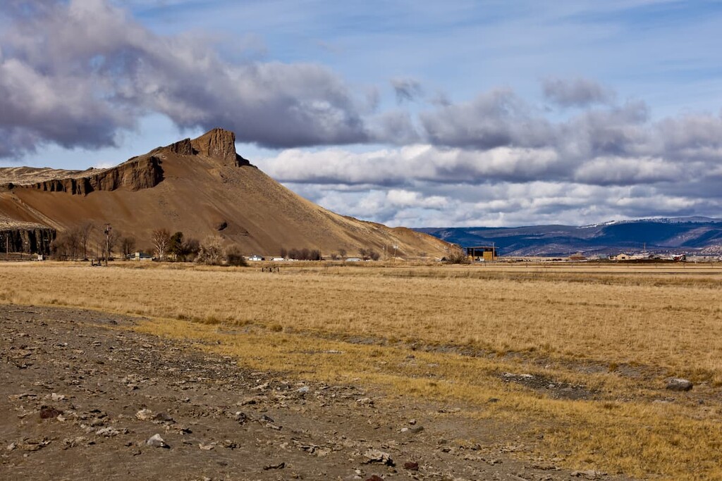
The monument contains 29 named mountains, the highest of which is Island Butte (5,538 ft/1,688 m), and the most prominent of which is Schonchin Butte (5,308 ft/1,618 m).
Lava Beds National Monument is located in northeastern California along the northeastern flank of Medicine Lake Volcano, a massive Cascade shield volcano that sits just 30 mi (50 km) northeast of Mount Shasta. At roughly 150 mi (241 km) wide around the base, 7,900 ft (2408 m) in height, and covering over 700 square mi (1125 sq. km) of land, Medicine Lake is the largest volcano by volume in the Cascade Range.
Though the park only encompasses about 10 percent of the volcano’s surface area, it highlights many of the well-preserved lava features that have been left behind by Medicine Lake’s many eruptions over the last 500,000 years. From the ground, Medicine Lake appears to form a broad highland. However, from the air, the volcano’s extensive network of lava flows becomes much more apparent.
Federal lands border the monument on all sides. A large part of the eastern half of Medicine Lake and its caldera lies south of the monument in Modoc National Forest. Klamath National Forest contains the northwestern side of the volcano, and Shasta-Trinity National Forest encompasses its southwestern flank. The Klamath Basin National Wildlife Refuge also manages land on the north side of the monument.
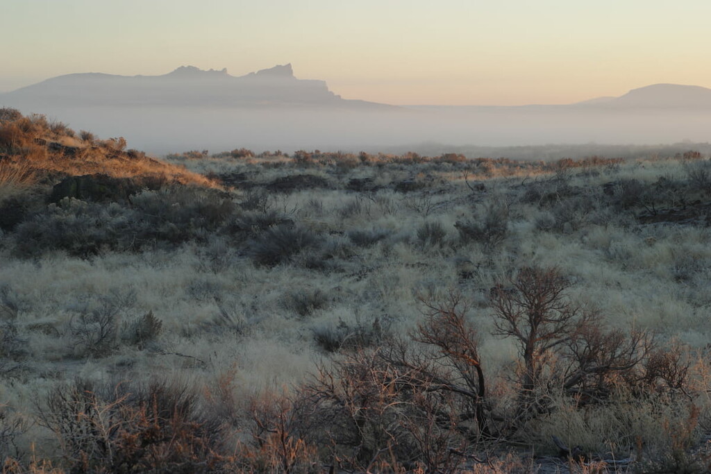
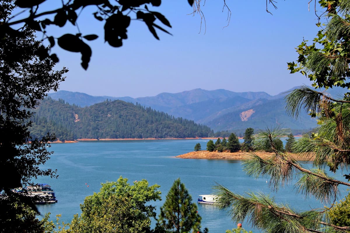
The northern edge of the monument coincides with the southern edge of Tule Lake, a seasonal lake that covers roughly 13,000 acres (5,260 ha) of northeastern Siskiyou County and northwestern Modoc County in California. South of Tule Lake, the terrain in the park rises from roughly 3,937 feet (1,200 m) to about 5,249 feet (1,600 m). The park’s highest mountain, Island Butte, lies along its southern boundary.
Generally, the park is separated into two areas. The first contains the lava flows and features from Mammoth Crater while the second, a separate 200-acre (81 ha) section of the park, protects more than 5,000 individual petroglyphs.
In 1972, the Lava Beds Wilderness was established to add further protections to more than half of the monument. The Lava Beds Wilderness encompasses 28,460 acres (11,496 ha) or 61% of the monument’s total land area. Its eastern unit contains the extensive Schonchin Lava Flow, and its western unit protects the transition zone of the Cascade Range and Modoc Plateau ecosystems. The next closest wilderness is the Mountain Lakes Wilderness, which is 45 miles (72 km) away in the Fremont-Winema National Forest.
Over the last 500,000 years, the land protected by Lava Beds National Monument has been the site of a significant geological turmoil. The monument contains an abundance of well-preserved volcanic features that illustrate the powerful geologic story of Medicine Lake volcano, which began to grow roughly one million years ago during the Pleistocene period.
Most of the lava in the monument is basaltic, or fine-grained extrusive igneous rock that formed from rapid cooling of low-viscosity lava. Andesitic lava and pumice, a type of rhyolitic lava, is also found in the monument.
Unlike other prominent Cascade volcanoes, like Mount St. Helens and Mount Mazama (Crater Lake), Medicine Lake eruptions have never been particularly violent. Instead, the volcano’s hundreds of surface vents and many small underground magma chambers have triggered many mild eruptions, subsequently forming a low, broad, gently sloping volcano. In fact, Medicine Lake has the most vents of any Cascade volcano.
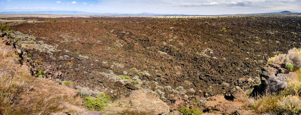
Thirty-six eruptions of the Medicine Lake volcano are represented in Lava Beds National Monument. Some of the major lava flows in the monument include the Callahan Flow, Schonchin Flow, Mammoth Crater Flow, Modoc Crater Flow, and Devil's Homestead Flow.
The oldest lava flow from Medicine Lake is the 450,000-year-old Basalt of Hovey Point located along the northern boundary of the park, while the most recent flows of pumice and obsidian were at Glass Mountain, south of Lava Beds in the Modoc National Forest, less than 900 years ago.
The youngest lava at the monument is from the 1,120-year-old Callahan Flow, but the most extensive lava flow in the park is the basalt of Mammoth Crater, which covered over 70% of the monument area.
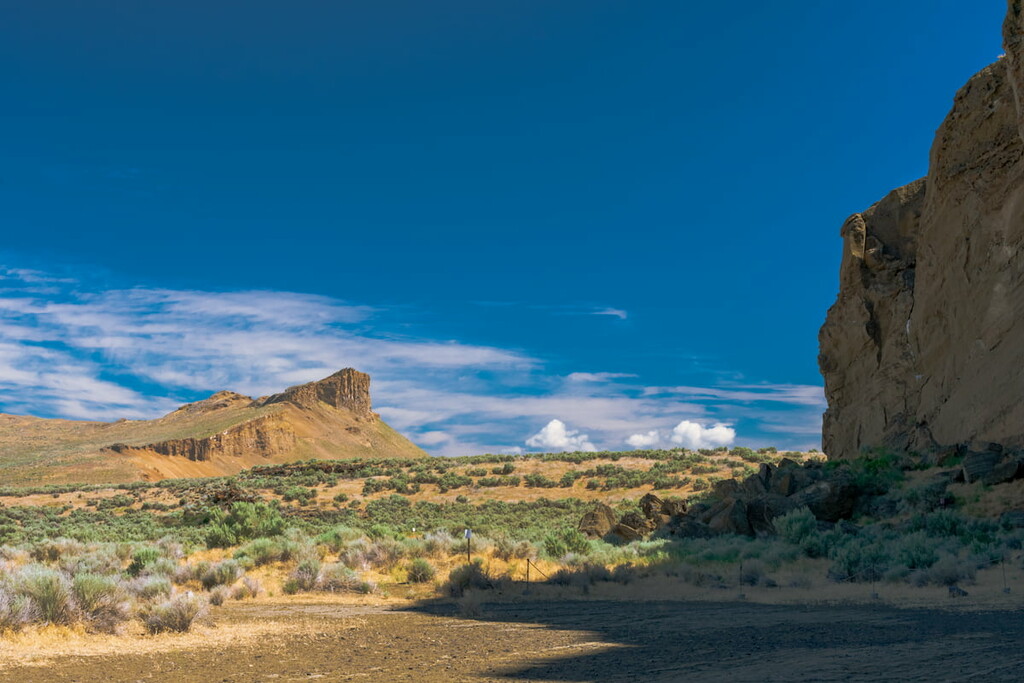
Meanwhile, the tuff layer on top of Gillem Bluff is roughly two million years old and it predates Medicine Lake volcanism. The Gillem fault within Lava Beds National Monument is a distinctive feature associated with tectonic activity. The basalt of Mammoth Crater also hosts the majority of the monument’s 700 caves.
Lava Beds National Monument is geologically significant due to its wide variety of volcanic formations. Some of the park’s most impressive features include the following:
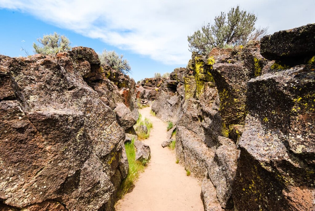
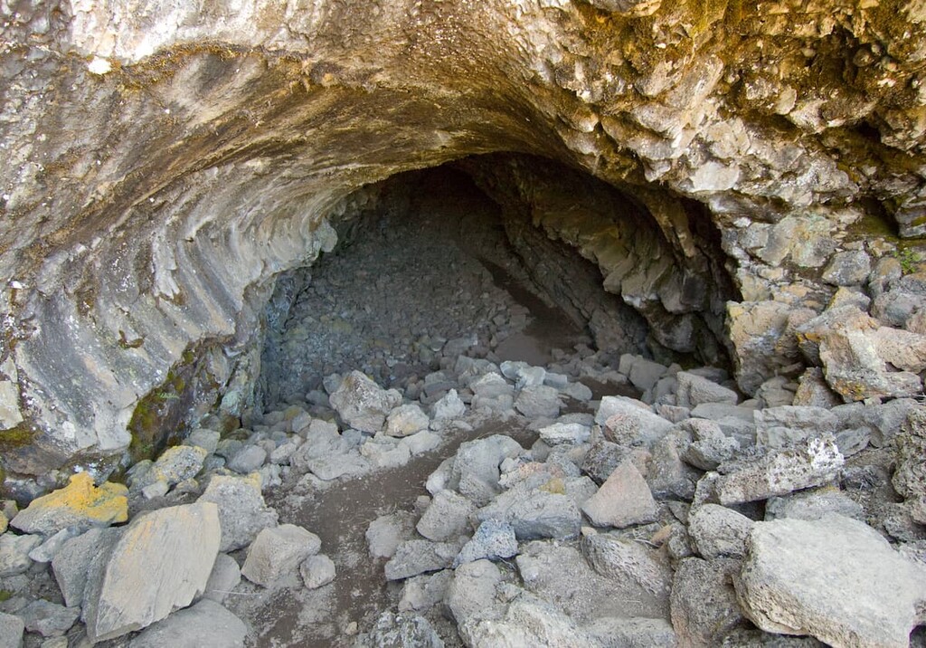
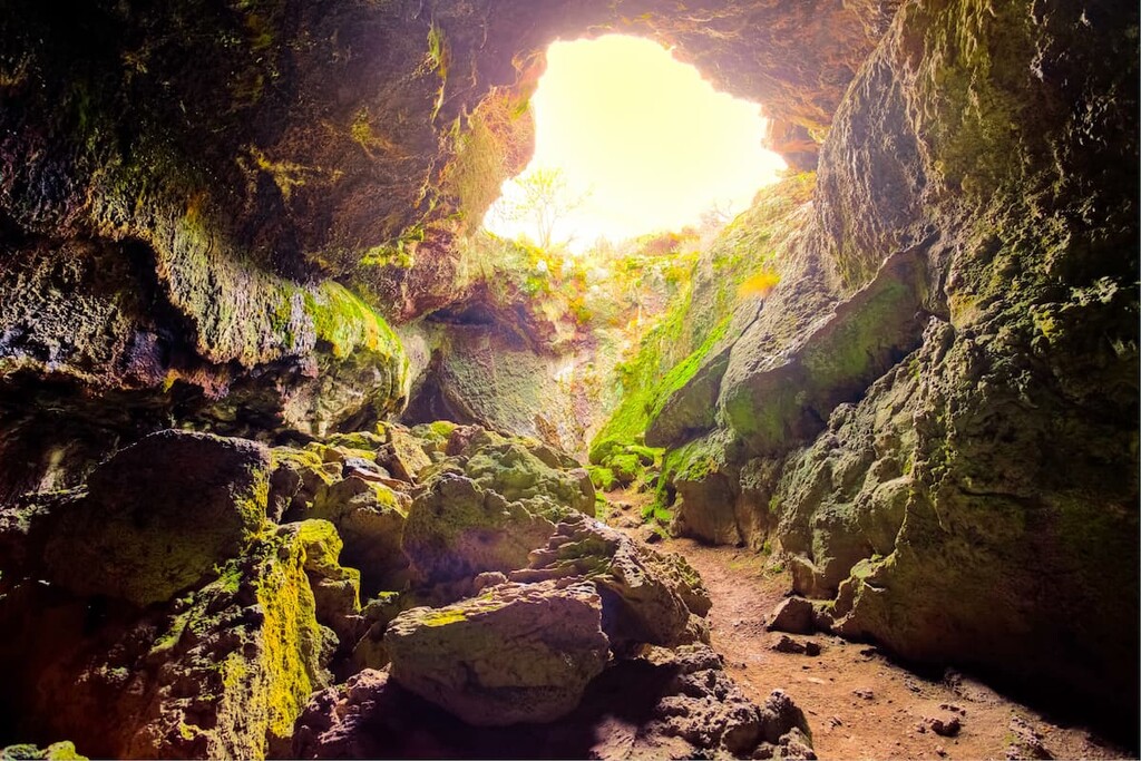
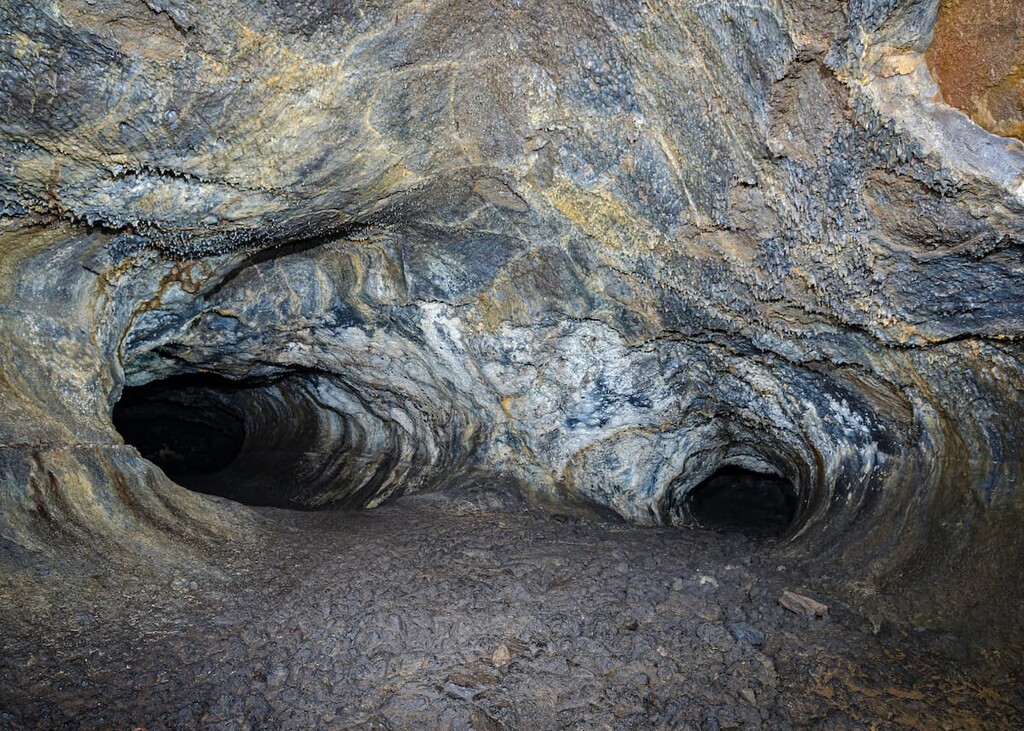
Nine major lava tube systems and over 700 known lava tube caves are located in and around Lava Beds National Monument. The lava tubes in the park formed when hot basaltic lava flowed downhill and immediately began to cool and solidify. This hard shell of cooled lava insulated the liquid rock inside, allowing lava to flow for miles before it eventually drained out or sealed the end of the tube.
The most extensive lava tubes in the monument are in the basalt of Mammoth Crater, which covers roughly two-thirds of the monument. Many of the park’s developed caves contain trails, stairways, or ladders, allowing visitors to explore these incredible natural wonders.
Cinder cones form when gas-charged lava is released into the air from a central vent. Ash and magma fall to the ground following the eruption, accumulating around the volcanic vent and forming a cone.
Lava Beds National Monument contains innumerous cinder and island buttes, many of which rise above the Callahan Flow near the southwestern corner of the monument.
Cinder Butte, the main vent for the basaltic andesite of the Callahan Flow, is roughly 1,120 years old. Also composed of basaltic andesite, the Hippo Butte, Three Sisters, and Crescent Butte are all more than 30,000 to 40,000 years old, while Juniper Butte, Bearpaw Butte, and Eagle Nest Butte formed over 100,000 years ago.
Juniper Butte, in particular, is believed to have formed from the eruption of lava into ancient Tule Lake during the Middle Pleistocene Epoch, between 300,000 and 180,000 years ago.
Spatter cones form when hot lumps of lava are thrown a short distance into the air, falling back to earth around a small central vent. Generally, spatter cones are constructed with thicker lava than cinder cones. Fleener Chimneys and Black Crater are examples of spatter cones. Visitors to the park can appreciate Fleener Chimneys from the Fleener Chimneys picnic area.
Mammoth Crater once contained a massive lake of lava that flooded and left behind an enormous, empty crater. The basaltic lava was transported many miles to the northern part of the monument, crafting an incredible network of lava tube caves along the way.
There are two primary types of basaltic lava in the monument: pāhoehoe and ʻaʻā. Pāhoehoe, the most common type of lava in the monument, has a billowy, smooth, undulating surface due to the movement of fluid lava under a hardening surface crust. ʻAʻā is a sharp and rugged lava flow that forms when pāhoehoe cools and loses some of its gases.
Lava Beds National Monument lies near the junction of the Sierra, Klamath, Cascade, and Great Basin geological provinces. As a result, the park is home to a variety of flora and fauna.
Lava Beds National Monument supports a wide variety of plant life, including a variety of lichens, mosses, fern, and desert flora.
Wildflowers in the monument have adapted to the region’s arid climate and stagger their blooms over the course of the warmer seasons. Some of the most common species include sagebrush buttercup, woodland-stars, yellow bell, daggerpod, granite gilia, and the California poppy.
Fern species, including the spreading wood fern and western swordfern, grow at cave entrances, where the environment is sheltered, shaded, and moist.
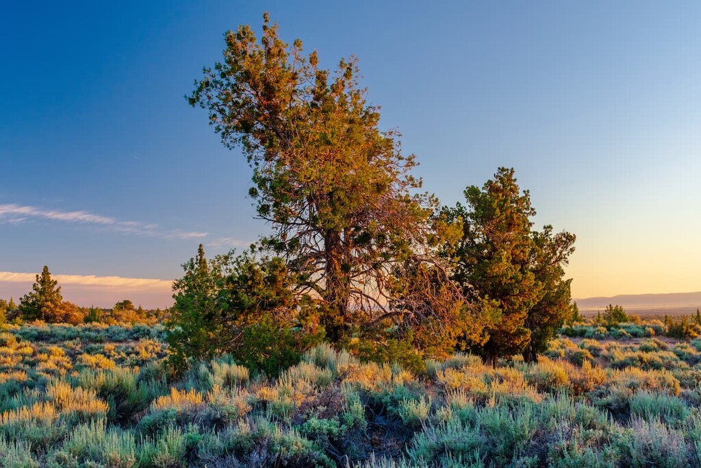
Sagebrush grasslands, including blue bunchgrass and northern wheatgrass, occupy the northern half of the monument, generally at between 4,000–4,500 feet (1,219–1,371 m) above sea level. Woody shrubs and isolated junipers can also be found in this region of the park.
Between 4,500–5,000 feet (1,371–1,524 m), junipers, mountain mahogany, and woody shrubs thrive. Above 5,000 feet (1,524 m), particularly at the southern end of the monument, ponderosa pine and white fir become the more dominant plant species.
Lava Beds National Monument spans three distinct habitats: pine forest, juniper and shrub woodland, and great basin shrub and grassland. As a result, the park sustains a wide range of animal species, including mule deer, gopher snake, bobcat, coyote, yellow-bellied marmot, pronghorn, and mountain lion.
Its location alongside the wetlands of Tule Lake National Wildlife Refuge makes it a particularly great destination for birdwatching. Several species of birds, including the white-headed woodpecker, dark-eyed junco, yellow-rumped warbler, sharp-skinned hawk, scrub jay, western bluebird, western meadowlark, and great horned owl, thrive in the region.

Amphibian species, unfortunately, are limited due to the lack of surface water and rugged terrain in the monument. Two species of amphibians live in the park, the boreal toad and pacific tree frog.
Interestingly, the park’s rocky lava flows and cave mouths also support a variety of animal species, including populations of the western rattlesnake, western fence lizard, Brazilian free-tailed bat, pika, and bushy-tailed woodrat.
It’s estimated that the Klamath and Tule Lake basins have been occupied for over 11,500 years. As a result, Lava Beds National Monument is filled with incredible cultural history, including two forms of rock art—carved petroglyphs and painted petroglyphs. Most of this art can be found near cave entrances in the traditional territory of the Modoc people, who occupied the shoreline of Tule Lake, Lost River, Lost River, Clear Lake, Butte Valley and several surrounding areas.
The Modoc people thrived on the region’s abundant waterfowl and game, edible plants, and accessible water supply before the arrival of European colonizers. The tribe was known to move about the area freely with the seasons, and they established many permanent and seasonal structures in the area now protected by the monument.
In the early 1870s, when European settlers migrated to the area to establish homesteads, they attempted to relocate the Modoc people to the Klamath Reservation, north of present-day Klamath Falls. However, poor conditions on the reservation prompted almost 400 Modoc people to leave the reservation and return to their homeland on the Lost River.
Conflicts between cultures eventually culminated in the Modoc Indian War of 1872–1873, the only major Native American war fought in California and one of the costliest wars in US history. In the winter of 1872-1873, a small band of Modoc people was besieged by the US Army. Though the Modoc were highly outnumbered, the war lasted six months and resulted in the death of 53 US soldiers, 17 civilians, 5 Modoc women and children, and 15 Modoc warriors.
The war was largely centered around Captain Jack’s Stronghold, a natural lava fortress named for the Modoc people’s war leader Keintpoos, who was known as Captain Jack to European settlers. Captain Jack’s Stronghold offered protection to the Modoc and sheltered them from the U.S. Army assaults.
Eventually, the Modoc were forced to surrender. Modoc leaders were convicted of war crimes and executed, while the remaining tribal members returned to the Klamath Reservation or were forcibly relocated to Oklahoma.
In 1925, President Calvin Coolidge established Lava Beds National Monument. The monument was initially managed as part of the Modoc National Forest, but eventually responsibility was transferred to the National Park Service. Many of the battlefields and relics from the Modoc War are located within the monument and are still preserved today.
Sixty years after the Modoc War, Gillems Camp, one of the primary military encampments used during the war, would become a base for the Civilian Conservation Corps (CCC) crews. These crews built the infrastructure of the monument, laying power lines, establishing a headquarters, and developing dozens of trails through the lava tube caves.
Lava Beds National Monument contains 13 hiking trails, all of which cross or enter the backcountry. These trails lead to a number of historic sites and geological areas within the Lava Beds Wilderness.
Popular hiking trails and natural attractions include:
This 0.4 mi (0.6km) trail can be found along FS Route 49 in route to Mammoth Crater. The trail begins beneath Ponderosa pines before cutting through thickets of mountain mahogany and juniper trees. The end of the trail boasts incredible views of a massive lava tube collapse. The Heppe Cave trail also leads to the Heppe Ice Cave, where visitors can explore seasonal ice cave formations.
The 0.7 mi (1.13 km) Gillem Bluff trail is located near the north entrance station to the park. The trail begins over flat terrain, passing the remnants of Gillems Camp, before it quickly climbs to the summit of Gillem Bluff. From the summit, hikers are rewarded with expansive views of the national monument and wilderness.
Located on the east side of the main park road, the 0.7 mi (1.13 km) Schonchin Butte trail steadily climbs 500 feet (152 m) to the summit of a cinder cone that hosts the historic Schonchin Butte Fire Lookout. The lookout was built by the Civilian Conservation Corps and, during summer months, a firefighter is on duty to provide information to guests.
Despite its unusual name, the Big Nasty trail is a beautiful, 2-mile (3.2-km) loop trail named after a brush-covered formation of rough lava rock. The trail begins just after the parking area for Bunchgrass Overlook. Initially, the trail follows the Mammoth Crater trail, before turning south and following the crater’s rim. The Big Nasty trail features sweeping views of the Modoc National Forest and Lava Beds Wilderness.
Created roughly 275,000 years ago, when cinders erupted through the shallow water of Tule Lake, Petroglyph Point displays more than 5,000 individual petroglyphs, making it one of the largest panels of Native American rock art in the United States. The petroglyphs are carved along the face of ancient Tule Lake, in the traditional territory of the Modoc people. Unlike rock art in other areas of the west, many of these petroglyphs feature geometric patterns.

The Petroglyph Point region is located several miles outside of the core monument. This area of the park is rugged and isolated, but this beautiful rock art can be appreciated via a short hiking trail
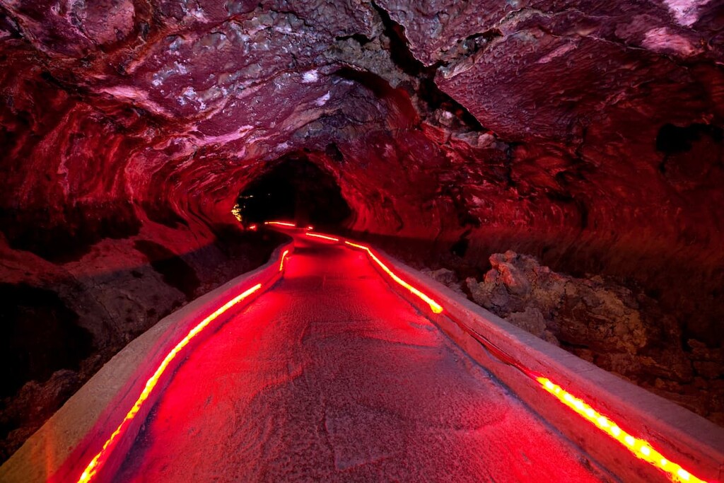
Home to over 700 caves and many miles of lava tubes, Lava Beds National Monument is the perfect destination for both experienced and novice cavers. Many caves in the monument are located along a 2-mile (3.2 km) road near the visitor center and contain trails, stairways, or ladders. Generally, the caves are grouped by their level of difficulty.
The least challenging caves have relatively high ceilings and smoother floors or trails. These caves include: Mushpot, Sentinel, Valentine, Skull, Merrill, Heppe, Big Painted, Symbol Bridge, Ovis, and Paradise Alley.
Moderately challenging caves generally contain low sections and rough terrain. Moderately challenging caves in the monument include: Golden Dome, Sunshine, Indian Well, Balcony & Boulevard, and Blue Grotto.
Finally, the most challenging caves in the monument require crawling and the use of safety gear. These caves include Labyrinth, Lava Brook, Hopkins Chocolate, Hercules Leg, Juniper, Catacombs, and Thunderbolt.
Looking for a place to stay during your visit to Lava Beds National Monument? Here are some of the best cities and towns to check out:
Yreka is located in Siskiyou County near the Shasta River. It serves as an ideal basecamp for exploring Shasta-Trinity National Forest and Klamath National Forest. Located just south of Oregon, in California, Yreka has a rich and diverse history. There are ample lodging and dining options available for visitors looking to spend any amount of time in Siskiyou County.
Known as an alpine community and one of the fastest growing tourist destinations in northern
California, the mountain’s namesake city, Mount Shasta, is the perfect destination for outdoor enthusiasts looking to explore the Shasta-Trinity National Forest.
Within proximity of the city, visitors will find hundreds of miles of hiking and biking trails, stunning mountain vistas, and tranquil alpine lakes. One of the larger cities in this region, Mt. Shasta offers a variety of accommodations including hotels, bed & breakfasts, resorts, and a few secluded retreats.
Known as “Oregon’s City of Sunshine,” Klamath Falls is a scenic community surrounded by natural treasures. Klamath Falls is central to six national wildlife refuges, miles of picturesque hiking and biking trails, and two incredible national parks: Crater Lake National Park and Lava Beds National Monument.
Klamath Falls is also the county seat of Klamath County and offers visitors plenty of restaurant, hotel, museum, and shopping options.
Located in northeastern Siskiyou County, Tulelake is named after nearby Tule Lake, a seasonal lake tucked in the Tule Lake National Wildlife Refuge that has existed continuously for more than one million years.
Visitors to Tule Lake can explore the Medicine Lake Highlands, Medicine Lake Volcano, Medicine Lake, Little Glass Mountain, as well as the numerous caves and volcanic features in Lava Beds National Monument. Though Tulelake isn’t a particularly large city, it also offers plenty of fun attractions and lodging options to accommodate visitors to the region.