Scan the QR code and open PeakVisor on your phone
Nestled between Eureka and Redding, California, the Trinity Alps Wilderness is a 525,627-acre designated wilderness filled with powerful rivers, incredible alpine lakes, and soaring peaks. Although the Trinity Alps Wilderness is one of the largest wilderness areas in the state, it’s far less popular than its neighbors – Yosemite and Sequoia.
The Trinity Alps Wilderness received its official designation after the signing of the California Wilderness Act in 1984. Prior to its official designation, 234,000 acres were already set aside as part of the Salmon-Trinity Primitive Area. In 2006, with the signing of the Northern California Coastal Wild Heritage Act, 26,510 additional acres were added to the wilderness. Today, the Trinity Alps are jointly administered by the Shasta-Trinity, Klamath, and Six Rivers National Forests and approximately 4,600 acres are administered by the Bureau of Land Management.
The Trinity Alps Wilderness contain portions of two small subranges of the Klamath Mountains, the Salmon and Scott Mountains. Both subranges contain impressive namesake summits - Salmon Mountain and Scott Mountain. Nearby, several more stunning Trinity Alps summits dot the landscape, like North Trinity Mountain, Trinity Mountain, and Thurston Peak.
The tallest peak in the Trinity Alps is Mount Hilton, which sits at 8,957 feet in elevation. Nearby, the equally as impressive Sawtooth Mountain also reach over 8,800 feet in elevation. Both summits offer sweeping views of the surrounding wilderness and are relatively easy to climb. Thompson Peak, arguably the most popular peak in the Trinity Alps, is home to one of the best backpacking routes in the area and is known for its craggy granite appearance. In route to the top of Thompson Peak, hikers will often gaze admirably at Wedding Cake, a dramatic summit with an exceptionally steep eastern face and memorable name.
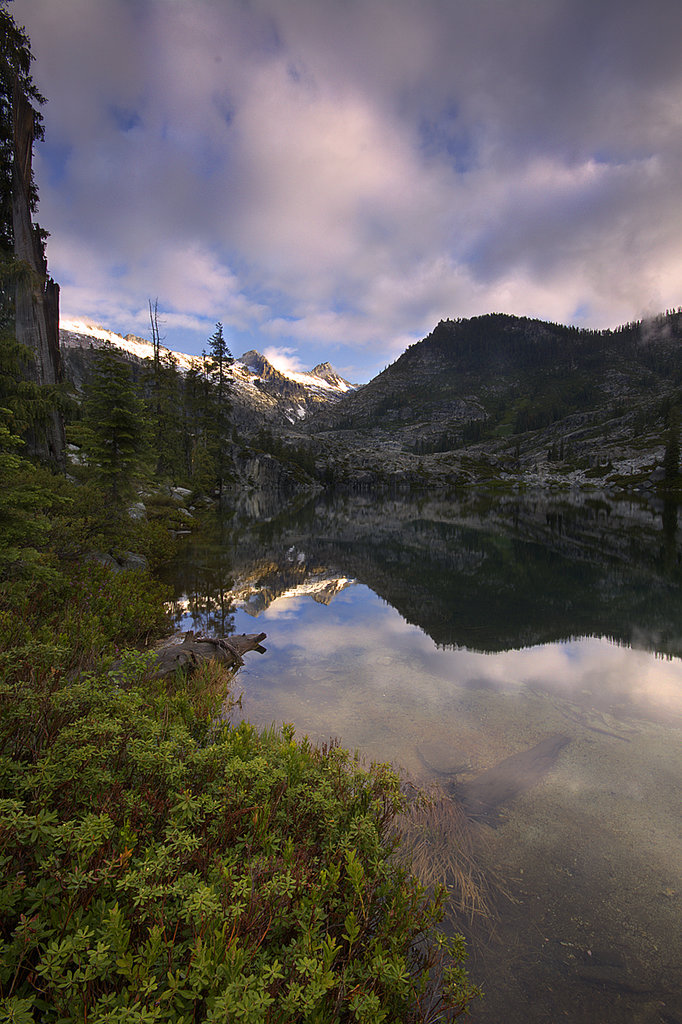
The Trinity Alps Wilderness also contains several small lakes, streams, and scenic rivers. In fact, the wilderness contains the Wild and Scenic Trinity River and Scenic Salmon River, which serve as a habitat for steelhead, rainbow trout, and Chinook salmon.
Geographically speaking, the Trinities can be divided into three distinct and diverse regions – the Green, Red, and White Trinities. In the west, the Green Trinities consist mostly of rugged ridgelines, vast stands of forest, thriving rivers, and vertical canyons. This area sees twice as much precipitation as the eastern half of the wilderness and contains much milder mountains. In the east, the aptly named Red Trinities contain several reddish-colored 8,000-foot summits and stunning lake basins. The Red Alps get their name from the serpentine soils that are prevalent in this region. The White Trinity region, or White Alps, sit between the Green and Red Trinities and were named for the stark, white granite features of the summits found in the area. The White Trinities are often considered the most scenic and contain the tallest peaks and largest lakes in the wilderness.
The Trinity Alps contain over 500 miles of hiking trails, including 17 miles of the Pacific Crest Trail and 35 miles of the Bigfoot Trail. However, this area is infrequently visited, which results in poor trail conditions. It’s recommended that visitors to the Trinity Alps have basic map and route-finding skills. Those that make the trip, however, will be rewarded with stunning views of granite peaks, glacial lakes, and valleys.
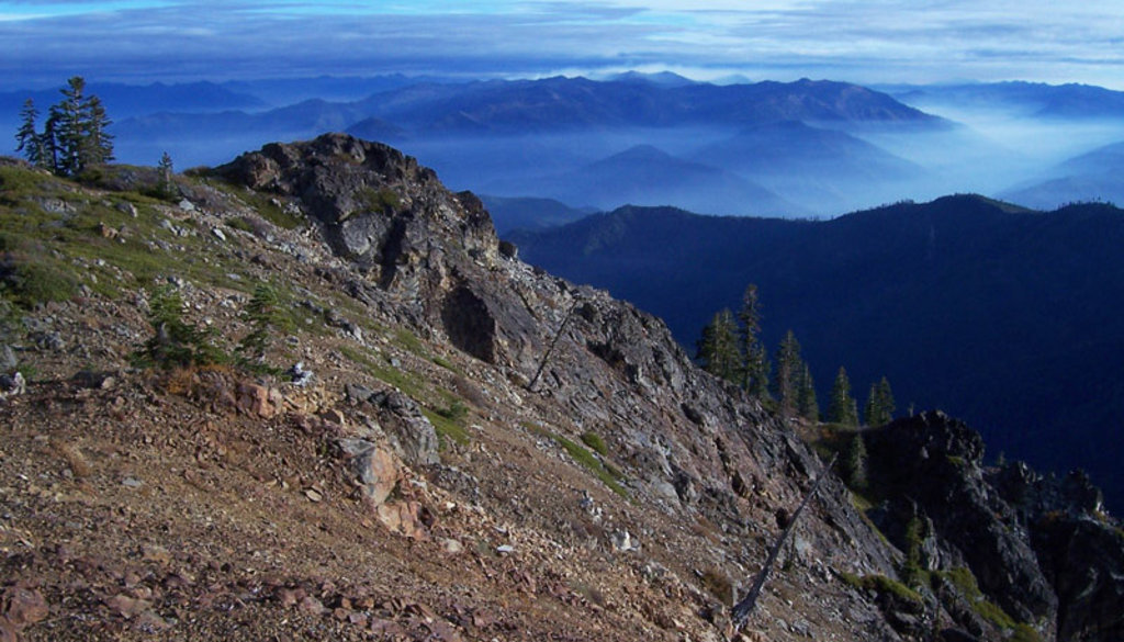
Siligo Peak is one of the best-kept secrets in the Trinity Alps. Unbeknownst to most visitors, Siligo Peak offers some of the best views in the Trinity Alps Wilderness and requires a lot less effort than competing trails. Hike along the 12-mile Long Canyon Trail or the 17-mile Stoney Ridge Trail for panoramic views of the Scott Mountains, the Red Trinities, the southern Klamath Mountains, the emerald-colored Diamond Lake, as well as Mount Shasta and Lassen Peak.
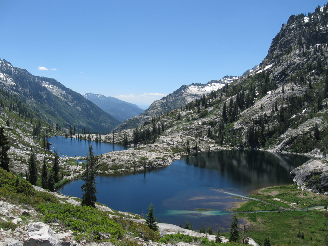
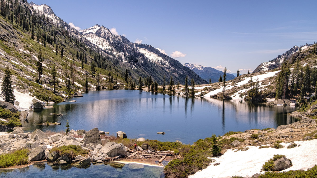
The Canyon Creek trail is one of the most popular hiking and backpacking trails in the Trinity Alps. This trail takes hikers deep into the heart of the Trinity Alps. The Canyon Creek ranges from 3,000 to 4,000 feet in depth and several 8,000-foot summits can be seen towering over the canyon and periodic, glacial lakes. In the summer months, a handful of waterfalls can also be seen and heard along the trail. Upper and Lower Canyon Creek Lakes and Boulder Creek Lakes are popular destinations for both day hikers and backpackers and, at just 7-miles (each way), this trail is one of the easiest treks in the area.
Hidden Lake is one of the most modest, family-friendly treks in the Trinity Alps. At just 2 miles, the trail to Hidden Lake Trail leads to a small and scenic lake nestled against a tall, craggy cliffs. This trail is a great trail for beginner backpackers or general outdoor enthusiasts that want to take a dip in a gorgeous alpine lake.
The 90-acre Trinity Alps Resort is surrounded by 500,000 acres of incredible wilderness. Built in 1920, the resort is not only a popular wedding venue and destination, but is also the perfect basecamp for swimmers, hikers, fishermen, and backpackers. If you’re looking to explore the Trinity Alps Wilderness, the resort’s idyllic location is hard to beat.
Nestled in the heart of the Trinity Alps, where the Klamath and Shasta National Forests meet, lies the Trinity Mountain Meadow Resort, a family-friendly wilderness retreat. Breathtaking alpine scenery surrounds the resort, making it a popular destination for outdoor enthusiasts. The resort contains a lodge that was built in the 1950s, as well as several cozy cabins.
Coffee Creek is a mountain town that sits just north of where Coffee Creek flows into the Trinity River. With only 200+ full-time residents, Coffee Creek isn’t a large city. However, it offers visitors unparalleled access to the heart of the Trinity Alps. The Coffee Creek Road originates at Highway 3, which leads to the interior of the Trinity Alps. There are also a variety of cozy cabins, resorts, and ranches in and around the town, including the Almay Ranch, Bonanza King Resort, and Coffee Creek Ranch.