Scan the QR code and open PeakVisor on your phone
The Six Rivers National Forest is located in California and spans 974,612 acres. The forest was originally established back in 1947 under President Harry S. Truman. There are 86 named mountains in Six Rivers National Forest. Orleans Mountain is the highest point at 6,184 feet. The most prominent mountain is Black Lassic. The forest stretches from the Oregon border southward for about 140 miles. Elevations in the forest range from nearly sea level up to the summit of Orleans Mountain. This range in elevation allows the forest to support a plethora of wildlife and diverse ecosystems.
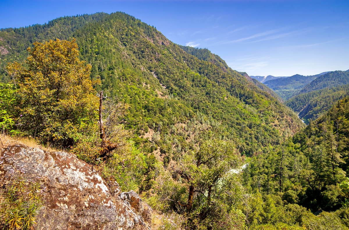
The Six Rivers National Forest is named after the six major rivers that run throughout it; the Smith, Klamath, Trinity, Van Duzen, Mad, and Eel. The Smith river is known for being the only major undammed, naturally flowing river left in the entire state of California. Due to the extensive network of rivers, the forest is a popular destination, like much of northern California, for rafting, kayaking, and fishing. There are over 1,500 miles of streams in this national forest which totals 9% of all of California’s freshwater runoff.
There are five wilderness areas in the Six Rivers. The Smith River National Recreation Area, sits in the northernmost region of the forest and spans 307,973 acres. Within the Six Rivers National Forest are more than 1,260 known historical or archaeological sites.
Devil’s Punchbowl is one of the most popular hikes in the Six Rivers National Forest. This 9-mile hike has 1,300 feet of elevation gain and is full of a diverse range of conifers making for a breathtaking hike from start to finish. After reaching a small lake, Devil’s Punchbowl stretches out before you. Find a spot to pitch a tent to stay the night and take a dip in the clear waters.
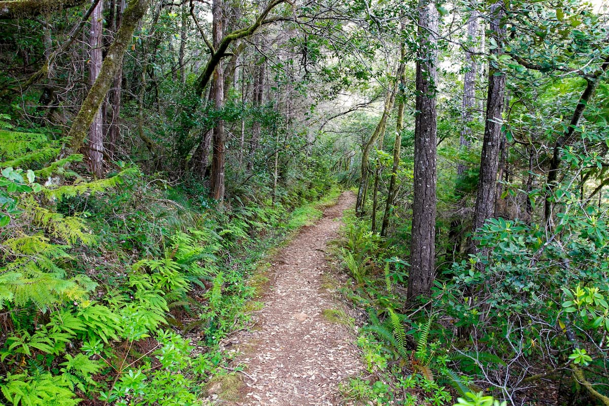
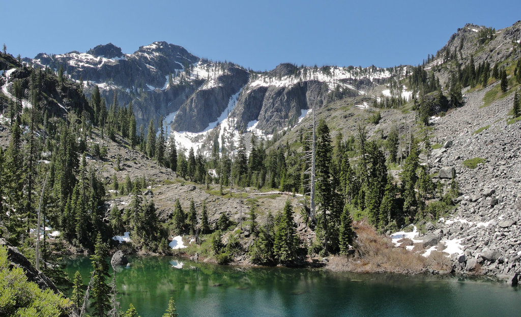
Raspberry lake is located in the Siskiyou Wilderness region of the Six Rivers National Forest. The trail totals 7.2 miles with just over 1,000 feet of elevation gain. The trail climbs steadily before reaching Raspberry Lake, tucked into a basin and the perfect place to camp, fish, and/or swim.
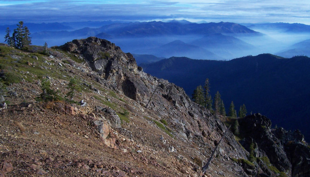
The Clear Creek National Recreation Trail runs north to south throughout the forest. The point to point route totals 22 miles from Youngs Valley Trailhead to No Mans Trailhead. The trail has a cumulative descent of 4,341 feet as it follows along the Klamath River toward the mouth of the river. Clear Creek has cool slow moving areas that are perfect during a hot day of hiking. Along the route, hikers pass Wilderness Falls and Trout Camp which has trails leading to other nearby hikes.
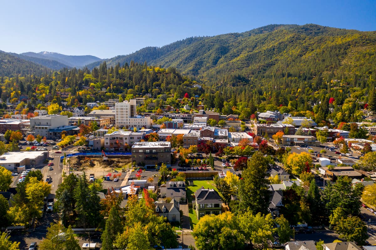
Ashland, Oregon is a city located in Southern Oregon with a population of around 21,000. The small city is known for being home to the Oregon Shakespeare Festival. The town is known for being very liberal, a sharp contrast to much of southern Oregon. Many of the city’s historical buildings have been preserved which give the downtown a quaint setting. Ashland is the perfect place to stay after a long hike in the mountains and is ideal for grabbing a bite to eat or check out a local gallery. The nearby city of Medford also has ample housing with close proximity to the surrounding mountain trails.
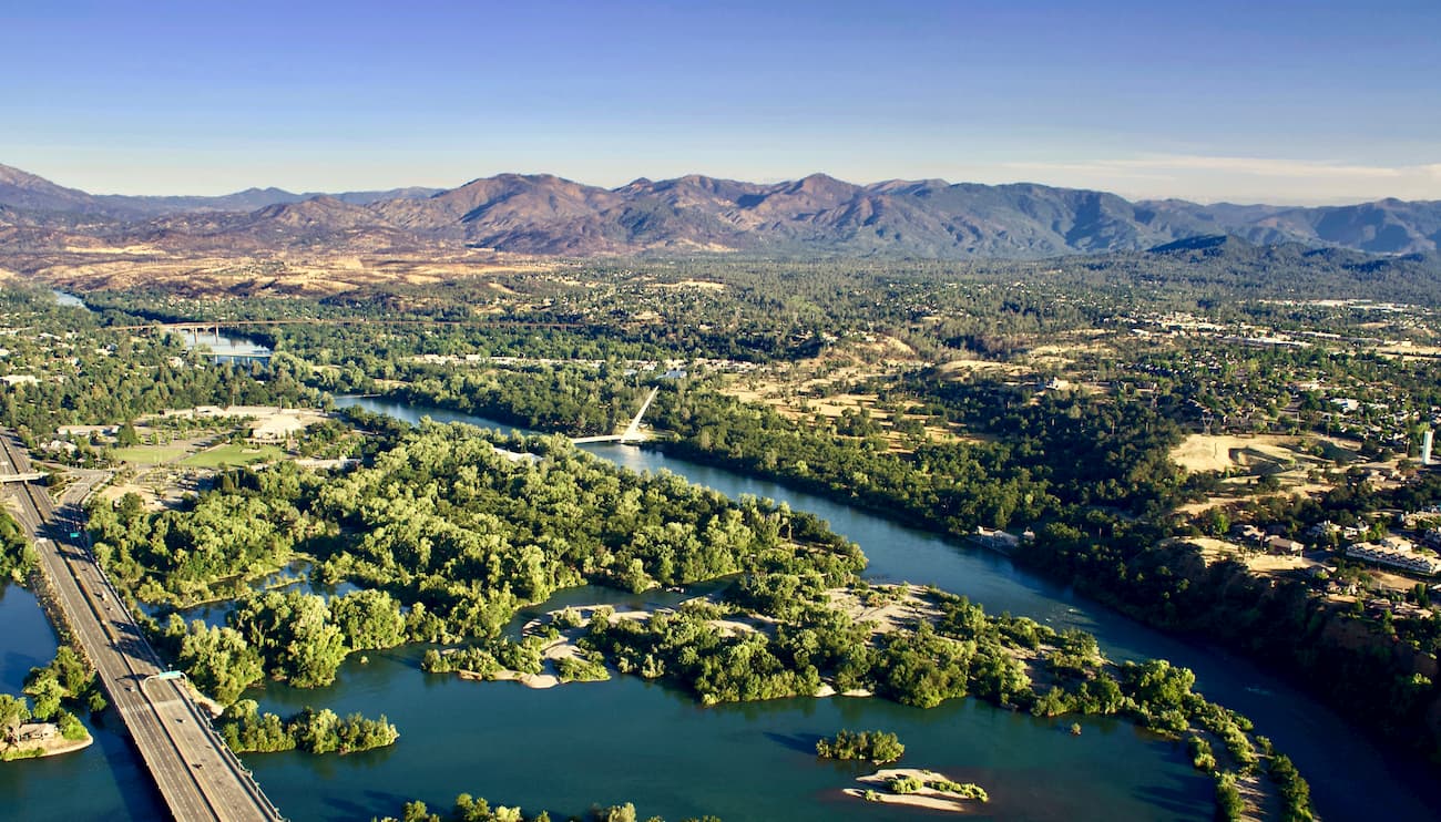
The city sits along the Sacramento River and is just 15 miles south of Shasta Lake. The city’s population is just over 90,000 and is at the very northwestern end of the Central Valley. Redding is surrounded by mountains to the north, east and west. The Market Center located downtown is the perfect place to explore the city and grab a bite to eat after a long day of hiking.
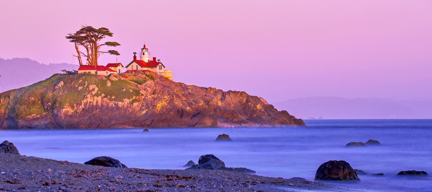
Crescent city is located on the very northwestern coast of California with a population of approximately 10,000. The city is also the location for the Redwood National Park headquarters. Crescent City sits just 20 mile south of the Oregon-California border. The city was named after the crescent shaped beach and it is known for being an abundant fishing location. Despite being in California, Crescent City is quite rainy and averages 71.24 inches per year. The isolation of the city makes it one of the most popular stops due to its proximity to numerous state parks, recreation areas, and the Lost Monarch, the largest known Coastal Redwood by volume.