Scan the QR code and open PeakVisor on your phone
Cuyamaca Rancho State Park is a beautiful outdoor recreation area located in the southern part of the US state of California that offers over 100 miles (160 km) of trails for hikers, equestrians, and cyclists, as well as camping and fishing in the nearby Cuyamaca Lake. The park contains 11 named mountains, the highest and most prominent of which is Cuyamaca Peak (6,496 ft/1,980 m).
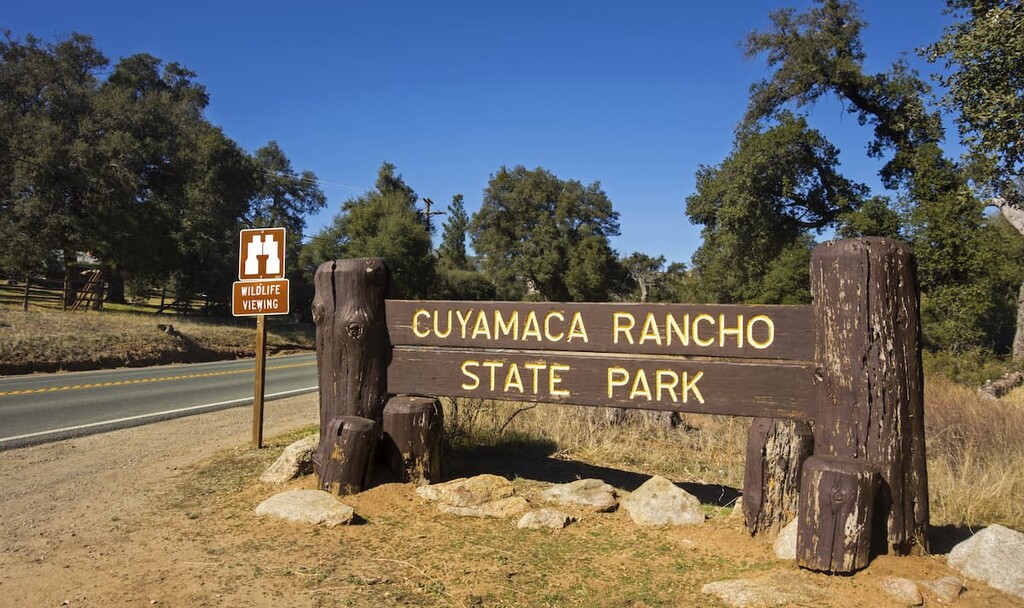
Cuyamaca Rancho State Park is a state-run outdoor recreation area located in the southern part of the US state of California. The park is situated just outside the city of San Diego in San Diego County, just to the north of the state’s border with Mexico.
With a total land area of about 24,693 acres (9,992 ha), Cuyamaca Rancho is actually one of the larger state parks in California, trailing closely behind Red Rock Canyon State Park and San Luis Reservoir State Recreation Area. However, while its small size pales in comparison to the massive Yosemite National Park and Sierra National Forest, Cuyamaca Rancho is home to a diversity of landscapes.
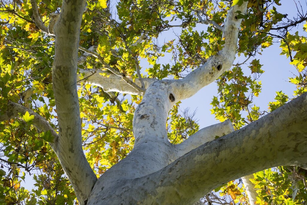
In fact, the landscape of the park varies a great deal within its borders, with pine, fir, and oak forests, along with meadows and streams that are able to exist as a result of the relatively high elevation of the area compared to its surroundings. Indeed, every hike through the park provides a bevy of photo opportunities for any hiker.
Cuyamaca Rancho is also located within driving distance of a number of other popular outdoor recreation areas, including Anza-Borrego Desert State Park and the Sawtooth Mountains Wilderness Area to the east, as well as the Pine Creek Wilderness and the Hauser Wilderness to the south.
Furthermore, Cuyamaca Rancho State Park also overlaps with the Cuyamaca Mountain State Wilderness and the Cuyamaca Meadow Natural Preserve.
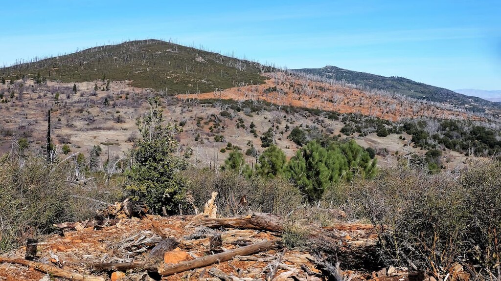
Cuyamaca Rancho State Park is part of the Peninsular Ranges of Southern California, which are chiefly made up of coarsely crystalline igneous rock, termed the Peninsular Ranges Batholith. The hills and overall geology of Cuyamaca Rancho State Park are influenced by the historic grinding of the North American plate sliding past the Pacific plate known as the San Andreas Fault system. Before this fault started to rip the state apart, California was the scene of major mountain building events, known as the Nevadan and Sevier Orogenies, which occurred during the Mesozoic era and were the result of the collision and subduction of the Farallon oceanic plate beneath the North American continental plate.
Around 165 million years ago, during the Jurassic Period of the Mesozoic Era, the west coast of North America was being subjected to intense volcanic activity as the supercontinent Pangaea was breaking apart and the North American plate started carrying the continent westward. The Farallon subduction plate, and was being pushed under North America and melted at depth beneath the continental margin. As a result, many volcanoes formed far to the east along the western margin of the developing continent creating a volcanic island arc. Additional volcanism occurred later at two distinct periods during the Cretaceous period, which possibly consisted of volcanic islands being formed offshore (where magma erupted and cooled into andesite and basalt) only to then be forces eastward and shoved up against the North American continent as a result of the continuing plate collision. This collision compressed and squeezed existing igneous and sedimentary rocks, causing them to be metamorphosed and be pushed up into huge mountains, many with peaks over 14,000 feet (over 4,000 meters). These huge mountains have since eroded to their smaller southern California mountains we know today and can be seen at state parks such as Cuyamaca Rancho.
Major peaks in Cuyamaca Rancho include Cuyamaca Peak, Middle Peak, Stonewall Peak, East Mesa, and Oakzanita Peak.
Cuyamaca Rancho State Park encompasses the headwaters of the Sweetwater River system, which flows all the way to San Diego. The region relies on seasonal rains and snowmelt that collects on Stonewall Peak to start the watershed. Here’s a quick look at the various flora and fauna you can see in the park:
Cuyamaca Rancho is part of the dynamic California chaparral and woodlands ecoregion, as well as California montane chaparral and woodlands ecoregion, the latter of which borders on southern California’s meadowlands and the Colorado desert ecoregion. As such, you will be privy to some of the most varied and dynamic landscapes in San Diego County when visiting Cuyamaca Rancho.
Thanks to its relatively high elevation of about 5,000 feet (1,524 m) there is more rain in the area than one might otherwise expect. This helps keep the region greener than other nearby areas and it enables many conifers and broadleaf trees to exist within the park.
Conifer varieties in the park include white fir, incense cedar, Coulter pine, Jeffrey pine, sugar pine and ponderosa pine. Broadleaf tree varieties include
Large shrubs in the area, which range from 4–15 feet (1.2–4.6 m) in height, include:
The park's smaller shrubs, which range from 1–4 feet (0.30–1.22 m) in height, include California buckwheat, Wright's buckwheat, chaparral honeysuckle, California rose, creeping sage, snowberry, and poison oak.
You will also see a wide variety of wildflowers in Cuyamaca Rancho. Early season wildflowers include:
Middle season wildflowers include:
Meanwhile, late season wildflowers found in the park include:
Cuyamaca Rancho makes for a perfect home for a number of animals. Mammals that call the region home include:
There are about 200 species of birds that have been documented in the park, such as:
Migrants and summer resident birds in the park include:
Amphibians and reptiles of the park include:
The area in and around Cuyamaca Rancho has been inhabited for thousands of years and is one of the most fertile and liveable parts of an otherwise arid and dry Southern California landscape. Luckily, as a result of the aims of the California government, this region and its flora and fauna is being preserved and protected for generations to come.
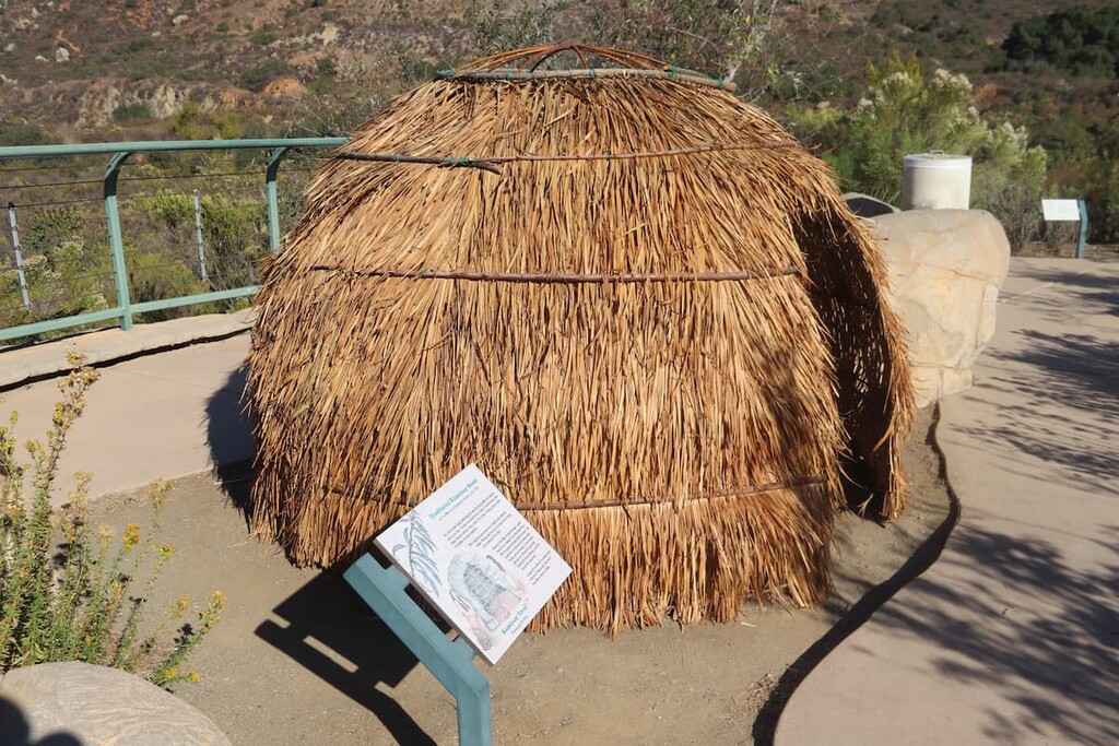
The area of Cuyamaca Rancho is the ancestral home of the Kumeyaay people. “Cuyamaca,” is the Spanish version of Kumeyaay, but the Kumeyaay are also known as “Tipai-Ipai” or by their other Spanish name “Diegueño.” The Kumeyaay consist of three related groups, the “Ipai,” “Tipai,” and “Kamia”.
The Kumeyaay people have lived in this area for at least 7,000 years, if not longer, and archaeological evidence of their history in the region is highlighted at the Cuyamaca Complex within the park. This area provides archeological evidence of human inhabitation in the region since time immemorial, such as early bedrock mortars that mark the sites of summer camps and villages.
Southern California is a famously dry area so it is interesting that the native name for the Cuyamaca Rancho region is actually “Ah-Ha Kwe-Ah Mac,” meaning “the place where it rains.”
The Kumeyaay peoples' traditional lands range from what is now San Diego east through the Cuyamaca and the Laguna Mountains, and as far as present day Anza-Borrego Desert State Park to beyond the Salton Sea in the east.
They also traveled south beyond present day Ensenada, Baja California on the Baja California Peninsula in Mexico. Various tribal bands would travel within a 20-mile (30 km) radius from their winter home. There are 12 federally recognized Kumeyaay tribes in San Diego County today.
With the discovery of gold in nearby Julian, Spanish, English and American settlers forcibly removed the Kumeyaay people and colonized this region. Diseases spread through the Kumeyaay, destroying local communities.
The Kumeyaay were ultimately expelled in 1875 from their ancestral lands and taxed without representation (which broke a number of historic treaties and promises made by the colonizers). Today, there are about 20,000 Kumeyaay descendants in San Diego County, approximately 10 percent of whom live on 18 reservations in the area that are anywhere from 6.3 to 122,000 acres (2.6 to 49,371 ha) in size.
In 1870, the Stonewall Mine opened and the boomtown of Cuyamaca City was established. The mining hit a peak between 1886 and 1891 and employed over 200 workers. This boom was not long lived, however, and the mine closed in 1892 after large losses, though not before the building of the Cuyamaca Dam in 1889.
In 1923 a man named Ralph Dyar bought the Cuyamaca Rancho area and lived there for ten years. He later sold his property to the state, which led to its establishment as a state park in 1933. These days, approximately half of the park is classified as a wilderness area.
Cuyamaca Rancho State Park is a haven for hikers and outdoor enthusiasts. Here are some of the best hikes to check out in the park:
Cuyamaca Peak is a choose-your-own-adventure-style hike when it comes to summiting and descending. Indeed, there are a number of different routes up and down the mountain from the Paso Picacho Campground, most of which are well under 10 miles (16 km) in length.
If you want an option that is easier on your feet, you can take the Lookout Road all the way up. While this is not a true trail hike hiking (as it is a walk up pavement) it does provide a less fun option and accessible option up to the peak.
Another option is the Azaleas Glen to Conejos Route. For this route you will start on the Azaleas Glen Trail from the campground until you reach Azaleas Glen Fire Road. The Azaleas Glen Trail stays pretty casual until you hit the higher elevations, at which point the trail gets a bit more difficult.
When you come to the fire road, turn right until you come to the Conejos Trail on the left. Enjoy the break the fire road provides because your time on the Conejos Trail is the most technical of the hike with a higher grade and a more rugged path. You will follow this path until you reach the paved Lookout Road, which you’ll follow the rest of the way up the mountain.
If you’re interested in a longer hiking option, you can check out the Burnt Pines Trail. This hike, if you have the time and energy, will add a bit of extra mileage to your adventure, but it’s well worth the effort.
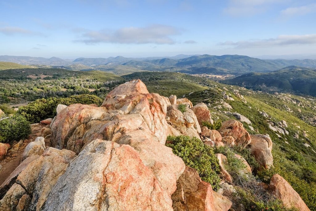
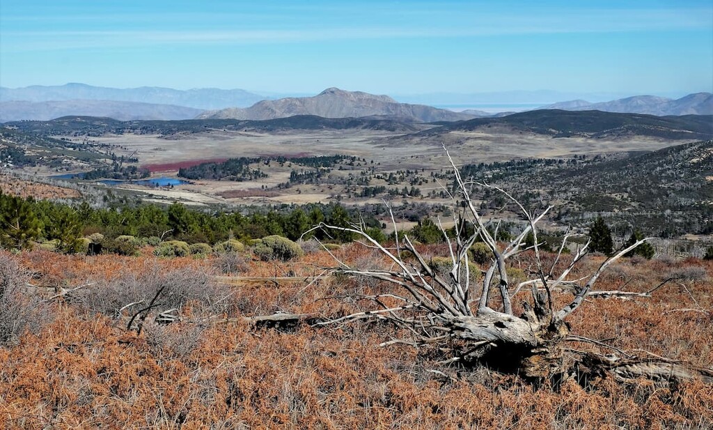
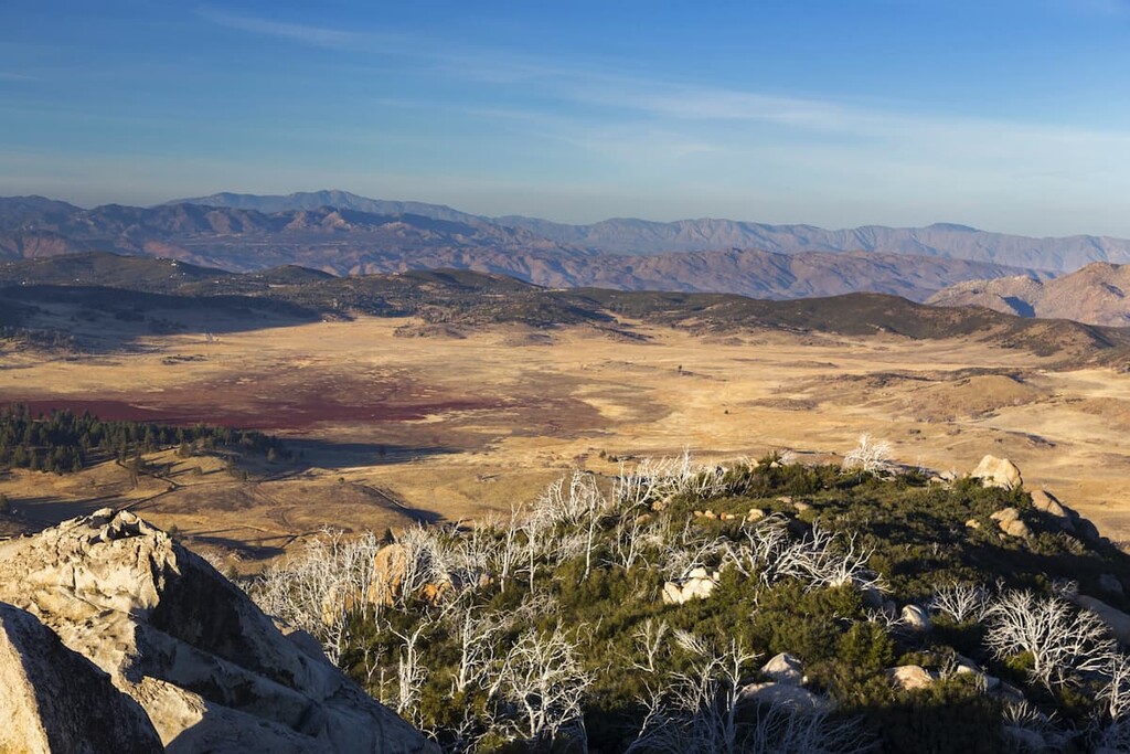
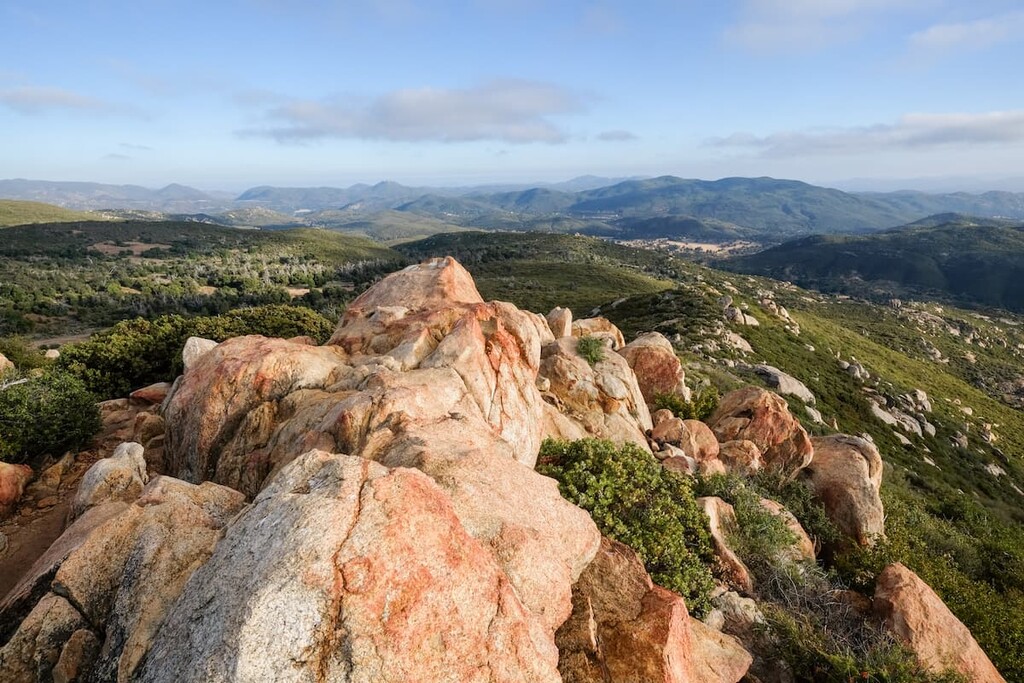
The top of Cuyamaca Peak highlights the best that the park has to offer and beyond. On a clear day you can see all the way to San Jacinto and you will get a 360 degree view of the chaparral, riparian, and desert landscapes that make this region famous.
One the way up the mountain, you can expect to see a great variety of bird life, as well as flora from a variety of micro-ecosystems. You will also be sure to see the effects of fire on the landscape. This is a beautiful hike that is not to be missed!
Stonewall Peak is an easy to moderately difficult hike that’s approximately 2 mile (3 km) long with 854 feet (260 m) of elevation gain. The approach to the hike is very simple and it starts at the road on Highway 79. If you are staying at the Paso Picacho Campground or the nearby day use area, you can easily cross the road and start your trek up Stonewall Peak.
The route to the summit is heavily trafficked and very well designed with many switchbacks. The only portion of the trail that is particularly challenging is located at the top. About 0.2 miles (0.3 km) from the top, the trail comes to a fork. Turn right here and you will begin climbing up a steep slope to the summit.
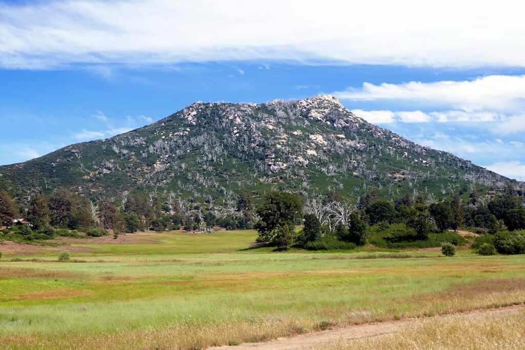
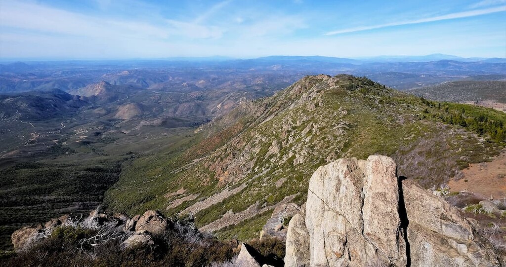
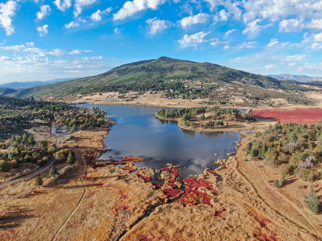
Once you arrive at the top, you will get an amazing view of the southern Cleveland National Forest and the entire Cuyamaca Rancho State Park area. To the north you will see the Cuyamaca Lake and the expansive grass meadowland of the region. You will also see hints of Palomar Mountain in the distance and, on a really clear day, you can sometimes see as far as San Jacinto Peak.
To the south, you will see the Laguna Mountains towards the east and on a clear day you can see as far as Mexico. The southern view is a great example of the region's vast chaparral ecosystems. Towards the northeast you will see Granite Mountain and the Santa Rosa Mountains, along with the vast desert regions that take over further east.
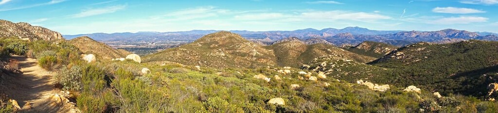
The Pine Ridge Trail is a scenic trail that starts at the Green Valley Campground. It is about 2 miles (3.2 km) long each way and is considered to be a moderate difficulty hike. The trail highlights views of the entire Green Valley from north to south and can be modified to be a 3.5 mile (5.6 km) adventure by taking the South Boundary Fire Road.
This is a moderately difficult trail with 1,200 feet (366 m) of elevation gain that runs about 4 miles (6.4 km) and starts from the Arroyo Seco Picnic Area. The trail's steady climb opens up to expansive views of the region that are not to be missed.
For this trail you will need to follow the connector trail at the north end of the Arroyo Seco parking area to the West Side Trail. At the top, turn right (north) onto the West Mesa Trail for a short side excursion on the West Mesa Trail for about 0.5 mi (800 m) to see the Airplane Monument.
Return back along the West Mesa Trail to get back onto your main route, and head toward the Arroyo Seco Fire Road to return to the Arroyo Seco Picnic area where you started.
This challenging trail climbs to the top of Oakzanita Peak with 1300 feet (396 m) of elevation gain over the course of 8 miles (12.9 km). Starting from the East Mesa Parking Lot along Highway 79, you will start this climb with a steady ascent up to the peak with a scramble towards the summit. At the top, you will be rewarded with spectacular views of the area.
You can make this trek into a simple in and out route or you can switch up your return by taking the Upper Descanso Creek Trail. It should be noted that these trails have very little in the way of shade so be sure to bring lots of water, wear lots of sunscreen and cover up with long sleeves and pants. These are also multi-use trails so keep an eye out for mountain cyclists.
Like many state parks, there are a number of things visitors need to be aware of as they hike through Cuyamaca Rancho.
Rattlesnakes are routinely found on the hiking trails and they are an important part of the region’s ecosystem. It is important to be aware of where you are stepping and if you hear the rattle of a snake, stop and locate the snake before moving away. These creatures are not interested in interacting with humans and will not bite unless provoked.
Ticks are another critter to be very aware of while at Cuyamaca Rancho State Park. The region’s brushy environment is a great habitat for ticks so be sure to do a tick check after your hikes, stay on established trails, and avoid moving needlessly through thick brush. Lyme disease is the biggest risk associated with ticks, however, luckily, Southern California’s instance of lyme disease is very low.
Poison oak is also a resident of the park. As a result, visitors need to remember the old saying ‘leaves of three, let them be’ when hiking in Cuyamaca Rancho so that they can avoid poison oak at all costs.
Hikers should also keep an eye out for ants. The large red fire ants that crawl around the region have a bite that is painful and leaves a welt, so stay on the trail and keep an eye out for them as you walk. Keeping a smart watch out for these things will result in a much happier trip overall.
Finally, mountain lions, or pumas, are a resident of the region and hikers need to take reasonable precaution to avoid an unpleasant encounter. Luckily, these animals are very shy and do not want to interact with humans for the most part; however, there are a few things we can do to avoid coming across their path.
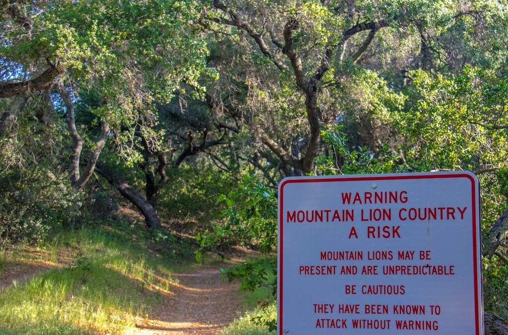
Just like with bears, it is important to always try to hike with a partner and make a fair amount of noise as you move so that you will not surprise a mountain lion as you trek. It’s also important to try not to hike during dawn or dusk. That is when mountain lions are at their most active.
If you do come across a mountain lion there are a few key things to remember. First, try to make yourself look big and, if you have a child with you, pick them up so that you both look bigger to the mountain lion. Then, make a lot of noise and move your arms around. Do not run! Finally, do not crouch down or turn your back on the mountain lion so that you don’t trigger its predator response.
There are a number of options for places to stay that range from the rough and tumble to the luxurious. While there are plenty of camping opportunities to be found in the park, you can also opt to backpack into some of the more off-the-beaten path areas of the park. Or, you can stay in state park- or privately-run cabins for a more comfortable night’s sleep.
The state park hosts two campgrounds, the Green Valley Campground and the Paso Picacho Campground.
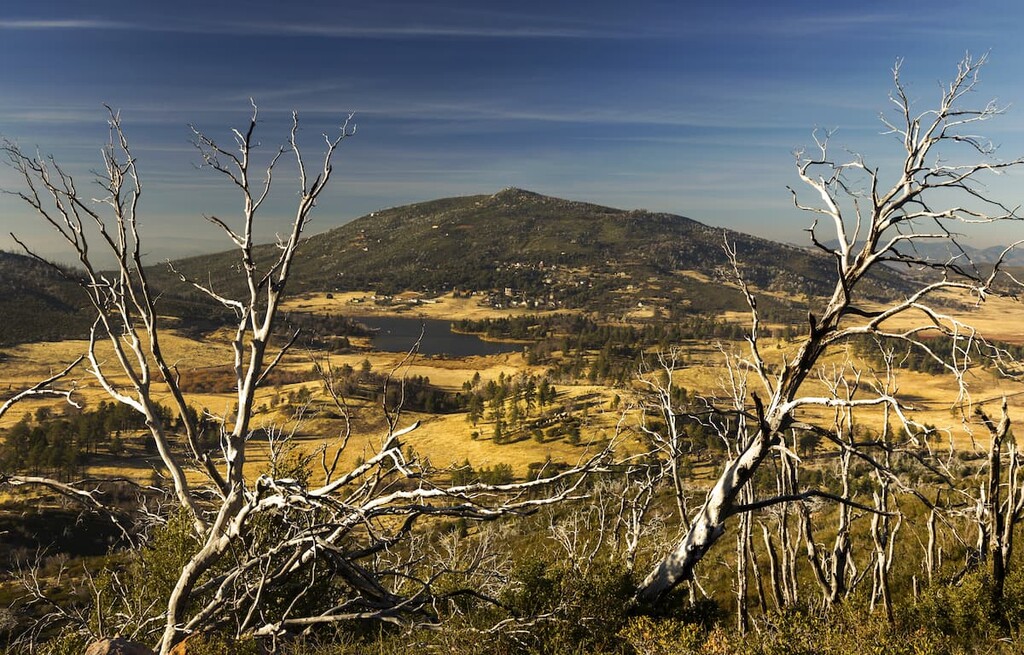
The Green Valley Campground sits at an elevation of around 4,000 feet (1,219 m) and the Sweetwater River runs through it’s 81-campsite area. The Paso Picacho Campground sits at about 5,000 feet (1,524 m) in elevation and it’s located just west of Stonewall Peak to the south of Cuyamaca Lake. This campground operates year round and has 85 campsites.
There are also a number of RV campgrounds in the area, the closest of which is located at the Cuyamaca Lake just outside of the state park boundaries.
You can stay, by reservation, at two different backcountry campsites—Granite Springs or Arroyo Seco—in the park.
Visitors have the option to either backpack or horse pack into these sites. Both sites have chemical toilets, non-potable water, corrals and tent sites. However, visitors need to remember to bring their own drinking water. Equestrians also need to remember to pack their own feed as grazing is not allowed in the park. These primitive sites can hold up to eight people and one group site can accommodate up to sixteen people.
Looking for a place to stay during your trip to Cuyamaca Rancho State Park? Here are some of the best cities and towns to check out near the park:
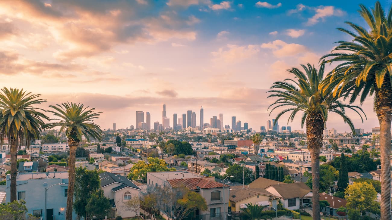
Los Angeles is about two and a half to three hours away from Cuyamaca Rancho, depending on traffic. But, it is an easy drive mostly down Interstate 5. While you could swing a day trip here from LA, the city is better as a stop-over one your way further south.
Cuyamaca Rancho State Park is only 40 miles (64 km) east of San Diego, or about a 45 minutes to an hour drive away. So, the park makes for a pleasant day trip from the city. The access to Cuyamaca from San Diego is simple as well as you only need to take Interstate 8 for about 30 minutes before entering the park.

If you are wanting to explore Cuyamaca Rancho State Park, but you want some of the comforts of home, Julian is your best bet. This small gold mining turned tourist town is a major byway for Pacific Crest Trail hikers. It even has dozens of restaurants, breweries, cider mills, wineries, antique and craft markets, bed and breakfasts, and hotels to keep you comfortable and entertained.