
Scan the QR code and open PeakVisor on your phone
Nestled in the heart of Inyo County, California, the Black Mountains are a chain of peaks in Death Valley National Park. The Black Mountains are home to 18 named peaks, the highest and most prominent of which is Funeral Peak (6,381ft/1945m).
The Black Mountains are actually part of the larger Amargosa Range System, which is a series of mountain ranges in Inyo County, California and Nye County, Nevada. The Amargosa Range System runs for approximately 110 miles (180km) along the eastern side of Death Valley National Park, separating the basin from the Amargosa Desert of Nevada.
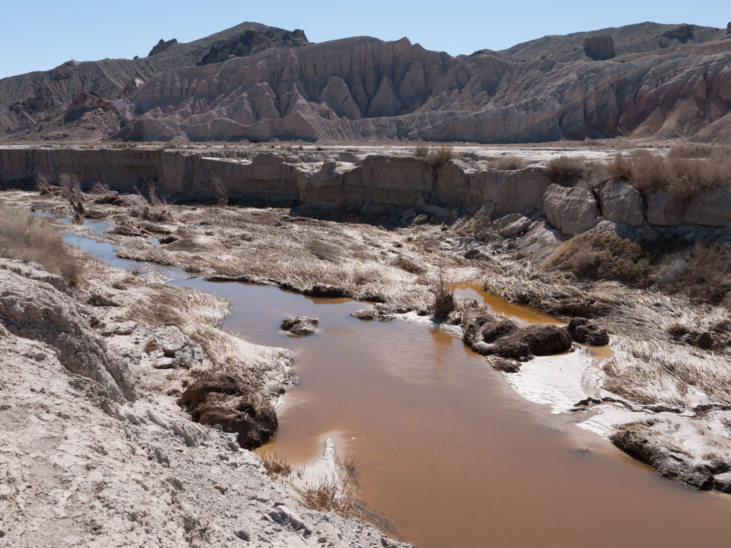
The Amargosa River, which is known for its distinctive U-shape, flows clockwise around the outskirts of the range system, ending at the lowest point in the United States - Death Valley’s Badwater Basin. In fact, the range is named for the river, which comes from the Spanish word “amargo,” or bitter. The river got this name due to its bitter tasting water, which is likely due to its alkaline pH.
As a part of the Amargosa Range System, the Black Mountains are sandwiched in by the Greenwater Range and the Funeral Mountains to the north and the Owlshead Mountains to the south on the other side of the Armagosa River.
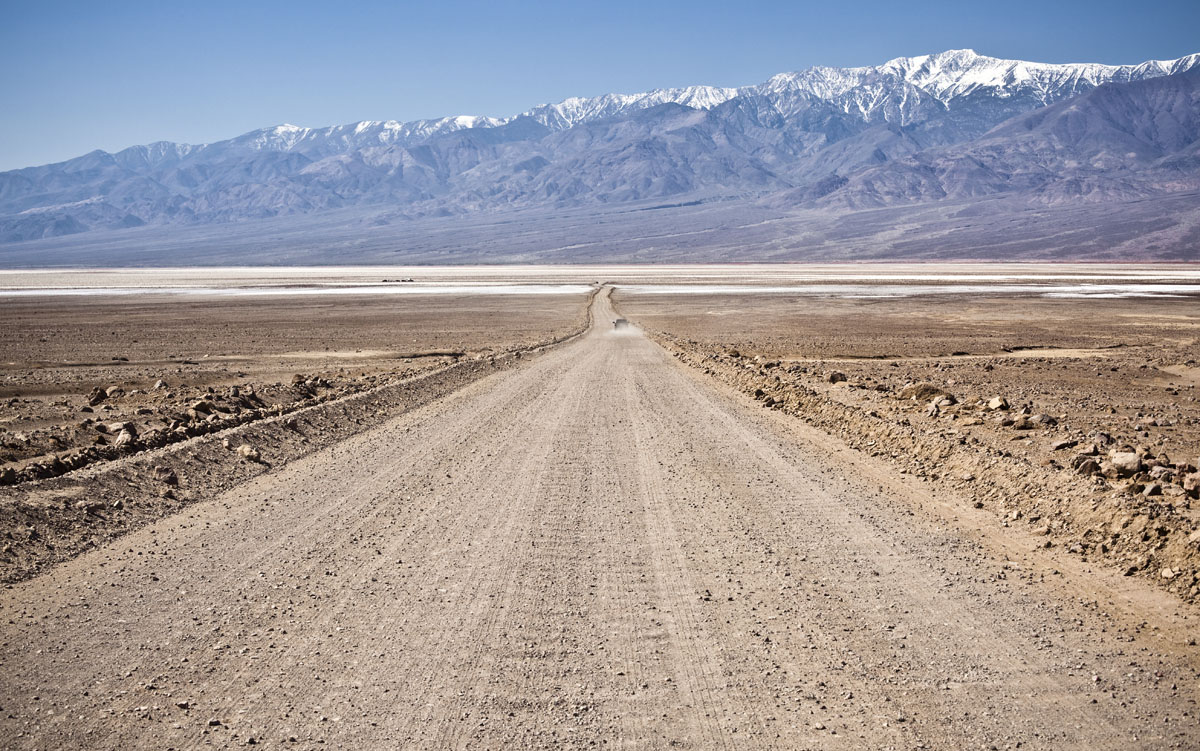
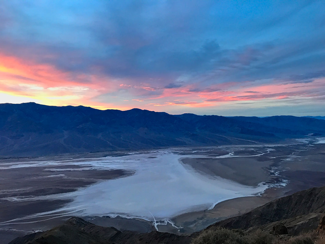
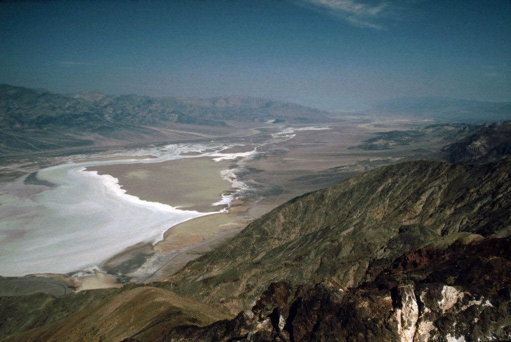
Perhaps the most recognizable feature in the Black Mountains of California is Dante’s View - one of the most popular attractions in Death Valley National Park. Dante’s View (5,492ft/1,674m) is a terrace viewpoint situated at around 5,476ft (1,669m) on the northern flanks of Coffin Peak (5,511ft to 1680m). The viewpoint overlooks Death Valley and Furnace Creek, some 16 mi (25km) to the north.
When at Dante’s View, visitors are treated to panoramic vistas of the Death Valley Basin. Looking to the south, hikers can see the Owlshead Mountains and to the North, the Funeral Mountains rise above Furnace Creek. Toward the west, Visitors can even see the Panamint Range and its tallest mountain - Telescope Peak.
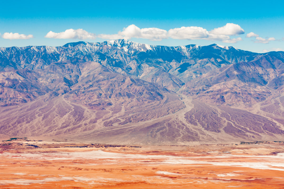
Those among us with a little luck can even see Mount Whitney (14,498ft/4,419m), the tallest mountain in the United States, from Dante’s View. Such a view is a rare sighting, but those lucky enough to see it can say that they’ve seen both the highest and lowest points in the Lower 48 States all at the same time - a rare privilege!
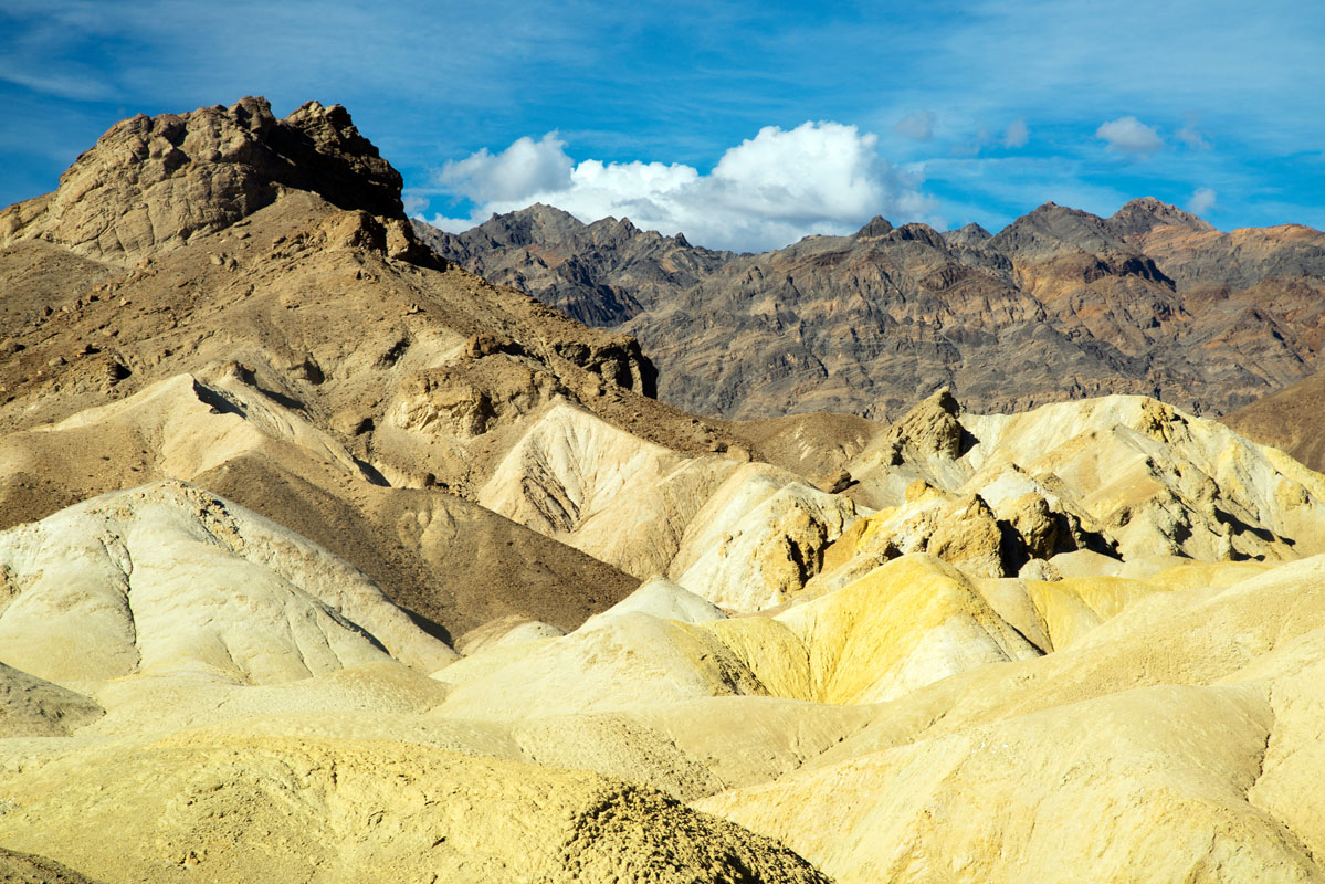
Geologically, the modern Black Mountains come from a series of ancient volcanoes, dating back to the Mesozoic era. The mountains that we now call the Black Mountains were formed when the Earth’s surface stretched and ruptured, allowing lava to flow and deposit sedimentary rock to create the modern landscape.
In more recent history, the Timbisha people, federally recognized as the Death Valley Timbisha Shoshone Band of California, have lived in the Death Valley region for at least a thousand years, learning to live and grow in an otherwise harsh landscape. These days, however, the Black Mountains are part of Death Valley National Park, which is managed by the US National Park Service as a place of outdoor recreation.
The Black Mountain’s location as part of Death Valley National Park means its a great place to get out and adventure. That being said, there are only a few maintained trails in the park, so if you want to get off of the beaten path, it’s not hard to find some solitude in these hills. Here are some of the best places to hike in the Black Mountains:
As we’ve already mentioned, Dante’s View is one of the most stunning places in the Black Mountains. Panoramic views await anyone who makes the trip, though, t be fair, it’s not a terribly strenuous adventure. In fact, you can drive up to Dante’s View from Furnace Creek to the road’s end.
However, if you want to leave the crowds behind, there are quite a few trails that extend from the parking lot up to the ridge. These trails are all relatively unmaintained and none extend for more than a mile long, but they offer better views with fewer people, so it’s well worth the effort. Just don’t forget to bring a warm layer as the elevation and high winds at Dante’s View means its quite cold up there!
The tallest and most prominent mountain in the Black Mountains, Funeral Peak is a relatively straight forward off-trail adventure into the hills. Although there’s no trail to the top, the peak itself is located quite close to the Greenwater Valley/Furnace Creek Road.
From the closest point at the road, one can beeline straight for the peak, walking up the gently sloping ridge on Funeral Peak’s eastern flank. The total trip is just over 8 miles (13km), round trip, and the elevation gain is about 2,460 feet (750m), so it makes for a nice day hike away from the crowds.
Death Valley National Park and the Black Mountains are remote, to say the least. Within the park, you’ll want to stay in one of the lodges, developed campgrounds or set out on a backcountry adventure. Despite the park’s remoteness, however, it is with a few hour’s drive of a number of major cities. Let’s take a look at them here:
The city of casinos and gambling is just about two hours by car from some of the most stunning wild landscapes in the United States. Vegas is a great place to fly into to start an adventure in the Black Mountains as flights, hotels, cars, food, and gas are very cheap in the city.
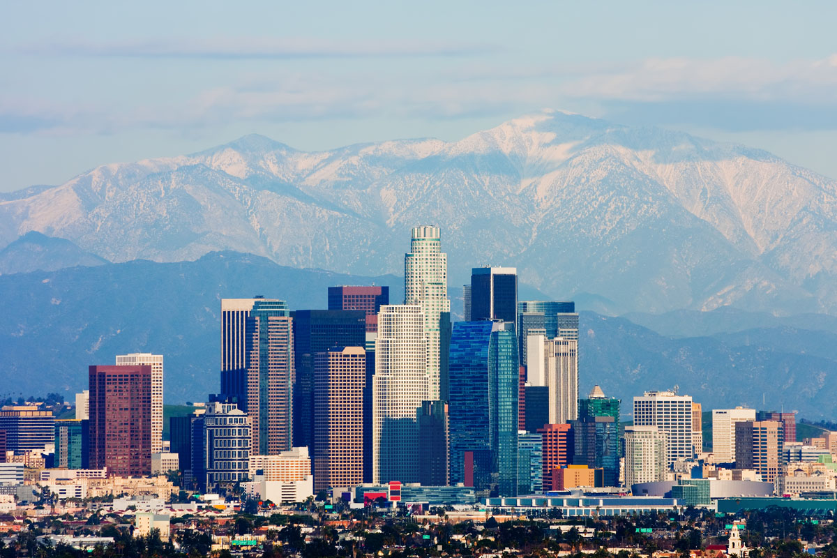
LA, as it’s affectionately known, is one of the largest cities in the United States and it just so happens to be only three and a half hours from the Black Mountains, provided you don’t run into any traffic, of course. It’s easy enough to fly into LA to start your adventure in the Black Mountains, so it’s a great starting point option for international visitors.


western-state-climbers
western-state-climbers-emblem
desert-summits-book
bartells-death-valley
sierra-club-desert
western-state-climbers
western-state-climbers-emblem
desert-summits-book
bartells-death-valley
sierra-club-desert


