
Scan the QR code and open PeakVisor on your phone
Mount Tamalpais Watershed has 23 named peaks. The highest is Mount Tamalpais East Peak at 784 m. Other notable peaks include Mount Tamalpais West Peak, Mount Tamalpais Middle Peak and Rocky Ridge.
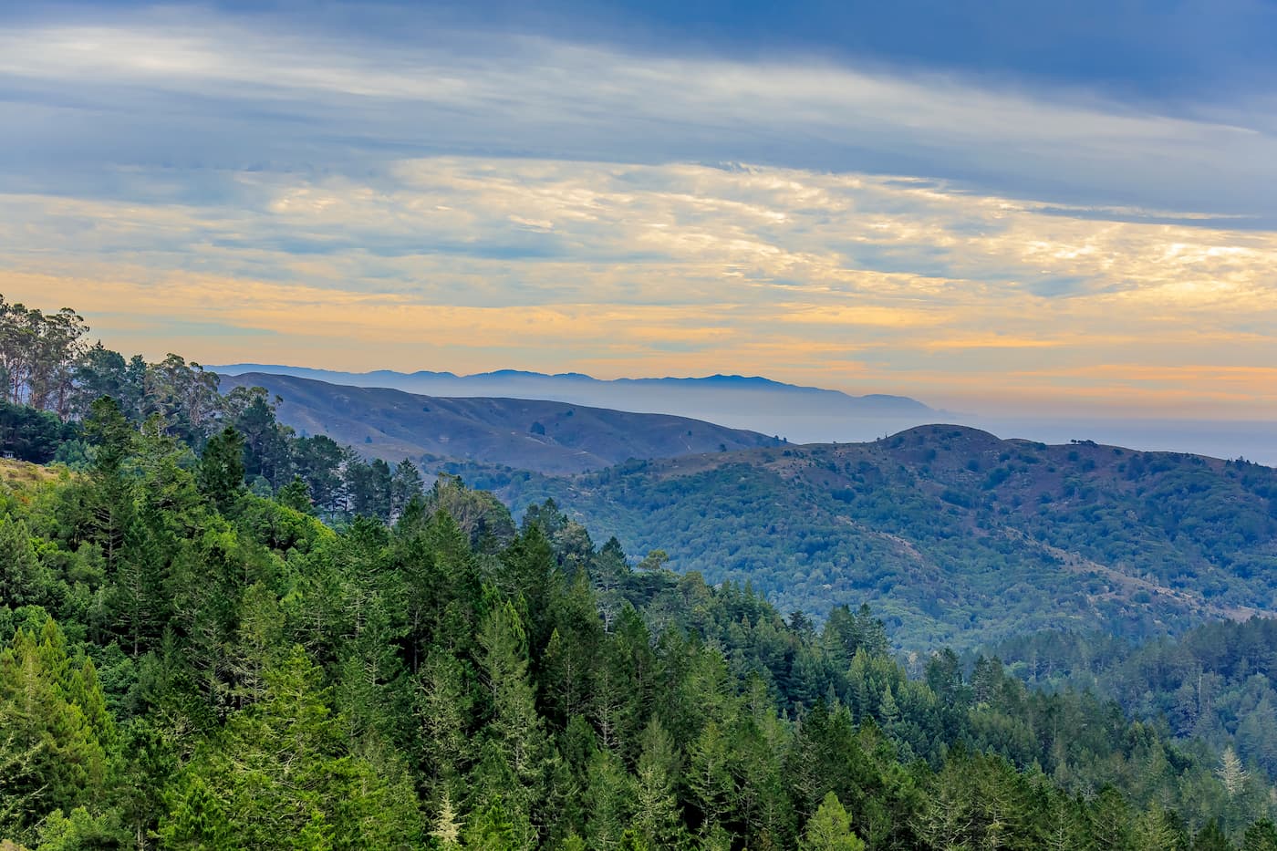
Known for its steep and rugged peaks, the Mount Tamalpais Watershed is located in the northern part of the San Francisco Bay Area in the US state of California. It contains 13 named mountains, the highest and most prominent of which is Mount Tamalpais West Peak (2,579ft/785m).
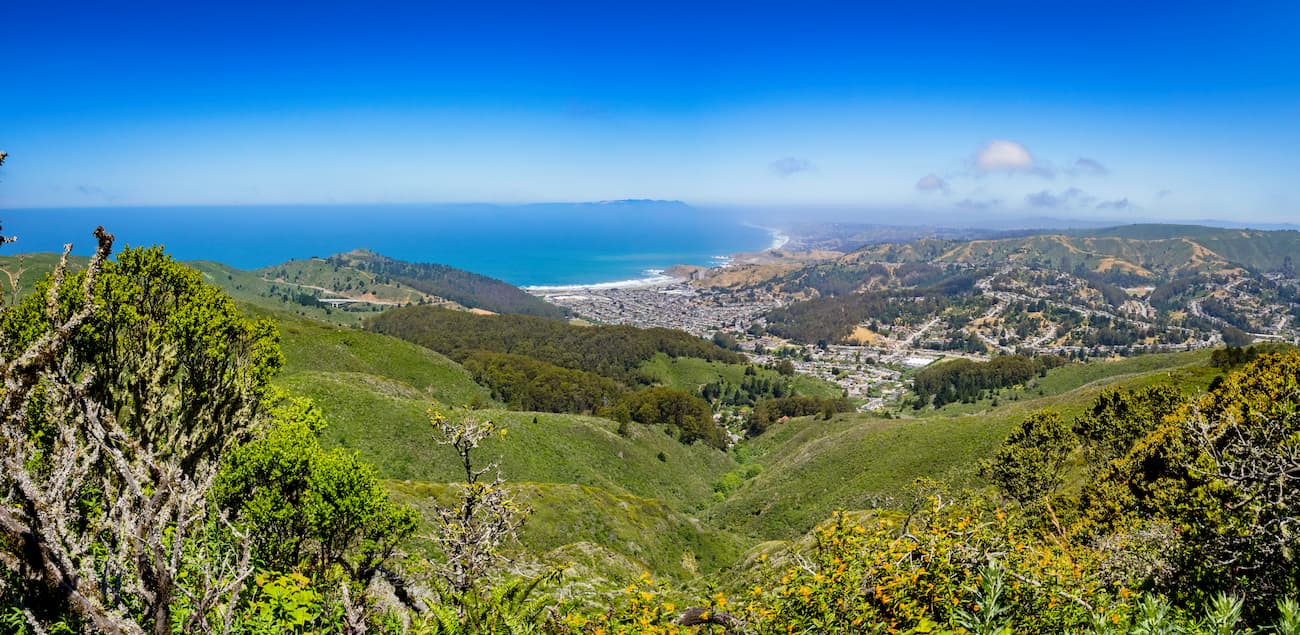
The Mount Tamalpais Watershed is located in Marin County, which is just across the Golden Gate Bridge from the city of San Francisco. It is located to the east of Point Reyes National Seashore, the Phillip Burton Wilderness Area, and the Greater Farallones National Marine Sanctuary. Additionally, the watershed is situated to the northeast of Mount Tamalpais State Park and to the east of China Camp State Park.
Both the watershed and the nearby state park are centered around Mount Tamalpais and its many peaks, including Mount Tamalpais West Peak, Mount Tamalpais East Peak, and Mount Tamalpais Middle Peak. In fact, there is quite a bit of controversy around which of the peaks is the tallest, though it is generally agreed that the West Peak is the highest in the Mount Tamalpais massif.
The mountains in the Mount Tamalpais Watershed are part of the Northwest US Coast Ranges, which were formed as a result of the subduction of the North American Plate under the Pacific Plate along the San Andreas Fault.
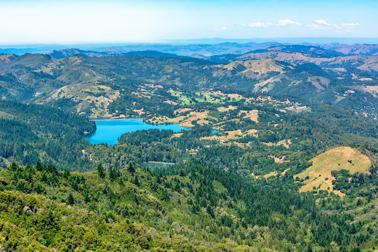
As a watershed, the Mount Tamalpais Watershed serves as a drainage basin for all rainfall on the southern side of Mount Tamalpais. The steep slopes of the mountain forces water down into Arroyo Corte Madera del Presidio, a short stream that flows from Marin County to Richardson Bay, which is a shallow arm of the greater San Francisco Bay.
Richardson Bay is one of the most ecologically important parts of the northern San Francisco Bay, as it is a pristine estuary that supports large areas of eelgrass and large intertidal habitats. It is a vital feeding and resting location for birds that are pelagic (live in the open ocean) and estuarine (coastal).
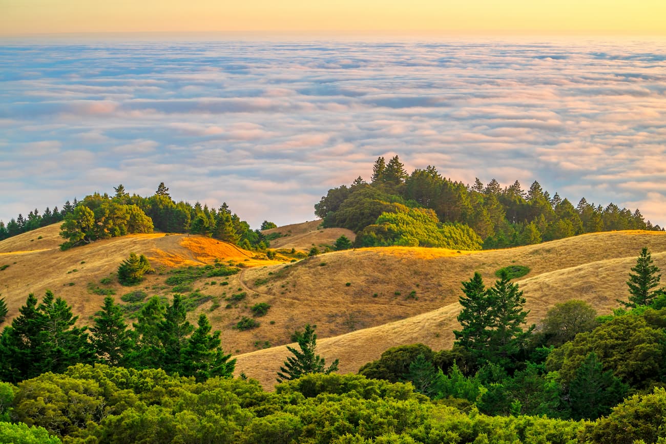
The Mount Tamalpais Watershed is home to a unique collection of microclimates, which are dominated by cool, foggy conditions at lower elevations and hot, dry conditions at higher elevations.
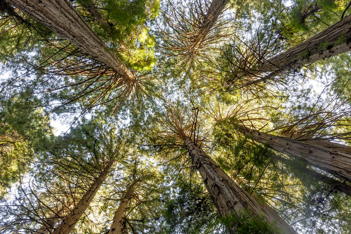
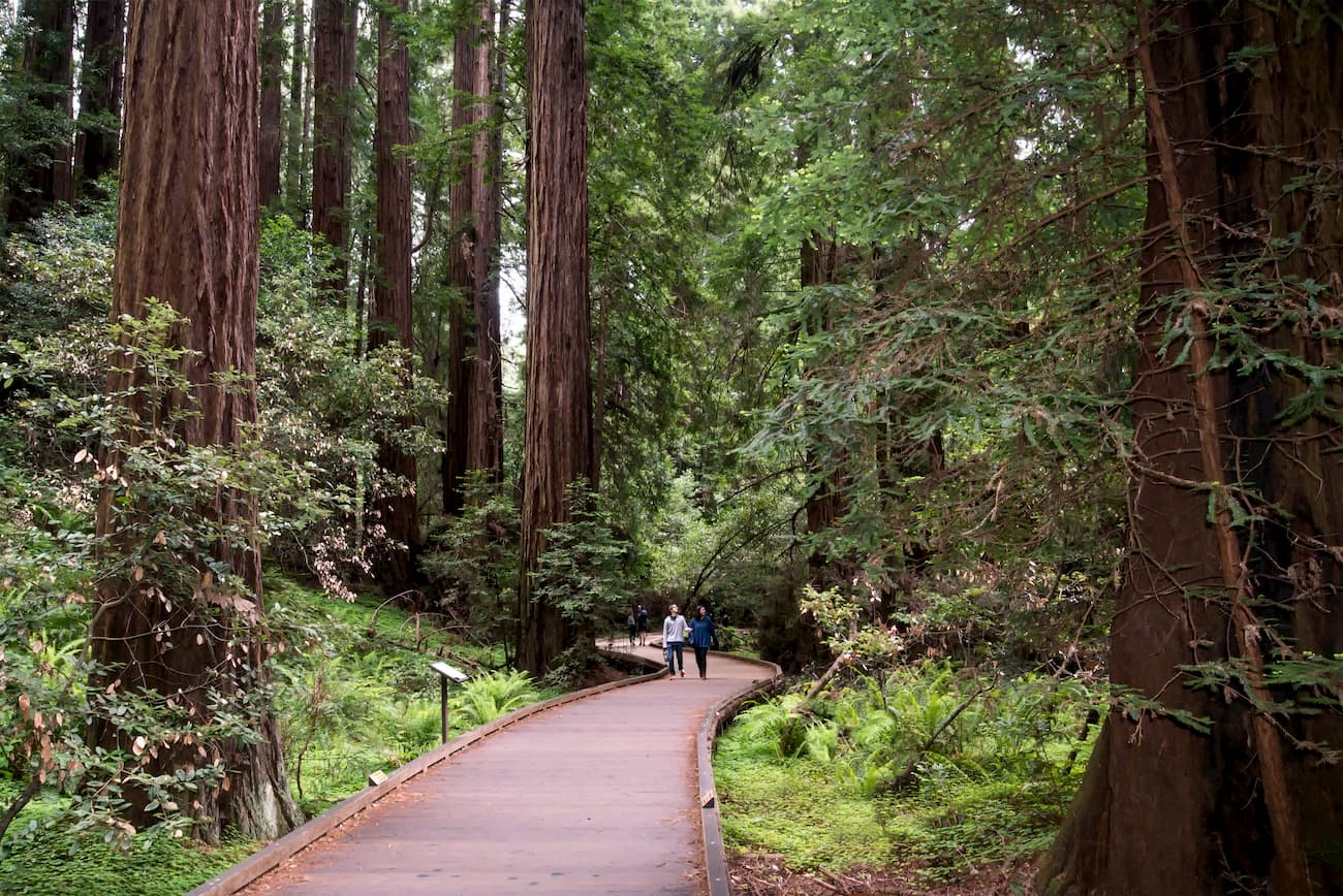
The lower valleys of the watershed feature redwood forests that are supported by 39.4-47.2 inches (1-1.2m) of rain a year. Most of the higher elevation slopes in the region are dominated by manzanita species and receive just over half of the total rainfall found in the valleys.
Interspersed within the manzanita communities, there are also hardwood forests of California oak, coast live oak, and madrone. Additionally, there are some small communities of mixed evergreen forests around the Alpine Lake region as well as some areas of grasslands at lower elevations.
The Mount Tamalpais Watershed is ecologically important as a source of habitat for coastal and pelagic birds that flock to the San Francisco Bay to feed and rest. It is also one of the last wildlife refuges in the San Francisco Bay Area, serving as a home for a great mix of mammals, amphibians, and birds. While the watershed is home to many rare and endangered species, perhaps the most commonly spotted large mammal is the black-tailed deer.
The region in and around the Mount Tamalpais Watershed has been home to human inhabitants for thousands of years. The Coast Miwok and their predecessors consider the region to be part of their ancestral homelands.
Sir Francis Drake and his crew were likely the first Europeans to land in the region in 1579, which set the stage for subsequent European settlement over two centuries later. The Spanish founded their first mission in the area, Mission San Rafael Arcángel, in 1817. After the mission was founded, a significant portion of the Coast Miwok population was wiped out due to a combination of introduced European diseases, violence, and forced labor.
The watershed is located within Marin County, which was one of the original 27 counties in the state of California, having been created in 1850 after the adoption of the California Constitution. As a result of the exponential growth of the cities in the San Francisco Bay Area, Marin County and the Mount Tamalpais Watershed have become some of the most sought-after home locations in the state.
The region was home to the Mount Tamalpais and Muir Woods Railway from 1896 to 1930. This railroad zig-zagged its way to the summit of the peak from the city of Mill Valley. It was a popular tourist attraction until a road was created in the early 20th century, which then took away most of the train’s regular ridership.
There was also a small Air Force Station, the Mount Tamalpais Air Force Station, in the region that was built in the aftermath of the Second World War. It was even home to a weather station, which supplied important data to the US Weather Bureau.
Mount Tamalpais and its steep slopes are considered to be the birthplace of mountain biking. It was a particularly popular location for major early proponents of the sport, including Charlie Kelly, Joe Breeze, and Gary Fisher.
These days, the region is a popular destination for outdoor recreation. Mount Tamalpais State Park was founded in 1963 and has become a hub for hikers, horseback riders, and bikers in the northern Bay Area. Moreover, the region is home to the annual Dipsea Race, which climbs up and down Mount Tamalpais from the city of Mill Valley all the way to nearby Stinson Beach.
The Mount Tamalpais Watershed is home to dozens of miles of hiking trails. Here are some of the best hikes to check out during your next visit:
The official Dipsea Race Course covers 7.4 miles (11.9km), though the trail itself covers 6.6 miles (10.6km) of terrain from Mill Valley to Stinson Beach. It starts out with a steep climb of 688 stairs as you leave from the town of Mill Valley and head toward the peak of Mount Tamalpais.
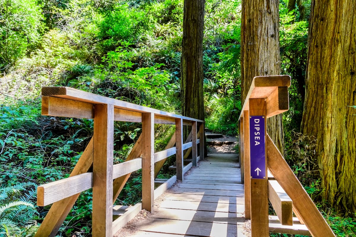
From there, the trail takes you to the top of Cardiac Hill, where it starts to transition into rolling terrain in a wooded area before giving you great views of the surrounding region. If you’re looking to do a thru-hike of the Dipsea Trail, you’ll want to organize your own car shuttle to get you from Stinson Beach back to Mill Valley. Otherwise, you can do a “Double Dipsea” for twice the fun!
The Redwood Creek Trail is a 7 mile (11.3km) round-trip hiking path that offers a great way to see much of what the Mount Tamalpais Watershed has to offer. It starts at the Muir Woods Visitor Center and takes hikers through redwood forests and up into an open cleaning for good views of the region before descending back down to the visitor’s center.
Looking for a place to stay near the Mount Tamalpais Watershed? Here are some good options:
Mill Valley is a city of around 14,000 people located just north of the Golden Gate Bridge. It offers the best access to the Mount Tamalpais region and is the starting point for the Dipsea Trail. Mill Valley is easy to get to by road from the major airports of the San Francisco Bay Area and it has plenty of hotels, restaurants, and other lodging options for visitors.
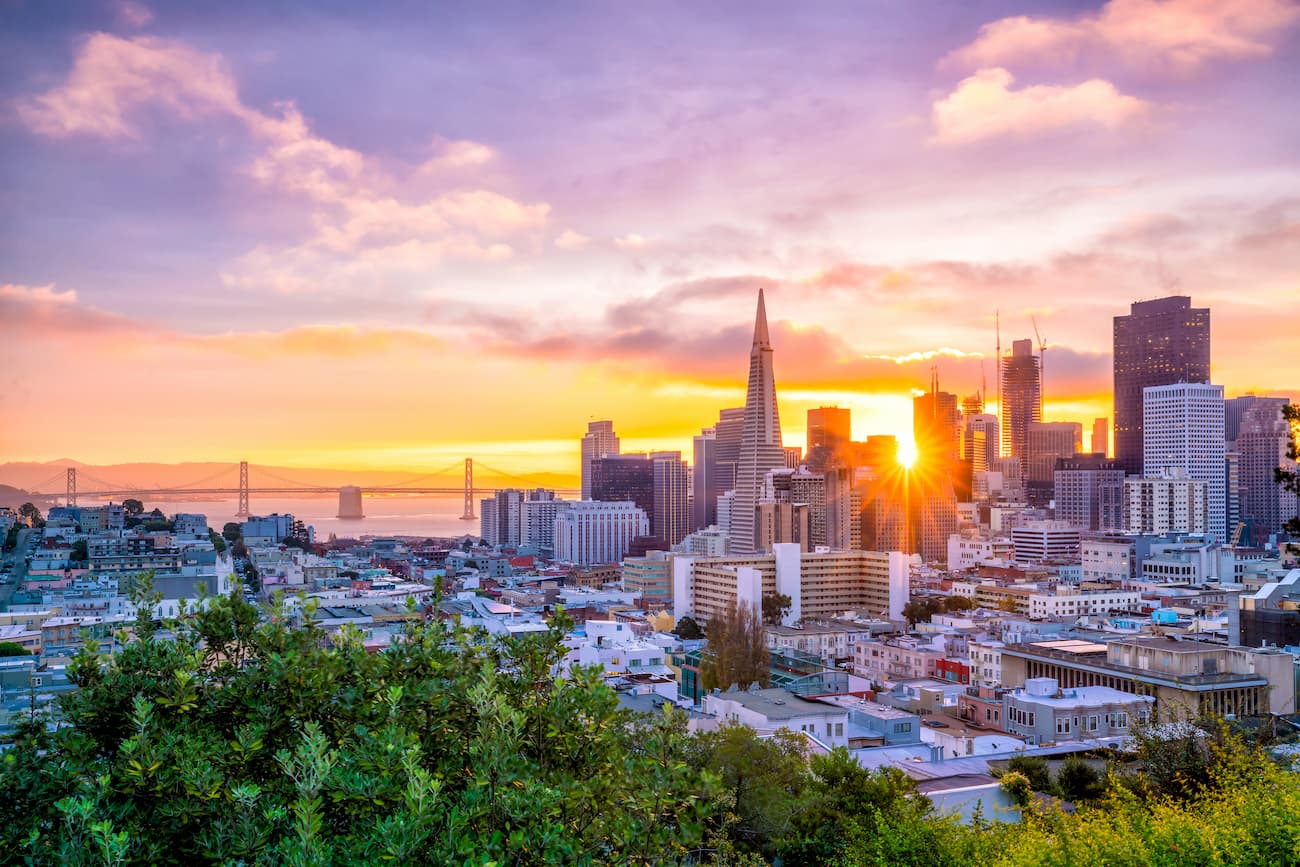
San Francisco is the cultural center of northern California and it is situated on the western edge of the San Francisco Bay. It is the state’s fourth-largest city with over 800,000 residents and is a popular tourist destination. San Francisco is a short drive from the Mount Tamalpais Watershed and offers good connections to other major cities around the world through its major international airport.


The highest peak in Mount Tamalpais Watershed is Mount Tamalpais East Peak, at 784 m.
Notable peaks in Mount Tamalpais Watershed include Mount Tamalpais East Peak, Mount Tamalpais West Peak, Mount Tamalpais Middle Peak, Rocky Ridge and Bolinas Ridge.


