
Scan the QR code and open PeakVisor on your phone
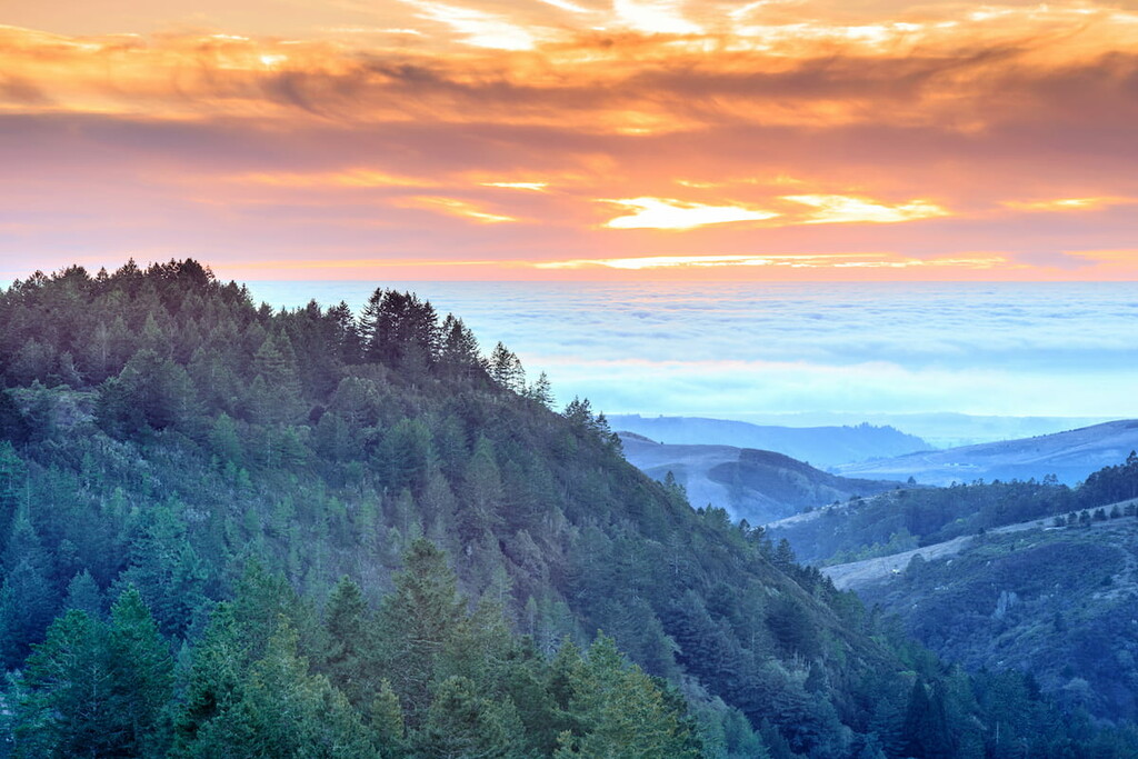
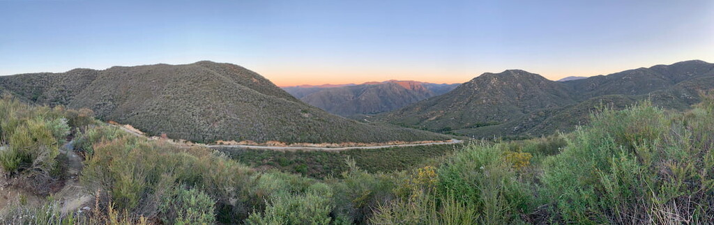
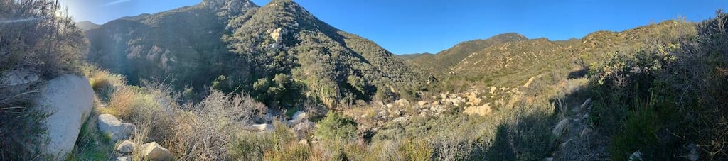
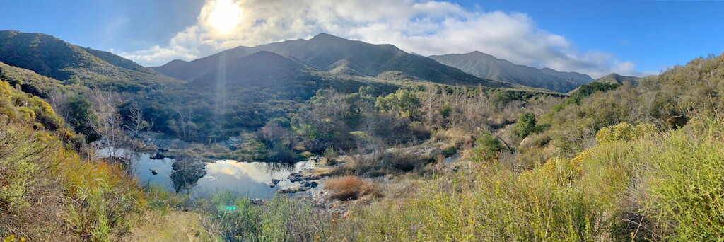
The San Mateo Canyon Wilderness is a rare and pristine 37,000-acre wilderness area located in the Santa Ana Mountains and Cleveland National Forest in Riverside County, California. This relatively untouched chaparral and coastal sage dominated landscape is one of the best places to beat the pace of city life and its diverse landscape is perfect for birdwatching, hiking, horse riding, and hunting.
The San Mateo Canyon Wilderness is home to 139 bird species, 37 mammal species, 46 reptile and amphibian species, seven species of fish. It is common to hear a multitude of bird songs in the canyon, as well as see a variety scat from coyotes to skunks, and hear a variety of frogs chirp throughout San Mateo Creek. It is also common to see field mice, quails, steller's jays, or western fence lizards, among others during a day hike.
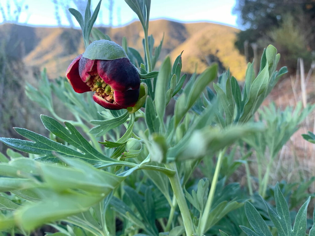
The Canyon is also home to a diversity of micro-climates as you move up and down the canyon. Often damp and cool in the canyon regions in the morning, the canyon quickly warms up as you hike up its dynamic typography to or around one of it four main peaks; its namesake, San Mateo Peak (3593 ft), Sitton Peak (3248 ft), Elsinore Peak (3563 ft), or Miller Peak (2940 ft - there is no trail to the summit of this mountain). Many deep drainages hide a lush growth of vegetation, with oak woodlands thick in the lower elevations. Spring brings a wealth of wildflower blooms. Summers tend to be very hot and dry, though you will probably find small pools in San Mateo Canyon most of the year.
The first inhabitants of the San Mateo Canyon region were the Acjachemen and Luiseño tribes. The Spanish later established ranchos in the area and used the San Mateo creek's usually perennial flow as a source of irrigation water. In the late 19th century, there was a gold rush in the upper watershed.
The San Mateo Canyon Trail follows along the approximately 22 mile long, southwesternly flowing San Mateo Creek in the heart of the wilderness and provides the backbone to the entire wilderness area. The San Mateo Creek runs both high and low throughout the year depending on rainfall and is a crucial element of the canyon’s ecosystem.
Draining a broad valley bounded by the Santa Ana Mountains and Santa Margarita Mountains, San Mateo Creek is notable for being one of the last unchannelized streams in Southern California. One of the least developed watersheds on the South Coast, San Mateo Creek's drainage basin covers 139 square miles.
Most of the little development in the watershed is now used for agriculture and the area around the wilderness is notably surrounded by ranches. The San Mateo Creek watershed includes the subwatersheds of Los Alamos Canyon Creek, Tenaja Canyon Creek, Devil Canyon Creek and Cristianitos Creek with its tributaries of Talega and Gabino Creeks.
Although grazing activities have hurt the biological quality of the semi-arid, Mediterranean-climate watershed, it still supports numerous biological communities including riparian zones, grassland and coastal sage scrub. A population of steelhead trout has recently been identified in the creek, which is affected by continuing groundwater pumping, and which may have been minimally impacted by minor agricultural runoff prior to cessation of farming activities along the stream aboard Marine Corps Base Camp Pendleton.
The Steelhead Trout of the San Mateo Creek are an anadromous form of rainbow trout, meaning that they rely on the San Mateo Creek’s watershed to return to for breeding. Compared to their Rainbow Trout siblings who stay in freshwater creeks and streams throughout their lives, the Steelhead Trout can live up to 5-years in the ocean. While living in freshwaters streams these two trout look the same, however, when the Steelhead Trout go to the ocean they lose their rainbow coloring and replace it with a silver color and they grow to be larger than their Rainbow Trout counterparts. However, once they return to their freshwater breeding zones, they quickly gain their rainbow color again. Unlike Salmon that often die after breeding, the trout can stay alive after the endeavour and Steelheads often return to the ocean. The trout of the San Mateo Creek are an important measure to the creek’s health and a number of local initiatives are focused on ensuring the trout’s and the stream’s survival.
Fisherman’s Camp is so named as a result of the canyon’s superb fishing. In the 1950’s the canyon attracted many anglers and provided the impetus for the US Government to set aside the San Mateo Canyon as a protected wilderness area. In a way, you could say the trout saved the canyon.

Mountain lions are incredibly rare, but at times present in the canyon wilderness. If you see a mountain lion do not approach it, crouch down, run from it or make any sudden moves (this will instigate its predator response). Instead you should stand tall and try to make yourself look bigger. If you have a child with you then pick them up to make yourself look bigger as well. If you are attacked, fight back.
Rattlesnakes are present in the Canyon wilderness, but do not pose a huge threat to hikers. Typically shy, they avoid humans and will not strike unless provoked. They are an incredibly important part of the canyon’s ecosystem and eat a variety of bugs and rodents.

Depending on the trail you take you should be aware of ticks in the wilderness. While most of the more trafficked trails will be cleared enough that ticks should not be a problem, the more remote trails will require hikers to navigate through brushy conditions, making the risk of getting bitten by a tick higher.
Annual rainfall averages 15 to 20 inches in the canyon, most of it falling in winter and early spring; flash floods rip through narrow canyons in heavy downpours. Be sure to check the weather before any visit as wilds and rains in the canyon can create dangerous conditions.
The San Mateo Wilderness South Area is a developed campsite just outside of the wilderness area in the Cleveland National Forest. A fee is required and reservations are needed during peak season.
Backcountry camping is possible but you must check with the local ranger district before doing so. Campfires are not permitted within the wilderness.
The San Mateo Canyon Wilderness is lovingly maintained by local rangers and volunteers. As such, much of the trail maintenance and signage is often better than it is in the surrounding Cleveland National Forest. Even when signage is not as prevalent, cairns are often placed to indicate the trail's direction, especially across streams and rocky pathways.

Both Horses and dogs are allowed on the trail in the San Mateo Canyon, however, dogs must be kept on a leesh. Entrance to the wilderness is free. The only requirement is that visitors sign in at the trailheads. Mountain biking is not permitted on the trails.
The San Mateo Canyon Trail is a 7.5 mile east to moderate one way hike (14 mile out and back) with 1340 ft of elevation gain. You can access the trail by taking Interstate 15 to Clinton Keith Road west towards the wilderness and turning onto Tenaja Road into the wilderness area. The San Mateo Canyon Trail is notable for being the most rugged and remote of the trails in the wilderness as it follows through the heart of the canyon along San Mateo Creek.
The Lucas Canyon Trail is an 11.1 mile moderate to strenuous trail with 2000 ft of elevation gain and 3200 ft of elevation loss. The trail can be accessed via the Sitton Peak Truck trail and is incredibly steep at its entrance/exit point.
The Morgan Trail is a 4.2 mile moderate trail with 720 ft of elevation gain that is accessible from Highway 74 and 2.8 miles down the South Main Drive road or via the Bear Canyon Trail. From the trailhead on South Main Drive road, the trail descends into Morrell Canyon and then goes on to traverse a broad ridge near some privately owned land before traversing Round Potrero and meeting with the junction of the Bear Canyon Trail. You can either go north to meet Highway 74 or south and continue along the Bear Canyon Trail.
The Tenaja Trail, not to be confused with the Tenaja Falls Trail is a 3.5 mile trail with 1300 ft of elevation loss and gain. Starting from the Fisherman’s Camp Trailhead the lower trail connects to the San Mateo Canyon Trail and can be extended to a 10.6 mile loop if you follow a mile along the San Mateo Canyon Trail and then loop with the Morgan Trail.
This popular, well trodden trail is only .7 miles from it’s trailhead and can be extended into a 6.1 mile trail if connected with the Morgan Trail. It is a moderate trail with only 300 feet of elevation gain. The access to the trail is the same to the San Mateo Canyon Trail. Tenaja Falls is a dramatic scene when water levels are high and is surrounded by large boulders and great landscapes. It is a popular hike for families, short day trekkers and beginner hikers.
Oak Flats is an easy 1 mile trail with minor elevation gain. The trail serves as a connector for the Verdugo to the Lucas and Bluewater Trails. The trail is notable for its Oak rimmed grasslands.
The Verdugo Trail is a 3.3 mile moderate to strenuous trail with 700 feet of elevation gain. The trail starts at Four Corners and descends into the San Mateo Canyon to connect with the Lucas Trail.


