
Scan the QR code and open PeakVisor on your phone
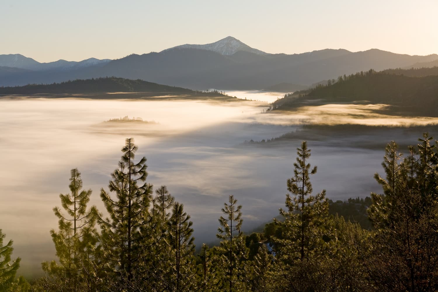
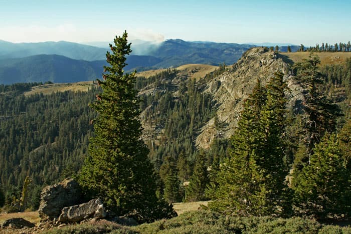
Featuring rugged mountains and dense forests, the Yolla Bolly-Middle Eel Wilderness is a federally protected wilderness area in the northern part of the US state of California. It is home to 24 named mountains, the highest and most prominent of which is South Yolla Bolly (8,084ft/2,464m).
The Yolla Bolly-Middle Eel Wilderness is located within Mendocino, Trinity, and Tehama Counties to the northwest of the Sacramento Valley. It is included within three different national forests - Mendocino National Forest, Shasta-Trinity National Forest, and Six Rivers National Forest - each of which shares the responsibility of managing it, alongside the Bureau of Land Management.
Yolla Bolly-Middle Eel is located to the north of the Snow Mountain Wilderness, the Berryessa Snow Mountain National Monument, and the Jackson Demonstration State Forest. To the north, the wilderness is bordered by the rest of the Shasta-Trinity National Forest.
The King Range Wilderness Area, the Elkhorn Ridge Wilderness, the Mount Lassic Wilderness, and the Humboldt Redwoods State Park are all located west of the Yolla Bolly-Middle Eel Wilderness. Meanwhile, Lassen National Forest and Lassen Volcanic National Park are all situated to the east of Yolla Bolly-Middle Eel on the opposite side of the northernmost section of the Sacramento Valley.

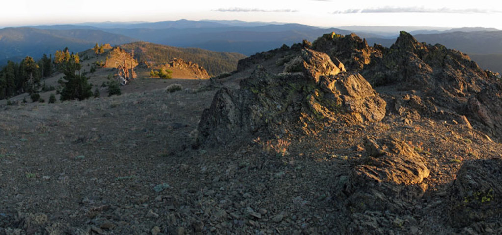
The peaks in the Yolla Bolly-Middle Eel Wilderness are part of the Northwest US Coast Ranges, which extends from California, through Oregon and Washington to the southern part of British Columbia in Canada.
Within the wilderness, most of the rocks are sandstones and serpentines typical of the Franciscan Complex, which extends throughout California, as far south as the Central Coast in parts of the California Ranges.
The area that is now the Yolla Bolly-Middle Eel Wilderness began to form some 150 million years ago as sediments accumulated on the ocean floor, before being uplifted into its current location. These days, the region is known for its many landslides, which are particularly common around its steep mountain slopes.
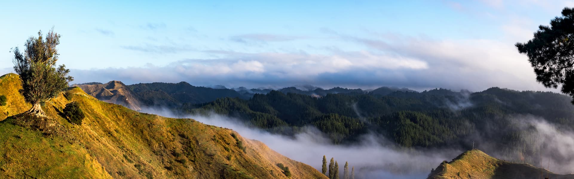
Much of the wilderness is covered in dense coniferous forests. The most dominant tree species in the region include Douglas fir, ponderosa pine, incense cedar, sugar pine, white fir, and red fit, alongside Jeffrey pine, western white pine, hemlock, black cottonwood, and the occasional yew. At lower elevations, the wilderness is home to some brushlands, oak woodlands, and dry meadows.
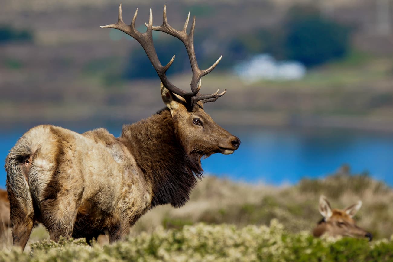
Like much of the Northwest US Coast Ranges, the Yolla Bolly-Middle Eel Wilderness is known for its diversity of wildlife. Lucky visitors to the wilderness get to see some of the many wild animals that roam the region, including wild turkey, Columbia black tail deer, bobcats, coyotes, marten, weasels, mountain lions, and black bears. There is also a healthy bird population in the wilderness, which includes an array of hawks, vultures, eagles, and even the northern spotted owl.
Both the Yolla Bolly-Middle Eel Wilderness and the surrounding National Forests are located on land that has been inhabited by humans for thousands of years. The region is the traditional homeland of a number of different groups, including the Maidu, Nomlaki Wintun, Yuki, and the Eastern Pomo, among countless others.
Northern California, particularly around the Mendocino National Forest Area became a popular location for mercury mining. At the same time, European and European-American settlers quickly realized the value of the vast timber reserves in the region, making the first timber sales in 1905 on what was then called the “Shasta Reserve.”
By 1927, the then-Chief Forester of the US Forest Service, William Greely, sought to protect some of the most pristine regions in the country as “primitive areas.” As a result, in 1931, the US Forest Service officially designated the Middle Eel-Yolla Bolla Primitive area, which covered some 107,000 acres (43,300 ha) of land.
With the passing of the 1964 Wilderness Act and the creation of the National Wilderness Preservation System, the primitive area was renamed as the Yolla Bolly-Middle Eel Wilderness and expanded to include over 180,000 acres (72,800 ha).
These days, the Yolla Bolly-Middle Eel Wilderness protects the headwaters of the Middle Eel River, which offers some of the best white water paddling in the region. It sees relatively little human traffic, making it a great place to adventure if you’re looking to get off the beaten path.
There are a few different hiking and backpacking trails in the Yolla Bolly-Middle Eel Wilderness, though some are less maintained than others. The region is remote, so all travelers to the Wilderness should be prepared to be wholly self-sufficient during their trip. Here are some of the best trails to check out in the Yolla Bolly-Middle Eel Wilderness:
The Ides Cove Loop National Recreation Trail takes hikers on a 10.5 mile (16.9km) loop around the base of Harvey Peak and South Yolla Bolly. It is perhaps the most heavily used trail in the region and is one of the best ways to access the more remote parts of the Wilderness.
The North Yolla Bolly Trail is a 3.2 mile (5.1km) hiking trail that skirts the base of North Yolla Bolly and offers fantastic views of the mountain. It ends at an intersection with the Cold Fork Ridge Trail, which is a great side trip into some of the Yolla Bolly-Middle Eel Wilderness’ old-growth forests.

Here are some of the best places to stay before or after your trip to the Yolla Bolly-Middle Eel Wilderness:
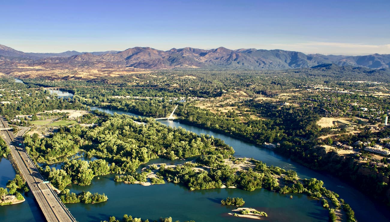
Redding is a city of over 90,000 people at the northern edge of the Sacramento Valley. It is a gateway to Northern California for people traveling from the Central Valley. Redding is well served by air, road, and train connections to the rest of California.
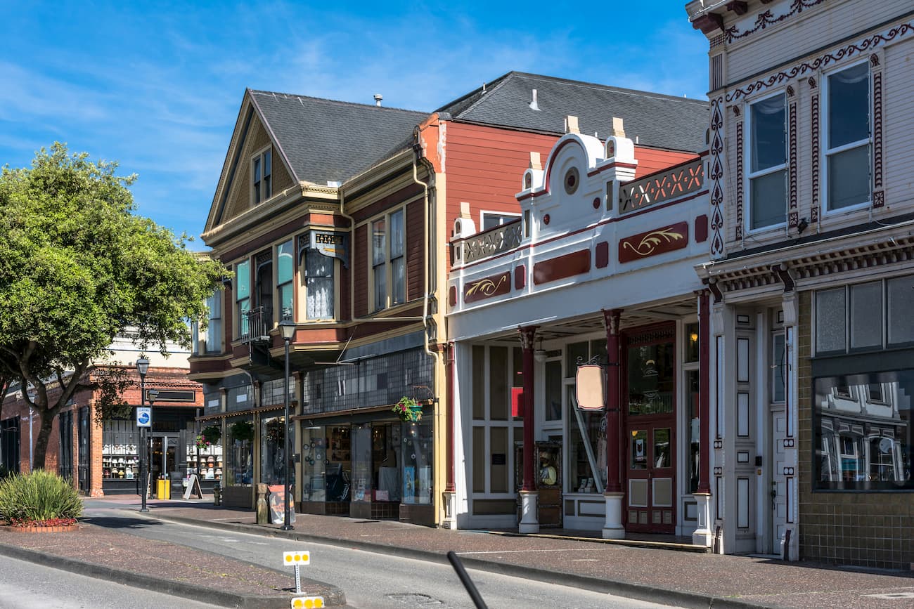
Eureka is located in the Redwood Empire region of California along the state’s northern coast. It is home to over 27,000 people and is the largest city along the coast between Portland, Oregon, and San Francisco. The city is a cultural and commercial center for the area. It has a full-service airport with connections to Los Angeles and San Francisco, as well as good road links throughout the state.
Sacramento is the capital city of California, as well as its sixth-largest city with a population of over 513,000 people. Although it is located quite a distance south from the Yolla Bolly-Middle Eel Wilderness, it is the closest big city to the wilderness and offers great transportation connections to the rest of the world.


western-state-climbers
western-state-climbers-emblem
chico-hiking-association
california-coastal


