
Scan the QR code and open PeakVisor on your phone
San Francisco City and County is home to 45 named mountains. The highest is Mount Davidson at 283 m.
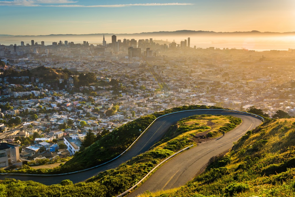
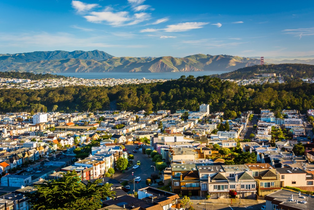
San Francisco is one of the two major cities and counties of the US state of California, on par with Los Angeles, located north of the latter on the shores of the eponymous San Francisco Bay in the Pacific Ocean. The main feature of the San Francisco mountains is its 45 named hills on some of which it was founded on June 29, 1776. The highest hill in San Francisco is Mount Davidson (283 m / 928 ft), but it is best known for its second-highest summit, Twin Peaks (297 m / 974 ft), which, in turn, became famous thanks to the American mystery series of the same name directed by David Lynch. But of course the Golden Gate Bridge brought even more fame to the “City in the Hills”, as it is also called. The city's unique bay location and hilly topography, as well as its layout and architecture, make it one of the most picturesque and inspiring places in the world, which is worth visiting (not) once in a lifetime.
San Francisco is named after the Catholic saint Saint Francis of Assisi, founder of one of the two largest monastic orders of medieval Italy and Europe, the Franciscans, also named after him (the second order is the Benedictines after Saint Benedict), who was originally from the town of Assisi in the province of Perugia in the Umbria region. The word "san" also speaks of the Spanish origin of the city and the state of California in general, which was part of Mexico, which, as in Italian, means a "saint".
San Francisco is also abbreviated simply as Frisco, San Fran or SF, Golden Gate City or Golden City, City in the Hills, Fog City, the Most European City in the US, and just The City. However, as this study shows, the locals themselves prefer to call the city by its full name and are annoyed when travelers call it by one of the abbreviated names in communication with them, leaving that right to themselves. It is like when someone calls you Johnny instead of John the first time you meet him.
San Francisco is the fourth most populous city in California (800,000+ inhabitants) after Los Angeles (3.8+ million), San Diego, and it's neighbor San Jose, and the 17th most populous city in the United States, located at the very tip of the San Francisco Peninsula in a relatively small bay with the same name on the west coast of the United States, washed by the Pacific Ocean.
At the same time it is also one of the 58 counties of California, whose neighbors on the administrative map of the state are San Mateo County in the south, which occupies the rest and most of the peninsula and hosts 57 more named mountains and hills; Marin County on the opposite, northern side of the San Francisco Bay; and Solano, Contra Costa, Alameda and Santa Clara on the eastern side.
However, the city has a land border only with San Mateo, from the rest it is separated by water. More precisely, the border between the two countries goes between the Outer Mission and Southern Hills neighborhoods, of which the former refers to San Francisco. If you know the city’s parks better, these are John McLaren Park and San Bruno Mountain State & County Park also north and south of the border, respectively.
There are all kinds of ways to get to San Francisco: fly to San Francisco International Airport from other cities in the United States and the world by direct flight; take the Amtrak train from Oakland, Emeryville, and Hayward or Greyhound bus from Los Angeles or the Northwest (Portland and Seattle); or come by water from neighboring counties or from abroad on a cruise ferry, as many of its first residents arrived to San Francisco.
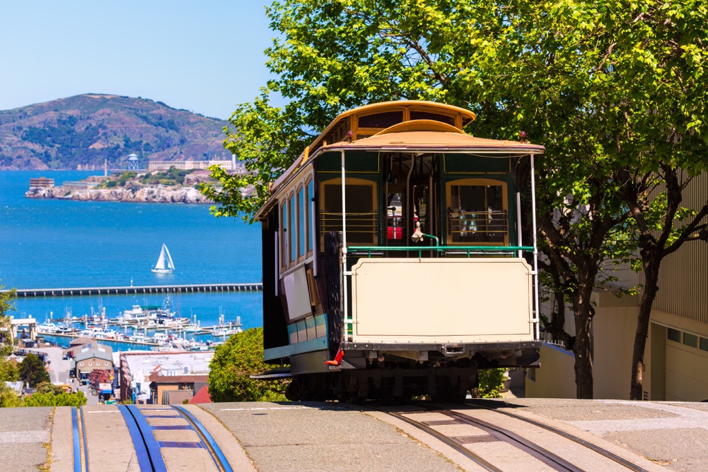
The most popular modes of transportation within the city, which are not found in most others in the country, are the European-like trolleybuses and the classic streetcars or cable cars. The latter are hand-operated and are essentially cable cars, which can also climb it's incredibly steep hills, something the city is also known for.
The city also has at least one classic funicular, a glass STC Aerial Tram to the Salesforce Park, a relatively new green rooftop public space at the top of the Transbay Transit Center in the Financial District of the Downtown San Francisco. A gondola lift is 45 m (148 ft) in length and 21 m (69 ft) in height holds 20 people at a time.
Another convenient way to get around San Francisco is by a light rail system Muni Metro with 117 stations covering the entire country, which, just like all other public transportation, is managed by the San Francisco Municipal Transportation Agency (SFMTA).
However, in my experience, the best way to explore the city is on foot. Yes, it’s slower, but it allows you to see the city in detail, unlike fast going public transportation.
In addition to the 45 named hills and higher mountains in the San Francisco Bay Area, about which I will tell you immediately below, the city’s landscape has many other features that make it world-famous. As usual, these can be divided into two large groups: natural and man-made. So now I’ll try to describe them in order of importance, although it’s damn hard, considering their beauty, uniqueness, and a large number, to help you navigate the city if you haven’t been there yet.
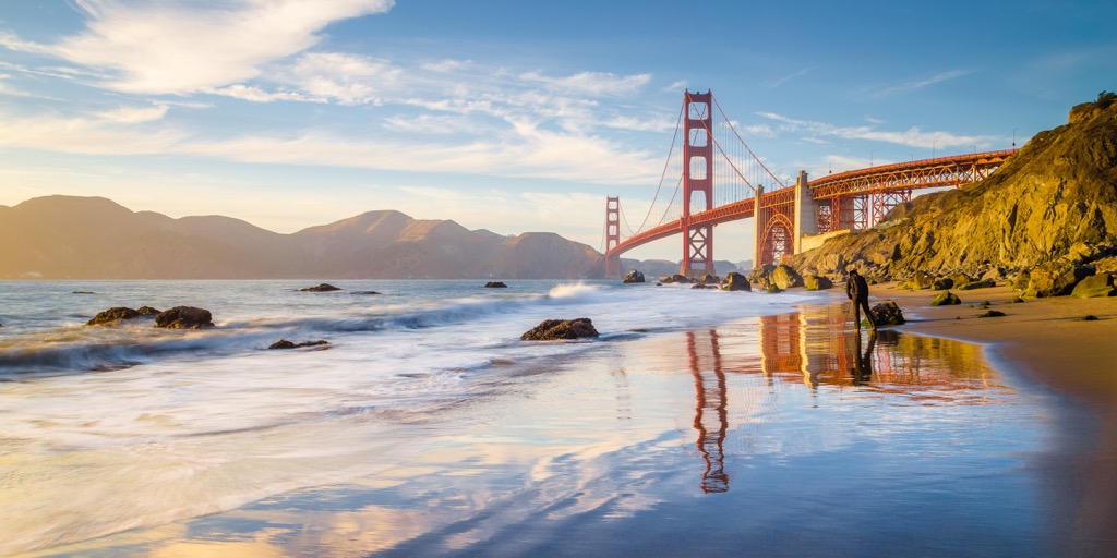
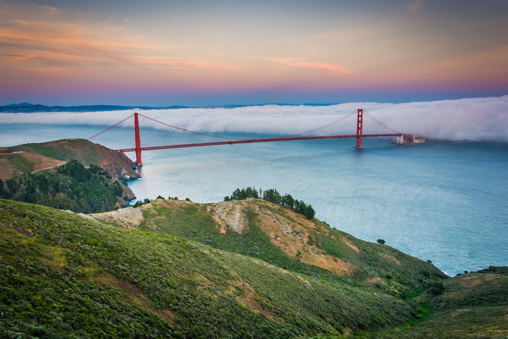
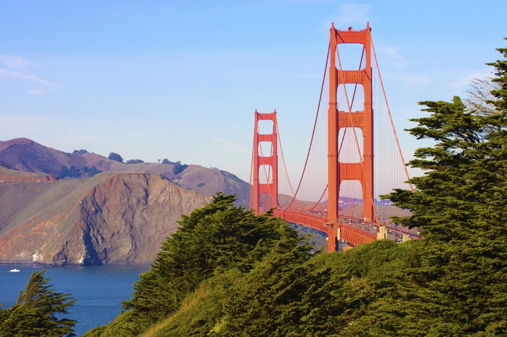
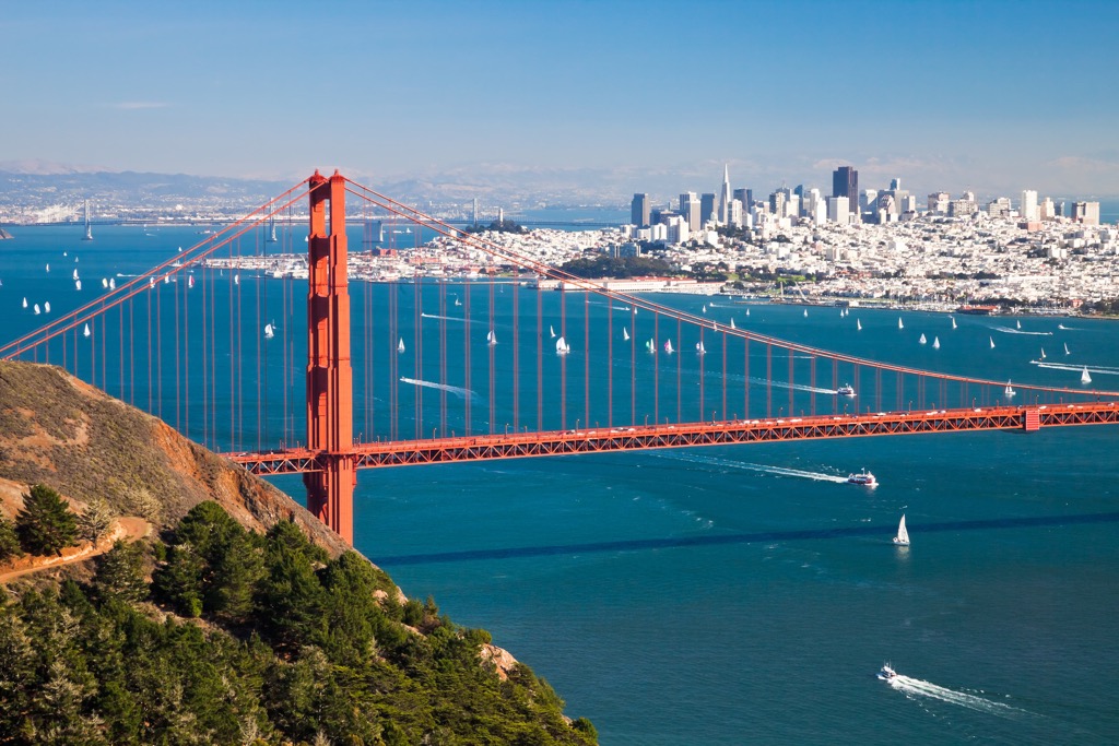
First of all, the landscape of San Francisco is primarily the Golden Gate Bridge, which spans the San Francisco Strait of the San Francisco Bay and connects the San Francisco Peninsula with the Marin Peninsula of the namesake county. The name “Golden” comes from the fact that they originally wanted to paint it that color, but eventually settled on red ochre, which is even better visible in the fog that often envelops the bay.
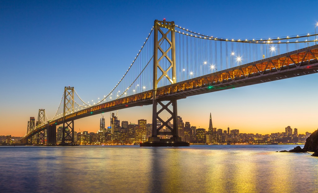
The bridge is not the only one, however. The city is also firmly associated with the San Francisco-Oakland Bay Bridge leading to Oakland. Another major bridge, the Richmond-San Rafael Bridge, connects the respective smaller towns in the north of the San Francisco Bay Area.
Second, the Frisco if the center the namesake San Francisco Bay Area, which you’ve probably already heard of many times, that is, the area around the bay, including all six of the aforementioned border countries, as well as neighboring Sonoma and Napa Valley, known as the wine regions—a total of nine, including San Francisco itself.
At the northern end, the bay is divided into several smaller bays, namely San Pablo Bay, Suisun Bay, Grizzly Bay, and Honker Bay. There is also Sherman Lake in the San Joaquin River Lagoon. So that's how the bay ends to the east. On the opposite, west side of the Golden Gate Bridge is the Gulf of the Farallones of the Eastern Pacific Ocean.
There are also four large islands in the San Francisco Bay—Alcatraz Island, known for its namesake prison from which there is “no escape” and the neighboring Treasure Island and Yerba Buena Island, as well as Angel Island and Red Rock Island to their north.
Also on the open ocean there are the two South Farallon Islands, related to the San Francisco Mountains in the PeakVisor database. We will come back to them.
Thirdly, San Francisco would not be the city it is without other man-made landscape features besides the Golden Gate Bridge. The most famous building of the city is the Transamerica Pyramid skyscraper in the Financial District of the Downtown, which was slightly overshadowed by the relatively new Salesforce Tower opened in 2018. Another lower and no less famous tower in the city is 64-m (210 ft) Coit Tower on Telegraph Hill, which even has one of the best views of the city, not to mention its observation deck.
Another architectural landmark that shouldn’t be missed is the San Francisco Ferry Building and marketplace at the city’s main harbor.
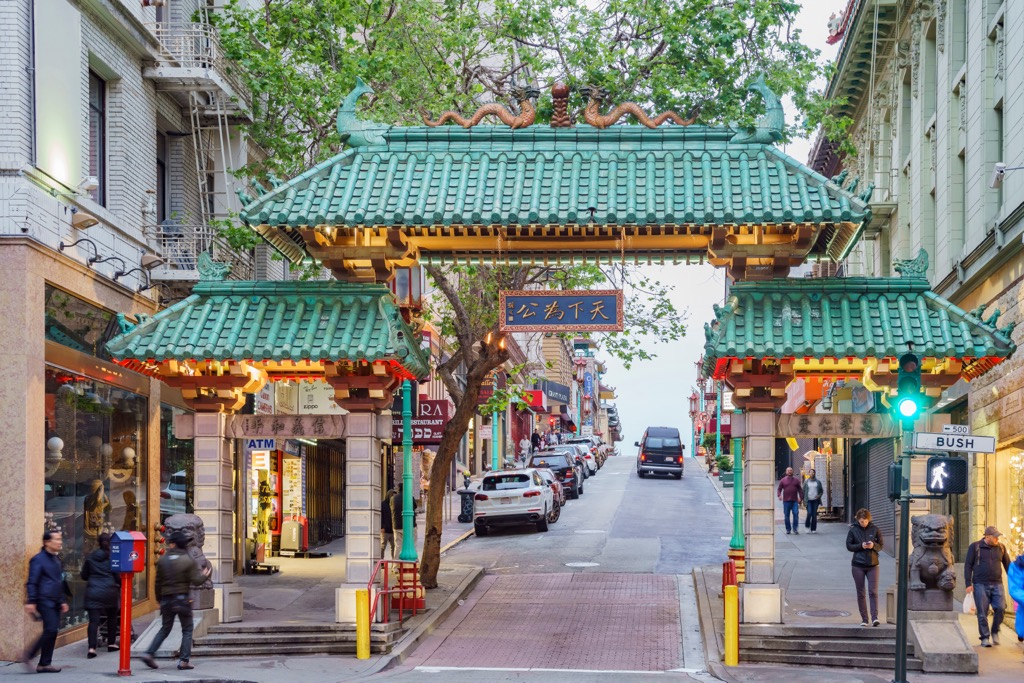
The city is also famous for the Dragon Gate at the south entrance of San Francisco Chinatown, which is the largest in the entire United States, and outside of Asia (!), thanks to a direct link to China via the Pacific Ocean.
Then, and of course, it is the futuristic headquarters of Apple Inc, in Cupertino, Silicon Valley, where the smartphones and computers on which you most likely read this guide and use the PeakVisor app are invented. While it’s not technically part of the Bay Area, it is as firmly associated with San Francisco as anything else.
But I’ll stop—it’s simply impossible to tell about all of the city’s architectural landmarks within the framework of a guide to its hills and mountains, so let’s get to it.
So, the San Francisco mountains are represented by 45 named peaks, most of which are relatively high and steep hills that are evenly scattered throughout the city. I need to tell you right away that two of the hills are located at a great distance from the rest as two rocky islands—Towel Hill and Main Top—with the same height of 68 m (223 ft) in the Pacific Ocean.
Highest hills. The highest mountain in San Francisco, Mount Davidson (283 m / 928 ft), is located approximately in the geographic center of the city, as is the next Twin Peaks (279 m / 915 ft), including, as its name suggests, not one but two summits: southern Noe Peak and northern Eureka Peak. The latter is known as one of the main viewpoints. The Twin Peaks are also accessible by road, so they are easy to get to. However, Mount Davidson also has a great view of the entire city.
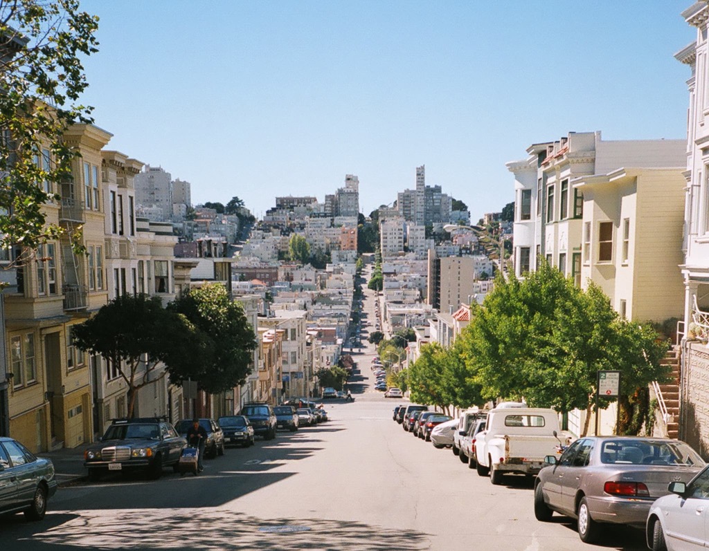
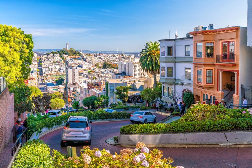
As for the lower but also famous hills of San Francisco, originally there were seven named, they remain the most famous. In addition to the two aforementioned, these are Telegraph Hill (90 m / 295 ft), Nob Hill (114 m / 374 ft), Russian Hill (109 m / 357 ft), Rincon Hill (35 m / 114 ft), and Mount Sutro (278 m / 912 ft). In turn, among these hills, Telegraph Hill is known for Coit Tower, as already noted, and Russian Hill for Lombard Street, the steepest street in the city with eight hairpin turns..
Steepest streets. Lombard has long been considered the steepest street in San Francisco, but it’s not. According to local topography enthusiasts, the city’s main street by this measure is Bradford Street from Tompkins Avenue with an incredible gradient of 41%. It is followed by Romolo Place from Fresno Street (37.5%), Prentiss Street from Powhattan Avenue (37%), Nevada Street from Chapman Street (35%), Baden Street from Mangels Avenue (34%), and a dozen others, excluding Lombard Street, so it is not even in the top ten.
Over time, to the original seven hills of San Francisco were added 36 more minus two island hills. Thus there are more than 40 named hills of the city, the history of which can be studied separately for their names. For example, Russian Hill refers to the Russian settlers who were among the first Europeans in California, but could not find the resources to develop it, and gave it up to the Spanish and others.
Best viewpoints. Almost all of San Francisco’s hills are natural lookouts and offer fantastic views of various parts of the city, other hills, the San Francisco bay, and the Pacific Ocean. Many of them are also parks, that is, places for walking and easy hiking. Some hills not yet covered in the guide are Bernal Heights (141 m / 462 ft), Buena Vista Heights (172 m / 564 ft), Grand View Hill (203 m / 665 ft), Tank Hill (182 m / 597 ft), Corona Heights (158 m / 518 ft), Potrero Hill (99 m / 324 ft), Kite Hill (167 m / 547 ft), and others.
Finally, many of the surrounding and often higher mountains in neighboring counties are also visible from the city’s hills. In particular, to the north of San Francisco, starting from Marin County, is the Northwest U.S. Coast Ranges, going along the entire Pacific coast all the way to the Canadian border, to the south—the Santa Cruz Mountains, and to the east—the Diablo Range.
Namesake mountains. Interestingly, mountains named San Francisco can also be found in neighboring states. For example, I have found at least two mountain ranges: the San Francisco Mountains, whose highest peak, Frisco Peak (2,944 m / ft), is located in Beaver County, Utah, related to the Great Basin Ranges; and the San Francisco Peaks, whose highest peak Humphrey’s Peak (1,840 m / 6,037 ft), is in Coconino County, Arizona, related to the Colorado Plateau.
Given that most of the San Francisco Peninsula is occupied by the neighboring San Mateo County, I remembered to check its mountains for similar matches as well. There are also two ranges of the same name: North San Mateo Mountains, which occupy part of the same Colorado Plateau in New Mexico, with the highest peak Mount Taylor (3,449 m / 11,316 ft) in Cibola County; and a separate mountain range, the San Mateo Mountains with the highest peak West Blue Mountain (3,146 ft / 959 m), located in Socorro County of the same state.
As a result, San Francisco is one of the most mountainous of the major cities on the west coast of the United States, which is surrounded by even higher mountains of larger ranges.
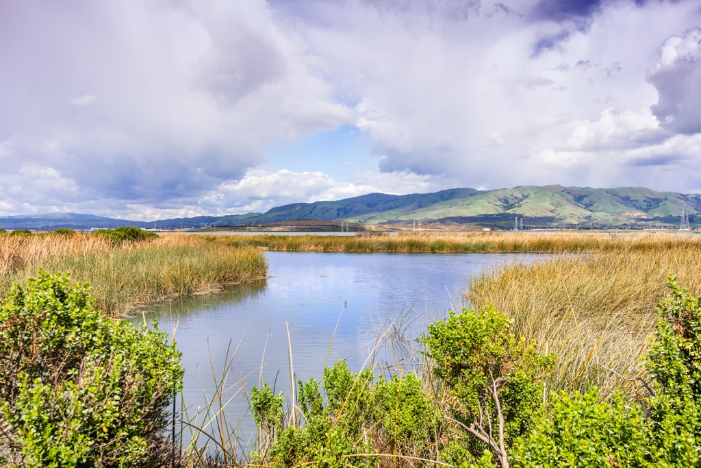
As I just noticed, many of San Francisco mountains are covered with trees and other vegetation and are parks, and thus are also hiking areas.
Among San Francisco’s largest parks, both inland and on the coast, are Presidio of San Francisco with the namesake Presidio Hill (120 m / 393 ft), Lincoln Park, Golden Gate Park and the neighboring San Francisco Botanical Garden, Twin Peaks hill area, Glen Canyon Park, Lake Merced Park, and John McLaren Park, among others. You’ll find uncomplicated marked hiking trails from a couple of hours to a full day at each of them. At Lincoln Park, for example, there is a Coastal Trail of 2.8 km (1.7 mi) and Lands End Trail of 3.4 km (2.1 mi) long.
Newcomers to San Francisco beware: the park near the Golden Gate Bridge is called Presidio, while Golden Gate Park is located south of it across the Richmond District.
There are also Bay View Park and Candlestick Point State Recreation Area in the east of the city south of the San Francisco harbor, as well as many golf fields for lovers of this outdoor sport.
But for longer and more challenging hiking, follow the San Francisco Peninsula’s largest park, San Bruno Mountain State & County Park, just across the border in San Mateo County. Just nearby, there is also the San Francisco Peninsula Watershed—a small but important ecological region with the self-speaking name, covering the western part of San Mateo County.
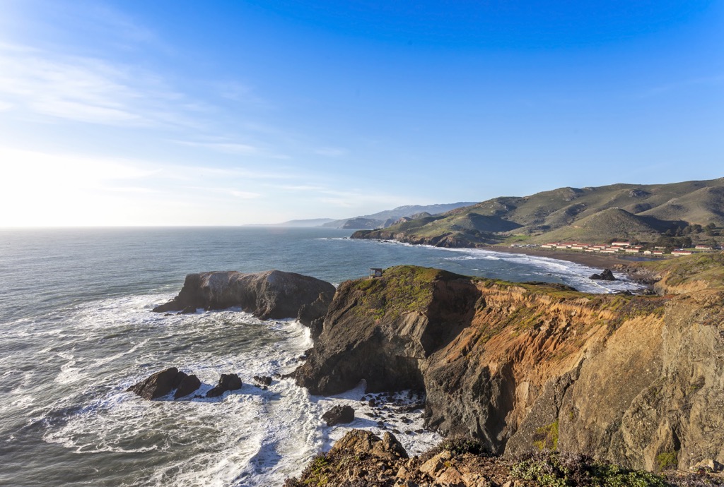
On the opposite side of the peninsula, go to the Marin Headlands and Golden Gate National Recreation Area north of the Golden Gate Bridge.
Hiking the Golden Gate Bridge? Of course, to get to the latter you can, and simply must, walk it. Its length is an impressive 2.7 km (1.7 mi). Although there are six lanes of traffic on the bridge which never stops, and the footway is relatively narrow with the total width of the bridge being 27.4 m (90 ft) it will be one of the best hikes (I will say more, days!) of your life, as the bridge lets you see the whole city, the bay and the surrounding mountains from a height of 2,737 m (8,980 ft). Put some of your favorite tracks on your headphones to drown out the noise of the cars. For example, during my walk, I listened to the Black Eyed Peas’ “Elephunk” album, repeating my favorite songs again and again.
Angel Island in the north of San Francisco Bay is also a namesake Angel Island State Park, where you can arrive by ferry.
As a big fan of coastal walking, I also recommend a stroll along one of the wide and long beaches on the city’s west coast where only locals are sure to be. For example, it is Baker Beach overlooking the Golden Gate Bridge, or the smaller China Beach to the south of it, where you can still see the bridge at a greater distance. However, the huge Ocean Beach, of 3.5 km (2.1 mi) long, running along the entire western border of the county surpasses them by several times in length and wide.
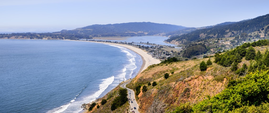
The coastal walking in San Francisco also makes sense because this part of the Pacific Ocean, unlike the coast in the Los Angeles area, is very cold due to currents and not suitable for swimming without a wetsuit.
The eastern part of the city has no beaches because of the port and is deprived of views of the open ocean going to infinity, but you can also walk it on foot.
To go around the entire San Francisco by a coastline it would take you 8 hours or 25 km (16 mi). By analogy, to cross the city diagonally from its outermost corners through Twin Peaks viewpoint would take about half or about 10 km (6 mi) or about 4 hours. By the way, this is a good idea for a hike I just came up with myself—you can use it.
The closest ski resorts to San Francisco are located east of the city on the California-Nevada border in the Sierra Nevada mountain range grouped in three zones.
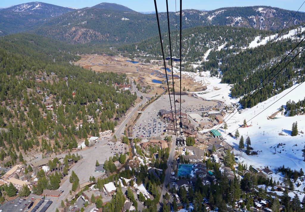
So, as you can see, there’s no problem with skiing in San Francisco.
Check the California ski resorts map and the larger USA ski resorts map in the World Mountain Lifts section of the site. It includes information about open ski lifts / slopes in California in real-time with opening dates and hours. There are also year-round cable cars, funiculars, cog railways, aerial tramways, and all other types of mountain lifts.
During your stay in San Francisco, visit the city's official tourist center to get more information on the spot, pick up a paper map of the city and its surroundings, and buy souvenirs, as well as ask for advice and more.
San Francisco Visitor Information Center
749 Howard St, San Francisco, CA, 94103, United States
+14153912000
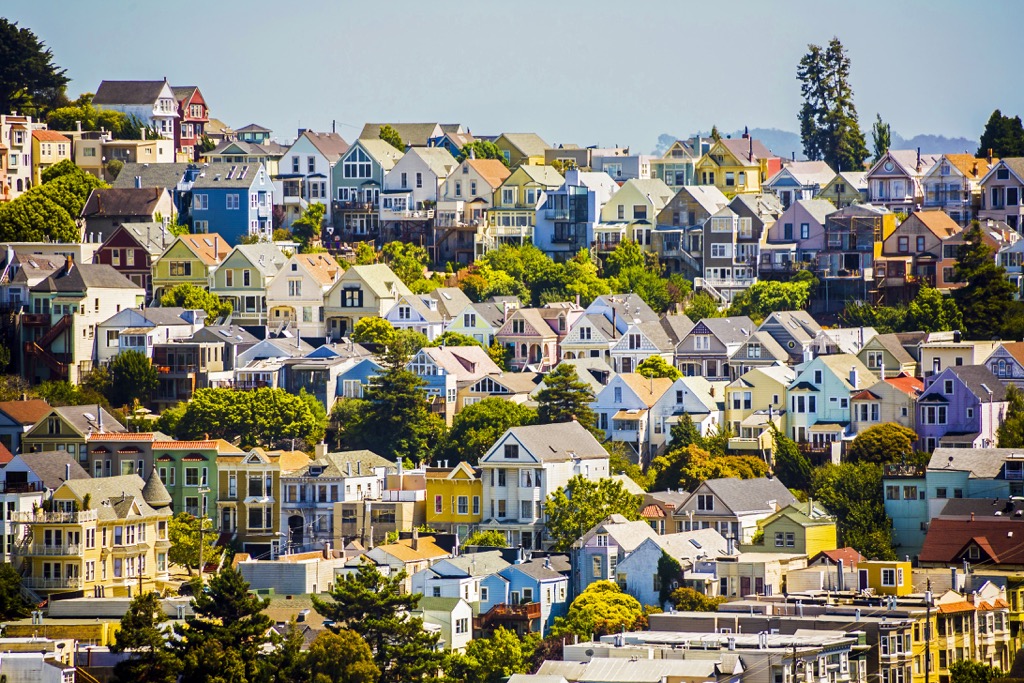
San Francisco is a relatively small yet incredibly diverse city in which you will find absolutely any type of housing, as well as those you can’t even imagine. It doesn’t make sense to give advice about specific ones, so I’ll rather point out some of the city’s most interesting neighborhoods, which are expectedly various immigrant communities as opposed to the Financial District in the Downtown area covered with skyscrapers.
Since 2018, the city government has implemented the Cultural Districts Program, which aims to highlight and support the city’s most ethnic and distinctive neighborhoods informationally and financially. They began collecting them in 2013 with Japantown, and by early 2023, they had brought the list to 10 districts, including the following one based on the geography: Calle 24 Latino, SoMa Pilipinas-Filipino, African American Arts, American Indian, Sunset Chinese, and Pacific Islander.
I guess, they will later add Russian Hill to the list, which many emigrants from Russia and other countries of the former Soviet Union chose based on the name. But even today you can find some Russian cultural centers, stores, etc. in the district.
So my advice is as follows: if you are from one of these regions or want to learn more about it while in the U.S., choose it from the list with the idea of looking for lodging in it. So, when you return each day after hiking through the city, you'll be able to live on a piece of your native land abroad (well, in a sense) or to explore one of the many cultures of this multicultural city.
San Francisco is not only one of the largest cities in the state, but also the center of a huge agglomeration, which includes many other settlements, where you can go from the city for a day or two. Among the other cities and resorts that I haven't yet named are Salinas and Monterey to the south—two neighboring coastal fishing towns, the first of which known, among other things, as a birthplace of a famous American (travel) writer John Steinbeck, and Sacramento to the northeast, California's sixth-largest city with a population of 500,000+ people with many landmarks from the state's Spanish (Mexican) period such as the Sutter's Fort and the namesake historic park, and others. In between are also two mid-sized cities: Stockton and Modesto, where you'll get a more complete map of San Francisco surroundings and the state of California in general than the average traveler who has limited his or her strolls to the Downtown and the Golden Gate Bridge.


Yes. San Francisco City and County has 45 named mountains. The highest is Mount Davidson at 283 m.
The highest mountain in San Francisco City and County is Mount Davidson, at 283 m.
San Francisco City and County has 45 named mountains.


