
Scan the QR code and open PeakVisor on your phone
One of California’s original counties, Tuolumne County covers roughly 2,235 square miles of the Sierra Nevada region in California. Originally referred to as Oro County, Tuolumne was organized in 1850. Portions of the county were gifted to Stanislaus County in 1854 and Alpine County in 1864.
In 1848, gold was discovered in Tuolumne County, which brought thousands of prospectors to the area. Several Gold Rush towns were established, including Sonora, the county’s only incorporated city. In the 1890s, timber became a significant commercial commodity, which led to further exploration and development of the region.
The name Tuolumne is known to be of Native American origin, but has several different proposed meanings. Mariano Vallejo, a Spanish general, believed that Tuolumne was a corruption of the Indian word talmalamne, which translates to ‘cluster of stone wigwams.’ However, there are several other interpretations of the word, including ‘people who dwell in stone houses,’ ‘straight up steep,’ and ‘the land of mountain lions.’
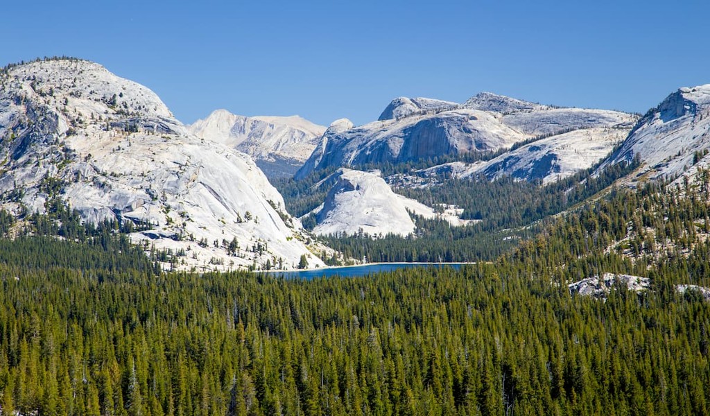
A county of contrasts, Tuolumne encompasses both rolling pasturelands and towering granite peaks. Yosemite National Park and the Stanislaus National Forest occupy the eastern part of the county, making Tuolumne an idyllic destination for hiking, rafting, camping, fishing, and other outdoor activities. Tuolumne County also boasts several historic hotels, parks, and a variety of museums.
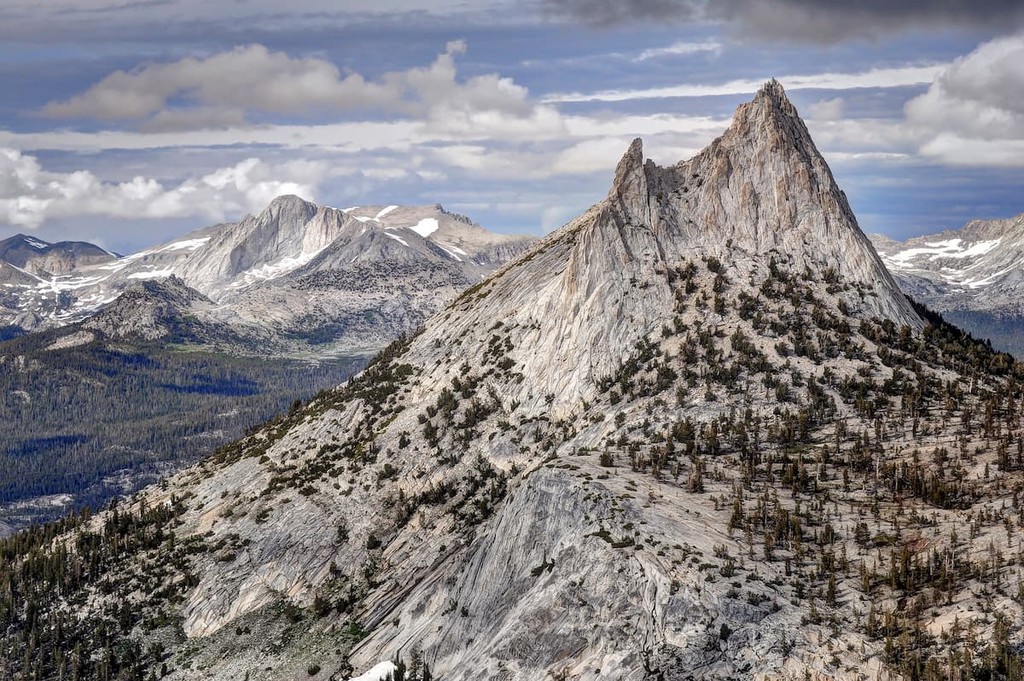
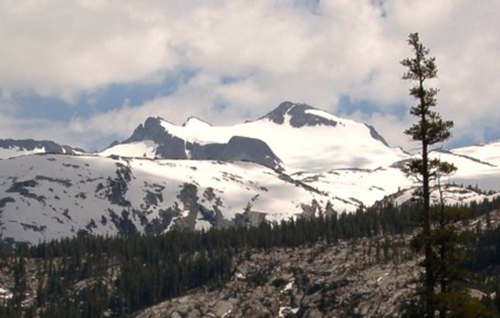
The tallest peaks in Tuolumne County, Mount Lyell, Mount Dana, Kuna Peak, and Mount Maclure reach over 13,000 feet in elevation and lie in Yosemite National Park. Glaciers sculpted these impressive summits as they moved through the area millions of years ago.
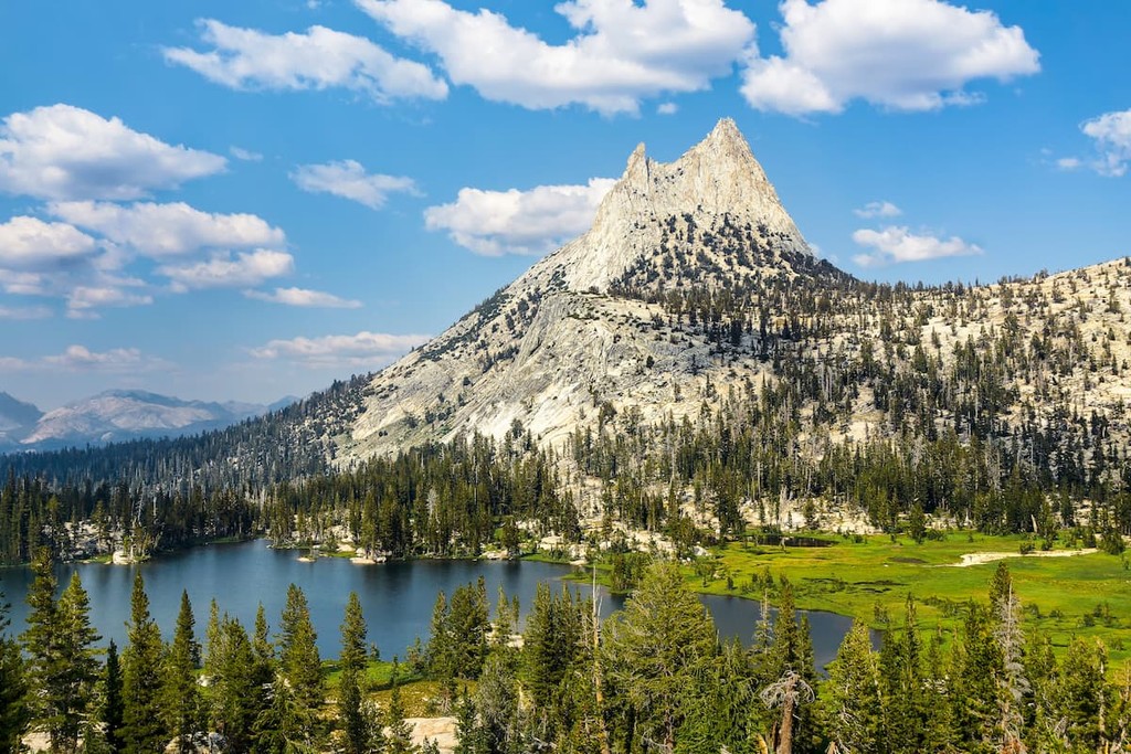
Located in the western Sierra Nevada, Yosemite National Park is one of the most iconic parks in the states. Famed for its giant, ancient sequoias, deep valleys, cascading waterfalls, and impressive granite peaks, Yosemite encompasses 1,200 square miles of mountainous scenery and boasts more than 800 miles of hiking trails.
Visitors to the park often remain in Yosemite Valley, taking in views of granite icons like Half
Dome and El Capitan. However, Yosemite Valley only represents a small fraction of the park. Yosemite high country is where avid hikers and backpackers go to explore beautiful mountain peaks like Mount Gibbs, Mount Conness, and Mount Lyell, the highest point in the park.
Established in 1897, Stanislaus National Forest covers over 890,000 acres in the Sierra Nevada. Located primarily in eastern Tuolumne County, the Stanislaus National Forest contains over 70 lakes, 1,100 miles of trails, and roughly 800 miles of rivers and streams. A popular destination for outdoor recreation, Stanislaus is home to portions of the Carson-Iceberg Wilderness, the Mokelumne Wilderness, and Emigrant Wilderness. Popular trails in the area include: The trail of the Gargoyles, Diana Falls, Pinecrest Lake, Kennedy Lake, and portions of the PCT, including Sonora Pass to Echo Lake.
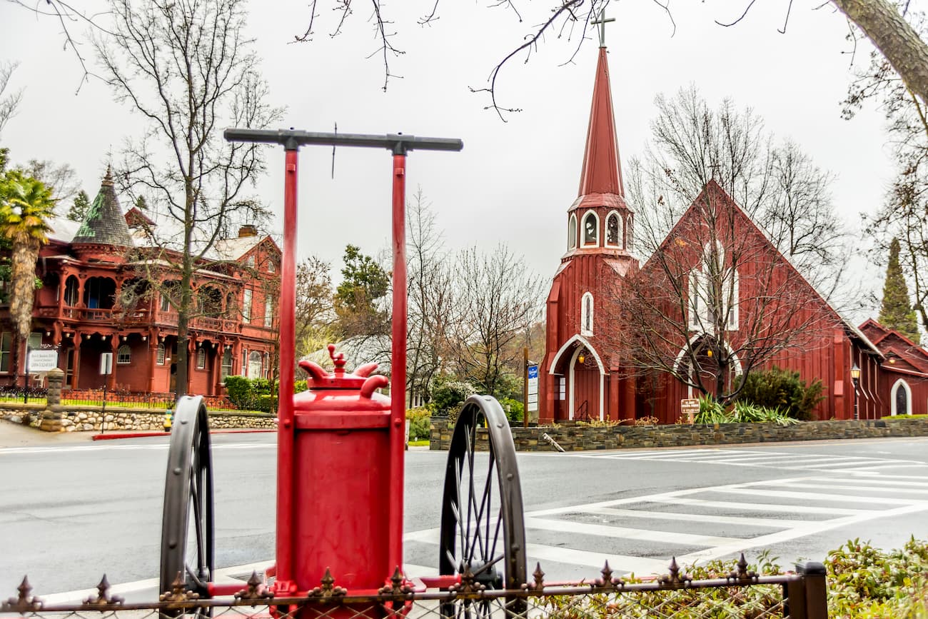
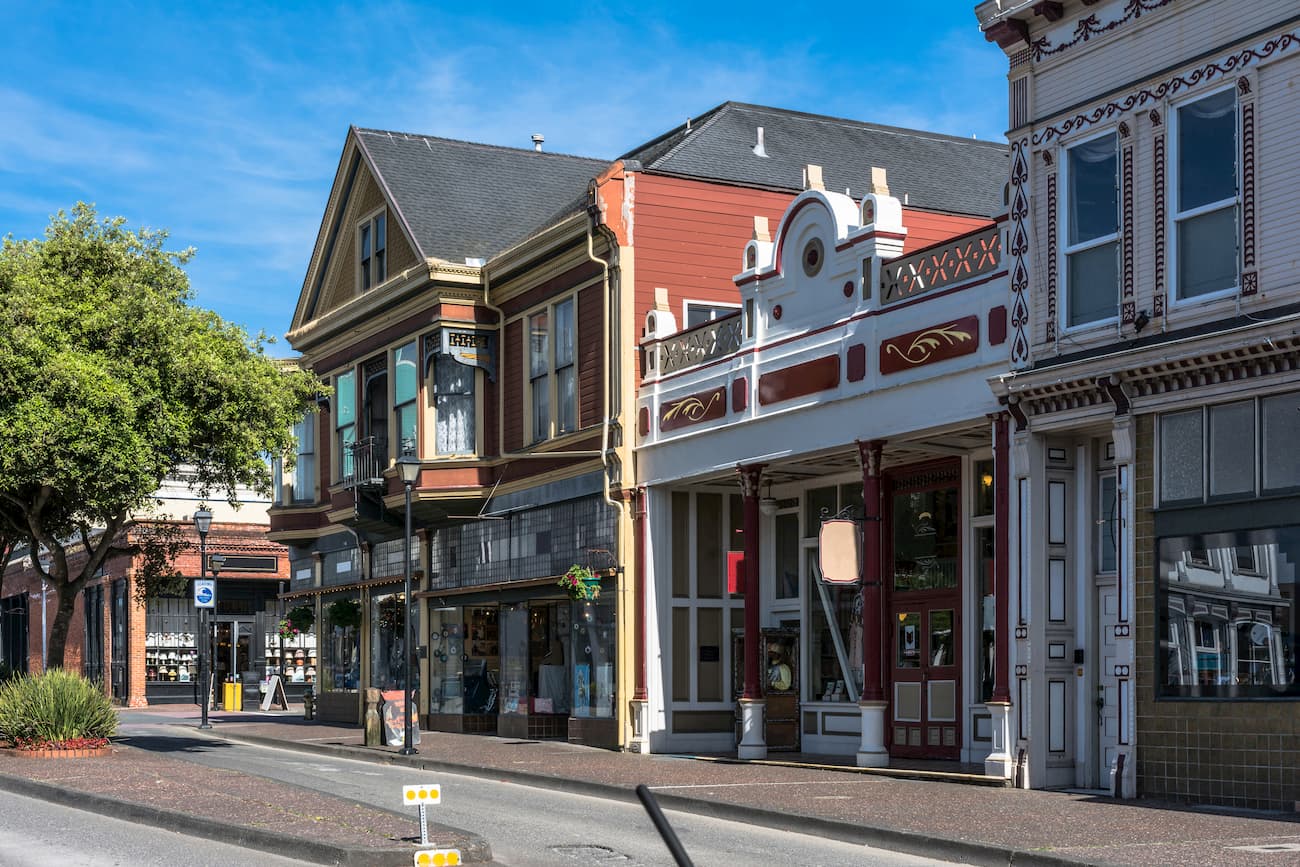
Originally settled by Mexican miners during the early gold rush era, Sonora is the only incorporated city in Tuolumne County. Known as the “Queen of the Southern Mines,” Sonora is nestled in the beautiful Sierra Nevada Foothills and is packed with historic charm. Today, the city serves as the perfect base camp for exploring Tuolumne County, Yosemite National Park, and the Columbia and Railtown State Historic Parks. Sonora also boasts a variety of historic lodging options, museums, and restaurants.
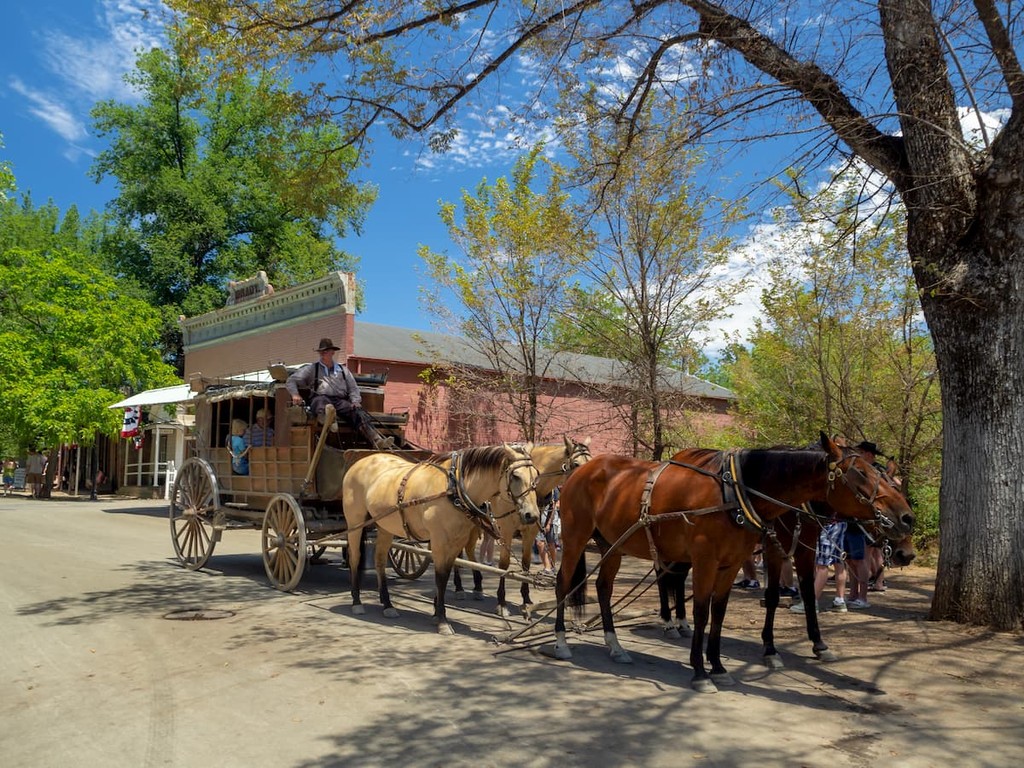
Columbia was established in 1945 as a historic park and is considered one of California’s best-preserved Gold Rush towns. Visitors looking to learn about California’s Gold Rush history will appreciate Columbia’s historic inns, restaurants, working blacksmith shop, and old-fashioned shops. In Columbia, visitors can pan for gold, ride a stagecoach, and have a cocktail at a local saloon.
Founded in 1854, Tuolumne was originally named “Eureka,” for its gold boom in the late 1800s. Today, however, the town lies just outside of the Stanislaus National Forest and serves as the perfect basecamp for camping, fishing, hiking, and exploring the Sierra Nevada.


13er
western-state-climbers
western-state-climbers-star
sierra-club-sierra-peaks-section
sierra-peaks-section-emblem
sierra-sampler
vagmarken-sierra-crest
13er
western-state-climbers
western-state-climbers-star
sierra-club-sierra-peaks-section
sierra-sampler
vagmarken-sierra-crest
13er
western-state-climbers
western-state-climbers-emblem
vagmarken-sierra-crest
western-state-climbers
western-state-climbers-emblem
sierra-club-sierra-peaks-section
vagmarken-sierra-crest
western-state-climbers
western-state-climbers-star
sierra-club-sierra-peaks-section
sierra-sampler
vagmarken-sierra-crest
western-state-climbers
western-state-climbers-emblem
sierra-club-sierra-peaks-section
sierra-sampler
vagmarken-sierra-crest
western-state-climbers
western-state-climbers-star
sierra-club-sierra-peaks-section
vagmarken-sierra-crest
western-state-climbers
western-state-climbers-star
sierra-club-sierra-peaks-section
sierra-peaks-section-emblem
sierra-sampler
vagmarken-sierra-crest
western-state-climbers
western-state-climbers-star
sierra-club-sierra-peaks-section
sierra-sampler
vagmarken-sierra-crest
13er
western-state-climbers
western-state-climbers-star
sierra-club-sierra-peaks-section
sierra-sampler
vagmarken-sierra-crest
western-state-climbers
western-state-climbers-star
sierra-club-sierra-peaks-section
sierra-peaks-section-mountaineers
sierra-sampler
vagmarken-sierra-crest
western-state-climbers
western-state-climbers-star
sierra-club-sierra-peaks-section
vagmarken-sierra-crest
western-state-climbers
western-state-climbers-emblem
sierra-club-sierra-peaks-section
sierra-sampler
vagmarken-sierra-crest
13er
western-state-climbers
western-state-climbers-emblem
vagmarken-sierra-crest
13er
western-state-climbers
western-state-climbers-star
sierra-club-sierra-peaks-section
sierra-peaks-section-emblem
sierra-sampler
vagmarken-sierra-crest
western-state-climbers
western-state-climbers-star
sierra-club-sierra-peaks-section
sierra-peaks-section-emblem
sierra-sampler
vagmarken-sierra-crest


