
Scan the QR code and open PeakVisor on your phone
Red Buttes Wilderness has 11 named peaks. The highest is Red Butte at 2,054 m. Other notable peaks include Kangaroo Mountain, Pyramid Peak and Figurehead Mountain.
The Red Buttes Wilderness is located in both the Klamath and Rogue River National Forests. The region covers land in both California and Oregon. In total the region spans 19,940 acres with a large majority of it being in California. There are 11 named mountains in Red Buttes Wilderness. The highest and the most prominent mountain is Red Butte at 6,713 feet. The Red Buttes Wilderness was established back in 1984 due to the California and Oregon Wilderness Acts of 1984. The wilderness gets its name from the distinguished peak in the Siskiyou Crest. Due to the high iron and magnesium of the rocks, the peak has a reddish orange color to it.
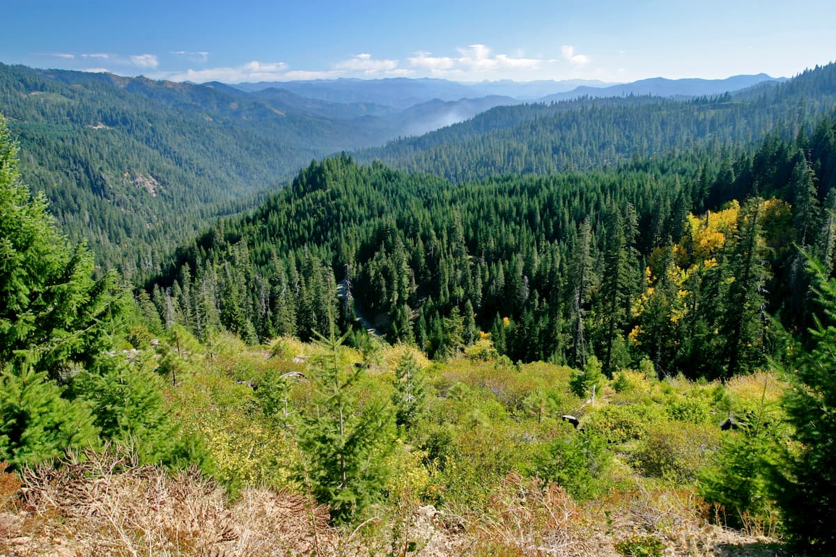
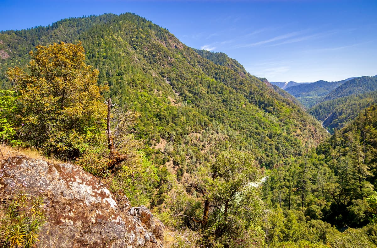
This wilderness area includes the crest of the Siskiyou Mountains that is located between the Rogue and Klamath Rivers. Elevations in the wilderness range from 2,800 feet up to 6,713 feet at the summit of Red Butte. All waterways within the Red Butte Wilderness are part of the Rogue River watershed. This includes Butte Fork, Middle Fork, Applegate River, Sucker Creek, and the headwaters for the Illinois River.
The Siskiyou Mountains are part of the larger Klamath Mountains Province that covers southwestern Oregon and northwestern California. These peaks were once part of the ocean floor and contain some of the oldest rocks in the entire region. Much of the wilderness is covered with a variety of spruce, pine, and fir trees. However, species such as Brewer’s spruce, Sadler oak, and Siskiyou lewisia are only found in southwestern Oregon and northwestern California. The Red Buttes Wilderness is home to many black-tailed deer with black bears, coyotes, and cougars being less common.
This region has been visited and/or inhabited as early as 8,000 years ago by Native American groups. The Dakubetede tribe is known to have used this area and hunted deer, sheep, elk, and even grizzly bears. Non-native people began visiting the region during the Siskiyou Mountain gold rush during the 1850s. In the 1920s and 1930s, the Forest Service began to build remote trails and cabins throughout the forest. Today this smaller section of wilderness is used for hiking, camping, and horseback riding. Many hiking trails run throughout the Red Butte Wilderness, making it an outdoor paradise nearly all year long.
As the tallest peak in the wilderness, hiking to the summit of Red Butte offers the best views in the wilderness. The 6.7-mile out and back trail has 2,286 feet of elevation gain. The trail climbs steadily throughout the ascent with the final section taking hikers over large boulders in order to reach the top. Along the hike, hikers have views of both Echo Lake and Elk Lake below. Take the trail down to Echo Lake or continue upwards toward the summit.
Though short, this 1-mile hike has 580 feet of elevation gain and some of the best views in the entire wilderness. The trail climbs steeply up the side of the mountain before reaching the summit of Whiskey Peak at 6,398 feet. From the top, hikers have panoramic views of the Red Buttes Wilderness along with the Klamath and Rogue River National Forests. At the summit is plenty of space to take a seat and take in the views.
This 6.7-mile loop trail has 2,165 feet of total elevation gain. The trail climbs nearly 2,000 feet in the first 2 miles before leveling out. The switchbacks take hikers through dense forest before reaching Frog Pond and Cameron Meadows. Stop to have a picnic at the pond, watch the ducks and other wildlife, or marvel at the expansive meadows full of wildflowers during the summer months.
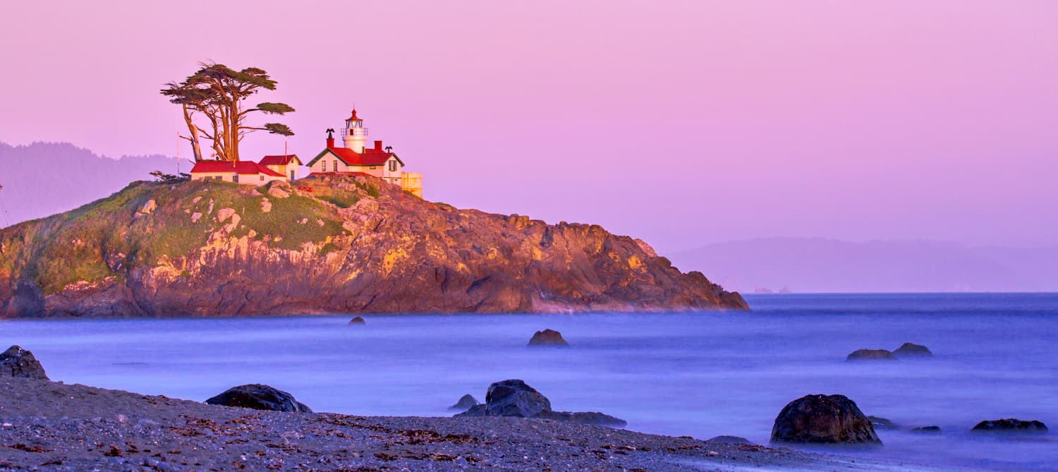
Crescent city is located approximately two hours west of the Red Buttes Wilderness, depending on which section of wilderness you are exploring. Crescent city is located on the very northwestern coast of California with a population of approximately 10,000. The city is also the location for the Redwood National Park headquarters. Crescent City sits just 20 mile south of the Oregon-California border. The city was named after the crescent shaped beach and it is known for being an abundant fishing location. Despite being in California, Crescent City is quite rainy and averages 71.24 inches per year. The isolation of the city makes it one of the most popular stops due to its proximity to numerous state parks, recreation areas, and the Lost Monarch, the largest known Coastal Redwood by volume.
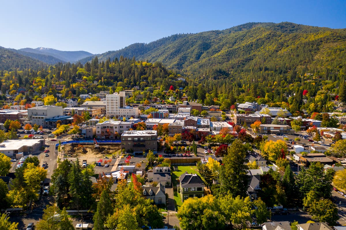
Ashland, Oregon is a city located in Southern Oregon with a population of around 21,000. The small city is known for being home to the Oregon Shakespeare Festival. The town is known for being very liberal, a sharp contrast to much of southern Oregon. Many of the city’s historical buildings have been preserved which give the downtown a quaint setting. Ashland is the perfect place to stay after a long hike in the mountains and is ideal for grabbing a bite to eat or check out a local gallery. The nearby city of Medford also has ample housing with close proximity to the surrounding mountain trails.


The highest peak in Red Buttes Wilderness is Red Butte, at 2,054 m.
Notable peaks in Red Buttes Wilderness include Red Butte, Kangaroo Mountain, Pyramid Peak, Figurehead Mountain and Rattlesnake Mountain.


