Scan the QR code and open PeakVisor on your phone
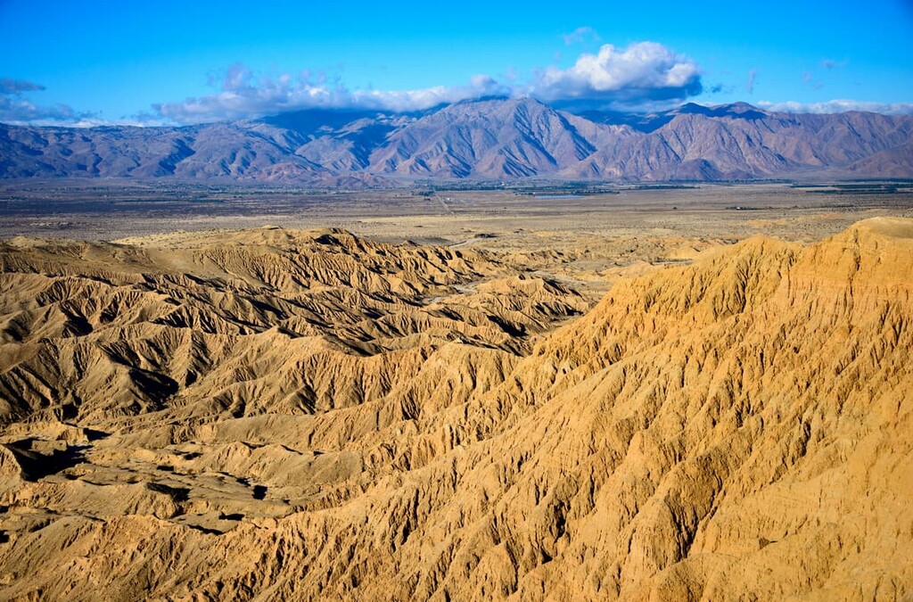
The Anza Borrego Desert State Wilderness encompasses much of the desert landscape in and around Anza-Borrego State Park, California’s largest and arguably most treasured state park. The wilderness area contains 29 named mountains, the highest of which is Combs Peak (6,184 ft/1,885 m), and the most prominent of which is Whale Peak (5,338 ft/1,627 m).
The Anza Borrego Desert State Wilderness (also known as the Anza Borrego Wilderness) is located within San Diego, Riverside, and Imperial Counties in the southernmost region of the US state of California. It encompasses a patchwork of other publicly-owned and protected lands near California’s border with the state of Baja California in Mexico.
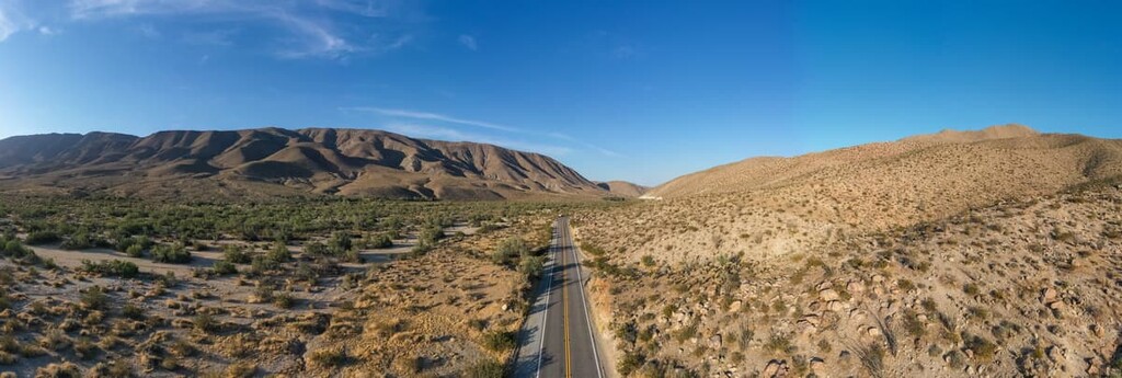
Much of the wilderness and public lands managed under the Anza Borrego Desert State Park, including the wilderness area, offer hiking opportunities. However, it should be noted that much of the public wilderness area (especially toward the east) welcomes off roading and ATVing. So hikers and campers should take care when traveling through the area.
For example, one public lands initiative taking place close to the wilderness is the Desert Cahuilla/Freemans Project (near the Salton Sea). The main goal of the project is to secure public lands for off-road recreation.
While some hikers may lament the increased development of off road ATV trails in the wilderness, much of the land that development is taking place on are not conducive to safe (or even enjoyable) hiking.
As a result, the local municipalities have taken these land acquisitions as a way to diversify tourism in the area. These areas are largely in the eastern most parts of the wilderness where there is little coverage and even less rainfall than on the western edge of the wilderness.
The Anza Borrego Wilderness is situated near a number of other popular outdoor recreation areas, including the Coyote Mountains Wilderness, Sawtooth Mountains Wilderness, Fish Creek Mountains Wilderness, and Cuyamaca Rancho State Park.
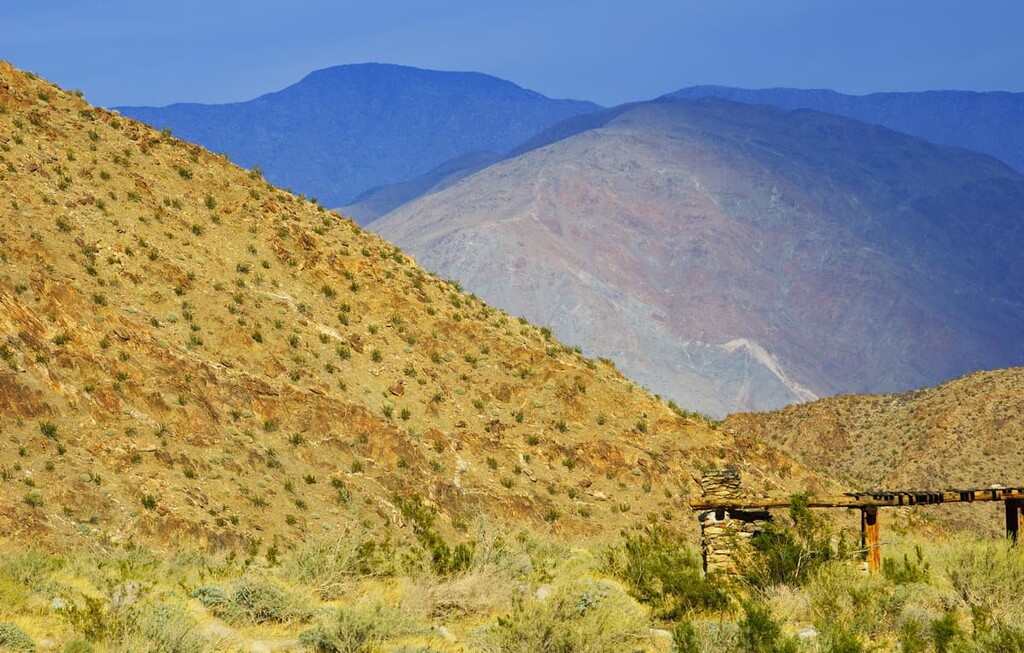
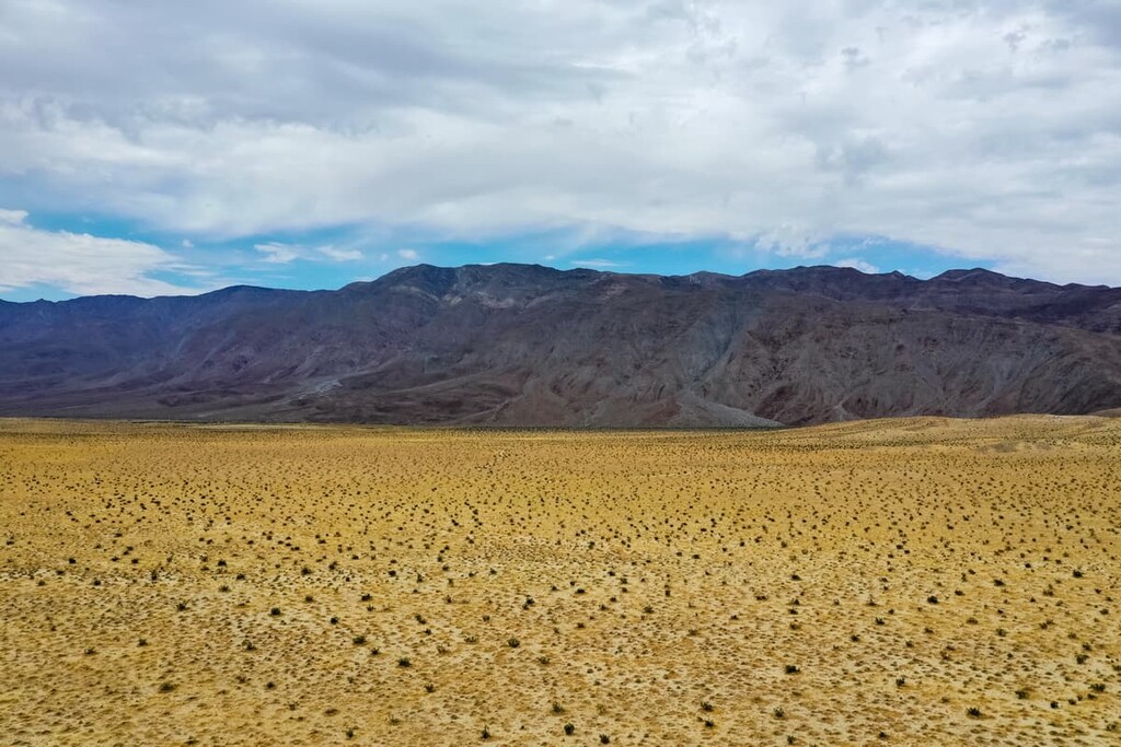
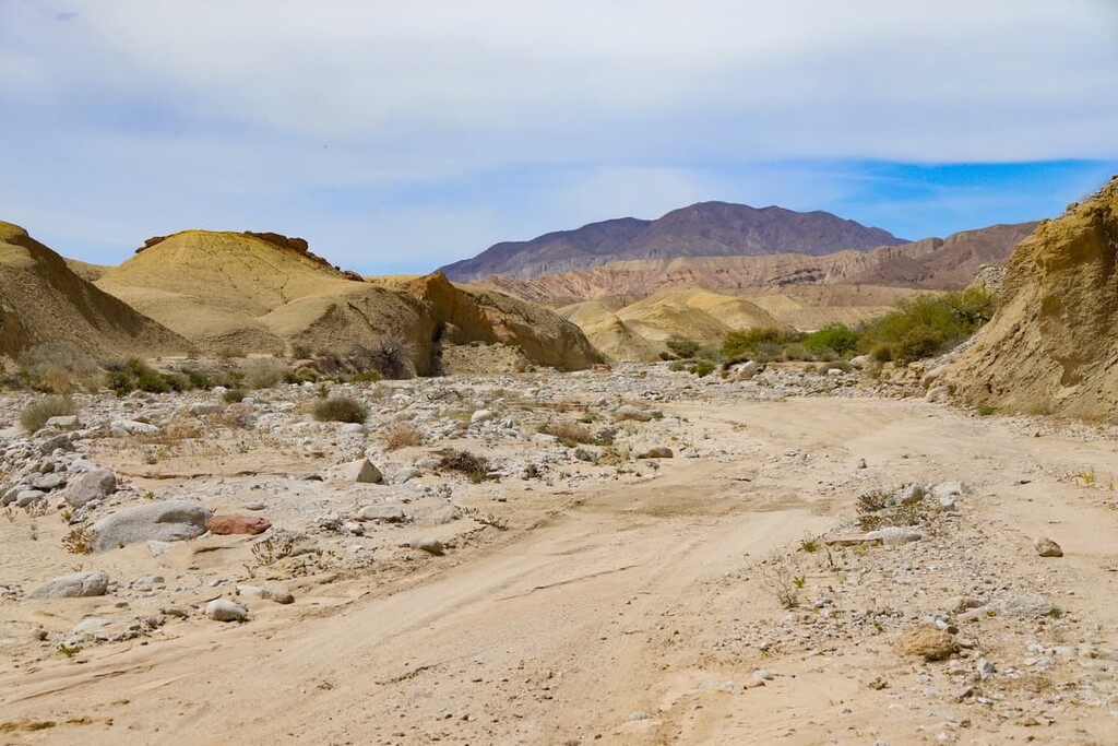
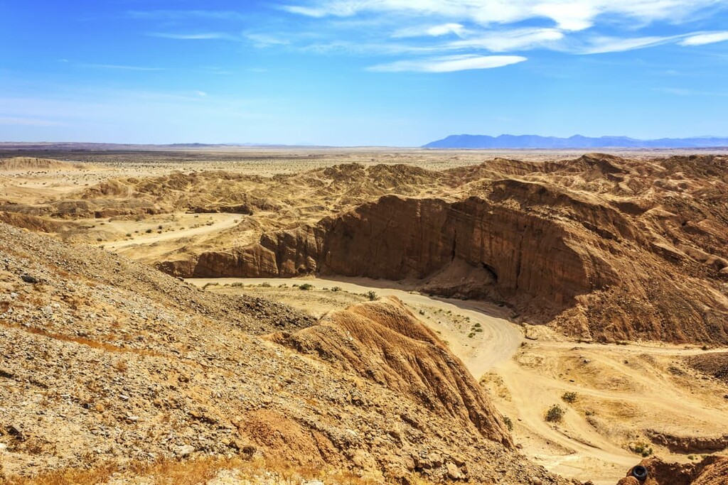
Anza Borrego has a variety of geological wonders that make hiking in the wilderness incredibly interesting. The mountains in the wilderness are predominately part of the Santa Rosa Mountains, which are a subrange of the California Ranges.
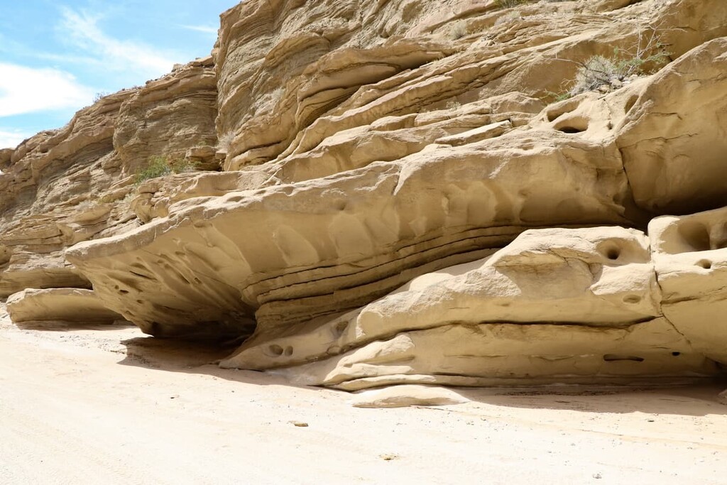
Many of the rocks in the area are metamorphic and igneous in origin, including tonalite. There are also a number of sedimentary rocks in the wilderness that are home to fossils such as pollen, spores, mammoth skeletons, and baleen whale bones. These fossils are most common on the eastern edge of the wilderness.
Also note that many of the rocks in Anza Borrego feature desert varnish. Desert varnish is the result of microscopic bacteria that on the surface rocks. These bacteria absorb the manganese and iron oxide, causing them to become blackish and red in hue.
Additionally, while you are exploring the wilderness you will often see bajadas, or collections of alluvial fans. Bajadas are triangle-shaped deposits of gravel, sand, and even smaller pieces of sediment, such as silt (also called alluvium) that are produced from rail flowing down the mountains into the valleys below.
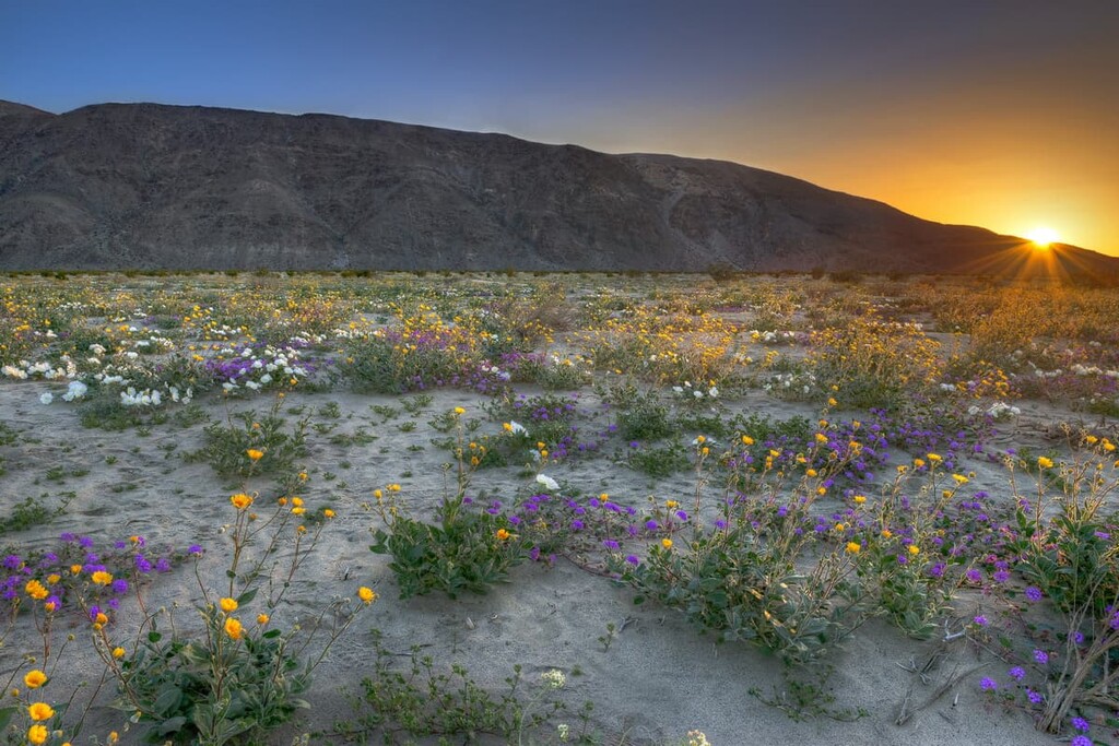
Despite its desert location, Anza Borrego is not without its wide variety of flora and fauna. Visitors are guaranteed to see vastly different landscapes throughout the year that will keep their hikes interesting and beautiful.
Anza-Borrego is known for being very hot, very dry, and very windy, so only the heartiest of plants can survive. However, the flora and fauna of the area is surprisingly diverse.
On any given hike you are likely to see cacti like the catclaw, barrel cactus, beavertail cactus, hedgehog cactus (also known as calico cactus), fishhook cactus, and jumping cholla (also known as teddy bear cholla).
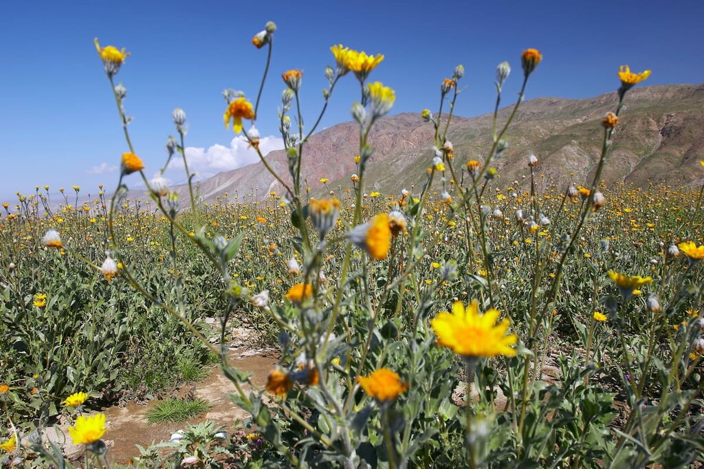
You can also see succulents like agave, and semi-succulent ocotillos, as well as other flora such as chuparosa, brittlebush, saltbrush (also known as cattle spinach), creosote bush, honey mesquite trees, and desert mistletoe.
A few of the invasive species that can be found in Anza Borrego include tamarisk trees and salt cedars. Salt cedars are actually another species of Tamarisk (Tamarix remosissima).
The handful of natural springs in Anza-Borrego create a number of oases within the wilderness. These oases in turn support Anza Borrego’s fauna, and are also home to the California fan palm (Washingtonia filifera), which is the only native palm tree in the state of California.
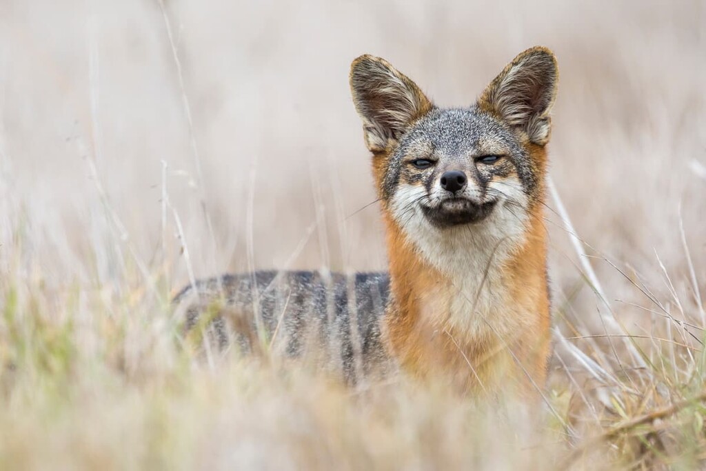
A few of the wildlife species you can find in the park include mountain lions, kit foxes, coyotes, mule deer, black-tailed jackrabbits, golden eagles, greater roadrunners, peninsular desert bighorn sheep phainopepla, and hummingbirds.
Anza-Borrego wilderness is part of the ancestral homelands of a number of Indigenous peoples, including the Cahuilla, Kumeyaay, and Cupeño, among countless others. Many of these communities had been living in the region for thousands of years at the time of European contact and the descendents of many of these Indigenous communities continue to live in the region today.
The wilderness contains a large number of petroglyphs, as well as other archaeological remains. The Kumeyaay people were the most effective at living in the Anza Borrego desert and their seasonal camps can be found all over the wilderness.
It is not uncommon to find pottery shards, bits of charcoal, and flakes of obsidian while hiking in the region. Guests are asked to leave artifacts alone and contact wilderness staff if they find any during their travels.
The desert’s name comes from that of Juan Bautista de Anza, who was a Spanish military officer that lived in the region during the eighteenth century. The word borrego is a Spanish word meaning “sheep.”
The wilderness itself was first established in 1933 along with the Anza-Borrego Desert State Park, making it among the earliest of the California state wilderness that are still in existence today.
It contains a number of wilderness areas, including Anza-Borrego Desert State Wilderness, Coyote Mountains Wilderness, Fish Creek Mountains Wilderness. The region was further designated as a National Natural Landmark in 1974.
The Anza Borrego wilderness is more or less fully open to backcountry camping. Visitors can pull over just about anywhere and stay the night, which makes planning your day to day activities in the park that much easier.
However, if you prefer a site that is a bit more maintained (and has bathroom facilities) there are a number of dispersed camping sites as well including Culp Valley, Sheep Canyon, Arroyo Salado, Yaquis Well, Fish Creek, Blair Valley, and Mt. Palm Springs (all of which have pit toilets), as well as Yaquis Pass (which does not).
When visiting Anza-Borrego, it is important to keep two environmental factors in mind: wind and heat.
Winds in Anza Borrego often pick up to over 30 to even 50 mph (13.4 to 22.4 m/s) and temperatures can stay well above 100ºF (38ºC) in the summer. When hiking, wear long sleeves, pack extra water, and hike either early in the day or toward the evening. Alternatively, adventure out for one of the area's famous night hikes when the moon is full—you won’t even need a flashlight on those nights!
Hikers, especially in the wilderness areas, should also be comfortable with backcountry desert navigation. Some trail markings may be hard to find in the wilderness.
The survey markers in the Anza-Borrego wilderness consist of benchmarks, corners, lines, and marks. Benchmarks are found at summits and were put there by surveyors. They usually give the name, height, and coordinates of a mountain summit.
Corners can be identified by metal disks, posts, sticks, pipes, or rock cairns and typically indicate square mile length along the trail. Lines are survey markers that indicate boundary lines in the wilderness and marks are any other markers that indicate the trail that are not, benchmarks, corners, or lines.
Hikers can also keep an eye out for jeep roads that are typically indicated on state park hiking signs by a jeep icon.
Anza-Borrego is a veritable choose your own adventure when it comes to hiking trails. Here are a few of the best:
Truckhaven, as the name would suggest, is very popular with off roaders. Hikers should keep an eye out for vehicles and avoid hiking in this area on holidays.
There are a number of hikes in this area ranging from 5 miles (8 km) to 0.1 miles (0.2 km) in length, all of which are considered to be strenuous. The Big Wash hike is the longest clocking in at 5 miles (8 km) and can be reached via Highway 86.
Turn on Coombs Drive until you hit the dirt road. Follow signs for the recreation area. There are maps to indicate the trailhead and hikers can keep an eye out for 6 directional markers on this trail.
Ocotillo Wells-East is a State Vehicular Recreation area, meaning that vehicles have the right of way. Hikers are welcome, but should hike to the side of trails as some fast moving vehicles may not see you, especially as they are coming over one of the area’s many hills.
The Campbell Wash hike is a moderately difficult 5 mile (8 km) loop that highlights the area’s diverse geological landscape and how it is rapidly changing from year to year. You can reach this trailhead via Highway 86 and turn on west when you are about 4.7 miles (7.6 km) out of Salton City. This trail is marked by 4 corners.
The Warner Spring area offers a variety of hiking delights in the northwestern-most corner of the wilderness. From mountain summits to hot springs, hikers have a lot they can explore at Warner Springs.
The area can be reached by driving west on Palm Canyon Drive (S22) for 1.4 miles (2.3 km) and turning left (south), on Montezuma Valley Road for 17.3 miles (27.8 km). Turn right on S2 and drive another 4.7 miles (7.6 km). You will then turn right onto Highway 79 and drive 1.6 miles (2.6 km) to the abandoned fire station in Warner Springs.
Options for hikes include the 10 mile (16 km) Hot Springs hike, the 3.4 mile (5.5 km) Seek Hike (which highlights some of the area’s flora and fauna), or the 4.6 mile (7.4 km) Combs Peak summit. All of these hikes are indicated by trailhead signs.
The Fish Creek Mountain recreation area is located on the north side of the mountains on Bureau of Land Management land. It is an interesting area to explore for its varied and dynamic terrain.
However, hikers need to take extra caution in this area for off road vehicles, as well as those participating in nearby target practice (which is allowed in the area). There are a variety of hikes that hikers can explore in this area including the Fish Creek Wash and the Fish Creek Mountains.
This area is also close to the more popular Fish Creek hiking area that is known for its wind caves, mud caves, and the popular Elephant Knees hike. This Fish Creek Mountain area, and surrounding areas, can be reached via Split Mountain Road, which heads south off of Highway 78.
Parts of the Anza-Borrego Wilderness that are located in the Yuha Valley are overseen by the Bureau of Land Management. As such, this area is popular for off roaders and competitive racing. Hikers need to take extra care when hiking here and should avoid the area on the weekends or holidays.
However, there are a number of draws for hikers in this area including a number of unnamed summit hikes, as well as a great 3.7 mile (6 km) hike through the Painted Gorge.
The Yuha Valley can be reached by driving south on S2 for 39.1 (63 km) miles to the Imperial County line from Scissor Crossing. Continue southeast for 6.8 miles (11 km) until you hit Shell Canyon Road, where you will turn left (north) and continue for another 1.5 miles (2.4).
Here are some of the best places to stay before or after your trip into Anza-Borrego Desert State Wilderness:
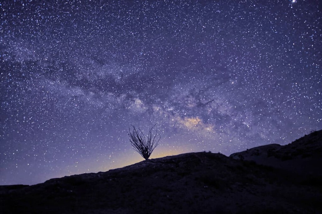
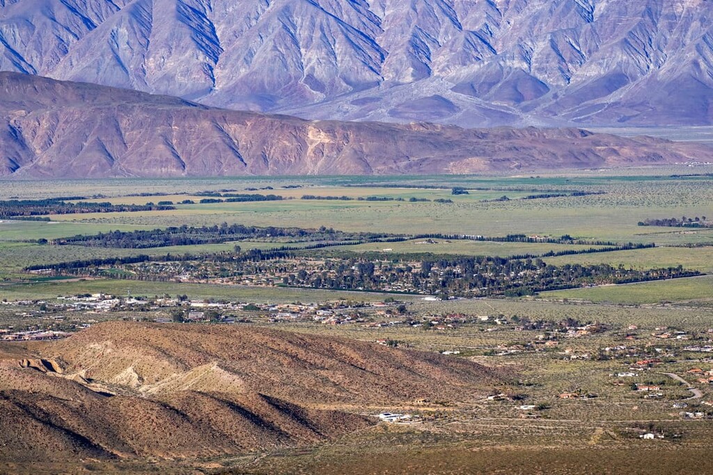
The town of Borrego Springs is surrounded by the Anza-Borrego Wilderness and it provides the best access to the park’s and wilderness’s trails. The town is considered an International Dark Sky Community for its expansive views of the starry sky.
While not technically a town, Agua Caliente is a seasonal county park (with camping amenities) that offers a great alternative to staying in the wilderness. Open only during the cooler parts of the year, and closing for around 2 to 3 months in June, Agua Caliente’s biggest pull for visitors is the natural hot and warm springs that erupt from the canyons near the community.
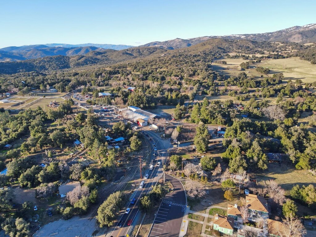
Julian is a small gold mining–turned tourist town. It has dozens of restaurants, breweries, cider mills, wineries, antique and craft markets, bed and breakfasts, and hotels to keep you comfortable and entertained.
San Diego is situated to the west of Anza-Borrego Desert State wilderness along the United States’ border with Mexico. While it is perhaps too far to drive back and forth between for longer stays, it is a good place to stop over on your way to the desert.