
Scan the QR code and open PeakVisor on your phone
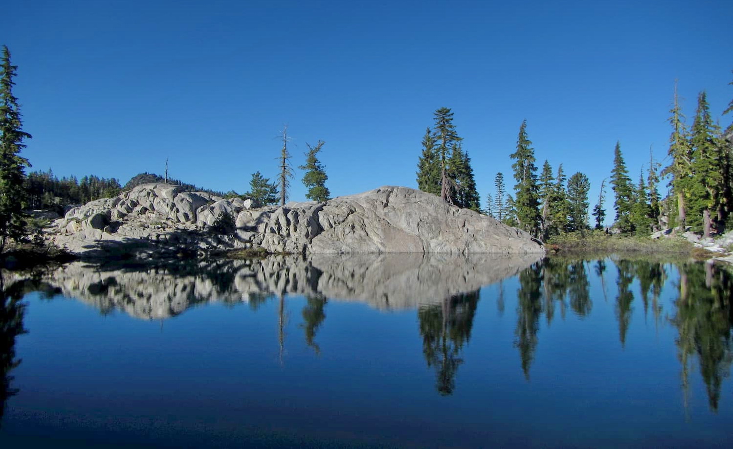
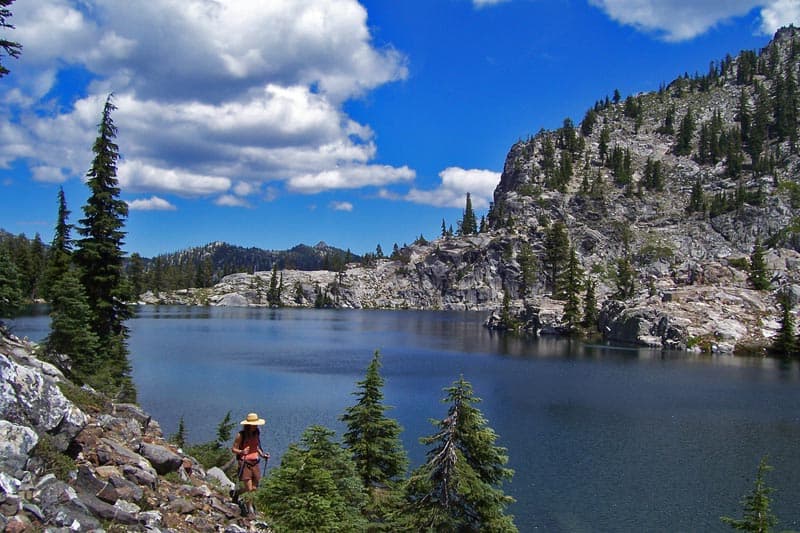
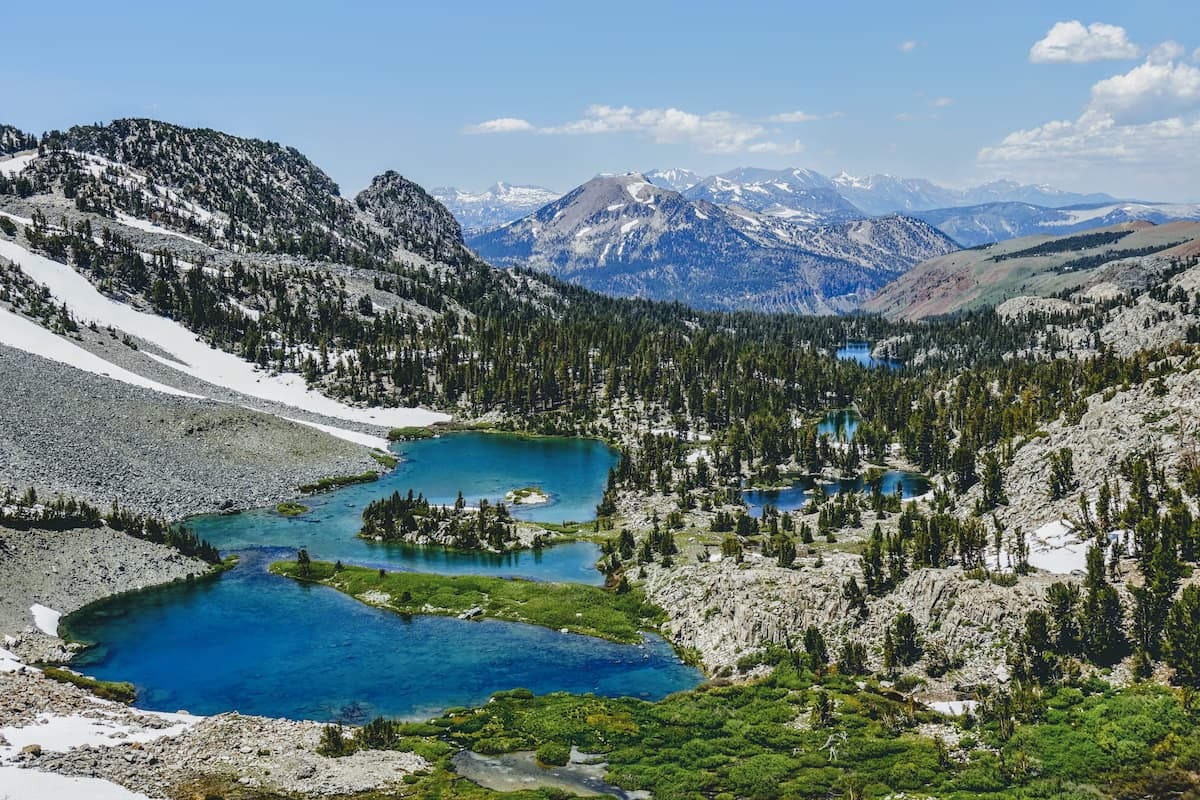
Boasting beautiful alpine lakes, jagged peaks, and an abundance of flora and fauna, the Russian Wilderness is a federally protected area in the northern part of the US state of California. The wilderness contains 3 named mountains, the highest and most prominent of which is Russian Peak (8,176ft/2,492m).
The Russian Wilderness is situated in northern California, mostly within Siskiyou County, some 65 miles (105km) northeast of the city of Eureka. It is managed by the US National Forest Service and covers about 19.7 square miles (51 sq. km) of land within Klamath National Forest, which extends from northern California into southern Oregon.
Due to its location in northern California, the Russian Wilderness is highly remote. Indeed, alongside the Trinity Alps Wilderness to the south and the Marble Mountain Wilderness to the north, the Russian Wilderness is part of a large roadless area that serves as a major habitat for wildlife in the region.
The Russian Wilderness is bordered to the west by the Six Rivers National Forest and the Hoopa Valley Reservation, and to the east by the northernmost part of the Shasta-Trinity National Forest. Although the wilderness and the rest of the Klamath National Forest are bounded by Highway 3 to the east and Highway 96 to the west, the region is almost entirely roadless, save for a few forest service access roads.
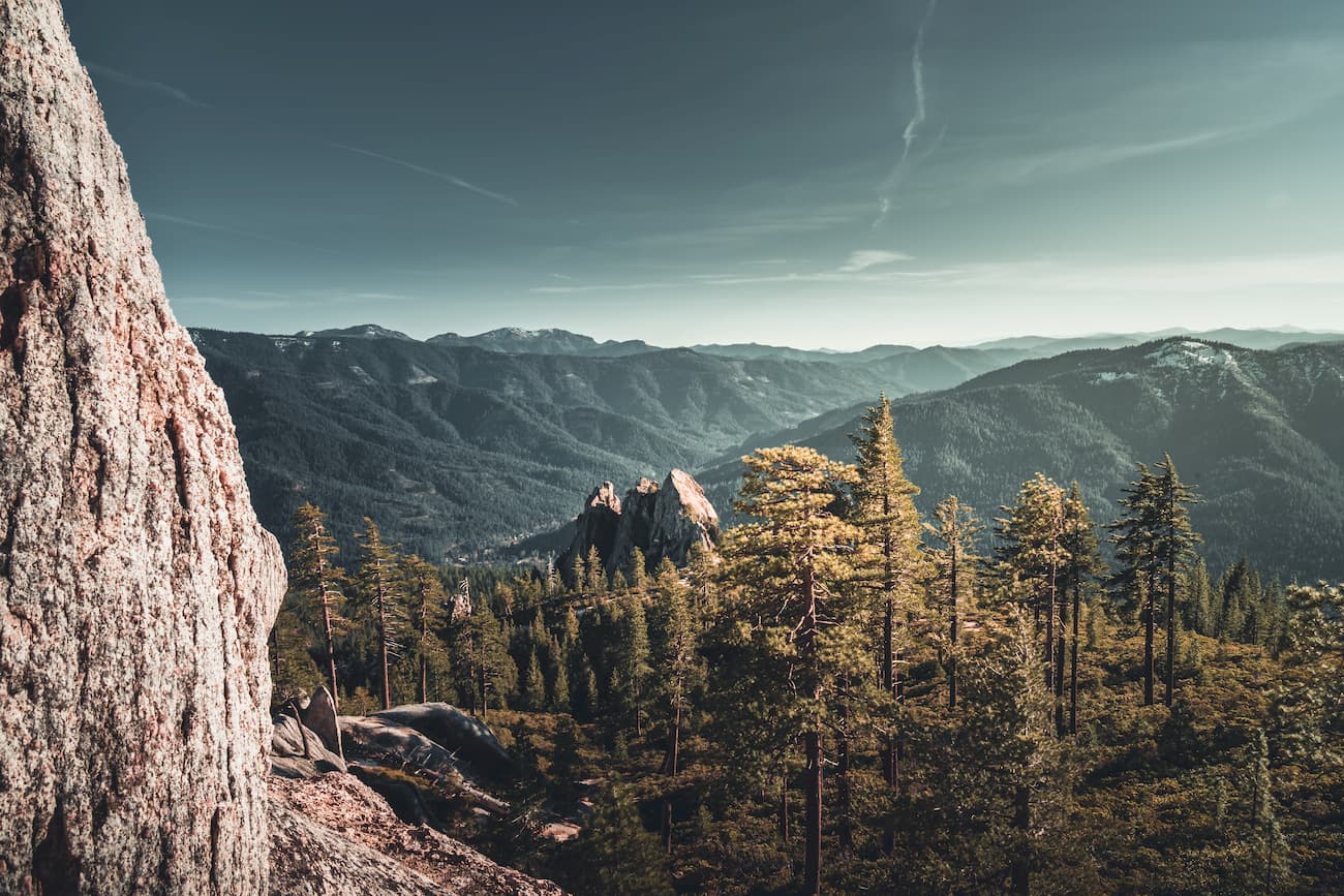
Within the Russian Wilderness, the peaks are part of the Klamath Mountains, which are a subrange of the Northwest U.S. Coast Ranges, though they have their own unique geologic history.
The Northwest U.S. Coast Ranges extend from the northern part of the Bay Area all the way to the northern border of Washington state, near its border with the province of British Columbia in Canada.
These peaks are part of a continuing system of mountain ranges that runs along the western edge of North America, including other major ranges, like the California Ranges, the Canadian Coast Mountains, the Northwest Coast Islands, and the Saint Elias Mountains.
The Klamath Mountains, in particular, are a rugged range within California and Oregon. They have a fairly complex geological history though the modern range is home to large areas of both serpentine and marble.
The region is the result of the accretion of different terranes, or pieces of crustal material that broke off the edge of one plate and then stuck onto the edge of another. However, while many of the terranes in the region are covered by other layers, the Klamath Mountains offer a good chance for visitors to see these metamorphosed terranes first hand.
The Russian Wilderness is located within what’s known as the Klamath Mountains ecoregion, which covers an area of coastal and inland California and Oregon from the Sacramento Valley in the south all the way to the banks of the Umpqua River in the north.
This area is considered a Level III ecoregion by the US Environmental Protection Agency and is officially designated as an important ecoregion by the World Wide Fund for Nature (WWF).
As an area known for its plant biodiversity, the Russian Wilderness and the Klamath Mountains are particularly important refuges for flora and fauna within the state of California.
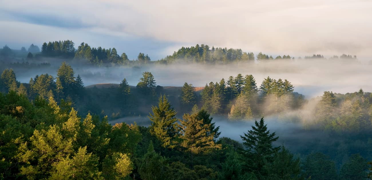
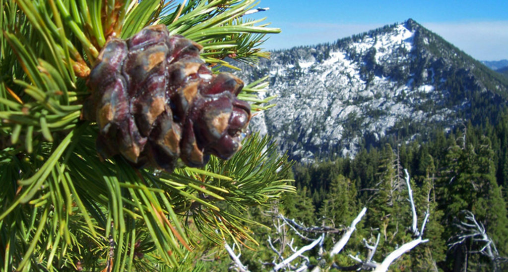
Within the wilderness, there are large stands of Engelmann spruce and subalpine fir. While these trees are not rare in the United States they are infrequently found within California. Moreover, the wilderness is home to a surprisingly large number of confiders, including Pacifc yew, common juniper, Douglas fir, incense-cedar, mountain hemlock, foxtail pine, western white pine, ponderosa pine, whitebark pine, lodgepole pine, Jeffrey pine, sugar pine, and white fir.
As far as wildlife goes, the Russian Wilderness is home to a wide array of animals, including black tailed deer, black bears, fishers, martens, beavers, wolverines, coyotes, and mountain lions. In the wilderness’ rivers and streams, there are also stocks of brown trout, eastern brook trout, and rainbow trout.
The region that is now known as the Russian Wilderness has been home to humans for thousands of years. A number of groups inhabited the region in and around the Russian Wilderness long before the arrival of Europeans, including the Karuk, the Tolowa Dee-ni’, the Yurok, the Shasta, the Konomihu, and the Hoopa, among countless others.
Unlike much of coastal California, the much more rugged, interior sections of the region, such as what would become the Russian Wilderness, were less frequently visited by the earliest European arrivals. It is likely that fur trappers and hunters traveled throughout the Russian Wilderness in between the 1820s and 1850s, as the Hudson's Bay Company had established a major trading post to the north of Portland, Oregon in the mid-1820s.
Many of these trappers likely traveled along the Siskiyou Trail, which traveled from the California Central Valley into the Willamette Valley in Oregon, a path that I-5 mostly follows. Although this trail traversed the easier, low-lying terrain to the east of the wilderness, it is not unfeasible that trappers ventured into the area in search of furs.
The region that would later become Siskiyou County later saw a large influx of prospectors and miners in the 1850s, after the discovery of gold to the northeast of the Russian Wilderness in the city of Yreka.
With the establishment of
The Russian Wilderness is situated in northern California, mostly within Siskiyou County, some 65 miles (105km) northeast of the city of Eureka. It is managed by the US National Forest Service and covers about 19.7 square miles (51 sq. km) of land within Klamath National Forest, which extends from northern California into southern Oregon.
in 1905, the area that would later become the Russian Wilderness was first put under federal management. However, it wasn’t until the 1984 California Wilderness Act that the Russian Wilderness would be officially designated and protected as a natural, roadless area.Compared to some of California’s other major recreation areas, the Russian Wilderness is lightly traveled. However, there are quite a few trails in the region for hikers to enjoy. Here are some of the best areas to check out.
The Pacific Crest Trail traverses the Russian Wilderness for about 18.5 miles (29.8km) as it makes its way from Mexico to Canada. Many hikers access the trail from the Etna Summit Trailhead, which also offers good connections to Upper Ruffy Lake, Paynes Lake, Smith Lake, and Syphon Lake.
The Bigfoot Trail is an unofficial hiking trail that connects approximately 360 miles (580km) of trails in Northern California. It enters the Russian Wilderness after leaving the Trinity Alps Wilderness and continues northward into the Marble Mountain Wilderness.
The Russian Wilderness is remote, but there are a few sizable cities located within driving distance.
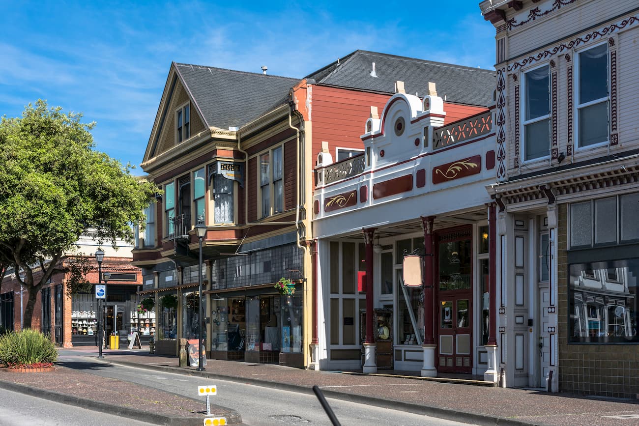
Eureka is a city of about 30,000 people that’s located along the northern coast of California. It is the largest coastal city between Portland and San Francisco and is a major commercial and cultural center for the region. The city is accessible by road on US Route 101, by bus, and by air, through the Arcata-Eureka Airport.
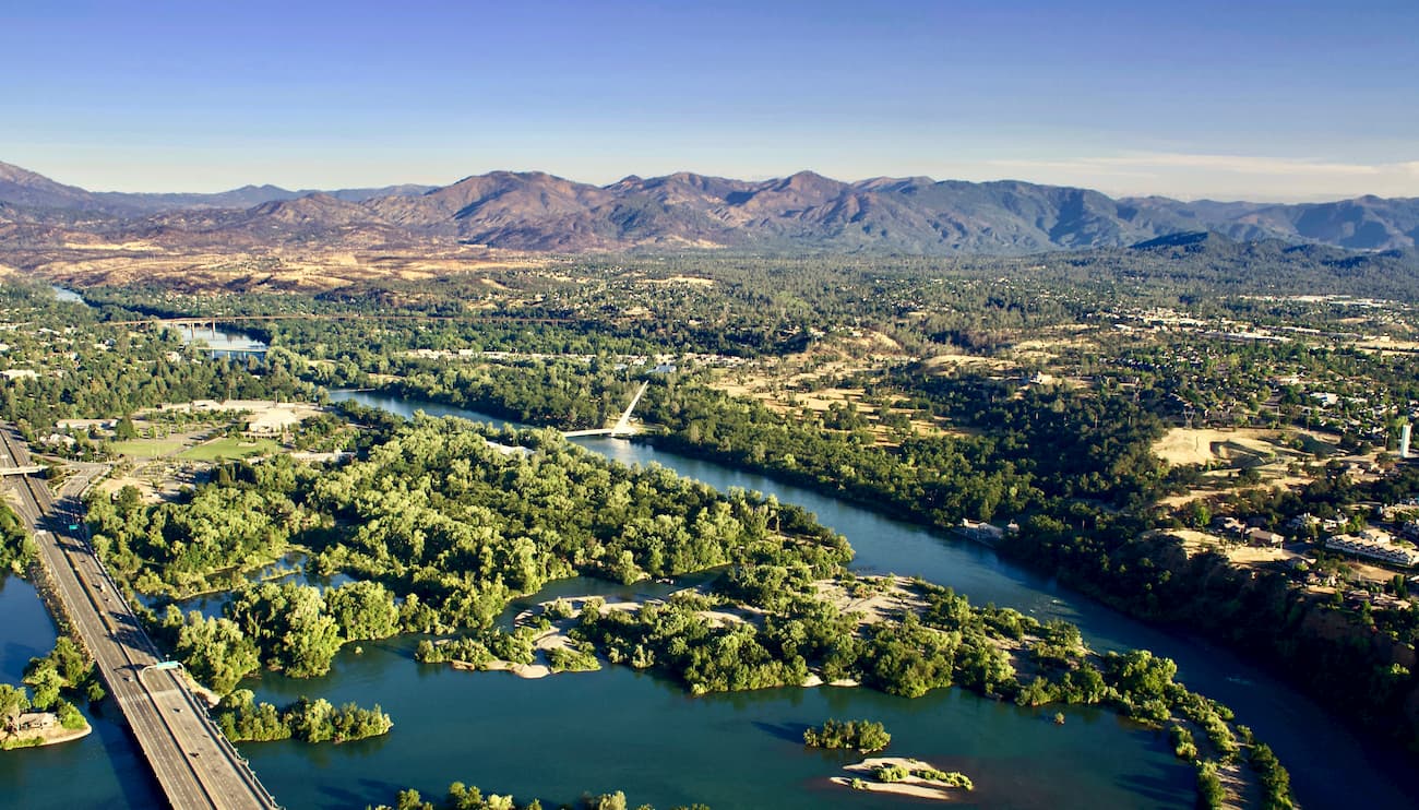
The city of Redding is situated to the southeast of the Russian Wilderness at the northern end of the Sacramento Valley. It is home to over 90,000 residents and is a major commercial center of the Shasta Cascade region.
Redding is located along I-5, which offers good road access to the rest of the western US. Additionally, the city has a small airport, as well as regular train connections throughout the west coast.
Yrkea is home to about 7,700 people and it is the county seat of Siskiyou County. It is located to the northeast of the Russian Wilderness in the Shasta Valley to the north of Mount Shasta. The city is a popular gateway to the Shasta Cascade area and is accessible by road on I-5.


