
Scan the QR code and open PeakVisor on your phone
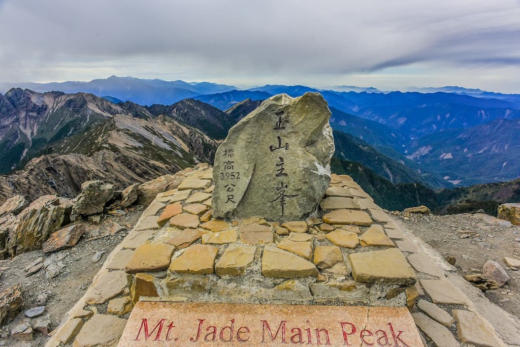
Home to fantastic food, rich culture, beautiful cityscapes, and stunning mountain ranges, Taiwan is (臺灣) an island located in the northern part of the South China Sea. Taiwan is a particularly mountainous island, with 4,598 named peaks, the highest and most prominent of which is Yushan (玉山) at 3,952m (12,966ft).
Located in the northern part of the South China Sea, Taiwan is an island (and collection of small nearby islands) that covers 36,197 square km (13,976 sq. mi) of land. This makes it larger than Belgium, yet smaller than the Netherlands.
With a population of over 23.5 million people, however, Taiwan is the 10th most densely populated geopolitical entity on Earth, with 650 people per square kilometer (1,683 people per sq. mi). Nevertheless, despite being one of the most densely populated places on Earth, the majority of the eastern half of the island is dominated by mountain ranges.
Taiwan is located to the south of the East China Sea, which separates it from Japan and South Korea, which are situated to the north. It is also located to the north of the South China Sea and the Luzon Strait, both of which separate it from Hong Kong, Hainan, the Philippines, and the rest of southeastern Asia, such as the countries of Laos, Vietnam, Cambodia, and Thailand.
Moreover, Taiwan is separated from the rest of mainland China by the 180km (112mi) of the Taiwan Strait to the west.
Taiwan can be subdivided into a number of different regions, some of which are de facto and others of which are de jure. Taiwan comprises 6 special municipalities, 13 counties and 3 cities.
Furthermore, although these divisions hold no political or legal meaning, Taiwan is often subdivided into 4 regions based on geography.
Aptly named, Northern Taiwan (北臺灣) encompasses the northern part of the main island of Taiwan. The region includes the northernmost counties and cities on the island, including Taipei (臺北市), New Taipei (新北市), Keelung (基隆市), Taoyuan (桃園市), Hsinchu (新竹市/新竹縣), and Yilan (宜蘭縣), Lienjiang (連江縣).
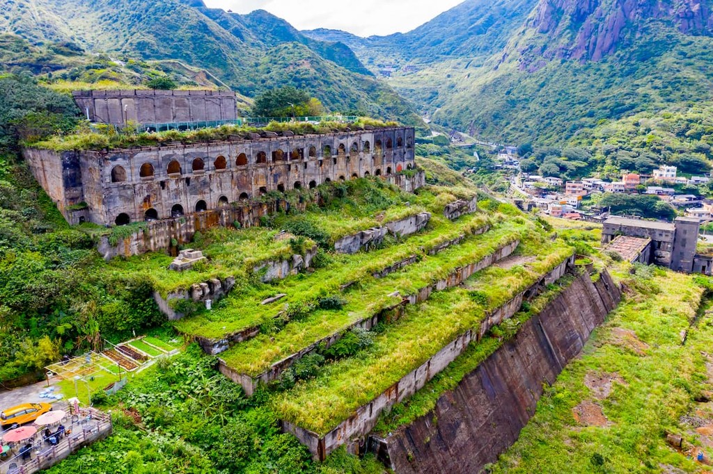
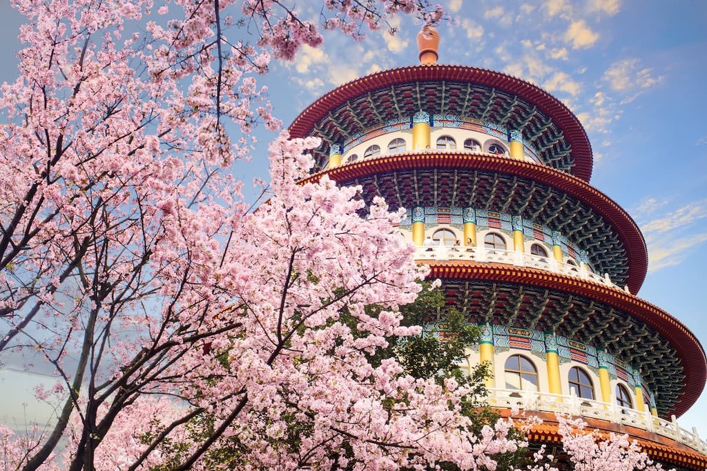
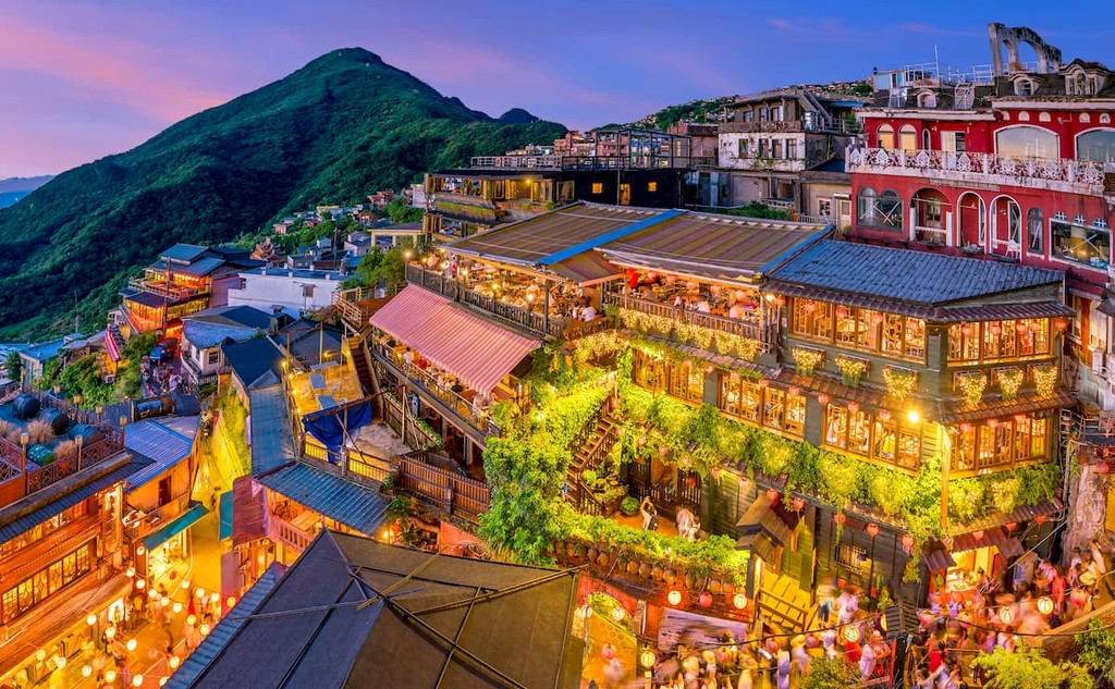
Thanks to the fact that it contains both Taipei and New Taipei cities, Northern Taiwan is the technical and financial part of the island and one of its most heavily populated regions. It is also the island’s primary tourist attraction, as a result of its many cultural and historic sites.
Moreover, although the region is very well-developed, Northern Taiwan does contain a great collection of parks and outdoor recreation areas, such as:
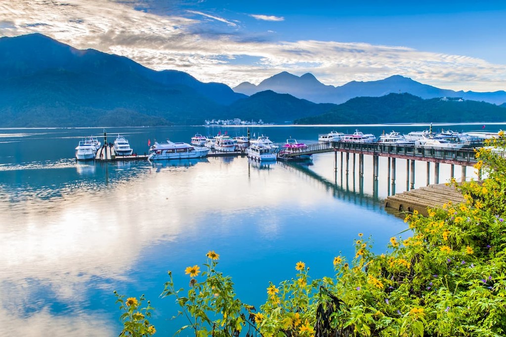
Covering much of the western half of the island, Central Taiwan (中臺灣) includes Miaoli (苗栗縣), Taichung (臺中市), Changhua (彰化縣), Nantou (南投縣), Kinmen (金門縣), and Yunlin (雲林縣) counties and cities. The region is often considered the heart of Taiwan and it is a popular travel destination thanks to its mild climate.
Central Taiwan is also a fun place to visit if you’re interested in checking out the island’s cultural and arts scenes, as there are many museums and art exhibitions in the region’s cities and counties.
While the westernmost coastal parts of Central Taiwan are arguably the flattest part of the island, the inland portion of the region is highly mountainous. In fact, the region contains a number of major parks and reserves for visitors to check out, such as:
Rich in culture and history, Southern Taiwan (南臺灣) is a political, cultural, and economic hub for the island outside the major cities of Taipei and New Taipei to the north. The region contains 5 counties and cities, including Chiayi (嘉義市/嘉義縣), Tainan (臺南市), Kaohsiung (高雄市), Pingtung (屏東縣), and Penghu (澎湖縣).
Southern Taiwan is home to Tainan City, which happens to be the oldest city on the island. It also has a very warm climate as the Tropic of Cancer actually passes right through Chiayi City. There are plenty of opportunities for outdoor recreation in the region, including water sports in the area’s many beaches.
Additionally, Southern Taiwan has a handful of popular parks and outdoor recreation areas, such as:
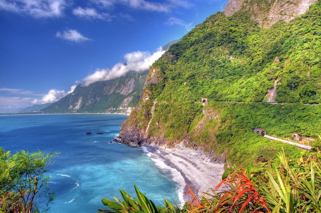
The fourth and final region on the main island of Taiwan is Eastern Taiwan. Although it includes just the two counties of Hualien (花蓮縣) and Taitung (臺東縣), Eastern Taiwan contains much of the island’s Pacific coastline.
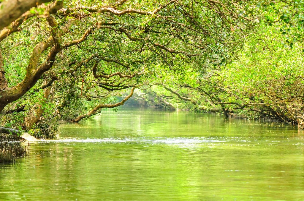
Home to an abundance of natural resources and a rich cultural history of farming, Eastern Taiwan is a particularly scenic part of the island. As a result, it’s a very popular place to hike and canoe, particularly near the Xiuguluan River (秀姑巒溪).
Furthermore, Eastern Taiwan contains an excellent collection of parks and reserves, including:
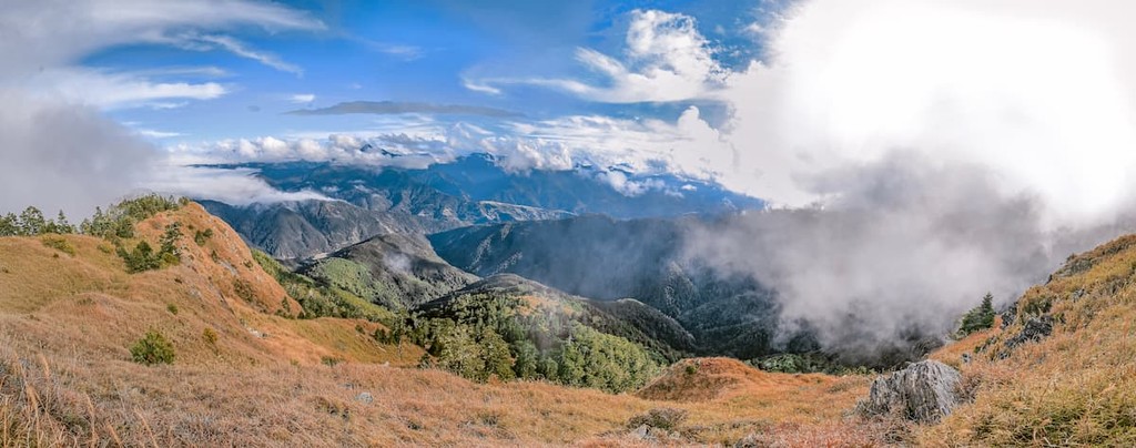
Despite being a relatively small island (at least when compared to behemoths, such as Greenland and Canada’s Baffin Island), Taiwan is a particularly geologically complex place. In fact, the island is located along the convergent boundary of the Yangtze subplate, the Okinawa plate, the Phillippine plate, and the Sunda plate.
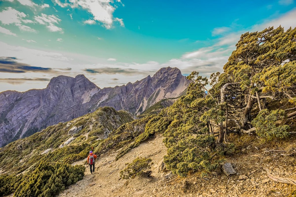
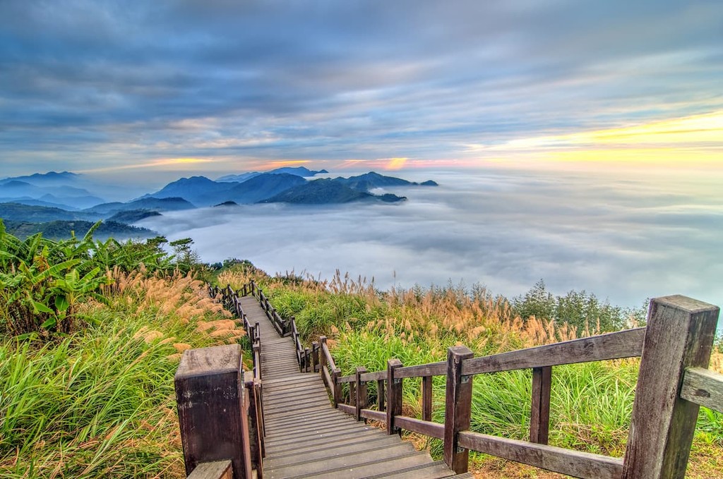
As a result, its geology is the result of a number of complex geologic processes with widespread evidence of metamorphism and volcanism as well as folding and faulting. The island is also dominated by 5 primary mountain ranges.
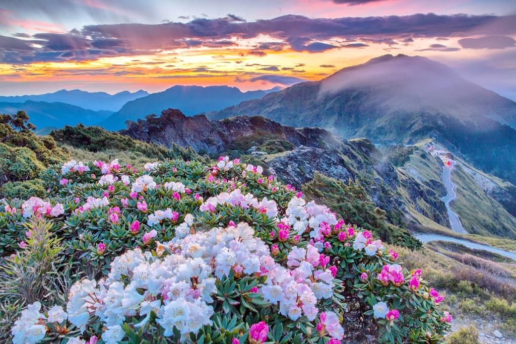
Forming a nearly straight line down the middle of the northern part of Taiwan, the Xueshan Range (雪山山脈) is a collection of 1,233 named mountains, the highest of which is Snow Mountain/Xueshan (雪山).
The range is composed of a number of different layers of metamorphosed sedimentary rocks, with meta-sandstones and slates dominating the region. There are also outcroppings of shale and sandstone that are minimally metamorphosed.
Within the range, there are plenty of great hiking opportunities, thanks to the region’s many ancient roads and trails. In fact, the range has been inhabited for thousands of years by the Indigenous Atayal (泰雅) people.
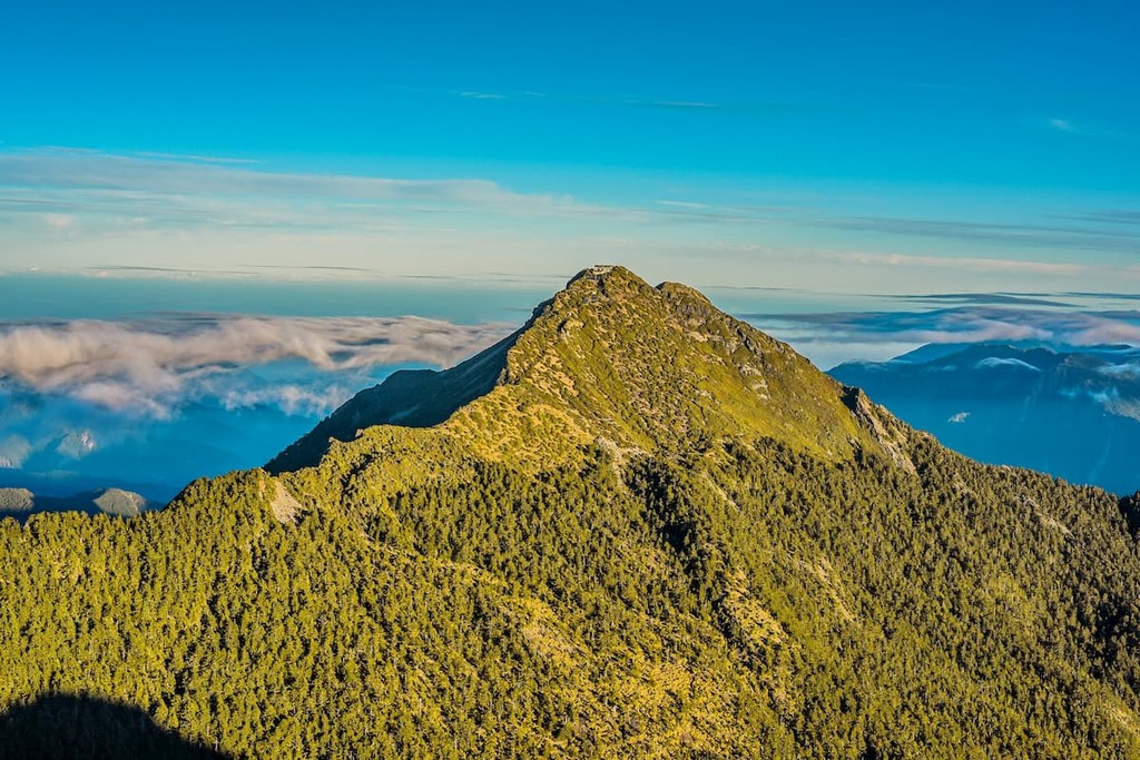
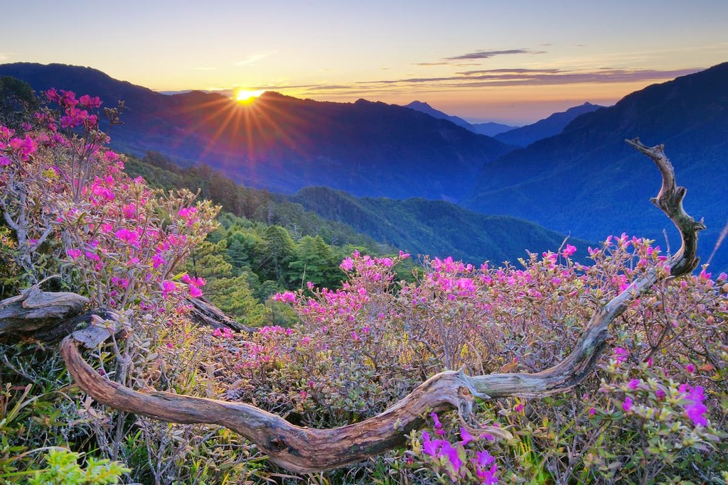
Named after the highest peak on the island, the Yushan Range (玉山山脈) is located in the heart of Taiwan. It contains 148 named mountains, the highest and most prominent of which is Yushan (玉山).
Also known as the Jade Mountain Range, the Yushan Range is particularly rocky and rugged. The range is located in a heavily faulted region though the rocks within the range are believed to be quite old, especially with respect to the nearby Alishan Range. Much of the range is protected within Yushan National Park, which is an excellent hiking area for high-elevation pursuits.
Aptly named, the Central Mountain Range (Chungyang Range/中央山脈) is the primary mountain range on the island of Taiwan. It runs nearly the entire length of the island, from just south of New Taipei to the southern tip of Taiwan, encompassing 1,249 named mountains, the highest of which is Xiuguluan Shan (秀姑巒山), and the most prominent of which is Beidawu Shan (北大武山).
The majority of the range is comprised of varied sedimentary and metasedimentary rocks, with sandstones and slates dominating the landscape. Moreover, the range forms a major natural barrier between the easternmost coastal part of the island and the rest of Taiwan.
Depending on who you ask, the Central Mountain Range may also include both the Yushan and Xueshan ranges. However, many hikers consider the 3 ranges to be distinct.
The Hai'an Range (海岸山脈), or the Coastal Mountain Range, is the easternmost of Taiwan's collection of peaks. Within the range, there are 189 named mountains, the highest and most prominent of which is Malaolou Shan (新港大山).
Despite being much smaller than the other ranges on the island, both in terms of height and total number of peaks, the Hai'an Range is a particularly scenic area. That being said, the range is surrounded by farmlands and it is among the most agricultural regions in Taiwan.
Taiwan’s westernmost range, the Alishan Range (阿里山山脈) is located in the south-central part of the island. It contains. 570 named mountains, the highest of which is Data Shan (大塔山).
Within the Alishan Range, the rock is mostly sedimentary, with shales and sandstones being among the most abundant. The range is located to the west of the Yushan Range and it is separated from its loftier neighbor by the Qishan River (旗山溪).
For being one of the most densely populated places on the planet, Taiwan is home to an impressive amount of biodiversity. Within Taiwan, there are 2 primary ecoregions, as defined by the World Wildlife Fund (WWF):
Encompassing the vast majority of the main island of Taiwan except the southern tip, the Taiwan Subtropical Evergreen Forests boasts an assortment of different plant communities.
The flora of the ecoregion depends greatly on your elevation, with evergreen deciduous forests and subtropical pine dominating the coastal plains. At higher elevations, the plant communities transition into woodlands of Japanese blue oak and at the highest elevations below treeline, the major species are formosan alder, Taiwan hemlock, firs, spruces, and maples.
Covering just a small portion of the southern tip of Taiwan, the South Taiwan Monsoon Rain Forests are a unique, highly biodiverse region that straddles the subtropical and temperate zones.
For the most part, the ecoregion is located within Kenting National Park. It boasts both evergreen and deciduous forests of Chinese cryptocarya, Chinese banyan, and Kapok. There are also a number of mangrove forests in the ecoregion, which include species like Black mangrove and Asiatic mangrove.
Moreover, the South Taiwan Monsoon Rain Forests is located along the East Asian-Australasian Flyway, so it’s a popular stopping point for migratory birds.
The island of Taiwan and its neighboring archipelagos have been inhabited by humans for tens of thousands of years and it has a rich cultural tradition that continues to this day.
It is believed that the sea levels around Taiwan were much lower during the Late Pleistocene than they are today, a fact that likely created a land bridge between the island and the mainland. As a result, there are remains of anatomically modern humans and other archaeological remnants that date back nearly 30,000 years.
Around 3,000 BCE, it’s believed that the people of the Dapenkeng culture appeared on the island and they were later succeeded by a number of other groups, including the ancestors of Taiwan’s Indigenous peoples.
The waters around the island were frequented by Han Chinese during the 13th century and during the succeeding century, the island and its coasts were commonly visited by people from mainland China and Japan.
During the 1600s, the Dutch East India Company ended up in Taiwan after being defeated by the Portuguese at Macau. The Dutch then founded Fort Zeelandia on the island.
Not long after, the Spanish established their own settlement on the island to help bolster their presence in the region and to protect their colony in the Philippines from the Dutch.
However, the Dutch attempt to colonize Taiwan was relatively short-lived. After ejecting the Spanish from the island and colonizing Taiwan’s Indigenous peoples, they were eventually ousted by Ming loyalists in the 1660s.
From the 1680s to the 1890s, the island of Taiwan was under the control of the Qing Dynasty of China. However, this period was particularly tumultuous and it saw hundreds of rebellions between the many groups on the island against the Qing Dynasty of China.
During this time, the island also saw a number of battles during the Sino-French War in the 1880s and it was briefly occupied by the French. However, after the Qing Dynasty of China was defeated by Japan during the First Sino-Japanese War, the island was put under the control of the Japanese.
After the First Sino-Japanese War, Taiwan became part of the Empire of Japan. The empire placed the island under colonial rule and the period saw the establishment of a number of industrialized networks, including transportation and sanitation systems.
Moreover, this period also saw Taiwan become one of the largest sugarcane producers in the world.
The period of Japanese rule of the island also coincided with the establishment of the Republic of China (ROC) in 1912. It also coincided with World War II, after which the Empire of Japan surrendered and the Republic of China gained control of the island of Taiwan.
After World War II, the Chinese Civil War began again in earnest between the Chinese Nationalists and the Communist Party of China, the latter of which was led by Mao Zedong. After suffering a number of defeats, the Chinese Nationalists moved the capital of the ROC to Taiwan.
Afterwards, Taiwan was ruled under martial law until the late 1980s. The government then experienced a number of democratic reforms in the late 1980s and early 1990s. By the early 2000s, a split within Taiwanese politics formed, with some advocating for Taiwanese independence and others advocating for Chinese reunification under the One-China policy.
These days, Taiwan has a burgeoning economy that is dominated by business rather than agriculture, due to the island’s dense population. The island is a major exporter of goods as well as a hub for informational technology.
Additionally, Taiwan remains a popular hub for tourism in Eastern Asia. It is a hub for outdoor recreation and it is a fan-favorite among visitors looking to check out its many cultural sites.
Interested in hiking in Taiwan? Here are some of the most popular hiking destinations to check out:
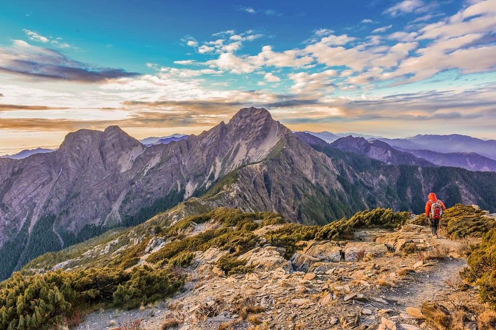
Although not technically a “hiking area,” the 100 Peaks of Taiwan (台灣百岳) are a collection of 100 mountains located on the island that are almost all above 3,000m (9,842ft) in height (only Lu Shan (鹿山) is slightly shorter).
While these peaks are not necessarily the highest mountains on the island, they were all selected by a group of Taiwanese hikers to be part of the list because of their excellent hiking opportunities. As a result, completing all 100 peaks is a popular challenge for hikers on the island.
For the most part, the peaks on the list are located in the Central Mountain Range, though smaller numbers are located in the Xueshan and Yushan ranges. The majority of the peaks have trails that lead toward their summits, though they range in difficulty from fairly easy climbs to challenging ascents.
Some peaks are accessible within a day, some others would make for a worthy multi-days trip while connected altogether. For some most enthusiastic hikers, peak-bagging all 100 summits has become their pursuit of the dream of life.
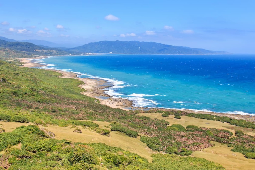
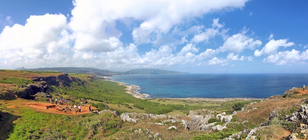
The oldest national park on Taiwan’s main island, Kenting National Park (墾丁國家公園) is located in the southern region. It contains 34 named mountains, the highest and most prominent of which is Wanlide Shan.
Known for its fantastic weather, the park is home to a number of fault valleys, as well as the massive Longluan Lake. Thanks to its diversity of landscapes, Kenting is home to hundreds of animal species. It also contains beautiful coral reefs just off shore. In the coastal regions of the park, visitors have a decent chance of seeing plenty of marine life, including hawksbill turtles, whale sharks and bull sharks.
Home to the highest peak in Taiwan, Yushan National Park (玉山國家公園) is located in the island’s central region. It contains 120 named mountains, the highest and most prominent of which is Yushan, which is also known as Mount Jade.
With over 30 peaks that crest the 3,000m (9,842ft) mark, Yushan is one of the highest elevation regions on the island. It also contains some stunning cliffs and canyons, which make for some truly spectacular scenery. Moreover, the park has a handful of beautiful alpine lakes including Dashueiku Lake (大水窟池) and Jiaming Lake (嘉明湖).
Due to the relative remoteness of the park, it is one of the least visited national parks on the main island. However, it still gets well over a million visitors each year.
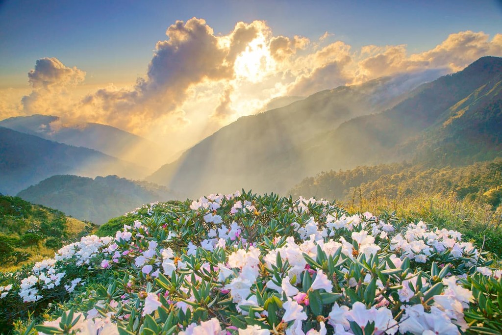
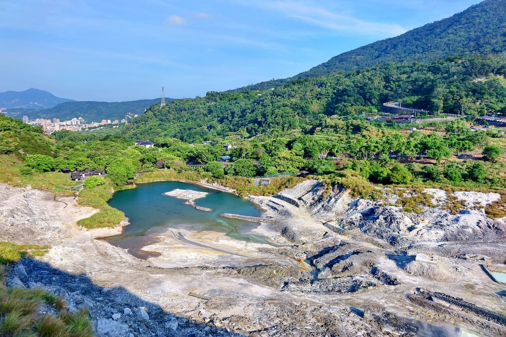
Situated between New Taipei and Taipei, Yangmingshan National Park (陽明山國家公園) is one of the most scenic areas in the northern part of the island. It contains 97 named mountains, the highest and most prominent of which is Mount Qixing (七星山), which is the highest dormant volcano on the island.
Despite being located at a lower elevation than the rugged national parks in Taiwan’s central region, Yangmingshan contains a unique volcanic landscape. It is home to hot springs, fumaroles, and other such evidence of the region’s volcanic past.
Moreover, the park is the perfect habitat for a number of ecosystems, which include large stands of cherry blossoms. There are also nearly 200 species of butterfly that call the park home, many of which can be seen during the summer months.
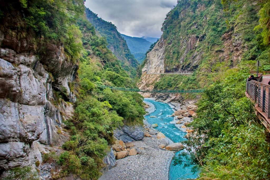
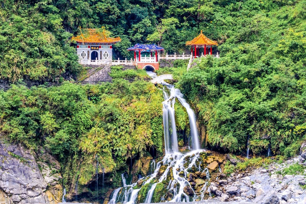
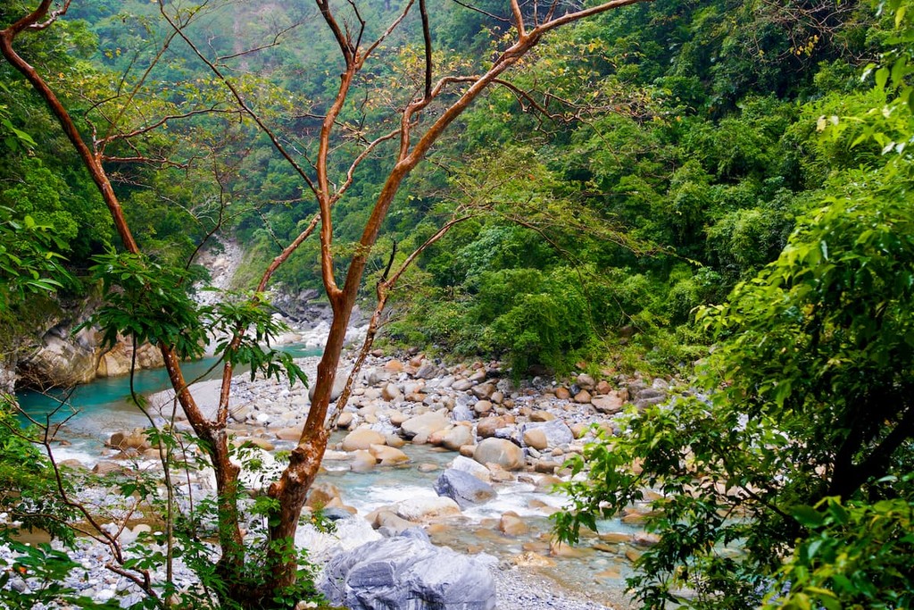
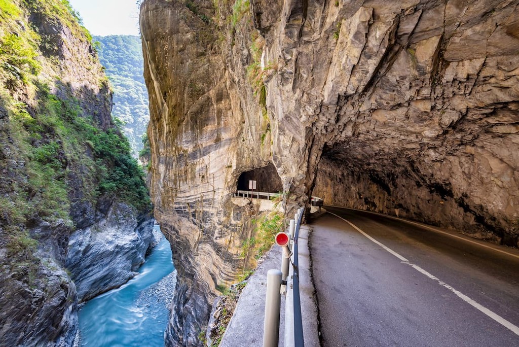
Located in the northeastern part of the island, scenic Taroko National Park (太魯閣國家公園) is one of the most unique landscapes in Taiwan. The park contains 140 named mountains, the highest and most prominent of which is Nanhu Dashan (南湖大山).
In addition to containing some of the highest peaks on the island, Taroko also contains a marble gorge and some staggering cliffs. There are also hundreds of plant and animal species in the park, including beautiful deciduous forests.
Hiking is particularly popular in the park and there are many scenic footbridges that cross Taroko’s massive gorges.
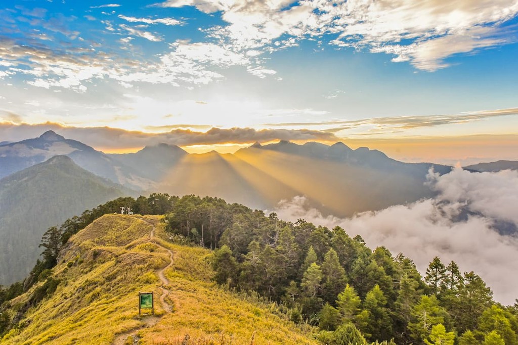
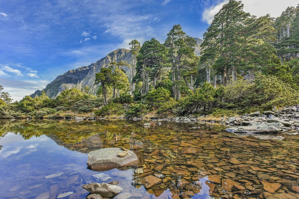
Boasting exceptional high mountain ecosystems, Shei-Pa National Park (雪霸國家公園) is located in Central Taiwan, just to the northeast of Taichung. The park contains 96 named mountains, the highest and most prominent of which is Snow Mountain/Xueshan (雪山).
Shei-Pa is best known for its rugged terrain, which includes jagged peaks, steep ridges, and beautiful alpine landscapes. The mountains within the park are actually home to the headwaters of some of the island’s major rivers, and Shei-Pa is an exceptional place to go hiking if you’re looking to get off the beaten path.
One of the smallest parks in Taiwan, Taijiang National Park (臺江國家公園) is located almost completely within the city limits of Tainan in the southern part of the island. It contains just one named high point - Mu Shan.
While Taijiang isn’t known for being particularly mountainous, it does encompass some fantastic coastal landscapes. In fact, it is home to some mangrove swamps as well as massive sandbars that stretch out into the Taiwan Strait. There’s also a lighthouse and some great walking paths to check out if you’re in Tainan.
Looking for a place to stay during your trip to Taiwan? Here are some of the best cities to check out:
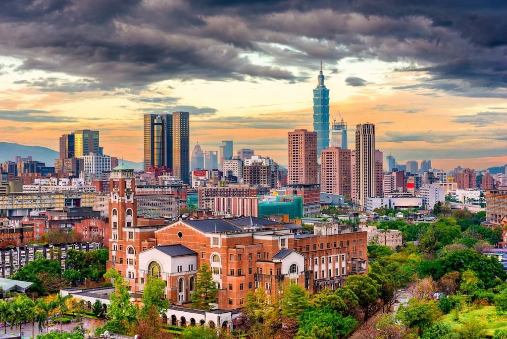
The capital of Taiwan, Taipei City (臺北市), more commonly known as Taipei, is a city of some 2.7 million people located in the northern part of the island. Taipei is one of the most populous metro areas in the entire world and it is the political, educational, and cultural center of Taiwan.
Taipei is well connected to the rest of the island by road and rail and it even has 2 airports for easy travel around the world. There are also dozens of famous sites in the city, including Taipei 101 and many other impressive feats of architecture.
Not to be confused with its neighbor, Taipei, New Taipei City (新北市) is the most populous city in Taiwan with some 4 million residents. Interestingly, New Taipei actually completely surrounds the city of Taipei on the northern part of the island.
New Taipei is home to a great collection of tourist attractions, including plenty of museums and cultural sites. There are even some great night markets, which are worth checking out during the evening. Like its neighbor, Taipei, New Taipei is well connected by road and rail and there is easy transport to the region’s 2 major airports.
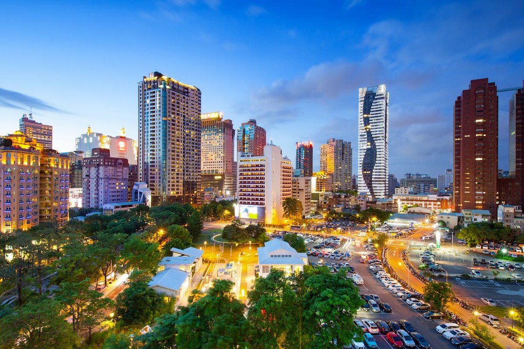
The second most populous city in Taiwan, Taichung City (臺中市) is located in the island’s central region. It is home to about 2.8 million people and it contains some of the best museums in the country, such as the National Museum of Natural Science and the National Taiwan Museum of Fine Arts.
Taichung also has famous hot springs, bustling night markets, and plenty of historical sites for visitors to check out. Getting to and from the city is also easy, thanks to its many rail lines and roads. It also has the island’s newest international airport - Taichung International.


tw100
ultra
taiwan-high-three
taiwan-ultras
tw100
ultra
taiwan-high-three
taiwan-ultras
tw100
ultra
taiwan-high-three
taiwan-ultras
tw100
ultra
taiwan-high-three
taiwan-ultras


