Scan the QR code and open PeakVisor on your phone
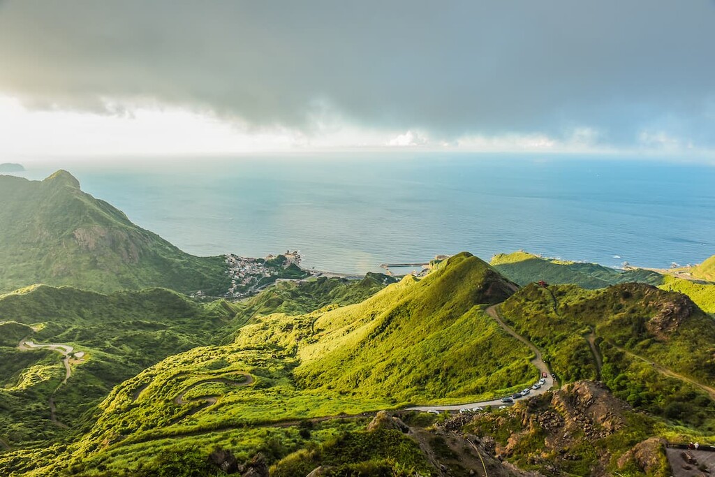
The Northeast Coastal Reserve (東北角沿海保護區) is a 102.5 km (63 mi) stretch of coastline along the northeast shore of Taiwan. A total of 46 named mountains are present in this strip of land. Dahushan (大湖山) is the highest peak in the reserve at 490 metres (1,608 ft) in elevation, while the most prominent mountain is Long Long Shan (隆隆山) at 436 metres (1,430 ft) in elevation.
The Northeast Coastal Reserve starts in the north at Nanya fishing village, in the Ruifang District (瑞芳區) of New Taipei City (新北市). It extends southwards down New Taipei City's coastal Gongliao District (貢寮區) and the Yilan County (宜蘭縣) townships of Toucheng (頭城鎮), Zhuangwei (壯圍鄉) and Su’ao (蘇澳鎭).
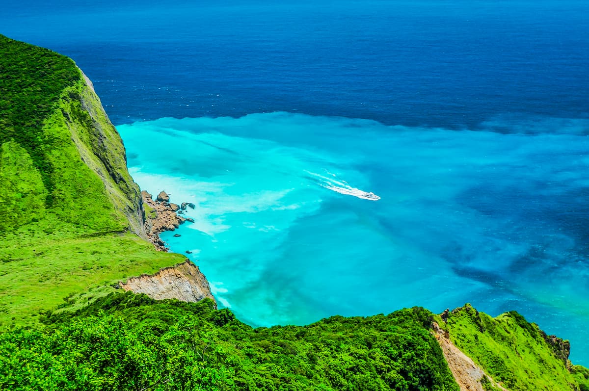
The area is prized for its spectacularly dramatic landscapes of aquamarine bays with golden beaches backed against luscious mountains that extend along the coastline. A fascinating selection of interesting rock formations and the mesmerising patterns of sea erosion add to the exquisite scenic beauty of this shoreline.
Provincial Highway 2 traces an accessible path along the Northeast Coastal Reserve, which is considered to be one of the most breathtaking drives in Taiwan.
Other notable mountains found in the Northeast Coastal Reserve include Bitoushan (鼻頭山), Fulongshan (福隆山), Dalijianshan (大里簡山), Laolanshan (卯里山), and Shichengshan (石城山).
Bitoushan is the northernmost peak in the Northeast Coastal Reserve, with Lailaishan (萊萊山) marking the region's eastern boundary. The southernmost mountain, Huomanliaoshan (火滿寮山), also doubles as the westernmost hill.
The Upper Masu River Special Conservation Area (瑪鋉溪上游水源涵養核心特別景觀區) is located west of the northernmost area of the Northeast Coastal Reserve. To the north and east of the Northeast Coastal Reserve lies the vast sea waters of the Pacific Ocean. Yangmingshan National Park (陽明山國家公園) is situated northwest of the reserve while Yilan's spectacular Taipingshan National Forest Recreation Area (太平山國家森林遊樂區) is southwest of the Northeast Coastal Reserve.
The coastal sea of the Pacific Ocean once submerged the shoreland of the Northeast Coastal Reserve. Over time, as the steep hilly land of Taiwan emerged from tectonic shifting, the retreating waters revealed the sunken land. The unusual shaped Nanya Rocks and the hills that hug the coast mainly comprise bedded sandstone from the Miocene epoch.
Thousands of years of weathering has moulded the rocks into peculiar, striking shapes. In particular, the Nanya Rocks contain iron ore, which has resulted in the striped pattern of cream, burnt orange, chocolate brown, and rusty red throughout the region, due to the process of oxidation.
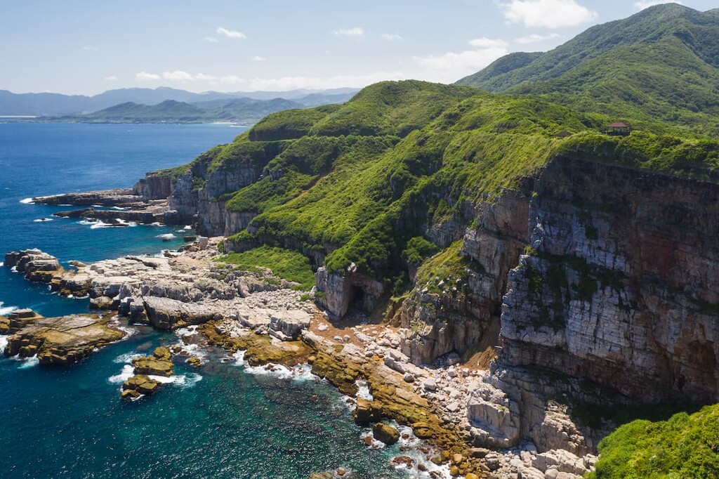
The craggy rocks of Longdong were formed from an accumulation of sediment, which then uplifted from the tectonic shifts created by the Eurasian and Philippine Sea plates. As a result, the rock strata include well-bedded sandstones and shales from the Eocene epoch. The rock cliffs of Longdong are a popular place for rock climbing enthusiasts, with some boulders standing as high as 70 metres (230 ft).
Just off the coast lies Guishan Island, or Turtle Mountain Island in English, a verdant island under protected status. Guishan Island was formed from an underwater volcano; thus, the rocks of the island are composed of volcanic rocks, such as andesite. Guishan Island is also particularly well-known for the crabs that reside in its subsurface fumaroles.
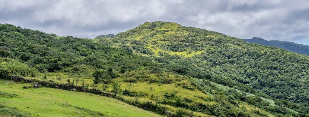
The vegetation of the Northeast Coastal Reserve is influenced by the northeast monsoon that carries torrential rain and heavy winds to the rugged region, adding moisture to this arid area in the winter months. Consequently, two distinct groups characterise the vegetation in this region: a coastal vegetation zone and a hillside vegetation zone. Each zone nurtures different plant species according to its ecological conditions.
The coastal vegetation zone is further segmented into beach plant communities, rocky shore plant communities, coastal shrubs, coastal forest, and dune forests. The primary plant life in the coastal vegetation zone is saddle leaf Philodendron, crossvine, sea lemon fruit, Taiwan lily, and yellow hibiscus.
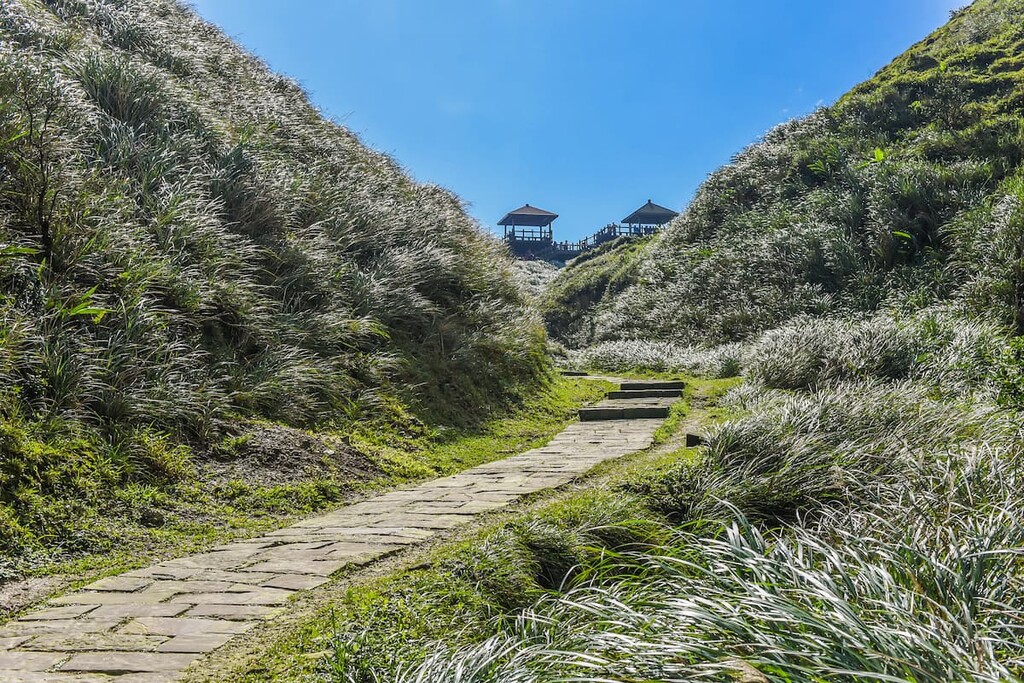
Plant communities in the hillside vegetation zone are subdivided into grass habitat communities and mountain forests. Typical plants that grow in this region are Phoebe chinensis, Phoebe glaucophylla, Phoebe formosana, Ficus retusa, and the small-leaved Laurel Adinandra millettii. In addition, miscanthus, otherwise known as silvergrass, envelopes the peaks, especially in the northern section of the reserve. Bamboo forests featuring Pseudosasa japonica are prevalent particularly on the slopes of Nanzilinshan (南子吝山).
The rich ecological nature of the landscape serves as a superb habitat for wildlife. Typical mammals seen in this area are wild boar, wild hare, Formosan gem-faced civet, and the leopard cat. In addition, a significant quantity of terrestrial birds and seabirds call this area home, with 149 bird species present. Common birds seen in the area are the kestrel, crested goshawk, osprey, terns, waterbirds, and seagulls.
As the Northeast Coastal Reserve is located along the Pacific Ocean, a wide variety of sea creatures are found in its coastal waters. A total of 290 species of shellfish inhabit the waters, as do 70 species of crustaceans, 40 species of echinoderms, as well as a total of 100 species of sponges, sea anemones, jellyfish, and ascidians.
Resident and migratory fish populate the waters of the Northeast Coastal Reserve. Additionally, the East China Sea in the north and the western Kuroshio Current affect the fish population in this area. The primary resident fish in the area include breams, perch, and roach, while migratory fish include mackerel, tuna, swordfish, and bonitos, all of which appear annually.
In addition to sea creatures and fish, cetaceans also inhabit the coastal waters of the northeast. In the summer and winter months, whales and dolphins, such as the common bottlenose dolphin, spinning dolphin, and the striped dolphin, can be seen along Guishan Island and Nanfangao.
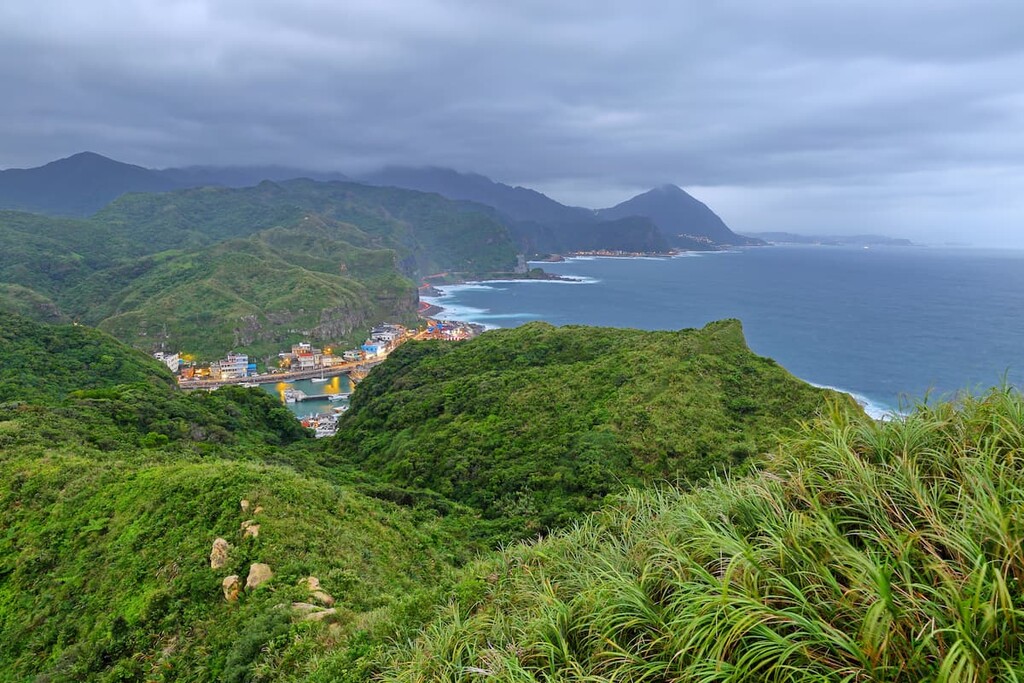
As the Northeast Coastal Reserve region is a vast strip of seaside land, the history of the area is rich and extensive. The Ruifang District, situated at the northernmost point of the coastal zone, holds a past of gold mining. In 1889, during the Japanese Occupation Era, traces of gold were discovered in the Keelung River. As a result, the Japanese established two mining companies on either side of Keelung Mountain (基隆山); Jinguashi and Juifen.
Silver and copper deposits were later found at the Jinguashi mining site in 1905, which soon overtook the prevalence of gold mining. The state of Taiwan overtook ownership of the mines after the Japanese retreated; however, these mines closed in 1987 as operating the mines became too expensive due to unpaid debts.
The Northeast Coastal Reserve features numerous ancient trails that were once used as major thoroughfares during older times. The Caoling Ancient Trail was the first cross-island road built by early Chinese settlers in 1807. Another old route is the Shitikeng Ancient Trail, which connected Shitkeng and Nanziping to the gold mining towns of Jiufen and Jinguashi.
The area of the Northeast Coastal Reserve was proposed as a national scenic area in 1984 in order to bring both national and international tourism to the rugged mountainous shoreline. On June 1, 1984, the Northeast Coastal Reserve was established as a scenic area, while on July 1, 1995, the region was declared a national scenic area.
The Northeast Coastal Reserve has bountiful beauty and is not short on admirable views from the many iconic hiking trails and sandy beaches. Here are some of the best trails to check out during your next trip to the reserve:
The Caoling Ancient Trail is situated in the Gongliao District of New Taipei City and it crosses the hills between Fulong in the north to Dali in the south. The 8.5 km (5.3 mi) path was once used as an essential road for people to travel between Yilan and Taipei.
This historic route highlights the scenic ocean views of turbulent turquoise waters crashing against the sandy shore. However, the historical significance is present in the stone-carved tablet featuring the Chinese character of a tiger. The story behind this carved boulder is that military official Liu Ming-deng inscribed the character of tiger in 1867 to quell the notoriously blustering winds of the northeast coast.
Hikers can begin the trail from either Yuanwankeng Riverside Park near Fulong or Dali. However, many hikers prefer the hike to Dali as it offers gorgeously scenic views of Guishan Island and the charming fishing harbour of Dali.
The first 1 km (0.6 mi) of the trail is a paved road; however, the path soon ascends a mountain slope of banyan trees where hikers are soon met with the illustrious tiger stone tablet. Hikers will then set forth towards what locals refer to as Yakou, or the mountain pass, where an Earth God Temple rests, which also features a resting spot for hikers. Finally, hikers can admire the striking scenic views of the coastal mountains of Dalijianshan hovering over Dali with pristine scenes of Guishan Island in the Pacific Ocean.
Descending Yakou, hikers can either take the gentle sloping S-shaped path towards Dali or climb down the steeper, more direct stone path. Near the end of the trail, hikers will encounter the elaborate Tiangong Temple, a majestic masterpiece built on the mountainside with incredible Pacific Ocean views.
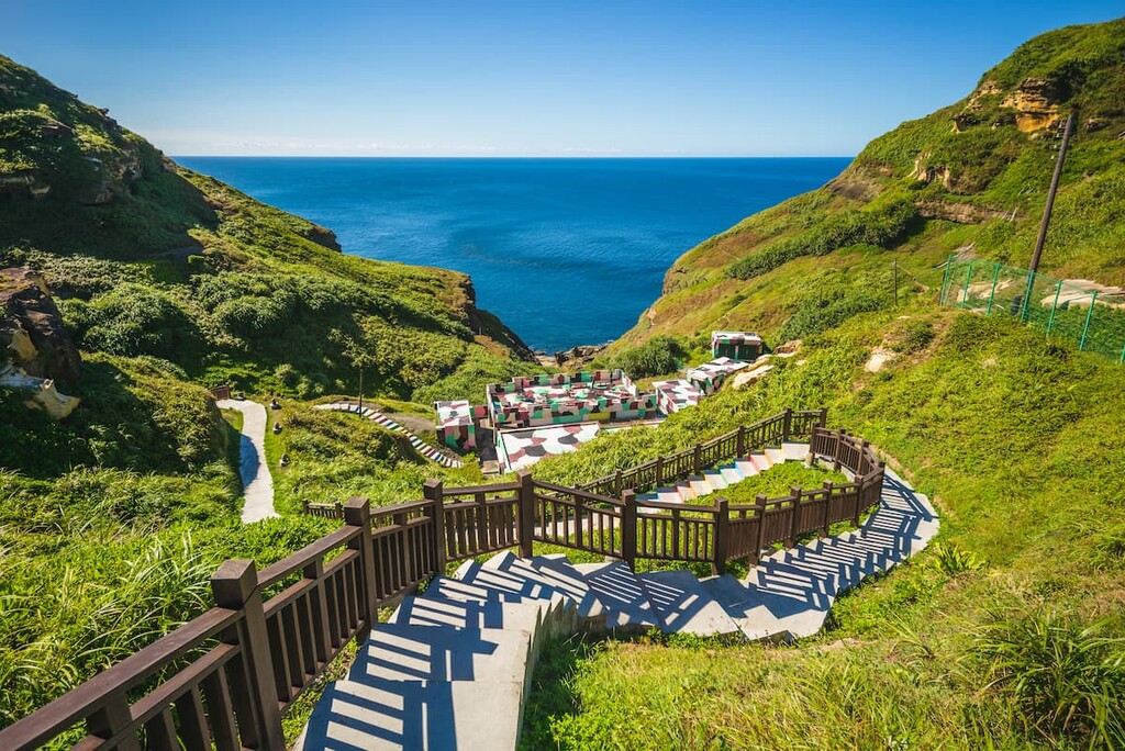
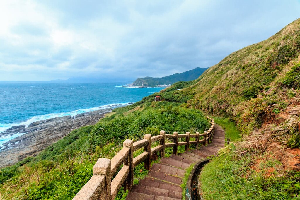
The Bitou Cape Hiking Trail is a much-loved picturesque hiking route for hikers of all ages and abilities. Situated to the north in the Ruifang District of New Taipei City, this 3.5 km (2.2 mi) wooden walkway leads hikers across verdantly luscious hills with gentle inclines. This path offers panoramic views of the surrounding sea-green bays swathed in a spectacular display of eroded sea rocks of peculiar shapes and size.
One of the main highlights of this ever-popular trail is the quirky variety of mushroom-shaped rocks and cliffs pockmarked with honeycomb weathering and ‘bean curd’ weathering. Both types of weathering are caused by saltwater flows eroding the boulders.
Hikers usually take an average of three hours to complete this short trail, as the scenic beauty of this path compels hikers to pause continuously to admire the stunning landscape. The beautiful combination of lush green rolling forested hills against the extensive backdrop of the blue ocean lit up by the ever-present Taiwanese sunshine allows one to feel completely connected to nature.
Additionally, hikers can marvel at the winding wooden walking lining and tracing the emerald coastal hills as it leads hikers towards the bay. Finally,Bitou Cape Lighthouse, which was constructed in 1896, straddles the easternmost cape of the Northeast Coastal Reserve and signals the end of this leisurely trail.
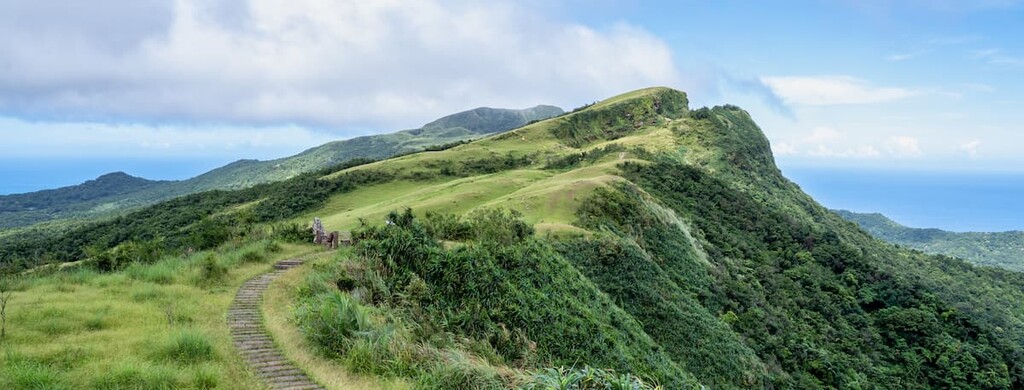
This ancient trail crosses rivers, bamboo forests, and rampant unruly regions of silvergrass to reach the summit of Nanzilinshan.
The beginning of the route is relatively easy walking the gentle slope of Nanzilin; however, the incline soon increases, as does the overgrown nature of the trail. Swarms of silvergrass create an arduous journey for hikers as they try to distinguish the correct path. Finally, hikers make use of the fixed rope to scramble up the near-vertical incline.
The climb up Nanzhilin is not easy, but sweeping views of ocean bay panoramas with the nearby coastal hills of Keelung Mountain in clear view reward hikers for their effort. Nanzilin has several peaks, all of which are carpeted with thick silvergrass. Hikers then must laboriously trek across the silvergrass covered peaks as they admire the quaint views of Nanya fishing port, which become closer and closer with each succeeding step.
Hikers can then descend the mountain and enter a bamboo forest as they head towards the elevated zone of Shitikeng, which is wholly enveloped with woodlands. Moving further onward, hikers will discover a cave featuring a 1.5-metre (5 ft) high tunnel through the rock. Hikers can appreciate views of Banpingshan (半屏山) from the other end of the tunnel.
Hikers then need to return to the trail as they make their way towards Nanya fishing village, which follows the path of the Shitikeng Ancient Trail. Hikers will soon encounter the diminutive moss-covered Land God Shrine, built over 100 years ago.
The path then slowly descends to the cool cobalt Shitikeng River stream, which hikers cross to trek towards Nanya village. Hikers will soon encounter the oddly fascinating display of weathered boulders along the coast of Nanya, which concludes the trail.
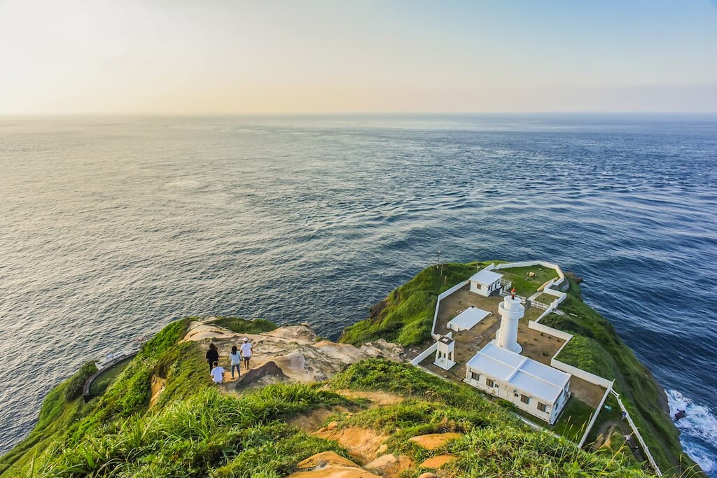
The Longdon Cape Trail is a fun and exciting trail that begins at Xilinyan Temple. A viewing platform lies a few minutes away from the trailhead. Here, hikers can revel in the scenic beauty of the cape.
The cape itself features striking rock formations and the vibrant blue ocean, all of which roar to life as the waves crash against the fingers of rock that extend into the sea.
As hikers head onwards, the mountain of Wenzikengshan (蚊子坑山) stands on the left with the views of the vast sea to the right. The coast features countless patterned sea eroded cliffs at which hikers can marvel.
Along the trail, hikers can note the appearance of the Yue Tao, a tall herbaceous plant that grows deep red fuzzy shells in the summer months. Finally, hikers make their way towards the iconic Longdong Bay rock climbing site, featuring sandstone cliffs as high as 30 metres (98 ft).
Hikers then descend along a paved road which is soon replaced by a stone trail leading through a verdant forest as it leads hikers to the shore littered with enormous boulders. Finally, hikers can return and retrace the path to Xilinyan Temple or take the 886 bus to Ruifang Train Station from the Hemei Elementary School bus stop.
The rock formations at Nanya Rocks that extend along the coast of the Northeast Coastal Reserve are one of the reserve’s top attractions. These sea gardens of Nanya Rocks feature swirling, twisted, and contorted rocks that boast the colours of an ice cream sundae and form a stark contrast to the sparkling cerulean waters of the Pacific Ocean.
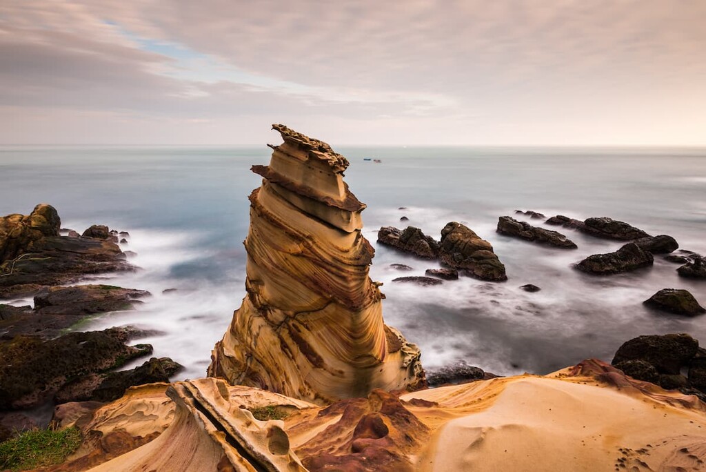
Nanya Rocks is one of the main attractions of the Northeast Coastal Reserve, as visitors can admire the incredible geological display of the unusual striped patterned boulders. The sunset and sunrise at Nanya Rocks are especially striking as the sun's soft glow gently illuminates the rocks, which are set against the warm golden colours of the twilight hours.
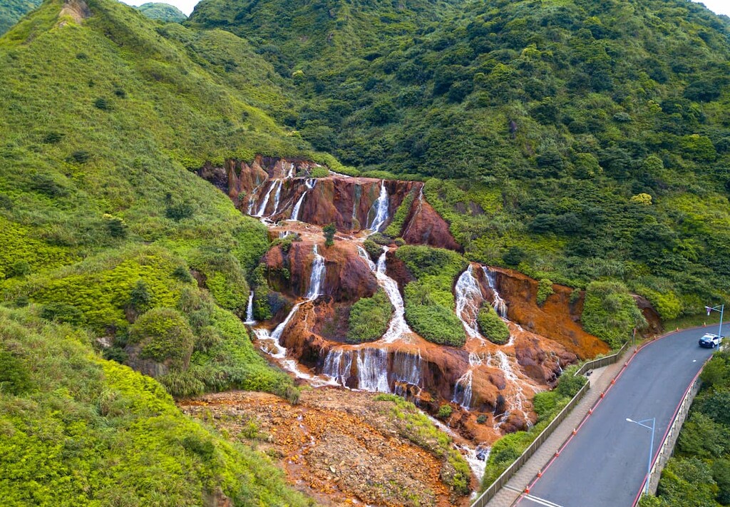
The Golden Waterfall, also known as Jinguashi, rests in the area of an old mining site that was active during the Japanese Occupation Era. The mountains contain high levels of iron pyrite and enargite and, when mixed with water, create oxidation, causing the rock's bright orange golden colour.
The water thus mixes with the oxidised rock, forming a golden yellow colour which one can notably distinguish as it reaches the sea. This water forms a clear contrast of yellow that surges against the blue ocean water. The mixture of these two distinct watercolours is referred to as the Yin and Yang Sea by the locals.
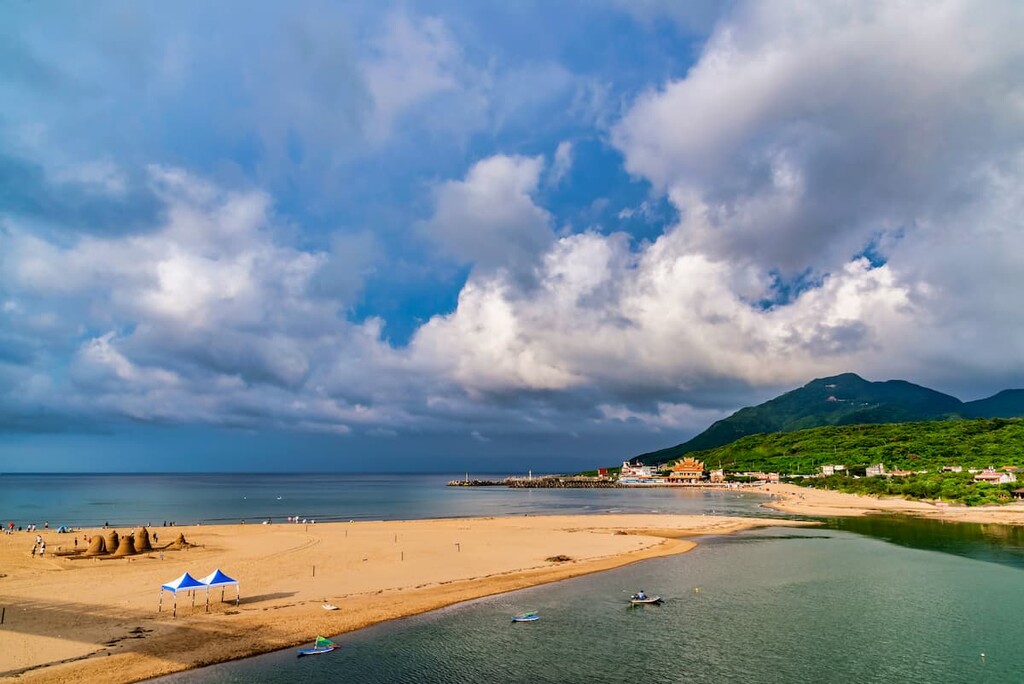
Renowned for sand sculpting competitions, Fulong Beach in Gongliao District features a 3 km (1.8 mi) strip of fine sand that stretches towards the Pacific Ocean as the turquoise waters that lap it on either side. Visitors can swim in these invitingly clear and warm waters as surfers ride the rippling waves and sailboats venture further into the deep blue sea.
The bay holds an area of 24 hectares (59 acres) of land, yet the presence of the Shuangxi River greatly affects the ecological environment of the beach. Mango flowers and silvergrass flowers are common plants that thrive on the mountain slopes of Wazikengshan (挖子坑山), which stands behind Fulong Beach.
In addition, visitors can also savour the local delicacy of the Fulong lunch box of grilled pork or fish accompanied by several vegetables, rice, and tea boiled eggs.
Situated in Toucheng Township of Yilan County, the dark sandy Wai’ao Beach is a treat for beachgoers. The tumultuous winter waves are a thrilling ride for experienced surfers, and views of the offshore Guishan Island can be seen from the shores of the bay.
As it is further away from Taipei, Wai’ao Beach is not as packed as Fulong Beach. Therefore, this less crowded beach ensures that one can unwind entirely, giving visitors the feeling as though they have the whole stretch of shore to themselves.
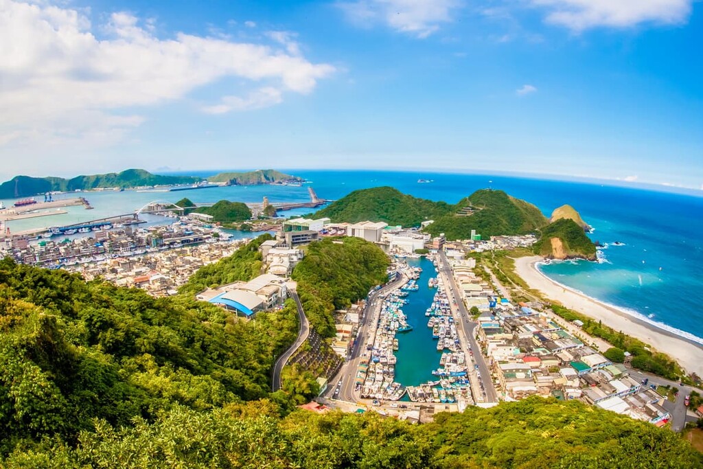
Su’ao Cold Springs is located in the Suao Township of Yilan County, the southernmost point of the Northeast Coastal Reserve. In comparison to hot springs, cold springs are quite a rarity and can only be found in a few places globally.
The clear, odourless waters of Su’ao Cold Spring contain high amounts of carbon dioxide and sodium bicarbonate. The fizzing bubbles caused by carbon dioxide cling to your skin as it feels like you are bathing in a non-sticky carbonated drink. The temperature of the water is 72°F (22°C).
There are many benefits of bathing in cold springs as they are traditionally thought to aid in curing skin diseases. Additionally, local communities traditionally believe that intestinal illnesses can be cured by drinking the mineral-rich water. In addition, the water is believed to hold beautifying properties as visitors are encouraged to wash their face in the sparkling carbonated water.
Visitors have the option of staying in one of many places during their trip to the Northeast Coastal Reserve. One option is on the southern end of the stretch of the Northeast Coastal Reserve in Yilan City. Alternatively, visitors could choose to stay near the northern tip of the border in New Taipei City.
Yilan City and its surrounding areas offer the pristine scenic beauty that Taiwan is known for with the added advantage of fewer crowds than in the more populated cities like Taipei and Kaohsiung.
Longtan Lake is one of the largest lakes in Yilan County. The still waters of the turquoise lake mirror the tufted peaks that encircle the wetland. A neat fitted wooden footpath traces the lake’s edge, allowing visitors to revel in the quiet nature of the serenely peaceful area. However, this quiet can be interrupted with nearby karaoke hosted by the local temple, which is a delightfully unusual experience to witness.
Yilan is synonymous with surfing, and surfers are spoiled with choices thanks to the various beaches found in the region. Typhoon season brings large swells to the eastern coast of Taiwan; thus, Yilan City sits in the perfect position for imposing wave breaks. Beaches such as Su’ao, Wai’ao, Wushi, and Shuangxi are the more desired beaches for surfing.
Luodong Night Market boasts an expansive area with bustling crowds and is open from early in the morning to late at night. A selection of fascinating local delicacies is served here, such as spring onion pancake, shaved ice with tapioca, smoked duck meat, like ya shang. Other popular dishes are herbal mutton soup, rice noodle soup, and thick pork soup with garlic.
Jimmy Square is located next to the Yilan City train station and features real-life sculptures of local Taiwanese comic characters. Jimmy is a famous Taiwanese comic artist, and he has recreated scenes from his books ‘Starry, Starry Night’ and ‘Turn Left, Turn Right’ with these animated sculptures. Described as an Instagram hotspot, this frivolous attraction is a much-loved attraction as visitors have plenty of photo opportunities to create that perfect Instagram snap.
As the region of New Taipei City is relatively large, attractions in and around the Ruifang District, where Nanya Rocks are located, shall be the focus. Overall, New Taipei City has it all: history, beaches, mountains, old mining villages, and its quirky features.
Jiufen, Jinguashi, and Shuinandong are former mining towns that the Japanese established during the Japanese Occupation Era. The gold mines are now closed; however, visitors can visit the mine sites to learn about the history and culture of mining in these old villages.
Jiufen is the most popular of the three towns due to its picturesque location on a hill overlooking the Pacific Ocean. The small and winding alleyways are lined with red Chinese lanterns, while the wooden Japanese architecture is still preserved. Treat yourself to a cup of oolong tea in one of the ancient tea houses that offer pristine views of the intricate maze-like backstreets. A gorgeous sea view with bright colourful temples framing the outlook awaits at many of these tea houses.
The fusion of yellow and blue waters of the Yin Yang sea, created by the Golden Waterfall in Jinguashi, is a popular attraction of the quiet hillside town. Visitors can take a turn past the Jinguashi Gold Ecological Park to learn about the area's mining practices. Or you can take in the sweeping views from the Japanese Shinto temple that overlooks the natural wonder of the Golden Waterfall.
The old copper refinery of Shuinandong is another attraction in Ruifang District. Situated very close to the Golden Waterfall and Ying Yang sea, at the refinery you can still distinguish the copper pipes of the abandoned building, which once featured 13 floors. However, the imposing sight of the refinery is softened by the resilience of nature. Each level features plants and trees growing through the concrete.
Houtong Cat Village is a sleepy hamlet set in the mountains with equally sleepy cats who feel entitled to nap wherever it may please them, be it in a flowerpot, on the path, or a table featuring cat merchandise. More than 200 resident cats prowl the ascending layer of streets of this former mining village. Here, local businesses have catered to the town's theme, selling cat biscuits and a plethora of cat-related souvenirs, such as cat note-pads, cat keyrings, cat purses, and cat-shaped pineapple cakes, to name a few.
From the major cities of Kaohsiung, Tainan, Chiayi, Taichung, Hsinchu, and Taoyuan, take the Taiwan High-Speed Rail (HSR) or the local train (TRA) to Taipei Main Station. To get to Nanya village, the northern tip of the Northeast Coast Reserve, take the 1811 bus from Taipei Main Station which shall transport you to Nanya. Nanya Rocks are only a seven-minute walk from the bus stop.
Alternatively, you can take the TRA train from Taipei Main Station to Ruifang Station. Once in Ruifang, take the 856 bus and alight at the Nanya Nanxin Temple bus stop. It is a seven-minute walk to the Nanya Rock formations.
If you would prefer to start in the south in Yilan County and make your way up the coast, then take the local train from Taipei Main Station to Su’ao Station.
If you would like to drive Provincial Highway 2, you can rent a car or scooter from Taipei or Yilan. The drive from Taipei to Nanya is 39 km (27 mi), while the distance from Taipei to Su’ao Township is 73 km (45 mi). The drive from Yilan City to Su’ao Township is approximately 24 km (15 mi).