Scan the QR code and open PeakVisor on your phone
New Taipei (新北市) is the second-largest city in Taiwan. It is located in the northern part of the island, and it features golden, sandy bays, grassy hills, majestic waterfalls, flowing rivers, and fascinating geological outcroppings. Tamanshan (塔曼山) is the highest hill of New Taipei City’s 963 peaks, measuring 2,130 meters (6,988 ft) in elevation. Qixingshan Main Peak (七星山) is the most prominent peak in the city with a prominence of 1,118 meters (3,668 ft).
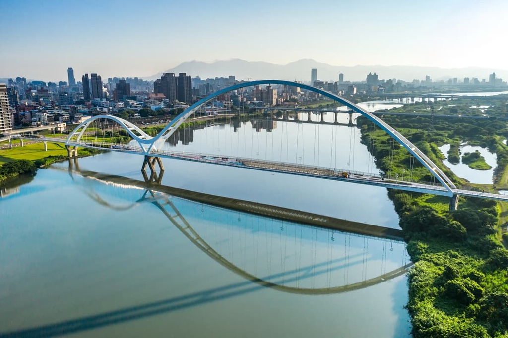
New Taipei City is the northernmost city in Taiwan. Taiwan’s second-largest city encompasses 205,257 ha (5,072 acres) of terrain in which over 4 million people reside. New Taipei City also surrounds the entire Taipei (臺北市) metropolis.
With a coastline stretching 120 km (75 mi), there are countless beaches to visit in the city itself. Indeed, New Taipei City’s shoes are incredibly scenic, so it’s a great place to check out if you’re looking to spend some time by the water.
The North Coast and Guanyinshan National Scenic Area (北觀風景區管理處) contains the shoreline between the city’s Tamsui District (淡水區) and the nearby Keelung City (基隆市). In addition, the Northeast Coastal Reserve (東北角沿海保護區) stretches from the shores of New Taipei City’s Ruifang District (瑞芳區) to Yilan City (宜蘭市).
Like the rest of Taiwan, New Taipei City enjoys year-round warmth due to its humid subtropical climate. Summers can get stifling hot when temperatures climb above 35°C (95°F). However, winters are wonderfully mild with an average temperature of 21°C (70°F), and it is rare for the temperature to drop below 10°C (50°F).
New Taipei City contains a total of 28 districts and one Indigenous mountain district. Tamsui, Ruifang, Pingxi (平溪區), and Xindian (新店區) districts are some of the most scenic areas in the city. Wulai (烏來區), New Taipei’s City Indigenous district, is exceptionally picturesque with its wild forests and stunning nature.
Taoyuan City (桃園市) borders New Taipei City to the west, while Yilan County lies to the south. Keelung City shares a land border with New Taipei City, while the vast Pacific Ocean laps to the north and eastern coastlines of the city itself.
New Taipei City’s northern hills belong to the Datun Volcano Group (大屯火山群), which erupted sporadically between 1 million and 200,000 years ago in what is now north Taiwan. Qixingshan belongs to the Datun Volcano Group, as does Zhuzi Shan (竹子山), Bailaka Shan (百拉咔山), and Xiaoguanyin Shan (小觀音山). The rock strata in the group consist primarily of volcanic and sedimentary rocks from the Pleistocene epoch.
Furthermore, New Taipei City’s southern hills form the northern extension of the Xueshan Range (雪山山脈), which stretches from Xueshan (雪山), Taiwan’s second tallest peak, in the south near Taichung City (臺中市) all the way to the northern part of the island. The bedrock of the Xueshan Range hills consists of sandstone and shale from the Oligocene.
The city’s vast coastline of mushroom rock has been heavily weathered from intense storms that whip the stone with incredible force. In places like Yehliu Cape Nature Reserve (野柳岬自然保護區), Nanya Rocks, and Bitou Cape, oddly shaped rock formations litter the shoreline. These rocks were all created by the combined erosive efforts of the wind and sea.
Broadleaf trees dominate New Taipei City’s low-lying hills. Common tree species found in the city include acacia, sweetgum, and ficus. Silver grass (Miscanthus sinensis) thrives on the hillside of New Taipei City’s peaks.
The northern part of Yangmingshan National Park (陽明山國家公園), including the peaks of Zhuzi Shan and Xiaoguanyin Shan, is located within New Taipei City’s boundaries. Each of these summits is also covered in a dense grove of Pseudosasa japonica, which is known as arrow bamboo.
Records of human activity in New Taipei City date back to the Neolithic. Archaeological findings in Bali District (八里區) suggest that humans have lived on the island and in the region around the current city since at least 4,700 BCE. Some two thousand years later, some of New Taipei City’s earliest inhabitants included the Ketagalan people, who lived in the region’s plains and valleys.
Han Chinese settlers began to migrate to Taiwan in the seventeenth century, starting around the year 1620. Immigration expanded once the Qing dynasty gained more control over Taiwan. As a result, large Han communities started to form in areas like Tamsui, which eventually became a thriving port where imports like tea and wood were shipped.
Tamsui District became exceptionally wealthy as British traders established trading posts and shops at the port. The British soon introduced Europe to Taiwan’s oolong tea, resulting in huge demand for the product. By 1850, Tamsui was a haven of activity and prosperity.
During the Japanese Occupation Era in 1895, the Japanese discovered gold in New Taipei City’s hills. Jiufen, Jinguashi, and Pingxi are examples of old Japanese mining towns in the region. However, the Japanese barred Taiwanese companies from profiting off the finds, so the mining towns at the time were primarily home to Japanese residents.
Up until the mid-twentieth century, New Taipei City was part of the Taihoku Prefecture, which covered the area of Taipei, New Taipei City, Keelung, and Yilan. However, once control of Taiwan shifted from Japan to China in 1945, New Taipei City was recognized as Taipei County. Over the years, Taipei County’s size grew as the local government included new districts in the county’s area.
In 2010, Taipei County was renamed New Taipei City. It was also granted the status of a “special municipality” in which the city operates just like a county. Banqiao District is New Taipei City’s municipal seat.

New Taipei City may be a sprawling metropolis located in northern Taiwan, but it offers its fair share of exciting opportunities for outdoor adventure. Here are some of the best hiking trails in New Taipei City to check out during your next trip to the region.
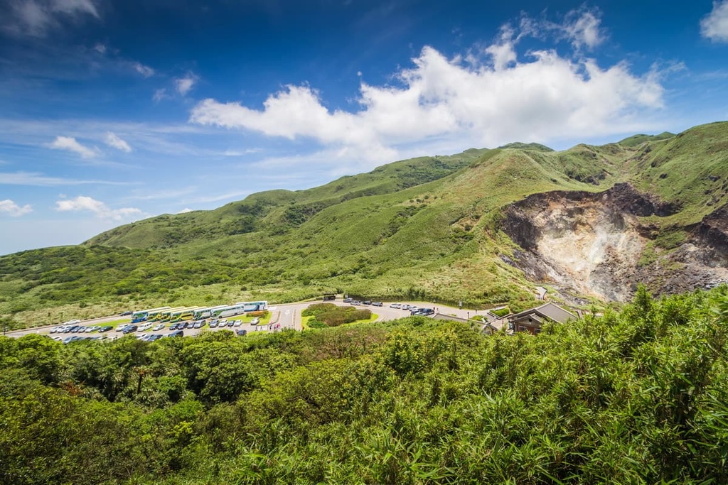
The name of the peak Qixingshan translates to ‘seven-star peaks,’ and it is most definitely the star of Yangmingshan National Park. Many locals and tourists visit this mountain and its slopes of silver grass and summer wildflowers on the weekend as they are eager to witness the wispy, smoky clouds of Xiaoyoukeng’s fumarole.
Xiaoyoukeng Trailhead is the most popular trailhead to start a hike up the mountain because it offers the easiest and quickest climb to the summit. From the trailhead, the hike to the summit is about 2.2 km (1.4 mi) long. Alternatively, you can hike 3.5 km (2.1 mi) to the summit from the Miaopu Trailhead, which is located on the other side of the mountain.
Another benefit of beginning the trek from Xiaoyoukeng Trailhead is that the steaming geothermal air vents lie a mere 400 meters (1,312 ft) away from the road. But, keep in mind that, due to the sulfuric deposits in the soil, an overpowering egg smell lingers in the air during this hike.
The trail itself is fairly casual except for a few steep ascents. While standing on top of Qixingshan, you can see the Taipei Basin below and its many tall skyscrapers, all of which appear like a miniature world that exists in the distance.
Most hikers descend the same path they climbed from Xiaouyoukeng; however, if you would like the walk the entire 5.7 km (3.5 mi) trail, then you can continue onwards toward Qixingshan East Peak (七星山東峰), which is just a short scramble away.
From the East Peak, you will descend the mountain on the eastern slope and then you can take a well-deserved rest at Qixing Park. At 880 meters (2,887 ft) in elevation, the park offers a slightly different perspective of Taipei, as you can see the city almost at eye level with its high towers.
A further 2 km (1.2 mi) downhill climb from Qixing Park leads you to the Miaopu Trailhead, which signals the end of the trail.
The trail to Xiaoguanyin Shan is notoriously dense and overgrown, to the extent that hikers use ghost money to track their progress on the route. The presence of ghost money usually foretells a sinister event; however, in this case, it is to prevent hikers from getting lost in Xiaoguanyin Shan’s overgrown jungle.
Three loop trails of differing lengths traverse Xiaoguanyin Shan and its several peaks. The standard route tops five mountain summits: Xiaoguanyin Shan West Peak (小觀音山西峰), Xiaoguanyin Shan West West Peak (小觀音山西西峰), Xiaoguanyin Shan North North Peak (小觀音山北北峰), Xiaoguanyin Shan North Peak (小觀音山北峰), and finally, Xiaoguanyin Shan Main Peak.
The path to Xiaoguanyin Shan West Peak is studded with tall and thick Pseudosasa japonica bamboo forests. Once through the forests, you can start enjoying the views of the surrounding scenery. From the peak, you can see Datunshan (大屯山) to the south while admiring New Taipei City’s Tamsui District and the glistening blue East China Sea stretching from the coastline to the west.
From the summit of Xiaoguanyin Shan West Peak, you can see as far as Xueshan’s snow-capped peak in Taichung City’s Shei-Pa National Park (雪霸國家公園), some 90 km (56 mi) away. One highlight of this trail is that each peak on the route offers a slightly different perspective of Yangminghshan National Park, Taipei City, New Taipei City, and the surrounding counties.
After leaving the trailhead, you’ll scramble to the nearby Xiaoguanyin Shan West West Peak, which is also known as Beizhuzishan. From here, you can see the northern parts of New Taipei City, such as the Sanzhi (三芝區) and Shimen (石門區) districts farming communities and the North Coast and Guanyinshan National Scenic Area.
To get to Xiaoguyanyin Shan North North Peak, you will have to descend another bamboo grove, after which a flourishing broadleaf forest awaits. After crossing a creek, you’ll commence your hike up the steep Xiaoguanyin Shan North Peak Trail. Here, the forest transforms into a romantic pink shade of cherry blossoms during the spring months or a crimson and amber delight of maple in the autumn.
Next, you’ll trek to Xiaoguanyin Shan North Peak, which provides views of Zhuzishan and Zhulishan (竹里山) in Yangmingshan. One last journey leads you to Xiaoguanyin Shan Main Peak, from where you can get views of Qixingshan and its smoking Xiaoyoukeng fumarole. In addition, from the summit, you can trace the Tamsui River’s meandering course through Taipei City.
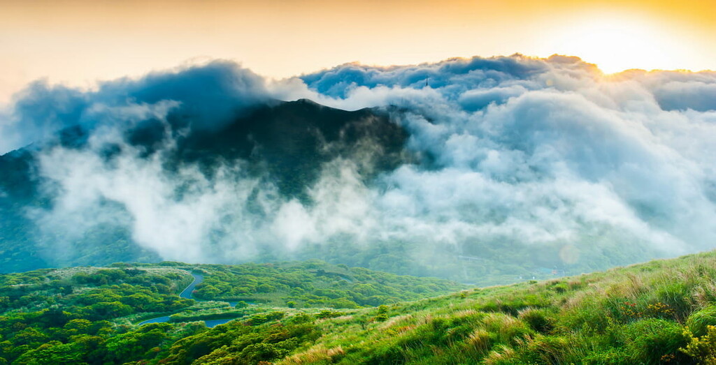
As it is the northernmost mountain in Yangmingshan National Park, the trek to Zhuzishan is relatively remote and is not as accessible as the hikes to Qixingshan and Xiaoguanyin Shan. Nevertheless, the route is exceptionally quiet, leaving you to feel one with nature.
Do note that a military control zone occupies the top of Zhuzhishan, so climbing to the very top is forbidden.
At first, the Zhuzishan and Alibang Waterfall Trail feels deceptively easy as it features a steady, somewhat unchallenging climb. The sound of falling water alerts you to the arrival of the magnificent Alibang Waterfall, which is nestled on Zhuzishan’s slope. Coats of velvety moss line the rocks that frame the white rapids. A turquoise pool collects at the waterfall’s base, looking inviting yet icily cold.
The path then leads up the waterfall’s rocky terrain to the top of Zhuzishan. The trail becomes challenging, with sharp gradients and slippery muddy paths. You’ll also have to cross yet another bamboo thicket before you pop out below the summit.
Even though you cannot reach Zhuzishan’s true summit, once you have cleared the bamboo forest, you can still get views of the eastern Jinshan District (金山區), Keelung City, and the beginning of northern Taiwan’s North East Coastal Reserve. In addition, you can gaze at the remote wilderness of Yangmingshan National Park.
New Taipei City’s Indigenous mountain district is home to the Atayal tribe. ‘Wulai’ is an Atayal word for hot springs, for which Wulai is renowned, together with its lush mountain forests and aquamarine rivers.
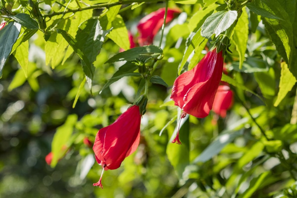
The Wulai Datong Mountain Hiking Trail begins at the Zhongzhi tribal village. From here, you will ascend a series of wooden steps up the steep hill. The course is densely sheltered with luscious broadleaf trees of acacia and cedar and is scattered with perennials of orchids and mountain hibiscus.
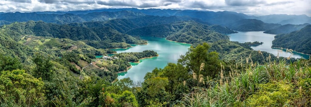
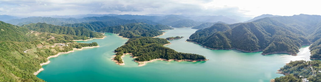
From Datongshan’s (大桶山) summit, you can survey the surrounding emerald landscape of rolling hills and abundant leafiness. As you stand on the summit, you can even see the peaks of Wulaishan (烏來山), Sikanshuishan (四崁水山), and Silaoshan (四寮山) as well as the Feitshui Reservoir (翡翠水庫).
Wulai is home to many other scenic attractions like the 80-meter (262 ft) high Wulai Waterfall and a plethora of hot springs. It is also a great place to experience the rich Atayal culture first-hand.
One of New Taipei City’s coastal hills, Teapot Mountain (無耳茶壺山), is a much-loved hiking trail due to the jagged nature of its landscape and the views it offers of the cerulean Pacific Ocean. Aptly named, Teapot Mountain resembles a fat, rounded silhouette of a teapot without its handle.
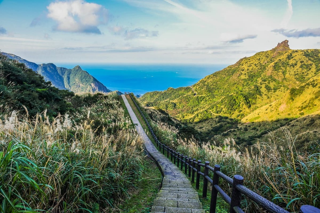
Starting from Jinguashi Gold Museum, you’ll make your way along this 8 km (5 mi) trail of stone steps by trekking through a sea of silver grass dancing in the coastal winds. Cherry blossom trees line the trail, creating a charming scene when the romantically pink flowers bloom in late winter. Many observation decks can be found along the trail and they offer great views of the surrounding coastal landscape.
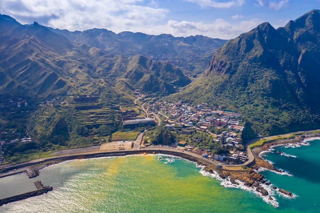
From Teapot Mountain’s summit, you can wonder at the peaks of Banpingshan (半屏山) and Fuxing Shan (復興山) in the distance. In addition, you can marvel at the strikingly golden Yin and Yang Sea, which is infused with amber from the iron ore rock over which it passes.
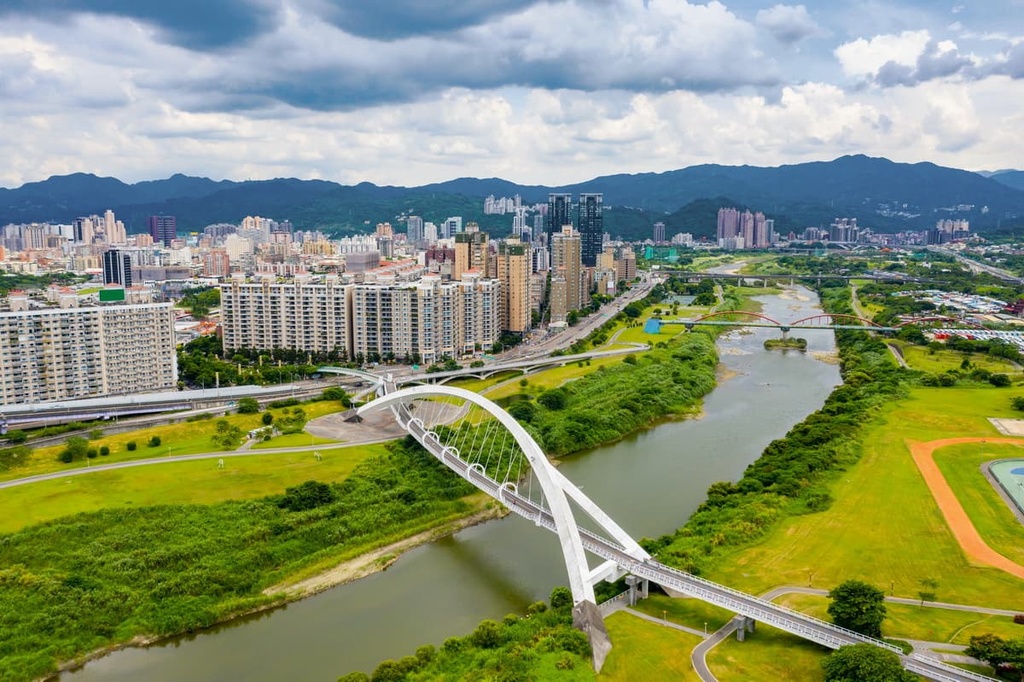
New Taipei City’s Xindian District is home to the picturesque Bitan Scenic Area and the Hemei Shan Hiking Trail. From the suburban hill of Hemei Shan (和美山), you can see Xindian’s green forests and the glistening Xindian River.
The 4 km (2.4 mi) long Hemei Shan Hiking Trail offers a superb chance to spend time in New Taipei City’s dense forests. On this trail, you’ll hike through stands of ficus, Taiwan alder, and red nan trees where you’ll also have great opportunities to spot local birdlife. A wide variety of butterflies and frogs also live on the mountain, and fireflies illuminate the evening skies throughout the month of April.
After a short trek of easy climbing, you will reach Hemei Shan’s summit. Although it is a relatively low-lying hill, the view from the top is fantastic. On a clear day, you can even see the Taipei Basin in the distance from the summit.
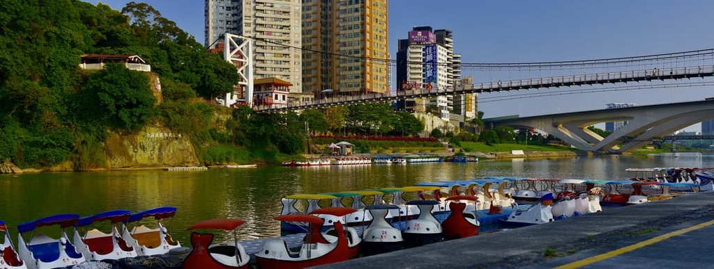
From the top, you will also get a chance to see the iconic Xindian Suspension Bridge, which straddles the emerald Xindian River below. On a sunny day, locals swarm to the Xindian River’s waters, and many hire paddle boats to discover the lesser-known areas along the Xindian River.
The famous Xiaozi Shan Hiking Trail features a vertical rock that blocks the path to the summit.
On this trail, you will have to swallow your fears and climb a metal-rung ladder to Xiaozi Shan’s (孝子山) peak, a terrifying prospect even on a sunny and wind-free day. Plus, Xiaozi Shan’s summit is so tiny that only a few people can stand on it before it gets too crowded.
This 1.5 km (1 mi) trail is reserved only for the fearless and those hungry for adrenaline. However, once you have hauled yourself up the mountain’s sheer cliff, the rewards are instantly worth your bravery. From the top, you can enjoy great views of the Keelung River Rift Valley and witness the encircling hilly terrain of grassy tufted peaks.
Thanks to New Taipei City's 29 districts, you are spoiled for choice when it comes to places to stay.
For ample opportunities to explore the region’s scenic attractions, consider staying in the Ruifang, Tamsui, and Xindian districts. Here’s what you need to know before your next trip to the city.

The Ruifang District is New Taipei City’s historic gold mining area. It is incredibly picturesque, thanks to its rolling hills and idyllic coastline. Every weekend, Taipei residents jump on a train for a short ride into the Ruifang District where they can enjoy the stunning scenery and the district’s charming streets.
Nestled in the Ruifang’s coastal mountains is the ancient Japanese mining village of Jiufen (九份). Here, you can get lost in the narrow passageways of Jiufen’s old town. Once you have exited the maze of streets, you can admire the district’s gorgeous views over the Pacific Ocean. You can also treat yourself to a cup of tea in the historic wooden A-mei Teahouse, which was built by the Japanese in their characteristic style of grand simplicity.
Another one of Ruifang’s highlights is Shifen (十分), which is known for its captivating waterfall. While not the highest of Taiwan’s rapids, it is the widest, thanks to its 40-meter (131-ft) width. You can take in all of Shifen Waterfall’s glory on a conveniently placed viewing deck.
A short walk away from the waterfall is Shifen Old Street, an old railway track over which people light Chinese paper lanterns that fly into the sky. There are increasing numbers of environmentally friendly lantern vendors in the district, too, so you can participate in this fun activity without harming the planet.
Located along the train ride to Shifen is the Houtang Cat Village (猴硐貓村), whose name says it all—it is a village swarming with cats. A population of 200 furry felines inhabits the small old mining town, double the figure of the human residents. While petting the cats is allowed, feeding the cats is discouraged.
While in Houtang Cat Village, you can take a wander around the stone streets where you will encounter the resident cats lounging around or having a wander themselves. A quick afternoon tea in the village’s cute cat-themed cafés is also a delightful way to relax after a day of adventure.
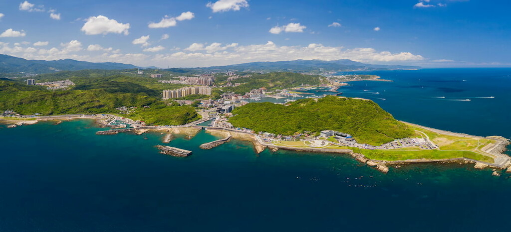
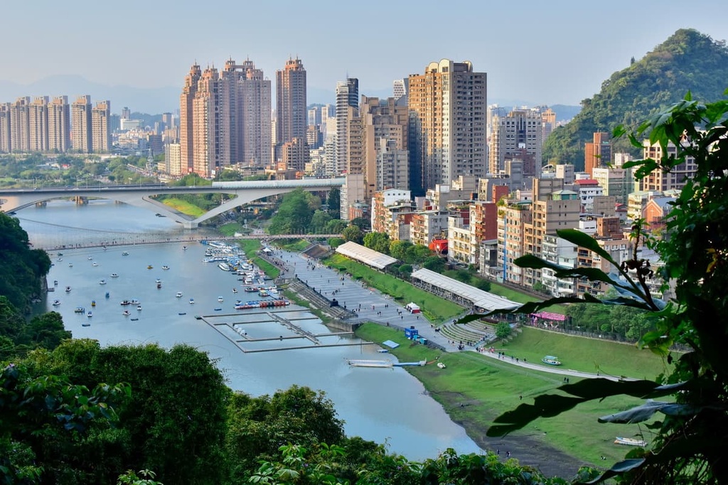
The seaside district of Tamsui is renowned for its stunning port area. In fact, this once-industrial area recently underwent a facelift and is now easily one of New Taipei City's most attractive areas. As Tamsui was one of Taiwan's earliest settlements, the region boasts a number of historical buildings.
The focal point of the district’s Tamsui Fisherman's Wharf (淡水漁人碼頭) is the 165 meter (541 ft) long Lovers Bridge, which features a long arch resembling a sail. At night, the crossing is illuminated in a rainbow color, making it a true wonder to behold.
In addition, the Lovers Bridge is the best spot in the district to observe the sunrise and sunset over the sapphire blue waterway. Tamsui's port is even engineered to flow with nature as floating docks accommodate the tide's movement. Visitors can also head up Lover's Tower to admire Tamsui's scenic views.
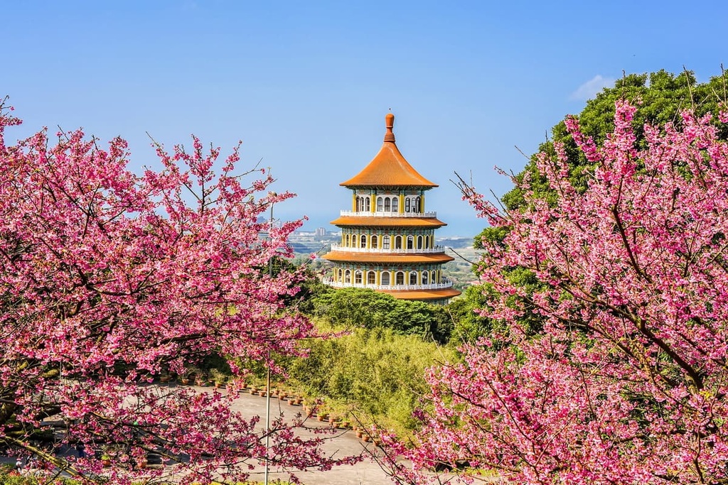
Another of Tamsui's beloved sites is the Wuji Tian Yuan Temple (無極天元宮). Situated on the outskirts of Yangmingshan National Park sits this majestic five-story Taoist temple. The temple is surrounded by a grove of Yoshino cherry blossom trees. As a result, around mid-March every year, an infusion of pastel pink flowers creates a dreamy appearance around the temple.
This makes the temple one of Taiwan's most picturesque places to view the highly-anticipated cherry blossom blooms. Additionally, while at the temple, you can wander the region’s many walking trails and get views of the Datun Volcano Group's many hills.
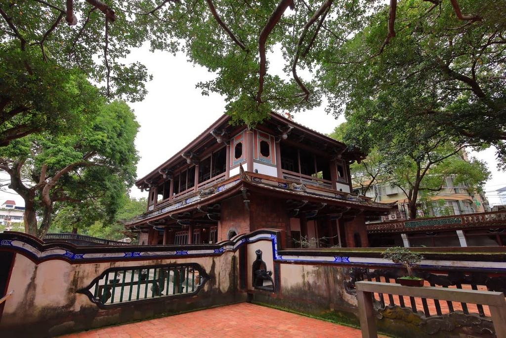
A relic of Tamsui's past is found at Fort San Domingo (紅毛城). Built in 1629 by Spanish sailors in the hope of invading Taiwan, the fort was a short-lived base for Spain as the Dutch claimed ownership of the area in 1642.
The fort then changed hands again in 1867 when it was placed under British control for around half a century. As one of Taiwan's oldest buildings, Fort San Domingo, is a great place to learn about the history of the island and to take in views of Tamsoi's river port.

Undoubtedly one of New Taipei City’s most scenic districts, Xindian is one of the best places to experience the region’s untouched nature. The district is located just a short trip away from the capital on Taipei’s MRT network, so it is a popular spot for Taipei and New Taipei City residents who want to escape the city and enjoy a bit of blissful nature.
One great activity to partake in while in the district is to head to the Bitan Scenic Area, where you can embark on a hiking trail to the fascinating Yinhe Cave (銀河洞), a mountainside temple built on a cliff with an enchanting waterfall flowing next to the shrine. You can enter the temple to view its interior and to follow the passageway that leads behind the waterfall itself.
Another spot in Xindian worthy of visiting is the Jingmei Night Market (景美夜市). Having been in operation for over 30 years, Jingmei Night Market is a great place to visit if you’re looking to try some steamed buns, salty fried chicken, sesame oil chicken, and tofu pudding. Unlike some of the more touristy night markets in the city, Jingmei is a more traditional market where local residents tend to shop, so it offers a more authentic experience than what you can find elsewhere.
To get to New Taipei City from Taiwan’s two international airports, Taoyuan Taiwan International Airport and Kaohsiung International Airport, you first need to make your way to Taipei City via the Taiwan High-Speed Rail (HSR) or local express train (TRA).
You will then arrive at Taipei Main Station, where countless local express trains (TRA) and local buses offer service into New Taipei City. Also, some of New Taipei City’s neighborhoods are serviced by the Taipei MRT system, like Tamsui and Xindian.
You can also hire a car or scooter to transport yourself around New Taipei City for added convenience. However, the heavy traffic in the city often makes traveling by public transport the better option.