
Scan the QR code and open PeakVisor on your phone
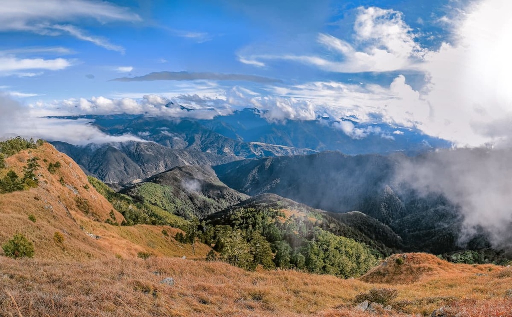
Taichung City (臺中市) is located in central Taiwan. It is home to stunning mountains and beautiful coastlines. The city contains 288 named peaks within its boundaries, the highest and most prominent of which is Xueshan (雪山) at 3,886 meters (12,749 ft) in elevation.
Located on Taiwan's west-central coast, Taichung City is an urban area that’s bordered by Miaoli County (苗栗縣) to the north and Changhua County (彰化縣) to the south. Nantou (南投縣), Hualien (花蓮縣), Yilan (宜蘭縣), and Hsinchu (新竹縣) counties all encircle Taichung City, too.
Population-wise, Taichung is actually one of Taiwan's most populous cities as it has around 1 million residents. But despite the fact that Taichung City is densely populated, it is also home to over one-fifth of Taiwan's top 100 peaks.
In fact, a total of 23 mountains over 3,000 meters (9,843 ft) in elevation can be found in Taichung. The mighty Xueshan Range (雪山山脈) and Central Mountain Range (中央山脈) are both located within the city’s borders and they include lofty peaks such as:
Taichung's hilly terrain serves as protection for many residents in times of natural disasters. Taiwan's notorious summertime typhoons wreak havoc on the island, especially on the east coast. However, the Central Mountain Range typically shields Taichung City to the east, and Miaoli's hills block the storms to the north. Therefore, Taichung City is often subject to less harsh weather than the island’s other coastal cities.
While colossal peaks encircle the outskirts of Taichung City, the coastal area of the island is a low-lying plain. Therefore, the city often experienced relatively cold temperatures when compared to the surrounding area.
Indeed, Taichung is one of the only cities in Taiwan where the average annual low temperature is below 20°C (68°F). Even northern Taiwan cities that regularly suffer the effects of the northeast monsoon have higher average low temperatures than Taichung.
Unsurprisingly, Taichung City experiences, on average, less precipitation each year than the rainy northern part of the island. The city receives an annual average rainfall total of around 1,700 mm (67 in). However, the average humidity in the city is normally around 80 percent, which can make the heat unbearable for many people.
Like Taipei City and New Taipei City (新北市), Taichung City is a special municipal area that enjoys city status. Taichung City consists of 29 districts, too, including one Indigenous mountain district.
Two of Taiwan's longest and most populated mountain ranges run through Taichung City. The Central Mountain Range encompasses 1,249 named peaks and is approximately 270 km (170 mi) long. This range stretches from the southern tip of the island all the way through central Taiwan and north into Yilan.
Taiwan's second-largest mountain chain is the Xueshan Range. It is home to around 1,233 named hills and is approximately 260 km (162 mi) long. This hilly range originates in Taichung City and stretches northward into New Taipei City. Here, you can find rocks like sandstones, shales, and slates that date back to the Eocene through Miocene epochs.
The highest alpine lake in Taichung City is Cuei Pond, which lies on the slopes of Xueshan at 3,520 meters (11,549 ft) in elevation. This lake formed as a result of glacial activity that occurred in the region during the Pleistocene.
Another relic of the last glacial maximum is the concave amphitheaters that are found on Taichung's highest hills. These inverted hollows once held large cirque glaciers, and the ice's mounting pressure carved out the basins that we see in the region to this day.
Taichung City’s ecology is diverse and varied. Subtropical species like the tung tree and sweetgum can be found throughout the city’s flatland areas and valleys.
Meanwhile, in the mid-elevation forests of Shei-Pa National Park (雪霸國家公園) and Basianshan Forest (八仙山國家森林遊樂區), you can find thriving broadleaf communities of Taiwan maple and bird-lime trees.
As you move higher up in the mountains of Taichung City and make your way into the colder forest zones, conifers tend to dominate the landscape. Taiwan cypress, Japanese cedar, and Taiwan fir are some of the common trees found in these regions.
Furthermore, conifers that can withstand freezing climates tend to grow in elevations above 3,100 meters (10,171 ft). Yushan juniper, Chinese hemlock, and Taiwan spruce are all hardy conifers that can flourish in the high-elevation forest zones of Taichung City.
Before the mass migration of Chinese settlers, Taichung City's residents were typically members of the Atayal, Taokas, Papora, and Hoanya tribes. The Atayal people traditionally lived in higher elevation areas of the region, particularly between 1,000 to 1,500 meters (3,281 to 4,921 ft), while the other tribes historically lived in Taichung's plains.
The ensuing arrival of Han Chinese settlers on the island of Taiwan instigated a period of unrest in Taichung. Many of the Indigenous people of Taiwan were subjected to forced labor, which ultimately led to a number of conflicts and uprisings in the area.
In 1731, pandemonium broke out in Taichung as Taiwan's tribes protested their inferior social standing and poor living conditions. However, the tribes were eventually quelled and forced back up to their villages in the mountains.
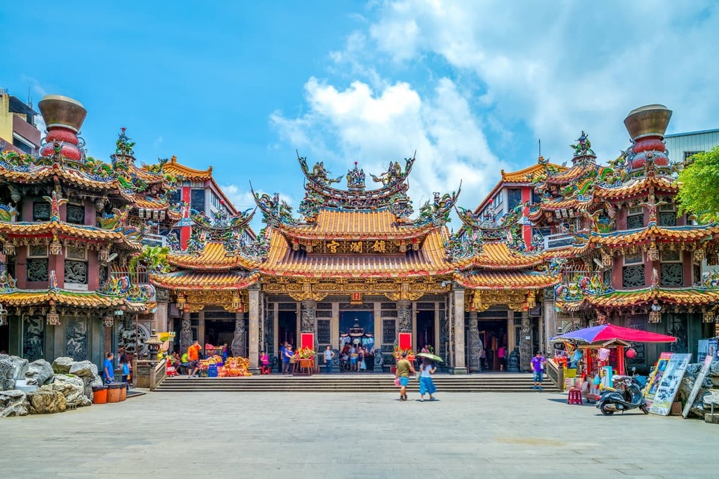
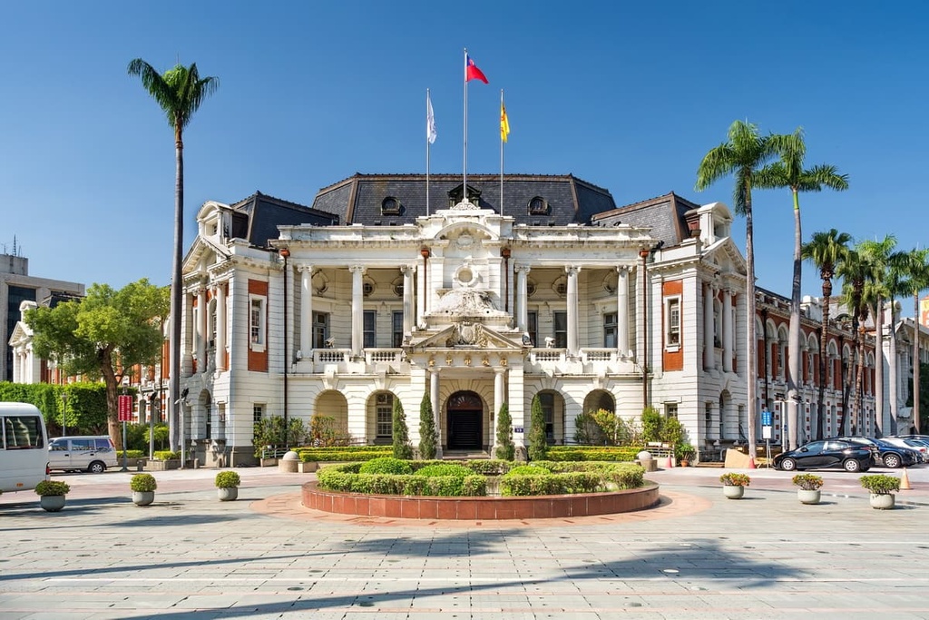
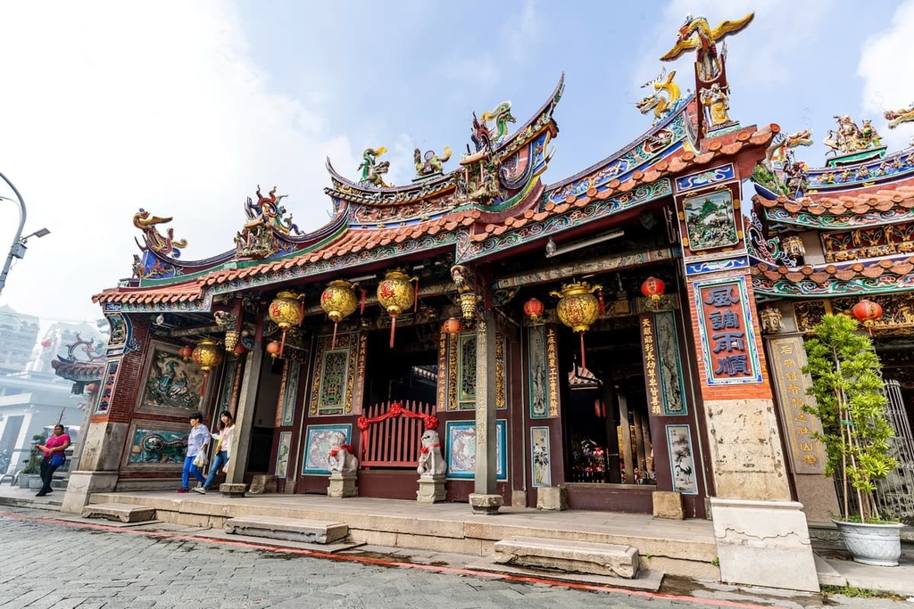
Like the rest of Taiwan, Taichung City was occupied by the Japanese for approximately 50 years between 1895 and 1945. Urban planning and development flourished in the region during the Japanese Occupation Era, though many Indigenous people were also oppressed during this time. Most of the architecture of modern-day Taichung dates back to this period of Japanese occupation.
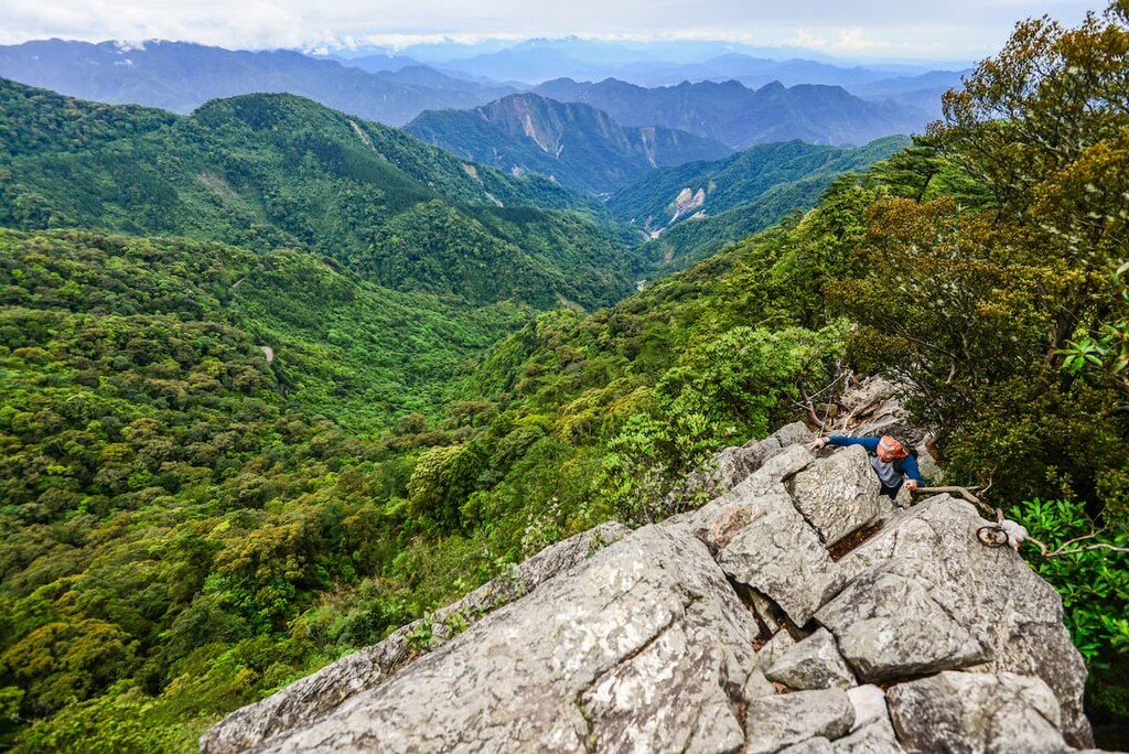
Taichung City is a haven for hikers. National parks, forests, hot springs, and scenic areas are all located within easy reach of the city. Here’s a look at some of the most popular hiking areas and trails in Taichung City.
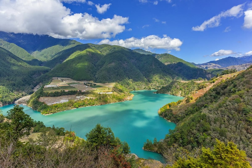
The Lishan Scenic Area is situated at an elevation of 1,945 meters (6,381 ft) in the outskirts of Taichung City. The views from the scenic area are particularly incredible as it is wedged between Shei-Pa National Park and Taroko National Park (太魯閣國家公園).
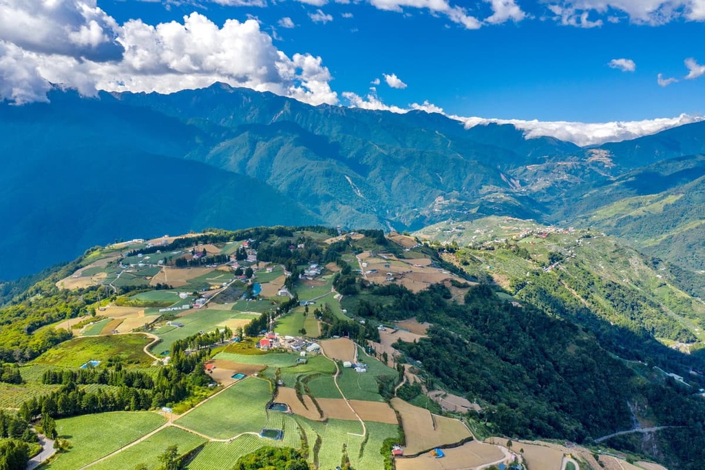
A constant cloak of cloud cover descends over the settlement of Lishan, giving the community a mystical charm. On a clear, sunny day, the behemoth peaks of Xueshan, Qilai Shan (奇萊山), Nanhu Dashan, and even Yushan (玉山) can all be seen from the scenic area, too.
As it is primarily a farming community, Lishan itself is known for growing apples, pears, and peaches. The orchards in the area also grow the most beautiful peach blossoms during the spring and summer months, so they’re well worth a visit if you’re in the area.
One of Taiwan’s most scenic thermal baths, Guguan Hot Springs (谷關溫泉), lies in Taichung’s Dajia River Valley. While at the Gugan Hot Springs, you can relax in the steaming 48°C (118°F) pools that are known for their enriched carbonic acid minerals.
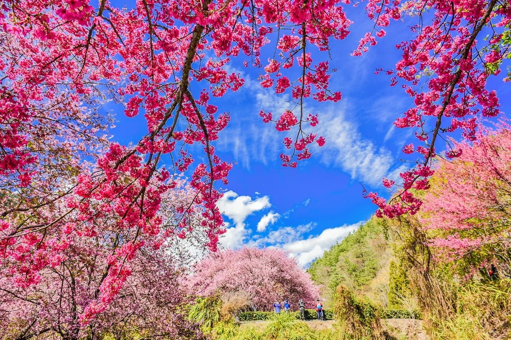
Spring and autumn are the prime seasons to visit the Guguan Hot Springs as the area’s forests burst with the many colors of cherry and maple trees during these times of the year. In particular, during the spring, the area’s cherry trees boast beautiful pink blossoms. Meanwhile, during the autumn, the forest’s many maple trees transform into an incredible crimson color.
The area of the Guguan Hot Springs was long known to the Atayal, but it didn’t become a tourist destination until the area was built-up by the Japanese as a resort destination. Nowadays, the region features a public bath that was actually frequented by Japanese emperors and their families.
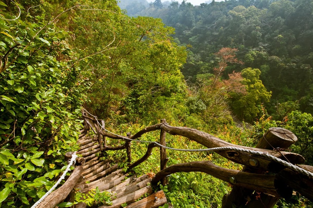
The Dakeng Scenic Area (大坑風景區) is home to some of Taichung’s most gentle hills. Here, you can feel lost in nature as you stroll along forested trails and take part in some forest bathing.
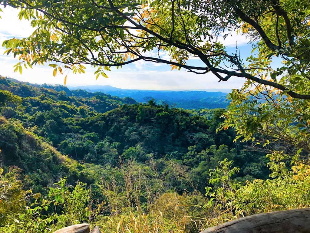
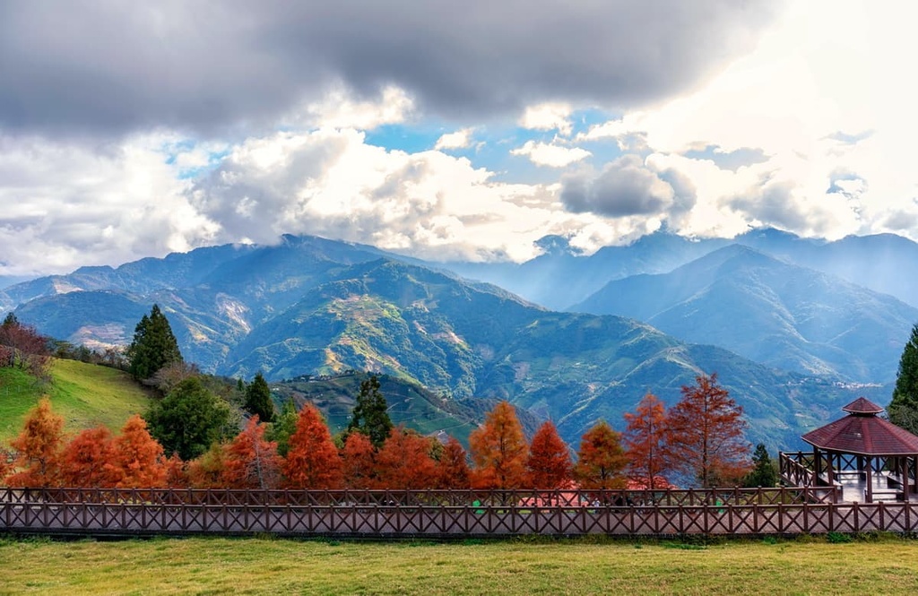
In the higher elevation parts of the scenic area, you can also get great vistas of Taichung’s blue-green mountains as they cascade into the distance. Dakeng is also a particularly popular spot to visit during the autumn as the area’s overlooks provide you with nice opportunities to see Taichung’s forests as they transform into crimson before dropping their leaves at the start of winter.
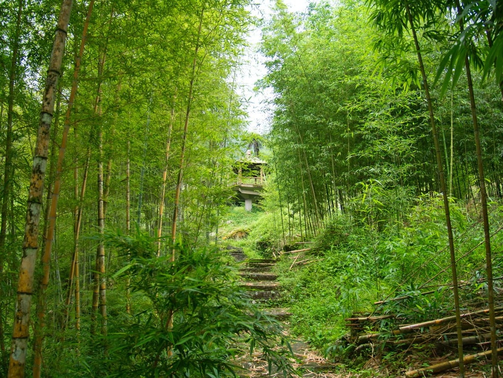
Considered one of Taiwan's most picturesque places, Basianshan Forest is an emerald wooded wonderland.
Visitors can hike one of the many verdant trails in Basianshan's woodlands. For example, in the recreation area, you can walk along the cool, damp path of the Bamboo Forest Trail or enjoy the flowers that bloom along the Cherry Blossom Path during the spring months.
There’s also an opportunity to hike to Malun Shan (馬崙山) during a visit to the Basianshan National Forest Recreation Area. From the top of Basianshan's peaks like Malun Shan, you can even gaze out at other lofty summits like Daxue Shan, Yushan, Xueshan, and Qilai Shan on a sunny day.
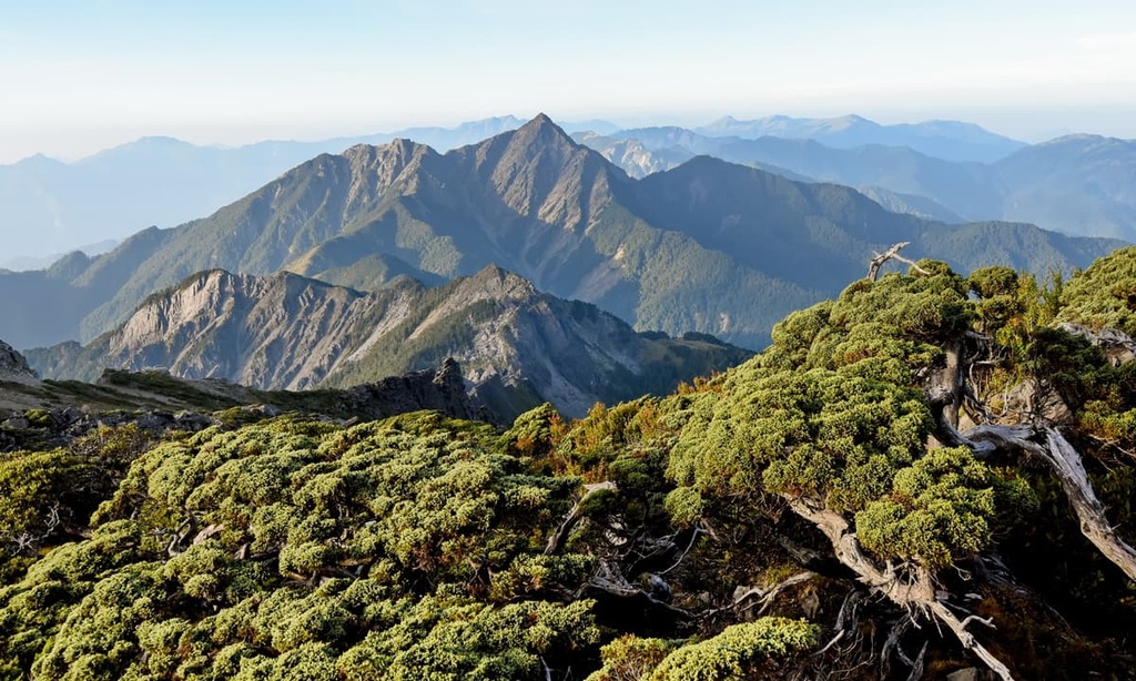
One of the holy grails of hiking in Taiwan, the Xueshan Hiking Trail is a popular trekking route that leads to the summit of the often-snow-capped Xueshan. Many keen hikers undertake this adventure to Taiwan’s second-highest peak, though it’s worth noting that this trail is challenging and is only appropriate for experienced trekkers.
The three-day trek to the summit involves ascending Xueshan East Peak (雪山東峰) before continuing the path to Xueshan proper. Right from the trailhead, the path starts heading uphill toward the infamous ‘Crying Slope’ that’s tested the mettle of countless hikers over the years.
After gazing out at the generous view of the region from Xueshan East Peak, trekkers on this trail make their way toward Xueshan by navigating through the dense and mystical Black Forest, which features clusters of Taiwan white fir that are over 1,000 years old.
Eventually, the trail makes its way to the summit of Xueshan where panoramic views await on a clear day. From the summit, it’s possible to see Nanhu Dashan, Dabajianshan (大霸尖山), Pintian Shan (品田山), Daxue Shan, and Xiaoxue Shan (小雪山) in the distance.
Taichung’s equivalent to Yangmingshan National Park (陽明山國家公園), Dongshi Forest Park (東勢林場遊樂區) is a recreation area that’s located in Taichung’s northeastern district. The park covers an area of 225 ha (556 acres), so it’s a nice spot for a day trip if you’re looking to experience the region’s beautiful forests first-hand.
During the spring months, the park is known for its many beautiful cherry and peach blossoms as well as for its chrysanthemums. Other plant species that you may see in the area include tung blossoms, orchids, and crepe myrtle flowers, all of which bloom in summer. In autumn, the region’s broadleaf forests often change color into crimson, ochre, or burgundy.
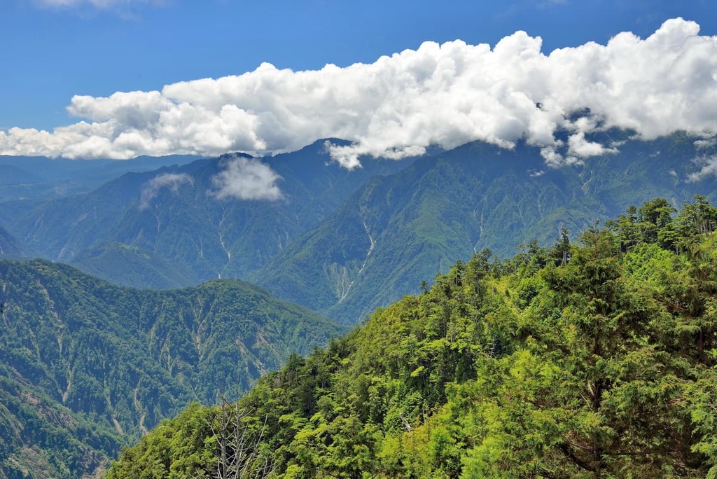
Daxue Shan Forest (大雪山國家森林遊樂區) is a popular trekking area in Taichung. It boasts a sea of rugged mountains that are often draped in a veil of mist that give them an other-worldly charm.
Within the forest, you can find ancient Taiwan red cypress trees, including one that’s around 1,400 years old and stands at over 49 m (161 ft) tall. Its 13-meter (43 ft) width makes it clear that this tree is truly ancient, too. Surrounding this ancient tree, there are also dense groves of Taiwan hemlock, Huangshan pine, and Taiwan red maple that add to the mystique of the region.
During a trip to Daxue Shan National Forest Recreation Area, you can head to Tianchi Pond, which is situated on Xiao Xue Shan’s southwest slope at an elevation of around 2,612 meters (8,570 ft).
Or, in the recreation area’s scenic forests, you can also embark on some forest bathing trails. Many of the region’s residents enjoy forest bathing as they believe that it helps them clear their thoughts and connect with nature.
Each of Taichung’s 29 districts offers something enjoyable for visitors. However, if you’re looking for a place to stay, consider one of these excellent destinations.
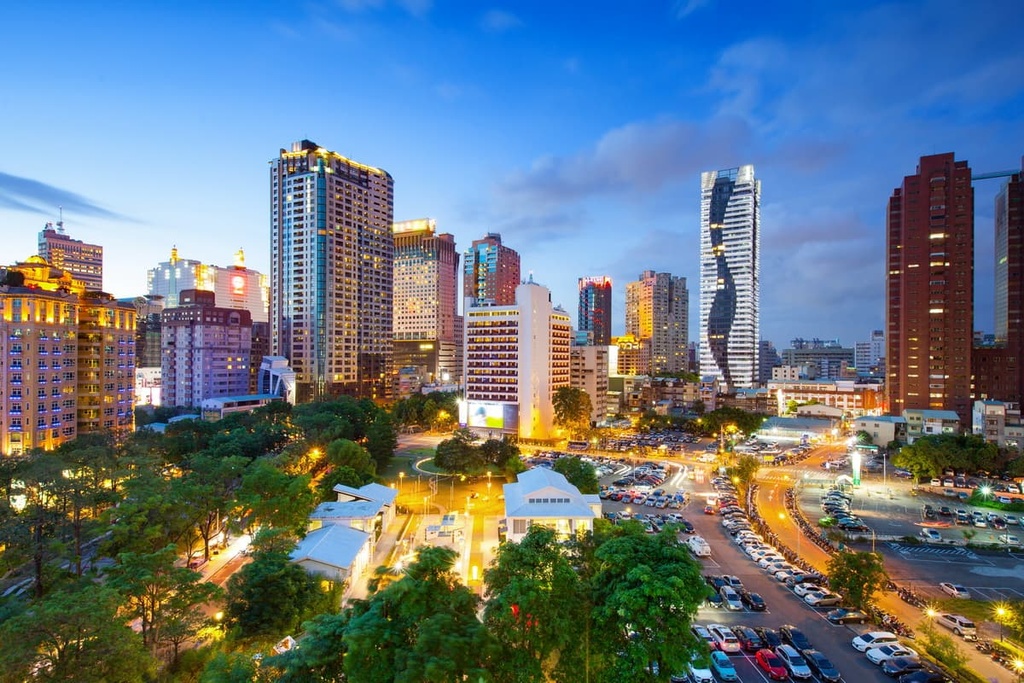
Taichung City pulsates with energy and excitement in its inner district. In fact, the Central District and surrounding North, West, South, and East districts are the heart of Taichung City.
If you’re looking for adventure in Taichung’s Inner Districts, you can head to the idyllic Taichung Park (臺中公園). Established by the Japanese during the occupation era, Taichung Park is the city’s oldest garden. The park’s layout is spacious and serene as it features a collection of banyan and palm trees. It also has an artificial lake that creates a tranquil setting for all to enjoy.
After working up an appetite in Taichung Park, you could head to the Fengjia Night Market (逢甲夜市) to sample some of Taichung’s best street food. The Fengjia sweet potato balls are a local favorite because they are delightfully doughy and chewy. Other popular local delicacies at the night market include the hotdog-style da chang bao xiao chang (fried sausages in bao buns) and dan bing (egg omelets).
Finally, if you’re traveling through the city’s inner districts, you can visit Taichung’s other much-loved outdoor space, Calligraphy Greenway (草悟道). This 3.6 km (2.2 mi) grassy path connects Taichung’s two well-visited galleries, the National Museum of Natural Science and the National Taiwan Museum of Fine Arts. Visitors are welcome to enjoy this calming green passageway while also appreciating the abstract art sculptures that are featured throughout the park.
Situated just to the west of Taichung City’s inner districts is the charming Nantun District (南屯區). As it is located relatively close enough to the city center, Nantun District is a popular choice among visitors due to its plethora of attractions.
One of the Nantun District’s most popular attractions is the Rainbow Village, which is a renovated military barracks. This former military installation was transformed into a happy celebration of color in recent decades, which saved it from demolition and helped it become a tourist destination.
Located just a short walk away from Taichung is the Fengle Sculpture Park (豐樂雕塑公園), which is 6 ha (15 acres) in size and features 52 sculptures from Taiwan’s top artists. While in the park, you can roam its manicured lawns and appreciate these intriguing and thoughtful statues. After looping through the grounds, you can even head to the lake in the park’s center, where you can sometimes spot turtles swimming in the waters.
Last but not least, if you’re looking to experience some of Taichung’s prettiest natural areas, the Xinshe District (新社區) might be worth checking out.
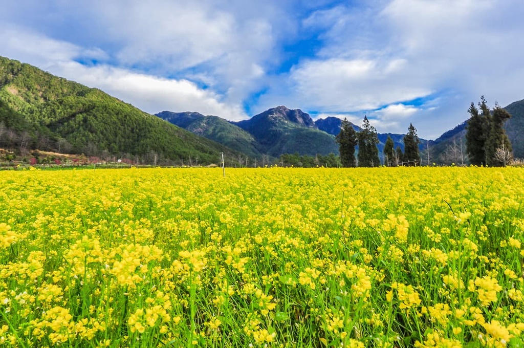
The Xinshe Sea of Flowers Festival is held in the district between November and December of each year. During the event, lavender, cosmos, sunflowers, tulips, and rhododendron flower beds encompass much of the district, giving tourists and flower lovers alike a chance to revel in these truly stunning floral creations.

Meanwhile, located just a short distance away from the festival grounds is the Lavender Cottage, which is a rustic house with endless lavender fields. Here, you can grab a cup of coffee at the café and gaze at the mesmerizing purple flowers. As the cottage is nestled between the hills of Tougui Shan (頭拒山) and Anying Shan (暗影山), the views you can get from its gardens are truly second to none.
From Taiwan’s international airports, you can take the Taiwan High-Speed Rail (HSR) or local express train (TRA) to Taichung City. Alternatively, you can hire a car or scooter and make the 162 km (100 mi) journey from Taipei to the city.


tw100
ultra
taiwan-high-three
taiwan-ultras
tw100
ultra
taiwan-high-three
taiwan-ultras


