
Scan the QR code and open PeakVisor on your phone
Located in the heart of Taiwan, Nantou County (南投縣) is the only land-locked county on the island. Four of the main five mountain ranges in Taiwan cross the county, including the Yushan Range (玉山山脈) and the Central Mountain Range (中央山脈). There are 532 named mountains in Nantou County, the highest and most prominent of which is Yushan (玉山), the highest point of Taiwan and of all northeastern Asia.
As the only landlocked county in Taiwan, Nantou County is jokingly nicknamed as the true and only “mainland” by Taiwanese people. The county is even home to a monument that marks the exact geographical center of the island, The Stele of Taiwan's Geographical Center (台灣地理中心碑).
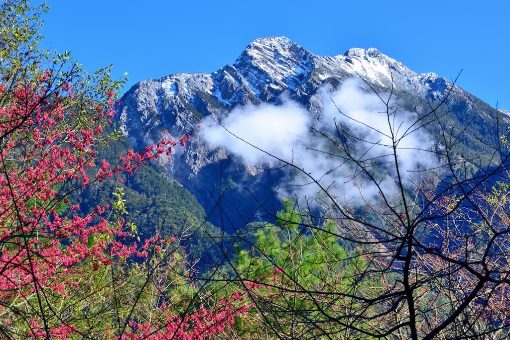
Most of the county is located to the north of the Tropic of Cancer, so it enjoys a subtropical climate at lower temperatures and relatively cool summers and warm winters at higher elevations.
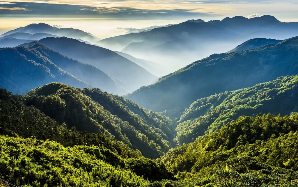
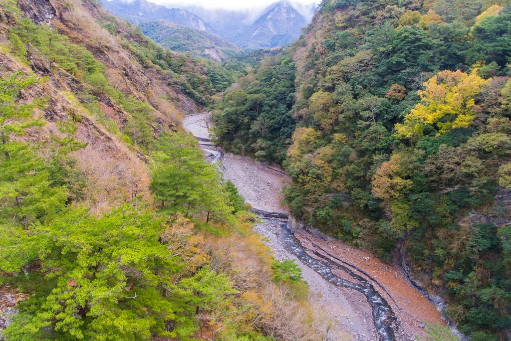
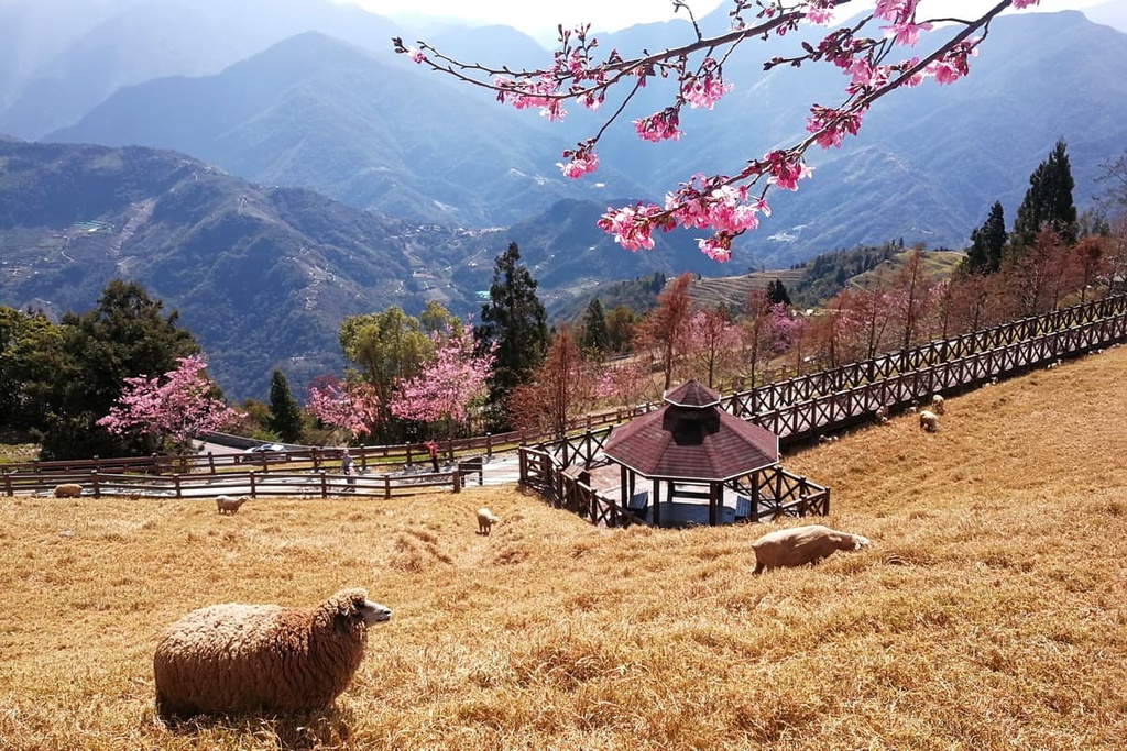
Tucked beneath the mesmerising Central Mountain Range, Nantou County is a good place to visit if you want to explore several of Taiwan's best hiking trails. It also features the highest peaks of Taiwan, which stretch out as undulating green waves. The longest river of Taiwan also winds through the county. Here, you can even see Taiwan’s second biggest lake, plus hot springs and other fascinating destinations for outdoor enthusiasts.
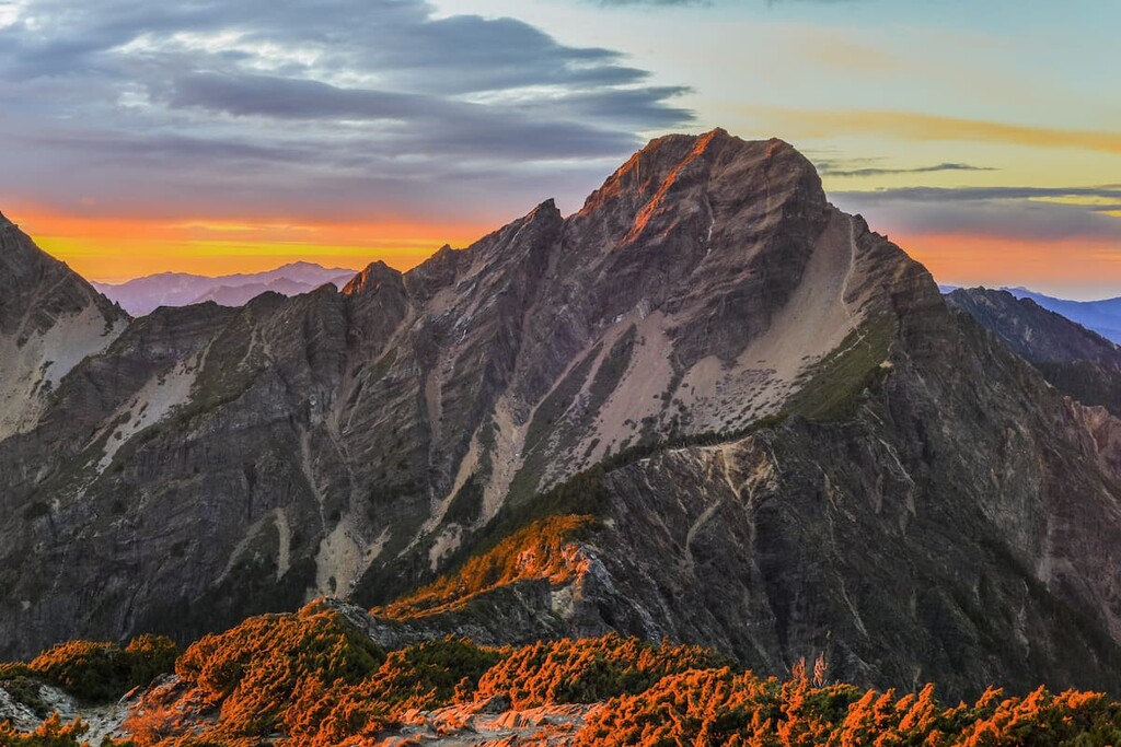
Nantou encompasses over 4,106 square kilometers (1,585 square miles) of terrain, and it boasts 41 peaks higher than 3,000 meters (9,843 ft) in elevation, many of which are listed as the renowned 100 Peaks of Taiwan (台灣百岳). Among them, the highest peak is the 3,952 meter (12,966 ft) tall Yushan, which means ‘Jade Mountain’ in Mandarin.
The Yushan Range, Central Mountain Range, Alishan Range (阿里山山脈) and Xueshan Range (雪山山脈) all cross Nantou. Yushan National Park (玉山國家公園), Taroko National Park (太魯閣國家公園), Hehuanshan National Forest Recreation Area (合歡山國家森林遊樂區), and Aowanda National Forest Recreation Area (奧萬大國家森林遊樂區) are also the main parks that are entirely or partially located in the county.
While some mountains in the county are accessible only via a multi-day trip, others can be easily accessed by car, scooter, or even bicycle.
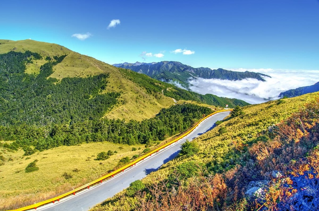
Wuling (武嶺), the highest point on any of the paved roads of Taiwan, is located in the Central Mountain Range at an elevation of 3,275 meters (10,745 ft). It is a popular mountain pass for challenge-seeking bikers. Wuling is also the source of Zhuoshui River (濁水溪), which is the longest river in Taiwan. The convenient accessibility and great visibility of Wuling make it a stargazing hotspot on clear nights.
Nearby peaks like Hehuanshan (合歡山), Hehuanshan East Peak (合歡東峰), Hehuanshan North Peak (合歡北峰), and Shimen Shan (石門山) are all accessible by foot with little hard work.
In the county, there are even several hot springs where you can arrange a relaxing soak in a natural mineral pool that’s surrounded by scenic views after hiking on your favorite trails.
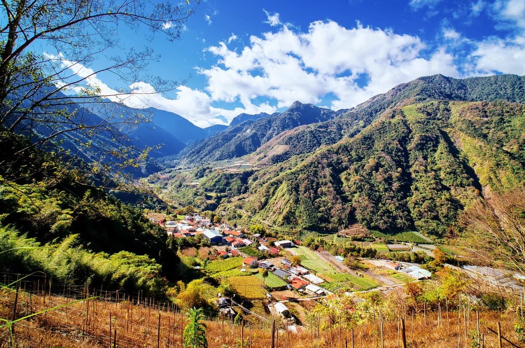
Over 90 percent of Nantou County is dominated by mountains and hills, with valleys and basins scattered within. The overall terrain slopes down from east to west. Most of the basins cover less than 1 sq. km (0.4 sq. mi) in area.
As it is home to four main mountain ranges, the landscape of Nantou is complex and fragmented. The topography of the county is the result of extensive and on-going tectonic plate movements and active submarine volcanoes.
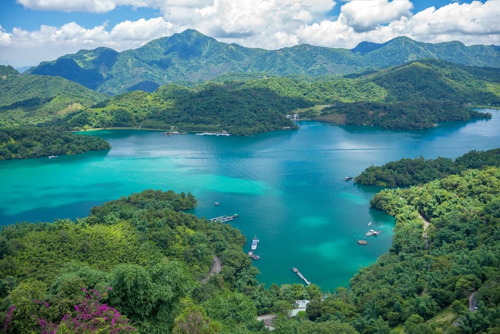
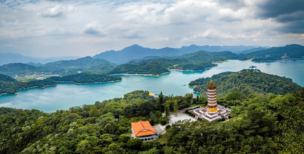
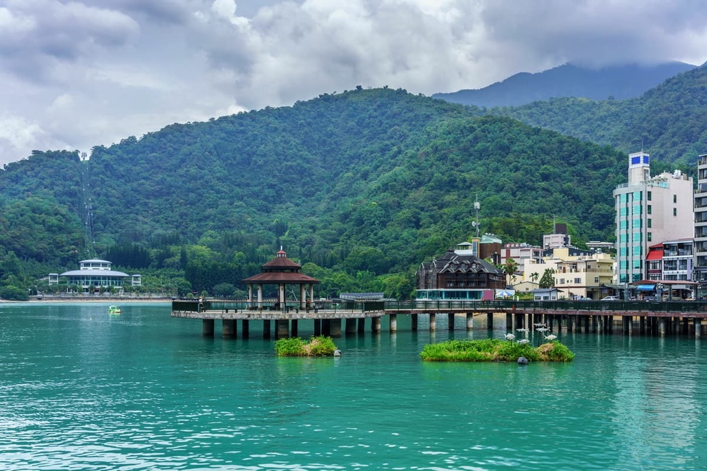
The famous Sun Moon Lake (日月潭), which is located at the western foothills of the Central Mountain Range, is the only lake that remains in the county.
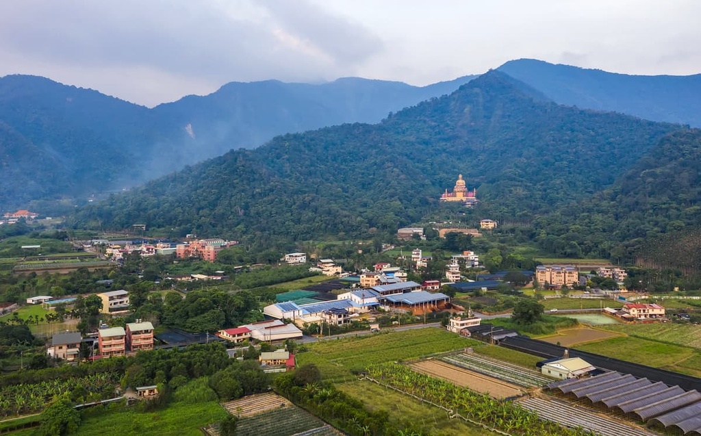
Around Puli Basin (埔里盆地), the largest and one of the most populous basins in Nantou, low-grade metamorphic rocks dominate the region. Argillaceous rocks such as dark-gray shales and slates are also found throughout the region.

On the other hand, the majority of the mountains and hills in Nantou are made up of sedimentary and metasedimentary rocks with larger sediment sizes. Many of these rocks were formed by alluvial deposits, colluvial soils, and orthents. The fragile nature of these rocks offers impressively diverse scenery to outdoor enthusiasts in this area, but it also sometimes also makes the journey unpredictable.
A magnitude 7.3 earthquake that struck the region in 1999 was the result of movement along the Chelongpu Fault (車籠埔斷層). Chelongpu is a north-south trending fault line that runs along the foothills of the Central Mountain Range, and has left a 100 km (62 mi) long exposed area of rock on the island. Sections of the lifted fault can be observed at the Chelungpu Fault Preservation Park (車籠埔斷層保存園區) in Zhushan Township (竹山鎮).
Though seemingly dangerous, it is this energetic geologic process of tectonic movement that gave birth to this encompassing and scenic island. It also makes Nantou the cradle of many prominent mountain peaks and one of the most desired destinations for adventure-seekers in Taiwan.
Before starting your great voyage, please keep in mind that, due to the unstableness of some mountains’ topsoils and the possibility of heavy rains during typhoon season, the paved roads and mountain trails in the county can occasionally be shut down by landslides—sometimes for years.
It is highly recommended that you check the real-time condition of your destination before setting out on your travels to avoid any disappointments during your adventures.
Due to the unique terrain found in the region, from canyons to peaks that reach a staggering elevation of 3,952 meters (12,965 ft), Nantou County features a number of distinct ecosystems. In fact, Nantou County may cover only 10 percent of Taiwan's land area, but it is home to more than half of Taiwan's native plants.

The ecosystems in Nantou can be divided into five main vegetation belts: alpine vegetation, fir forests, hemlock and spruce forests, oak forests, and castanopsis.
In the county, Yushan juniperus squamata (玉山圓柏), Taiwan firs (台灣冷杉) and Yushan canes (玉山箭竹) are your best companions as you hike to the region’s highest peaks. Meanwhile, oak forests and certain cypress trees that are endemic to Taiwan can be seen where the thickest clouds and fogs linger.
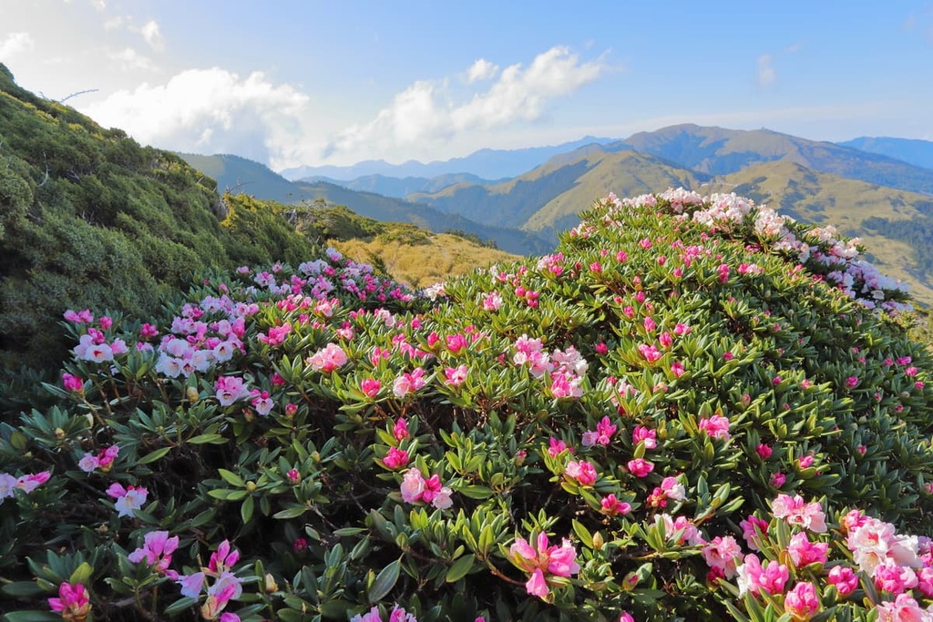
Many of the region’s flowers blossom in the spring, such as false-gold-flower rhododendron (玉山杜鵑). In the autumn, many of Nantou’s trees have leaves that turn red, such as Taiwan mountain ash (巒大花楸). The region also features maple trees that are also big attractions for hikers during the autumn months.
Additionally, Nantou contains almost 80 percent of all the mammal species found in Taiwan. Among the 65 species of mammals that live in Yushan National Park, there are 16 large and medium-sized animals, such as Formosan black bear (台灣黑熊), Taiwan serow (台灣長鬃山羊) and Formosan wild boar (台灣山豬). Most of them live deep in the mountains away from human interference in the Central Mountain Range.
Hundreds of species of birds also nest in this area, including more than 30 endemic species. There are also hundreds of species of butterflies as well as dozens of reptile, amphibian, and fish species that can also be found in the county.
If you look closely at the names of the mountains and the ponds in Nantou County, you’ll find that many of them lack a literal translation in Mandarin. This is because they were historically named by the ancestors of the region’s Indigenous people and need to be understood in the languages of the Indigenous communities who have lived here for countless generations.
For example, the peak of Patungkuon, which is more commonly known as Yushan, is a sacred mountain for the Tsou people (鄒族) and the Bunun people (布農族).
Additionally, Rmdax tasing, which is also known as Baishi Shan (白石山) and literally means “shining rock,” is a sacred place for the Seediq people (賽德克族). Furthermore, Lalu Island (拉魯島) is the island located in the middle of Sun Moon Lake, and its name literally means “sacred mountain” in the language of Thao people (邵族).
Nantou County continues to be home to a wide diversity of people from a range of backgrounds and ethnicities. Furthermore, we can see a lot of the history of this region in its ancient walking paths.
For example, the Batongguan Traversing Trail (八通關越嶺古道) and Nenggao Traversing Trail (能高越嶺古道) were built during the Japanese occupation period to implement the policy of controlling the Indigenous people of Formosa.
A similar story can be found in Hehuanshan area, where a cross-island road was built after Musha Incident (霧社事件), the last major uprising against colonial Japanese forces.
Parts of the current Central Cross-Island Highway (中部橫貫公路) were built along this ancient road and excavated by the soldiers of the Chinese Kuomintang (中國國民黨) who fled to Taiwan after WWII. Nowadays, many of the restaurants located near Qingjing Farm (清境農場) feature the dishes of Yunnan Province (雲南省) of China.
The 29.7 kilometer (18.5 mi) long Jiji Line (集集線), which runs through the county, is the longest branch line of Taiwan Railways. Originally built for transportations of dam construction, and for the movement of goods in the logging and sugarcane industries, the east end of the Jiji Line is located in Shuili Township (水里鄉).

This area served as the original base camp for hikers to Yushan many years ago. During that time, hikers might rest a night in Shuili and then hop on log wagons to travel to the Dongpu Hot Spring (東埔溫泉). By hiking along the Batongguan Traversing Trail, they could summit Yushan from its north slope.
The well-designed national parks and national forest recreation areas in Nantou County are great starting points to explore some of the best attractions in the region.
But before you go, it is worth checking the forecast for your destinations, since the mountain ranges in the region tend to be unpredictable in the monsoon and typhoon seasons. Visitors to some trails in Yushan and Taroko National Parks are also required to register for park entries at least five days in advance. Be sure to check the official website to register before you depart.
Here’s a quick look at the best parks in Nantou County that you can check out during your next trip to the region.
Covering 1,031 square kilometers (398 square miles) of mountainous terrain, Yushan National Park is the largest and one of the most popular national parks of Taiwan. It is home to the Yushan Range and to the southern section of the Central Mountain Range, as well as the highest peak in Taiwan: Yushan.
Known for its rugged mountainscapes, the park contains 120 named mountains, 30 of which are listed among the 100 Peaks of Taiwan. The 100 Peaks of Taiwan is a list of the best peaks to summit in Taiwan that was created by four Taiwanese mountaineering pioneers in 1971.
Taroko National Park boasts a beautiful array of marbleized canyons, deep rocky gorges, and clear turquoise rivers that wind through narrow cliff faces. While most area of the park is situated in Hualien County (花蓮縣), it encompases part of Nantou County, where most of its highest peaks are located.

Located on the border of Nantou County and Hualien County, Hehuanshan National Forest Recreation Area is the home to the watershed of three main rivers of southern Taiwan.
It is located to the west of Taroko National Park and it is home to the Wuling mountain pass, which is the highest point of any paved road in Taiwan.
As it is highly accessible by vehicle, the peaks in Hehuanshan are also popular for beginners who aim to summit all 100 Peaks of Taiwan. In winter, this recreation area is also one of the few snow-accumulating spots on the island that is accessible by vehicle.

Home to valleys, rivers, and forests, Aowanda National Forest Recreation Area is known for its maple woodlands and its abundance of birdlife.
Visitors to the recreation area can expect to see animals like with Taiwan blue magpie (台灣藍鵲) and other over 170 species of birds. The recreation area contains 7 named mountains, mostly at elevations of 1,500–2,500 meters (4,921–8,202 ft).
Several well-designed and family-friendly trails can be found in the 25 sq. km (9.7 sq. mi) Xitou Nature Education Area (溪頭自然教育園區).
Filled with lush forests and diverse plant life, the area provides a soothing environment for visitors who want to head out on a blissful stroll. For those interested in a hike, consider heading out on one of the following trails during your visit:

The 74.8 sq. km (28.9 sq. mi) Huisun Forest Area (惠蓀林場) is another option for leisurely strolls in Nantou County. The forest is home to both peaks and valleys and, as a result, it contains a multitude of plant species.
In Huisun Forest Area, you can find a number of hikes, such as the 3.8 km (2.4 mi) Tanggong Monument Trail (湯公碑步道) and the 2.5 km (1.6 miles) Songfeng Shan Trail (松風山步道).
From the highest mountain peaks to the deepest river valleys, the heart of Taiwan offers stunning landscapes and adventures for nature lovers.
In this region, you can find family-friendly trails as well as the most difficult trails in Taiwan, many of which require experienced navigational and cliff-crossing skills. Here are some of the best hikes to consider for your next trip to Nantou County.
If you’re looking to summit Taiwan’s highest peak, check out these trails in the Yushan area:
Hehuanshan National Forest Recreation Area is home to an abundance of trailheads and hiking areas, such as:
One of the six sections of the trail that takes you through the Central Mountain Range, South Section Two (南二段) is among the most beautiful hikes in the region. It’s known for its grassy plains and turquoise alpine lakes.
From Nantou County to Taitung County (台東縣), most of the 89.3 kilometers (55.5 miles) of this trail are located above 3,000 metres (9,843 ft) in elevation. You’ll get to summit 10 of the 100 Peaks of Taiwan, too.
However ,this is the only section of the trail with mountain huts throughout its entire length, so this 7 day long hike is a great option for serious hikers who start to challenge themselves with week-long mountain journeys.
Hikers can also customize their itinerary on this trail to suit their needs.
For example, you can start from Dongpu Trailhead (東埔登山口) in Nantou and make a 68.6 km (42.6 mi) round trip along the Batongguan Traversing Trail to Batongguan Shan, Dashuiku Shan and Xiuguluan Shan (秀姑巒山) and Xiuguping (秀姑坪). This hike is called the Ba-Da-Xiu Trail (八大秀), and it’s a beautiful 4-day section of the South Section Two.
One of the highlights of this shorter hike is that on Xiuguluan Shan, the highest point of Central Mountain Range at 3,825 meters (12,549 ft.) high, you can enjoy the magnificent views of Yushan Range and Central Mountain Range stretching beneath your eyes.
North Section Three (北三段) of the Central Mountain Range is also called the Nenggao-Andongjun Trail (能高安東軍).
It starts in the north at Nenggao Shan and in the south at Andongjun Shan (安東軍山). This trail is 49 km (30.4 mi) long and it takes about 6 days to complete for advanced hikers.
This is a trail that takes you to five prominent peaks that overlook the highest peneplains in Taiwan. Along the way, you can see vast alpine grasslands and lovely ponds as you traverse this mountain ridge.
You can expect to encounter Formosan sambar deer (台灣水鹿) especially around Baishi Pond (白石池), Wanli Pond (萬里池) and Tunlu Pond (屯鹿池). When night falls, flocking Formosan sambar deer forage on the rolling grassland under the twinkling sky.
However, the last part of this trail require good navigational skills through collapsed cliffs and Wanda South Creek (萬大南溪) before you end up at the Aowanda National Forest Recreation Area.

For hikers who do not want to pursue a week-long journey, setting out on a shorter hike through certain parts of the North Section Three is also doable. There are two popular trails around this area that connect the main trail to nearby attractions, and they are no less fun than the North Section Three itself!
For example, if you hit the trail from Tunyuan Trailhead (屯原登山口) in Ren’ai Township (仁愛鄉) of Nantou, you’ll have plenty of options for a multi-day journey.
Qilai-Nanhua Trail (奇萊南華), which is named after Qilai Shan South Peak (奇萊南峰) and Nanhua Mountain (南華山 and also features Nenggao Shan North Peak 能高山北峰), is a three-days beginner-friendly round journey through diverse landscapes such as suspension bridges, collapsed cliffs, soft grassy slopes and waterfalls.
Tianchi Lodge (天池山莊) and Paiyun Lodge are the two most conveniently located mountain cabins in Taiwan. Therefore, they are equally competitive in their lottery system. Note that the campground in front of the lodge usually has more vacancies than the lodge itself. Remember to register on the official website six days in advance.
From here, you can continue all the east for one or two more days, traversing the Central Mountain Range to Hualien County in the process. Doing so will take you along the 26.5 km (16.5 mi) long Nenggao Traversing Trail (能高越嶺古道), which is named after Nenggao Shan (能高山).
As the trail was originally developed by the Indigenous Seediq people, it also speaks to the long and often difficult history of the island. For example, along the way, you’ll pass by Japanese police stations left by colonial officials, as well as electric towers, lines and stations established by Chinese Kuomintang governments.
Here, along the border of Nantou and Hualien, you’ll also find the “Monument of Spread Light Across the Land” (光被八表碑, or Kuang Pei Pa Piao Monument), which commemorates the completion of east coast to west coast power transmission on the island.
On the last day of the trail, you’ll get to travel through the the 1.3 km (0.8 mi) long Tianchang Tunnel (天長隧道), which is only tunnel dug through marble rock in Taiwan.

The South Section Three (南三段) of the Central Mountain Range awaits the most adventurous souls. The most difficult section of Central Mountain Range, this grueling trail is one of the most unforgettable trekking sections for experienced hikers who complete the entire Central Mountain Range Grand Trail (中央山脈大縱走).
The South Section Three is usually separated into the Danda-Dongjun Crossing Trail (丹大東郡橫斷) and the Mabolasi Crossing Trail (馬博拉斯橫斷). There are also shorter trails that lead to Liushun Shan (六順山) and Junda Shan (郡大山), the two further peaks of the South Section Three.
The Danda-Dongjun Crossing Trail and the Mabolasi Crossing Trail are part of the “four obstacle treks” (四大障礙) of Taiwan, which are notorious for their challenging routes.
Danda-Donjun Crossing Trail is the main trail of South Section Three, and it is sometimes called “The Little South Section Three.” This ten-day long journey includes treks to the top of Danda Shan (丹大山) and Donjunda Shan (東郡大山). It takes you into the hidden gems of Taiwan.
This trail features turbulent rivers, collapsing cliffs, and both steep ascents and descents. It takes you to the summit of 20 peaks higher than 3,000 meters (9,843 ft). Many of the days on this trail require climbing or descending more than 1,000 meters (3,281 ft). You will gain some exhausting yet rewarding memories.
Along the way, you can see the traces of black bears’ paws scratching against tree trunks, and the cries of Reeves's muntjac (山羌). You may also encounter Taiwan serow and Formosan sambar deer from far away or just in front of you. In other words, you will definitely be humbled by the vitality of nature on the Danda-Dojun Crossing Trail.
However, watch out for the blood-sucking leeches (螞蝗) on the Ruisui Forest Road (瑞穗林道), sneaky-hungry Siberian weasels (黃鼠狼) at your campsites, and the hornets (虎頭蜂) near Wuwalabi Creek Campground (烏瓦拉鼻溪營地) along this trail.
Additionally, if you’re looking for a shorter adventure in the area, you can check out the Mabolasi Crossing Trail, which is connected to the Batongguan Traversing Trail. It is situated between South Section Three and South Section Two of the Central Mountain Range, and it passes by the peaks of Xiuguluan Shan and Mabolasi Shan (馬博拉斯山).
The extensive history of tectonic movement in the region has created numerous steep cliffs and valleys in the area, making this trail an arduous yet exciting journey. However, despite the fun that you’ll likely have this trail, we would still like to warn you about the rampant leeches on the Zhongping Forest Road (中平林道) so you can steer clear of them during your journey.
Between the Malijianan Shan (馬利加南山) of the Mabosali Crossing Trail and the Yixiqingmazhi Shan (義西請馬至山) of the Danda-Dongjun Crossing Trail, experienced adventurers may find the way to the newly discovered Bay of Sighs (嘆息灣, pronounced as Tanshi Bay.)
It is a secluded breathtaking valley that’s worth checking out. It offers a romantic refuge and a recharging break before continuing on more obstacles. However, if you’re venturing to the bay, be sure to add a few extra days to your original journey just in case your travel plans don't stay on schedule.
To reach Liushun Shan (六順山) and Junda Shan (郡大山), the two farthest peaks of the South Section Three, hikers can split their journey into two independent treks that also give you time to see other nearby attractions.
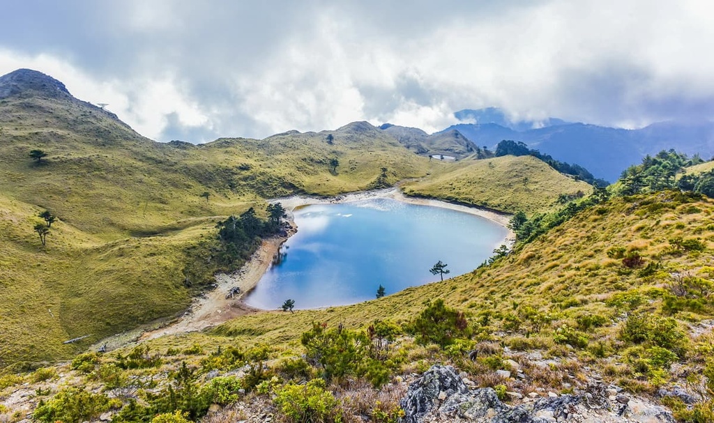
For example, you can visit Liushun Shan on the 120 km (74.6 mi) long Qicai-Liushun Trail (七彩六順), which also takes you to Qicai Lake (七彩湖). The lake, whose name literally means ‘seven-color lake,’ is a tranquil spot at the border of Nantou and Hualien counties that’s surrounded by soft Yunshan canes and usually mysterious mists. It is the second-deepest alpine lake in Taiwan, with a depth of 8 meters (26 ft), but it is still crystal clear.
The reopening of Danda Forest Road (丹大林道) in 2019 has also made it easier to enter the area from the west. Still, keep in mind that the water level on this side of the region might be too dangerous to cross during rainy seasons.
If further adventure is what you seek, check out the 3,263 meters (10,705 ft.) high Junda Shan, Junda Shan North Peak (郡大山北峰), and Wangxiang Shan (望鄉山). You can visit all these peaks on a 8 km (5 mi) round-trip outing. The bumpy Junda Forest Road (郡大林道) leads the way to the peak, so it’s a relatively easy walk. However, the ruggedness of the road means that it’s not a great option for driving on.
Finally, to the east, the Guanmen Traversing Trail (關門古道) is another trail that’s great for history enthusiasts. That said, unless you have a local guide, solid navigation skills are required for this trek.
If you’re up for an adventure, consider getting up early and making your way up the trail to Shuishe Dashan (水社大山), the 2,059 m (6,755 ft) tall peak that overlooks Sun Moon Lake and the rest of the Central Mountain Range.
This 5.6 km (3.5 mi) round trip includes stone steps in the beginning then more rugged trails to the summit. It ascends 1,300 meters (4,265 ft) in elevation and takes approximately 8 hours to complete.
99 Peaks (九九峰), pronounced as Jiujiufeng, is composed of 99 sharp independent peaks in Caotun Township (草屯鎮). It is also known as Flaming Mountain (火炎山) due to how its red clay soils look like the dazzling flames from a distance.
Although the highest peak in the 99 Peaks is only 779.4 meters (2,557 ft) tall, the region’s special geological landscape makes it one of the “three flaming mountain terrains” of Taiwan.
If you’re interested in visiting the area, you can hike along the 99 Peaks Forest Trail (九九峰森林步道). Along the way, you’ll see the slopes that were devastated by the 1999 Jiji earthquake. This loop trail follows the main ridge for 1.93 kilometers (1.2 miles), and can be completed in 1 hour.
Depending on the destination, visitors usually have plenty of accommodation options to choose from in Nantou county.
For hikers planning to do a multi-days trail, it is necessary to research and reserve huts and potential campgrounds in advance.
While some of these huts and campsites are available on a first-come-first-get basis, some others require registration in advance. For some popular ones, like Paiyun Lodge and Tianchi Lodge, hikers are even responsible for registering for the lottery system. No matter which method you choose, always make a backup plan just in case.
Keep in mind that some water sources in the mountains of Nantou County aren’t always reliable. They can dry out, flood, or become undrinkable for a variety of reasons. It’s a good idea to ask people who just visited the area for the most updated information on water availability in the region. Always have a backup plan or bring extra water in the dry season.
Note that campfires are prohibited in national parks unless in an emergency. Stoves are useful for multiple-days trails.
With that in mind, here are some of the best places to stay in Nantou County during your visit.
Here are some of the best places to stay in the Yushan area:
Some of the best places to stay in the Hehuanshan and Aowanda include:
Some of the best places to stay in the Huisun Forest area include:
Here’s a quick overview of the easiest ways to get to and around Nantou County during your next trip.
If you’re coming from the west, the easiest way to reach Nantou County by public transportation is by railway and bus.
From major cities, hop on the Taiwan High Speed Railway to Taichung (台中) Station. From there, hourly buses go to Nantou.
Visitors can also take Taiwan Railways to Taichung, Changhua (彰化), Yuanlin (員林), or Puli (埔里) Station. There are also buses bound for Nantou County from these stations.
From the major train and bus stations, you can use the following routes to get to the county’s most popular trailheads:
Note that buses to these trails are not as frequent as most local buses, and the schedule might not match seamlessly with local bus timetables.
It is worth checking the schedule for these buses in advance and reserving your seat if necessary. To reach other popular places, check local buses by apps like 南投搭公車, 南投公車趴趴GO or Bus+.
From the east, driving is the only way to reach Nantou County.
The Central Cross-Island Highway goes from Hualien County through Taroko National Park and up to the mountain pass of Central Mountain Range. It then enters the Hehuanshan National Forest Recreation Area. This trip takes around 3 hours to complete. Going to downtown Nantou takes another 1.5 hour.
Driving to downtown Nantou County takes approximately 3 hours from Taipei City, 1 hour from Taichung City, and 3 hours from Kaohsiung City.
Note that the Taiwan Provincial Highway No. 21 (台21線) has a section between Nantou downtown and Tataka Saddle Trailhead, specifically between 110–145K, that is closed every day between 5:30 pm to 7:00 am. In the winter when there’s heavy snowfall, the vehicles going up to Hehuanshan on Provincial Highway 14 can cause traffic jams, too.
Some sections of the paved mountain roads in and around Nantou, such as the Taiwan Provincial Highways No. 21, No. 18 and No. 16, can be shut down after natural disasters for road maintenance. It is worth checking the latest road conditions on the highway’s official website before you go.
Finally, if you are going to travel by car in Taiwan, consider arranging your travel before arriving.
It’s a good idea to hire a 9-seat or 15-seat 4-wheel drive van with a driver who is familiar with the roads if you’re going to head to some of the more remote parts of Nantou County. Be sure to determine your pick-up date and time before you start your hike, just in case you don’t get good cell service in the mountains.


tw100
ultra
taiwan-high-three
taiwan-ultras
tw100
ultra
taiwan-high-three
taiwan-ultras


