
Scan the QR code and open PeakVisor on your phone
Taitung County is home to 396 named mountains. The highest is Guan Shan at 3,668 m.
A land of wild beauty and untouched nature, Taitung County (臺東縣) is a paradise on earth. This Eastern Taiwan county has 396 named mountains, with Guan Shan being the tallest, measuring 3,666 meters (12,028 ft). Malaoloushan is the most prominent peak at 1,684 meters (5,525 ft).
Taitung County is Taiwan’s southeastern region, sandwiched between Hualien County (花蓮縣) to the north and southern Pingtung County (屏東縣). Kaohsiung City (高雄市) borders Taitung County to the west, and the Pacific Ocean crashes on its shore to the east. Taitung County has two offshore islands in the Pacific Ocean; Green Island (綠島) and Orchid Island (蘭嶼).
Regarding land, Taitung County is Taiwan’s third largest area, with 351,500 ha (868,575 ac). Northeastern Taiwan’s Hualien County is the greatest, followed by Central Taiwan’s Nantou County (南投縣).
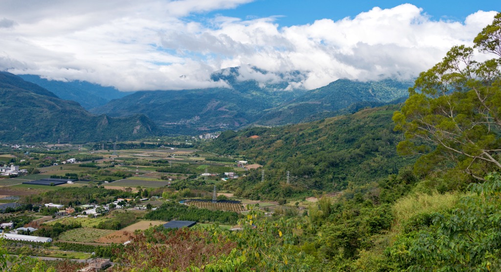
Taiwan’s southeastern region is steadily flat near the coast but starts to raise in height towards the west. The Central Mountain Range (中央山脈), Taiwan’s longest massif, runs along Taitung’s west. These massive mountains divide eastern Taiwan from the west with their rugged, rocky, and steep terrain.
In fact, ten of Taitung’s Central Mountain Range peaks belong to Taiwan’s tallest 100 mountains, also known as Baiyue. Some of these towering hills are Xiangyang Shan (紅葉山), Taguan Shan (大關山), Sancha Shan (三叉山), and Beidawushan (北大武山).
Thus, due to Taitung being cut off from the well-connected west, its land is remote and hard to reach. For this reason, Taitung County was the last region colonized by the Han Chinese settlers who set up communities along Taiwan’s northern and west coasts. Taitung holds the largest percentage of native Taiwanese people, 35% of its population. They mostly belong to one of seven tribes: the Amis, Bunan, Kavalan, Paiwan, Puyama, Rukai, and Yami people.
Another advantage of being isolated is that Taitung doesn’t suffer from air pollution like its other low-lying areas. And with fewer inhabitants living in the region, there is less urbanization, so nature can thrive. For this reason, this wild and rampant region has many beautiful scenic attractions.
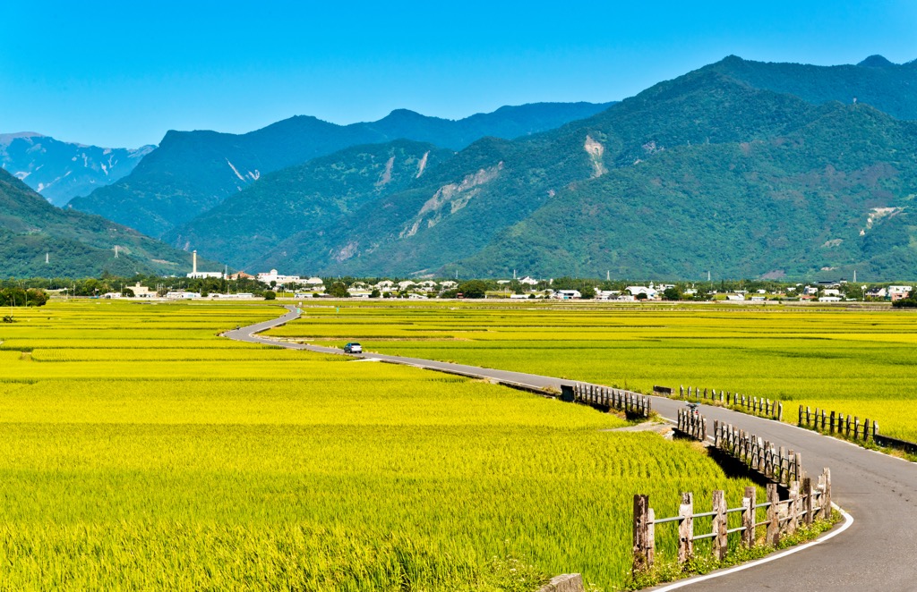
Luye Highlands (鹿野高台), Zhiben Forest (知本國家森林遊樂區), and Taitung Forest Park (台東森林公園) are popular outdoor attractions. Other well-known natural sites are the Huadong Valley (花東縱谷) to the north, and southern Dawu Coast Park (大武濱海公園). Dawu Mountain Nature Reserve (大武山自然保留區) and Yushan National Park (玉山國家公園) are to the south and northeast.
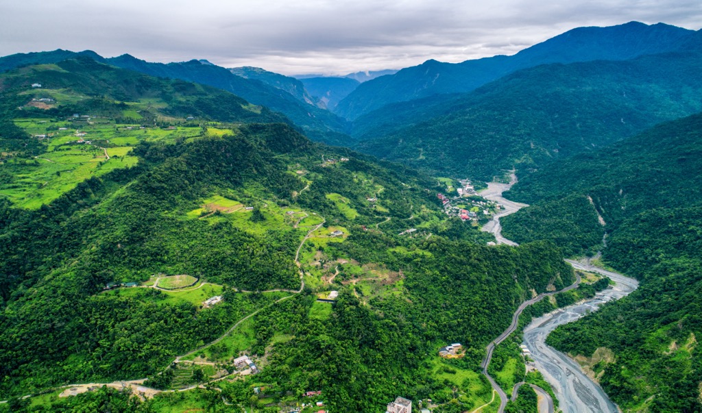
Two mountain ranges span Taitung County’s region. The Central Mountain Ranges runs its linear spine along Taiwan to the west. The longest sierra on the island stretches for 270 km (168 mi) from southern Pingtung County to northern Yilan County (宜蘭縣). Slate, phyllite, and quartz interbed in the Central Mountain Range’s rock strata.
Meanwhile, the Hai’an Range (海岸山脈) traces the coast. The hills are more flat and rounded compared to the pointed, jagged peaks of the Central Mountain Range. These gentle mounds were once submerged by the Pacific Ocean. These coastal hills have sediment and volcanic rock from the Miocene and Pliocene epochs.
As Taitung County is located in the warmer south, its high-elevation areas have few cold-temperate conifers on the mountains. Thus, Taitung has a flourishing broadleaf forest of camphor and subcostate crape myrtle trees. In the lower southern regions, especially near Pingtung County, is a tropical monsoon rainforest with various ficus arboreals.
As the elevation increases along Taitung’s western area leading up to the Central Mountain Range, the vegetation consists of subtropical montane broadleaf forests. The Japanese bay tree and Japanese blue oak grow in this region.
Warm-temperate conifers thrive on the mountains, such as Quercus morii and the Cartwheel tree. Further up the elevation, temperate plants like Taiwan cypress and Chinese yew thrive. Lastly, near the peaks’ summits is where cool temperate conifers flourish. These are Taiwan hemlock and Snow Mountain holly.
Taitung County was Taiwan’s last region to be colonized by the Japanese. Like most of Taiwan, Japanese officials removed Taiwan tribes living in the mountainous areas with thriving forests. One such region in Taitung County is Beidawushan’s hilly woodlands.
The Paiwan tribe lived on Beidawushan’s foothills at an elevation of 700 meters (2,296 ft). As the Japanese wanted access to the flourishing cypress woodlands, they forced the tribe to resettle around the 300 meters (984 ft) mark.
During the Japanese Occupation Era, Japanese officials ordered indigenous Taiwanese to fight for them during the Second World War in Nanyang, Southeast Asia. This group was called the Takasago Volunteer Army, which is ironic as they didn’t have a choice not to join. Tragically, many lost their lives battling for a country where they didn’t live. There is a monument on Beidawushan dedicated to the Takasago Volunteer Army, remembering the lives of these brave soldiers.

The most favourable hiking trails and areas in Taitung County are:
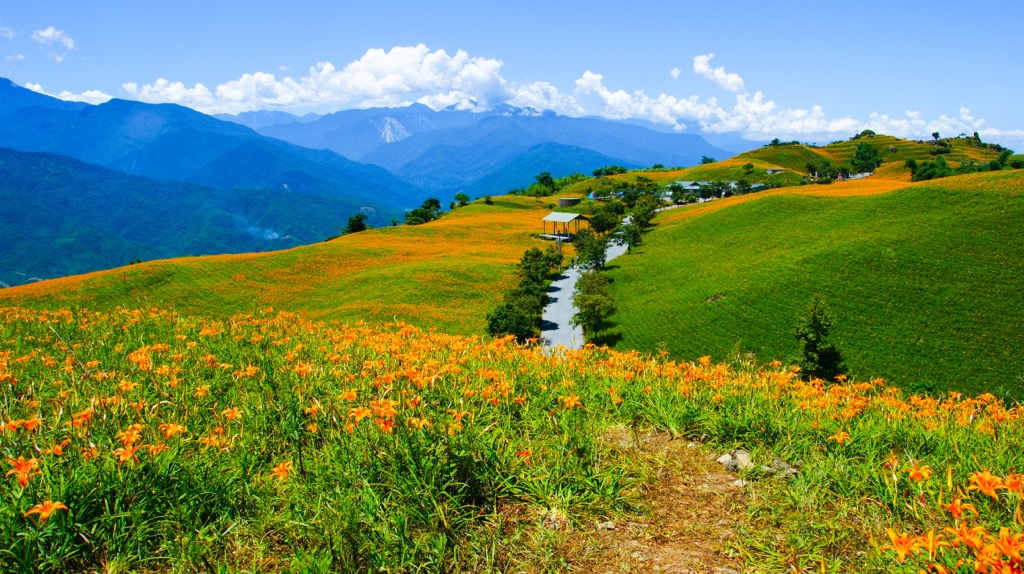
A whirlwind of activity occurs in the Luye Highlands, especially in the summer, during Taiwan Hot Air Balloon Festival. This internationally acclaimed event attracts visitors from around the globe. As hot air balloons float above, Taitung’s blue skies are awash with color every July or August. Some balloons are cute cartoon characters, while others look like a rainbow of patchwork.
As the Luye Highlands is sandwiched between the smaller Hai’an Range hills and the staggering Central Mountain Range, the wind flows in the same direction. This makes it a perfect spot for wind sports. A paragliding ground lies next to Fulushan (撫魯山), so people can have a beautiful view of the Luye Highlands as they glide across the sky. In the nearby tea plantation, you can watch the activity from above as you sip on fragrant tea.
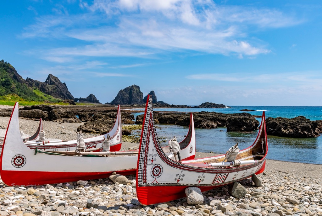
Catch a ferry from Taitung City to the offshore Green and Orchid islands. These two islets are tiny slices of tropical paradise with overgrown wilderness in their remote ocean setting. Volcanic eruptions formed both islands, and they have a coral reef that attracts beautiful marine life.
Green Island is located 33 km (20 miles) east of Taitung in the Pacific Ocean. For many, the former political prisoner exile is intriguing for its history and nature. Green Island's pristine coastline is surrounded by coral shards, making it an ideal location for diving and snorkelling. Explore the lush landscape by scooter, admiring its grassy plains, rolling hills, clear bays, and ancient Taiwanese settlements.
Meanwhile, Orchid Island lies further away from Taitung at 64 km (40 mi). Like Green Island, Orchid Island features dense greenery and incredible unspoilt nature. It has a rich cultural heritage with the Yami tribe, indigenous to Taiwan and the island. Many visitors head to the ocean and scuba dive in the warm current to view the exotic wildlife. You can swim past turtles and tropical shoals of fish.
The local Paiwan people consider the southernmost Baiyue in Taiwan a legend. They believe that Kavulungan, their name for Beidawushan, is sacred, and you'll find it mentioned in many folklore and songs.
Not only is it revered, but it also features historical monuments. Locals built the Takasago Volunteer Army memorial at the trail's 8 km (5 mi) mark to commemorate fallen soldiers who fought for Japan. Furthermore, Dawu Temple and Otago Shrine lie a few metres ahead, both erected by the Japanese. Dawu Temple remembers Pearl Harbour fighters.
You'll find flourishing forests along the 9 km (5.6 mi) trek to the summit. You'll come across a 1,000-year-old towering red cypress tree that has grown to 25 meters (82 ft) and has a width of 11.7 meters (38 ft). As you enter the temperate forest zone, you'll be in the largest hemlock grove in Taiwan. At this point, you'll be above the sea of clouds. As you overlook the landscape, wispy white clouds flow through the sky like foamy waves.
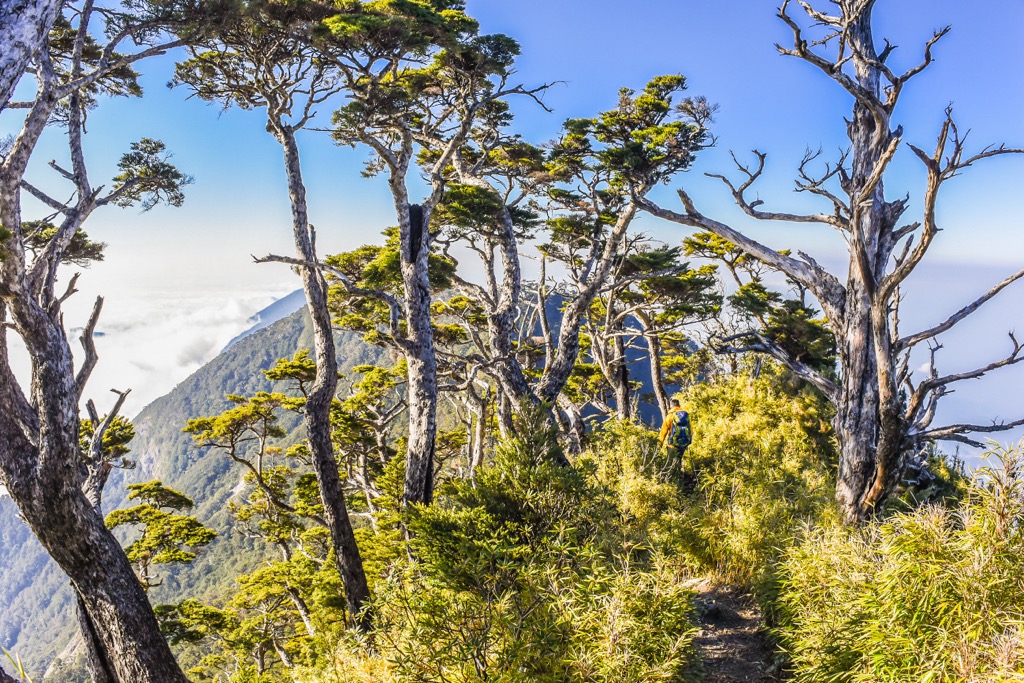
In terms of difficulty, Beidawushan Hiking Trail is a challenging climb. Make use of the metal rods when clambering up the hill to help you with your footing. At the top of the mountain, alpine plants slightly limit the view. You'll notice Nandawushan (南大武山) in the south and the Hengchun Peninsula further south. Then, in the opposite direction, you'll see Taiwan's tallest peak, Yushan (玉山).
For unrivalled views, beautiful sunrises, and to reach Taiwan’s second-highest lake, venture along the Jiaming Lake Hiking Trail. The 13 km (8 mi) trek forms the last part of the mammoth South Second Hiking Trail spanning 89 km (55 mi).
The climb to Jiaming Lake (嘉明湖) involves summiting Sancha Shan first, then progressing towards the alpine pool on the mountain’s southeast slope. You’ll encounter a white deadwood conifer forest along the way to Sancha Shan. Mountain fires stripped the trees of their color and vitality; now the Taiwan firs, Yushan juniper, and Taiwan hemlock are an ashen shadow of their old selves.
You’ll reach Sancha Shan’s pinnacle soon after the forest, where you’ll view an endless sea of rippling ridges and peaks. You’ll note nearby Xiangyang Shan, Xinkang Shan (新康山), Xiuguluan Shan (秀姑巒山), and even Yushan from the mountaintop.
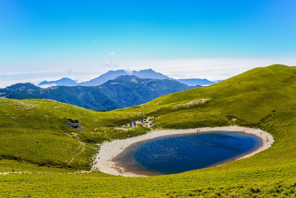
Then begin to descend the hill towards Jiaming Lake, which lies at 3,310 meters (10,860 ft). Considered to be formed by meteor impacts 10,000 years ago, Jiaming Lake is a divine beauty that mirrors the Taiwan sky like a shining pearl. Keep a look out for Taiwan sambar deer roaming the alpine grasslands. Yushan azaleas, Taiwan lilies, and Yushan rhododendron frame the picturesque lake in soft, floral colours in spring and summer.
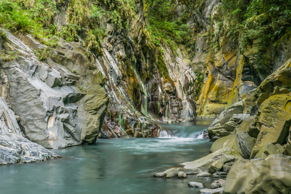
View one of Taiwan’s most impressive caves and thermal streams by visiting Lisong Hot Springs (栗松溫泉). A 30-meter (98 ft) high waterfall of weak alkaline carbonate water feeds the thermal river with mineral qualities in its 149°F (65°C) water. Marvel at the rock walls that don a milky green coat from the falling rapid.
Soak in the striking turquoise stream that simmers with misty vapor. You’ll also notice velvety algae growth on the rock walls from the humidity. The warm bath is a superb way to relax after the 3 km (1.8 mi) trek through rugged terrain to get to the secluded hot spring.
Set out to Zhiben Forest for a refreshing natural stroll amongst eastern Taiwan’s subtropical flora. Groves of Taiwan cycads, white banyan, camphor, and mahogany trees thrive in the undulating region of gentle, rolling hills.
Inhale the fresh phytoncide from the lush broadleaf woodlands that retain their vibrant greenery year-round. Let your mind clear and feel your stress melt away from the wooded scent that brings you calm and focus. In the autumn months, surround yourself with amber foliage from the maple trees as you step on the crunchy forest floor.
Once you’ve finished your forest bathing walk, treat yourself to a rejuvenating soak in the Zhiben Hot Springs. Cleanse your skin in the 131°F (55°C) sodium bicarbonate water and take in the scenic view of Zhiben’s exuberant leafy forest.
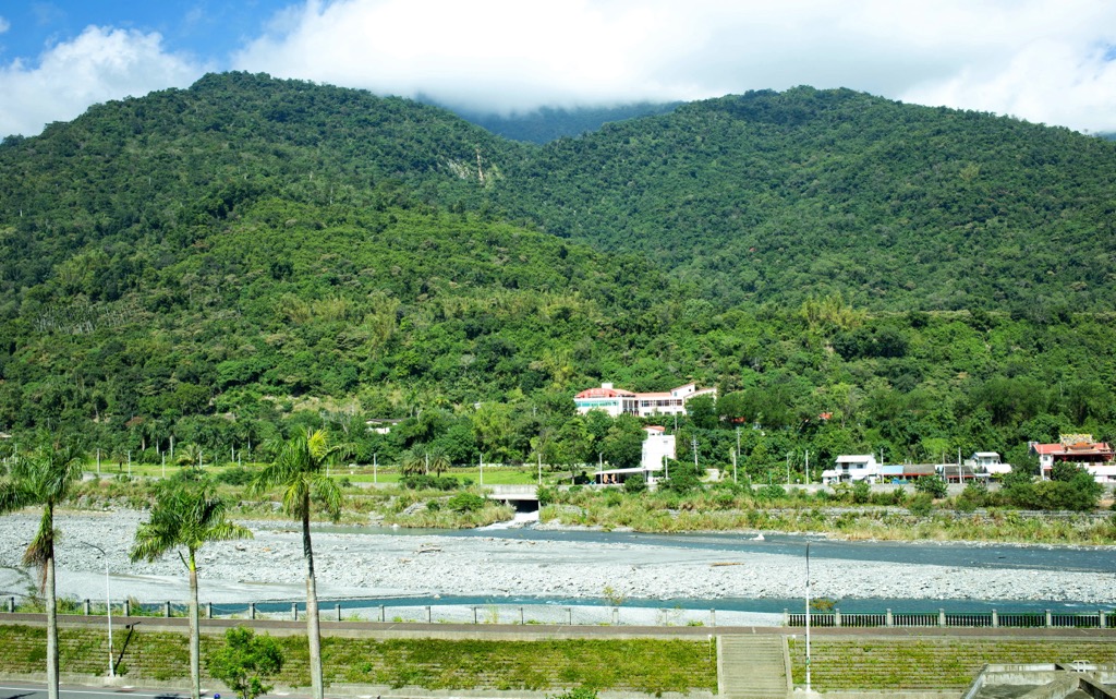
When visiting Taitung County, the easiest and most convenient place to stay is in Taitung City. Coastal Chenggong Township (成功鎭) is another suitable option for its scenic landscape where the green verdant meadows meet the sea.
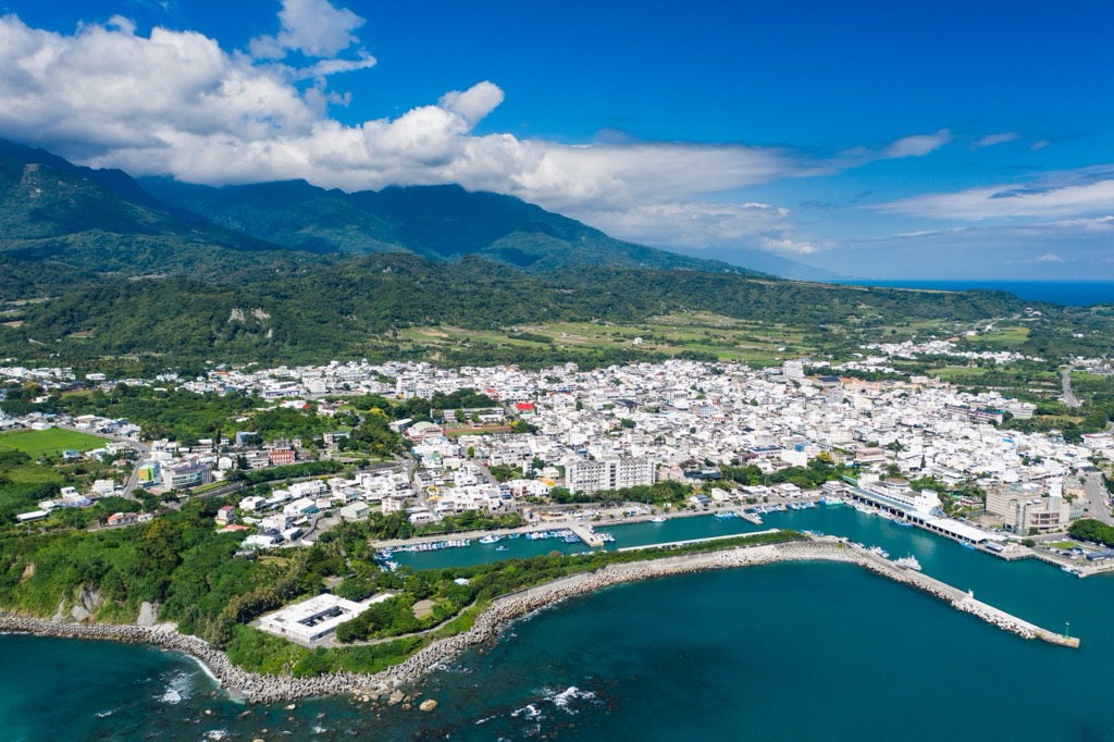
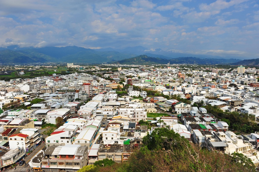
Taitung County's largest city and the region's capital, Taitung City's friendly locals evoke a laid-back atmosphere. You'll feel on holiday as soon as you step foot in this easy, breezy coastal city with stunning scenery and abundant nature.
Wander in nature to the sound of the ocean at Taitung Forest Park. The 280 ha (692 ac) grove is an oasis of tranquility with a dense beefwood forest and scenic views of inland hills. Head towards Pipa Lake and marvel at the pure turquoise water showing the lakebed. This popular sanctuary is where locals and tourists take a blissful stroll in nature.
The best way to view Taitung City is from above, on the coastal hill Liyu Shan (鯉魚山). While only 76 meters (249 ft), it's a short scramble to the top, but the view is utterly worthwhile. You'll have a 360° outlook over the city and the shore to appreciate Taitung City's green lungs and pristine land.
Another great way to experience Taitung City is through its food. There is no better place for this than the Taitung Night Market. Sample local Taiwanese dishes and flavours, such as Dongshan duck head, pork bao buns, crispy chicken, and sugar apples. Get swept up in the buzzing ambience as you wander around, taking in all the smells, sights and sounds of a bustling night market.
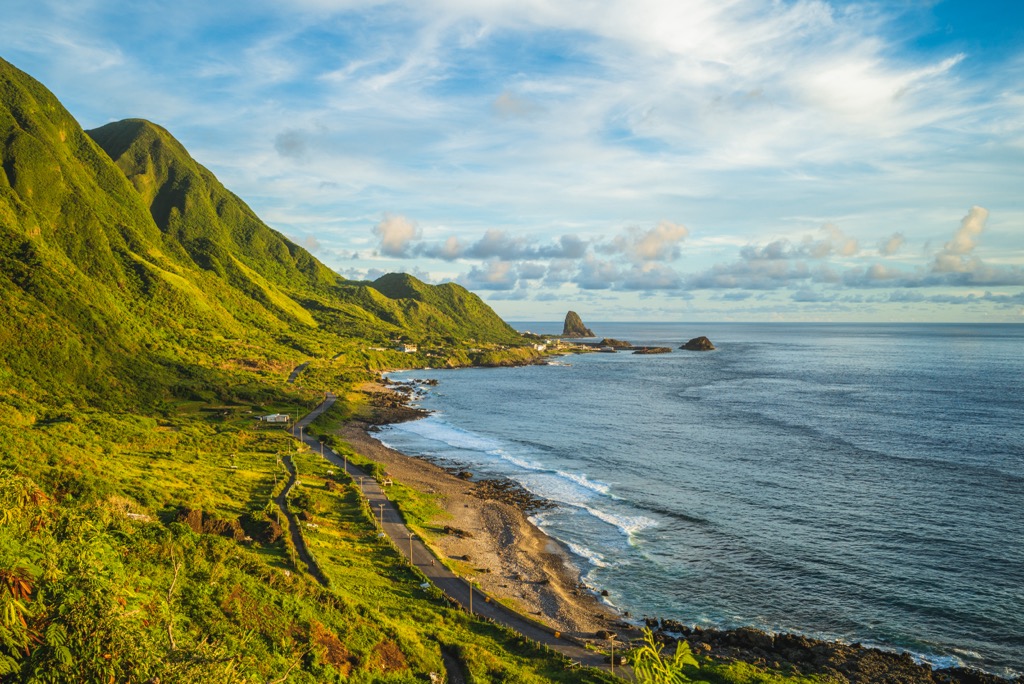
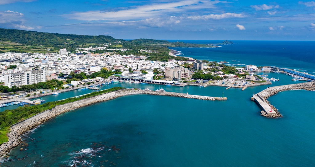
Situated north of Taitung City, Chenggong Township has the longest coastline in the whole county. A stronghold for the Amis tribe, Chenggong Township is a land of cultural pride with a prosperous fishing industry.
Visit one of Taitung's most well-known wonders, Sanxiantai Bridge. You’ll immediately realise why its so popular once you set your eyes on the intriguing bridge. It has a fascinating eight-arched structure that resembles a Chinese dragon, and its fun to walk across the waterway as you rise and fall with each curve.
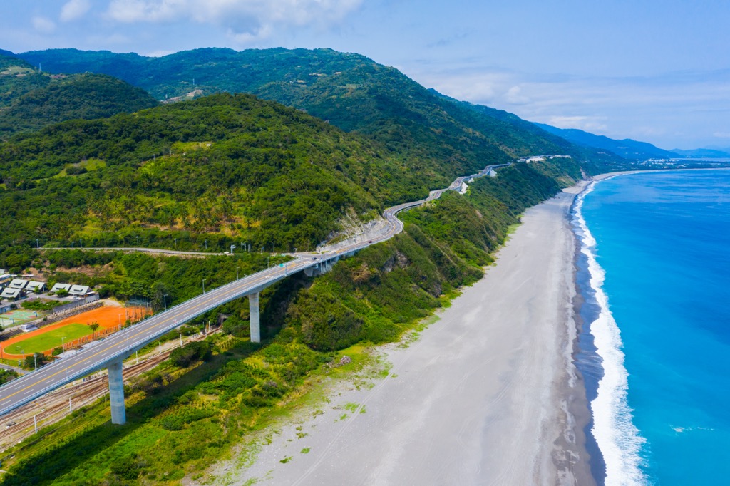
Next, visit the East Coast National Scenic Area (交通部觀光局東部海岸國家風景區), part of a 170 km (106 mi) stretch of coastline that spans from Hualien to Taitung. Admire the eroded rocky shores and pockmarked landforms that the elements shaped into strange formations.
Finally, head to Chenggong Fishing Harbor, for the freshest catch of the day. Sights, smells, and sounds feed your interest at this bustling port, the pride of Chenggong Township. Stop at one of the many seafood restaurants for a delicious lunch, and stroll along the harbor, admiring the colorful fishing boats, aquamarine water, and jolly atmosphere.
Start your journey to Taitung from Kaohsiung. Take a local express train from Xinzuoying Station in Kaohsiung City to Taitung City. Or you can rent a car or scooter from Kaohsiung, driving 163 km (101 mi) to get there.


Yes. Taitung County has 396 named mountains. The highest is Guan Shan at 3,668 m.
The highest mountain in Taitung County is Guan Shan, at 3,668 m.
Taitung County has 396 named mountains.


