
Scan the QR code and open PeakVisor on your phone
Dawu Mountain Nature Reserve has 46 named peaks. The highest is Beidawu Shan at 3,092 m. Other notable peaks include Nandawushan, Santafeng and Mt. Wutou.
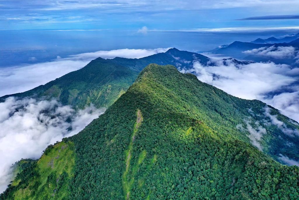
Dawu Mountain Nature Reserve (大武山自然保留區) is a protected area set along the southeastern coast of Taiwan. This area boasts undulating terrain, alpine lakes, cascading waterfalls, and old-growth forests where wild animals roam. Of the 46 named peaks in the park, Beidawushan (北大武山) is the highest and most prominent with an elevation of 3,092 metres (10,144 ft).
Set against the southern foothills of the Central Mountain Range (中央山脈), Dawu Mountain Nature Reserve holds the title as the largest nature reserve in Taiwan. It covers 47,000 ha (116,139 ac) of hilly terrain. The extensive area of the nature reserve spreads across the Taimali (太麻里鄉), Jinfeng (金峰鄉), and Daren (達仁鄉) Townships of Taitung County (臺東縣) and the Taiwu Township (泰武鄉) of Pingtung County (屏東縣).
Wildlife, old-growth forests, and mountain lakes are the protected features of Dawu Mountain Nature Reserve. Special measures are in place to conserve the natural landscape of the reserve, such as limiting the number of visitors allowed each day and patrolling the area to prevent hunting and poaching.
The nature reserve contains elevations as low as 200 metres (656 ft) in the Tamaili River Basin as well as elevations as high as 3,092 metres (10,144 ft) at the summit of Beidawushan. The average temperature in the reserve greatly depends on a location’s elevation. The lower elevations in the reserve have an average temperature of 72.5°F (22.5°C), while elevations around 3,000 metres (9,842 ft) in the reserve have an average temperature of around 45.5°F (7.5°C).
Dawu Mountain Nature Reserve contains only one of the top 100 peaks of Taiwan, which are also known as Baiyue. Indeed, Beidawushan holds the honour of being the only Baiyue in Dawu Mountain Nature Reserve.
Additionally, Beidawushan is the highest peak in southern Taiwan. The other significant peaks in the Dawu Mountain Nature Reserve are Nandawushan (南大武山), Wutou Shan (霧頭山), Tangtailanshan (唐太蘭山), Lajialajia Shan (拉戛拉戛山), and Dapu Shan (大埔山).
The east coast of Taiwan around Dawu Mountain Nature Reserve is notorious for its turbulent weather. A whirlwind of typhoons batters the east coast as they progress westward. Summertime, the season of storms, heralds an average rainfall of 500–800 mm (20–31 in) a month, adding to the typical annual rainfall of 4,400–4,800 mm (173–189 in).
Areas of interest near Dawu Mountain Nature Reserve include Chachaya Lai Mountain Major Wildlife Habitat (茶茶牙賴山野生動物重要棲息環境) in the south and Dalun Forest Farm (都蘭林場) in the north. The waters of the Pacific Ocean furiously rap the coastline to the east, while Maolin National Scenic Area (茂林國家風景區) is located to the west.
The peaks of Dawu Mountain Nature Reserve are part of the Central Mountain Range, Taiwan’s most prominent mountain range. However, although the Central Mountain Range is home to a multitude of Taiwan’s highest peaks, the hills of Dawu Mountain Nature Reserve are primarily low-lying, except for the Baiyue of Beidawushan.
There are three primary geological formations in the park: Paleozoic to Mesozoic schists, the Bilushan formation, and the Lushan formation. Throughout the reserve, shale and slate are the primary rock types, though there are some outcroppings of sandstones and limestones.
The low- to medium-elevation forests of the Dawu Mountain Nature Reserve have unfortunately seen substantial amounts of human disturbance. However, the medium to high-elevation forests in the reserve have remained relatively untouched. Nevertheless, there are still widespread patches of old-growth broad-leaf forests in the lower elevations of the region.
Since the reserve is located in the southern part of Taiwan, where the climate is warmer and the mountains are relatively low-lying, there are relatively few coniferous forests. Despite this, there are five distinct vegetation zones in Dawu Mountain Nature Reserve.
First, there is a tropical monsoon rainforest in the lower elevations of the nature reserve. The primary plant species here include species of the fig tree, such as Ficus irisana, Ficus ampelas, Ficus benjamina, and the Taiwan sugar palm.
The second zone is a subtropical montane broad-leaf forest. This area features the Japanese bay tree and Japanese blue oak tree.
As the elevation increases, a warm-temperate hardwood coniferous forest covers the mountains. The dominant vegetation in this zone includes Quercus morii and the Cartwheel tree, known as Trochodendron aralioides.
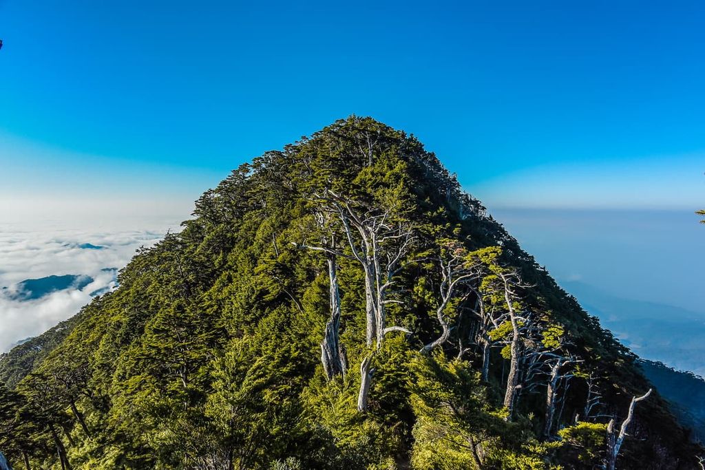
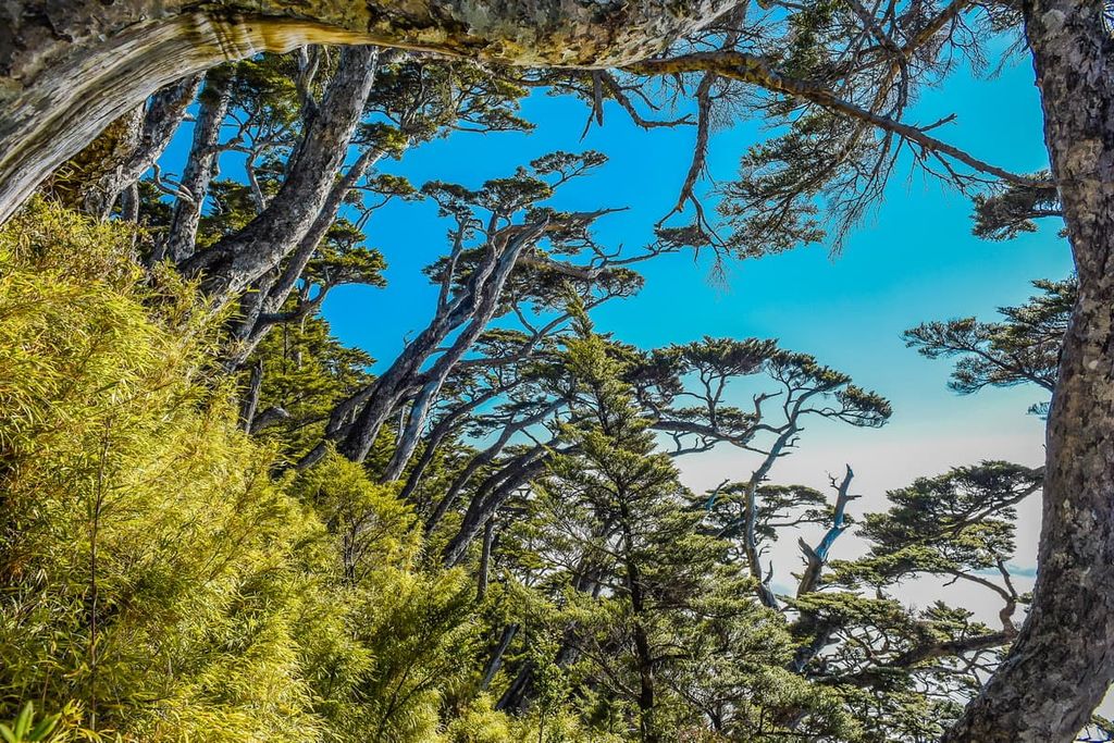
Following the warm-temperate hardwood coniferous forest is the temperate montane coniferous forest, where the indicative plant species are Taiwan cypress, Taiwan red cypress, and Chinese yew.
Finally, the cool-temperate mountainous coniferous forest occupies the highest elevations in the Dawu Mountain Nature Reserve. This zone features Taiwan hemlock and Snow Mountain holly, which is also known as Ilex tsugitakayamensis.
In terms of wildlife, the Dawu Mountain Nature Reserve is home to many near threatened and endangered species. This includes the Formosan black bear, Formosan clouded leopard, Mikado pheasant, and Swinhoe’s pheasant.
A great assortment of wildlife inhabits the vast land of Dawu Mountain Nature Reserve, including 31 species of mammals, 145 species of birds, 18 species of amphibians, 36 species of reptiles, and 27 species of fish.
According to the local Paiwan people, the southernmost highest mountain in Taiwan, Beidawushan (Kavulungan), is a sacred mountain. Beidawushan is also prominent in many examples of traditional poetry, legends, and songs from the region.
The Jinfeng Township of Taitung County is located on the traditional lands of the Paiwan tribe. Paiwan families traditionally lived in the low foothills of the mountains at an elevation of around700 metres (2,296 ft).
However, during the Japanese Occupation Era, these Paiwan residents were forced to move to lower heights of 300 metres (984 ft) so the Japanese could have access to the low to medium forests of the Dawu Mountain Nature Reserve. Settlement ruins and pottery urns are scattered in the mountain of Tangtailanshan.
As with other mountain areas of Taiwan, the southern regions of Pingtung and Taitung are home to ancient roads that were traditionally used for transport and trade. The Shuishuiying Ancient Road is one of the longest such paths in Taiwan, measuring 47 km (29 mi). Another prominent ancient road is the coastal route along the east coast of Taitung and Pingtung counties, which is also known as the Alangyi Ancient Road.
The Council of Agriculture established the Dawu Mountain Nature Reserve in January 1988. The nature reserve was created with the main purpose of protecting the endangered Formosan clouded leopard, which lives in the forests of the Dawu Mountain Nature Reserve.
There are many exciting and interesting trails in the Dawu Mountain Nature Reserve. Here are some of the best hikes to consider during your next trip to the reserve:
This hike takes you to the summit of the southernmost Baiyue in Taiwan. The whole journey is about 9 km (5.6 mi) long to the summit of Beidawushan and is divided into a two-day trek.
Due to the great height of Beidawushan, hikers encounter a variety of plant communities as they ascend the mountain. Interestingly, the Beidawushan hemlock forest is the largest in Taiwan. In the forest zone below the hemlock forest lies a 1,000-year-old giant red cypress tree that measures over 25 metres (82 ft) in height and 11.7 metres (38 ft) in diameter.
In addition to the flora of Beidawushan, the trail is bursting with human history. Below the summit of Beidawushan, at the 8 km (5 mi) mark of the trek, is the Takasago Volunteer Army monument. During the Second World War, the Japanese ordered many of the Indigenous peoples of what is now Taiwan to form a troop to assist them in battle. Thus, the Takasago Volunteer Army commemorates those fighters who bravely fought in Nanyang, also known as Southeast Asia.
A few metres ahead lies the Dawu Temple and the Otake Shrine. A rather large and grand torii gate imposingly stands at the entrance of this site. Dawu Temple was built in 1931 by the Japanese to honour fallen soldiers who battled in Pearl Harbour.
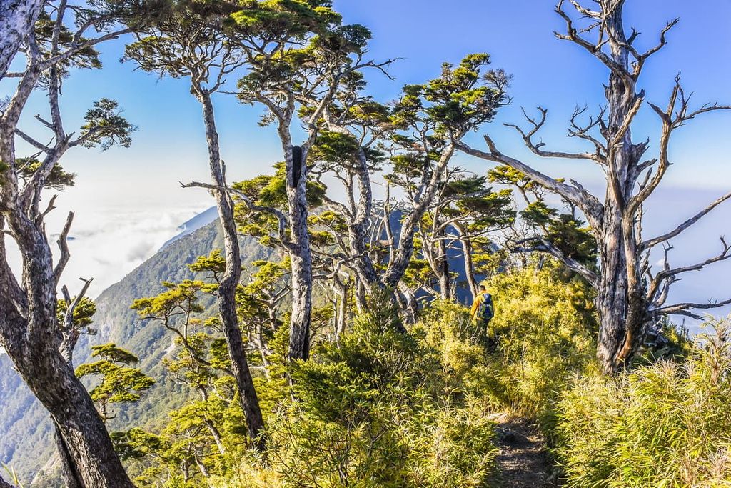
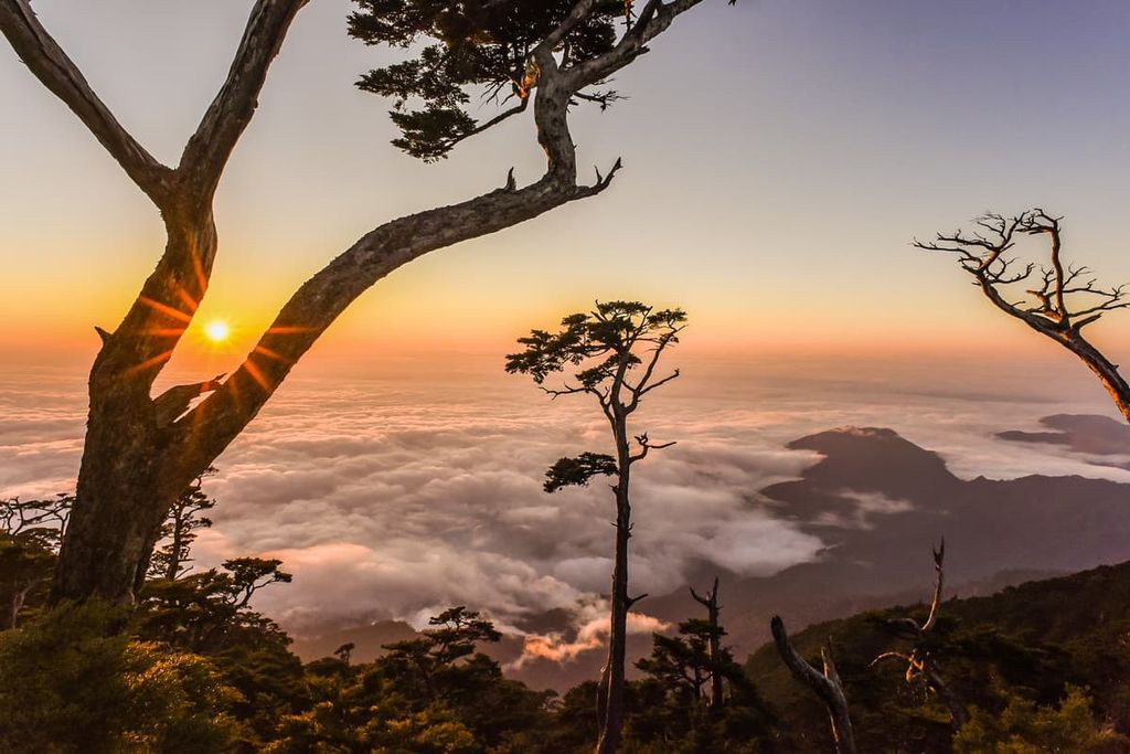
The trek to Beidawushan is challenging due to the ruggedness of the terrain. The mountain is home to a number of metal rods that are fixed into place to provide footholds for easier climbing. The arduous trail is decorated with lush foliage, demonstrating the rich forest vegetation of the hill. In addition, as hikers trek above the cloud cover belt, a sea of clouds perch on the grand mountain, introducing hikers to the alpine world above the clouds.
The summit of Beidawushan is partially covered with alpine shrubbery; thus, the view is slightly obscured. However, Nandawushan can be seen from clearings on the trail, as can the southern Hengchun Peninsula, where the three seas of the Taiwan Strait, Bashi Channel, and the Pacific Ocean merge. Additionally, to the north, hikers can admire Taiwan’s tallest peak, Yushan.
The second-highest mountain in southern Taiwan after Beidawushan, Nandawushan measures 2,840 metres (9,317 ft) in elevation. This hike brings you to the summit of Nandawushan, which is located just down the ridge from its taller neighbor.
Although Nandawushan doesn’t get as many hikers as Beidawushan, the trek itself is fantastic. Here, low to middle elevation broad-leaf forests feature the tung oil tree, blood vine, silvergrass, and kidney fern. In contrast, the high elevation forest of the peak features deadwood of hemlock trees that were ravaged by a forest fire.
The path to Nandawushan, although slightly less challenging than that of Beidawushan, does involve some steep climbing. Plus, while Beidawushan summit partially forested, the summit of Nandawushan is entirely open; thus, it’s the perfect place for hikers to admire the undulating ripples of hills in the Taiwu and Laiyi (來義鄉) townships of Pingtung County and the Jinfeng Township of Taitung County.
The cloud-covered trail to Wutou Shan is notoriously foggy due to this subtropical region's overcast and rainy climate.
Here, a bumpy and rocky terrain ascends for 9.5 km (6 mi) to the summit of Wutou Shan. As hikers ascend the mountain, misty mountain air hangs in the dense forests of cypress, hemlock, and Yushan rhododendron.
The intense humid and damp climate of the region nurture the plant life found along this hike. The relative lack of hikers along this trail also make it a great place to potentially spot the clouded leopard.
From the summit of Wutou Shan, hikers can admire the surrounding hills of Songshan (松山), Chapuyan (茶埔巌), and Xiadie’er Shan (霞迭爾山).
Connecting the east coast counties of Taitung and Pingtung, Alangyi Ancient Road is a 12 km (7.4 mi) stretch of coastal road that was once an old trading route. More specifically, this linear path links Nantian Village (南田村) of Daren Township to Xuhai Village (旭海) of Mudan Township (牡丹鄉).
The attractions of this coastal road include a number of weathered rock formations that the sea and wind have eroded away over time to sculpt intriguing shapes. Additionally, along this trek, hikers will pass through the Xuhai Guanyinbi Nature Reserve. If you’re lucky, you can also see green turtles swimming in the waters of the Guanyin bend.
Nantian stone pebbles cover the beaches along the south-eastern coast of Taiwan on this hike. The weathered stone has a smooth surface from the seawater polishing and filing down the rough texture of the rocks.
Throughout this adventure, hikers are afforded generous views of the cerulean blue waters of the Pacific Ocean. However, note that the trail is unshaded, so hikers will be in the sunlight while trekking along the beach.
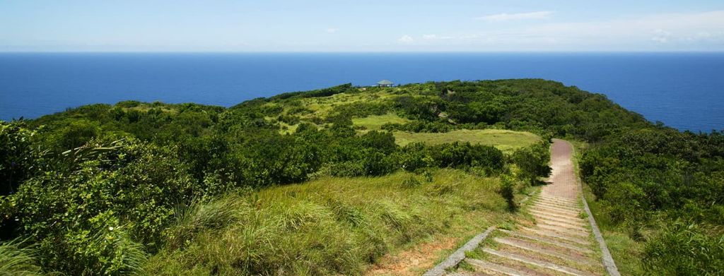
One particular spot on this hike that offers the best views is on the summit of Guanyin Shan (觀音山). From here, hikers can see an endless stretch of sandy shores as well as Nantian Shan (南田山) in the north and the rippling inland hills of Taihe Shan (太和山) and Qigu Balin Shan Dongfeng (耆古巴林山東峰) to the south.
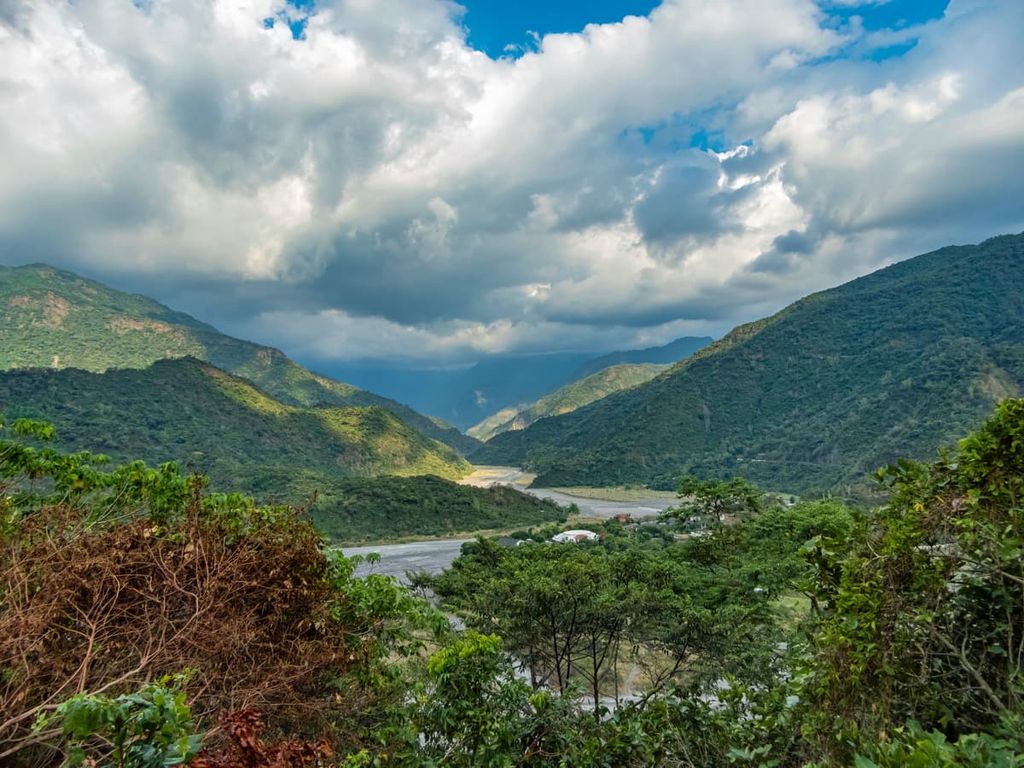
Shuishuiying Historic Trail is an old road that once connected the west coast of Kaohsiung City (高雄市) to the Daren Township of Taitung County on the east coast. While the route spans 47 km (29 mi), visitors usually trek just 15.4 km (9.5 mi) of the road. Most people begin at the marker near 23.5 km (14.6 mi) on the Dahan Forest Road and then head to the Guzailin Suspension Bridge in Daren Township.
Artefacts from years past, such as charcoal kilns, Japanese police stations, and disused railways bridges can be found along this mountain road. Plus, as you make your way down the old forested road, you can occasionally get views of Beidawushan and Nandawushan in the distance.
The shaded trail is rich in flora and fauna. Over 700 plant species can be found along the ancient road, such as Taiwan cedar, lemon eucalyptus tree, Alishan orchid, and rhododendron. In addition, over 300 species of ferns adorn the route. The remote forest is also a haven for birds, with birdsong merrily tweeting along the path.
The terrain of the Shuishuiying Historic Trail is gentle as the trail gradually rises to the forested summit of Chushuipo Shan (出水坡山) then steadily dips down to the trail’s end at the Guzailin Suspension Bridge.
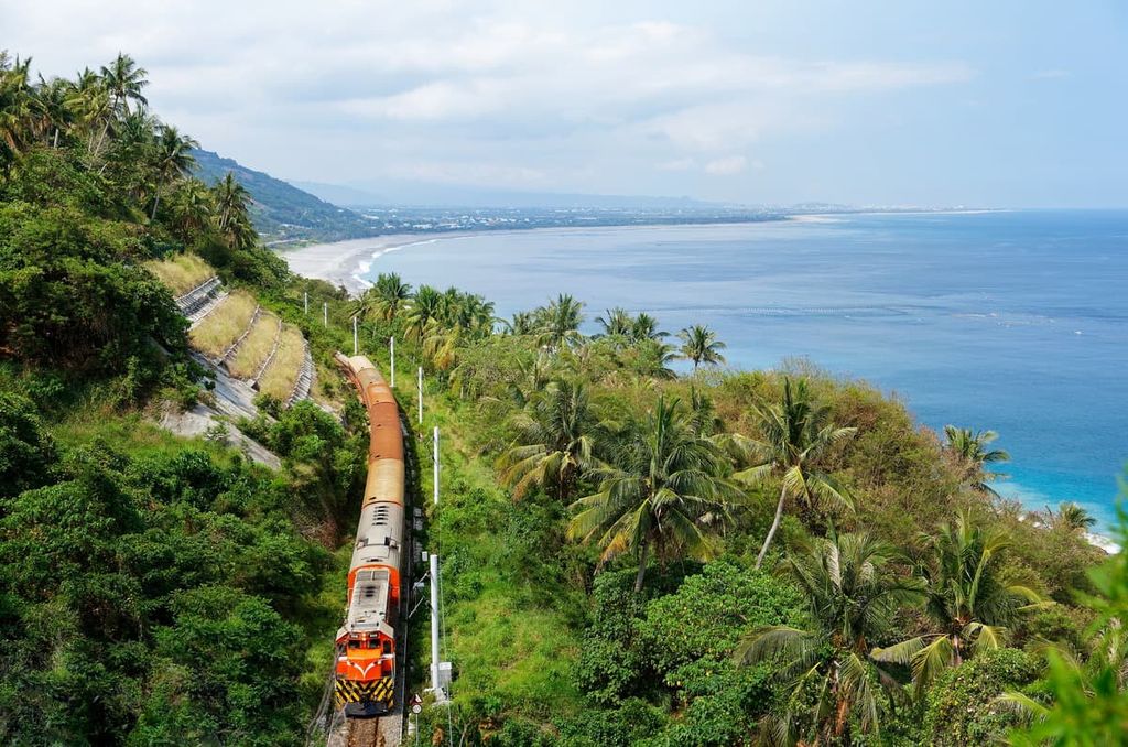
Taitung City is the closest and most accessible city to Dawu Mountain Nature Reserve. The southern city of Hengchun in Pingtung County is another great place to stay when visiting the nature reserve. While Taitung City is surrounded by the remote and wild nature of Taiwan’s east coast, the city of Hengchun features a laid-back, beachy lifestyle.
As Taitung lies east of the towering peaks of the Central Mountain Range, it is more difficult to get to than the other cities of Taiwan. Therefore, fewer tourists frequent the area. However, this remote city has an advantage over the other cities in that it offers a unique nature experience.
For the best views of Taitung City and beyond, a climb up Liyushan (鯉魚山) offers unparalleled panoramas of the endless fields of rolling hills that meet the vibrant blue waters of the Pacific Ocean in eastern Taiwan.
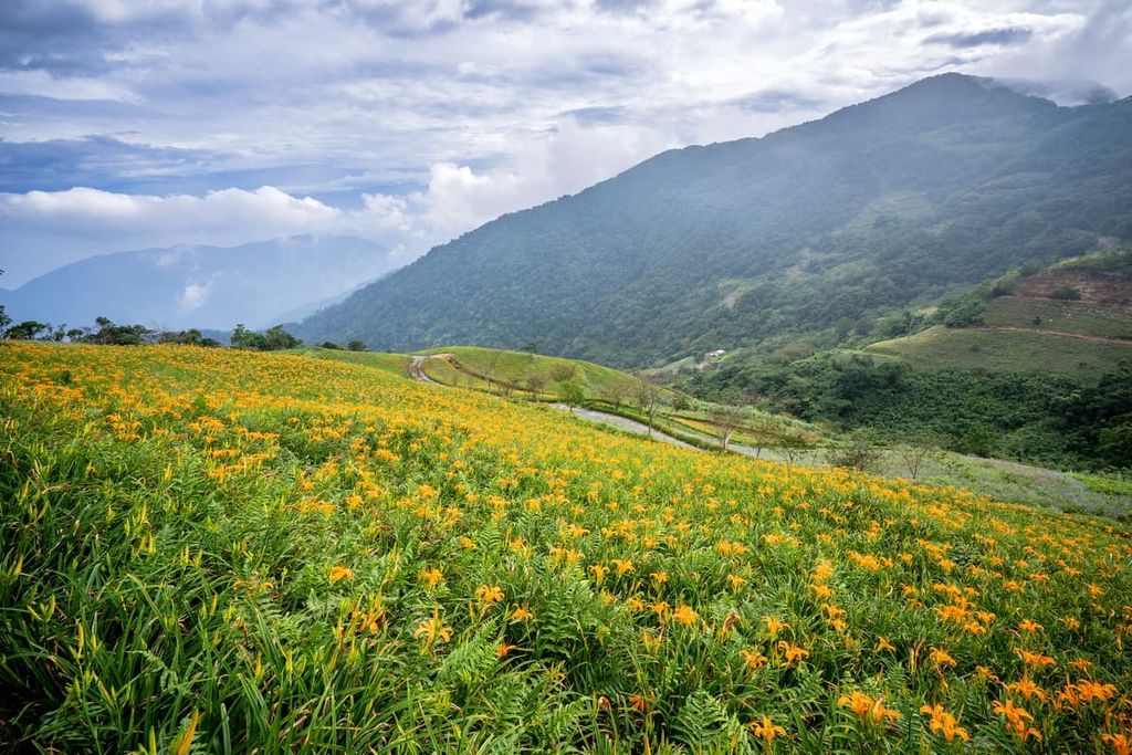
For nature lovers, a journey on the ‘flower route’ when climbing Kinchen Shan offers a great chance to see some of the most striking wildflowers in the region. The best time to venture on this blossoming trek is between June to September. There are many observation points on the trail that offer sweeping views of Taimali Beach.
Lisong Hot Spring, one of the most beautiful hot springs in Taiwan, is a 1.5 to 2-hour drive from Taitung City, but it is well worth the journey. To reach the hot spring, visitors embark on a trek down the valley and cross a river. Thermal waters gush up from the ground, creating a stunning waterfall over turquoise-striped rocks.
Another great attraction in the city is Xiaoyeliu. Xiaoyeliu is the southern smaller sibling of the famous Yehliu Geopark of New Taipei City (新北市). Here, the southeast coastline features fascinating rock formations of inverted sandstone and mudstone. Once covered in a coral reef, erosion from the ocean helped shape the area’s rock into surreal formations, some of which resemble mushrooms and tofu.
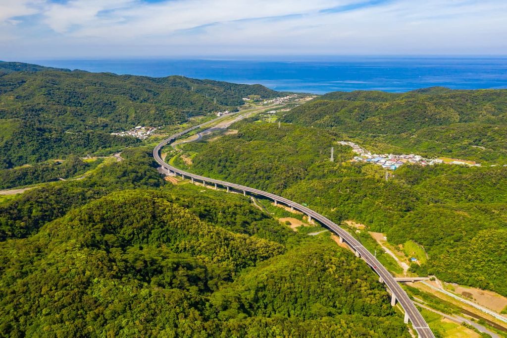
Whilte in the region, visitors can also check out the East Coast Scenic Route, a well-known drive from Hualien in the northeast to Kenting in Taiwan’s southernmost point.
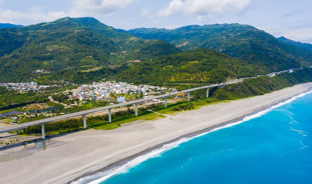
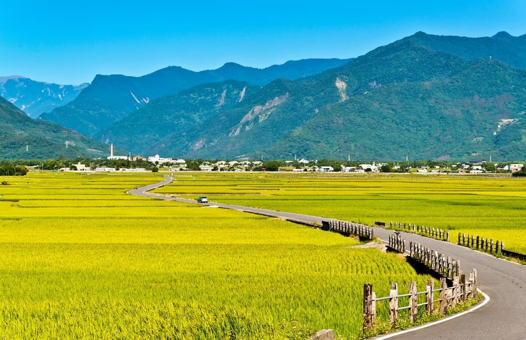
Known as one of the most scenic drives in Taiwan, the East Coast Scenic Route passes the grand mountains of the Central Mountain Range of central Taiwan and verdant fields of rice paddies in the east. It then passes by some of the best surfing beaches on the southeastern coast before reaching Taiwan’s subtropical paradise of Kenting National Park.
While Hengchun City is mostly used as a rest stop before heading to Kenting National Park, this city offers both history and natural beauty. Its relaxed atmosphere is inviting and compelling, and the concept of time ticks differently in this spell-binding city.
One of the main attractions of Hengchun City is its proximity to Kenting National Park. Beautiful and endless stretches of sandy beaches, a subtropical forest of banyan trees, and fascinating fairy-like stalactite caves are just a few features of Kenting National Park. Visitors love the summertime blue skies that shine all year round and the warm weather of this southern paradise.
The pavilion near Yuquan Temple is a delightful spot to enjoy a moment of calm in the city. Set on Shanjiaoli (山腳里), visitors climb the small hill to admire the amazing views of southwestern Pingtung County, such as that of Guan Shan (關山), Longluan Lake, and the valley as a whole. It is also a beautiful spot to witness the sunrise and sunset over southern Taiwan.
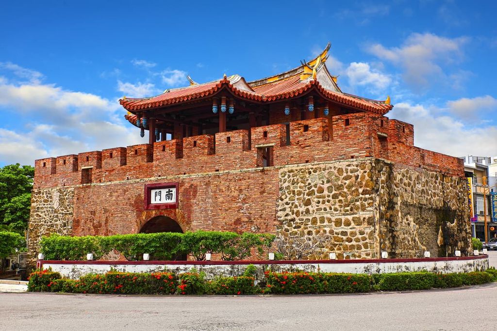
Hengchun Old Town holds remnants of the past in the old South Gate and West Gate of the city. The old city walls that extend from the West Gate are still intact, too. Visitors can view Hengchun City in another light by traversing the old city walls that once bordered the ancient centre of Hengchun. In the old town, ancient buildings stand well-preserved, and there are markets that sell traditional Taiwanese goods.
The sandy shores of Nanwan Beach are only a 10-minute drive from Hengchun. Here, beach loungers and umbrellas are scattered across the wide beach. There is very little rock across the seashore, which makes swimming in the invitingly blue waters an enjoyable outing. Plus, as the weather in southern Taiwan is favourable year-round, it is not uncommon for people to frequent the beaches in winter months.
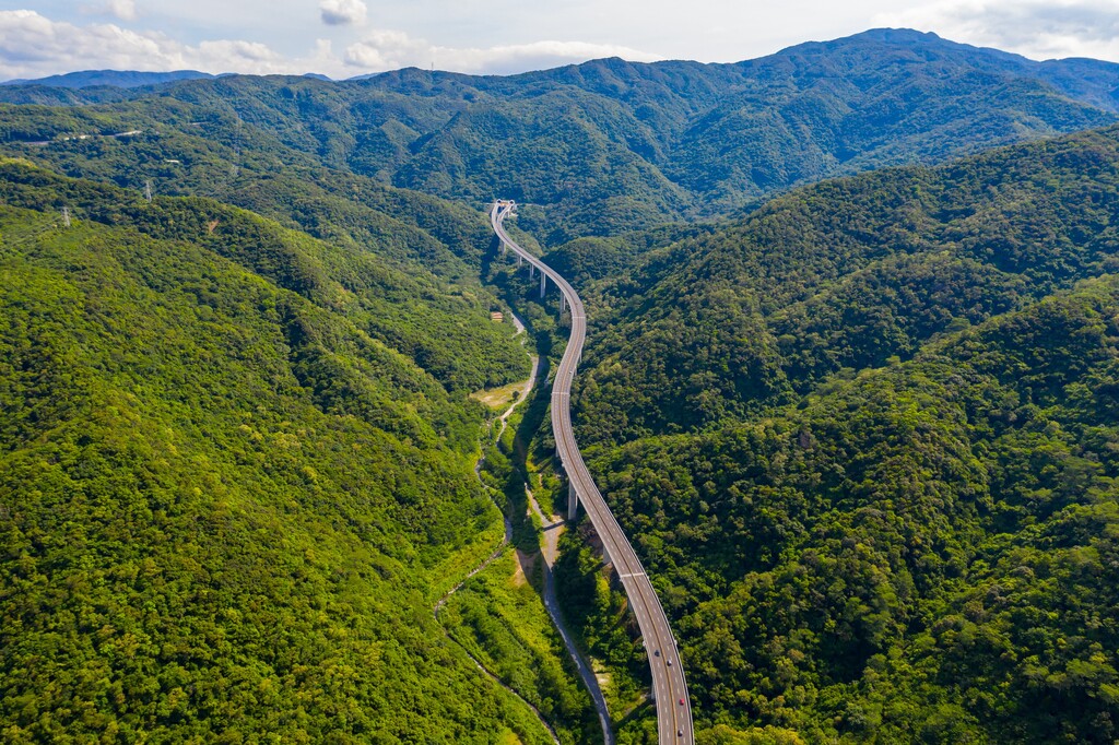
As the east of Taiwan is not well-connected to the northern and western parts of Taiwan, the journey to Dawu Mountain Nature Reserve involves a long commute.
From Taipei City, visitors can take the local express train (TRA) to Taitung City. Alternatively, visitors can take the Taiwan High-Speed Rail (HSR) to Kaohsiung City. From there, take the 9188 or 9117 bus to Hengchun City.
From Taitung to Dawu Mountain Nature Reserve, the journey is about 160 km (100 mi). Alternatively, it is a 88.5 km (55 mi) journey from Hengchun City.


The highest peak in Dawu Mountain Nature Reserve is Beidawu Shan, at 3,092 m.
Notable peaks in Dawu Mountain Nature Reserve include Beidawu Shan, Nandawushan, Santafeng, Mt. Wutou and Dapushan.


