Get PeakVisor App
Sign In
Search by GPS coordinates
- Latitude
- ° ' ''
- Longitude
- ° ' ''
- Units of Length

Yes
Cancel
❤ Wishlist ×
Choose
Delete
The southern commercial hub of Taiwan, Kaohsiung City (高雄市) is the largest mecca of south Taiwan. Its land varies from coastal shores to rocky, mountainous inland terrain. Yushan Main Peak (玉山主峰) is the highest hill of the 364 named mountains, measuring 3,952 meters (12,966 ft).
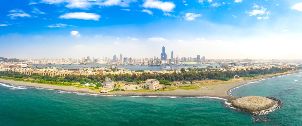
Southern Taiwan's Kaohsiung City is a port city, the largest in Taiwan. Chiefly used for commercial transportation, Taiwan's imports and exports are moved and stored in shipping containers. Kaohsiung's container harbor is the 13th largest in the world.
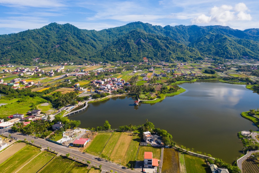
Due to its buzzing economy, Kaohsiung City attracts many residents for its maritime trade, creating job opportunities. Kaohsiung is Taiwan's third largest city with a population of 2.7 million.
Another factor that attracts residents to Kaohsiung City is its tropical savanna climate. The Tropic of Cancer lies a degree south of the city, so the city enjoys year-round warmth and sunny skies.
Lying between northern Tainan City (臺南市) and Pingtung City (屏東縣) in the south, Kaohsiung covers 295,200 ha (729,455 ac) of land. Its landscape ranges from its seaport, stretching inland to where Taiwan's highest mountains soar. In fact, Kaohsiung City's inner land extends northwards, trailing northeast of Tainan and Chiayi (嘉義市) cities.
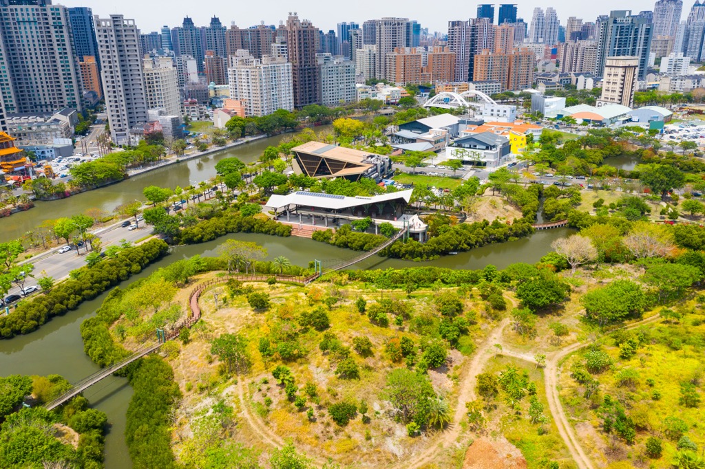
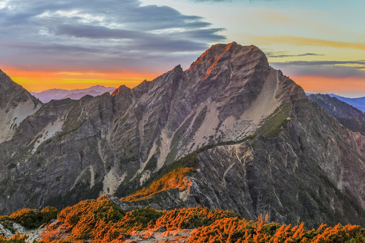
Taiwan's highest peak, Yushan, lies on the very outskirts of Kaohsiung City. Many towering mountains run along Kaohsiung's eastern escarpment. In fact, 20 of Taiwan's top 100 tallest peaks, also known as Baiyue, lie in Kaohsiung City.
Kaohsiung is a popular tourist center for locals and international visitors. One of its main attractions is its striking skyscraper, the 85 Sky Tower. Lotus Pond is another popular spot, a scenic lake with three colorful pagodas. Shoushan National Nature Park (壽山國家自然公園) is a desirable weekend hiking spot, with views overlooking the city and the ocean.
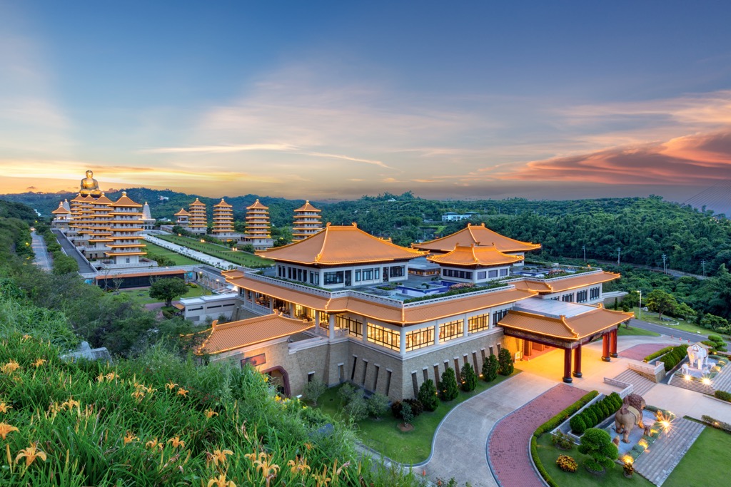
Taiwan's largest port city has many other well-known places for natural beauty and manufactured landmarks. Cijin Island (旗津島) lingers off Kaohsiung's west coast, and the butterfly sanctuary of Maolin National Scenic Area (茂林國家風景區) is in the east. In the northeast is Yushan National Park (玉山國家公園), while in the south is Fo Guang Shan Buddhist Museum (佛光山佛陀紀念館).
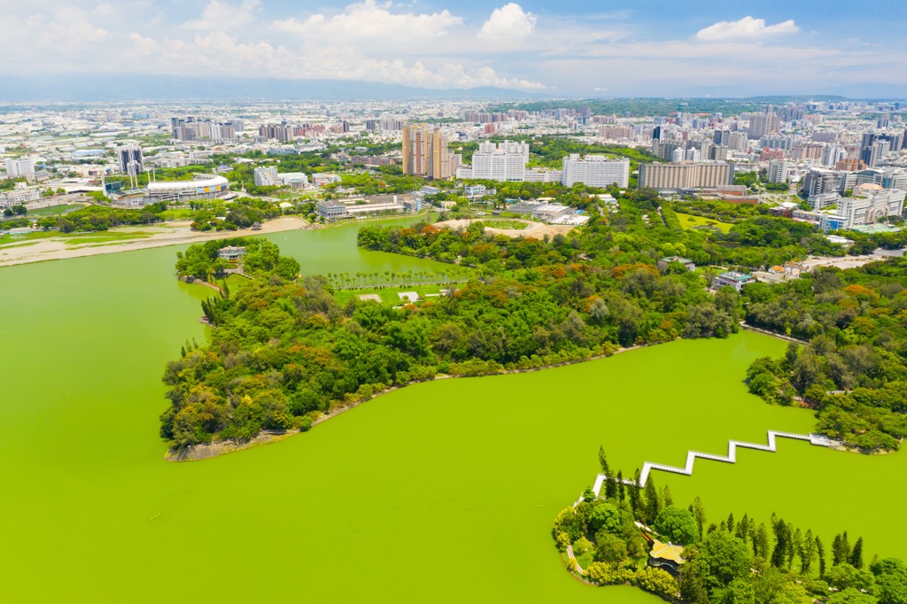
Kaohsiung City's hills comprise three mountain ranges. The mountains nearest to Kaohsiung's coast belong to the Alishan Range (阿里山山脈). Smaller in stature and gentler in gradient, these hills are the southwestern extension of Alishan's massif.
As the mountains progress inland, their height begins to rise drastically. Kaohsiung's inland hills in the south form the southern branch of the Central Mountain Range (中央山脈). Slate, phyllite, and quartzite comprise the sturdy and robust rock bed, creating the Central Mountain Range's signature jagged pinnacles.
In Kaohsiung's northeast region, the peaks soar to great heights, and their sheerness sharpens. These colossal peaks form part of the Yushan Range (玉山山脈), the most revered mountain in Taiwan. Unmetamorphosed rock from the Miocene epoch dominates Yushan Range's western hills of this rugged sea of hills.
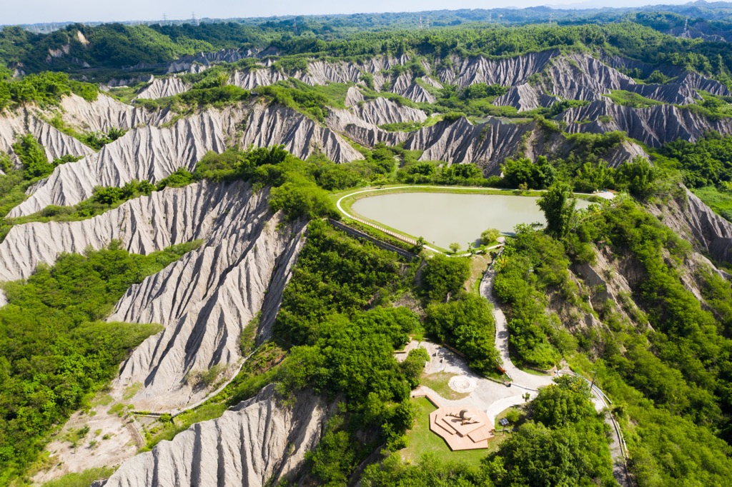
Kaohsiung’s coastal ecology mainly consists of broadleaf plants, deciduous trees, and many ferns. Shoushan National Nature Park, situated on Kaohsiung City’s shore, has a diverse ecology where 917 plant species thrive. Of these, 600 groups of flora are endemic, such as the paper mulberry tree, Taiwan peony wild vine, and the stinging wood nettle.
Heading inland, the temperature drops as the elevation increases. A mix of broadleaf and coniferous trees begins to flourish in the same environment. Camphor, Taiwan cypress, and Taiwan maple thrive in this higher land.
Kaohsiung City’s northwestern region is mountainous backcountry where cold-temperate conifers grow in the icy climate. Taiwan fir, Chinese hemlock, and Yushan Juniper dominate the hilly forests near the summits.
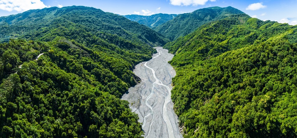
Kaohsiung City’s earliest inhabitants were the Makatao people who lived in the coastal areas around 4,000 to 5,000 years ago. Various cultural excavation sites feature around Kaohsiung City; two burial grounds are in Shoushan National Nature Park.
The city grew significantly after the arrival of Chinese settlers in the early 17th century. These immigrants ventured southwards to Taiwan’s remote land to create settlements and fruit farming communities. During the Qing dynasty, Kaohsiung’s port began operating in the 1680s. The city soon reaped the benefits of its harbor, with the city economy prospering.
During the Japanese Occupation Era, Kaohsiung’s port received an upgrade and facelift, its size expanding to become an international commercial harbor. The Japanese also established transport links into Kaohsiung, connecting it to Taiwan’s major cities.
However, Kaohsiung’s port was a bombing target during the Second World War and was subsequently damaged. It was restored to mint condition, and trade became booming once again. Kaohsiung overtook Keelung (基隆市) as Taiwan’s largest port city, and its bustling import trade brought jobseekers, becoming Taiwan’s third largest city.
Kaohsiung City’s major hiking trails and areas are:
For epic views over Kaohsiung's cityscape and seaside, Shoushan National Nature Park is the perfect place. Many hiking trails line the oceanside hill, but to observe the park's main attractions and stunning outlooks, take the Shoushan Hiking Trail.
Most people begin the 11.4 km (7 mi) trek from the Shoushan Hiking Trail South Entrance due to its convenient location near the Kaohsiung City Shoushan Zoo. The path rises immediately, trailing towards Chaishan (柴山), where you can admire the sweeping views over the Kaohsiung Harbor and the city center.
Climb the tallest peak, Chaishan Triangulation Points (柴山三角點), for ultimate views of the southern Taiwan hub. You will observe Kaohsiung's iconic 85 Tower skyscraper soaring above other buildings. This is south Taiwan's tallest structure at 347.5 meters (1,140 ft).
You'll then head northwards towards the sheltered Shou Shan (壽山), known for its flourishing forest of interlinking aerial roots of banyan trees. This leafy shaded path is a welcome respite in Kaohsiung's tropical heat.
From here, you'll venture towards Linhua Cave (蓮花洞), an enchanting combination of punctured limestone walls draped in banyan roots and ferns. With a height of 6 meters (20 ft), the sun shines onto the rippling stone lair, with frilly folds in the rock.
One of Shoushan's spectacular sites awaits you as you progress further. The 40 meter (131 ft) ravine, Taiguo Valley (泰國谷), is a mesmerizing limestone rift with a 3-meter (10 ft) amber curtain of Jinping vine aerial roots. Admiring the earthen hair-like strands, you feel lost in a jungle, not o9n Taiwan's third largest city's hill.
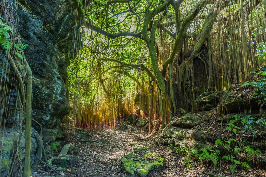
You then loop your way south to the trail's entrance, looking out onto the cerulean sea as you walk back.
Complete your Taiwan peak climbing bucket list by checking off Yushan. What makes Yushan's pilgrimage so iconic is that its surrounding peaks are close by, so you can extend your journey to Taiwan's highest mountain with other colossal and well-revered hills.
Starting at Tataka Saddle, you'll begin your ascent to Yushan Main Peak. With a total mileage of just under 11km (6.8 mi), the first 8.5 km (5.2 mi) climb is primarily steady and surprisingly unchallenging. However, all the intensity, sheer scrambles, and death-defying cliff walls await you after this point.
Hikers usually rest overnight at the 8.5 km (5.2 mi) mark at 3,402 meters (11,161 ft) at Taiwan's highest residence, Paiyun Lodge. If you wish to enjoy your climb in daylight hours without ascending or descending the mammoth peak in the dark, it's best to reserve a bed at Paiyun Lodge.
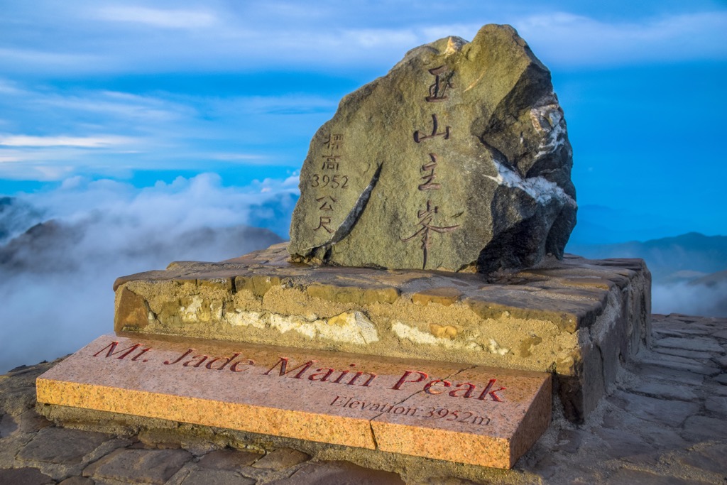
For the remaining 2.4 km (1.5 mi) of the trail, you'll need to show some grit and have nerves of steel. Some ridgeways are so narrow that only one person can shuffle across at a time, a brave feat with the billowing high-elevation winds. You'll also need to tread carefully as loose stones line the path. There are steel barriers for safety and steel cables you can grip when climbing the steep incline.
After all your efforts, you'll finally reach Yushan's summit. Take in the majestic scene on Taiwan's tallest peak, and feel on top of the world. Yushan's jagged peaks surround it, adding a rugged landscape to the view.
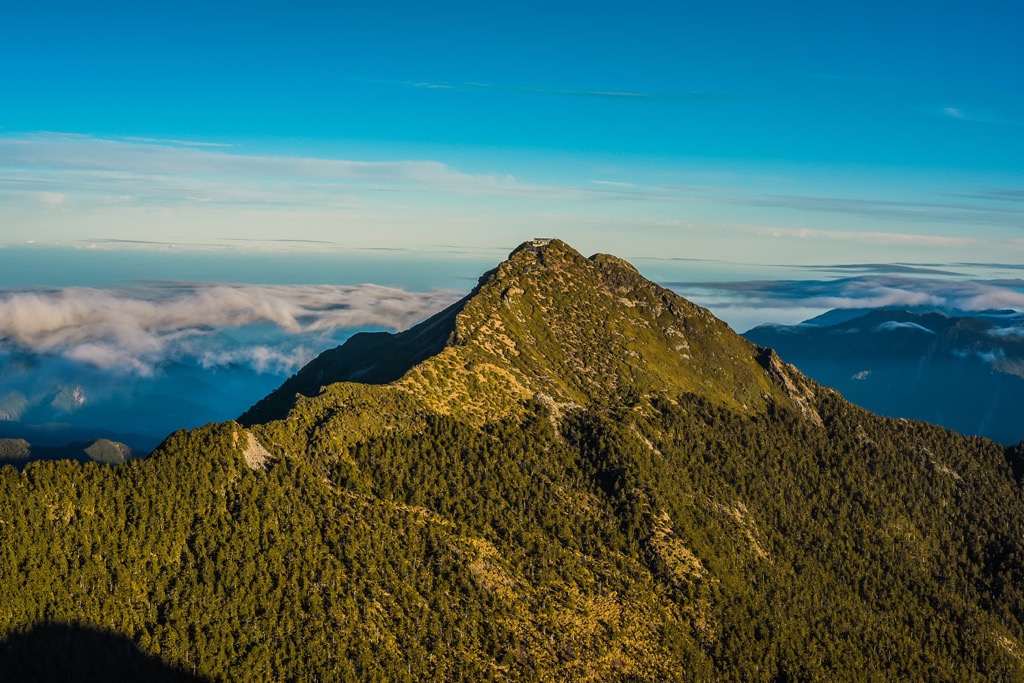
Situated in the lush jungles of the Central Mountain Range, Maolin National Scenic Area is a peaceful paradise of rich natural resources that attract butterflies. You can hike many leafy trails in this hilly emerald forest, cross rivers, climb the undulating terrain, and find beautiful waterfalls.
If you want to see all that Maolin offers, take the Lumusu Creek Trail. ‘Lumusu’ translates to a beautiful valley in the indigenous Lukai language, and you’ll be amazed at what you’ll encounter. On the 4km (2.4 mi) path, you’ll cross a suspension bridge over a narrow river where bountiful foliage extends from the flourishing broadleaf forest.
Revel in the tropical bliss of the emerald landscape. The gentle gurgling of the river accompanies your trek to Maolin Waterfall. A foamy curtain cascades down the steep cliff between dense greenery of ferns, where a turquoise pool of water collects at the bottom. It is a stunning sight of supreme beauty.
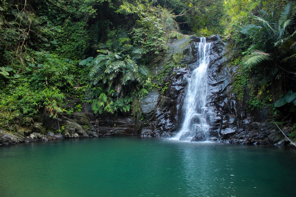
For misty mountain groves in Kaohsiung’s Central Mountain Range, north of Maolin Scenic Area is the rich virgin forested Tengjhih National Forest Recreation Area (藤枝國家森林遊樂區). Over 1,700 plant species thrive in this hilly jungle, of which 40% are endemic to Taiwan.
Climb Dong Tengzhi Shan (東藤枝山) for an overgrown path of leafy camphor and maple trees. In the clearings, you can gaze onto sublime views of Yushan, Beidawushan (北大武山), and Guanshan (關山). One of the highlights of this path is the melodic wildlife of twittering birds and chirping cicadas.
If you’re visiting springtime, hike the two separate Begonia and Rhododendron trails that lead you through pastel flowering pathways. You can appreciate the Spruce Trail all year round with scented coniferous needles and layered pine cones.
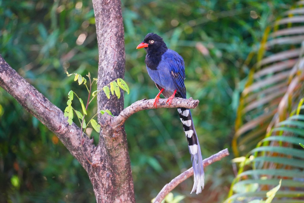
Take a 10km (6.2 mi) walk to the Shi Keng Hot Spring, a steaming cave-like area with shimmering walls of milky white, deep turquoise and jet black. The sodium bicarbonate waters simmer at 50°C (122°F) in Kaohsiung’s wild and remote valley. Soak your body in the warm pool as you spot Taiwan blue magpies flying across the skies above.
Like Yushan’s brave undertaking, this mountaineering route is not for the faint-hearted. You will climb four mountains, all belonging to the impressive Taiwan Baiyue. While not as high as Yushan, these craggy beasts are sheer, steep, and laborious.
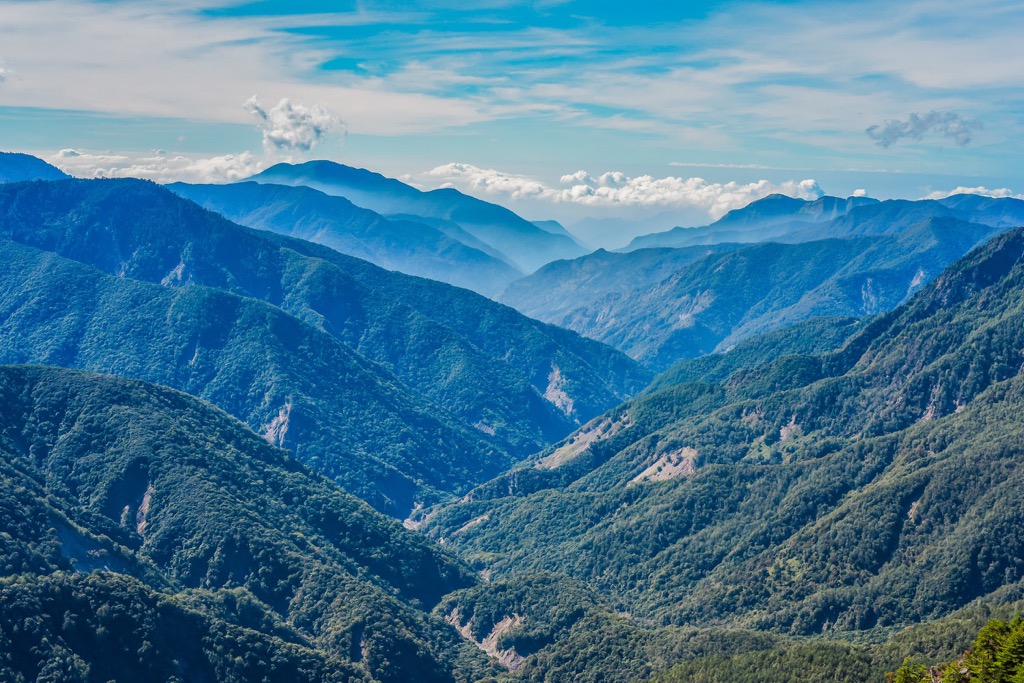
You’ll start with the highest peak of the four, Kuhanuoxin Shan (庫哈諾辛山). As the mountain is precipitous, be careful on rainy days as the muddy paths are slippery on the steep incline. You’ll venture past a dense Taiwan hemlock forest, after which an evergreen grove of Taiwan fir shelters the trail. In the clearings, you’ll gaze onto the nearby Xiangyang Shan (紅葉山).
Take in the splendid unobstructed views on Kuhanuoxin Shan’s summit from where Yushan’s colossal mound lies in the north and Guanshan’s (關山) sharp pinnacle in the south. You’ll set up camp on Kuhanunoxin Shan’s slope overnight before setting out for Guanshan the following morning.
Known for its chilling narrow ridges, you’ll need to conjure steely nerves to scale this jagged hill. As thick clouds descend like clockwork in the afternoon over the monstrous peak, this can cause visibility issues in high elevations.
After another night camping on the hill, you’ll embark on Taguan Shan (大關山) the next day. Taguan Shan’s ecology is diverse, featuring cypress woodlands and an arrow bamboo grove. From the summit, you can spot Guanshan and Kuhanuoxin Shan. Upon descending the hill towards Guanshanling Shan (關山嶺山), you’ll encounter a 1,000-year-old towering cypress tree.
The final hill to pursue, Guanshanling Shan will feel like a breeze after the last three challenging summits. The dense woods of Taiwan hemlock and Yushan juniper shelter the path, while the views open near the summit in the fields of arrow bamboo. From Guanshanling Shan, you can gaze back at the three previous peaks as you complete your mountain mission.
Shanping Forest Ecological Garden (扇平森林生態科學園) is Kaohsiung’s bird-watching paradise in the low-lying Central Mountain Range hills. A total of 134 bird species live in this broadleaf forest where birdsong echo is a constant sound.
If you’re seeking the soulful effects of nature, Shanping Forest will blow you away. Wooden boardwalk trails trace river pathways where moss grows like velvet on the creekside pebbles and boulders. Flourishing flora is everywhere you look, growing in all directions and adding every shade of green to the environment.
Feel invigorated as you experience forest bathing at its finest in the deciduous woodlands where 177 plant species thrive. Spring is even more picturesque as cherry and plum blossoms’ pink petals add a romantic hue to the jungle.
For centrality and being close to Kaohsiung's best attractions, stay in the areas of Zuoying (左營區) or Yancheng districts (鹽埕區). Both these areas are next to the ocean, so you'll smell that salty sea air in these two desirable districts in Kaohsiung.
Once a military base in the 17th century, Zuoying District retains some old military relics, like bunkers and fortresses. Considered the hub of Kaohsiung, Taiwan High-Speed Rail (HSR) rolls into Zuoying Station, the most southern stop of this express train.
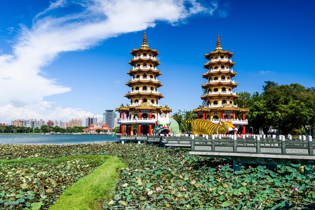
From Zuoying HSR Station, you can walk to one of Kaohsiung's most scenic and iconic attractions, Lotus Lake. You'll be amazed at what you see the moment you set eyes on this picturesque pool. Three striking and animated pagodas stand on the lakeside amidst water lilies. One of the most popular, the Tiger and Dragon Pagoda, is the first pavilion which shows stunning views from its seven-tiered shrine.
Once you're done admiring the larger-than-life characters on the lake, head to Guishan for a short hike and magnetic views of Lotus Lake. An 800-meter (2,624 ft) wooden boardwalk leads to the 52 meter (170 ft) summit. On the way, a mulberry forest shelters the path, where you'll find a 3031 military bunker from the Japanese Occupation Era. The best time to hike this trail is before twilight to watch the sunset radiate over Lotus Lake.
After you've left the proximity of Lotus Lake and Guishan (龜山), head to Ruifeng Night Market. Savor the finest of southern Taiwanese street food on this bustling road. One of the best reasons to visit a night market is to sample bite-sized foods while looking for your next snack. Some of the most southern Taiwanese foods to try are grilled clams, powder pancakes, and bubble tea toast.

Another central spot to stay in Kaohsiung is Yancheng District. Close to the sea, you'll have close access to Kaohsiung port, where you can catch a ferry to Cijin Island. Many tasty seafood stores line the harbor for a fresh, sea salty meal.
Visit Kaohsiung's barrier isle, Cijin Island, for breezy, beachy walks, street food and refreshing cocktails. On the ferry journey, you'll see fantastic views of 85 Sky Tower near the harbor. Once you reach Cijin Island, you'll feel the tropical vibes from the palm tree beach. You'll cross paths with the ornate Cihou Tianhou Temple for a cultural sighting while sampling the freshest grilled calamari and tempura prawns. Find Sunset Bar to recline on a lounger and sip a fruity cocktail as you look out onto the Taiwan Strait.
Back on Taiwan island, admire the expressive outdoor exhibit at Pier 2 Art Center. Local Taiwan artists have transformed abandoned shipping containers into a lively spot where quirky murals and sculptures feature in the once downtrodden area. Independent coffee stores and curiosity boutiques populate the artistic seaside pier. Locals and tourists head to Pier 2 Art Center for a fun day out.
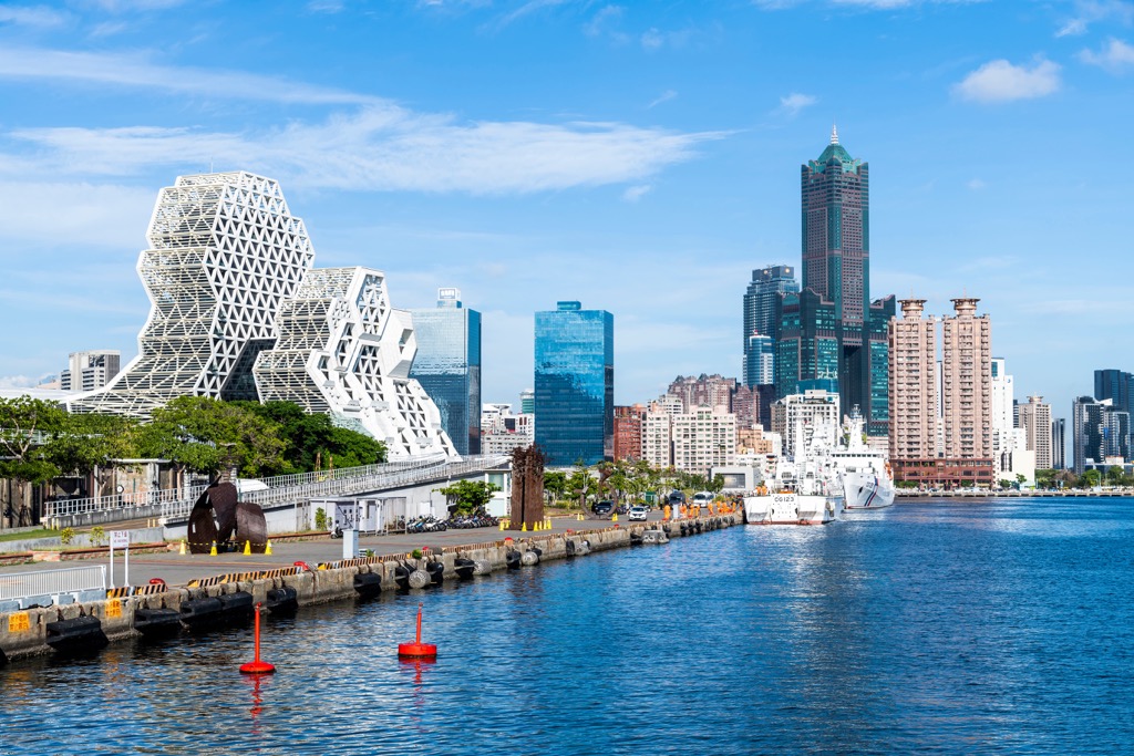
Finally, visit the Love River for beautiful views of Kaohsiung and its port. It's most striking at night time when the neon lights illuminate the area. But in the daytime, you'll get to enjoy the sweeping outlooks. Love River attracts couples who love the romantic ambience of the place, but everyone is welcome to bask in its glorious riverside setting.
Take the Taiwan High-Speed Rail (HSR) or local express train (TRA) to Kaohsiung from any of Taiwan’s major cities. Taiwan High-Speed Rail stops in Zuoying, while the local express train makes a stop at Kaohsiung Main Station. You can jump on the Kaohsiung MRT from these two stations or hop on a local bus to venture in and around this exciting city.
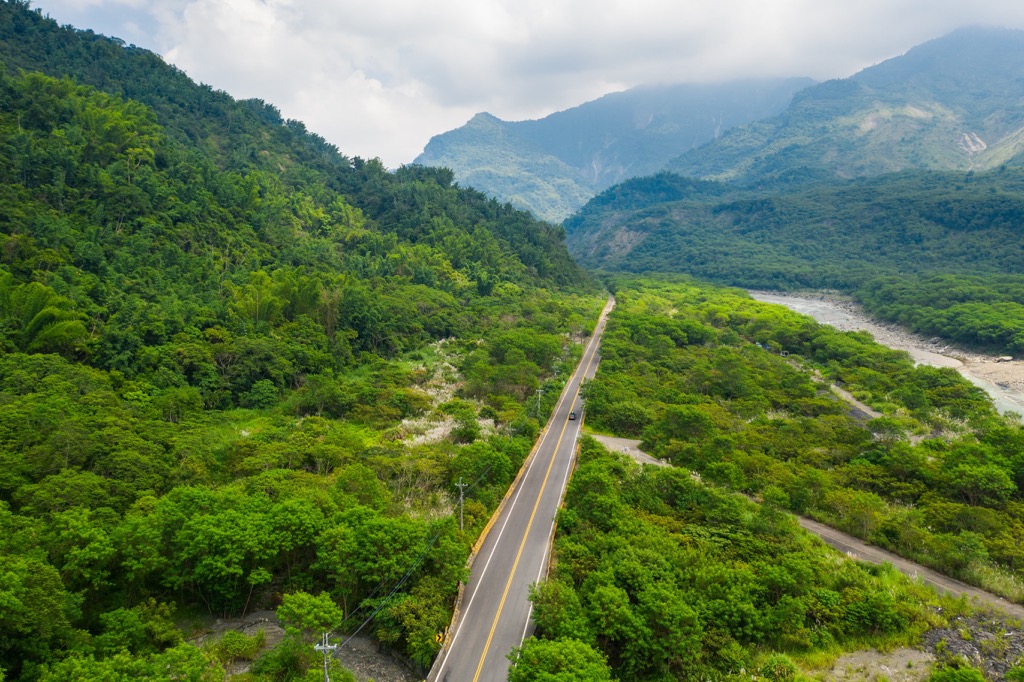
Explore Kaohsiung City with the PeakVisor 3D Map and identify its summits.



tw100
ultra
taiwan-high-three
taiwan-ultras
tw100
ultra
taiwan-high-three
taiwan-ultras
