
Scan the QR code and open PeakVisor on your phone
Shoushan National Nature Park has 23 named peaks. The highest is Shǎo Nǚ Fēng at 359 m. Other notable peaks include Chái Shān Zhǔ Léng Sān Jiǎo Diǎn, Bǎi Shòu Yán Jī Shí and Watershed.
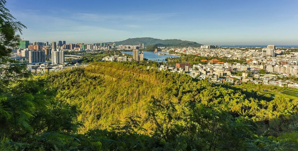
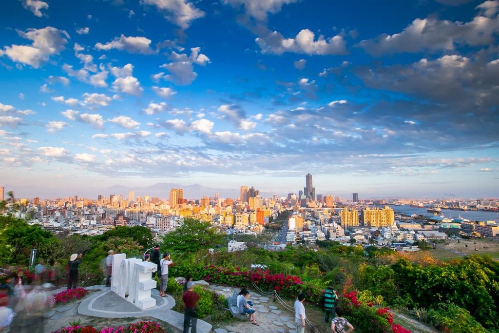
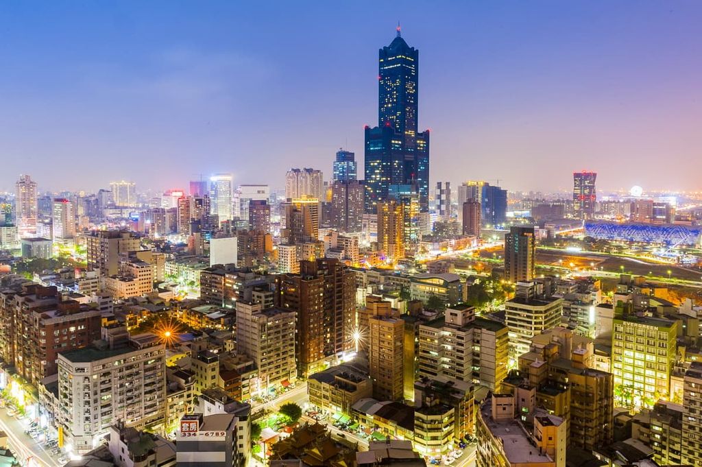
Perched against the coastline of the Taiwan Strait, Shoushan National Nature Park (壽山國家自然公園) overlooks both the ocean and the city of Kaohsiung (高雄市) in southern Taiwan. The ten high points of Chaishan Triangulation Points (柴山三角點) are the highest and most prominent mountain in the park with a maximum elevation of 356 m (1,168 ft).
The main area of Shoushan National Nature Park is a 5.5 km (3.4 mi) long and 2.5 km (1.5 mi) wide stretch of hilly land that is situated in the western district of Gushan (鼓山區) in Kaohsiung City.
The hills of Shoushan National Nature Park are not all connected; thus, some peaks are situated in nearby districts with more urbanised settings. The other districts of Zuoying (左營區), Nanzi (楠梓區), and Cijin (旗津區) are home to some of the outlying peaks in the park.
Overall, Shoushan National Nature Park consists of a total landmass of 485 ha (1,200 acres). Compared to the national parks of northern, central, and eastern Taiwan, the low-lying hills of Shoushan National Nature Park possess a gentler topography.
Some other peaks that are found within Shoushan National Nature Park territory are Shou Shan (壽山), Banpingshan (半屏山), Chaishan Boy Hill (柴山少男峰), and Guishan (龜山).
Shoushan National Nature Park is locally called Monkey Mountain due to the large presence of Formosan rock macaques on its slopes. An extensive network of wooden footpaths weaves across the hilly nature park that features various eroded limestone caves along the western edge of the park.
As its maximum elevation only reaches 356 metres (1,168 ft), Shoushan National Nature Park enjoys a tropical climate, with a warm average annual temperature of 77°F (25°C). In summer, the temperature reaches an average of 84°F (29°C) while it’s usually around 66°F (19°C) in winter.
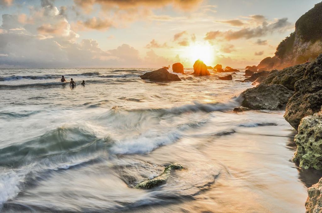
The rainy season in the park occurs during the summer months when typhoons are most likely to occur. The annual average rainfall of Shoushan National Nature Park is 1,748 mm (69 in).
Areas of interest nearby Shoushan National Nature Park include the Taiwan Strait (台灣海峽) in the west with Tiajiang National Park (臺江國家公園) in the north. Kenting National Park (墾丁國家公園) is located to the south of Shoushan National Nature Park, while Linhousilin Forest Park is situated (林後四林平地森林園區) to the east.
Around 1.25 million years ago, the hills of Shoushan National Nature Park were once a shallow underwater floor, wholly submerged by the waters of the Taiwan Strait. Corals, algae, shells, and foraminifera developed, forming hard limestone, which now comprises the core body of Shoushan National Nature Park.
Over the millennia, silt deposits accumulated on the seabed, which halted the formation of coral. A layer of sandstone and mudstone covered the limestone surface. At the same time, the shallow sea bed gradually rose above sea level, exposing the hills of what is now Shoushan National Nature Park.
Thus, the hills of Shoushan National Nature Park are now composed of coral reef limestones and younger sandstones, both of which have endured centuries of weathering and erosion.
The subsequent weathering and erosion of the limestone broke down the weakened rock. Thus, the formation of canyons, cliffs, and caves featuring stalactites and stalagmites that now dominate the region materialised from the calcium carbonate enriched mineral water that dripped from the limestone.
The ecology of Shoushan National Nature Park is both unique and diverse. The plant in the park includes 917 different species, which mainly consists of ferns, broad-leaved plants, deciduous trees, and perennial flowers.
Additionally, there are 600 species of native plants, such as the paper mulberry tree, Taiwan peony wild vine, Hengchun thick shell tree (Ehretia resinosa) and the stinging shrub Dendrocnide meyeniana.
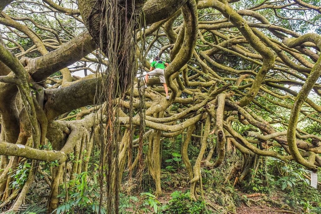
The most extraordinary plant life of Shoushan National Nature Park is the banyan tree. The tree creates an interconnected network of elongated branches, spreading and linking their protracted aerial roots that suspend from great heights.
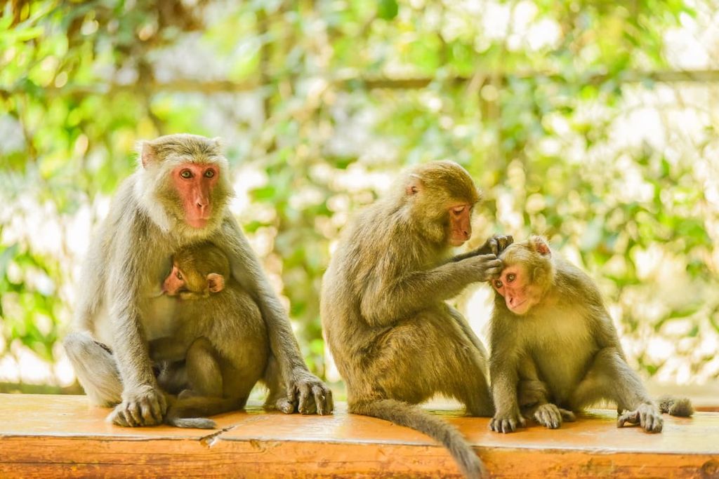
In terms of wildlife, 16 mammals inhabit the hilly landscape, such as Formosan rock macaque, Palla's squirrel, and the masked palm civet. Taiwan hwamei, crested goshawk, and the black-naped monarch are 3 of the 137 species of birds found in the park.
Additionally, 22 kinds of reptiles can be found in and around the coastal plains of Shoushan National Nature Park, such as the mangrove skink, the long-tailed sun skink, and the Hokou gecko. Two species of crustaceans inhabit the park's sandy shores, while five species of amphibians trace the water's edge.
Some 4,000 to 5,00 years ago, the Makatao tribe lived in the low-lying hills of what is now Shoushan National Nature Park in the northwest region of Taozaiyuan. This community is the oldest known cultural site of Kaohsiung City. Ancient relics such as shards of pottery, stone tools, and urn coffin tombs were excavated from the Taozaiyuan cultural site.
Another cultural site is located in northern Shou Shan. This site is known as the Neiwei Xiaoxi shell mound site. According to excavation findings, the ancient artefacts of shell mounds, animal bones, and pottery found at the site likely belonged to the Pingpu people who lived in the area for 400 to 2,000 years.
Although the Makatao and Pingpu tribes are not officially recognised as official tribes in Taiwan, the Makatao tribe does possess local recognition in southern Taiwan, where the tribe initially settled. The Pingpu tribe is still awaiting any form of acknowledgement from national and local authorities.
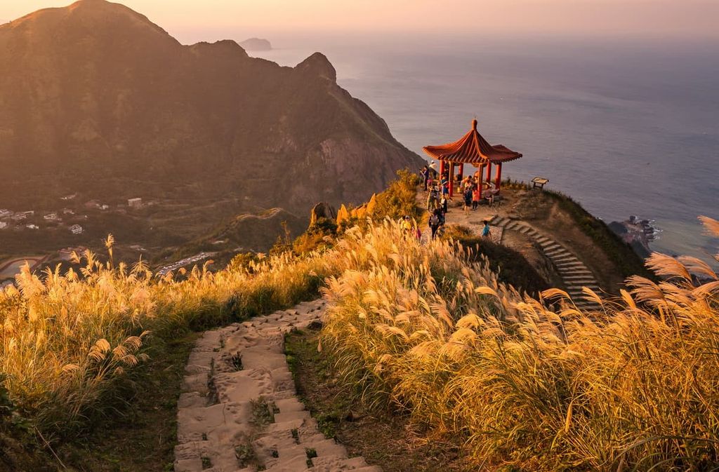
The trails of Shoushan National Nature Park also feature bunkers that overlook the sea. These were used by the Japanese during the Japanese Occupation Era to guard the city of Kaohsiung against coastal invasion.
On 11 December 2006, Shoushan National Nature Park was established. It was the first national park to receive official status from the efforts of civilian conservation groups, thus making history in Taiwan.
There are plenty of great places to hike and adventure in Shoushan National Nature Park. The major hiking trails are:
Shoushan National Nature Park features many hiking trails of differing lengths; however, the main hiking trail is the 11.4 km (7 mi) long Shoushan Hiking Trail. This trail loops around the entire hillside path of Chaishan Triangulation Points, linking the hillside road to Shou Shan in the north.
Starting from the Shoushan Hiking Trail South Entrance, situated near the Kaohsiung City Shoushan Zoo, hikers ascend the principal hill of Chaishan, resting at several observation points on the way as they admire the city of Kaohsiung and the Kaohsiung harbour to the south.
From the highest point of 356 metres (1,168 ft) on Chaishan Triangulation Points, hikers are granted generous views of southwest Kaohsiung. The generous vistas display a jagged skyline featuring the futuristic 85 Sky Tower, Kaohsiung’s tallest building at 347.5 metres (1,140 ft) in height. From here, hikers can also see the hotel block of Farglory THE ONE, with Kaohsiung Harbour located to the west.
Hikers then head towards the northern part of Shoushan through an earthen staircase of jagged limestone slopes that connect with Changchun Pavilion. From here, the path leads northwards toward the overgrown and forested peak of Shou Shan. In addition, the much-loved dense banyan area of Panrongshan Rest Area features on the trail, where Formosan rock macaques and squirrels frequent the tea shop as non-paying customers.
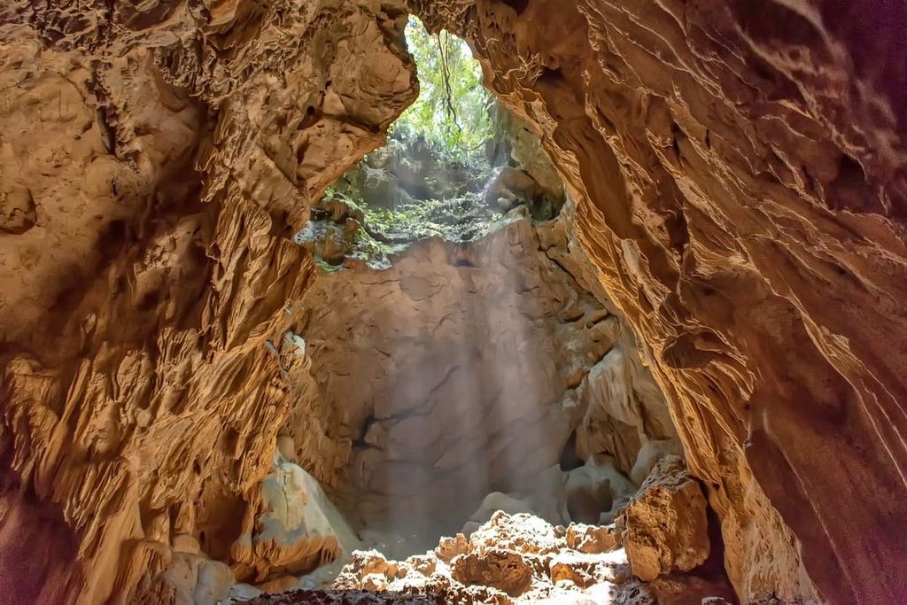
Hikers then venture westward toward Lianhua Cave (蓮花洞), otherwise known as Lotus Cave, a famous pockmarked limestone cave embellished in lush ferns and banyan roots. Lotus Cave measures 10 metres (33 ft) in length and 6 metres (20 ft) in height. Inside the cave, pockets of illuminating rays infiltrate the dark bone-like lair with sharp, rippling limestone rock dripping from the high rock walls.
Hikers then follow the path northwards to the 40-metre (131 ft) ravine of Taiguo Valley (泰國谷). Also known as Thailand Valley, the ravine is the largest natural limestone rift in Shoushan National Nature Park. What makes Taiguo Valley so spectacular is the terracotta curtain of fine vertical strands of Jinping vine aerial roots that descend for 3 metres (10 ft), creating an alluring atmosphere against the rugged limestone terrain.
Hikers then loop back onto the hillside route after admiring the expansive views from Xiaopingding viewing platform. They then head southward toward the starting point of Shoushan Hiking Trail South Entrance where the trek terminates.
Starting from the Bei Shoushan Climbing Pass, this path makes its way up the undulating shallow hill of Shou Shan. Along the way, the path is drenched in giant bayan trees parading their ostentatious aerial roots along the uplifted coral reef path.
It is not uncommon for visitors to encounter cheeky Formosan rock macaques on their hike. During this hike, many viewing platforms showcase different views of Kaohsiung City and the tropical mountain forest of Shoushan National Nature Park.
HIkers head north toward the Red Iron Bridge as the gravel path dips and rises through the woodlands of banyan trees. Progressing onwards, hikers then follow the road to the stalactite grotto of Ke’nan Cave (克難洞), where the entrance is a gaping hole on the forest floor. Cylindrical spirals of stalactites and stalagmites puncture the narrow and dimly lit pathways of the limestone cave as it descends into the ground.
Heading northward, hikers progress towards Chaishan Boy Hill while admiring the vistas of the north coastal area of Kaohsiung and enjoying the thinning crowds along this more secluded part of the trail. The terrain in the northern region of Shoushan National Nature Park is increasingly gorgeous, featuring a combination of rift valleys and sheer limestone walls.
Before hikers reach Chaishan Boy Hill, they stumble upon an old military bunker cave on a hill that’s now a popular attraction. Used as a lookout during the Japanese Occupation Era, this concrete structure is hidden under the footpath between limestone boulders where it offers a narrow, yet wide view of the Taiwan Strait.
Hikers then trek further afield to reach Chaishan Boy Hill with Cape of Chaishan Northwest (柴山西北角), a short walk away. From these peaks, hikers can admire the unobstructed northern views of the Kaohsiung coastline.
The path then returns to Bei Shoushan Climbing Pass, as hikers retrace their steps through the dense banyan forest while appreciating the views at the numerous viewing decks that display generous vistas of Kaohsiung.
Banpingshan is one of the few hills that are not connected to Chaishan Triangulation Points. As such, it is located to the north of Shou Shan at the intersection of the Zuoying and Nanzi districts of Kaohsiung City. As the terrain is gentle and the hill is flat, the 3.2 km (2 mi) trail is a favourite trekking route for people of all ages and different fitness levels.
Hikers begin their journey on the trail entrance off Cuihua Road, where they ascend a series of steps along a boardwalk to reach the dirt road leading to the peak.
Unlike Shou Shan, which is home to an assortment of monkeys, the wildlife on Banpingshan primarily consists of birds and butterflies. However, the terrain is similar to the hills of Shou Shan as limestone crevices, lush ferns, and a community of brilliantly draped banyan trees adorn the topography of Banpingshan.
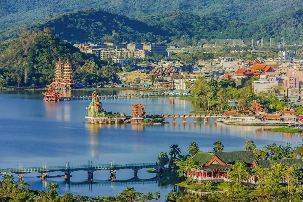
After a leisurely climb to the 181-metre (594 ft) summit, hikers can admire the splendid views overlooking the famous Lotus Pond in the south, where alluring and animated pagodas are planted on the lake’s edge, attracting a crowd of tourists and locals. Guishan can be seen in the south as it is the prominent coastal hill of Shoushan National Nature Park. The Taiwan Strait can be viewed in the west of Banpingshan, with the dynamic centre of Kaohsiung located to the east.
Hikers then descend the mountain using the same path. Eventually, hikers will cross the wetland area of Banping Lake on the descent.
An 800-metre (2,624 ft) wooden footpath leads through the verdant shaded paths of paper mulberry and Hengchun thick shell trees to reach 52 metre (170 ft) high summit of Guishan. One of the highlights of this walk is the presence of the 3031 Bunker, which was built during the Japanese Occupation Era to shield the city of Kaohsiung.
The journey to the low-lying summit takes less than 10 minutes. Even though the hill is not lofty, there are no high rises in this area; thus, one has unobstructed views from 52 metres (170 ft) above.
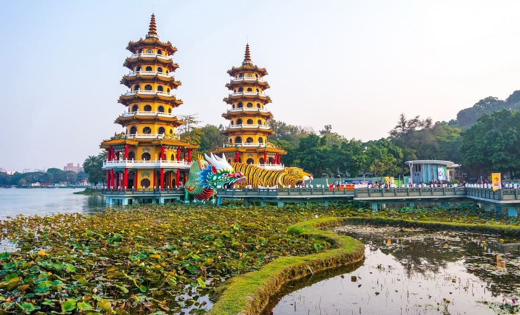
Lotus Pond is especially striking to see from the hill since Guishan is located near the attractive and famous Tiger and Dragon Pagoda. One can also note Banpingshan on the other side of Lotus Pond, while the Shou Shan hills can be admired in the other direction.
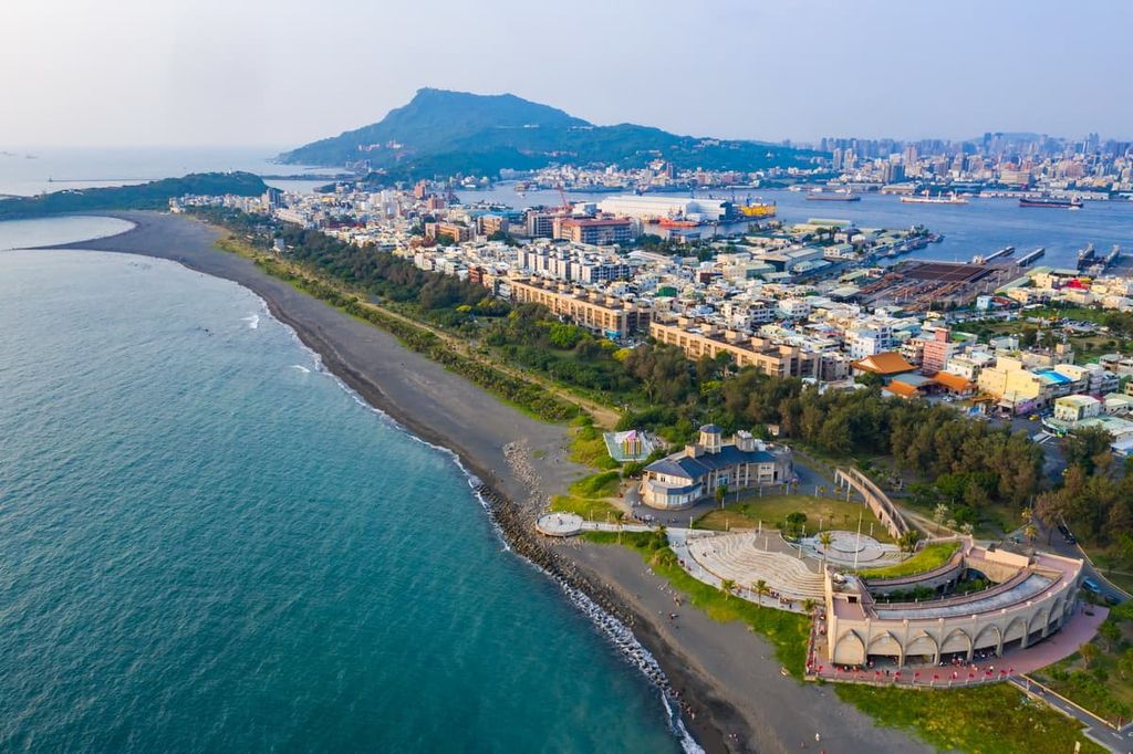
Qihou Shan ranks as the smallest hill in the park at 44 metres (144 ft) in elevation. It is located in the Cijin District of Kaohsiung City. As Cijin District is an island strip of Kaohsiung, visitors can either access the island via the Cross-Harbour Tunnel or take a ferry to the island from Kaohsiung harbour.
Qihou Shan faces the coastal hillside strip of Chaishan Triangulation Points situated to the north. Meanwhile, the waters of the Taiwan Straits are located to the west.. Kaohsiung harbour is located in the east, with 85 Sky Tower standing solidly in view.
Cijin Fort is located on the shallow hill of Qihou Shan, which was built in the 1870s. A combination of Chinese Qing Dynasty and western architecture was used in the construction of the fort. Further up the hill sits Cijin Lighthouse, which has been in operation since 1883 and is still in use today. Visitors can climb to the top floors to gain exquisite views of the busy port of Kaohsiung.
If you’re looking for places to stay, Kaohsiung City is an obvious choice as Shoushan National Nature Park is situated within its prefecture. However, the nearby city of Tainan (臺南市) is also an attractive option for visitors who wish to discover the ancient capital of Taiwan.
Taiwan's second-largest city, the southern port city of Kaohsiung, evokes a laid-back lifestyle despite the fact that it is a major commercial hub. As Kaohsiung lies in the south, it enjoys sunnier weather and a warmer climate than the capital city of Taipei (臺北市), which is situated in the northeast monsoon pathway during winter.
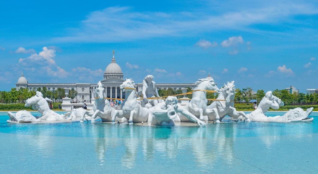
One of the most stunning destinations in Kaohsiung, Lotus Lake is 1.5 (0.9 mi) km long and 500 metres (1,640 ft) wide, with eight picturesque temples encircling its shoreline. The three pagodas located on the western edge of the lake are known as the coveted Tiger and Dragon Pagoda, the animated Spring and Autumn Pavilion, and the imposing statue of Xuan Wu, the God Emperor of the North.
Cijin Island is home to a network of 15 km (9.3 mi) of cycle paths that circle the coastal waters looking out toward the Taiwan Strait. Once visitors set foot on Cijin Island, they are instantly welcomed by street vendors selling the freshest seafood of calamari, prawns, mussels, and oysters. In addition, visitors can marvel at Tianhou Temple, the oldest temple in Kaohsiung, established in 1673.
Formosa Boulevard MRT Station features a kaleidoscope of stained glass ceiling panels known as the 'Dome of Light,' which illuminates the ticketing area below. The vast 30-metre (98 ft) diameter artwork is dedicated to the four aspects of earth, wind, water, and fire and is a mesmerising sight to behold.
Creatives and art lovers will be drawn to Pier 2 Art Centre situated at Kaohsiung Harbour. Here, murals adorn former warehouses that showcase art collections of local artists. Independent coffee houses line the colourful streets, which are decorated with intriguing statues while the cityscape of Kaohsiung and its busy port loom overhead in the near distance.
This ancient capital city is affectionately known as the 'Kyoto of Taiwan' due to the abundance of temples lining its many streets. In fact, in Tainan, there are more festivals celebrated and more gods worshipped than in any city in Taiwan.
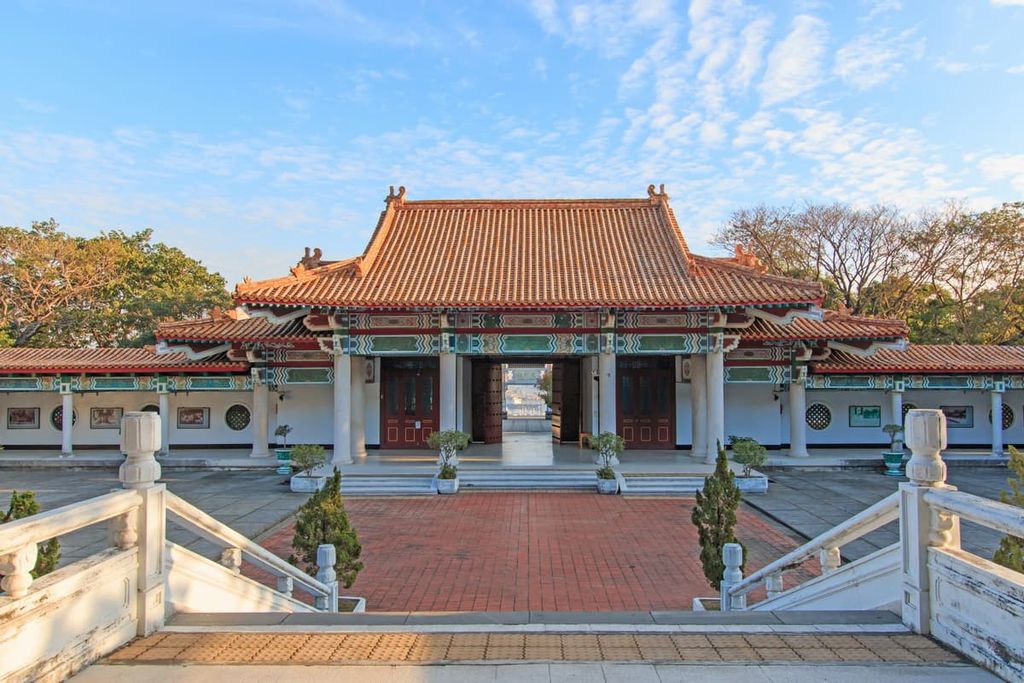
Taiwan's oldest Temple, Confucius Temple, was constructed in 1666. As opposed to the usual animated and decorative temples, the Confucius Temple displays a more modest and simplistic style, which adds to the zen ambience.
Tainan Flower Night Market is Tainan's largest and most favourite night market. Local delicacies like pungent stinky tofu, linger in the electrifying air while the sizzling of oyster omelettes being prepared amplifies the din of merry night market visitors. A bright and jolly entertainment area allows visitors to partake in pinball, dart shooting, and arcade games.
Anping Treehouse features an abandoned warehouse once belonging to British traders where a banyan tree has flourished, spreading its branches and roots across the walls of its dilapidated structure. Visitors can take a wander around the house and climb the barren stairwells inside, admiring the beauty of nature taking over humankind’s creations.
Tiajiang National Park features an emerald swamp framed by mangrove trees, creating a tunnel through the sheltered waterway. The park is also a protected area for endangered black-faced spoonbills who migrate to the waters of the Zhongwen River every winter. Bicycle paths weave across the expansive wetlands where visitors can observe the special marine life of this ecologically diverse national park.
From the major cities of Taipei, Taoyuan, Hsinchu, Taichung, Chaiyi, and Tainan, visitors can board the Taiwan High-Speed Rail (HSR) or local express train (TRA) to Kaohsuing. From the Zuoying HSR Station, Shoushan National Nature Park is located 6.4 km (4 mi) away.
The quickest journey to Shoushan National Nature Park is to transfer from Zuoying HSR Station to Xinzouying TRA Station and take the local train to the Museum of Fine Arts TRA Station in Gushan District. The entrance to Shoushan National Nature Park is 2.5 km (1.5 mi) away.
Alternatively, visitors can take the R51A, R51B, R53, or 219A bus from Xinzouying TRA Station and alight at Longquan Temple, which is close to Bei Shoushan Climbing Pass.


The highest peak in Shoushan National Nature Park is Shǎo Nǚ Fēng, at 359 m.
Notable peaks in Shoushan National Nature Park include Shǎo Nǚ Fēng, Chái Shān Zhǔ Léng Sān Jiǎo Diǎn, Bǎi Shòu Yán Jī Shí, Watershed and Chaishan Triangulation Points.


