Scan the QR code and open PeakVisor on your phone
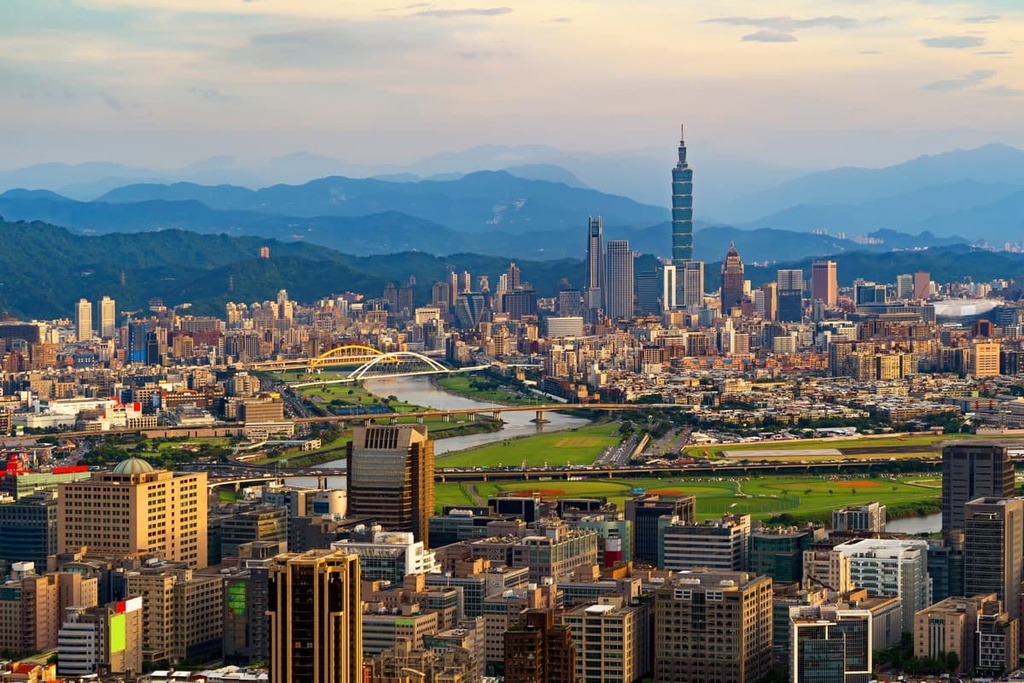
Taipei City (臺北市) is the vibrant capital of Taiwan. The city is located in the northern part of the island of Taiwan and it is fully enclosed by New Taipei City (新北市). There are 241 named mountains located within the city boundaries, the highest and most prominent of which is Qixingshan Main Peak (七星山主峰) at1,118 meters (3,668 ft) in elevation.
Taipei City covers 27,180 ha (67,163 acres) of hilly terrain and pristine valleys in northern Taiwan. While it’s not the largest city in Taiwan by total land area, Taipei is the most populated city on the island, with 2,554,000 people living in its urban area. In fact, roughly one-third of Taiwan’s population resides in Taipei.
There are 12 districts in the Taipei City metropolis, including Beitou District (北投區) in the north, Nangang District (南港區) in the east, Wenshan District (文山區) in the south, and Wanhua (萬華區) in the west. Taipei’s city center is located in the Zhongzheng (中正區), Zhongshan (中山區), Da’an (大安區), and Xinyi (信義區) districts.
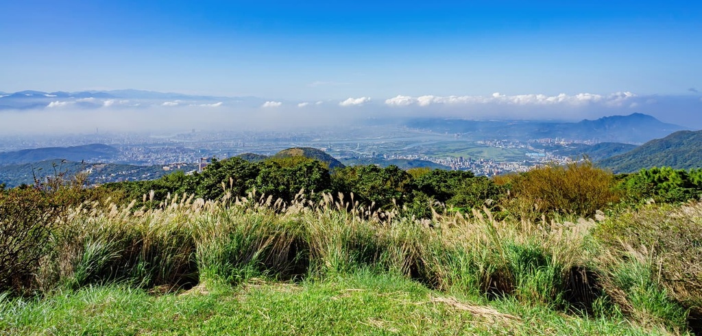
Taiwan’s capital is known as the Taipei Basin due to the fact that it’s encircled by countless rolling hills. This makes it a prime spot for the adventurous people among us who wish to hike and climb Taipei’s many peaks.
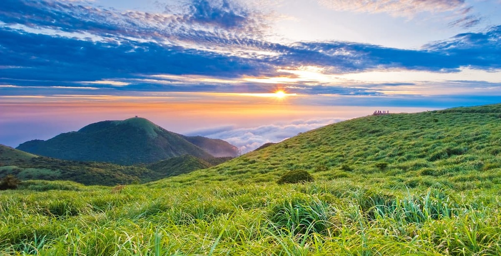
The famed Yangmingshan National Park (陽明山國家公園) is located in Taipei’s backyard, and it’s where most of Taipei’s tallest peaks are located. Qixingshan, Datunshan (大屯山), and Xiaoguanyin Shan (小觀音山) are all located in the park and they’re fan favorites among local hikers.
Taipei’s rivers are another scenic attraction in the area. The Tamsui River (淡水河) runs from the west, while the Keelung River (基隆河) flows westward into central Taipei. The Xindian River (新店溪), another offshoot of the Tamsui River, passes through the southern part of Taipei.
One of Taipei’s best qualities is its year-round warm, sunny weather. Taipei enjoys a humid subtropical climate; thus, summertime temperatures average a blissfully warm 34°C (93°F), while the winter temperature is normally around a modest 21°C (70°F).
It is uncommon for the winter weather to reach single digits in Taipei as the regional temperature rarely drops below 10°C (50°F). While the summertime heat may be stifling at times, generally, Taipei’s weather is advantageous for year-round outdoor activity.
Around 3 to 5 million years ago, tectonic activity at the boundaries of the Eurasian and Philippine Sea plates created the island of Taiwan.
Taipei’s hills formed as a result of this activity. This is particularly true with respect to the Datun Volcano Group (大屯火山群), which stretches across northern Taipei’s Beitou and Shilin (士林區) districts. As a result of the volcanic nature of the region, many fumaroles and hot springs can be found around Taipei to this day.
Between 1 million and 200,000 years ago, the now-dormant volcanoes of northern Taipei experienced frequent eruptions. These eruptions helped to create the rock strata that we currently see in the region, which consist of a mixture of igneous and sedimentary rocks.
Taipei’s southern hills are mostly an extension of the Xueshan Range (雪山山脈), which stretches from central Taichung City (臺中市) to northern Taiwan. These hills contain sandstones and shales that date back to the Oligocene.
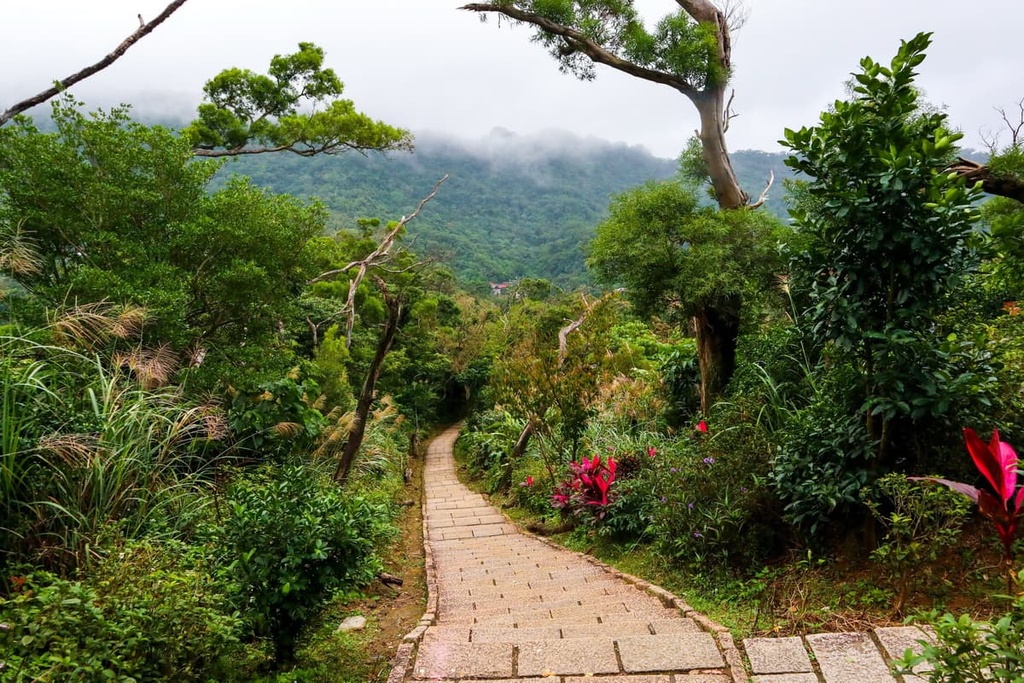
Taipei’s surrounding hills are primarily dominated by a subtropical broadleaf forest of acacia, sweetgum, and red nanmu. These hills are generally flat and do not reach great heights; thus, high elevation softwood trees are uncommon in and around the city.
In Yangmingshan National Park, silver grass is found on the summits of most peaks, as it is a hardy plant that can withstand fierce winds. A bamboo forest of Pseudosasa usawai thrives in the park, while broadleaf trees like Taiwan cherry, Japanese maple, and birdlime can be found in the region, too.
Taipei is home to many parks, such as the Da’an Forest Park (大安森林公園), Fuyang Eco Park (富陽自然生態公園), and Taipei Botanical Garden (台北植物園). Deciduous camphor, ficus, and maple trees are the most common trees found in these parks.
Taipei City's earliest human inhabitants were the Ketagalan tribe. Once the Qing dynasty overtook Taiwan in 1683, there became a slow and steady migration of Han settlers in the Taipei area.
By the eighteenth century, immigration from the mainland had ballooned to the extent that well-established Han settlements had formed in Taipei. Wanhua, Taipei's central district, was a particularly large Han community at the time.
Around the late nineteenth century, Taipei began to thrive as Taiwan's economic hub. This economic prosperity was thanks, at least in part, to the nearby Tamsui port, which enabled international trade through the shipping of goods, mainly tea.
With its distinct flavor and aroma, Taiwan's oolong tea was a hot commodity for the global market. Due to Taipei's economic importance, the Qing dynasty recognized it as Taiwan's capital in 1894.
Over the centuries, Taipei established itself as an international trading hub, which helped it become the most populous city in Taiwan. When the Japanese took control of Taiwan in 1895, as a peace offer from the Qing dynasty for losing the First Sino-Japanese War, Taipei's layout and feel gradually changed with the establishment of more formal city planning practices.
During this time, the Japanese government built administrative centers in the city for civil servants and housing for the increasing population. Much of Taipei's current cityscape and important buildings, such as the Presidential Building and the National Taiwan Museum, were built by the Japanese during this period.
In 1945, upon Japan's defeat in the Pacific War (i.e., the Pacific theater of World War II), the Chinese nationalist Kuomintang party took over control of Taiwan. The Taiwanese people were unhappy and voiced their concern by gathering at the Monopoly Bureau in Taipei on February 28, 1947. The Kuomintang army resisted this uprising by shooting and killing between 18,000 to 28,000 Taiwanese protesters.
Two years later, after China's Communist Party gained control of mainland China following the Chinese Civil War, the Kuomintang party fled to Taiwan. Chiang Kai-shek, the Kuomintang's leader, arrived with his party members in December 1949. Chiang remained in power in Taiwan until his death in 1975.
His arrival led to a period between the late 1940s and the 1990s that was known as the White Terror. During this time, the Kuomintang operated an island-wide hunt for Taiwanese political dissidents. Many of these people subsequently went missing, were killed, or were imprisoned.
Immigration expanded once again in Taipei from the early 1950s onward. In 1968, the rapidly growing Beitou, Shilin, Nangang, Neihu (內湖區), and Jingmei (景美區) districts joined Taipei City.
Taipei reached a population of 1 million residents early in the 1960s. The city’s population then doubled to 2 million residents only ten years later. Taipei remains a densely populated city, and it retains its economic importance as one of Asia's biggest exporters of electronics, computers, and cars.
Although it is one of the most densely populated urban areas in Taiwan, Taipei City is a great place to base yourself if you want to go hiking in the northern part of the island. Here’s a quick look at some of the best hikes in Taipei to check out during your next trip to the region.
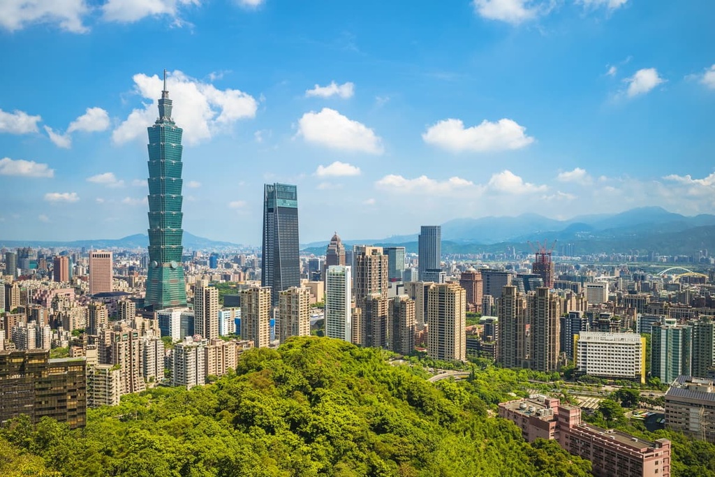
Undoubtedly Taipei's most visited peak, Elephant Mountain (象山) is located in Taipei's eastern Xinyi District, and its claim to fame is the picturesque view that it offers of Taipei 101. Locals and tourists swarm to this hill daily for a vigorous workout as they climb the peak’s 600 steps and for the chance to get great vistas of Taipei’s city center.
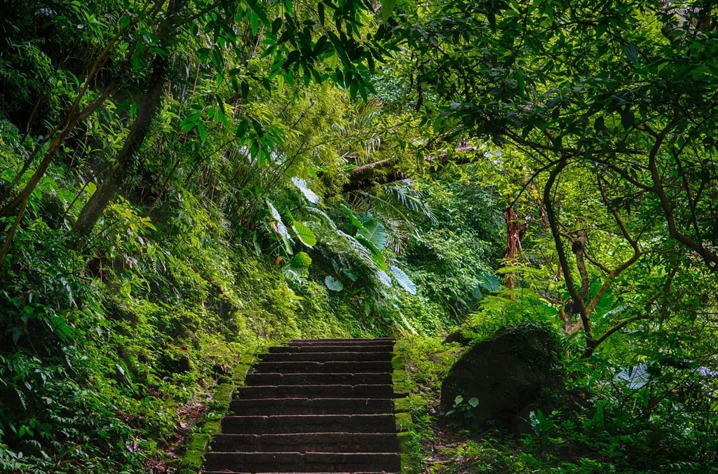
As you hike up Elephant Mountain’s stone staircase, the lower part of the trail is sheltered by a dense broadleaf forest of acacia, Taiwan cypress, white banyan, and green oak trees. While the exuberant plant life limits the views that you can enjoy from the early stages of the trail, it does give you the chance to admire the hill's luscious flora.
Continuing up the trail, you’ll soon feel the Taiwan sun warming your skin as the thick foliage starts to wane. At this point, you can start to appreciate the views from the trail's clearings, but you’ll need to carry on further for an even more incredible panoramic vista.
While Elephant Mountain is only 184 meters (604 ft) tall, it offers excellent views of Taipei 101 and the rest of the city center. This makes it a must-do hike for anyone visiting the city, especially on a sunny day.
Grab a ride on the Maokong Gondola (if you are brave enough, opt for the crystal floors) if you want to enjoy some wonderful views of the tea farms located around southern Taipei.
You can start the journey to the region from the Taipei Zoo, where the gondola transports you along a 4 km (2.4 mi) line to Maokong (貓空). Along the way, you’ll pass over rampant, overgrown fields of camphor trees and tea plantations.
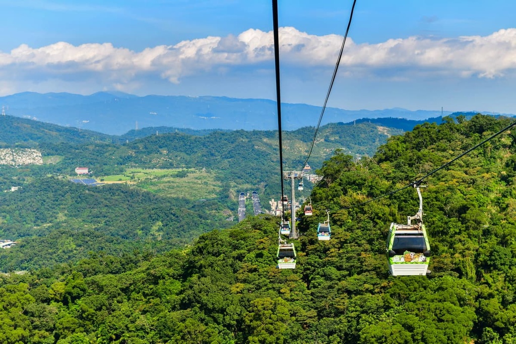
The Maokong Gondola makes for an exceptionally captivating ride at sunrise and at night when Taipei City’s lights twinkle in the distance. Once at Maokong, you can sample Taiwan’s specialty—oolong tea—in one of the region’s charming wooden tea houses.
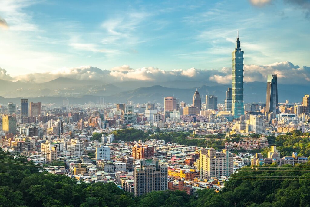
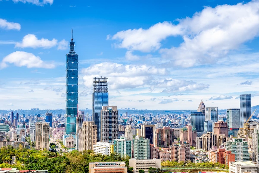
Officially the world’s eleventh tallest building, Taipei 101 is still one of the highest eco-friendly buildings worldwide. In fact, Taipei 101 is a LEED platinum-certified building, thanks to its energy-reducing and sustainability efforts.
Technically, Taipei has 101 floors, though visitors are only able to make it to the observation deck on the 89th floor. The observation deck offers a 360-degree panorama of the city center, and on a clear day, you can see the peaks of Yangmingshan, Maokong, and Elephant Mountain surrounding the Taipei basin.
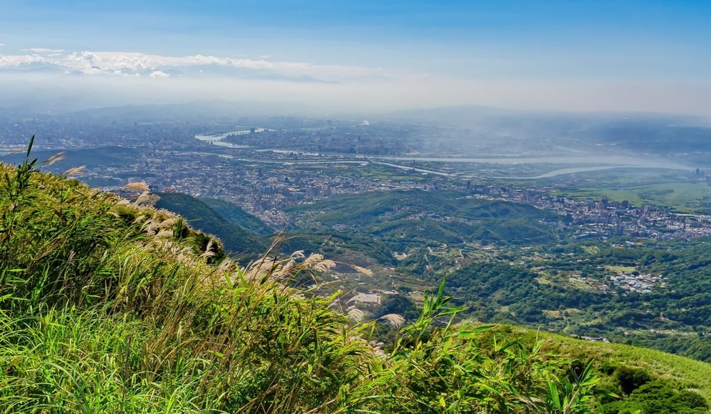
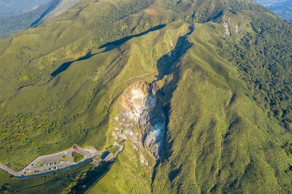
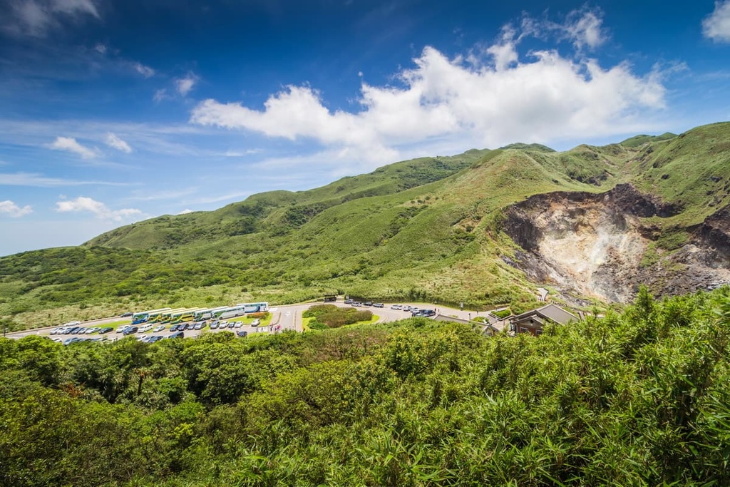
Taipei’s highest peak is the dormant volcano Qixingshan. It is located in Yangmingshan National Park, which is known for its hilly landscape, fertile valleys, steaming fumaroles, and luscious environment. Qixingshan is very accessible for hikers, as it is situated just a short ride on the Yangmingshan 108 shuttle from the park’s entrance.
Hikers usually begin the climb to the peak from the Xiaoyoukeng Trailhead. Here, you can witness smoky fumarole releasing clouds of sulfuric gasses. Xiaoyoukeng’s hydrothermal vent is located on Qixingshan’s western slope, too, just 400 meters (1,312 ft) down the trail.
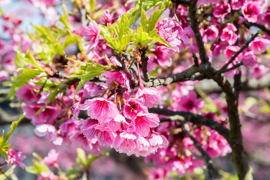
Swarms of silver grass flourish along the trail to Qixingshan’s summit. The verdant emerald canvas of the surrounding landscape is embellished with pink maple blossoms and red nanmu flowers in the summer months.
A 2.2 km (1.3 mi) climb up the trail leads you to Qixingshan’s summit, which offers a bird's-eye view of the Taipei basin below. Even the massive Taipei 101 seems minuscule from the lofty summit of Qixingshan.
You can either descend the same path that led you to the summit or continue on a point-to-point trail to complete the entire 5.7 km (3.5 mi) journey up and down the mountain. If you continue onward, a short scramble will lead you to Qixingshan East Peak (七星山東峰), too.
As you descend via the point-to-point trail, a sheltered broadleaf forest of rhododendron and Taiwan cypress trees offers some much-needed shade. Qixing Park is a convenient rest stop as you make your way down the hill as it gives you a chance to see Taipei’s skyscrapers from a different vantage point. The trail then steadies downhill for 2 km (1.2 mi) until you reach the Miaopu Trailhead on Qixingshan’s eastern slope.
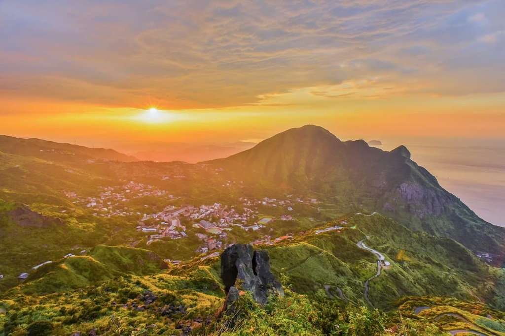
The Datunshan Hiking Trail is a fun hike to the top of one of the volcanic peaks in Yangmingshan National Park. It is a bit more casual than the climb to Qixingshan as it's only a 900-meter (2,953 ft) trek to the summit.
While the trail is slightly shorter than the hike to Qixingshan at 5.4 km (3.3 mi) in length, the path scales three peaks—Datunshan Main Peak, Datunshan South Peak (大屯山南峰), and Datunshan West Peak (大屯山西峰).
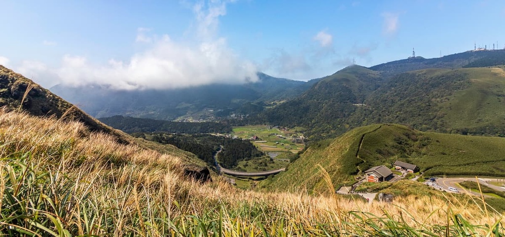
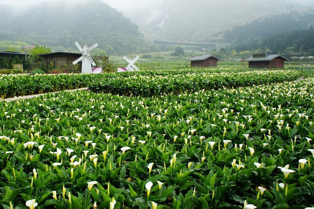
From Datunshan's summit, you can admire the fertile Zhizihu valley, which erupts with lily flowers each February. Furthermore, you can also see Qixingshan's cone-shaped hill and its surrounding peaks to the east as well as the Taipei basin to the south. As Datunshan is located in Yangmingshan's western region, you can also see the Tamsui River in the distance as it makes its way to Taipei.
The trail then continues on mixed terrain of inclines and dips as you make your way to Datunshan South Peak. Keep in mind, however, that the trail can be very muddy and slippery after heavy rains. Therefore, be sure to use the rope assists as you make your way up to Datunshan West Peak.
From these two summits, you can see both Datunshan Main Peak to the northeast and Qixingshan to the east. You can also get views of the hills of Datunshan Southwest Peak (大屯山南西峰), Zhongzheng Shan (中正山), and Miantian Shan (面天山) from the tops of both peaks.
Situated in the outlying hilly Neihu District, the Zhongyong Shan Hiking Trail is a short 1.2 km (0.7 mi) track that offers a combination of exquisite nature, sweeping views, and lavish hillside temples. As it's a lesser-known trail in the Taipei region, you can often find relative solitude on Zhongyong Shan.
Once you leave the trailhead, you’ll enter a lush broadleaf forest of acacia, sweetgum, Ryuku pine, and oak. As soon as you reach the summit, you’ll see a giant bronze statue of Taiwan's former leader, Chiang Kai-shekt. The top of Zhongyang Shan (忠勇山) offers endless views of the Neihu Lakes below, so it’s a true wonder to behold.
If you hike a little further ahead, you’ll make your way to the ornate Bishanyan Temple. While the beautifully decorated temple is certainly worth admiring, the real benefit of visiting Bishanyan is that it offers incredible views of downtown Taipei, including of both Taipei 101 and the Rainbow Bridge.
Situated behind Elephant Mountain is the lesser-known Muzhi Shan (拇指山). With an elevation of 313 meters (1,027 ft), Muzhi Shan is higher than Elephant Mountain and it offers even better city views than its more famous neighbor.
Since it is less popular than Elephant Mountain, Muzhi Shan is a great place to visit if you want to escape the crowds. From the summit, you can even enjoy unobstructed 360-degree views of Taipei and its surrounding terrain.
The best part? If you’re looking for even more adventure, you can also continue your hike from Muzhi Shan to Elephant Mountain where you can enjoy additional panoramic views.
Fuzhou Shan (福州山) is a notable peak located in the southwestern part of Taipei’s Da’an District. The trailhead is located very close to the Linguang MRT Station, which makes it easy to access for residents and visitors alike. Plus, the trail is just 2 km (1.2 mi) long, so it’s a nice option if you’re looking for a short afternoon or morning outing.
One of Fuzhou Shan’s highlights is that the path is lit up at night, allowing visitors to frequent the trail at any time. While the views of Taipei are outstanding in broad daylight, they’re particularly fascinating at night when you can see the city’s lights illuminate the dark sky.
As you ascend the paved steps to the summit of Fuzhou Shan, a lavish forest of acacia and Machilus trees awaits. Once at the top, you can look straight ahead at Taipei 101 and admire the views of the city from above.
Taipei's inner and central districts are convenient places to stay if you want to explore the city as they provide easier access to public transportation in and around the city. Here are some of the best districts to check out during your next trip to Taipei.
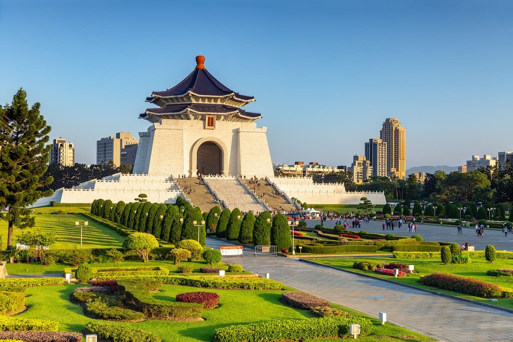
The Zhongshan District is the historical center of Taipei. It is home to a number of important sites including the Presidential Building and the Chiang Kai-shek Memorial Hall.
The Chiang Kai-shek Memorial Hall (國立中正紀念堂), which honors Taiwan's past president, is particularly worthy of a visit. Its stately appearance evokes grandeur as the 76 meter (249 ft) high white marble structure radiates under the glorious sun.
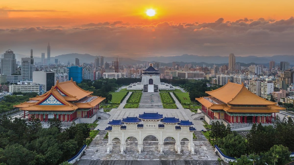
Other nearby attractions that are worth visiting include the red pagoda-roofed National Concert Hall and National Theater, which are located in an area known as Liberty Square. From here, you can enjoy scenic views of Taipei and explore some of the city’s most iconic historic sites.
If you’re visiting the Zhongzheng District, be sure to check out Taiwan's oldest museum, the National Taiwan Museum (國立臺灣博物館), which opened its doors in 1908. It initially served as a gallery that highlighted Taiwan's railway network. But the National Taiwan Museum now features a number of important displays, including exhibits on the geology, ecology, botany, and anthropology of the island.
Behind the National Taiwan Museum is a space created to honor the victims of the February 28, 1947 massacre when a mass protest occurred against the Kuomintang government. The aptly named 2-28 Peace Memorial Park (二二八和平公園) consists of walkways, pavilions, and shrines that are nestled on the shores of three lakes. This calm and beautifully manicured area allows one to collect their thoughts and reflect on the park's purpose.
Taipei’s first ethnically Han settlement is now the city’s most modern and trendy area. The Wanhua District attracts a younger crowd as it’s considered fun and entertaining by shoppers and youths eager to get their hands on the latest craze.
One of the district’s best attractions is The Red House (西門紅樓), is an immaculate octagonal-shaped exposed red brick building that once housed opera performances and a cinema during the 1950s. It now hosts cultural events such as live music shows and productions.
Taipei’s main shopping district, Ximending (西門町), is located across the road from The Red House. Electrifying, bizarre, and effervescent, a walk through Ximending is a great way to admire the eccentric fashion that’s on display 24/7. Known as the ‘Harajuku of Taipei,’ Ximending pulsates with life and bustling activity.
Or, for a peek into Taipei’s past, take a wander down Herb Alley (青草巷), which is situated on Xichang Street (西昌街). Here, traditional Chinese medicine is still practiced, and the streets are packed with shops selling therapeutic herbs that are believed to ease any ailment.
Known as Taipei's commercial zone, East Taipei is a glorious fusion of ancient and modern buildings. For example, in the district, Taipei 101 is located just two blocks away from an old Japanese tobacco factory that has now been remodeled into an art gallery called the Songshan Cultural and Creative Park.
For a more outdoorsy outing in East Taipei, head to Xiangshan Park (象山公園), which is the only place in the city where you can find the Taipei tree frog. To protect the frog, the city council established the park and planted various plants, such as giant taro, ginger lily, and bird's nest fern. In the mornings, the park is a hive of activity as its beautiful setting inspires runners and exercise enthusiasts to start their day with a burst of energy.
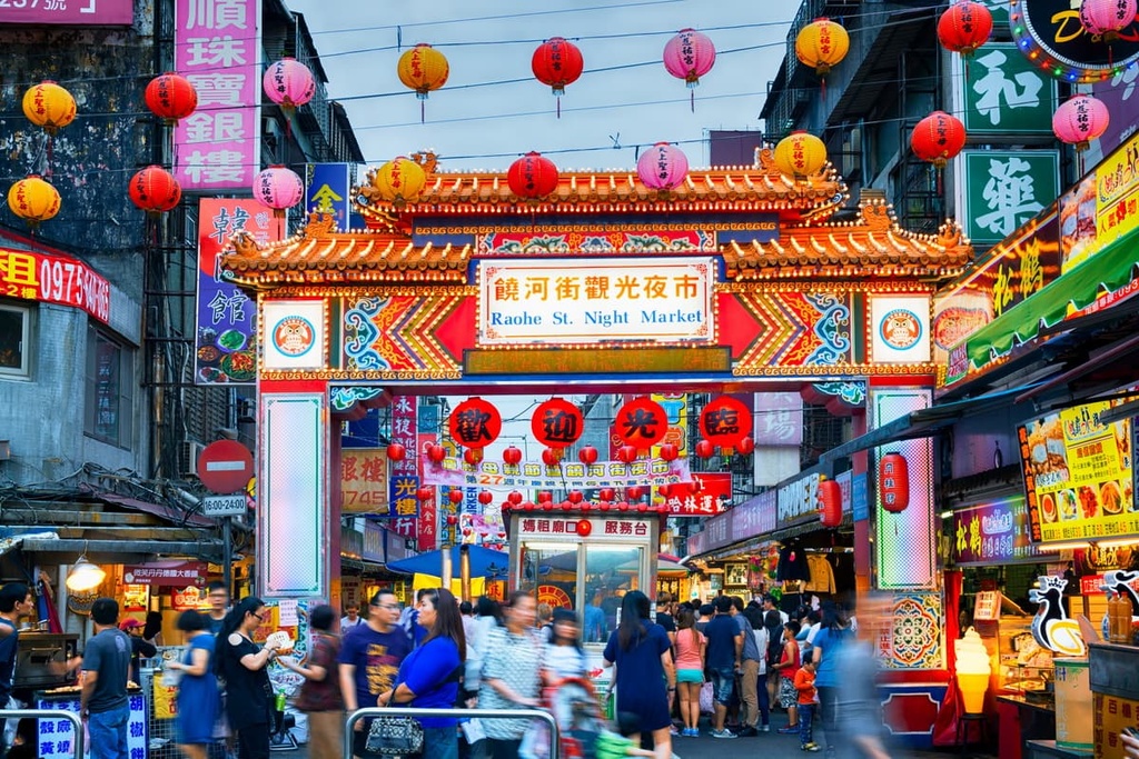
However, a trip to Taipei is not complete without visiting one of East Taipei's vibrant night markets. If Raohe Night Market's (饒河街觀光夜市) multi-colored illuminated gate doesn't impress you, its multitude of lined stalls will definitely pique your interest. From watermelon milk, salted squid, and stinky tofu to fried milk on a stick, you can find an endless collection of both sweet and savory treats to sample in this bustling market.
Additionally, in the Taipei 101 Mall, you can find the flagship restaurant of Din Tai Fung (鼎泰豐), which is known for its steamed buns called xiaolongbao. In 1993, The New York Times featured the Taiwanese dim sum store in their list of the world’s best eateries. As a result, locals and tourists alike wait hours for a table in this world-famous restaurant.
Taipei is relatively easy to get to as it is a transportation hub for Taipei. When you arrive in Taiwan, you will land at either Taiwan Taoyuan International Airport (TPE) or Kaohsiung International Airport (KHH).
To get to Taipei, you need to take the Taiwan High-Speed Rail (HSR) or local express train (TRA) from either Taoyuan or Kaohsiung. These trains will stop at Taipei Main Station in Taipei’s city center.
Getting around Taipei is easy enough as the city boasts the convenient Taipei MRT train system. This system consists of five train lines that stretch across the city.
Alternatively, you can hire a car or scooter if you prefer to drive; however, the roads of Taipei are congested with traffic, so public transport is generally recommended.