The Xueshan Range include 1,311 named peaks. The highest is Xueshan / Snow Mountain at 3,886 m. Other notable peaks include BeiLingJiao Mountain, Kailantekunshan and Kailantekunshan North Peak.
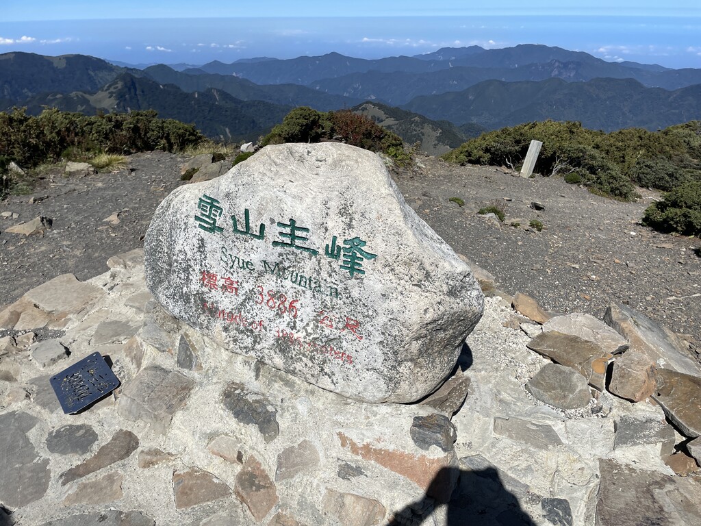
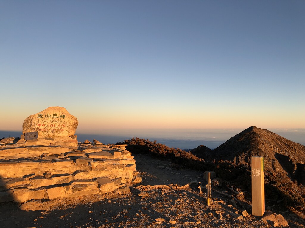
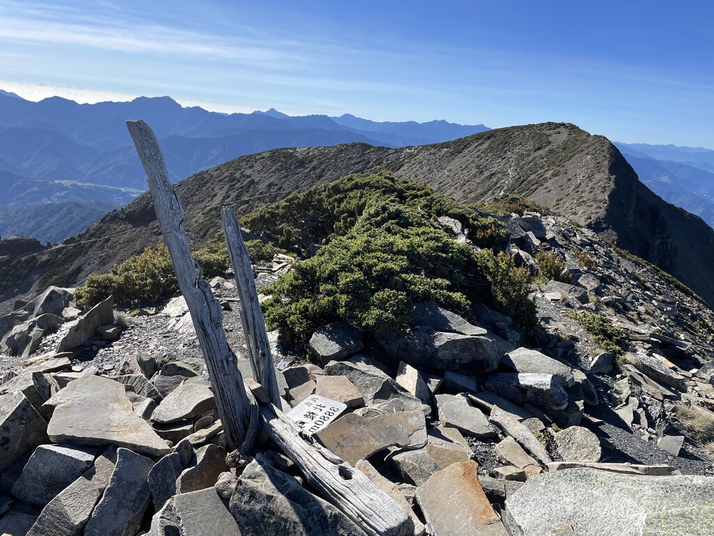
Xueshan (雪山, ‘Snow Mountain’) is Taiwan’s second tallest peak, at 3,886 meters. Along with Yushan (3,852 meters), Mount Xiuguluan (3,805 meters), Nanhu Mountain (3,742 meters), and Beidawu Mountain (3,092 meters), Xueshan makes up part of Taiwan’s “5 Peaks,” considered the most representative mountain in Taiwan. Xueshan is also the second tallest mountain in East Asia, second only to Taiwan’s Yushan. Xueshan is located near Taichung in central Taiwan and has a prominence of 1,932 meters, making it an Ultra.
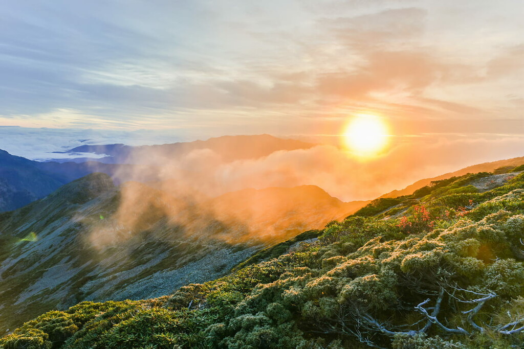
Xueshan has been called by many names over the centuries. The mountain is home to Taiwan’s aboriginal Atayal population, and the peak is one of their traditional hunting grounds. In the Atayal language, Xueshan is referred to as Babo Hagai (‘rock mountain’), Mahamayan, or Sekoan (‘broken rocks and cracks’). Xueshan’s Chinese name probably comes from the snow visible on its peaks from great distances, a rare sight in subtropical Taiwan. On clear days, it is said that Xueshan is even visible from the hills of Taipei more than 100 kilometers to the north. Xueshan became known in the West as Mt. Sylvia after it was spotted by sailors aboard the HMS Sylvia in the 1800s. In Japanese, the mountain was known as Tsugitakayama (literally ‘second highest mountain’).
Xueshan is located in the Shei-Pa National Park, so hikers must apply for passes from the park before entering to hike. Hikers should apply one week to one month in advance to ensure they receive passes on time. To climb into high-altitude areas, hikers will need to also apply for a pass from the Xueshan police office. This pass can be applied for the day of departure.
Major Trails and Hiking Areas
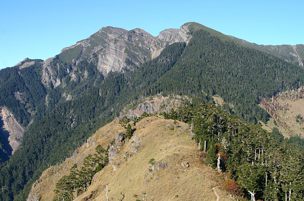
Due to the vast size of Shei-Pa National Park, Xueshan’s hiking is often split along its six principle ridges: Main Ridge, South Ridge, North Ridge, Northeast Ridge, Southeast Ridge, East Branch Ridge.
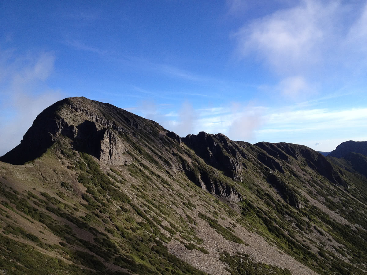
- Main Ridge: This stretch includes Xueshan Peak, as well as Huoshi Mountain (3,310 meters), Touying Mountain (3,510 meters), Daxue Mountain (3,445 meters), and Zhongxue Mountain (3,173 meters). This branch provides a challenge for even the most experienced hikers, as nearly all the peaks top 3,000 meters. At Daxue Mountain, the smallest of the group, hikers can visit the National Forest Park and appreciate the scenery.
- South Ridge: The South Ridge’s peaks include Dajian Mountain (3,593 meters), Youpolan Mountain (3,308 meters), Jiayang Mountain (3,314 meters), and Jianshan (3,253 meters). Youpolan Mountain is a popular camping destination in the Xueshan Range, and visitors can reserve a seat at its campgrounds before visiting. Please note that in Taiwan, most camping is only allowed within designated campgrounds.
- North Ridge: The North Ridge connects to the Main Ridge and is a popular route for hikers looking to reach Xueshan’s peak. Major hiking peaks include Kailantekun Mountain (3,731 meters), Xueshan’s North Peak (or Babo Tarakusya, 3,703 meters), Mutelebashan (3,626 meters), Sumida Mountain (3,438 meters), Bashalayun Mountain (3,402), Dabajian Mountain (3,490 meters), and Xiaobajian Mountain (3,418 meters). These peaks make up the “Holy Ridgeline Trail” to Xueshan’s peak, and there are campgrounds and cabins located at many stops along the way.
- Northeast Ridge: An offshoot of the North Ridge, this ridge contains Pintian Mountain (3,524 meters), Chiyou Mountain (3,303 meters), Taoshan (3,325 meters), and Kelaye Mountain (3,133 meters). Visitors to this area of the par can also make a visit to Wuling Farm, one of Taiwan’s most popular mountain farms.
- Southeast Ridge and East Branch Ridge: These two smaller offshoots include Zhijiayangda Mountain (3,345 meters), Ganmulin Mountain (3,690 meters), and Xueshan East Peak (3,201 meters).
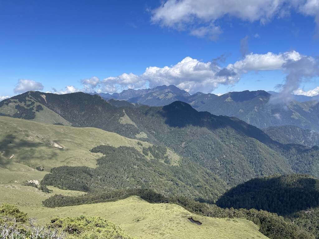
- Cuichi: This is the highest mountain lake in Taiwan, at 3,520 meters, and is only around 1 kilometer down the trail from Xueshan’s peak. It is also the starting point for the Xueshan River.
- Black Forest: This forest is also located on the trail to Xueshan’s peak, and the dense fir forest is said to be especially beautiful in the winter months.
Cabins
Cabins along the hiking trails provide resting spots for hikers with bedding, as most of the hikes in the Shei-Pa National Park cannot be completed in one day.
- Qika Cabin
- 369 Cabin
- Cuichi Cabin
Towns and Villages
As a national park, settlements within Xueshan are limited mostly to aboriginal villages.
- Tai’An Township is one of the largest settlements within Shei-Pa National Park
- Huanshan Village: This aboriginal village is surrounded on all sides by 3,000+ meter mountains
- Songmao Village: Surrounded by forests, this village is near Jiayang Mountain, which is called Kituxang in the aboriginal language, meaning ‘meeting place of ancestor’s souls’.
- Qingquan Village: Here hikers can find natural hot springs and abundant wildlife
- Bailan Village: Located in the ‘cloud band’ on Xueshan Mountain, the views from Bailan Village are said to change minute by minute