
Scan the QR code and open PeakVisor on your phone
Pingtung County is home to 290 named mountains. The highest is Beidawu Shan at 3,092 m.
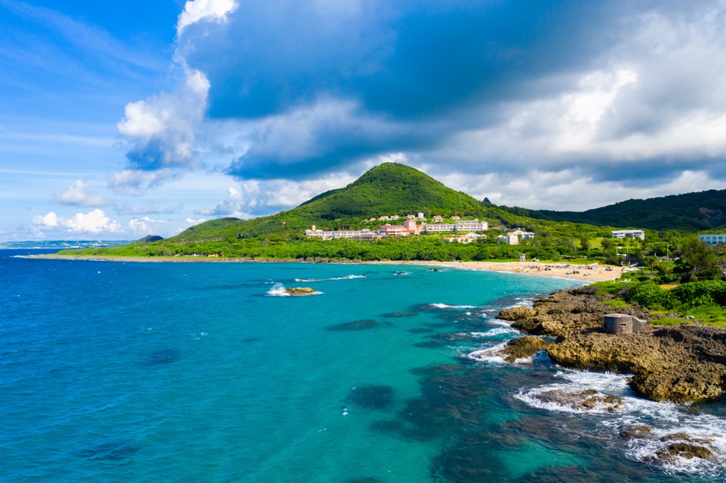
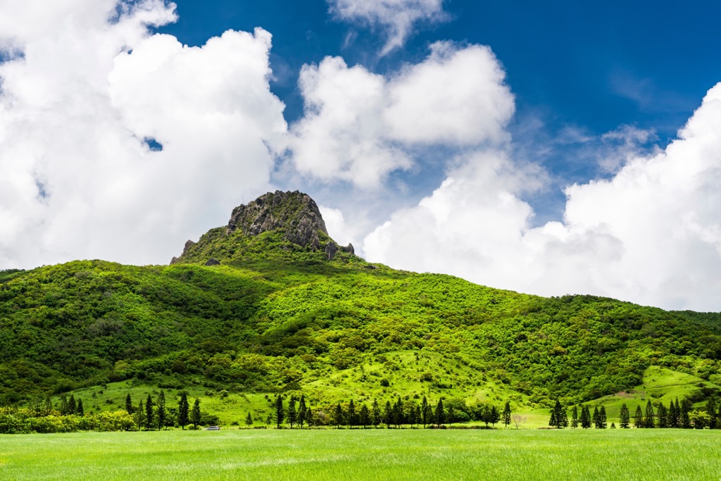
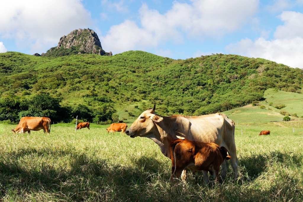
Taiwan’s southernmost region is a subtropical paradise of sandy beaches, coral islands, rainforests and undulating hills. Beidawushan (北大武山) is the highest mountain out of Pingtung County’s (屏東縣) 290 named peaks. The prominent hill measures 3,092 meters (10,144 ft).
Pingtung County lies below western Kaohsiung City (高雄市) and eastern Taitung County (臺東縣), making it the southernmost area in Taiwan. It covers 277,560 ha (685,866 ac) of land, making it the fifth largest county in size in Taiwan.
To its north lies the southern extension of the Central Mountain Range (中央山脈), while three seas border its southern lands. The Taiwan Strait laps its western shores, and the Bashi Channel drifts to the south. While in the east, the vast Pacific Ocean ebbs and flows.
Due to its location, Pingtung County has one of the warmest climates in Taiwan. With an average daily mean of 77°F (25°C), Pingtung County residents enjoy year-round summer temperatures. Between April to November, temperatures average between 86 to 104°F (30 to 40°C) while dipping only slightly between 77 to 82°F (25 to 28°C) between December to March.
While Pingtung County enjoys an endless summer, it is affected by typhoons, mainly due to its low-lying land. Typhoon Morakot, one of Taiwan’s deadliest storms, wrecked Pingtung County in 2009, causing significant flooding and landfalls.
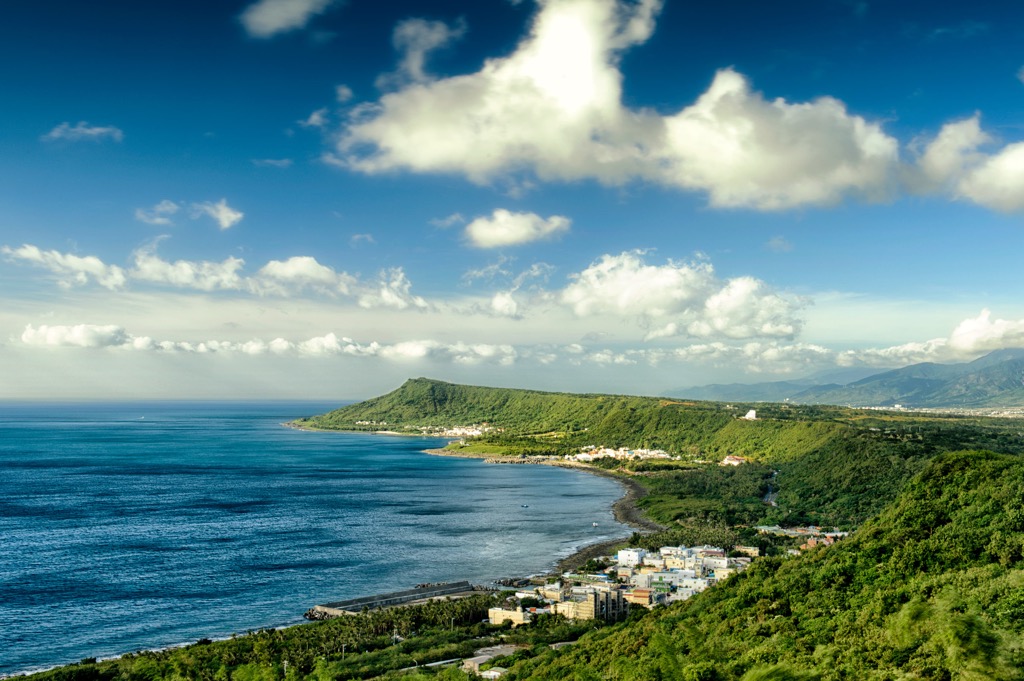
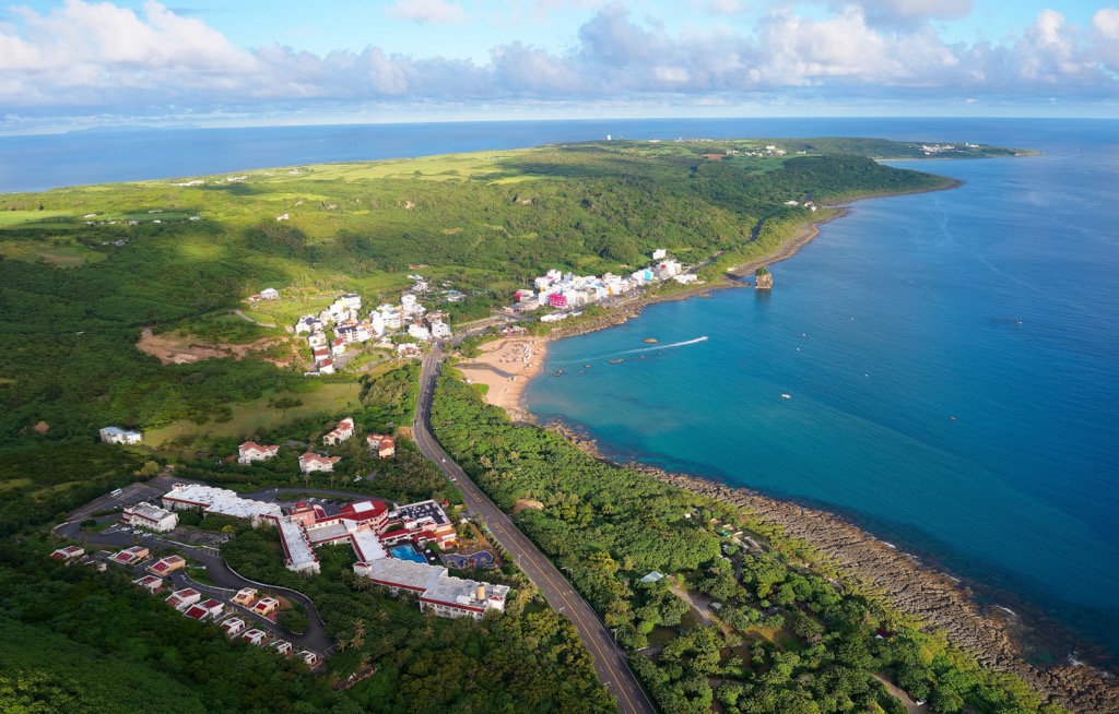
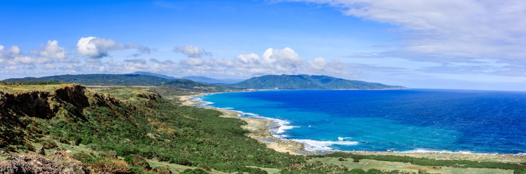
Known for its diverse natural beauty, Pingtung County holds many scenic attractions. The offshore Xiaoliuqiu (小琉球) island is a small coral isle where you can spot turtles swimming near the shore. Kenting National Park (墾丁國家公園) lies along Pingtung County’s southern coastline, the only tropical national park in Taiwan.
Other well-known spots in Pingtung County are Dawu Mountain Nature Reserve (大武山自然保留區) in the north and Jianshan Coastal Reserve (尖山沿海保護區) to the west. In the east is Nanren Mountain Ecological Reserve (南仁山生態保護區), and Kenting National Forest Recreation Area (墾丁國家森林遊樂區) is in the south.
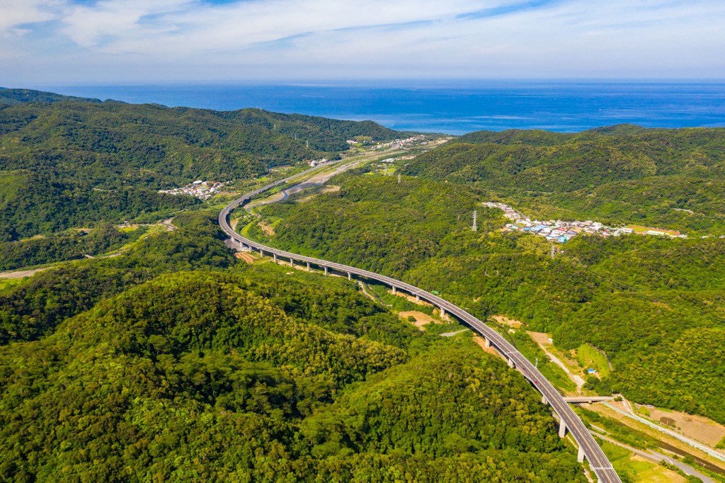
Pingtung County has varied terrain, with flatlands in the south that rise towards the peak-heavy north. Pingtung’s northern hills belong to the Central Mountain Range that runs along Taiwan’s center, forming a mountainous spine spanning north to south.
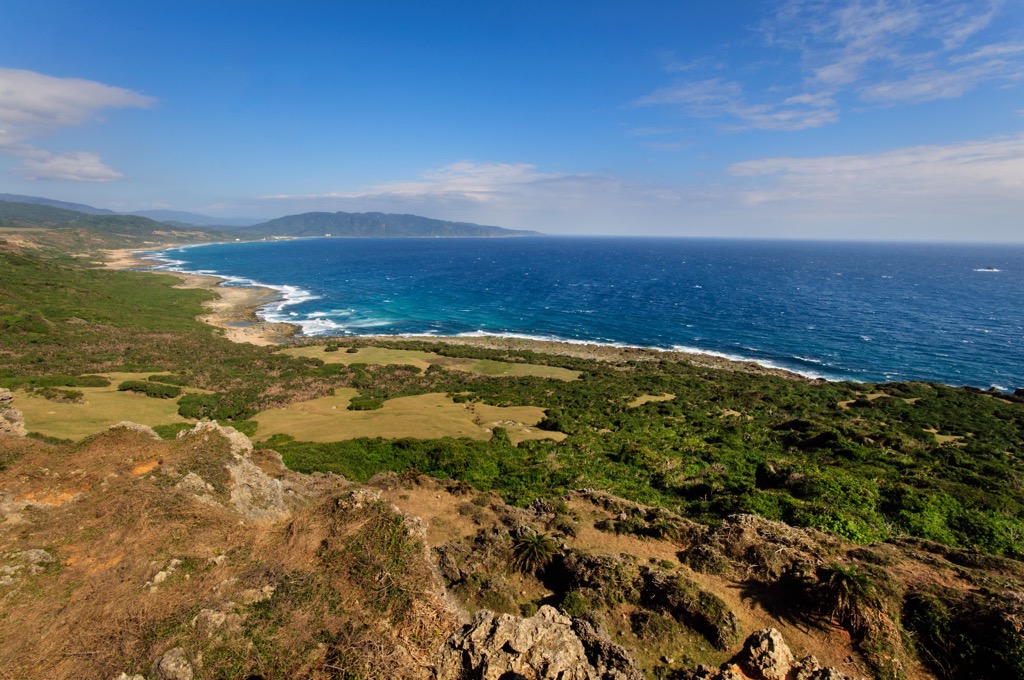
While the Central Mountain Range’s peaks are the tallest in Taiwan’s center, it tapers in height and sheerness towards its northern and southern ends. Therefore, Pingtung’s hills are primarily shallow and gentle, except for Beidawushan, which belongs to Taiwan’s 100 tallest peaks.
The rock strata are mainly shale and slate, with some mixture of sandstone and limestone.
Pingtung’s ecology is characterized by coastal plants and a tropical monsoon forest heading inland. Parts of Pingtung County that were once underwater are now exposed coral reefs where a thriving community of reef pemphis grow.
Other plants that thrive in the coastal forests are predominantly Moraceae and Lauraceae, such as the banyan, mulberry, and camphor trees. Fagaceae plants, like oak and beech trees, flourish inland at elevations above 1,000 meters (3,281 ft).

In Pingtung’s highest elevation, like Dawu Mountain Nature Reserve, the climate drops drastically, thus affecting plant life. The evergreen Quercus morii and the Cartwheel Tree are common warm-temperate trees, while the cool-temperate Taiwan cypress and Chinese yew are higher in elevation.
Pingtung County is the home of Taiwan’s indigenous Paiwan tribe. Having lived on this land for centuries, the Paiwan people hold specialist knowledge of Pingtung’s ecological paradise. Thus, Paiwan experts lead nature tours in Pingtung’s forests.
One of Taiwan’s historical incidents occurred in Pingtung County in 1874. A few years before the Japanese Occupation Era, stormy seas along Pingtung’s southern coast caused a shipwreck, leaving the 66 Okinawan crew stranded in Taiwan.
As the sailors ventured into the Paiwan’s territory, the Paiwan people massacred 54 Okinawans. The 12 surviving crew members fled and returned to Okinawa, retelling their horrors to the Japanese government.
At the time, the Qing dynasty ruled over Okinawa, so the Japanese government sought intervention and retaliation against the Paiwan. After the Qing dynasty ignored their pleas, the Japanese took fate into their own hands and planned a murderous attack on Paiwan villagers in 1887.
Thus, the Mudan Incident is known in Taiwan as a bloody battle. It created tensions between the Qing dynasty and the Japanese. Han Chinese immigration soared as the Qing dynasty planned to boost the Chinese population in Taiwan.

Pingtung County’s major hiking trails and areas area:
Southern Taiwan’s tropical botanical garden is a haven for nature lovers. Kenting’s forest holds over 1,000 plant species and is a plush jungle of leafy greenery.
Enter the woodlands of banyan trees with crisscrossing aerial roots, while ancient Chinese pistache trees and rubber plants also thrive in the humid environment. Enjoy the lush shaded path as you stroll through Kenting’s forest, an emerald wonderland.
Another of Kenting National Park’s attractions is the Fairy Cave, which was once submerged by water. Visit the magical grotto with dripping limestone stalactites and rounded stalagmites on the uneven floor.
Look above at the One Line Sky, a thin blue radiant light shining through the cave’s crack. One of Taiwan’s severe earthquakes shattered the hard limestone rock, creating a fissure in the hollow.
Admire the forest’s foliage from 27 meters (89 ft) above from the observation tower. Gaze out onto Kenting’s sandy bays, where the Bashi Channel washes up in foamy waves. You can also try to locate offshore Orchid Island in the distance to the east.
Outside the forest, you can head to Baisha Bay, Kenting National Park’s white sand beach. Take a slow stroll across the 400 meter (1,312 ft) seashore as you inhale the salty sea air and watch the tide break across the bay.
Make your way to Maobitou Park to observe sea-eroded rock extending towards the ocean. Southern Taiwan’s wind is fierce; thus, the reef is pockmarked and punctured from centuries of weathering. The sea is beautifully blue against the rock, and along the coast, you can observe the peaks of Santai Shan (三台山), Da Shan Mu Shan (大山母山), and Men Ma Luo Shan (門馬羅山).
Also, you can visit the southernmost tip of Taiwan, where Eluanbi Lighthouse is stationed. Supposedly Asia’s most illuminated watchtower, Eluanbi Lighthouse, is a famous landmark in Taiwan.
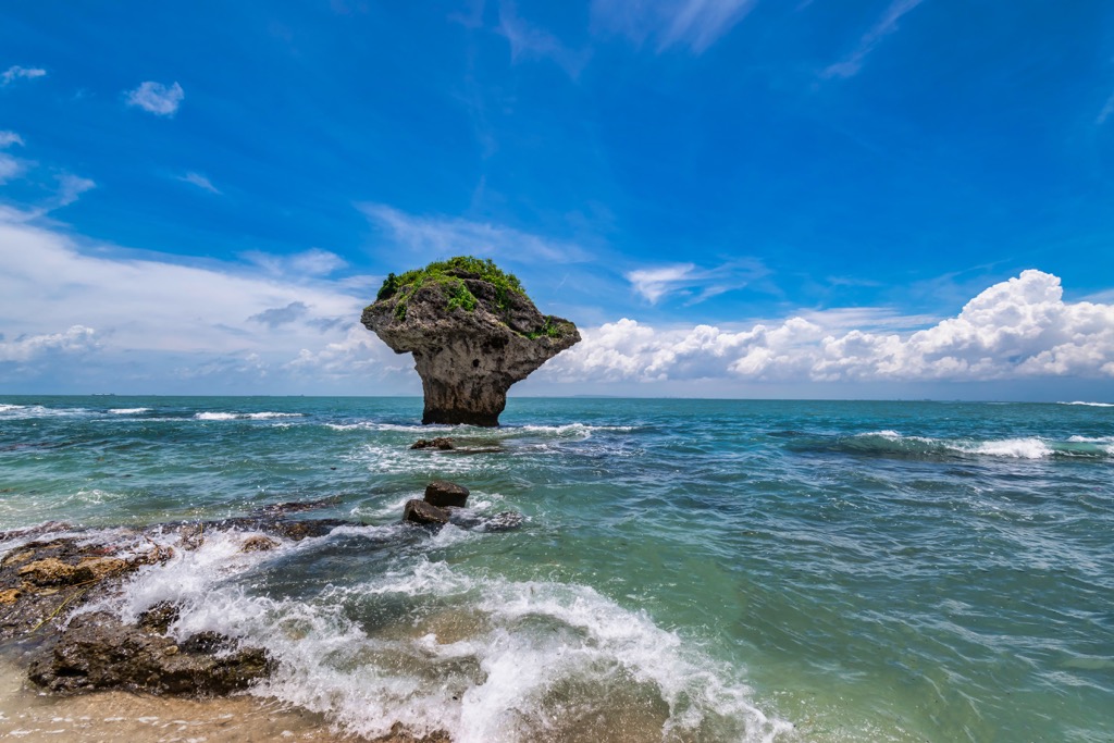
Located in the Taiwan Strait, Xiaoliuqiu is an offshore coral isle off the coast of Pingtung. If you love a remote island getaway with breathtaking scenery and pristine ecology, board the ferry at Donggang’s port.

Snorkel in the clear turquoise waters, where you’ll admire fascinating sea life, from clownfish to sea turtles. After a refreshing swim, lounge on Xiaoliuqui’s many white sandy bays to dry off and soak up the glorious Taiwan sun.
Don’t miss Vase Rock, Xiaoliqiu’s natural landmark. The striking coral outcrop, weathered into a top-heavy rock formation, lies in the intertidal zone. It’s one of your first sightings as you near Xiaoliuqiu on the ferry.
For stunning views over the small 680 ha (1,680 ac) islet, head to the White Lighthouse. You’ll gaze over the emerald landscape of an island jungle of dense banyan and bamboo.
Beidawushan’s 9km (5.6 mi) trek spans two days of intense hiking. After all, it is the southernmost Baiyue in Taiwan, so the journey shouldn’t be undermined.
This rugged, sheer peak is surprisingly decked with commemorative landmarks. At the trail’s 8km (5 mi) mark is the Takasago Volunteer Army monument. The memorial pays homage to Taiwan’s indigenous people, who the Japanese forced to fight in the Second World War. Many tragically lost their lives fighting for a country to which they didn’t belong.
Just past the Takasago Volunteer Army pillar are Dawu Temple and Otake Shrine. Both built by the Japanese, these posts remember the Japanese troops who did not survive Pearl Harbour’s bombings.
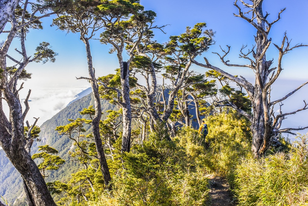
Although the terrain is remarkably challenging due to its steep and rocky path, the plant life and scenery are beautiful. The largest hemlock forest lies on Beidawushan’s slopes, as does a 1,000-year-old cypress tree measuring over 25 meters (82 ft). Hikers ascend above cloud cover to view a sea of foamy cumulus heaps.
While Beidawushan’s summit is obscured by plant growth, you can enjoy the prospect from the forest’s clearings. You’ll see Nandawushan’s (南大武山) smaller peak in the south as well as Pingtung’s southern coast. You can locate Yushan’s (玉山) sharp pinnacle to the north.
Explore Pingtung’s tropical monsoon forest as you hike to Wanlideshan (萬里得山), situated in the Nanrenshan Ecological Reserve. The hill is a smaller coastal mound, so the journey is short at 3 km (1.8 mi) and relatively easy.
Wander through wild and overgrown vegetation that sometimes covers the path. You may need to pass through emerald leafy tunnels as the plants extend in all directions in this evergreen jungle. You’ll feel entirely surrounded by nature with the echoes of birdsong and butterflies crossing your path.
Without much effort, you’ll reach Wanlideshan’s open summit, where you can bask in glorious views. Gaze out onto the turquoise shores on either side of Pingtung’s coast. You’ll locate Dajianshishan (大尖石山) and Dashanmushan (大山母山) to the south, eastern Piyishan (埤亦山) and Laofoshan (老佛山) in the west.
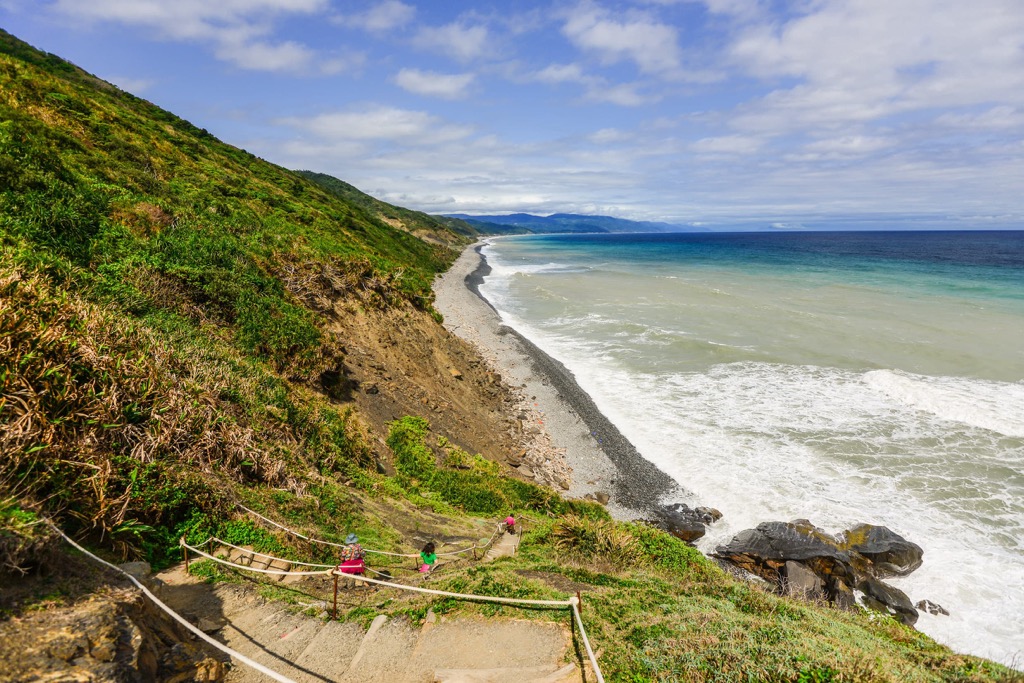
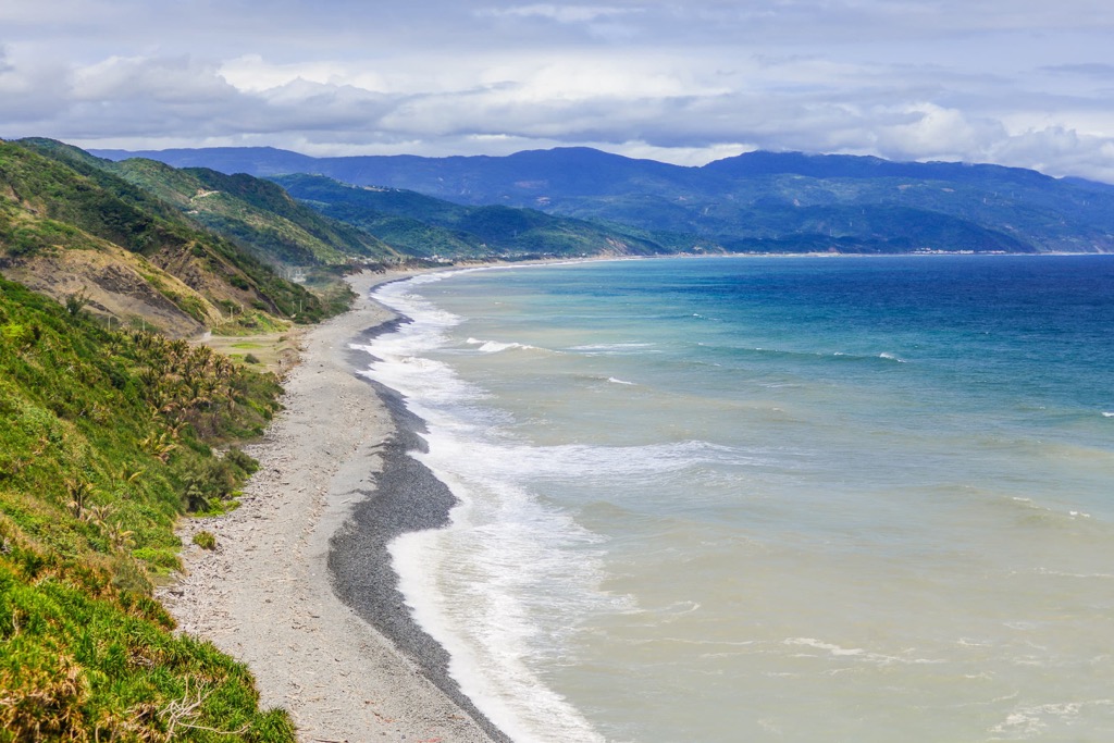
Once an old rural pathway that connected two villages along Taiwan’s east coast, the Alangyi Ancient Road is a popular trek. The 12 km (7.4 mi) linear route links Pingtung’s southern Xuhai Village (旭海村) to Taitung County’s (臺東縣) Nantian Village (南田村) in the north.
Along the trail, the deep blue Pacific Ocean laps on the eastern shores, a constant flowing sound of the roaring sea. The intense east coast winds have weathered the reef and rocks that line the shore. Take to the bays to admire the craggy outcrops and their striking formations. Nantian pebbles, known for their smooth texture from weathering, cover Taiwan’s southeast coast beaches along the route.
You’ll pass through the exuberant Guanyinbi Nature Reserve, where low-elevation forests and coastal ecosystems thrive. You may be lucky to spot green turtles swimming on the Guanyin bend.
If you want sweeping views of the luscious subtropical rainforest and undulating hillside, hike up Guanyin Shan (觀音山). You’ll gaze over the vast Pacific Ocean and see Nantian Shan (南田山) in the north, southern Qigu Balin Shan Dongfeng (耆古巴林山東峰) and the inland hill of Taihe Shan (太和山).
Enter the wonderland of green plumage of the Shuangliu National Forest Recreation Area (雙流國家森林遊樂區). Luscious camphor and banyan trees populate the dense woodlands where the spellbinding Shuangliu Waterfall flows. Once considered the second most beautiful cascade in Taiwan, it is a majestic sight.
You’ll begin the 3.2 km (2 mi) path near the visitor’s center, from where you’ll descend to the Fenggang River. Gently cross the flowing creek using the large stepping stones and keep your balance. Or, you can get your feet wet for a refreshing foot soak.
Formosan ash foliage shelters the path from where the elevation begins to rise towards Shuangliu Waterfall. The 25 meter (82 ft) gushing rapid produces 9,350 negative ions. Inhale the healing benefits of these atoms that improve blood circulation, awaken your senses, and induce mental clarity.
Pingtung County is one of Taiwan’s least populated regions. For this reason, there are not many large cities, but this is part of Pingtung’s magic. You’ll feel swept away by the mellow charm in Pingtung City (屏東市) and Hengchun Township (恆春鎮).

Pingtung City is a hidden gem in Taiwan and is the county’s laid-back capital. A lesser-visited place, Pingtung City, oozes in arts, culture, and slow-island living.
Visit the Taiwan Indigenous People’s Culture Park to learn about Taiwan’s native tribes. The 30 ha (74 ac) open-air museum exhibits the traditional homes of each tribe, so you can wander around and learn about the lifestyles of each culture.
For rustic views of Pingtung County, head to Gaoping Iron Bridge. This old railroad crossing was built during the Japanese Occupation Era to transport sugar cane from Pingtung County to Kaohsiung Harbor. It is now disused, but you can walk on the tracks to admire the scenery of sunflower fields and the winding Gaoping River.
Once the sun sets and the evening begins, set out to Pingtung Night Market to explore Taiwan’s food scene. Street vendors and food stalls fry and sizzle their unique dishes, and a trail of delicious aromas fills the air. Sample some bite-size snacks to taste Taiwan’s popular cuisine of turkey rice, swordfish soup, and beef noodles.

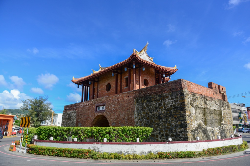
The gateway to beachy Kenting National Park, Hengchun Township is chilled and buzzing, especially during Kenting's festivals. This outdoor museum of ancient history is a beautiful spot to explore.
Hengchun Township boasts the best-preserved city walls in Taiwan, measuring 2,700 meters (8,858 ft) in length. The area is so tiny, so you can walk to the four gates (north, south, east, and west) within a few minutes. You'll be fascinated with the quality of the ornate gates and historic walls.
The pavilion near Yuquan Temple has stunning views over the city and southern coast. You can see Guanshan (關山) near the southwestern shore and gaze as far as the Bashi Channel in the south. It's a delightful spot to witness the glowing sunrise and sunset over the ocean.
Finally, for a quirky event, visit the Hengchun Pole Climb. Hosted annually, teams climb a 12-meter (39 ft) rod in a race to the top. This odd competition began when Hengchun was a prosperous city, and the wealthy sought a way to distribute their money. Today, the Hengchun Pole Climb is purely for entertainment, and people make their way to the small township each year to participate in the tradition.
Take the Taiwan High-Speed Rail (HSR) or local express train (TRA) to Kaohsiung City from Taiwan's major cities. From there, you can board another train to Pingtung City or take the Kenting Express bus that runs to Kenting National Park, stopping at Hengchun Township.
Alternatively, you can rent a car or scooter to explore Pingtung County. You can hire transport in either Kaohsiung City or Pingtung City on arrival.


Yes. Pingtung County has 290 named mountains. The highest is Beidawu Shan at 3,092 m.
The highest mountain in Pingtung County is Beidawu Shan, at 3,092 m.
Pingtung County has 290 named mountains.


