
Scan the QR code and open PeakVisor on your phone
A stunning natural area located in the heart of Taiwan, Yushan National Park is a popular outdoor recreation area known for its rugged mountainscapes. The park contains 120 named mountains, the highest and most prominent of which is Yushan (3,952m/12,966ft).
Yushan National Park is situated in the remote backcountry of Nantou County (南投縣) and it is where the heart of Taiwan, Yushan, is located. Yushan National Park (玉山國家公園) is a rugged expanse of 103,121 hectares (398.15 square miles) of mountainous land, bearing 3% of Taiwan’s total land area.
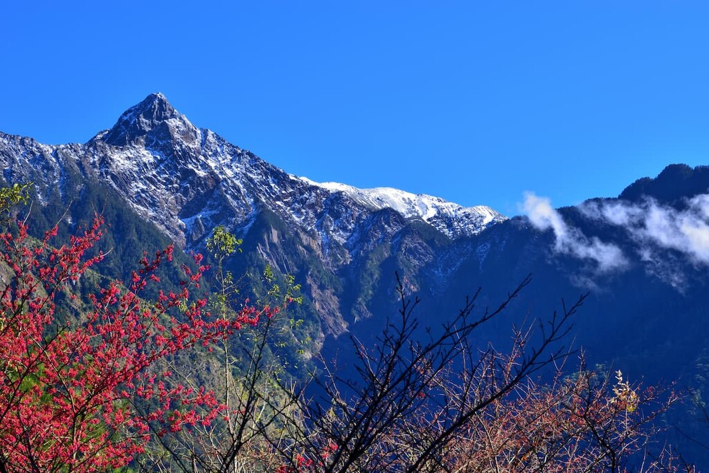
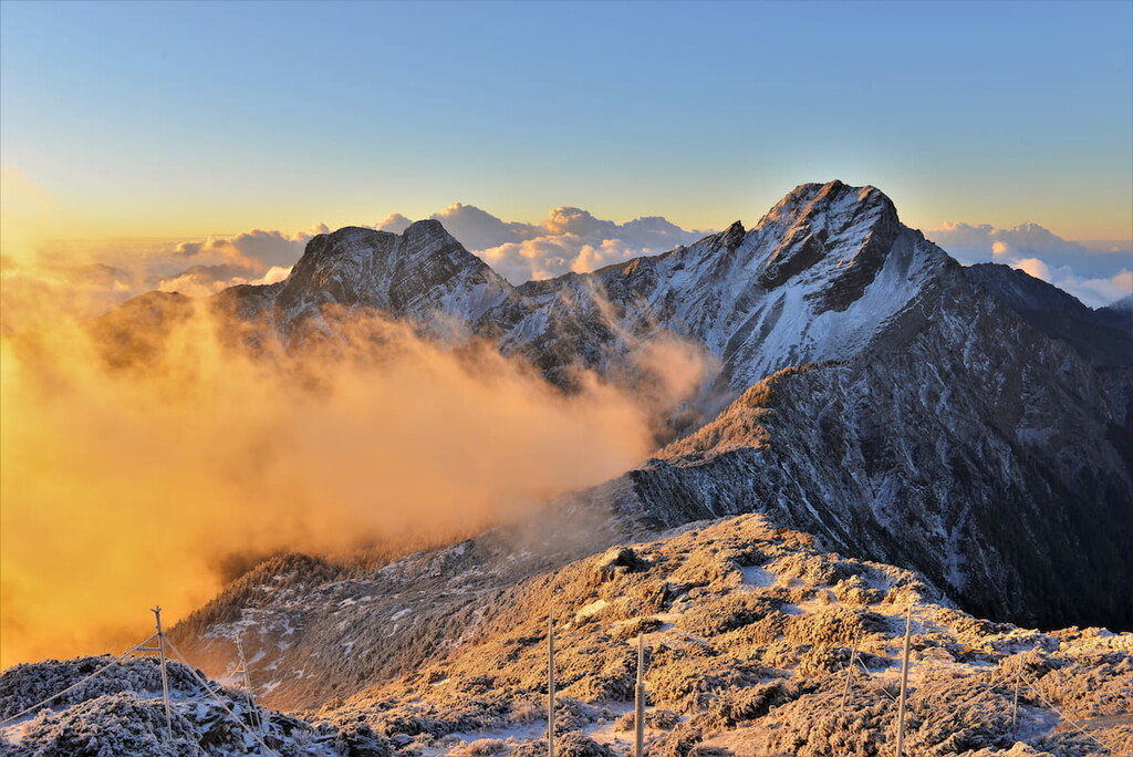
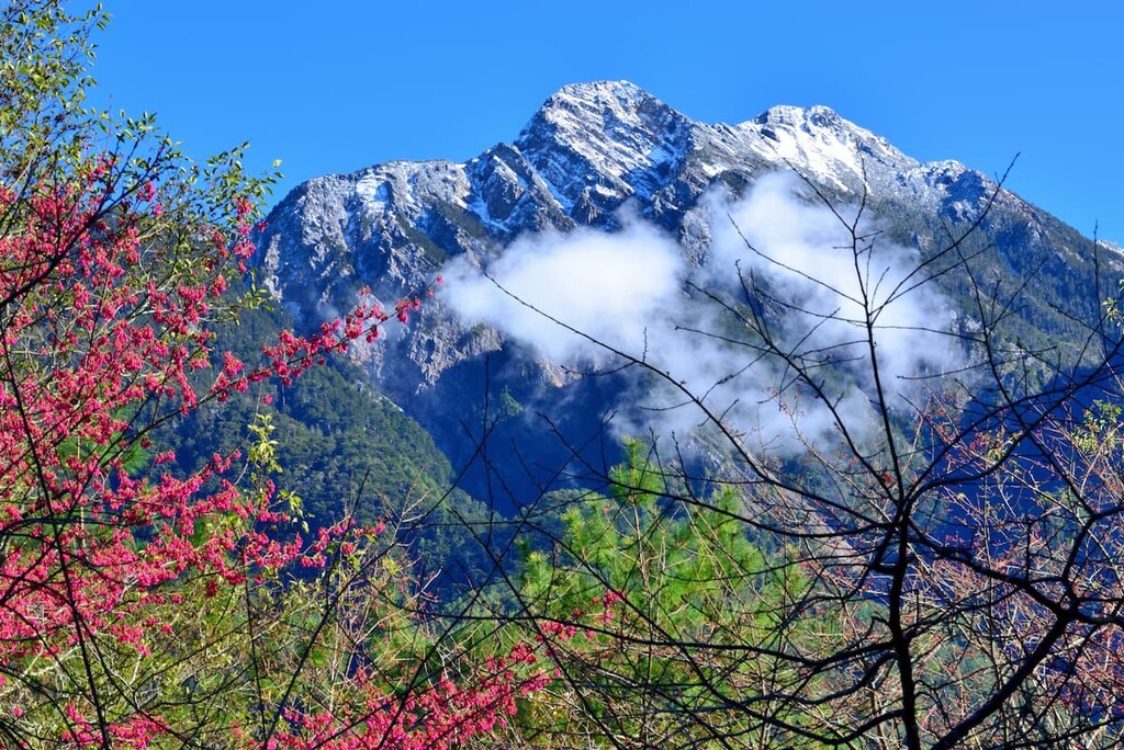
Holding the tallest mountain in Taiwan and northeast Asia at a whopping 3,952 metres (12,966ft) above sea level, Yushan National Park is most known for Yushan, or Mount Jade, which is its English translation and as otherwise known. Its name is derived from its wintertime imagery, as a thick blanket of snow covering Yushan is believed to resemble steel jade.
Yushan National Park finds itself situated among nearby parks and recreation areas. To the west of the park lies Alishan National Forest Recreation Area (阿里山國家風景區), while Huandong Coastal Reserve (花東沿海保護區) is located further east from the park. Sancha Mountain (三叉山) and the Xiangyang Mountain Special Scenic Area (向陽山特別景觀區) both sit north of the park.
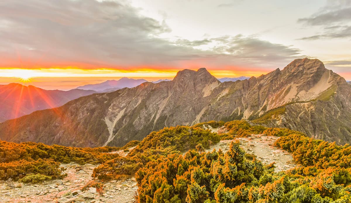
Yushan National Park also offers a thrilling assortment of geological rock surfaces due to regular seismic activity, as the island of Taiwan balances on powerful tectonic plates.
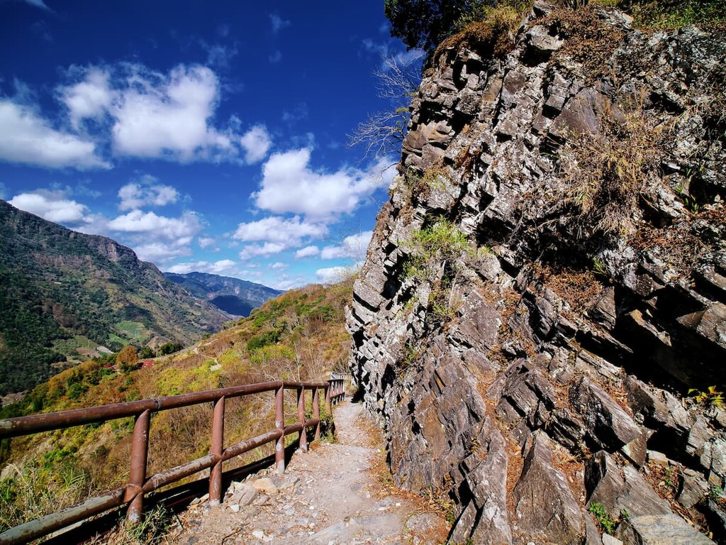
The fault scarp in Laonong, on the Batongguan Traversing Trail, displays the movement in fault lines as some faults have vertically shifted, causing them to rise amidst the inactive fault lines that lay dormant.
The Great Precipice found on the Yushan Peaks Trails is an excellent showpiece of geological wonder as prehistoric marine based fossils and rippled marks in the rock evidence the mountain’s ancient past as part of the ocean sea.
Yushan National Park boasts two range of the highest peaks in Taiwan, as the Central Mountain Range (中央山脈) and the Yushan Range (玉山山脈) intersect the park.
Encompassing a total of 120 peaks at an elevation above 3,000 metres (9,842 ft), Yushan National Park is a hikers dream and attracts global recognition as a hiking mecca.
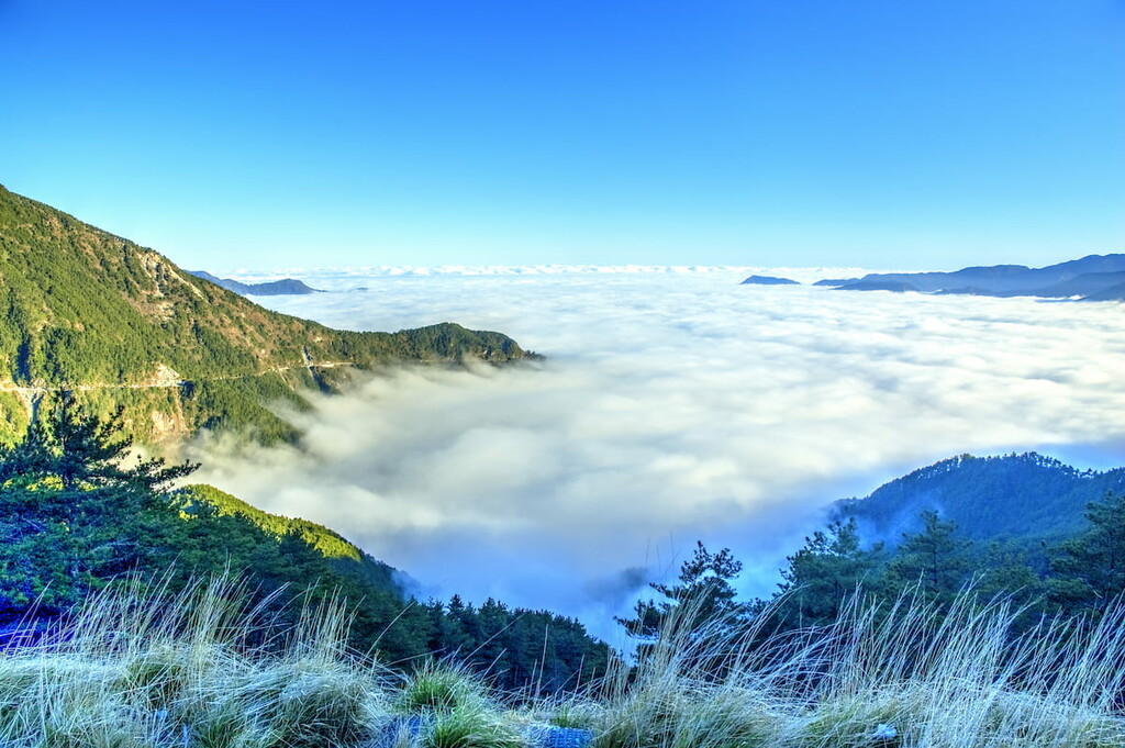
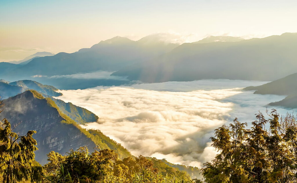
The elevation difference is 3,600 metres (11,811 ft) owing to the many steep cliffs, dense valleys, and deep canyons. Yushan National Park is considered to be one of the most scenic national parks in Taiwan as it offers a variety of vastly different landscapes from alpine grasslands to gushing waterfalls, craggy mountain ridges and thick, lush forests.
There are five focal mountains in Yushan National Park:
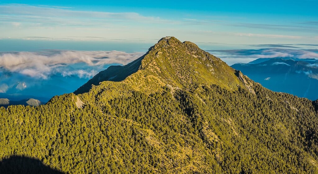
The most popular of these is Yushan Main Peak, being the tallest and most challenging peak, and is somewhat of a Taiwanese pilgrimage to summit the mountain.
The East Peak, which is a further 1.2 km (0.7 mi) slog from the Main Peak, is the next hardest climb, being the second highest peak and belonging to one of Taiwan’s Ten Major Summits.
The North Peak’s ridgeline silhouette resembles a camel’s back as two humps jut out of the mountain peak, and it is this image that is printed on the NT$1000 note. The South Peak, covered entirely in black shale, provides a contrasting geological setting, while the West Peak is lined with lavishly dense forests.
Other major peaks in the park include Xiuguluan Shan (秀姑巒山), Mabolasi Shan (馬博拉斯山), Guanshan (關山), Yun Feng (雲峰) and Xiangyang Shan (向陽山).
Yushan National Park holds a splendid and interesting variety of animals, birds, and insects. There are over 65 species of mammals that inhabit the park, most of which are protected by wildlife conservation by the Council of Agriculture of the Executive Yuan. In addition, 233 species of birds, of which 29 species are local to Taiwan, roam the park’s skies, while 16 species of freshwater fish occupy the mountain rivers and streams. Furthermore, the park contains a colossal 1,574 species of insects (including 285 species of butterflies), 46 species of reptiles, and 21 species of amphibians.
Half of Taiwan’s native plant species are grown in Yushan National Park. A staggering 2,055 species of flowers (comprising 475 monocots and 1,580 dicots) together with an incredible selection of 2,522 plants coexist in the park. A fascinating diversity of 433 species of ferns can be found, while 230 kinds of mosses and 147 types of fungi are discovered in the park.
The park also holds historical significance. During the Japanese Occupation Era, Indigenous peoples were forced to flee in the mountains, and the Japanese built police stations in the mountains in an effort to patrol and police the Indigenous peoples.
Although now abandoned, these police stations, as well as school buildings, still remain and can be seen when navigating the Battongguan Traversing Trail, offering a glimpse into the oppressed life of Indigenous peoples during this era.
The first sighting of Yushan was recorded during the Qing Dynasty by American captain, W. Morrison in 1857. As W. Morrison was leaving Anping Harbour aboard the Alexandra in Tainan, he noted the sight of the imposing peak of Yushan in the far distance. It is the first western document acknowledging Yushan.
During the Japanese invasion of Taiwan, Yushan’s surrounding area was recognised for its variety of biodiverse nature, and plans were drawn in the 1930s to create a national park. However, these plans were thwarted by the onset of World War II, and Yushan National Park only received its official status as a national park on 10 April 1985 by the Taiwanese government. In recent years, Yushan has become a symbol of Taiwanese identity, as it proudly appears on the NT$1000 note.
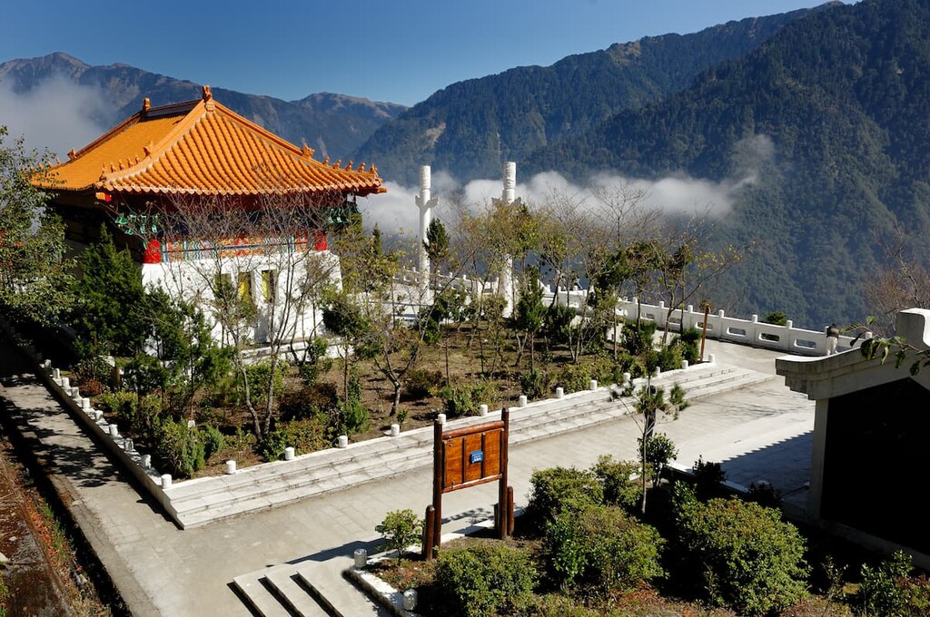
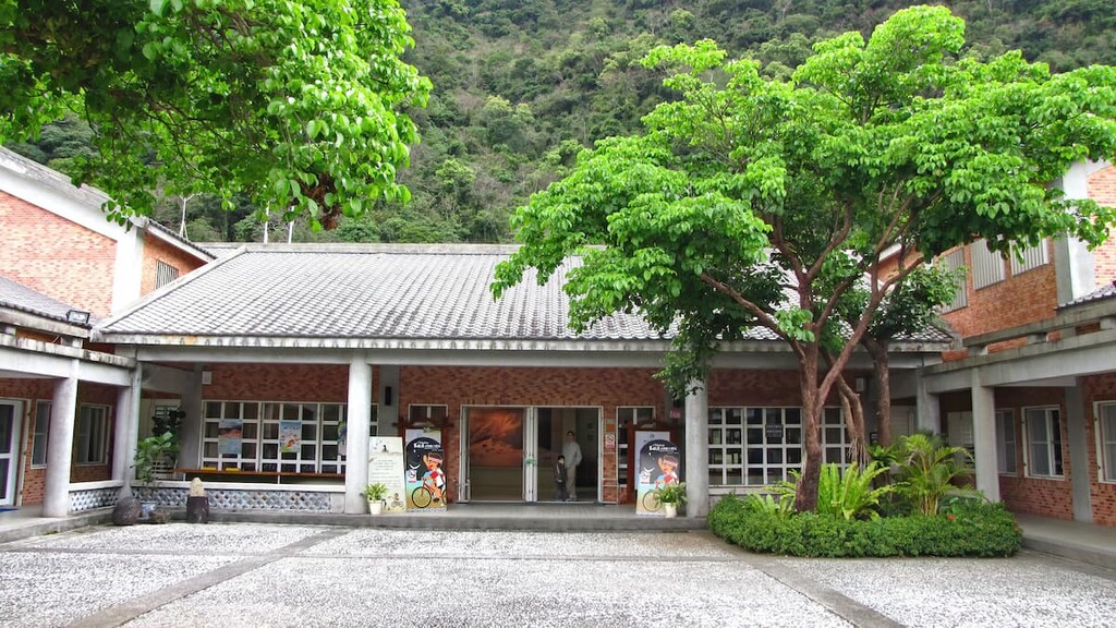
Yushan National Park has four visitor centres dispersed at different locations. Tataka Visitor Centre is located near the Tataka Saddle Trailhead, northwest of the park in Nantou County.
Meishan Visitor Centre sits on the Southern Cross Island Highway and is the gateway to the park from the south. Nanan Visitor Centre is located in the east of the expansive park in Zhuoqing Village of Zhuoxi Township in Hualien County. Shueili Visitor Centre is also located in Nantou County, however it sits just outside of the park.
It is notable to add that in order to scale any mountain in this park or to trek one of the many mountainous hiking trails, one first needs to apply for a permit. Yushan National Park official website has details on how to apply for this permit.
Yushan National Park offers hikers an abundance of trails to wander in its striking natural beauty.
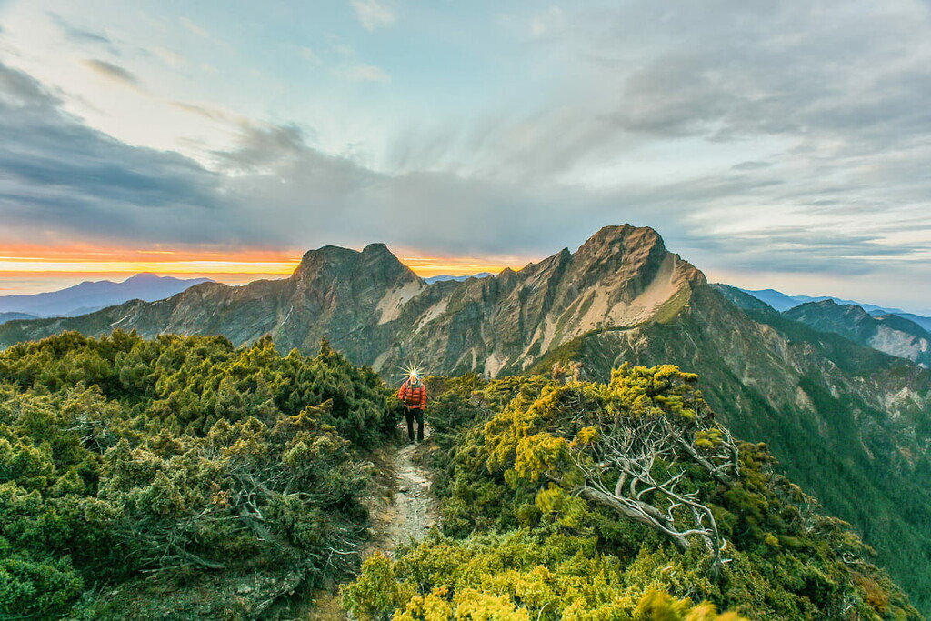
Yushan Peaks Trail holds the key journey to Yushan Main Peak. It also offers hikers the opportunity to head to the Yushan West Peak, Yushan East Peak, Yushan North Peak, Yushan South Peak and Dongsiaonan Peak.
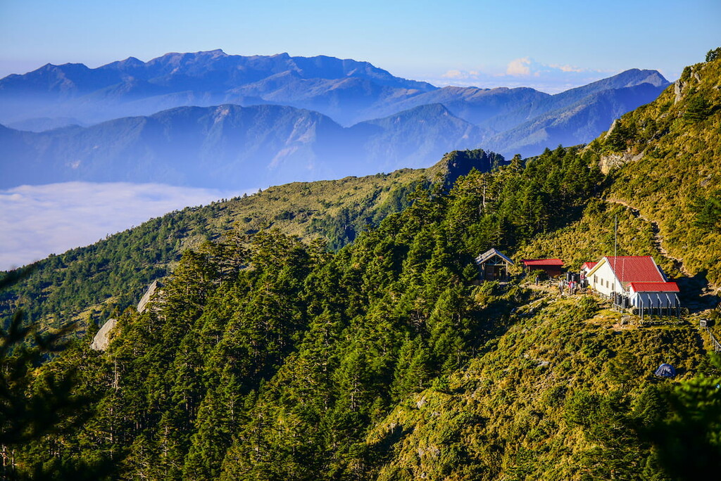
Hikers start the journey at the Tataka Saddle Trailhead, also known as Tatajia Saddle, following in the same direction. It is an 8.5 km(5.3 mi) climb from Tataka Saddle to Paiyun Lodge. Paiyun Lodge offers rest and accommodation to hikers, so if hikers decide to split the hike in two days, and they have pre-arranged their accommodation at Paiyun Lodge, they can board there for the night.
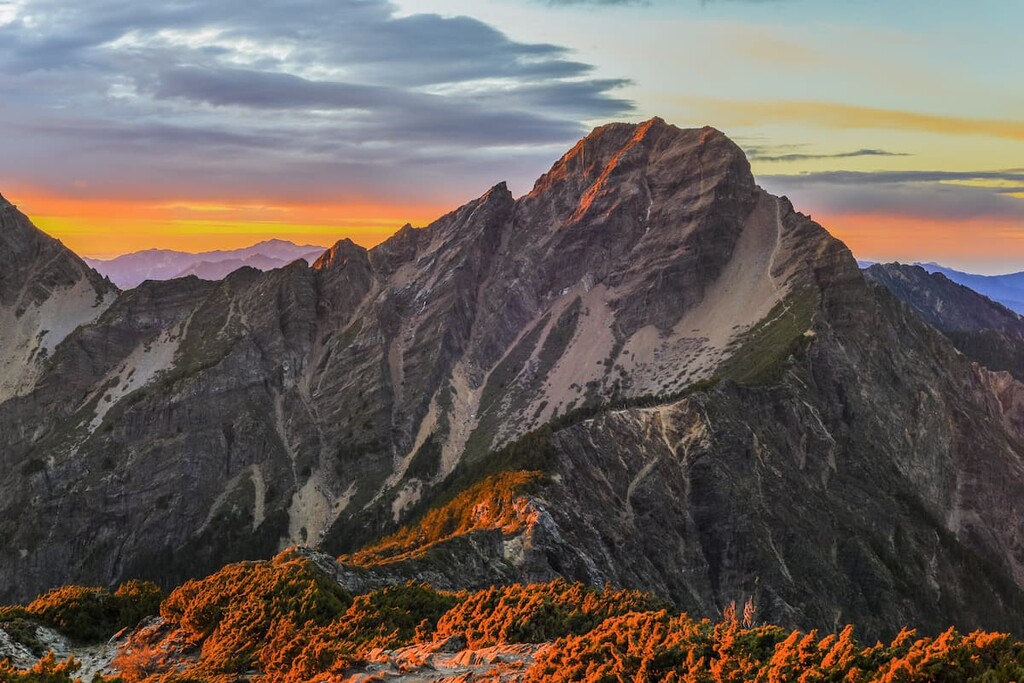
It is definitely possible to hike Yushan Main Peak in one day, however this will be a very gruelling journey so one needs to be in optimum physical condition. From Paiyun Lodge, it is a further 2.4 km (1.5 mi) hike to the summit of Yushan Main Peak, but because of the steep climb, loose rocks, and the high altitude, hikers need to take caution.
The view from Yushan Main Peak is spectacular, taking in the imposing vista of the surrounding peaks.
Hikers can set off to Yushan West Peak from Paiyun Lodge, which is a further 2.2 km (1.4mi) hike, however ensure that there is enough time to get there and back before sunset. Visibility is essential when hiking as loose rocks and muddy paths could cause a severe injury.
For hikers wanting to hike to Yushan North Peak, simply carry on the journey from Yushan Main Peak, however, ensure that time is aplenty to return within daylight hours back to Paiyun Lodge or Tataka Saddle.
As already stated, the East Peak is a 1.2 km (0.7mi) trek from the Main Peak, while the South Peak and Dongsiaonan Peak is a bit further afield from Paiyun Lodge. Hikers wanting to reach these two peaks have the option to rest at Yuanfong Cottage, provided it has been arranged beforehand, before reaching the summit
The Batongguan Traversing Trail offers both idyllic scenic views and interesting historical remains. This trail is a maze of lush forest leading to heavenly, cascading waterfalls.
Yunlong Waterfall is a striking goddess of nature, sitting high at 70 metres (230 ft) as water tumbles down its long neck. This stunning sight can be enjoyed from the safety of the conveniently placed suspension bridge.
This trail has numerous hardy suspensions bridges that allow crossing over deep gorges and furious rivers, which offers a chilling yet majestic view of the land and activity below.
Dashuiku, 37.8 km (23 mi) from the Dongpu Trailhead and 3,210 m (10,531 ft) above sea level, offers a different perspective as it boasts vast plains of mountain grass situated around a still alpine lake.
The area of Dafen, which is 22 km (13.7mi) from Dashuiku, is a former trading post, and this is where there still remains an old police station, school, and ammunition depot.
The Batongguan Traversing Trail was formed during the Qing Dynasty as a means to create a path connecting the rugged east to the urbanised west. During the Japanese Occupation Era, extensions to this trail were added to police the aborigines who were forced to flee in this mountainous area.
The Batongguan Traversing Trail offers a historical perspective of Taiwan during the Japanese Occupation Era, and artefacts such as bottles, tools or coins can still be discovered hidden in the grassy plains.
This eight day moderate level hike covers 96 km (60mi) in length spanning from east to west across Yushan National Park. The trail can either begin or end at the Dongpu Trailhead in Nantou County, a hot spring town, and it continues all the way to the Shangfeng Trailhead, 6 km (3.7mi) shy of the Nanan Visitor Centre near Zhuoxi, in Hualien County.
There are many smaller trails on this extensive route that can be accomplished in a day. One such trail is the popular 14 km (8.7mi) stretch of the Walami Trail, beginning from the Shangfeng Trailhead.
It needs to be highlighted that while this trail receives regular maintenance, typhoons may collapse some paths along the trail, making it extremely challenging to progress safely with the hike. Formosan black bears (臺灣黑熊) are also known to stumble across this route, and if one is spotted nearby, it is best to remain calm and make no sudden movement. Instead, gingerly inch away creating distance, and once out of sight then hasten to an area that is safe from the bears.
The Southern Section Two Trail is reserved for seriously skilled hikers. Most of the trail operates at 3,000 metres (9,840ft) above sea level, and climbs of 1000 metres (3,200ft) are soon met with descents of 1000 metres (3,200ft), as one zigzags their way up and down this punishing trail.
One incentive is that the route is devoid of crowds due to its challenging course involving steep climbs, dramatic cliffs, and high altitude. It is not only the gruelling nature of the hike that appeals to staunch hikers, but this trail is known for its changing landscape as one ascends through the clouds to a majestic view of rugged backcountry then being met with shaggy grassy plains and craggy cliffs upon descent.
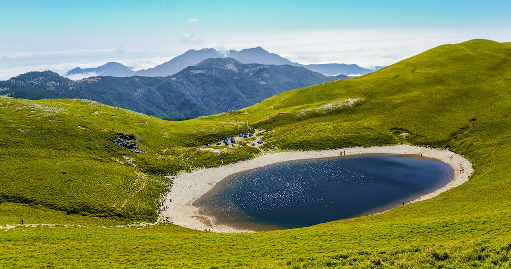
Jiaming Lake (嘉明湖), which lies a mere 11.6 km (7.2mi) from the Xiangyang Trailhead, is an attractive alpine lake, sitting at an elevation of 3,310 metres (10,859ft) and is considered to be so clear and reflective that it looks like a large pearl had been deposited in the mountain.
The Southern Section Two Trail is a point-to-point hike, so one can start the hike at either point from the Xiangyang trailhead situated on the South Crossland Highway or from the Dongpu trailhead. The length of this hike is 89.3 km (55.4 mi) and it is estimated to take seven days to complete the full hike, but once again, hikers have the option of hiking only a section of the trail.
Perhaps the most strenuous and challenging trail as it is considered as one of the four great obstacle courses in the hiking world, the Mabolasi Crossing Trail lines the northeast ridge of Yushan National Park.
The Mabolasi Crossing Trail measures 96.3 km (59.8mi) across eight days, starting at Dongpu Trailhead in Nantou County and commencing at the exit of Yulin Bridge of Yuli Forest Trail, in Hualien County.
Highlights of this trail are the sweeping views of the dramatic, raw, rugged peaks of the surrounding mountains from Xiuguluan Mountain and Mabolasi Mountain, number one and two peaks respectively of the Central Mountain Range.
This trail is reserved only for the most advanced hikers who can manage to remain calm in the face of its chillingly steep cliffside walks and unstable rocky terrain. Extreme caution must be heeded when traversing the cliffside paths between Malijianan Mountain and Maliyawenlu Mountain, and hiking ropes are gravely recommended to ensure safety amidst loosely rocky terrain and intense vertical drops.
Crossing the gnarly Wulameng escarpment will be a highlight for the brave, as it involves navigating unstable terrain on a mountain cliff. The Zhongping Forest Trail, which is the last 17 km (10.5 mi) stretch of this hike, is lined with dense thicket of trees and veiled with mountain mist and mossy overgrown paths, making the scenic journey a sightly spectacle.
An array of vastly different landscapes is displayed along this 64 km (39.7 mi) hiking route that rests on the southeast boundary of Yushan National Park. Tranquil lake views of Jiaming Lake, fields of grassland on Sancha Mountain, incredibly steep cliffs of Xinkang Mountain and its distinctive looking peak are some notable features that this trail unveils.
The Xinkang Crossing Trail can pack a few hair-raising moments as the landscape is excessively steep, and thus the use of hiking ropes is strongly endorsed. As most of this trail sits at an elevation of 3,000 metres (9,842 ft), it presents a problem in the lack of water sources along the route, so hikers need to plan in advance to ensure a plentiful supply of water to last the duration of the five day hike.
The culmination of the first day’s hike leads to the marvellous alpine beauty of Jiaming Lake, which provides hikers with a last-minute opportunity to refill their water supply if it is worryingly low. Hiking the Xinkang Crossing Trail feels like one is literally climbing through clouds due to its high elevation, while the nature of the hike is incredibly brutal and the terrain physically taxing.
The Southern Cross-Island Highway Three Mountains and Guan Mountain Hiking Route offers a series of trails that can be completed individually or as one long hiking trail. Thus completing this trail can last from one day to four days depending on the route chosen.
This route welcomes the likes of intermediate level hikers who want more of a relatively gentler and shorter hike, but who still desire to witness the dramatic mountain scenery.
The three mountains are Kuhanuoxin Mountain, Taguan Mountain, and Guanshanling Mountain, and the forth mountain being Guan Mountain. Guan Mountain is a striking piece of rock, as it bears resemblance to the shape of a pyramid. Each mountain has its own trailhead, each of which is dotted along the Southern Cross-Island Highway.
While this trail attracts more people based on its short course and friendlier terrain, all four mountains have an elevation of over 3,000m (9,840ft), so a steep climb is guaranteed.
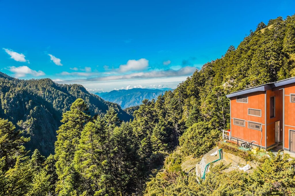
Paiyun Lodge sits at an elevation of 3,402m (11,161ft), and is only a mere 2 km (1.2 mi) from the summit. For hikers wishing to break their climb to Yushan Main Peak into a two day hike, there is only one inn offering lodging on this mountain. If hikers want to spend the night on the mountain, there are no camping options available, so it is essential to book a bed in the lodge.
With only one hundred beds available and taking into account the popular nature of the hike, hikers need to book their spot here at least thirty five days to four months in advance to secure a space.
When hikers apply online for their permit to hike Yushan, they will be provided with the option to book their stay at Paiyun Lodge, provided that it is at least thirty five days prior to their hike.
There is a quota of twenty four beds that is allocated to foreigners who plan to hike during the week (Sunday night to Thursday night), however this is not offered over the weekend, so foreigners have a better chance of securing a bed during the week.
There is only one way to get to Paiyun Lodge, and that is up. Just off the New Central Cross-Island Highway 18 lies the Tataka Saddle, the trailhead to Yushan National Park, which hikers need to climb 8.5 km (5.3mi) to reach Paiyun Lodge. Food is provided at a cost.
Meals and bedding must be reserved at least seven days before your trip. In the event that meals are not booked beforehand, it is essential to bring your own premade food to the lodge. Water is provided should you wish to boil your food or make yourself a cup of tea or coffee.
Some hikers opt to stay at Dongpu Lodge before they start their ascent up Yushan Main Peak or if they wish to embark on one of the nearby trails. This lodge is situated just off Highway 18 only 3.3 km (2.1mi) away from the Tataka Saddle trailhead.
Before beginning the trail, a visit to Tataka Police Squad is required to present your hiking permit. From there a shuttle service operates dropping you off at the trailhead and later picks you up.
The shuttle service operates between 6:30am to 5pm and runs both ways every fifteen minutes. If you are heading off in the early hours of the morning to begin your hike, you will probably have to walk 3.3 km (2.1mi) to the trailhead.
Unlike Paiyun Lodge, you do not need to apply for a permit to stay at this hostel. It should be noted that the facilities of this lodge are more on the humble side, so do not expect luxury treatment as it is a simple resting place.
While there are many campsites and cabins along trails to offer rest, all of which require a permit for lodging, if one is searching for comfort in a freshly made bed and hot showers, then there are other options to stay just 20 km (12.4mi) outside Yushan National Park in Alishan. Another option is to stay in XInyi, just 40 km (24.9mi) away.
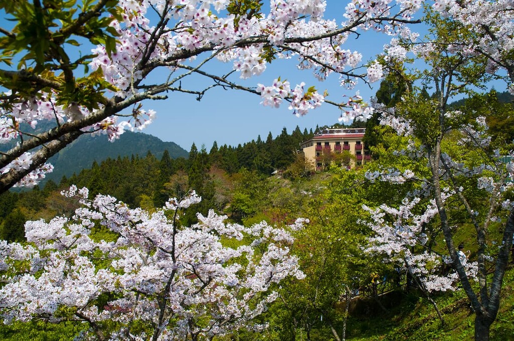
Accommodation is plentiful in Alishan. There is the Cing Shan Hotel situated right on the doorstep of the beautifully scenic Alishan National Forest Recreation Area. The four star Alishan Hotel promises the most luxury as it houses a spa and wellness centre, while the Alishan Tea Homestay offers sweeping mountain vistas. All options offer free Wi-Fi and flat screen televisions in every room.
One also has sufficient options if staying in Xinyi. One popular attraction in Xinyi is the Dongpu Hot Spring, which is a superb way to relax tired and aching muscles after a long day of hiking. Accommodation ranges from Dongpo Ti Lun Hotel that is situated in the Dongpu Hot Spring Village to the much loved and cosy Umas Hostel and the highly rated Tabakai Homestay.
If you are coming from the big cities of Taipei, Taichung, Tainan or Kaohsiung, take the train to Chiayi. Once at the Chiayi Train Station, several options are available.
Hop on the 7322 bus, which operates four times a day, headed to Alishan. This journey will take 2 hours and 8 minutes. Once in Alishan, change to the twice daily 6739 bus headed to Sun Moon Lake which is a 41 minute journey to Tataka Visitor Centre.
Another option is to take a taxi from Chiayi which would cost around NT$2000 to NT$2500, or to hire a car for the 86 km (53 mi) journey and drive there directly taking 1 hour and 23 minutes along the New Central Cross-Island Highway 18.
If coming from Sun Moon Lake, board the twice daily 6739 bus to Tataka Visitor Centre which is a near three hour journey.

If one finds oneself on the east coast of Taiwan, the best option would be to drive directly to Yushan National Park.
Driving to the Tataka Visitor Centre from Hualien is a mammoth journey, taking just over five hours and driving 260 km (161mi). The drive is even more intense from Taitung, crossing 358 km (239mi) over five hours and twenty minutes.
From Hualien, the Nanan Visitor Centre in Yushan National Park is the closest in distance, and is a one hour and forty five minute drive across 96 kilometres (60 mi). From Taitung, the journey spans 86 km (53mi) taking one hour and thirty five minutes.
The Nanan Visitor Centre is 6 km (3.7mi) from where the Batongguan Traversing Trail and the Xinkang Crossing Trail begins.


tw100
ultra
taiwan-high-three
taiwan-ultras
tw100
ultra
taiwan-high-three
taiwan-ultras


