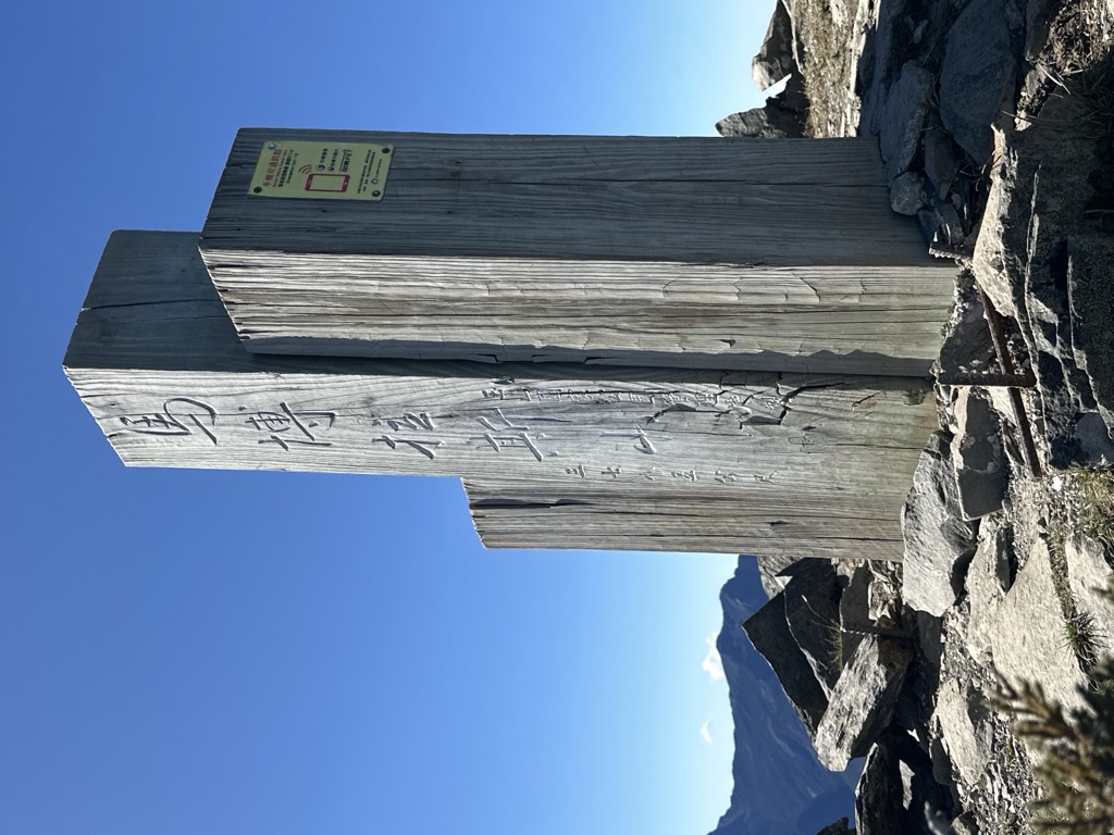
The Mount Mabolasi (traditional Chinese: 馬博拉斯山; simplified Chinese: 马博拉斯山; pinyin: Mǎbólāsī Shān) is a mountain in Taiwan. The peak is located in Xinyi Township, Nantou County, near the border of Hualien County. It is also known as the Mount Wulameng (traditional Chinese: 烏拉孟山; simplified Chinese: 乌拉孟山; pinyin: Wūlāmèng Shān).
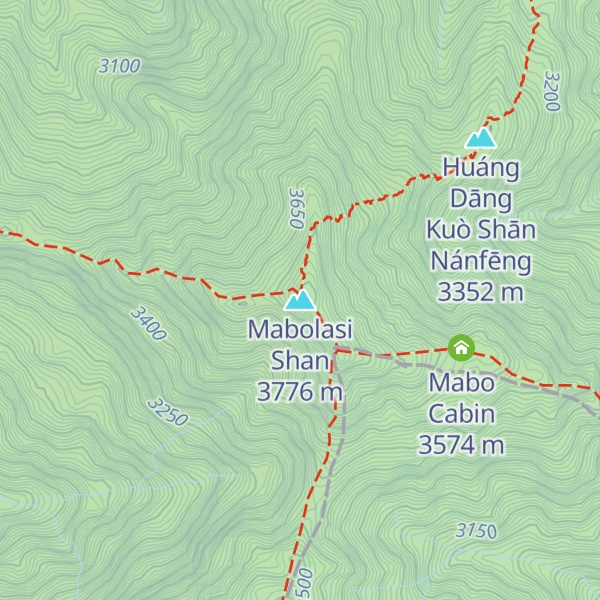
There's a trail called 盆駒山步道 leading to the summit.
The nearest mountain hut is Mǎ Bó Lā Sī Shān Wū located 738m/2 421ft ESE of the summit.
By elevation Mabolasi Shan is
# 11 out of 4492 in the Taiwan Mountains # 6 out of 510 in Nantou County # 8 out of 2855 in Taiwan Province # 9 out of 121 in Yushan National Park # 11 out of 4586 in Taiwan # 1 out of 73 in 核心資源保護區 # 2 out of 1249 in the Central Mountain Range
By prominence Mabolasi Shan is
# 23 out of 510 in Nantou County # 97 out of 2855 in Taiwan Province # 11 out of 121 in Yushan National Park # 5 out of 73 in 核心資源保護區 # 61 out of 1249 in the Central Mountain Range
We use GPS information embedded into the photo when it is available.
3D mountains overlay
Adjust mountain panorama to perfectly match your photos because recorded by camera photo position might be imprecise.
Move tool
Rotate tool
Zoom
More customization
Choose which peak labels should make into the final photo and what photo title should be.
Next
Photo Location
Satellitte
Flat map
Relief map
Latitude
Longitude
Altitude
OR
Latitude
°'''
Longitude
°'''
Apply
Register Peak
Peak Name
Latitude
Longitude
Altitude
Register
Teleport
PeakVisor
This 3D model of Sagarmatha National Park in Nepal was made using the PeakVisor app topographic data. The mobile app features higher precision models worldwide, more topographic details, and works offline. Download PeakVisor maps today.
Download OBJ model
PeakVisor
The download should start shortly. If you find it useful please consider supporting the PeakVisor app.
PeakVisor for iOS and Android
Be a superhero of outdoor navigation with state-of-the-art 3D maps and mountain identification in the palm of your hand!