
Scan the QR code and open PeakVisor on your phone
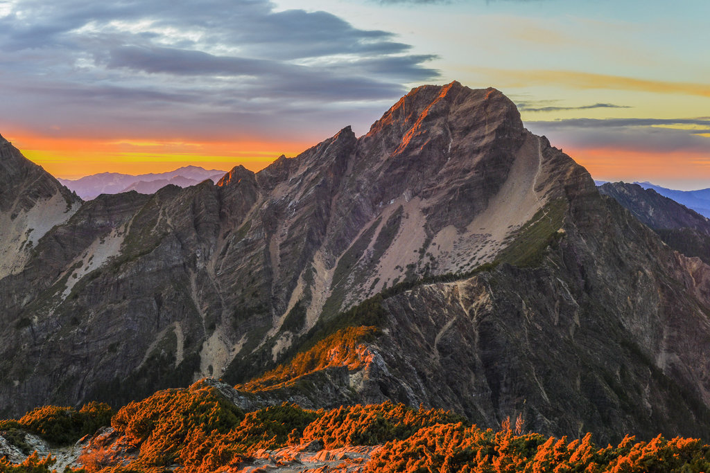
Core Resource Conservation Area has 90 named peaks. The highest is Yushan / Jade Mountain at 3,952 m. Other notable peaks include Yushan East Peak / Jade Mountain East Peak, Yushan North Peak / Jade Mountain North Peak and Yushan South Peak / Jade Mountain South Peak.
The vast protected area known as the Core Resource Conservation Area (核心資源保護區) is located inside central Yushan National Park (玉山國家公園) in Taiwan. There are 90 named mountains in the conservation area, the highest of which is Mabolasi Shan (馬博拉斯山) at 3,805 m (12,483 ft) in elevation. Meanwhile, the most prominent peak in the area is Xinkang Shan (新康山) with a prominence of 3,952 m (1,890 ft).
The Core Resource Conservation Area is the largest region within Yushan National Park in Taiwan. It includes part of three counties: Xinyi Township (信義鄉) of Nantou County (南投縣), Zhuoxi Township (卓溪鄉) of Hualien County (花蓮縣), and Taoyuan District (桃源區) of Kaohsiung City (高雄市).
The Core Resource Conservation Area contains the central components of Taiwan’s steepest hills in the Central Mountain Range (中央山脈). Out of 73 peaks in the conservation area, 12 are part of Taiwan’s 100 tallest hills, which are also referred to as Baiyue.
Besides Mabolasi Shan and Xinkang Shan, the other Baiyue in the conservation area are Yushan West Peak (玉山西峰), Nanshuangtou Shan (南雙頭山), Lulu Shan (轆轆山), Maxi Shan (馬西山), and Batongguan Shan (八通關山).
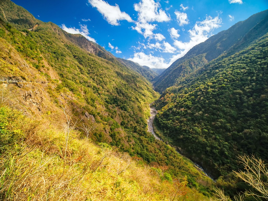
While the conservation area contains high hilly peaks, the topography of the region wavers as pockets of deep valleys and river beds dissect the landscape. For this reason, a plethora of plant life is found in the conservation area.
With the differing elevation levels of the Core Resource Conservation Area, the regional climate changes dramatically with height. In the lower reaches of the region, there’s an annual average temperature of 68°F (20°C). As the elevation climbs to 2,500 meters (8,202 ft) and above, the average temperature lowers to 52°F (11°C). From 3,500 meters (11,483 ft), and above, the average temperature drops to 43°F (6°C).
The combination of low temperatures and gusty winds carrying moisture from the Pacific Ocean in the east create a rather damp and muggy environment in the conservation area. In fact, average humidity levels hover around 80 per cent. Thus, rainfall is abundant in the Core Resource Conservation Area, which receives an average of 3,000 to 4,700 mm (118 to 185 in) of rain per year.
Other areas of interest surrounding the Core Resource Conservation Area include Danda Major Wildlife Habitat (丹大野生動物重要棲息環境) to the north and Guanshan and South Hinogu Special Landscape Area (關山、南橫檜谷公路沿線特別景觀區) to the south.
Additionally, Yuli Wildlife Reserve Core Area (玉里野生動物保護區 核心區) is located to the east and Alishan National Forest Recreation Area (阿里山國家森林遊樂區) is situated the west of the conservation area.
The hills of the Core Resource Conservation Area belong to two of Taiwan’s top mountain ranges. Yushan West Peak and Yushan Front Peak (玉山前峰) are part of the Yushan Range (玉山山脈), which contains Taiwan’s tallest mountain, Yushan Main Peak (玉山主峰).
The remaining peaks are part of Taiwan’s longest chain of peaks, the Central Mountain Range. This range stretches from Pingtung County (屏東縣) in the south to New Taipei City (新北市) in the north.
Geologically, the Yushan Range primarily consists of unmetamorphosed rock dating back to the Miocene. Meanwhile, slate and shale from the Eocene to Miocene dominate the bedrock of the Central Mountain Range.
Due to the extreme elevation changes throughout the Core Resource Conservation Area, the area is home to five different forest types.
Most of the region's highest elevations feature the hardy Pseudosasa japonica bamboo that thrives despite the alpine zone’s harsh climate. Yushan cane also thrives above 3,600 meters (11,811 ft), as does Yushan juniper.
Between 3,100 to 3,600 meters (10,170 to 11,811 ft) in elevation, a dense fir forest dominates the landscape. A mixed coniferous and broadleaf forest is found at these elevations. The primary tree species here are Taiwan hemlock, Taiwan spruce, Taiwan red pine, Formosan alder, and brown oak.
In the lower elevations of the conservation area, the fir forest belt dominates. Here, Taiwan hemlock stands tall within a hemlock-spruce forest that exists between 2,500 to 3,100 meters (8,202 t0 10,170 ft) in elevation.
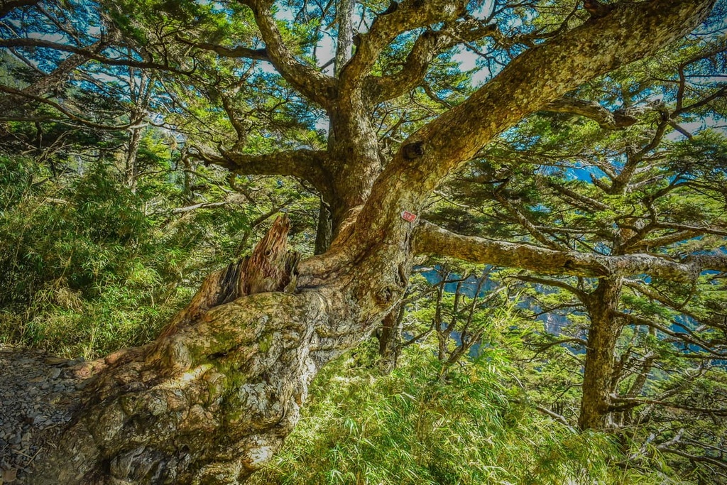
Between 1,500 to 2,500 meters (4,921 to 8,202 ft), the flora is quite varied. Many plants, including Lauraceae, Fagaceae, broadleaf, and coniferous plant life thrive in this area. The coniferous Taiwan red cypress grows on the shaded, wet slopes, while the exposed sunny mountain slopes are a suitable area for camphor trees. Japanese maple, Taiwania, and Alishan elm all grow here, too.
Finally, between 500 and 1,500 meters (1,640 to 4,921 ft), the region is home to the Michilus-Castanopsis forest, which features Formosan phoebe, Taiwan Douglas-Fir, and Machilus pseudo longifolia.
The wildlife of the Core Resource Conservation Area is just as varied as the plant life. The Formosan black bear is known to wander the high mountains of this area, as is the Taiwan serow. Formosan rock macaques and Taiwan wild boar are some of the other 65 mammal species found in this region.
Birdsong echoes throughout the conservation area, too. A total of 233 species of birds have been recorded in the Core Resource Conservation Area. The most common species are the red-billed black bulbul and the white eye thrush.
The rivers running through the Core Resource Conservation Area contain 16 groups of freshwater fish and 21 species of amphibians. In addition, there are 46 species of reptiles and a staggering 286 species of butterflies in the conservation area.
The Batongguan Yueling Ancient Road stretches across the Core Resource Conservation Area. This old path dates back to the Japanese Occupation Era. However, even though the Japanese sought the resources of the region's forests for economic and practical purposes, the land that is now part of the conservation area is the traditional territory of the Bunun tribe, who have lived in the region for countless generations.
As a result, the Japanese constructed a surveillance road through the region and forced the Bunun to live next to it. Life was not easy for the Bunun when they were forced to live on the Batongguan Yueling Ancient Road, where they were constantly under surveillance.
Yushan National Park, which contains the Core Resource Conservation Area, was founded in 1985 in order to protect the region’s fantastic landscapes and biodiversity.
Some of the most coveted hiking trails and areas to discover in and around the Core Resource Conservation Area include:
Batongguan Yeuling Ancient Road is now a popular path to hike. As the road continually rises and dips between elevations of 452 to 3,220 meters (1,483 to 10,564 ft), a fascinating journey awaits hikers on the road as they encounter a myriad of forest belts, plant communities, and changing landscapes.
The appearance of banyan and camphor trees in lower elevations mark the presence of subtropical broadleaf plants. As hikers begin to climb, the environment gradually transforms, most significantly above the cloud cover belt where a constant haze of mist envelopes the environment.
Along the road, history is alive with written rock carvings, the most interesting of which reads “subjugate the foreign people.” This was written by two Taiwanese men determined to overthrow the Japanese’s hold over Taiwan. Other items such as commonplace artifacts of discarded beer bottles and bits of broken pottery showcase life in the now-abandoned settlements.
Deserted police station buildings still stand along the road. What was once an oppressive outpost is now an interesting piece of architecture, displaying the simple Japanese wooden building style with thin slatted stone walls.
There are no peak ascents on this hike; however, the scenery of the entire trek is mesmerizing. Hikers will saunter through shaded lush woodlands, where a sea of thick greenery surrounds their vision. Once in the open, meadowed mountain slopes turn yellow under the sun’s exposure, while tufted peaks feature verdant forests that add texture and a jungle of jade hues.
In the western part of the trail, which is known as the Walami Trail, an exuberance of delicate ferns adorn the course, signalling the humid, warm-temperate climate of the valley.
The Batongguan Yueling Ancient Road runs for 96 km (60 mi) to the southeast from Dongpu Village (東埔村) in Nantou County to Yuli Township (玉里鎮) in Hualien County.
The Xinkang Crosswalk Trail is a loop hike that connects the peaks of Sancha Shan (三叉山), Lianli Shan (連理山), Xinkang Shan, and Xinxian Shan (新仙山) over the course of 27 km (17 mi).
As most of the trail is above the elevation of 3,000 meters (9,843 ft), alpine vegetation of Pseudosasa japonica bamboo and coniferous forests dominate the environment. This hike also provides excellent views of the surrounding region.
Xiangyang Shan (紅葉山) is the first mountain on this hike’s itinerary, although hikers won’t reach the summit on the trail. The climb is not entirely physically draining, though you will make your way through a white wood forest known as a Bai Mulin. Here, Yushan juniper, Taiwan fir, and Taiwan hemlock are the dominant tree species.
Hikers then head forth toward Jiaming Lake, which is set on the southeast slope of Sancha Shan at 3,310 meters (10,860 ft). Jiaming Lake is Taiwan’s second-highest alpine lake, and its presence is likened to a pearl in the mountain. The sparkling sapphire waters of the lake easily reflect the gleaming sun, giving it a lustrous, pearlescent appearance.
Afterward, hikers will progress to Sancha Shan, where the views showcase a jagged spine of craggy hills as they reach into the horizon. Hikers can also observe Yushan in the distance as well as Xiuguluan Shan (秀姑巒山) and Yunfeng Shan (雲峰山). Xinkang Shan and Xiangyang Shan are also visible to the east and west, respectively.
Lianli Shan is the next hill to summit on this trail, and it serves as the true test to hiker’s endurance. However, wild shrubbery obscures any views from Lianli Shan’s summit, which could serve as a bit of a disappointment after the amount of effort and energy consumed in ascending the peak.
Thankfully, Xinkang Shan is just 1.7 km (1 mi) away, and it is home to glorious views. From here, Yushan is once again in plain sight, along with Sancha Shan and Xiangyang Shan. Additionally, from the summit, you can see the winding ridgeline that connects the Baiyue of Nanshuangtou Shan, Lulu Shan, Dafen Shan (達芬山), and Dafenjian Shan (達芬尖山) spiral northwards.
Finally, the peak of Xinxian Shan serves as the last major attraction on this trail. Xinxian Shan is the smallest peak on the trail, but it’s still a high summit with an elevation of 3,130 metres (10,269 ft). The path to the top is moderate and from Xinxian Shan’s summit, hikers can easily see Xinkang Shan.
A lengthy hike covering 94 km (58 mi) and seven Baiyue, the Mabolasi Transverse Hiking Trail takes most trekkers eight days to complete. The route first heads north from Batongguan Shan to Mabolasi Shan, after which it heads steadily south until you reach Kaxipanan Shan (喀西帕南山).
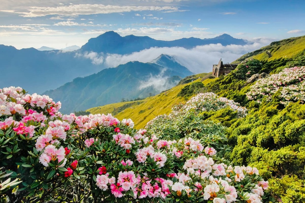
Hikers first ascend Batongguan Shan, which is known for its alpine meadows that burst with colour in spring and summer with the delicate appearance of foxgloves, chrysanthemum, and red rhododendron. The trail then connects to Xiuguluan Shan, the highest peak of the Central Mountain Range, where hikers first encounter the Xiuguping deadwood forest of charred tree stumps.
A forest fire ravaged the thriving woodlands saturated with Yushan juniper, but now all that remains are burnt and brittle debris of dead timber. As the forest sits at an elevation of 3,480 meters (11,417 ft), dramatic views of the Central Mountain Range’s steep and pointy peaks encircle the landscape.
Xiuguluan Shan is notoriously hilly, and it is well-known that the trek to the summit is physically challenging. Once at the top, the views are grand. You can see Yushan to the west and Mabolasi Shan to the north.
Hikers will then progress northward toward Jupen Shan (駒盆山) before reaching Mabolasi Shan. The trail once again increases in difficulty at Ulamang Cliff where you need to cross a 30 cm (12 in) narrow cliff. Once across, hikers have a bit of scrambling to do until they make it to Malijia Nan Shan (馬利加南山).
The trail then turns south to the dense Taiwan red pine forest that leads to the summit of Maxi Shan. While trekking this area, the easternmost boundary of the Core Resource Conservation Area and Yushan National Park, hikers can see the pristine Taiping Valley and its thicket of Pseudosasa japonica bamboo.
Kaxipanan Shan is the last peak that you’ll summit on this trail, and it also serves as Yushan National Park’s eastern boundary. Yushan’s dominating presence is visible from Kaxipanan Shan, as are most of the Baiyue of the Mabolasi Transverse Hiking Trail.
The pilgrimage to Yushan offers hikers the opportunity to summit five of its surrounding peaks on the Yushan Peaks Trail. While Yushan West Peak and Yushan Front Peak are the only hills found in the Core Resource Conservation Area, hikers can continue along the trail to Yushan Main Peak.
Most hikers who want to summit Taiwan's tallest peak need to head straight up to Yushan Main Peak and back down again. For the adventurous and the curious with abundant energy, the trek to the rest of Yushan's peaks is an extra challenge that’s worth considering.
Starting at Tataka Trailhead, hikers first climb an 8.5 km (5.2 mi) gravel path to Paiyun Lodge before climbing up to Yushan Front Peak and Yushan West Peak. Yushan Front Peak is only a 400 meter (1,312 ft) walk away. A 2.2 km (1.3 mi) narrow rocky road with dense woodlands of Yushan juniper leads to the summit of Yushan West Peak.
Hikers usually use Paiyun Lodge as an overnight rest stop before venturing to Yushan Main Peak in the early morning. While it is possible to climb Yushan in a day, it’s not recommended.
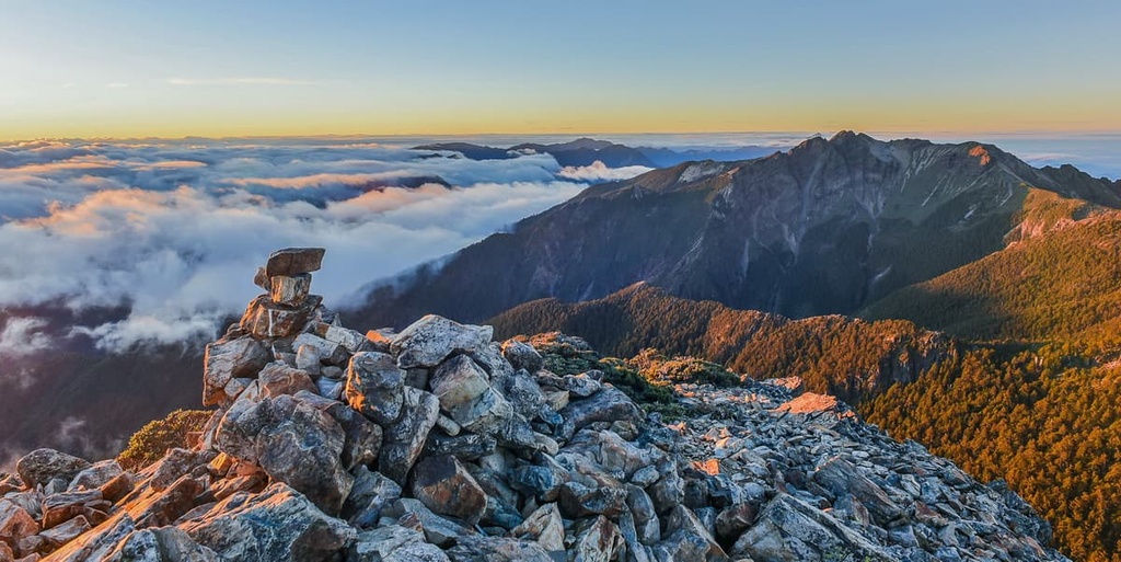
The climb to Yushan Main Peak from Paiyun Lodge is physically demanding, as the steep, unsteady rocky road tapers to a razor-thin ridge. Once hikers finally reach Yushan Main Peak, the last 2.4 km (1.5 mi) climb from Paiyun Lodge is forgotten amidst the break-takingly grand vistas of the encircling Yushan peaks. At 3,952 metres (12,966 ft), hikers revel in victory, standing on top of the world on Taiwan's highest peak.
For hikers wishing to trek the additional Yushan peaks, Yushan East Peak (玉山東峰) is the closest to Yushan Main Peak at 1.2 km (0.7 mi). While the journey seems short, Yushan East Peak's steep terrain poses a serious challenge, even for the experienced hiker.
Yushan North Peak (玉山北峰) is located just 2.4 km (1.5 mi) from Yushan Main Peak. To reach it, hikers must first descend Yushan Main Peak and follow the trail that connects to Yushan North Peak. Note that some scrambling is required to get to the summit.
To get to Yushan South Peak (玉山南峰), hikers will head off on a short spur trail. After a 2.5 km (1.5 mi) trek, hikers can find themselves at the summit of Yushan South Peak, the most accessible and least challenging Yushan peak, apart from Yushan Front Peak.
While the East Rift Valley is not technically a feature of the Core Resource Conservation Area, it is a magnetic piece of scenery that’s located nearby and that’s worth checking out.
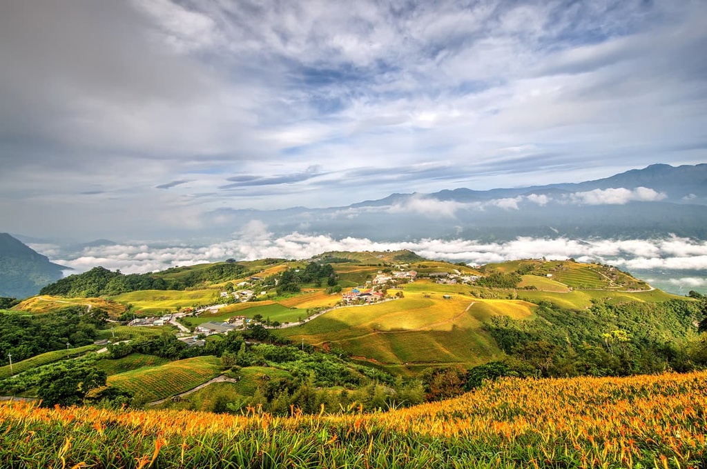
Also known as the Huadong Valley (花東縱谷), the East Rift Valley spans 180 km (112 mi) of terrain between Hualien City (花蓮市) and Taitung City (臺東市). The elongated yet narrow East Rift Valley is nestled between the mighty Central Mountain Range and the flatter Hai’an Range (海岸山脈), which is otherwise known as the Coastal Mountain Range.
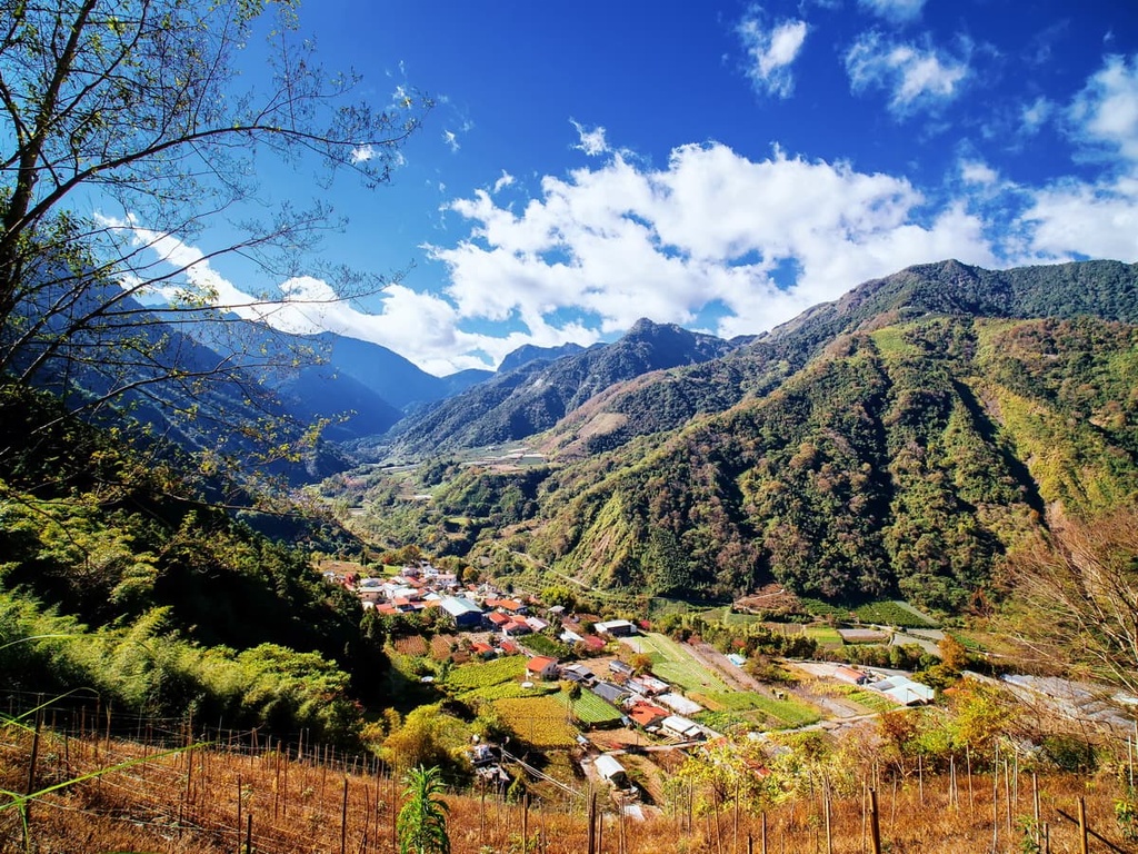
In this valley, the vegetation is varied and it all forms a pristine landscape of natural beauty. Here, lush orchards burst with plump fruit hanging like Christmas baubles. Tea plantations add dimensions to the scene, where endless rows of green tea plants line the gentle, rolling hills.
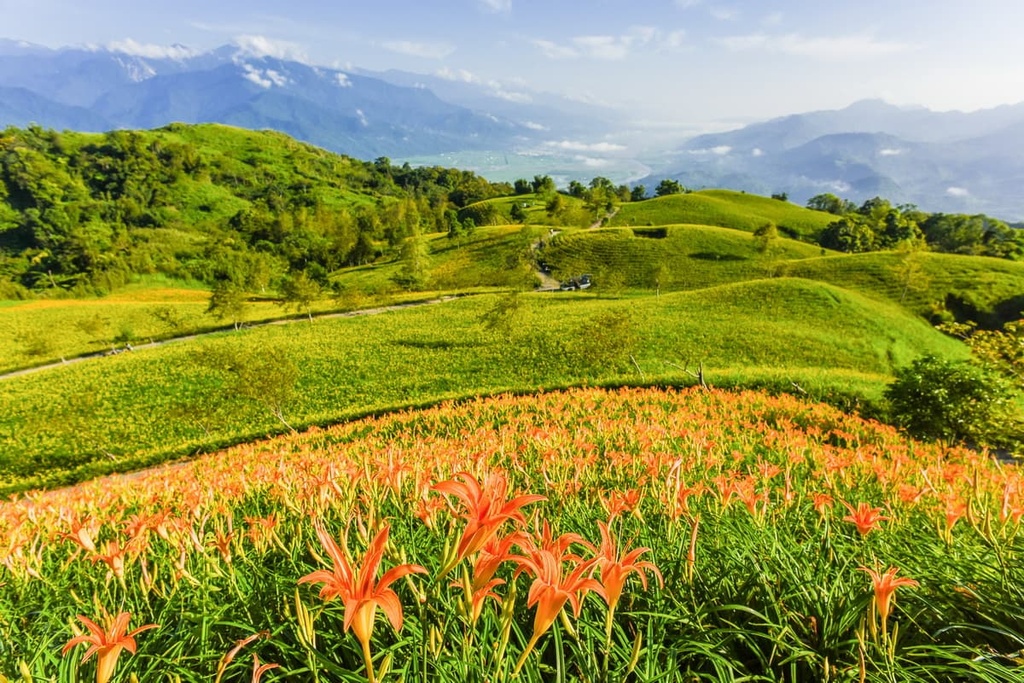
Additionally, rice paddies are strewn across the valley as pockets of pools descend along the region’s flat elevation, like a wide, shallow staircase. At first look, the lily fields create a drenched snow appearance as flocks of white blooms stretch across the basin, creating a carpet of creamy florals.
As the Core Resource Conservation Area lies in a remote region with limited road access, there are no major cities that are situated just a short drive away. However, there are two townships located at opposing ends of the conservation area: Alishan to the northwest and Yuli to the southeast.
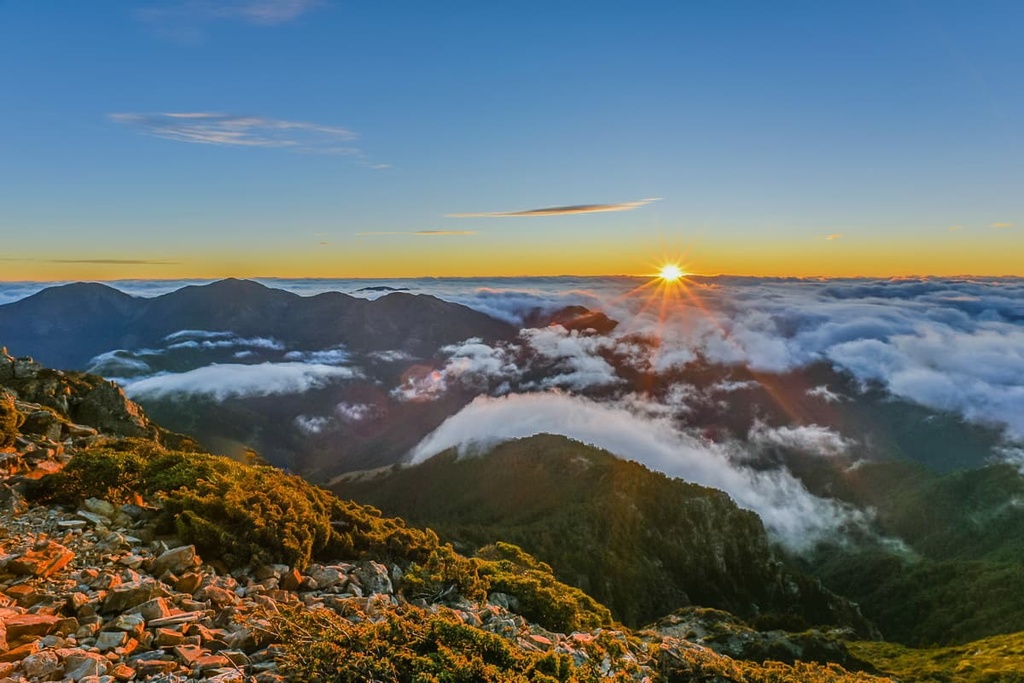
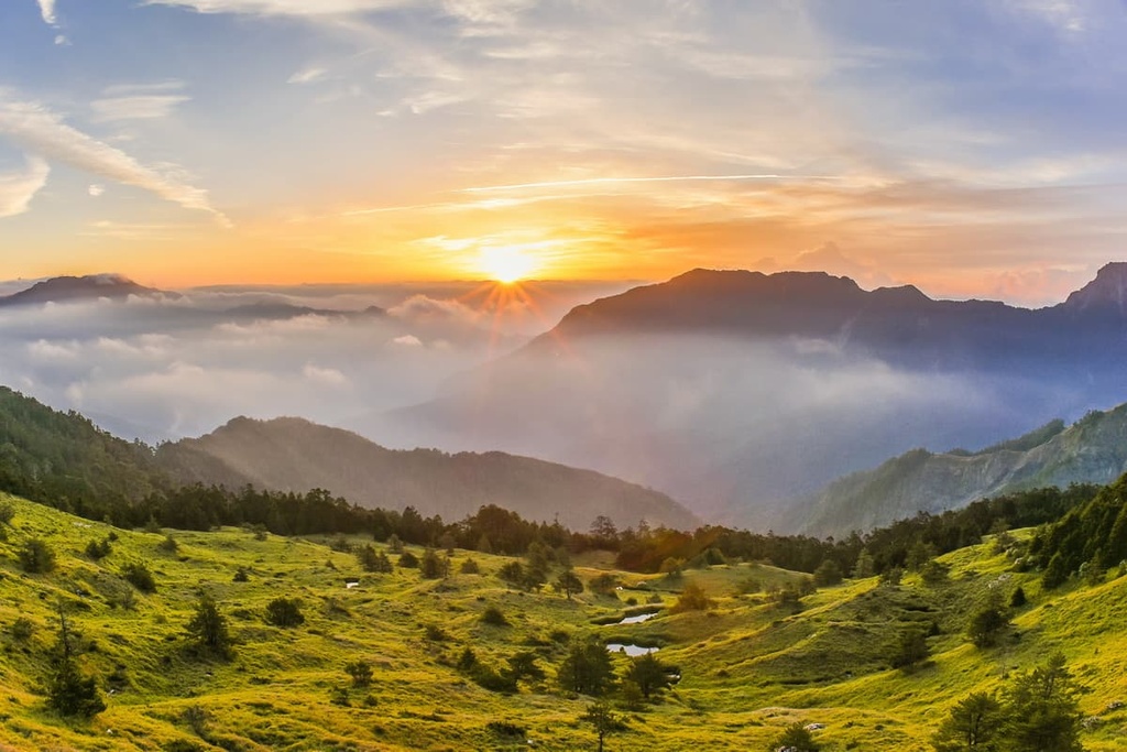
Rated as one of Taiwan’s top attractions, Alishan’s mist-soaked forests of lush high mountain timber will steal your heart. As it is set in the Alishan mountains, the scenery surrounding the town is magnificent, with endless peaks stretching across the horizon.
One of Alishan’s specialities is its glowing auburn skies at dawn and dusk. Many visitors get up early just to witness the golden promise of a new day as darkness gradually lifts, creating a skylit canvas of effervescent warm shades of orange interspersed with deep pinks, lemon yellows, and blood reds.
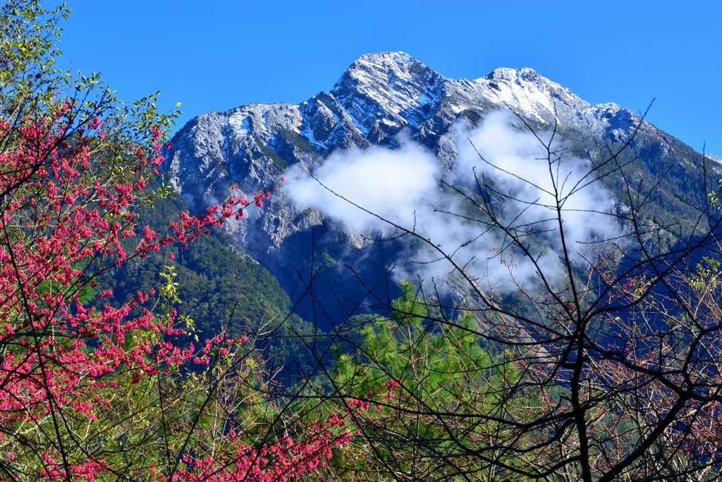
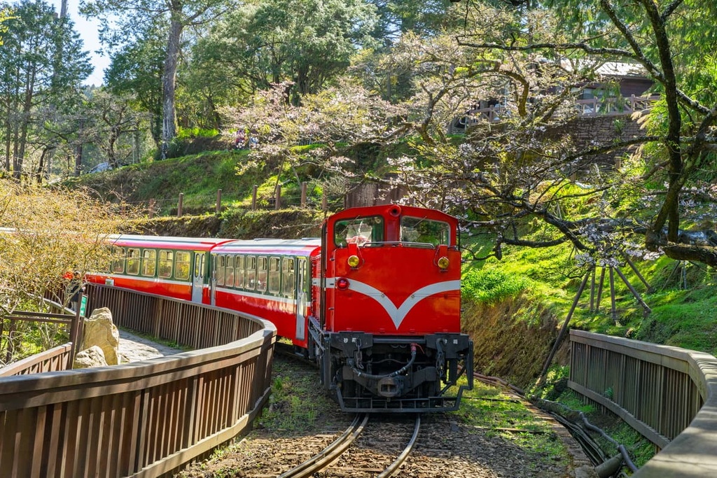
Another of Alishan’s main features is cherry blossom season, when the mountain forests signal spring's much anticipated presence with a blanket of soft pink flowers. These delicate blooms create a stirring and heartwarming scene, as nature boasts its beauty against the backdrop of mountain vistas.
While in the township, visitors can also board the Alishan Forest Railway, a steam train that journeys through the region’s verdant sheltered woodlands. A band of endless greenery envelops the rail line, creating an emerald forest tunnel. The Alishan Forest Railway is also a scenic means of transport, as it stops at numerous stations in the forest, too.
Huddled around the halfway point of the 180 km (112 mi) long East Rift Valley is the picturesque plain of Yuli. With the colossal Central Mountain Range on one side of the town and with the calmer Coastal Mountain Range flanking the other side, Yuli is draped in a dramatic mountain view all around.
For intrepid hikers, Yuli’s location close to the Walami Trail (the eastern section of the Batongguan Yueling Ancient Road) makes it well worth visiting. Additionally, Nanan Waterfall lies within walking distance to the beginning of the Walami Trail. This splendid 50 metre (164 ft) cascade of roaring frothy water is a true wonder to behold.
Antong Hot Springs is another much-loved spot for soaking one’s stress away. The bubbling 66°C (151°F) thermal waters simmer with minerals like hydrogen sulphide. The quietness of the location is only interrupted by merry birdsongs and the soft rustling of foliage, making it a perfect place to unwind and enjoy the warm waters that melt away any tension and worries.
Also situated near Yuli is Ruisui Township, where the most adventurous travelers visit to get a chance to raft the Xiuguluan River's wild waters. Whitewater rafting here is synonymous with Ruisui, which boasts a 24 km (15 mi) section of river that drops 65 metres (213 ft) and provides endless opportunities for adventure.
Visitors can take the Taiwan High-Speed Rail (HSR) or local express train (TRA) to Chaiyi from any one of Taiwan’s major cities.
Once in Chiayi, visitors can board the 7322 bus heading to Alishan, where they’ll transfer to the 6739 bus going to Sun Moon Lake. Visitors alight at Dongpu Village, which is the northwestern entrance of the Core Resource Conservation Area.
Alternatively, you can hire a car or scooter in Chiayi. It’s a 109 km (68 mi) drive to the Core Resource Conservation Area.


tw100
ultra
taiwan-high-three
taiwan-ultras
tw100
ultra
taiwan-high-three
taiwan-ultras
The highest peak in Core Resource Conservation Area is Yushan / Jade Mountain, at 3,952 m.
Notable peaks in Core Resource Conservation Area include Yushan / Jade Mountain, Yushan East Peak / Jade Mountain East Peak, Yushan North Peak / Jade Mountain North Peak, Yushan South Peak / Jade Mountain South Peak and Yushan Far North Peak.


