
Scan the QR code and open PeakVisor on your phone
Guanshan and South Hinogu Special Landscape Area has 4 named peaks. The highest is Guan Shan at 3,668 m. Other notable peaks include Guan Shan Beifeng, Konglongjianshan and Taguan Shan.
Guanshan and South Hinogu Special Landscape Area (關山、南橫檜谷公路沿線特別景觀區) is located in the southern region of Yushan National Park (玉山國家公園) in southern Taiwan. Guanshan is the highest and most prominent mountain of the 4 named peaks in the park with an elevation of 162m.
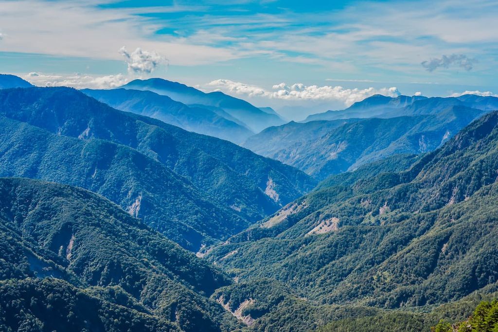
While Yushan National Park, the largest national park in Taiwan, contains some 105,490 ha (260,671 ac) of land, Guanshan and South Hinogu Special Landscape Area is quite small. In fact, it is just 4 km (2.4 mi) wide between its western and easternmost peaks.
The mountain road between the four peaks of the Guanshan area is located along the boundary line between the Taoyuan District (桃源區) of Kaohsiung City (高雄市) and Haiduan Township (海端鄉) of Taitung County (台東縣). The peaks are oriented in a diagonal row, starting from the southwestern Guanshan (關山) and leading toward the northeastern mountain of Taguan Shan (塔關山).
Out of the four mountains in the park, two summits are included among Taiwan’s top 100 peaks (known as Baiyue), namely Guanshan and Taguan Shan. Guanshan is one of The Ten Steeps(十峻) in Taiwan. The other two remaining peaks in the park are Guanshan Beifeng (關山北峰) and Yingzizui Shan (鷹仔嘴山).
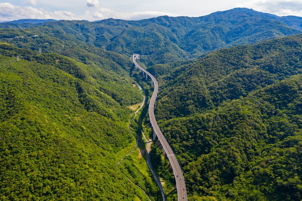
One of Taiwan’s national highways, the Southern Cross-Island Highway, also known as the Nanheng Highway, borders the north of Guanshan and South Hinogu Special Landscape Area. This makes the area particularly accessible for visitors.
For peaks over 3,500 metres (11,483 ft) in elevation, the annual average temperature is about 43°F (6°C). Meanwhile, the average temperature increases to 52°F (11C) for areas above 2,500 metres (8,202 ft). In wintertime, the Baiyue of the Guanshan region are usually covered in a thick blanket of snow.
May to September mark the rainy season in the park. This coincides with the occurrence of turbulent typhoons. The area receives a typical rainfall of 3,000 to 4,700 mm (118 to 185 in) a year. Additionally, due to the wet climate in the region, Guanshan and South Hinogu Special Landscape Area endures a yearly average humidity level of 80%; thus, foggy weather and damp mountain roads are standard features on the trails.
Neighbouring places of interest are Taiwan’s highest peak, Yushan (玉山), in the north with Shuangliu National Forest Recreation Area (雙流國家森林遊樂區) in the southern region of Pingtung County (屏東縣). Fuxing Hot Spring (復興溫泉) is located to the west, and the Baiyue of Guanshanling Shan (關山嶺山) are situated to the east.
Taiwan's primary mountain range, the Central Mountain Range (中央山脈) extends from Pingtung County (屏東縣) to the north shore of Yilan County (宜蘭縣). The four named peaks of the Guanshan and South Hinogu Special Landscape Area are a part of this extensive mountain range.
Millions of years ago, when the collision of tectonic plates created the island of Taiwan, rock strata surfaced through the Earth's crust and rose vertically, forming the steep and high mountains of the Central Mountain Range. Thus, the Central Mountain Range boasts a longitudinal network of giant peaks.
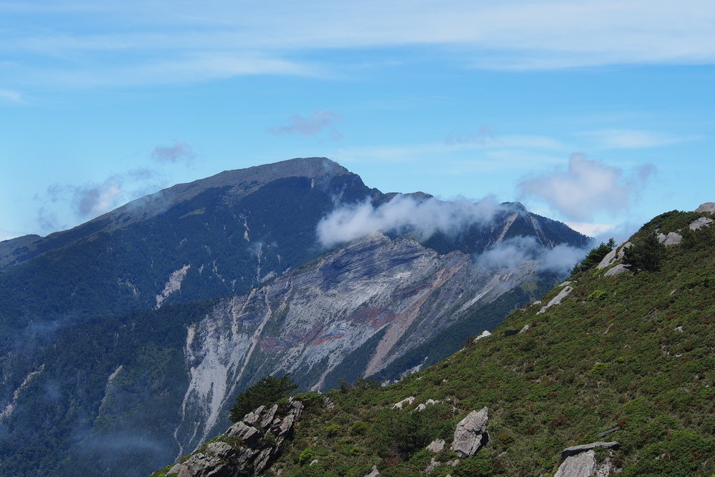
The geology of the Guanshan and South Hinogu Special Landscape Area peaks is mainly composed of slate, phyllite, with quartzite interbedded in the rock strata. A sheer cliff extends from the rise of Guanshan to the north, stretching for 10 km (6 mi) on the mountain ridgeline. Thus, the mountain road comprises broken rock, thrilling cliffs, and weathered gravel slopes.
Due to the differing levels of elevation in the park, the climate of Guanshan and South Hinogu Special Landscape Area ranges between subtropical, warm temperate, cold temperate, and sub-frigid. As such, five distinct vegetation zones flourish in the various climate elevations.
A Machilus-Castonopsis vegetation zone features in the subtropical climate in areas between 500 to 1,500 metres (1,641 to 4,921 ft). The primary plant species here consist mainly of Lauraceae plants like Machilus kusanoi and Phoebe formosana.
Following this is the Oak Forest belt from 1,500 to 2,500 metres (4,921 to 9,202 ft), where Taiwan cypress, Taiwan red cypress, Taiwania, and Chinese yew dominate the woods.
The cool temperate plants of Taiwan hemlock, Taiwan white pine, and Taiwan spruce flourish in the Hemlock-Spruce Forest belt at 2,500 to 3,100 metres (8,202 to 10,170 ft). A fir forest belt progresses from 3,100 to 3,600 metres (10,170 to 11,811 ft), where a conifer woodland of Taiwan fir thrives.
Finally, from 3,600 metres (11,811 ft) and above is the alpine vegetation zone. Here, flowering plants like rhododendron and the alpine grass of Pseudosasa japonica bamboo grow atop mountain peaks.
Taiwan sambar, Formosan rock macaque, and Taiwan wild boars are just some of the 65 species of mammals that live in the Guanshan and South Hinogu Special Landscape Area. The tawny owl and the northern goshawk account for 2 of the 233 species of recorded birds in the vicinity of the Guanshan area.
Due to the high elevation of the Guanshan region, only 46 species of reptiles are found in the area, including 31 species of snakes, 12 species of lizards, and 3 species of turtles. In addition, 21 species of amphibians and 286 species of butterflies inhabit the Guanshan area.
The Bunan and Truku people have traditionally lived throughout the Central Mountain Range, including the area of Guanshan and South Hinogu, for countless generations. In particular, most of their traditional communities are located central and southern Taiwan in the counties of Nantou (南投縣), Kaohsiung, and Taitung.

However, the Japanese Occupation Period brought about a period of forced removal from the region. The Bunan people fought tirelessly against the Japanese; however, they were outnumbered and were eventually forced to leave their homelands.
Thus, the Japanese removed the Bunan people from their homes, as they wanted to gain control of the rich forests in the region and the resources they contained. During this time, the Japanese built the Guanshan Yueling Ancient Road, a 170 km (105 mi) path connecting Kaohsiung City to Taitung County through the Central Mountain Range.
The Bunan resettled along the Guanshan Yueling Ancient Road, which the Japanese heavily surveilled. Some old station posts are still partially intact, such as the Zhongzhiguan Station, located near Tianchi, the largest surveillance station on the Guanshan Yueling Ancient Road.
After the Japanese left Taiwan at the end of the Second World War, the Taiwanese government used the blueprint of the Guanshan Yueling Ancient Road to construct the Nanheng Highway, also known as the Southern Cross-Island Highway.
While most of the ancient trail has been paved for the motorway, parts of the Guanshan Yueling Ancient Road are still intact, such as the corridor of Zhongzhiguan Ancient Road, connecting Zhongzhiguan and Tianchi.
While many adventurers seek to climb the highest mountain of Yushan in Yushan National Park, the remote location of the southern region of the Guanshan area evokes pristine and primitive beauty. Most of the trails climb the two Baiyue of Guanshan and Taguan Shan.
A series of hiking trails connect this mountain network of four Baiyue, namely Kuhanuoxin Shan (庫哈諾辛山), Guanshan, Taguan Shan, and Guanshanling Shan. Kuhanuoxin Shan and Guanshanling Shan are located outside Guanshan and South Hinogu Special Landscape Area; however, they are within hiking distance to Guanshan and Taguan Shan.
Hikers can ascend these mountains individually or follow the hiking trail linking the mountains into one long climbing route. Thus, the journey can range from 1.5 km to 34.5 km (0.9 to 21 mi).
The route begins in the west at Jinjingqiao Mountain Pass. The first Baiyue to be summit is Kuhanuoxin Shan. The steepest incline of the four Baiyue, Kuhanuoxin Shan, will be a challenging climb, especially in wet weather with the added obstacle of steep, slippery, and muddy paths.
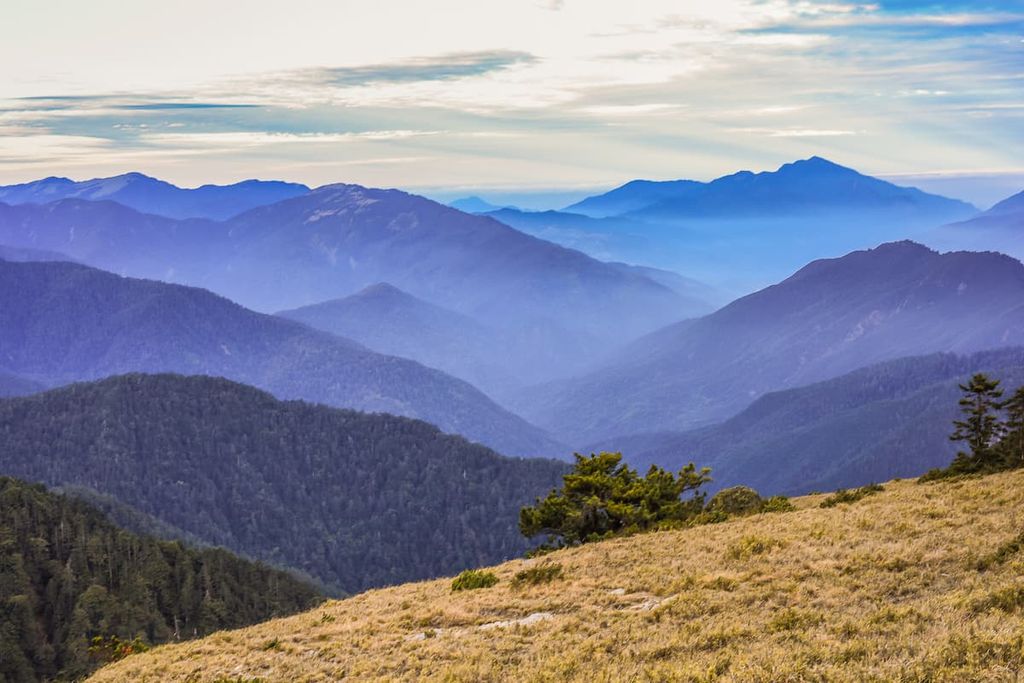
The journey up the mountain is particularly sheltered and damp due to the dense woodlands of towering Taiwan hemlocks, which transform into a forest of Taiwan fir as the elevation increases. In the clearings, hikers can admire the rocky, jagged peak of Xiangyang Shan (向陽山) in the east and its most infamous large cliff, the Xiangyang Collapse.
The views on Kuhanuoxin Shan are unobstructed; thus, hikers can observe Taiwan's tallest peak, Yushan, in the north and the pointed pyramid peak of Guanshan in the south.
Hikers then descend the muddy path toward the south-eastern lodging of Kuhanuoxin Mountain House, where they can rest overnight. In the morning, the journey continues toward Guanshan, the second and highest Baiyue of the trek.
As hikers venture to the summit of Guanshan at the break of dawn, morning mountain fog descends over the earthen pathway and around the giant maze of hemlocks that obstruct the route. An ocean of clouds suspends in the soft morning light over the staggering high Guanshan.
While the terrain is less challenging than Kuhanuoxin Shan, ascending the rugged Guanshan cliff does take time as hikers will need to climb a relatively exposed rocky section. From Kuhanuoxin Mountain Lodge to the top of Guanshan is nearly a 4 km (2.4 mi) journey.
The peak of Guanshan offers exceptional views of the nearby mountains; however, due to the combination of low temperatures and strong winds, thick clouds of fog descend in the afternoon. In addition, an armour of frost coats the windblown alpine shrubbery, adding a layer of icy glazing to the plant life. Hikers then retreat to Kuhanuoxin Mountain House for an overnight sleep before heading towards Taguan Shan at daybreak.
The trek to Taguan Shan from Kuhanuoxin Mountain House is arduous. It is about 14 km (8 mi) down the mountain and across the highway to reach the Taguan Mountain Hiking Pass of Nanheng Highway. From here, it is a further 2.2 km (1.3 mi) climb to the summit of Taguan Shan.
Taguan Shan features a swarm of giant cypress trees that shade the path from harsh sunlight and oppressing heat. A Pseudosasa japonica bamboo forest transforms the scenery from towering trees to grasslands of rough shoots as the path inches closer to the summit of Taguan Shan. The sheer relief of Guanshan can be seen from Taguan Shan's peak, as can Guanshan Beifeng and Yingzizui Shan.
After the descent of Taguan Shan, hikers can even see a one-thousand-year-old cypress tree. The following morning, hikers will summit the final Baiyue of the trail—Guanshanling Shan.
Hikers begin the route from the Nanheng Highway Guanshanling Mountain Climbing Pass, which involves a 1.5 km (0.9 mi) climb to Guanshanling Shan, the least challenging peak to climb of the four Baiyue. However, this does not mean that climbing the mountain will be smooth sailing due to the steepness of the terrain.
A forest of Taiwan hemlock dominates the mountain’s slopes, standing in stark contrast to the white Yushan juniper that dots the landscape. Meanwhile, a forest of Pseudosasa japonica bamboo signals that hikers are getting close to the summit. At the top, hikers can appreciate the grand views of Guanshan, Kuhanuoxin Shan, and Taguan Shan.
This route involves traversing the four peaks of Guanshan and South Hinogu Special Landscape Area. The trip starts in the south from Guanshan and passes Guanshan Beifeng and Yingzizui Shan before finally reaching Taguan Shan.
The rugged terrain of Guanshan is one of the main challenges of the trail. Along the way, hikers will need to follow the rough, rocky road that connects the peaks of the Guanshan area. The entire 10 km (6 mi) journey features weathered rock formations and steep drops on either side of the trail after reaching the summit of Guanshan.
A carpet of Pseudosasa japonica bamboo offers some relief from the otherwise uneven terrain as hikers forge their way to Guanshan Beifeng. A near-vertical 6-metre (19 ft) rock wall is the first challenge when ascending Guanshan Beifeng, though there are some fixed ropes in place to help you get to the top.
Hikers usually set up camp on the main ridge of Guanshan Beifeng. In the morning, the fog is often so dense that hikers should take caution when walking along the path. Edging ahead, hikers then encounter a 12-metre (39 ft) cliff. Although double in height, it is easier to climb than the first rock wall due to its many hand and foot holds.
After scaling the cliff, hikers will walk to the summit of Guanshan Beifeng. Depending on the time of day and the weather, the views will either be entirely hidden by grey fog, or open for all to see. You can usually see Guanshan, Yingzizui Shan, and Kuhanuoxin Shan from the summit.
Fields of Pseudosasa japonica bamboo lead hikers down Guanshan Beifeng and toward Yingzizui Shan. Its pointed rocky surface resembles the spiky back of a stegosaurus. Protruding jagged rock turrets extend from the mountain path, leading to the bamboo covered summit of Yingzizui Shan.
Additionally, the infamous Dinosaur Tower is located on the downhill journey from Yingzizui Shan. Juggernauts of weathered rock with a height of 9 metres (29 ft) jut out above the cliff, looking both ominous and fascinating.
Hikers then make their way down the sheer cliff behind the Dinosaur Tower, using the fixed climbing ropes. The final peak of Taguan Shan is located behind a razor-thin, rocky ridgeline that can be slippery in damp weather. After scrambling up the steep slope, hikers will reach the summit of Taguan Shan.

The disused 3.5 km (2.1 mi) section of the Guanshan Yueling Ancient Road that the government deserted when constructing the Nanheng Highway is known as the Zhongzhiguan Ancient Road (中之關步道). This old mountain road connects the valley of Zhongzhiguan with the elevated area of Tianchi (天池); thus, hikers have a choice to trek up or down the path.
Wooden boardwalks make navigating the ancient mountain road through a tunnel of emerald forests of Taiwan hemlock much easier. During autumn, the colour of Taiwan red maple’s leaves set ablaze, adding warmth to the sumptuous greenery of the mountain forests.
The shaded forests of the region maintain the refreshingly cool mountain air while the rustling of the breeze gently raps against the healthy foliage. Orbs of penetrating sunlight that manage to infiltrate past the forest canopy illuminate the earthen forest floor. Due to the dampness of the forest, a coat of mossy velvet touches the surface of rocks and trees, adding an extra layer of living green to the forest trail.
Decrepit and abandoned charcoal kilns are littered along the trail, making them a prominent feature on the Guanshan Yueling Ancient Road. As the annual temperature in the shaded mountain region does not exceed 59°F (15°C), many local residents created charcoal kilns in the years before the Japanese Occupation Era.
Situated 6km(3.7mi) from Tianchi, just off the Nanheng Highway, is the verdant valley of cypress, also known as Kuaigu (檜谷). Cypress Valley is located at an elevation of 2,454 metres (8,051 ft); thus, oak forests dominate the landscape.
Lush thickets of evergreen Taiwan cypress and Taiwan red cypress extend their bodies from the forest floor and skim the mountain sky with their brush of needles. The forest is known for being both humid and refreshingly cool at the same time, allowing a thick morning mist to engulf the landscape.
A chorus of light-hearted birdsong can be enjoyed from the trails of the largest virgin forest on the Nanheng Highway. Along the way, visitors can attempt to spot the many bird species that frequent the emerald woods' untouched beauty.

Named after a well-known alpine lake on the saddle between Qilaishan South Peak (奇萊山南峰) and Nanhuashan (南華山) of the Danda Major Wildlife Habitat (丹大野生動物重要棲息環境), Tianchi lake is located at 2,280 metres (7,480 ft) above sea level. Pseudosasa japonica bamboo grasslands surround the lake, while forests of cypress trees lie in the distance.
The imposing Baiyue of Kuhanuoxin Shan, Taguan Shan, and Guanshanling Shan guard the still, picturesque lake, adding to its pristine beauty. As Tianchi covers an area of 0.18 ha (0.4 ac) with a depth of 1.2 metres (4 ft), the glorious blue heavens of Taiwan reflect in the lake's smooth surface.
Located nearby is the Changqing Temple, also known as Evergreen Temple, built to honour the 116 fallen construction workers of the Nanheng Highway. While the mood is somber, the views are pristine, as the chine lines of rugged peaks rise and dip dramatically in the background.
The scenery surrounding the Daguanshan Tunnel is the prime attraction of this 600-metre (1,968 ft) underpass on the Nanheng Highway. Sitting at an elevation of 2,722 metres (8,930 ft), the landscape of Daguanshan Tunnel is a mix of cool temperate and cold temperate vegetation, with forests of Taiwan pine with Taiwan hemlock and spruce adding to the plant life.
The significance of the natural landscape is the different outlooks from either end of the tunnel. The western outlook of Daguanshan Tunnel displays the collapsed crumbling rocky road connecting Guanshan to Taguan Shan. The eastern view showcases the endlessly undulating verdant landscape of gentle peaks and lush valleys, which feature dreamy waterfalls.
The cities of Pingtung (屏東) and Taitung (台東) are the closest major population centers to the Guanshan and South Hinogu Special Landscape Area. While these cities are both close to the Guanshan region, they are located on opposite coastlines of Taiwan.
Taiwan’s coastal southeastern gem, Taitung, was the last city to be colonized in Taiwan. Its remote location, positioned on the eastern side of the impenetrable Central Mountain Range, results in fewer tourists crowding the area, giving the city a more authentic feel.

Taitung Forest Park occupies 280 ha (692 ac) of woodlands and contains three peaceful lakes. The density of dark beefwood trees gives the park its nickname, the ‘Black Forest.’ Visitors enjoy walking the verdant paths of the woods, observing the marine life in the bodies of the water, and watching different species of birds frequent the forest. Additionally, bike rentals are offered in the park for visitors to explore the well-established cycle trails.
A Taitung favourite, Zhiben Hot Spring, offers visitors a wide selection of spa resorts, as well as smaller hot spring inns that facilitate the sulphur carbonate waters that are rumoured to alleviate arthritis and intestinal problems. As this was once a gathering place for the Amis people, local Amis residents offer speciality food for visitors, like salted raw fish and stone hot pot featuring vegetables and seafood cooked on an areca palm leaf.
Taitung is the gateway to Green Island, situated 33 km (20 mi) east of Taitung in the Pacific Ocean. Once an old exile for political prisoners, the tropical paradise of Green Island is a popular getaway for both locals and tourists alike. Shards of coral border the pristine coastline of Green Island, a haven for diving and snorkelling activities. In the clear waters surrounding the island, visitors can witness a wide variety of fascinating marine life.
Just north of Taitung, in Chenggong Township of Taitung County, is the immensely popular arched Sanxiantai Bridge, linking the mainland of Taiwan to the island of Sanxiantai. Visitors can explore the 10 km (6 mi) stretch of beach while admiring the wavy bridge that resembles a dragon’s arched back. On the island of Sanxiantai, visitors can experience the untouched beauty of the little isle that features a heavy concentration of Taiwan date palm and coastal plants.
A lesser-visited city of Taiwan, Pingtung City, enjoys a subtropical climate with sunny weather. As Pingtung City receives less tourism than some other nearby destinations, it has the feel of a sleepy city that charms visitors with its relaxed and friendly atmosphere.

The Rui Gang Night Market offers southern Taiwanese delicacies such as sweet mung bean soup, onion cake, and pig knuckle. In addition to this, an exciting selection of arcade games is available to visitors, adding an element of entertainment for both children and adults.
Liudui Hakka Cultural Park offers exhibitions that focus on the lifestyle of the Hakka people in the Pingtung region. In addition to this, it also provides Hakka language lessons and cultural performances of Hakka dance and songs. The park contains 30 ha (74 ac) of land and it features a flower garden, a lake, vast grasslands, and landscaped grounds.
In the Sandimen Township of Pingtung County, the Indigenous Cultural Park showcases an outdoor museum that includes 82.5 ha (204 ac) of architecture from sixteen Indigenous tribes in Taiwan. At the park, visitors can learn more about the traditional ways of life of each tribe.
Xiaoliuqui Island is a coral reef located off the west coast of Pingtung. Visitors love to snorkel in the clear, unpolluted waters near the island where exotic marine life and sea turtles are known to roam. Visitors can lie on the many sandy beaches on the island and unwind to the chorus of crashing waves and the chiming of soft wind.
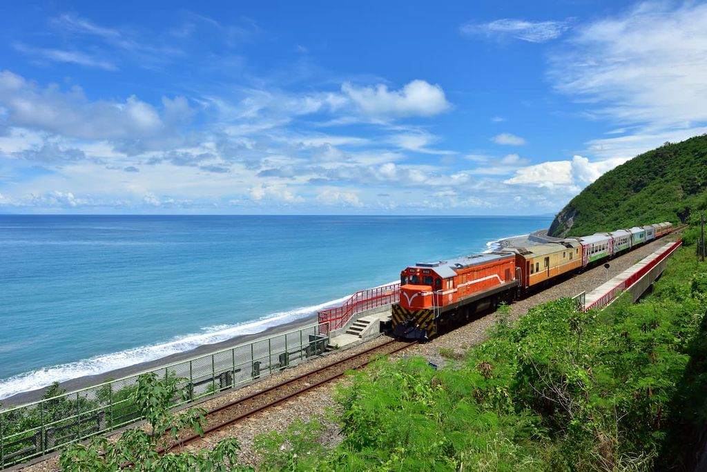
From the major cities of Taipei, Taoyuan, Hsinchu, Taichung, Chiayi, Tainan and Kaohsiung, take the local express train (TRA) to Pingtung on the west coast, or Taitung on the east coast. As the Guanshan and South Hinogu Special Landscape Area is in a remote part of Taiwan, there is limited public transport to reach the area.
Hiring a car or scooter from Pingtung or Taitung would be the easiest option for visits to the Guanshan area. It is an 85 km (53 mi) trip from Taitung to reach Guanshan and South Hinogu Special Landscape Area. From Pingtung, it is an 80 km (50 mi) journey.


The highest peak in Guanshan and South Hinogu Special Landscape Area is Guan Shan, at 3,668 m.
Notable peaks in Guanshan and South Hinogu Special Landscape Area include Guan Shan, Guan Shan Beifeng, Konglongjianshan and Taguan Shan.


